KOREC has hosted the first in a series of KOREC Connect events in collaboration with BACH (British Association of Construction Heads) aimed at forging stronger connections between education and the construction industry. The primary goal was to address the pressing skills shortage within the surveying sector and highlight some of the challenges that BACH and BACH members are facing including high dropout rates.
The first event in the series was held on the 10th October in Durham and brought together representatives from further education, local survey companies and industry associations with a common aim – to explore proactive solutions for bridging the skills gap.
The event included a series of informative presentations from Jason Howe (BACH Regional Chair), Katie Holt (CICES) and representatives from KOREC and BuildingPoint UK and Ireland, outlining the latest advancements in cutting-edge digital technologies, which are set to captivate the next generation of tech-savvy, enthusiastic engineers and surveyors sought after by the industry.
Jason Howe spoke about BACH and how it was structured about the members who are mainly Heads, Managers and Leaders of the Built Environment workforce training in FE Colleges and training providers in the UK.
Katie Holt representing both CICES and TSA talked about their initiatives to attract new blood to the industry and the support they provide for schools and colleges.
Sam Hough from KOREC showed some of the past technologies used in survey, then moved onto future trends and some of the innovative technology that can be used to attract a new generation of talent to the industry including mixed and augmented reality, laser scanning and robotics.
Cesar Almeida from KOREC highlighted the vast amount of Trimble resources available on the technology and topics driving change in our fast-paced world. These included Ttimble’s Virtual World, a simulated work site training environment and other practical ‘how to’ guides.
The event was exceptionally well attended with strong participation from both industry professionals and colleges. The afternoon panel discussion, in particular, provided valuable insights and revelations on critical issues:
Colleges and industry found common ground with colleges struggling to find placements for students whilst survey companies actively sought able students for hands-on experience. Colleges urged survey companies to contact them with their requirements which they would seek to fulfil.
Colleges faced a dual problem in both attracting students to courses and retaining them with red tape restricting their visits to schools with a sixth form. Suggestions were made on course content.
Both industry, associations and colleges were unsure who should be responsible for raising awareness of the opportunities within the survey industry. However, it was agreed that a more holistic view to joining up career paths and education would be an excellent starting point with the focus on students of GCSE age and upwards.
Amanda Bradshaw – KOREC Regional Sales Director played a significant role in establishing the new event. She said: “It was wonderful to hear the passion from industry and the dedication to support the promotion of our sector. It was also magnificent to hear how the Colleges are in a prime position to work with employers and develop students to assist their business whether that be with graduate or full-time positions.”
Daniel Rogers – Associate at Ridge and Partners LLP property and construction consultants said: “Ridge were pleased to support KOREC’s first ‘Connect’ initiative in the UK. Bringing together representatives from further education, employers and industry bodies, the key aim of this Northeast event was to look at how we can improve the connection from education to industry. As UK wide multi-disciplinary business, we look forward to working with the industry bodies to build relationships with the colleges and help create an improved pathway to industry for the students. Ridge is passionate about working with individuals developing and supporting them to reach their full potential therefore we look forward to supporting future events.”
KOREC would like to thank BACH, CICES, Costain, Tri-Tech, Academy Geomatics, Gridmark Surveys, Ridge & Partners, Balfour Beatty, 360 Group, Esh Group and all the FE Colleges that joined us on the day.
For information on future events please contact atalanta.lawson@korecgroup.com
ENDS
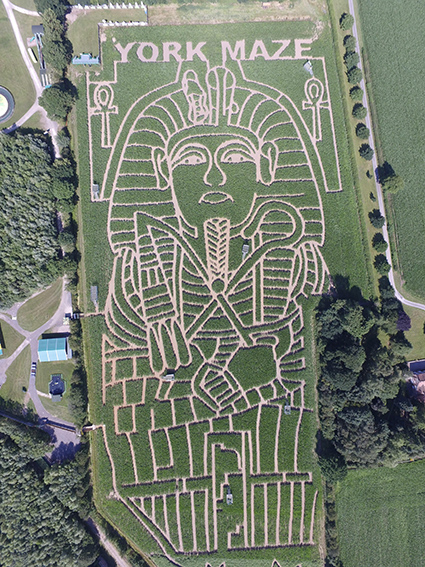
Visitors to York Maze will find this year’s amazing maize maze, even more challenging thanks to the accuracy of a KOREC supplied Trimble TDC650 handheld GNSS.
York Maze, Maze Master Tom Pearcy, has created another fantastic maze using over 1 million maize plants in an area larger than 8 Wembley football pitches, making it the largest maze in Britain and one of the biggest in the world!
Over the years, Tom has tackled many themes from Star Wars to Lego and Roald Dahl to Mr Men, all using a KOREC supplied Trimble Geo Explorer with its 0.5m accuracy. However, this year, Tom has upped the ante and opted for a handheld Trimble TDC650 (scalable positioning from metre to centimetres). The incredible result is a complex maize tribute to Tutankhamun to celebrate the 100th anniversary of his tomb being discovered. Tom has been delighted with the results:
“The TDC has been great for mapping out the maze, it holds its accuracy all day long, and it didn’t lose its connection for the whole time we used it, something the previous models could be prone to. The accuracy allows us to create ever more complex mazes, that look truly amazing from the sky !! “
Tom Pearcy, Maze Master, York Maze
A couple of years ago, Tom revealed exactly how the maize magic happens.
“We’ve come a long way since our first creation in 2002. Back then our mazes were based on just lines and circles drawn onto graph paper and in the field, we used sticks and strings to set out the design, a time-consuming exercise which could take two weeks or more.
Today the process is much more straightforward. Our theme is designed in a basic drawing package and then uploaded onto our Trimble handheld GNSS. We then go out into the maize field and effectively create the biggest dot to dot in the world!
Using the map on the handheld, I plot out the design amongst the 6” high maize plants, marking the points as I go, whilst a cultivator follows on behind.”
This year saw Tom cut over 5km of pathways into the 15 acre field to create the ‘iconic’ image of King Tut.
York’s maize maze is open from Sat 15 July – Mon 4 Sept 2023 and you can book tickets here.
If you’d like to learn more about the Trimble TDC650 call our KOREC Mapping Team on UK: +44 (0) 345 603 1214 or Ireland +353 (0) 1456 4702
How to reliably capture accurate survey data and transform it into intelligence for increased productivity and improved decision making.
KOREC works with a number of utility and fibre companies who have adopted a digital approach to their field data collection and data handling workflows. These companies are now reporting significant benefits from accurately capturing survey data across four main areas; plan, design, build and operate & maintain.
KOREC specialises in tackling the challenges that can impede productivity in all of these stages:
PLAN & DESIGN: Using mobile mapping to enhance productivity for survey, planning and design services
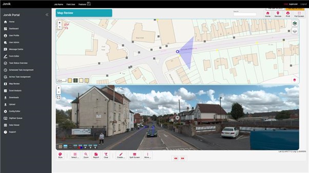
Jorvik Design Group has revolutionised its data capture operations through its investment in a KOREC supplied, vehicle mounted mobile mapping system. Their Trimble MX50 system delivers a very accurate point cloud of the environment along with complimentary immersive imagery and enables Jorvik to create extremely accurate designs without time consuming and labour-intensive site walkovers.
KOREC worked closely with Jorvik to create an enhanced workflow so that clients can now provide a boundary map and all relevant UPRNs (Unique Property Reference Numbers) along with a request that Jorvik plans a design for that network. An initial survey is then driven with the MX50 system mounted on Jorvik’s Land Rover Defender.
Having access to a current, high-accuracy, 3D point cloud means that the Jorvik Design Group can now provide an even better service for its clients through the provision of an accurate 3D point cloud data set for measurements related to costing; a faster design service based on correct asset location and a fully up to date, accurate map of all their assets at the job’s conclusion.
CONSTRUCT: Utility construction company working on new build site
Working on new build sites, the installation of utilities is based on designers’ detailed line drawings rather than OS MasterMap data which has yet to be created for new developments. However, digitising these line drawings to take into the field, sometimes up to 6,000 in a single project, is extremely problematic due to the density of the information contained.
In order to create a new digital workflow, KOREC’s software division, K-MATIC, worked with the client to create an easy drag and drop solution which allows for the easy transfer of these large files from the office on to field devices.
CONSTRUCT: Utility installation company seeking a digitised workflow for greater efficiency and faster payment
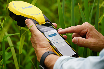
KOREC was approached by a company that wished to become more efficient in the field, collecting as-built information. The company required better than 10cm positional accuracy on each connection (as per UK legislation) and also wished to document each connection with attribute information fed live to a secure cloud-based portal. This would enable them to provide proof of connection and bill weekly for work done.
KOREC supplied the company with Trimble Catalyst, a low cost GNSS option (with a choice of subscriptions for different accuracies) and KOREC Capture field data software designed to run on standard smartphones or loggers.

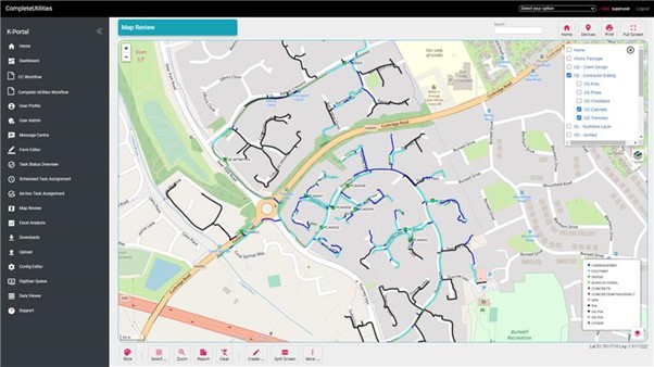
OPERATE & MAINTAIN: a network operator pre-empting potential problems and minimising risk
A utility company has to maintain an existing network including pole inspection and vegetation encroachment across the network. The company approached KOREC who undertook a mobile mapping survey through its Professional Services division. This data, once processed, was analysed with automated routines for poles that were not in the existing inventory and also locations where vegetation could encroach the network and impact connectivity. This allowed them to better manage their assets and foresee potential issues.
Visit KOREC on stand 33b at Connected Britain or look out for our exhibition presentation
We’ve always believed that the geospatial industry offers up some fabulous stories, great personalities and interesting points of view and that now’s as good a time as any to celebrate this with some quick fire interviews.
In the first of our ‘Latitude and Attitude’ series, we posed 10 questions to Mike Roller, Civil Engineering Surveyor, Galliford Try. Why did we pick Mike for our first post? Well, the KOREC team has been lucky enough to socialise with Mike at work related functions over the years, including a recent trip to Trimble Dimensions in Las Vegas, so we knew he’d be a safe bet for some great stories…. and that with over 30 years in the indsutry working for some of the biggest names including Balfour Beatty, Skanska and even Trimble, there was a rich vein to be mined. Mike didn’t disappoint!
Why did you choose a career in surveying?
I was advised by my then Maths teacher to take a one or two-day course run by Birkbeck College. I believe it was called Vocational Guidance. They gave me an IQ test and alternatives from which to choose that were basically indoor or outdoor, using your brain or your hands, arts or sciences…etc. They concluded I could achieve a maths degree and my aptitudes lay in something like Clerk of Works or Quantity Surveying. I tried for a job in Quantity Surveying and thought I’d try for one in Land Surveying as well thinking they must be similar. I got the job in Land Surveying.
If you weren’t a surveyor what would you be….
I tried to join the RAF as a Pilot Officer on a twelve-year commission. I passed the medical and got good marks in the flying aptitude tests during the first two days of a four-day course at Biggin Hill. Unfortunately, I didn’t get to the next two days as, during the interview at the end of the second day, I was deemed “not officer material”. It was only several years later while I was applying for Canadian citizenship (my dad was Canadian) that I discovered that my dad’s parents were Russian, which I felt may have actually been the reason, it was the 1960s, the Cold War etc…!
What was your most memorable survey moment?
I spent a year doing all the survey and setting-out for a five-kilometre conveyor belt for British Gypsum between their mine in Brightling and their processing plant at Mountfield, East Sussex. It was the first of its kind to follow the contours of the route rather than being a series of straight belts. The belt was pulled from the Mountfield end along a route which consisted of horizontal and vertical curves so any inaccuracy in the positioning could result in the belt being pulled off its rollers. When the M & E team came to commission the belt, they had allowed two months to tweak any problems. They started it up and it ran perfectly. They then loaded it with gypsum, and it continued to run perfectly so after two days they were on their way home!
What was your most dangerous survey moment?
Being shot while working in Iraq during the war with Iran in 1981. I still have the bullet lodged so close to my heart that the surgeon(s) thought it safer to leave it where it was than to try to remove it.
What was the best project you’ve worked on?
Lingfield all-weather racecourse. I carried out all the survey and setting-out for this contract during which time I was given free badges to bring my family to watch the horse racing free of charge. They were very enjoyable days out and we had three of them during the year I was working there.
What are your top three surveying tips?
Check, check, check.
Tell us about your favourite survey story
I worked for a year for the Eastern Road Construction Unit checking the setting-out of the alignment of the M11 as it was later to be known. I was checking the northern most section down to the A10, then three colleagues were doing the same for three more sections down as far as the North Circular Road. We used to meet up in a pub in Great Chesterford after work one or two evenings a week and on one particular evening, one of the other locals who was often in the pub after a train journey from London (let’s call him Simon, early thirties, not a surveyor) received a phone call on the pub’s land line…
Landlord: “Simon, it’s for you.”
Simon: “Hello? oh hello darling,” (pub goes a bit quiet, listening) “well, yes, about half an hour” (pub goes very quiet, listening intently by now), “oh alright then fifteen minutes.” Simon then replaces the receiver and announces to all listening “That ****** told her didn’t it?”
What is the best bit of survey technology you’ve used?
EDM.
If you could give one bit of advice to your younger self it would be….
I left after A Levels because I wanted to get away from school. I should have had a “Gap” year to get the leaving school idea out of my system and gone to university.
What next – do you have any unfulfilled dreams or aims?
When I was ten years old, my parents emigrated to Canada. There was my mum and dad, two sisters and a brother and we spent an enjoyable Atlantic Crossing by Cunard liner to Montreal, then a train journey to Winnipeg, where my dad’s parents were, then a car trip across the rest of Canada to the west coast to settle in British Columbia near Vancouver. Unfortunately, things didn’t work out for Dad, and we returned home after eight months but that’s another story. I intend to make a similar trip with my wife, driving to Vancouver, then driving south to California enjoying the views from the Pacific Coast Highway, then turn East to come back along Route 66 to Niagara Falls, then New York and home.
If you’d like to be a part of KOREC’s ’10 Questions’ series, drop us your name at: marketing@korecgroup.com
One job – two standout reasons to use the Trimble X12 3D Laser Scanner.
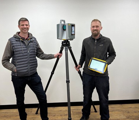
With an extensive survey fleet to choose from, it was the Trimble X12 that Land Development Services’ Scan Technician Andrew Coggan selected for a recent Measured Building Survey of a nine-storey landmark building in Poole.
Download a PDF of the case study here
Experts in the gathering of data since 1969, Wiltshire based Land Development Servicesis a company known for its professionalism (LDS is an RICS Regulated Firm and also a full member of The Survey Association) and its wide range of experience. Over the years, the team has worked on projects as large and varied as raising the roof on a new construction in London and surveying infrastructure for large international sporting events right down to the smallest jobs such as single building elevation surveys and garden projects.
Assisting with the company’s successful reputation in such broad ranging areas is its commitment to investing in groundbreaking survey technology and in particular, Trimble 3D Laser Scanning systems. Supplied by KOREC, the LDS 3D laser scanning fleet includes two Trimble TX8s for precise, HD scanning, an SX10 Scanning Total Station, two X7s for fast scanning and most recently, Trimble’s highest performing laser scanner, the X12.
Responsible for these systems and the main point of contact for any scanning based enquiries or tricky site work is Scan Technician, Andrew Coggan. Familiar with all the survey fleet, it is Trimble’s high-end X12 that Andrew favours for many of the jobs and especially for Measured Building Surveys. Purchased early in 2023, the X12’s high precision data at long range, lightness and size for travelling ensure that it is in almost daily use.
About the Trimble X12 3D Laser Scanner:
Released in July 2022, the Trimble X12 integrates Trimble software for precise data capture and in-field registration (Trimble Perspective) with state-of-the-art 3D laser scanning and imaging hardware technology from Zoller+Fröhlich (Z+F), combining the expertise of two industry leaders into a single solution. The results is a ‘best of both worlds’ combination of Z+F technology and a tried and tested Trimble workflow. The end result is amazingly crisp data. Small for a scanner of this range (0.3 m–365 m) and precision (≤ 1 mm + 10 ppm/m), the compact unit measures just 150 mm (W) x 258 mm (D) x 328 mm (H)) and weighs in at 7.7kg including the batteries. The unit also has a handle is driven via the Trimble T10x Tablet running Trimble’s tried and tested Perspective software which is also common to the Trimble X7 scanner.
One job, two stand out reasons to use the Trimble X12
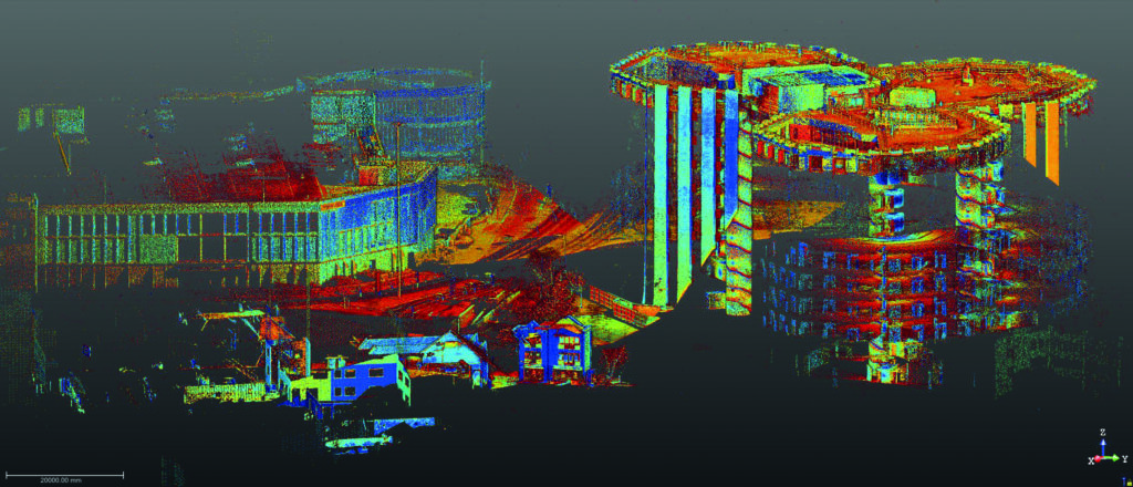
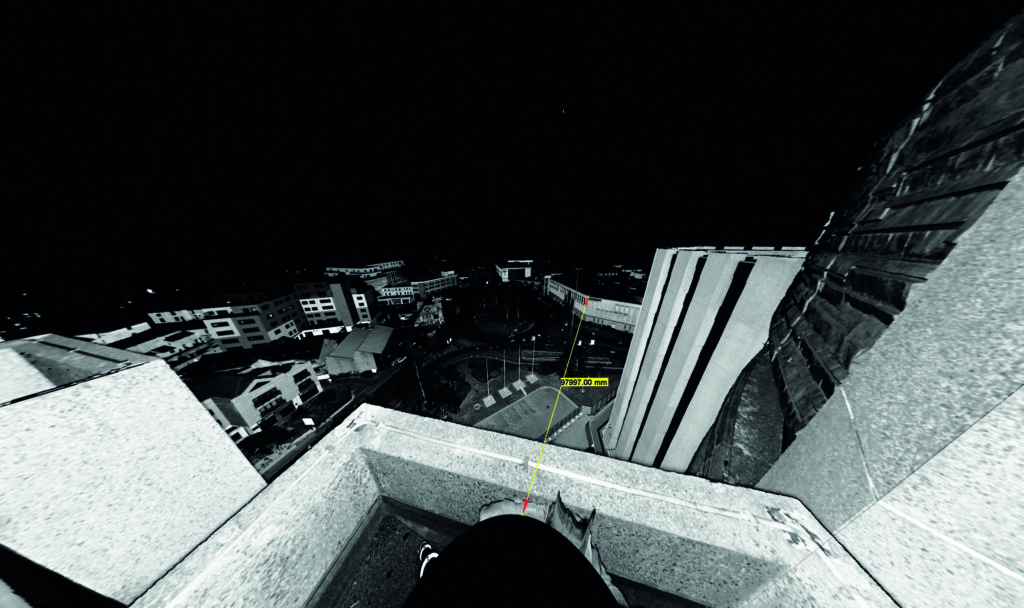
The landmark nine-storey Barclays House building in the centre of Poole has dominated the town centre’s skyline since its opening in January 1976. Following a decision by the bank to relocate its staff to Bournemouth, LDS was contacted to create elevation drawings of the whole building which is made up of three conjoined octagons. This was followed up by a further request to deliver a roof plan and detailed plans of the three concrete, spiral staircase fire escapes which run down the centre of each of the octagons from top to bottom. The landings were also requested. Whilst Andrew had access to all of the LDS laser scanning fleet, he felt that the X12 was the only option for this job for two reasons:
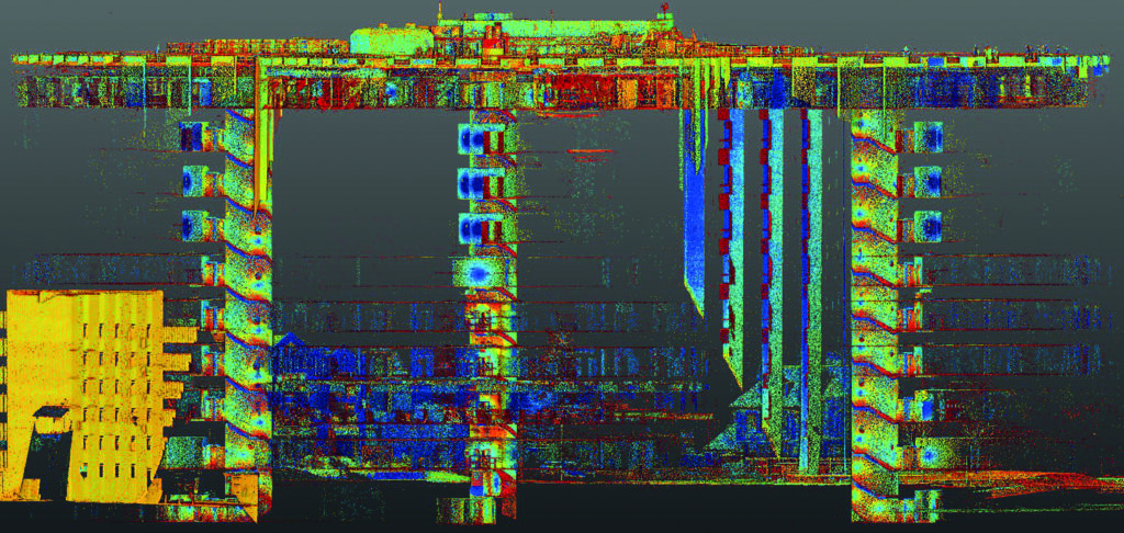
Firstly, the Trimble X12 can scan at a short range of just 0.3m and also has a minimal ‘blind spot’ which is considerably smaller than that of other scanners, to the extent that you can see the tripod legs. This would mean that Andrew could complete the staircase scans far faster because fewer setups would be required – around half as many compared to using an alternative scanner.
Secondly, for this job, Andrew required the distance that the X12 can measure whilst still delivering high-quality, crisp data. The X12’s long range would allow him to link data from the roof to the surrounding buildings at floor level. This would enable registration from the ground to the roof, even on a nine-storey building.
“The distance, speed and smart light features were what attracted me to the X12 and this speed, coupled with the clarity of the scans, blows my mind every day.”
Andrew Coggan, Scan Technician, LDS Ltd
Additional benefits
Andrew says that crucial to the success of the job was the Trimble Perspective software which is used to mange the X12 via a Trimble T10x Tablet. The alternative would be to undertake the work ‘blind’ which could have caused a number of problems when processing the data. Instead, onsite registration means that Andrew could check that he had captured all the data he required before leaving the site.
Overall, Andrew completed 157 scans internally (including the roof ones) and a further 127 externally. He used three setting; low-setting (0:46) for the internals, mid-setting (1:34) for the roof with two set ups using the high-setting window scans in each.
Andrew concludes, “The speed of the X12 coupled with the clarity of the scans blows my mind every day and it’s exceeded my expectations. Additionally, although we’re pretty adept at dealing with any issues we may have on site, KOREC is always there to help us and we have a good rapport with them.”
If you’d like to know more about the X12, please contact our 3D Laser Scanning Sector Specialist, Melvin Penwill at melvin.penwill@korecgroup.com watch our X12 webinar here where you can request an access code.
For product information on the Trimble X12 please visit here or to learn more about customer experiences with the X12, please visit here and here.
KOREC Group is delighted to announce the consolidation of its relationship with sales, hire and service providers, SEP Geospatial. Under the terms of a new agreement, which is effective immediately, SEP Geospatial will become a KOREC reseller for Trimble Geospatial in the UK.
The new agreement entitles SEP Geospatial to resell Trimble Geospatial products into the construction sector. Through this agreement, KOREC, as the authorised Trimble dealer in the UK and Ireland, will seek to strengthen its presence in the onsite construction market.
The KOREC agreement puts in place a structure to accommodate the growing demand for Trimble technology within the UK and to enable a greater Trimble presence within new markets whilst ensuring that the high level of expertise and service experienced by existing customers is continued into new areas.
Trimble customers working in the construction sector will additionally benefit from SEP Geospatial’s 30 years of industry experience, Trimble product knowledge and its in-house support and hire services.
Alan Browne, CEO, KOREC said: “The demand for Trimble Geospatial solutions in the UK is at an all-time high with increasing popularity in the Geospatial and Construction sector. Through this agreement with SEP we strengthen our continued partnership to deliver market leading Trimble solutions and services to the UK construction market.”
Oliver Brooks, Managing Director, SEP Geospatial said: “We are excited to support the growing adoption of Trimble in the UK and this new partnership with KOREC enables us to support our customers with the best-in-class products they need backed up by our technical support and service operations.”
ENDS
About KOREC Group
KOREC Group specialises in the provision of intuitive software and world lead positioning technology for the measurement, mapping and management of the natural and built environment.
KOREC is the UK and Irish distributor for Trimble (www.trimble.com) and operates nationwide out of offices in Huntingdon, Liverpool, Dublin and Craigavon (NI).
About SEP Geospatial
SEP (Site Engineering Personnel) Ltd, has over 30 years of experience within the onsite construction market and provides a full one stop shop through its industry experts.
SEP Ltd operated through three distinct divisions: SEP Engineers, SEP Geospatial and SEP Technical.
www.sepltd.com
Download a PDF of the release here
MORE, MORE, MORE!
KOREC Rail announces plans for Rail Live – Stand F25
The KOREC Rail theme for this years’ Rail Live event is ‘MORE, MORE, MORE! Here’s why:
More rail related solutions
KOREC Rail is renowned for delivering Trimble technology for track survey and measurement, but did you know that we also offer rail related mapping, forensics, monitoring, 3D Laser Scanning and mobile mapping solutions?

More people for you to talk to
On our stand we’ll have all the KOREC Rail team plus consultants from our monitoring and mapping business as well as Trimble Rail’s Matthew Moss.
More equipment on the stand for demonstrations
On the stand, we’ll be featuring two Trimble GEDO systems, Trimble’s MX50 Mobile Mapping System, a Trimble X7 3D Laser Scanner, a Trimble S9 high accuracy Total Station and a Trimble SX12 Scanning Total Station. We’ll also have a ‘tunnel’ and rail setup.
More giveaways
KOREC is s a proud member of the SME Climate Hub, and we have publicly committed to halving our carbon emissions (2021 baseline) by 2030 what better way to reflect this than with our Rail Live KOREC giveaways, individual mini desk top gardens & seed bombs!…and if it’s sunny, we’ll also have KOREC branded sun cream.
More
….and just when you thought we couldn’t offer anything else, don’t forget to tag @KORECrail on our LinkedIn page to win £300 worth of Greggs vouchers.
We look forward to welcoming you on stand F25.
For further information, please visit www.koregroup.com/rail or follow us on LinkedIn at www.linkedin.com/showcase/korec-rail/
After a day on site with the Trimble X12 3D Laser Scanner – we catch up with Paul Williams, Director of Survey Dimensions
The X12 is Trimble’s highest end scanner and marketed as a ‘best of both worlds’ combination of Z+F technology and a tried and tested Trimble workflow that uses its Perspective software. But does the reality deliver in the field? Customer feedback is vital to both us and Trimble so we were delighted to let Paul Williams, Director of Survey Dimensions, put the X12 through its paces and share his down to earth appraisal.
Paul’s Trimble X12 top 4
Crispness of the data – ‘the data quality is amazingly good’
Perspective workflow – ‘we were up and running immediately, it’s the same interface as the X7 and very easy to pick up’
Ability to scan at very short range and to challenging surfaces – ‘the X12 is very versatile’
It has a handle – ‘this is vital when carrying high value equipment up and down ladders etc’
First thoughts
As a Trimble X7 user, Paul was pleased to see that the X12 was also a manageable weight at 7.7kg (including the batteries). In particular, he noted that it would be easy to carry it up and down ladders and position into tight areas thanks to the handle – something that he was quick to point out that not all scanners have but is vital when you’re manoeuvring a high value piece of equipment around your site. Aside from its portability, his expectations were especially high concerning the quality of the data, the speed of the scans and also how versatile it would be on the trial job he had selected that required both short range and medium range scans in a variety of different scenarios.
Former convent school project
The project that Paul trialled the X12 on is a former Convent School, now owned by Falmouth University, with a spec that required exterior and interior surveys for remediation work and planning. Paul’s X7 was also taken along for the ride and all work was undertaken by a two-man team in a single day. Both scanners were used to complete a total of over 300 scans on the day.
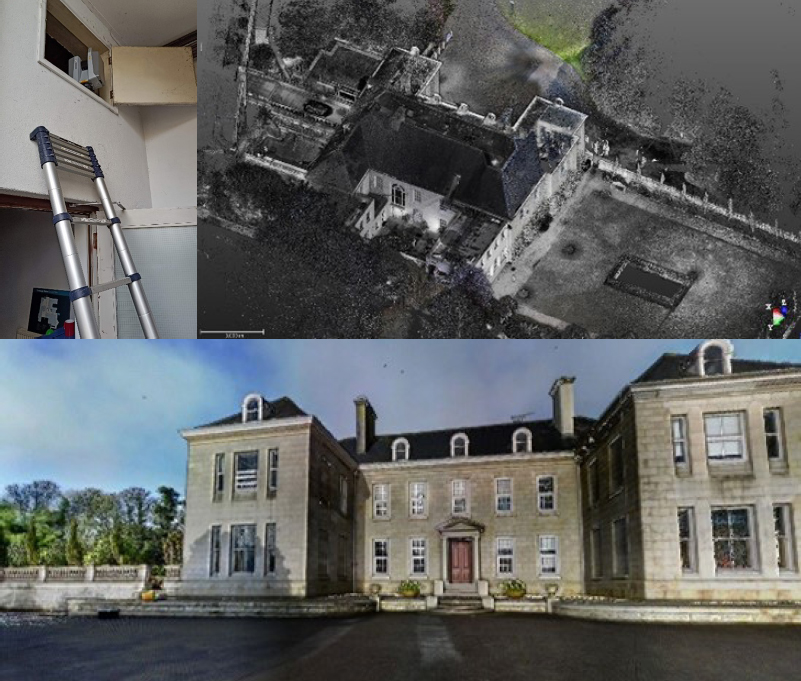
With the X12, Paul was up and running immediately because he was already familiar with the Trimble Perspective workflow from his X7. From his earlier X7 experience, he also knew that the Perspective software was extremely intuitive, even for someone using it for the first time. X12/Perspective features such as ‘Window Scan’ for focusing on areas where greater detail would be required, and the on-site registration to ensure that everything was captured before leaving the site were both rated as good time savers.
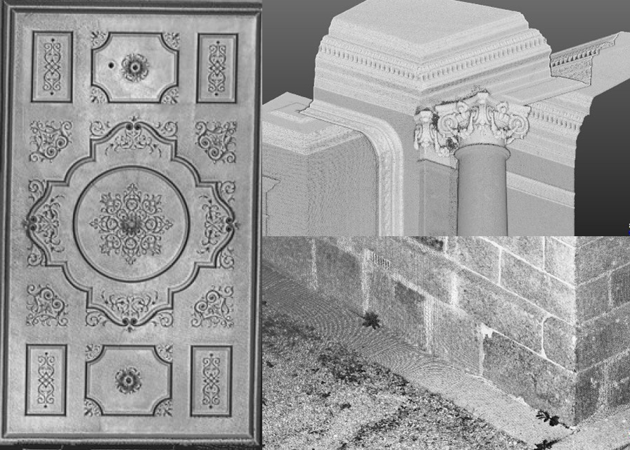
During the day, the X12 was used on and off a tripod and also at very short range to scan inside a small dark cupboard. Where more detail was required, for example when scanning architraves and decorative ceiling mouldings, the highest definition was used.
Paul’s feedback
Whilst Paul appreciates that the range of the X12 is over 300m, for this project he was working mainly at a range of 40m and lower. He also carried out a couple of comparisons with the X7 and noted that the quality of the data from the X12 is amazingly good; when sliced from the side, the X12 data had zero deviation on a 3mm thick slice compared to a light fuzziness with the X7. He also reports that the overall quality of the X12 scan data is second to none, especially inside on the ceilings and outside when looking at the brick detail. Around the site, Paul found that there were no surfaces too challenging for the X12 and scan quality was consistently excellent even when scanning at short range into darkness.
Paul noted that the colour imagery was easy to add, parallax free and excellent quality. The X12 also performed far faster than the X7 when scanning at higher definition (6mm point spacing). For example, a one minute 30 second scan with the X12 was far, far denser than a 5 minute scan with the X7. However, this makes perfect sense considering the different applications the scanners have been developed for.
Overall, Paul feels that the standout feature of the X12 is the ‘amazingly good’ crispness of data and rated the following four points as the X12’s stand out benefits:
“Your support and willingness to help is second to none!
We always find you helpful, nothing is too big to deal with”
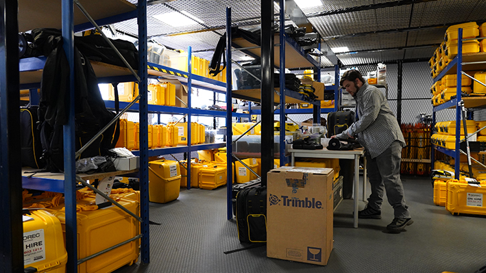
How to you differentiate yourself from the competition? It’s a question that every company asks and here at KOREC we’re no different. We’re aware that there are any number of hire businesses out there ticking the boxes on next day delivery and an extensive fleet. But KOREC has always been about more than shifting units and that’s why our Hire Service department receives the highest ratings in our customer surveys and more personalised feedback than any other part of the business.
…and that’s the KOREC difference!
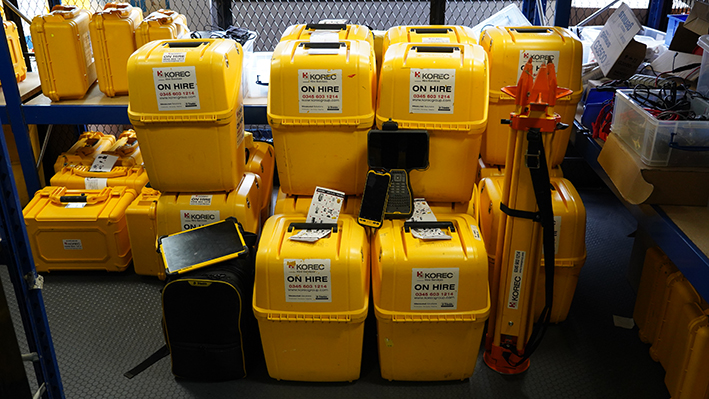
Here’s what you can expect as a KOREC Hire customer:
- Personalised Service – our biggest advantage is the hire team who take your calls, prepare your equipment and provide a customised service depending on where you are and what you need. For example, if you’re based on a hard to access site or need a special delivery point, we’ll deliver it ourselves! Our couriers are reliable and timely but sometimes we know that a personalised service can make a big difference. The KOREC Hire team ensures you get the best equipment, delivery and back-up for every project from the straightforward to the more complex.
- Consultancy – as well as being highly trained, our hire team is based on the same premises as where our hire fleet is stored, serviced and checked. In short, all our hire team members have their finger on the pulse. They can advise you on whether our top of the range, newly released Trimble X12 3D Laser Scanner is best for your job, or if the Trimble X7 with its ease of use and on-site calibration is going to be a better choice. Do you need a standard Trimble R2 GNSS or the ground breaking R12i with tilt technology perfect for super-fast surveying? Need a specialised solution for rail track measurement or just a DiNi level and a fast turnaround? Our trained team is equipped to match you up with the best technology for your project and your budget.
- Communication – we offer contact that doesn’t stop when the van leaves our yard. We understand that if you’re arranging a same day or next day delivery, there is a certain urgency to your work, so we make sure that you have three lines of communication open to us. You can call our Hire Team, you can call our Technical Support Hotline or we now also have a WhatsApp number if you don’t have access to a mobile network. Above all, we’re here to help when you need us.
- High-quality, latest equipment maintained on site in a Trimble Accredited Workshop – our Trimble Accredited Workshop is at the same location as our largest regional hire depot. That means it’s a straightforward process to ensure that all our equipment is fully calibrated, serviced and checked before it arrives on your site. Our fleet is made up of the latest equipment and all software is the most recent version.
- A ‘can do’ approach to every single hire – our customers can be demanding when schedules are tight and they’re under pressure themselves, but that’s something over 50 years in the business means that we understand. The Hire Team is rightly proud of its ‘can do’ approach and our customers are kind enough to take the time to show their appreciation with their many testimonials.
“The KOREC Hire Team has moved heaven and earth to get kit out to us- we would have been stuffed without the efforts!” Charles, South East England
“Thank you for KOREC’s assistance during this hire, you’ve been a pleasure to work with. We will definitely be using you more in the future!” Will, Suffolk
“Your support and willingness to help is second to none! We always find you helpful, nothing is too big to deal with!” Large contractor, nationwide
“I cannot find any fault with all the staff within Korec Group,
A prompt reply on requests and fast, reliable action. On sales, Hire and Servicing.” Sam, Lancashire
“We have utilised your hire fleet quite extensively over the last 6 weeks and the service I’ve received has been second to none!!! The team always goes above and beyond to ensure our requirements are fulfilled, even at late notice.” I’d love to give a huge thank you and shoutout to the Hire Team at KOREC. The girls in the hire team are absolutely fantastic, helpful, polite and will always go out of their way to help us out.” Lee, Oxfordshire

Five reasons to consider hire:
Cost-efficiency – purchasing new equipment can require a significant upfront investment. Hire means that you pay for equipment only when you need it. You’ll also avoid any depreciation costs.
Reduced downtime – our hire team manages all the equipment meaning you don’t ever have to book it in for servicing, repairs or calibration
Gain access to the equipment most suitable for your project – equipment range from a basic level or total station to globally recognised market leading scanning and GNSS technology
Try before you buy – try out Trimble equipment without the commitment of a purchase to ensure that it’s going to be a useful addition to your technology portfolio
Push your equipment for greater efficiency – each KOREC hire comes with consultancy, advice and hotline Technical Support
Contact KOREC Hire Services
Our dedicated hire team are on hand to assist with your equipment hire needs;
UK Customers | 0345 603 1214
Republic of Ireland & N. Ireland Customers | 01 456 4702
Thinking of purchasing instead? Browse our range of solutions by Industry or Solution

To learn about the mobile mapping aspect of this project as well, visit here
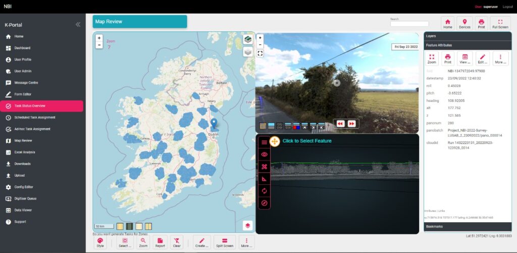
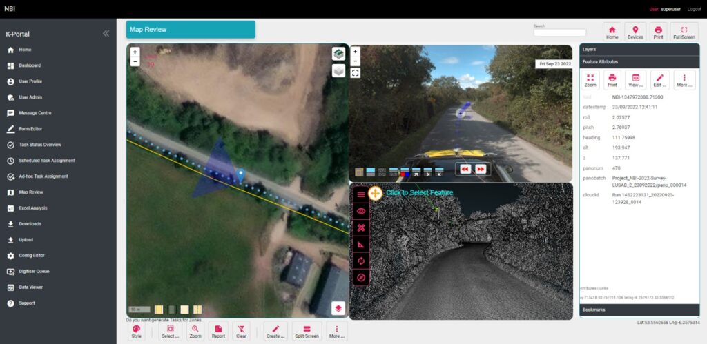
This case study is all about how KOREC’s clever field data capture app and a Trimble Catalyst cm accurate, low-cost GNSS have enabled National Highways to achieve the same amount of defect work in just one shift whilst saving around £20k on each 5km stretch of carriageway.
The digital revolution has taken hold on virtually every aspect of our lives and each day we witness technology branching out across all sectors and industries as they seek to raise productivity and streamline processes. Whilst the transport industry has in general profited from the digital revolution, specific areas such as highways maintenance are lagging behind, often still using pen and paper methods for data collection and analysis . This is something that National Highways is seeking to rectify with an innovative programme designed specifically for the concrete roads sector.
National Highways is investing £27.4 billion in the strategic road network (SRN) between 2020 and 2025 with digital data and technology being critical to its main objective, namely providing safer, smoother and more reliable journeys for its customers. Consequently, National Highways has been developing methods to enhance delivery efficiency and improve data quality to support long-term decision making.
Over the past three years, KOREC Group has been working closely with National Highways (and its delivery partners, identifying innovative new methods that can reduce both the cost of the works and the impact of construction on roads users and communities. These methods include mass data collection (mobile mapping), digital twins, IOT, augmented/mixed reality, cloud platform (KOREC Portal), machine learning and of course, field data capture (KOREC app).