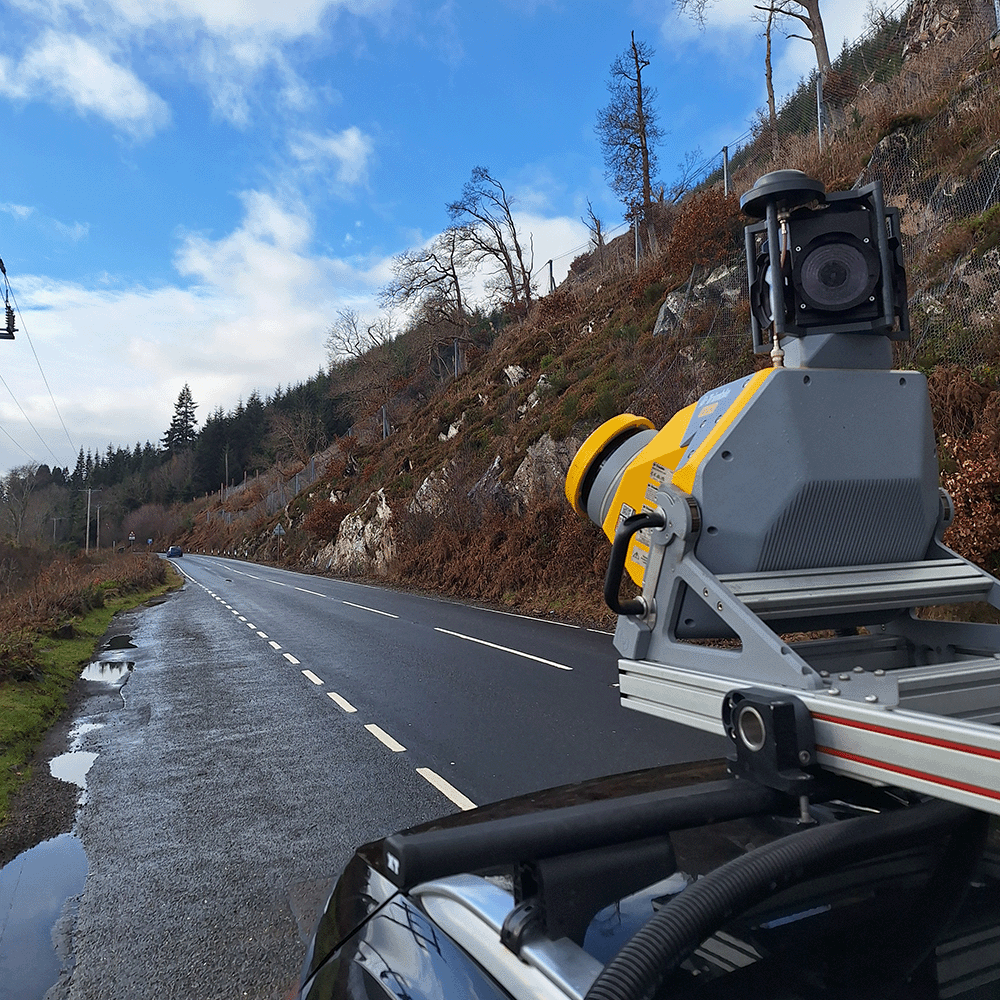
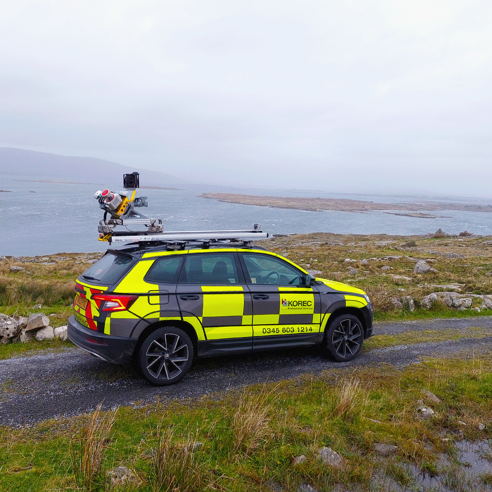
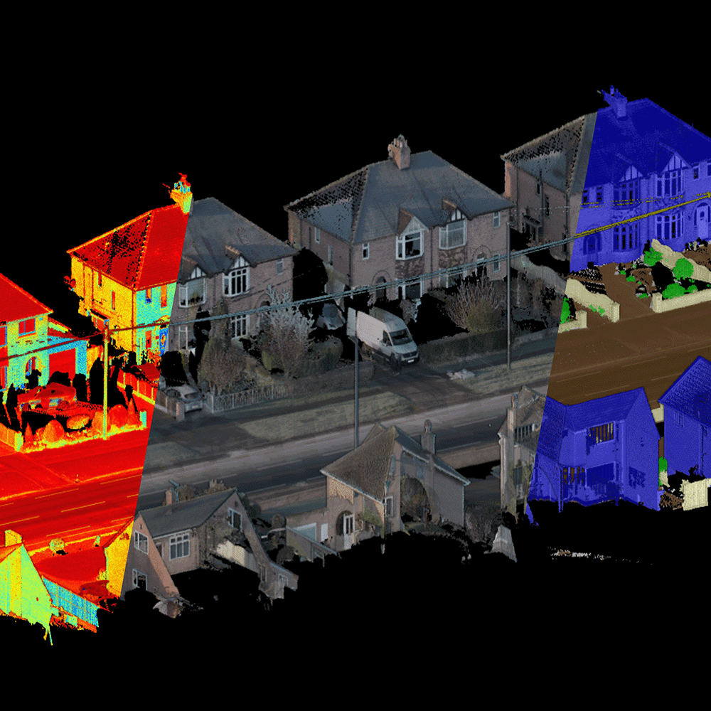
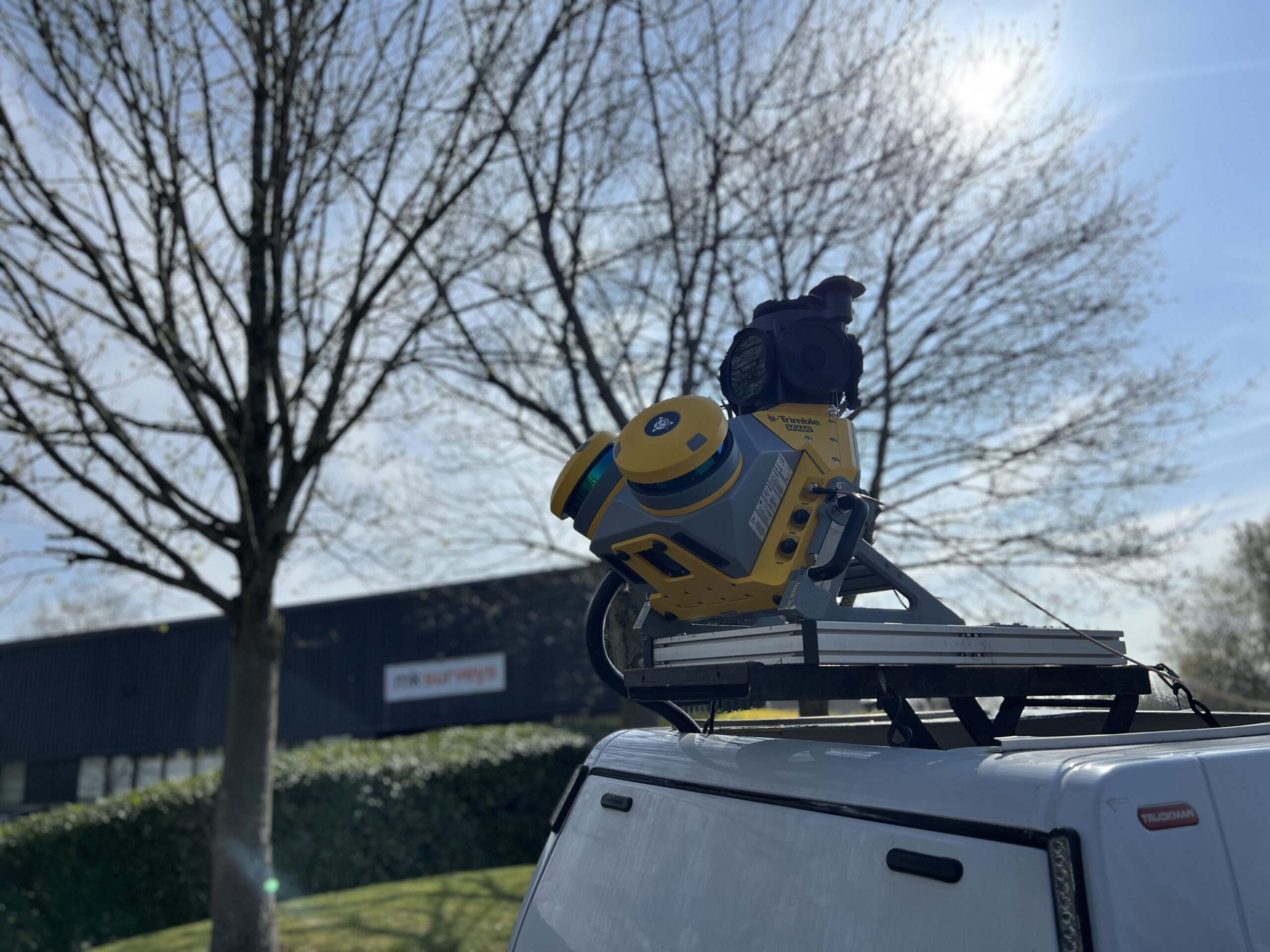
Mobile Mapping

Enabling our customers to deliver their mobile mapping projects. As a Trimble partner, we are the only service provider offering a clear route to independent expertise in mobile data collection for those looking to expand beyond our services. We provide adaptable solutions for system hire or flexible purchase, backed by expert KOREC training in data capture and processing.

Hero Block
Hero Block Mobile

The route to independent expertise

Our experienced team is experienced in working alongside a range of customers from Tier 1 contractors to small survey practices, supporting them at every stage, regardless of budget or expertise. We guide your journey, offering services, system hire with expert support, or the option to purchase.
  • Flexible options for self-sufficiency
  • Full training for data capture and processing
  • Supportive team for ongoing success

Our service offering

KOREC Professional Services also specialises in the provision of field-to-finish mobile mapping solutions, including the capture, processing and digitisation of your projects. Each job is undertaken using a blend of our team’s expertise (over 60 years combined experience) and a choice of high-tech systems, unique to KOREC Professional Services, through our valued partnership with Trimble, the global market leader in mobile mapping. This distinctive approach has been recognised by our customers who gave us a resounding 100% satisfaction rating in a recent survey.

  • Flexible solutions tailored to fit every budget
  • An expert team at the forefront of commercial mobile mapping from its earliest days
  • Access to Trimble’s latest market-leading technology
  • 100% customer satisfaction rating
  • Scheduled delivery of projects

Data capture

Our turnkey data capture services use the latest Trimble mobile mapping technology to deliver precise, efficient results. Operating at normal traffic speeds, we eliminate the need for traffic management whilst capturing high-resolution 3D LiDAR data and georeferenced 360-degree imagery. Optional sensors – including thermal imaging, HD photography, and GPR – can be added to suit your project’s needs. 
  • Rapid, large scale data acquisition
  • Reduced or zero Traffic Management requirements
  • Safety for surveyors
  • Option to join our team for knowledge sharing
  • Projects successfully delivered on roads, rail and water

Data processing

KOREC can support with data pre-processing for surveys collected through services or mobile mapping hires. Pre-processing includes trajectory optimisation, GNSS processing, run matching, and adjustment to ground control in order to maximise survey grade accuracy. Imagery can also be blurred to obscure number plates and faces to meet with GDPR regulations. We also offer a full range of post processing services to support your projects. Trimble Business Centre is used to process your data from initial trajectory corrections through to the final classified registered point cloud and georeferenced images. 
  • Fast processing using AI and semi-automatic routines
  • Experienced mobile mapping analysts
  • Scalable projects – no job too large
  • Cloud software solutions for easy, low-cost data sharing

case studies

Delivering spatial understanding for all

10/20/25

Growing a business through clarity: How Image Surveys used Soarvo, a cloud-based 3D geospatial platform, to make 3D drone data interactive and easy to share for all of an events management team.

New KOREC case study: When context is everything

06/12/25

How GeoDrone Survey helped a landowner pinpoint the exact proximity of an underground bunker to the Norfolk coastline thanks to Soarvo, a powerful cloud-based platform for managing and visualising geospatial data.

New KOREC case study: Exeter underground – surveying the city’s hidden history

05/19/25

A request to survey a 390m network of Exeter’s historic underground tunnels – some as narrow as 430mm – and to tie those tunnels to the topography of the streets above, presented exactly the kind of complex, technical challenge that Benchmark Surveys excels at.

New KOREC case study: Mission Impossible?

04/07/25

A project no builder dared to take on… a relentless problem-solving mindset… and the smart use of Trimble technology. Discover how Stephen Napper, Director of MMC Engineer, found the most cost-effective way to deliver a brand-new apartment in a tight, enclosed courtyard with almost no access.

New KOREC case study: After the spray paint fades….

03/31/25

How the smart application of Trimble’s AR SiteVision technology has enabled Castle Keep Surveys to provide their client with an innovative solution for identifying underground utility assets—long after the completion of a PAS128 Underground Utility Survey.

New KOREC case study: Complexity to Clarity

03/03/25

How Glanville Consultants used a Trimble X9 Laser Scanner and Perspective software to tackle an expanding brief on a 10-year, campus project in the east of Oxford.

New KOREC case study: Easy to use, quick to learn

02/13/25

A recent project for Scottish Water showcases the success of Edwards Diving Services’ in-house survey team. Their choice of three core Trimble instruments, supplied by KOREC, highlights the importance of user-friendly survey technology for specialist businesses managing a range of measurement requirements.

New KOREC case study: The Power of Three

01/09/25

The strategic planning of the A30 Costain/Jacobs JV survey portfolio utilised a focused Trimble hire fleet and the acquisition of three core instruments—Trimble SiteVision, an R12i GNSS, and an SX10 Scanning Total Station

New KOREC case study: Elevating customer satisfaction

10/23/24

Centred around the Trimble X9 3D Laser Scanner, a strong workflow, which is constantly growing and evolving, has enabled South West Surveys to build a highly satisfied customer base.

New KOREC case study: “The Trimble X9 is life changing”

10/21/24

How a small inheritance, a smart business plan, and one unbeatable piece of survey equipment transformed 23 year old architectural assistant, Will Turner, into the successful founder of ScanPlan, a thriving measured building survey company.