Discover geospatial excellence with KOREC
We help you measure, map and manage the natural and built environment


We help you measure, map and manage the natural and built environment
KOREC’s mission is to empower you to measure, map and manage the natural and built environment. When operating in the natural and built environment consistent success demands accuracy, safety and speed, whilst reducing costs and environmental impact.
We believe embracing geospatial solutions will transform your outcomes and deliver that success. Combining industry knowledge, with intuitive software, and world-leading positioning technology, KOREC transforms your operations bringing certainty to your decision making.
Our Brand Promise
At KOREC, TRUST is at the heart of everything we do. Our promise is simple: to be
That means being open and honest with you, delivering on our word, listening to your needs, and always being there when you need a hand. We know your time matters, so we focus on getting things right quickly and efficiently. For us, building trust isn’t just a promise — it’s the way we create lasting partnerships.
KOREC’s friendly, approachable consultants have decades of experience solving complex problems across a wide range of industries. We have the lived experience to fully understand your business operations and find new ways of working that deliver
Our technology partners
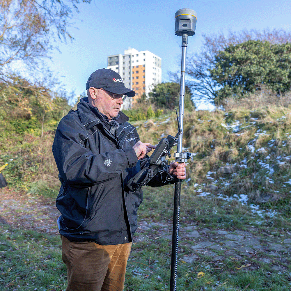
Trimble are famous the world over for rock-solid, reliable and highly accurate hardware. Across GNSS, Total Stations, Laser Scanning, Rail, Monitoring and more, Trimble are the largest manufacturer of geospatial hardware in the world. And what truly sets Trimble apart goes beyond the hardware to the wider ecosystem. The integration between Trimble hardware and With Trimble powering easy field-to-finish workflows – no friction, no roadblocks, just the data you need when you need it – it’s no wonder Trimble are the industry standard. Read more about why you should choose Trimble for your geospatial technology solutions.
KOREC have been the UK distributor for Trimble for decades. We leverage that experience each and every day with experienced technical pre-sales and after-sales support to make sure you’re making the right investment. At KOREC, we don’t just sell you boxes: we solve your problems and remain on-hand long after the PO has been signed. When you partner with KOREC, can know we’re always in your corner.

See technology in action
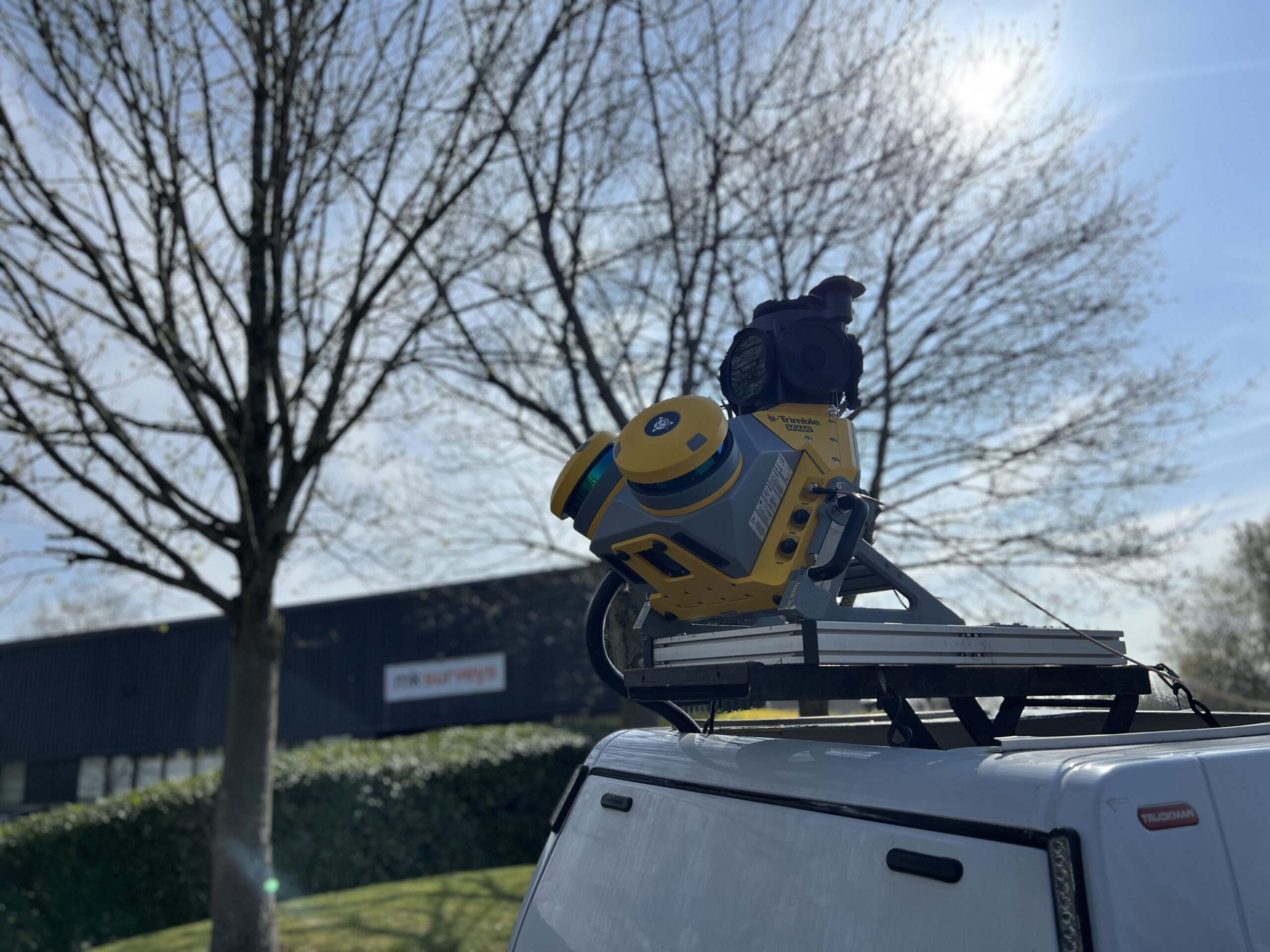
MK Surveys is maximising the value of its Trimble MX60 Premium system in two ways: by treating it as a precision survey tool rather than solely as a mobile mapping solution and by developing new client-focused workflows.
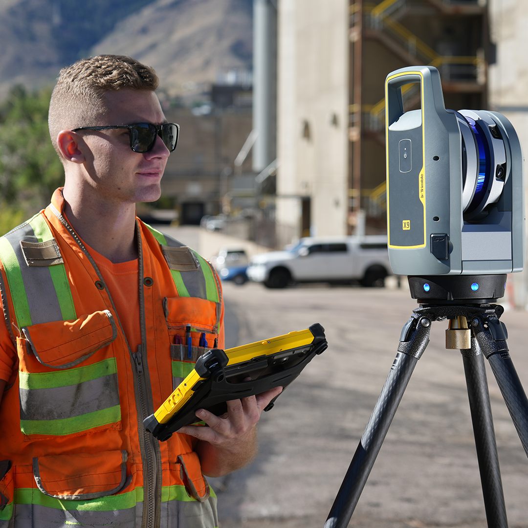
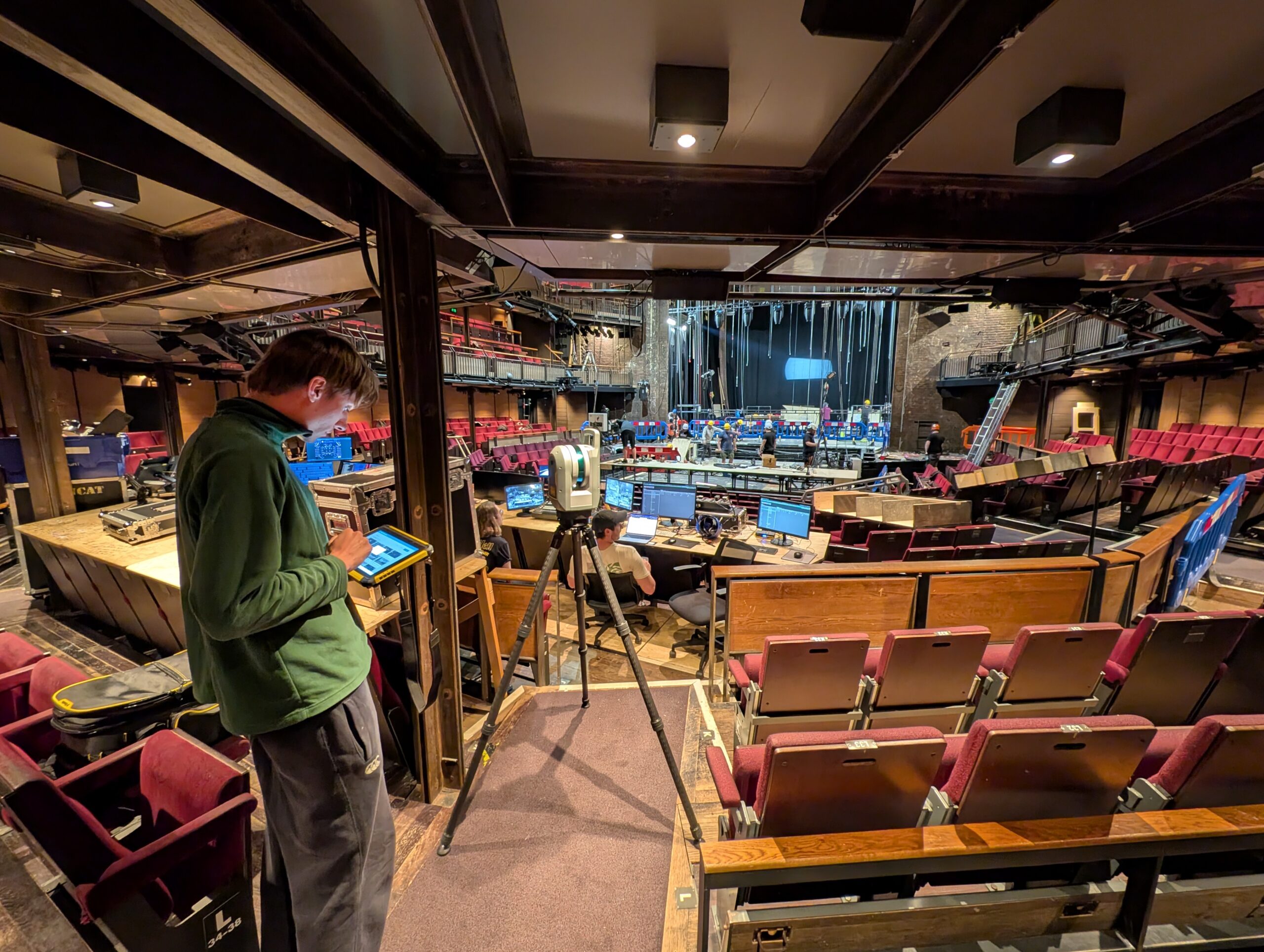
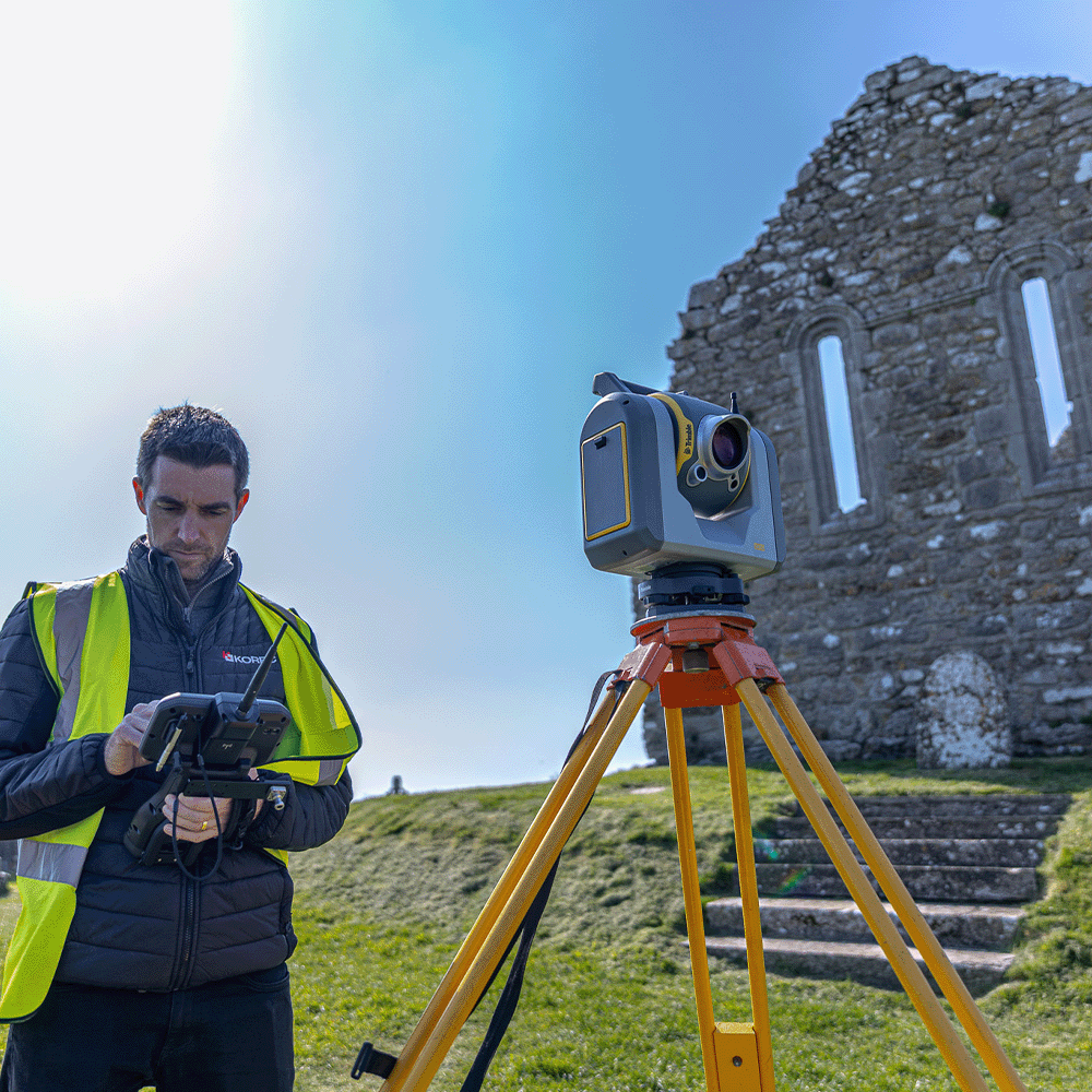
How the Royal Shakespeare Company is using a Trimble X9 Core LT 3D Laser Scanner to move beyond 2D plans and truly understand the 3D spaces they design for.
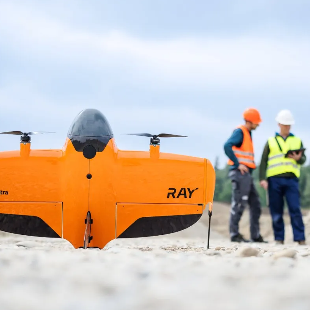
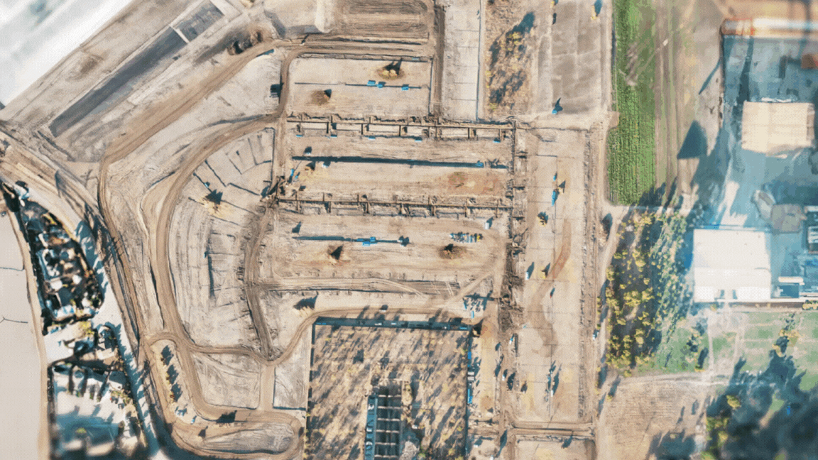
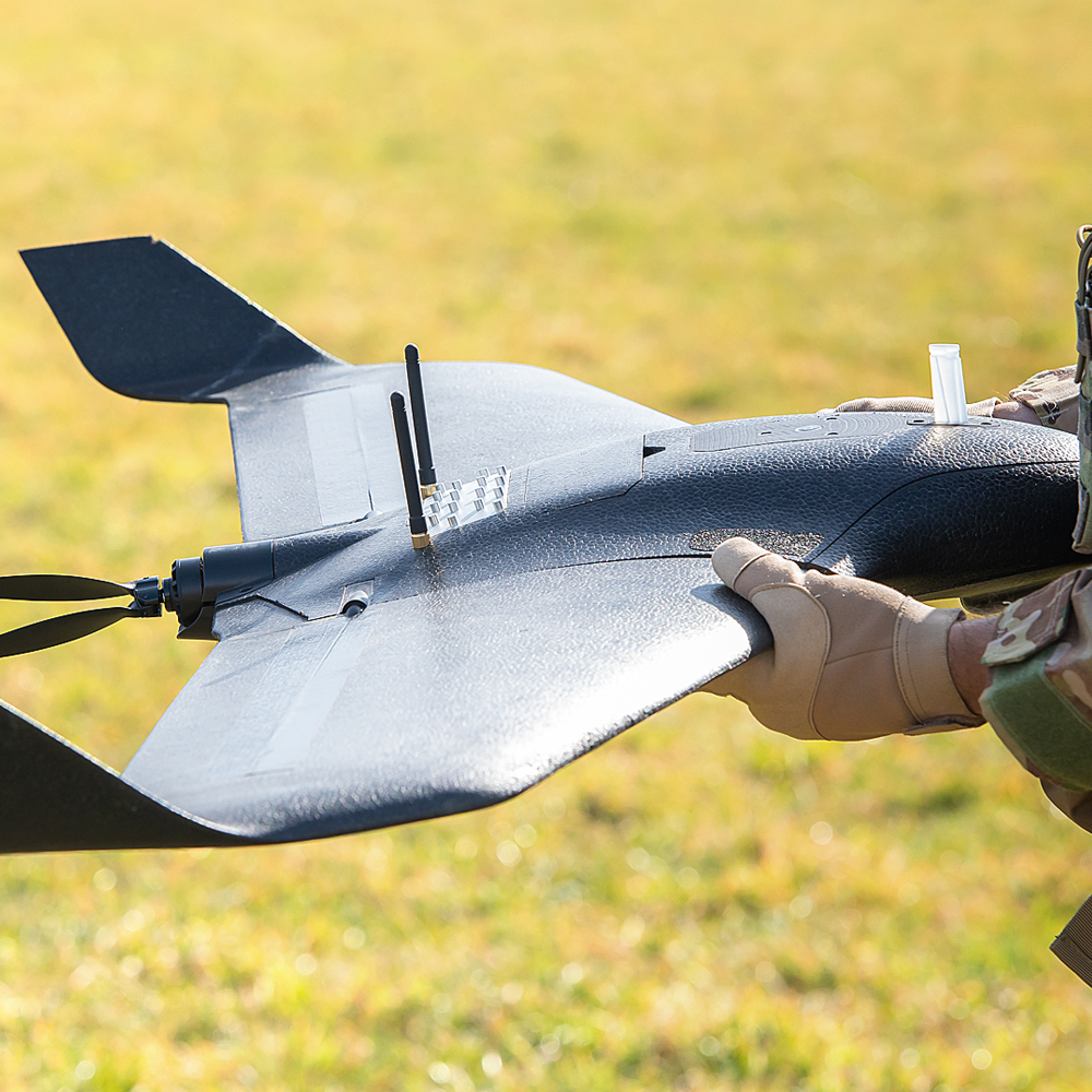
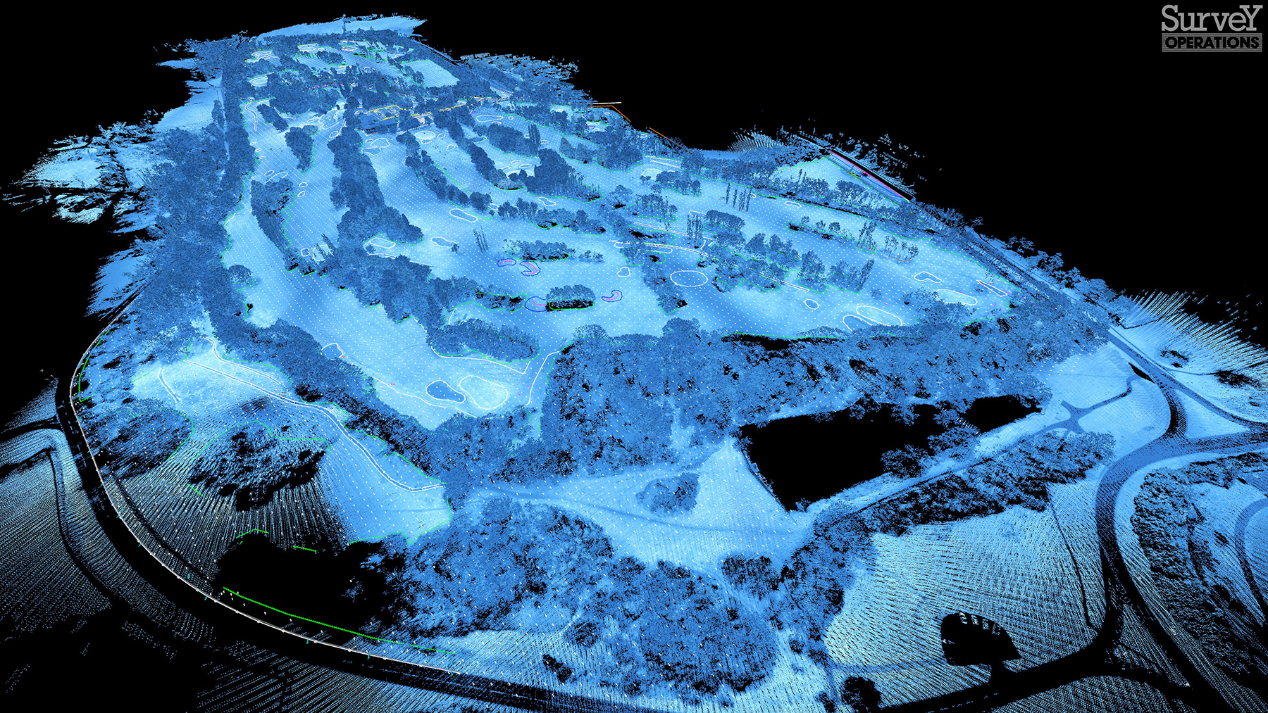
Survey Operations has exploited its Wingtra GEN II drone’s interchangeable LiDAR/camera payloads and straight forward workflows to create impressive operational and data quality advantages, not just on large scale projects, but on the small ones too.
The reliability of the Trimble X9 Core for 3D laser scanning has made it a go-to tool for the Royal Agricultural University, both in preparing the next generation of land […]
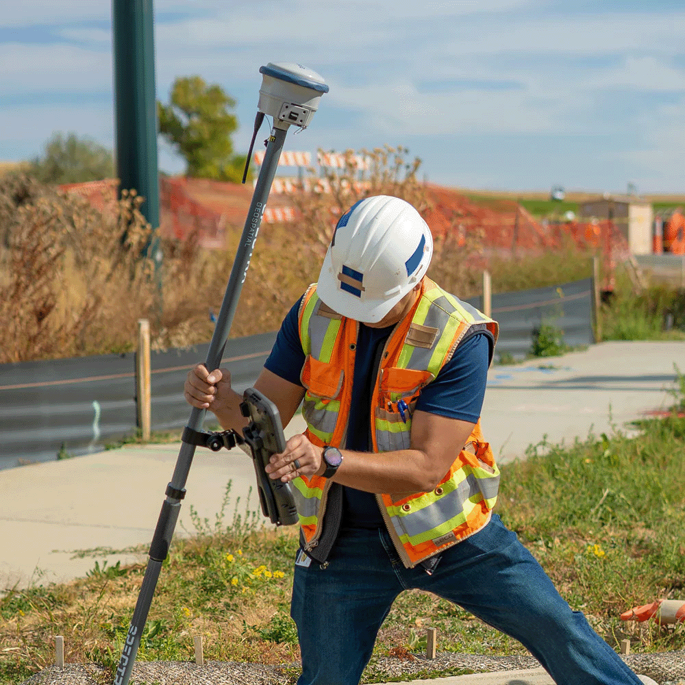
Using Trimble Catalyst to accurately map plots on their natural burial ground, Forget Me Not Fields has found a perfect balance between efficiency and tranquillity amongst the wildflower meadows. Download […]
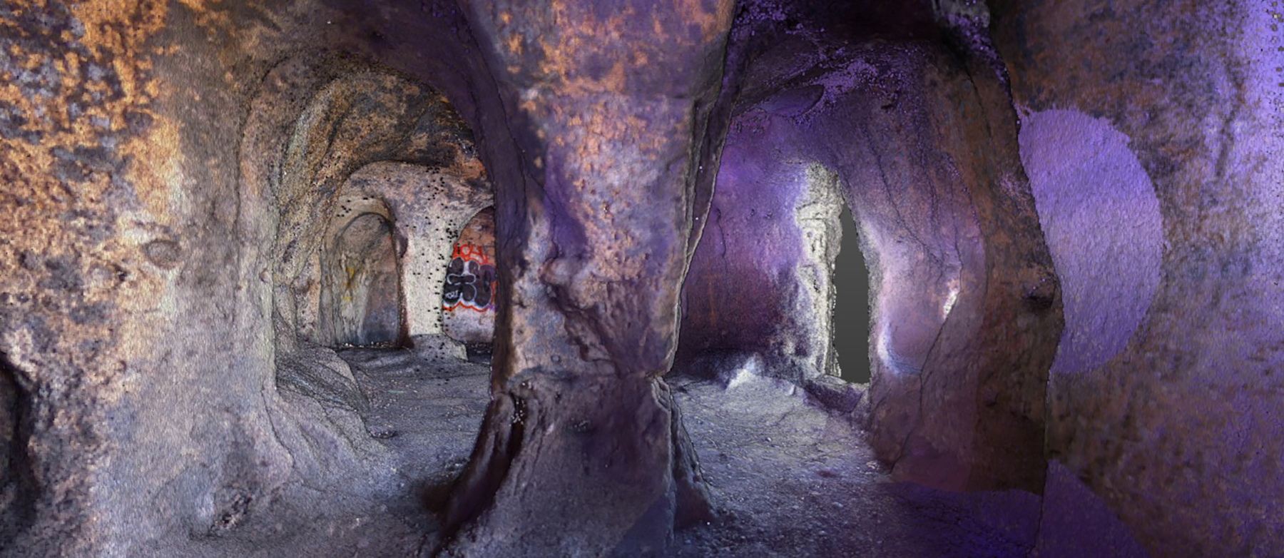
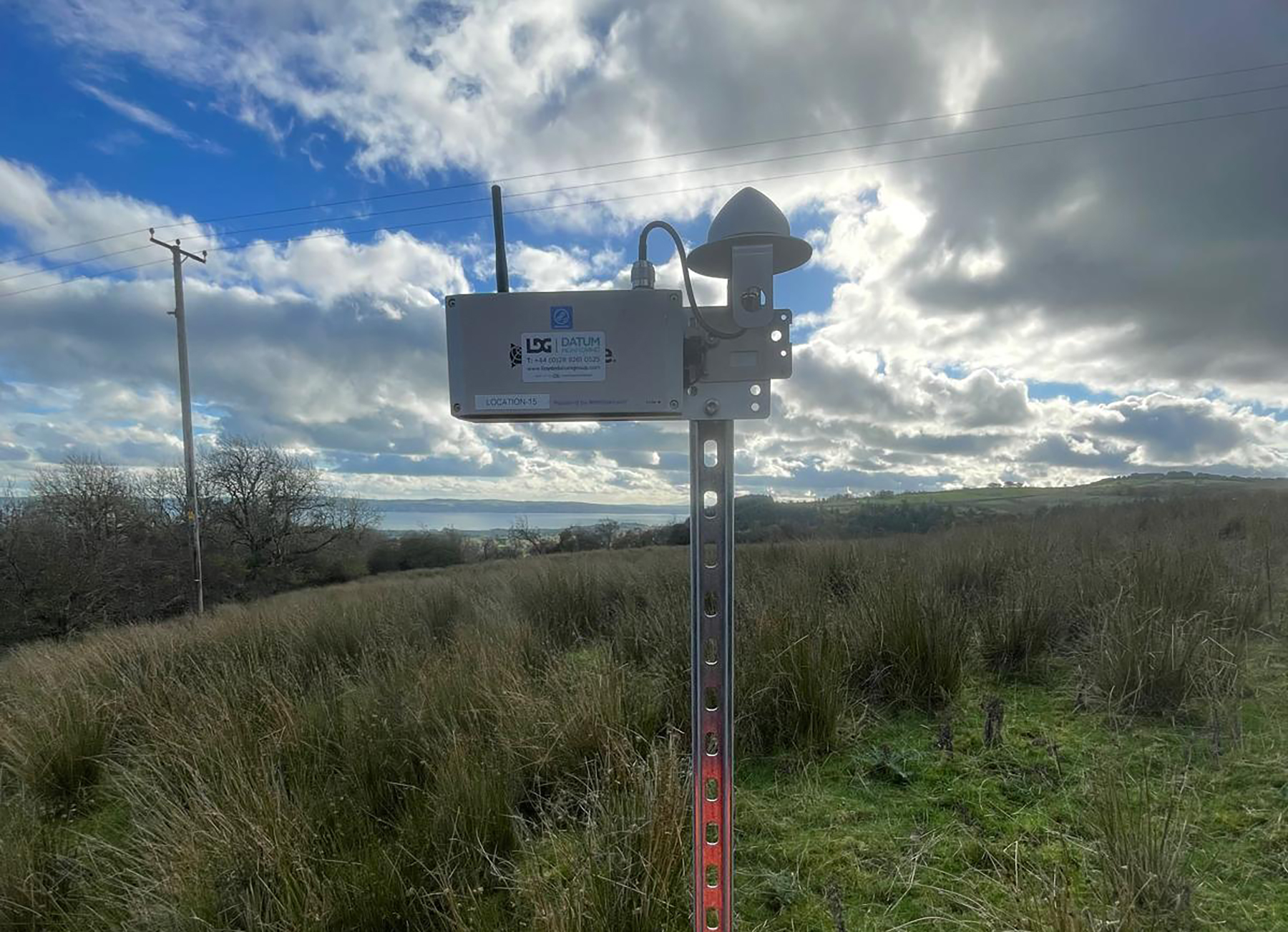
Lloyds Datum Group (now part of SOCOTEC UK and Ireland) has pioneered a landmark project on an abandoned mine site in Northern Ireland. It is the country’s first large-scale ground […]
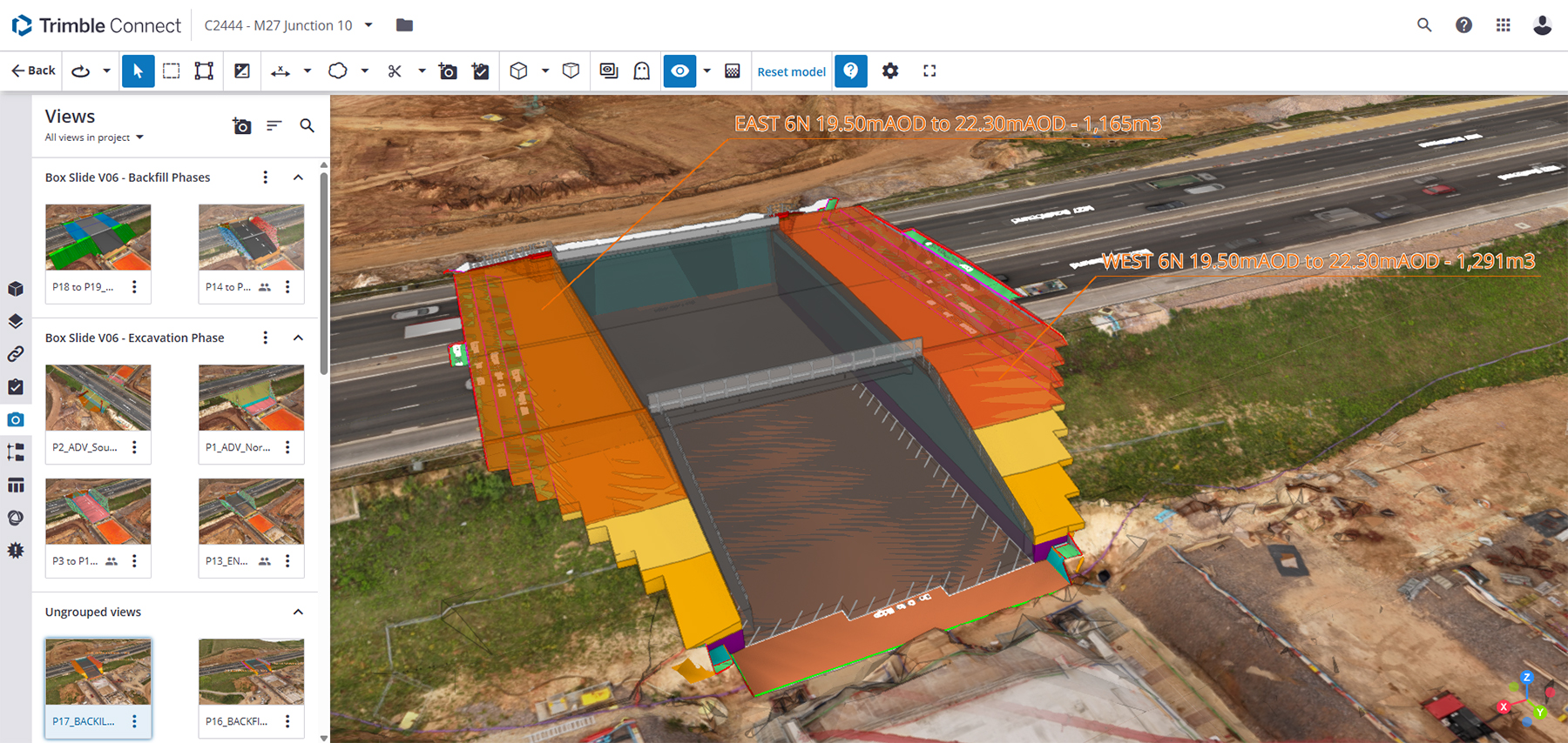
Leading earthworks and civil engineering contractor MJ Church, has combined its holistic, model-driven approach to complex infrastructure projects with a fully integrated Trimble ecosystem of hardware and software – all hosted within Trimble Connect’s Common Data Environment.
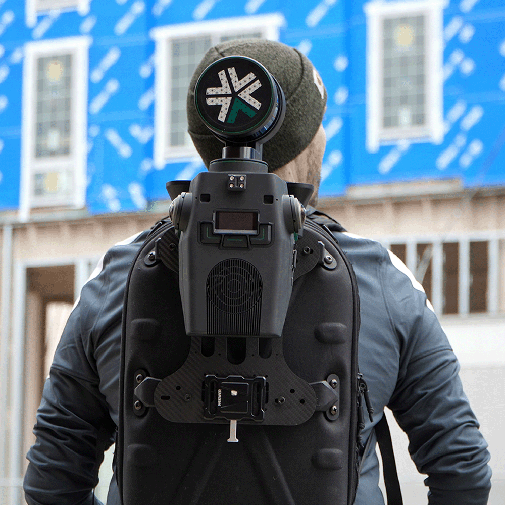
When Neon Surveys introduced the Exyn Nexys SLAM system into their floor-plan surveying workflow, the only difference their clients noticed was how much faster they received the finished deliverable.
How a strong understanding of the Exyn Nexys SLAM technology enabled SYSTRA UK to strike the perfect balance between speed and accuracy during a recent structural assessment survey of a large and complex building in Manchester.
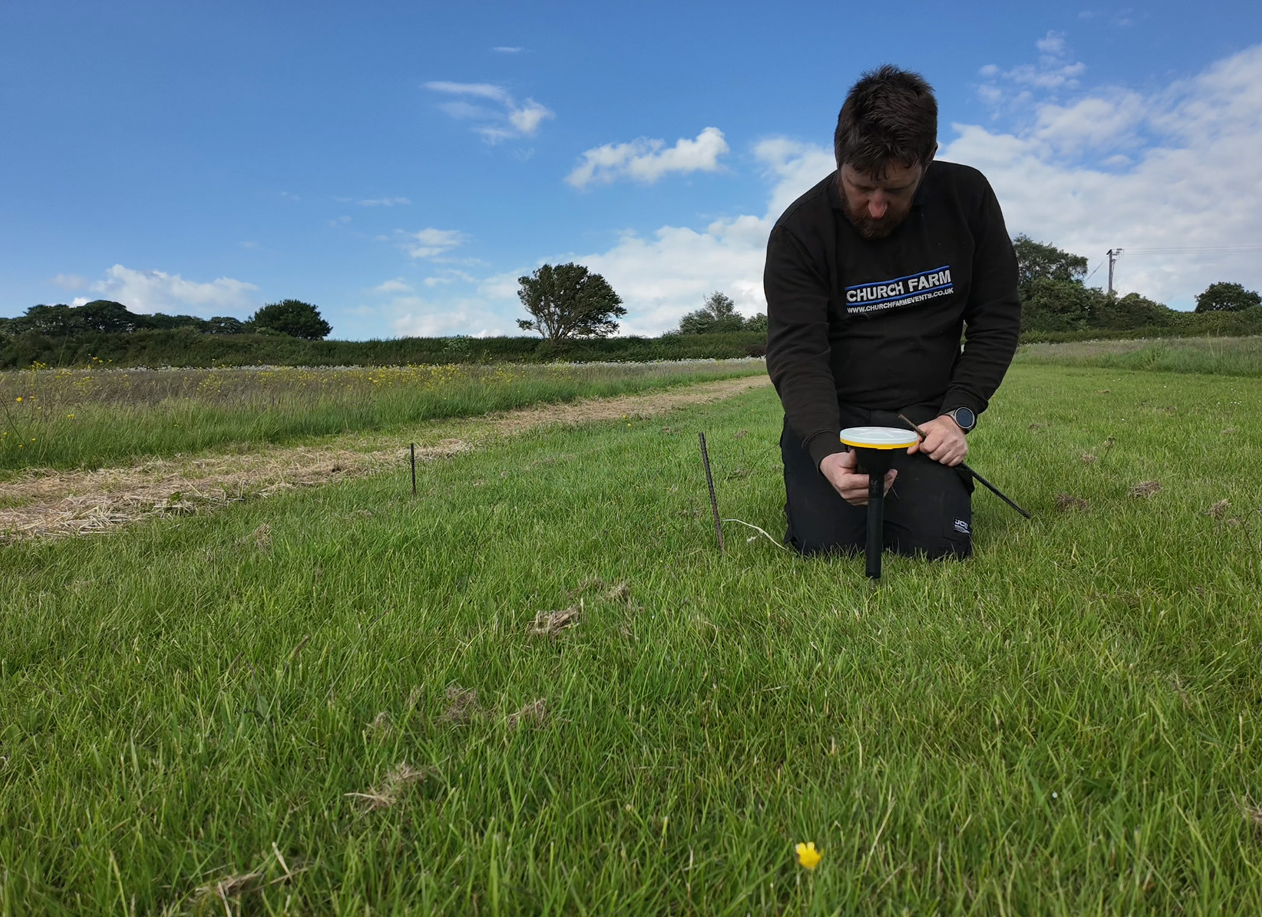
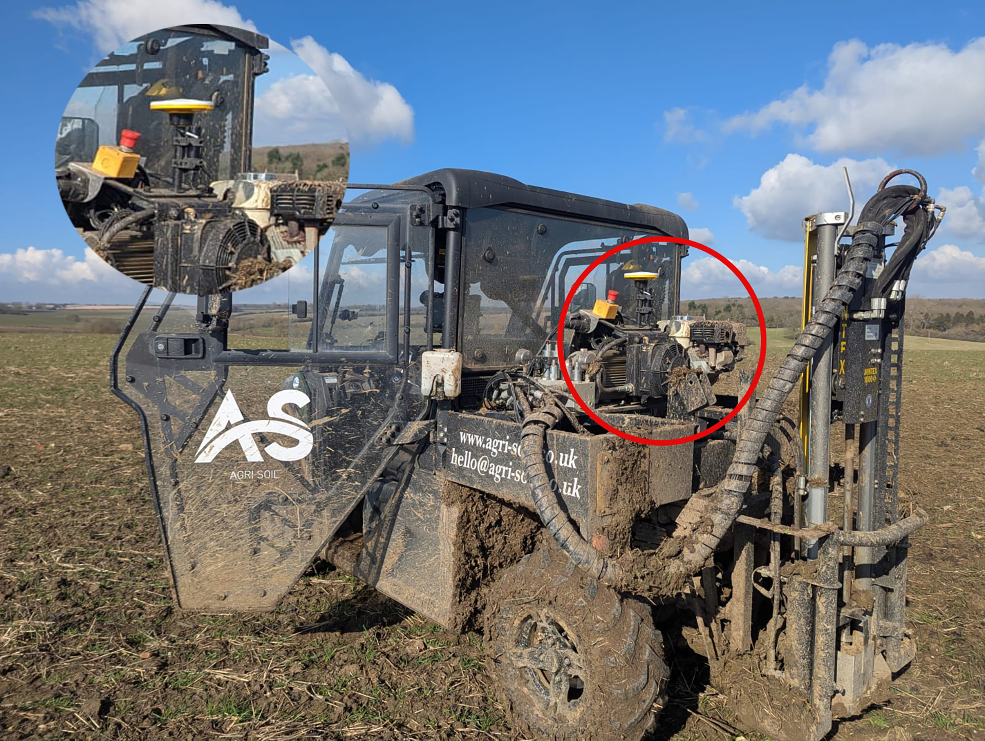
A family farm has diversified into providing an expert soil sampling and analysis business as an independent alternative to using services provided by large agricultural chemical companies.
Top-end laser scanning
With flexible subscriptions and different performance packages, it’s never been easier to add laser scanning to your business. Get started with the Trimble X9 Core LT laser scanner on subscription from an upfront cost of just £28,500*, and seamlessly upgrade capability as your business grows! There’s never been a better, easier way to access state-of-the-art laser scanning. Famous Trimble reliability, exceptional quality, all backed by the KOREC service and support we’re known for.
*Contact KOREC for full details on the ‘from’ price. EUR pricing also available for our customers in Ireland.