Get low cost, high precision location data.
Trimble Catalyst is a flexible, subscription-based GPS that delivers precision location data for survey, mapping, utility, construction, events management and much more!


Trimble Catalyst is a flexible, subscription-based GPS that delivers precision location data for survey, mapping, utility, construction, events management and much more!
Trimble Catalyst is a pick-up/put-down way to survey-grade precision in a flexible, low-cost package.
Find out more about this much-loved technology by speaking to our friendly KOREC experts.
Trimble Catalyst’s flexible, subscription-based precision location makes it a great solution for a wide range of industries.
Most GIS systems and location repositories don’t know knowing whether a point is 10cm or 5m out, and neither do most end users once the data is in the system. This is why location and precision matters – accuracy is a foundation for tangible business outcomes. Trimble’s Catalyst gives you:

Customer
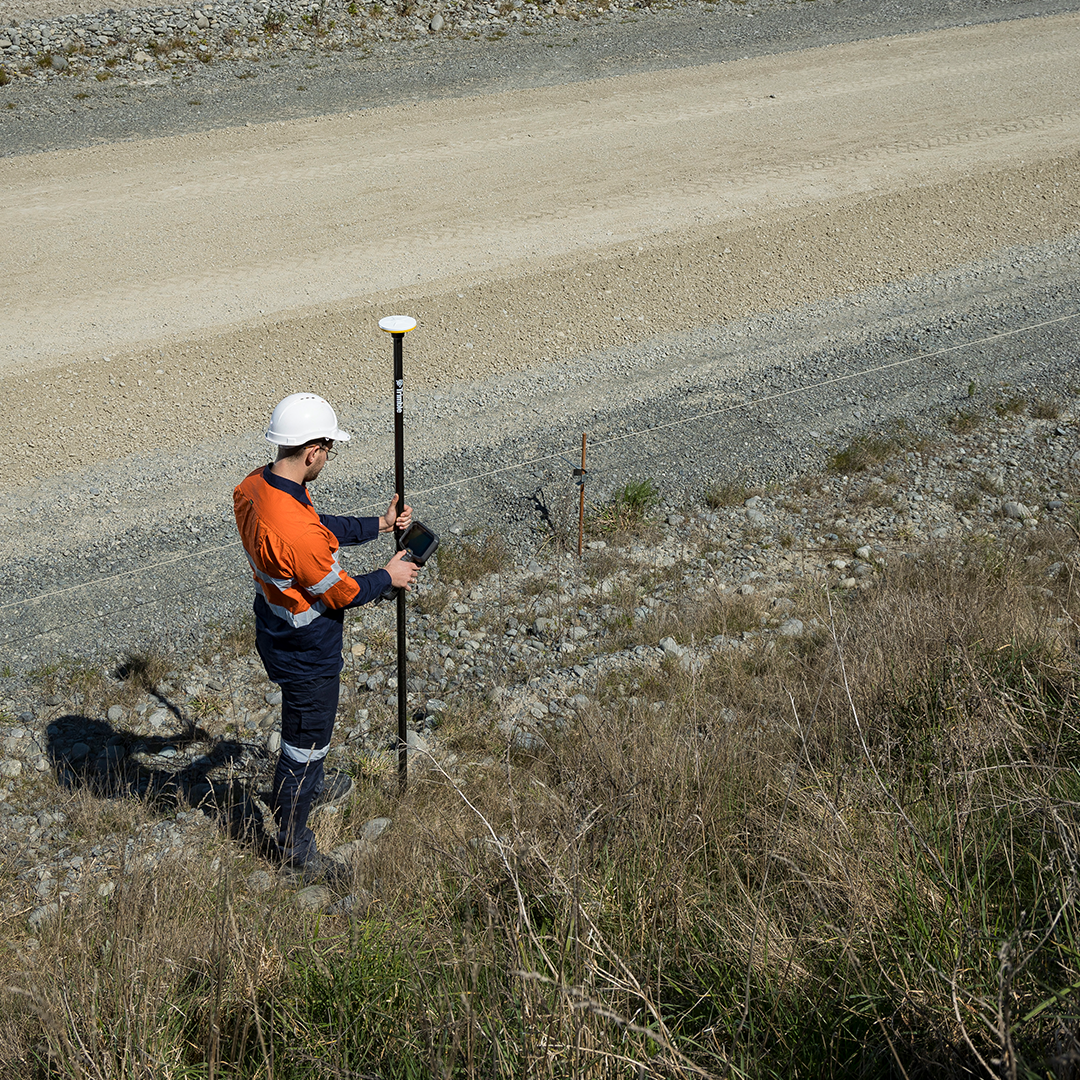
The HALO Trust (Hazardous Area Life-support Organization) is the world’s largest humanitarian landmine clearance and weapons disposal organisation.
Project Aims
The HALO Trust needed to equip a local workforce with a range of user-friendly systems, portable and discreet, for the recording of reliable sub-metre and decimetre positions worldwide.
Summary
Accurate maps are key to the Trust’s work, including the creation of boundaries of areas to be cleared, assessment of threat areas and the actual position of each landmine after clearance. However, one of the most important maps that HALO will create is the one that is presented to the local community and national authorities on completion of a successful clearance operation. This map provides vital visual information on reclaimed areas which will allow local communities to access their land and infrastructure again.
All of these maps are reliant on the quality of data captured in the field and for many years The HALO Trust has previously worked with basic handheld GPS systems, traditional survey methods and even paper maps. With support from KOREC and Trimble, The HALO team is now equipped with the most suitable and cost-effective mapping GNSS in Trimble Catalyst, fully integrated with their existing Esri workflow. The end result is streamlined workflows and reduced manual data processing with seamless data integration between Trimble solutions and Esri software.
Shop with confidence
Head to our online shop to buy all things Trimble Catalyst:
KOREC have been serving the geospatial industry for over 30 years, and we’re official Trimble dealers for UK & Ireland. When you buy from KOREC you shop with the confidence that comes from a buying from a trusted geospatial partner.
See technology in action
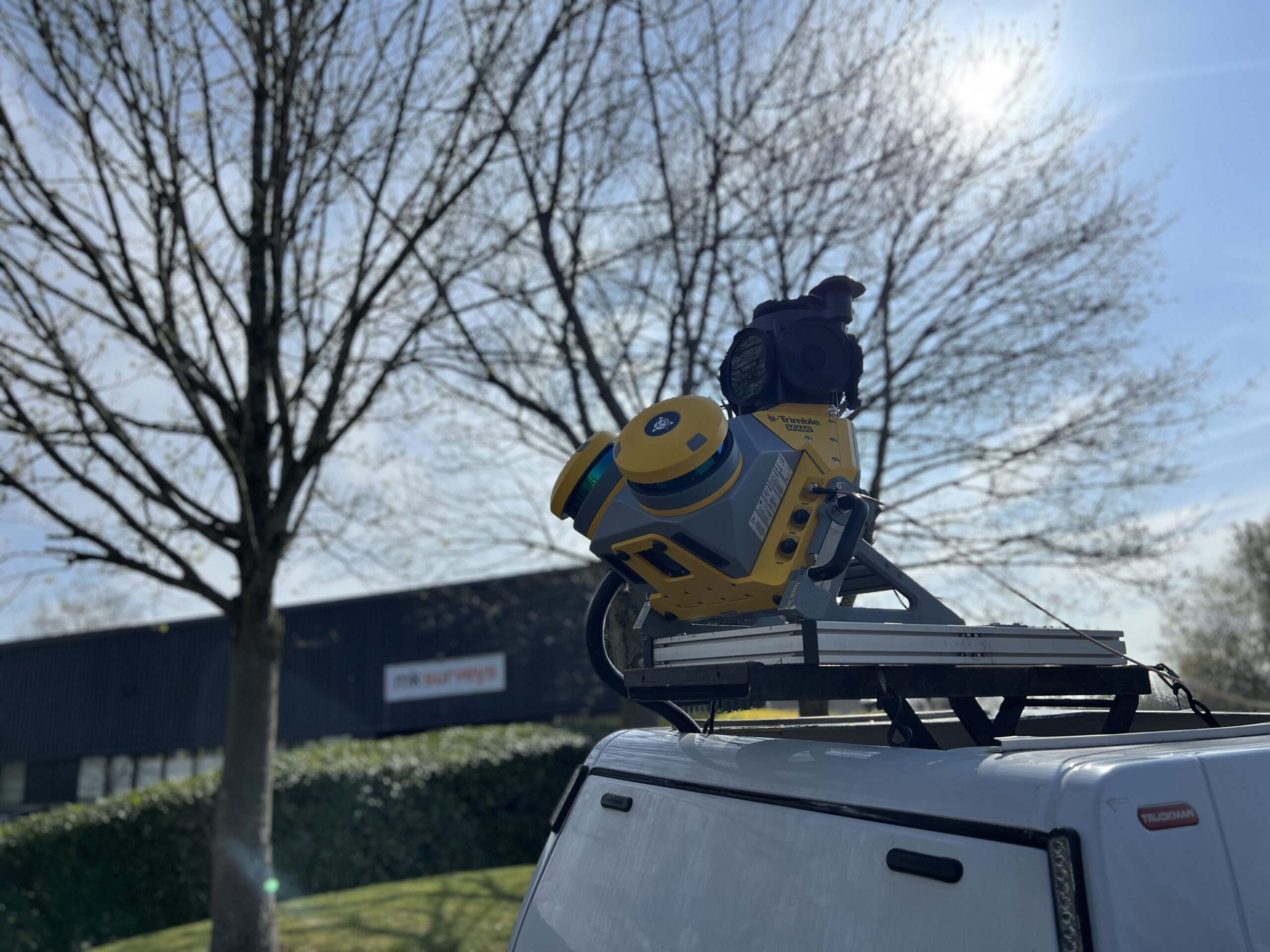
MK Surveys is maximising the value of its Trimble MX60 Premium system in two ways: by treating it as a precision survey tool rather than solely as a mobile mapping solution and by developing new client-focused workflows.
How the Royal Shakespeare Company is using a Trimble X9 Core LT 3D Laser Scanner to move beyond 2D plans and truly understand the 3D spaces they design for.
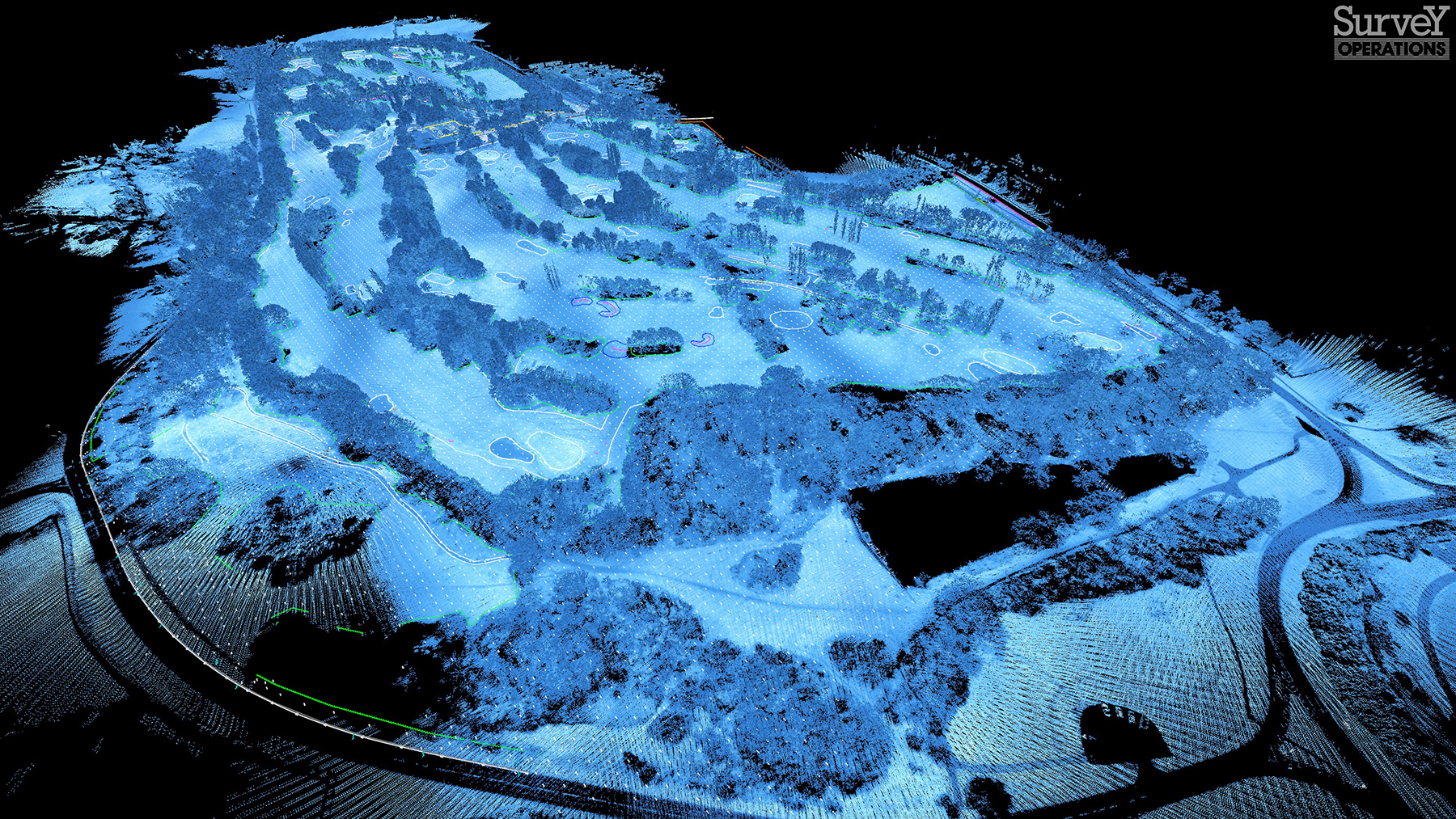
Survey Operations has exploited its Wingtra GEN II drone’s interchangeable LiDAR/camera payloads and straight forward workflows to create impressive operational and data quality advantages, not just on large scale projects, but on the small ones too.
The reliability of the Trimble X9 Core for 3D laser scanning has made it a go-to tool for the Royal Agricultural University, both in preparing the next generation of land […]
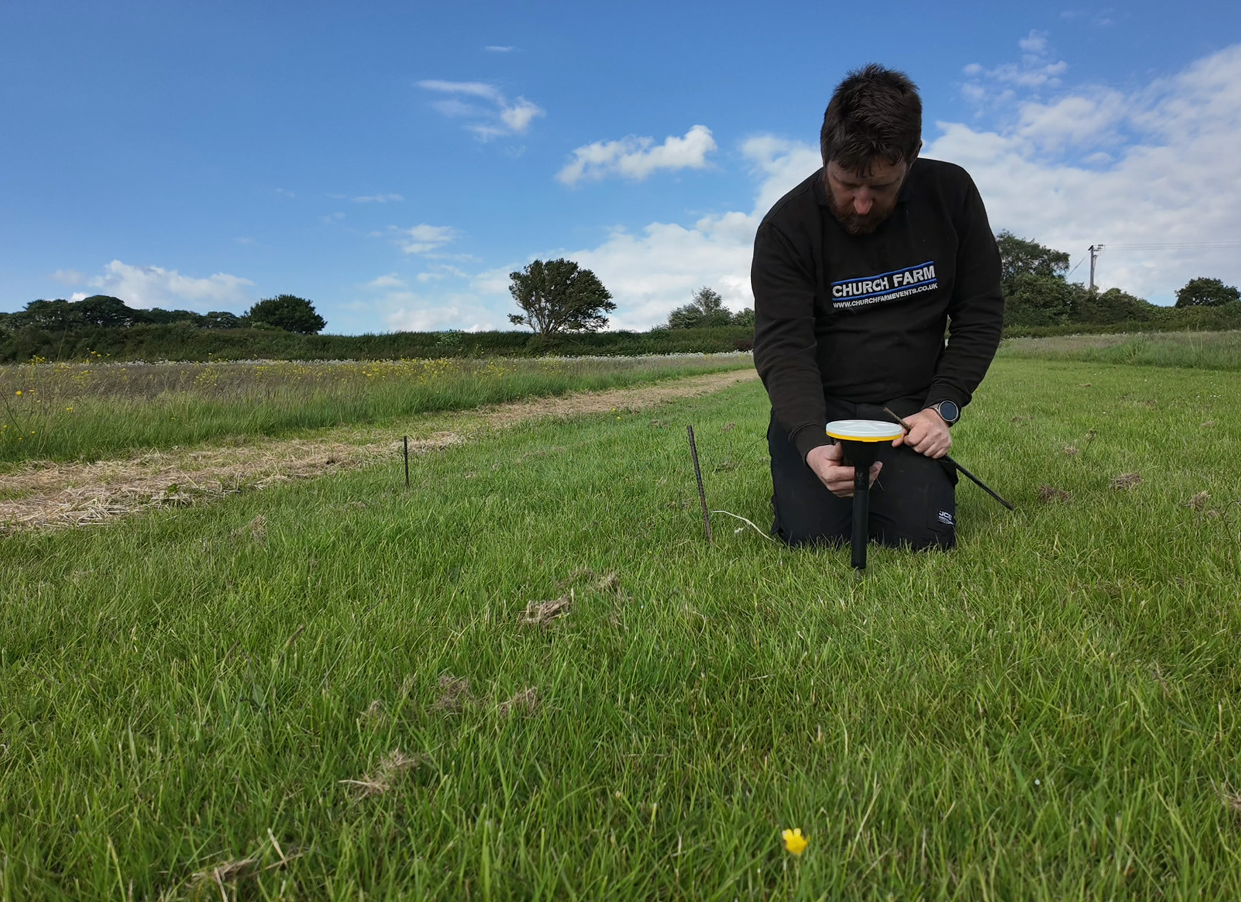
Using Trimble Catalyst to accurately map plots on their natural burial ground, Forget Me Not Fields has found a perfect balance between efficiency and tranquillity amongst the wildflower meadows. Download […]
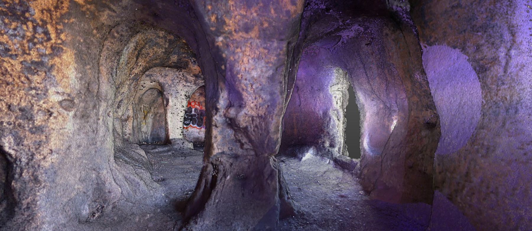
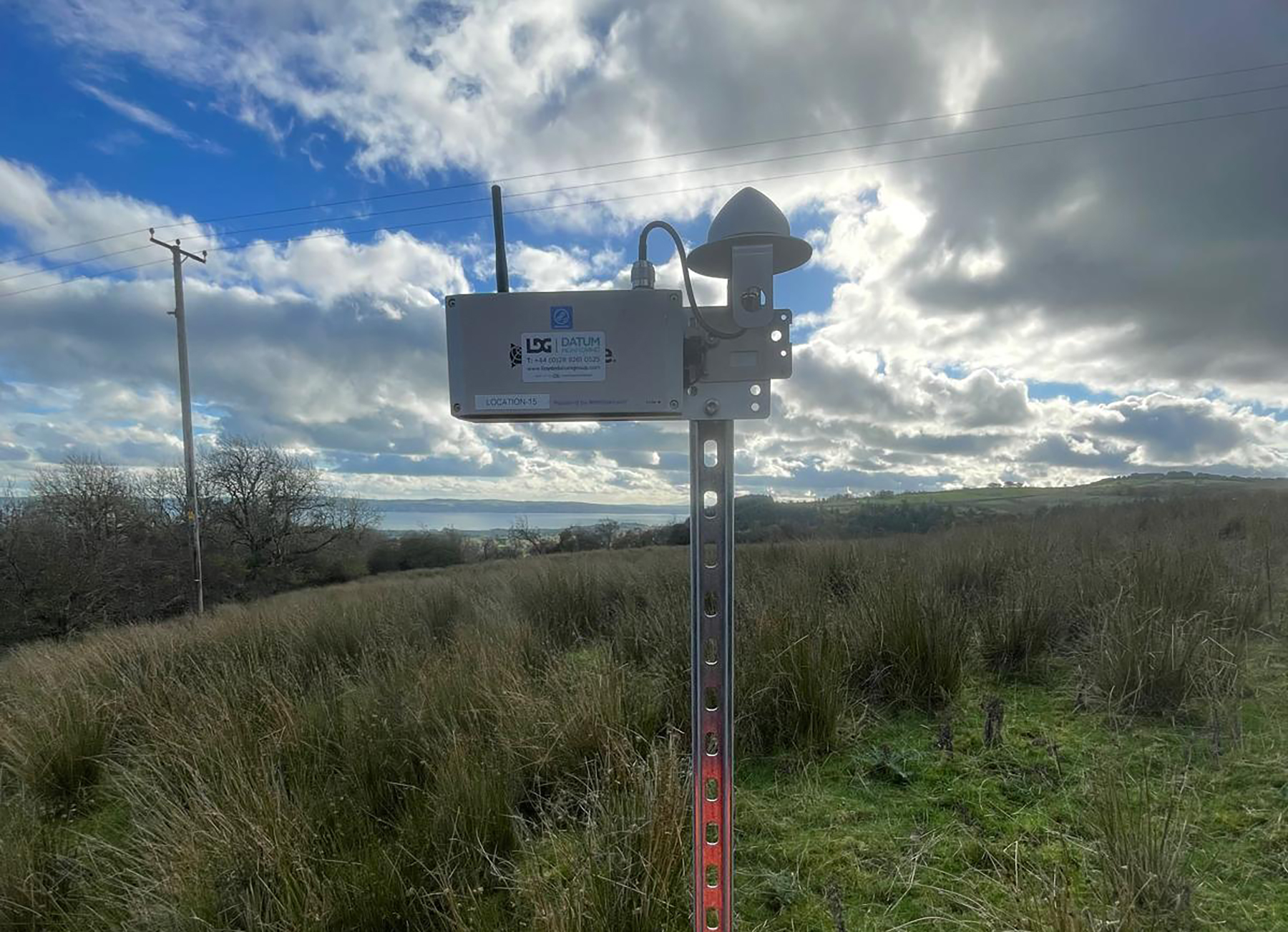
Lloyds Datum Group (now part of SOCOTEC UK and Ireland) has pioneered a landmark project on an abandoned mine site in Northern Ireland. It is the country’s first large-scale ground […]
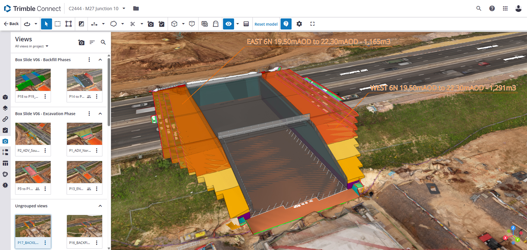
Leading earthworks and civil engineering contractor MJ Church, has combined its holistic, model-driven approach to complex infrastructure projects with a fully integrated Trimble ecosystem of hardware and software – all hosted within Trimble Connect’s Common Data Environment.
When Neon Surveys introduced the Exyn Nexys SLAM system into their floor-plan surveying workflow, the only difference their clients noticed was how much faster they received the finished deliverable.
How a strong understanding of the Exyn Nexys SLAM technology enabled SYSTRA UK to strike the perfect balance between speed and accuracy during a recent structural assessment survey of a large and complex building in Manchester.
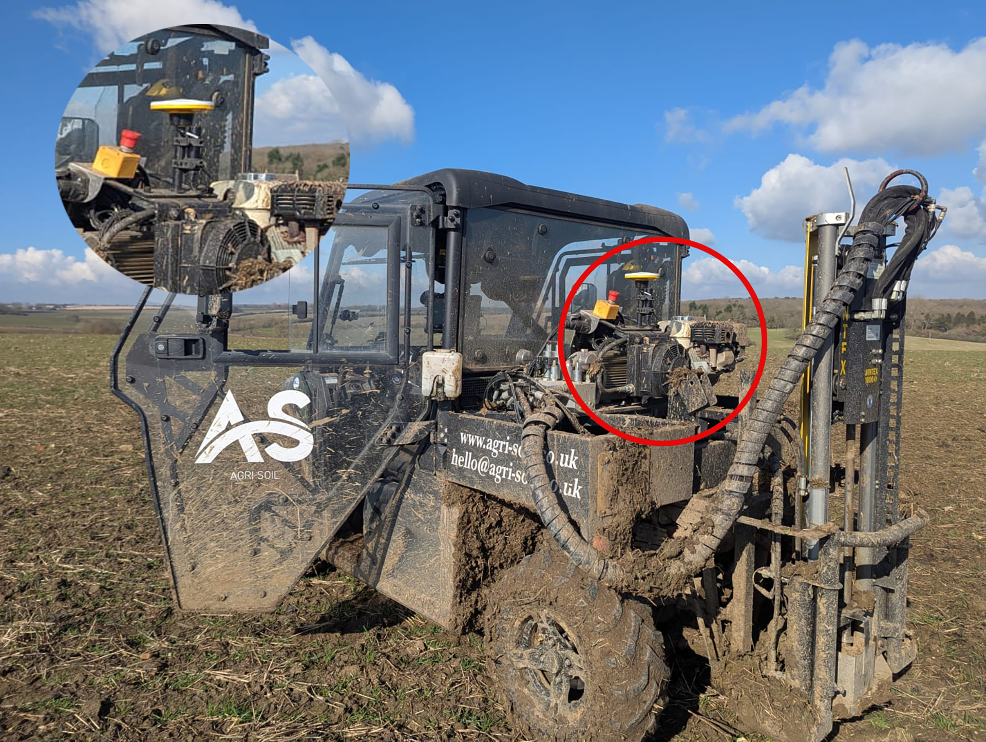
A family farm has diversified into providing an expert soil sampling and analysis business as an independent alternative to using services provided by large agricultural chemical companies.