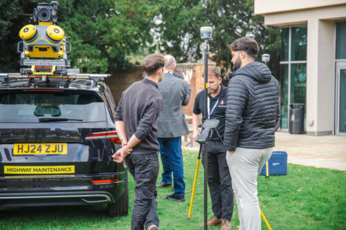
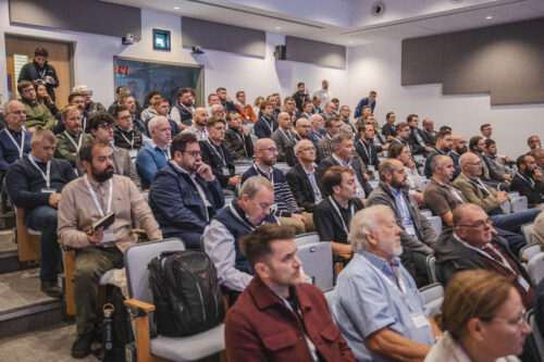
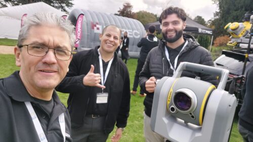
KTUC25: When Community, Innovation & Connection Converged
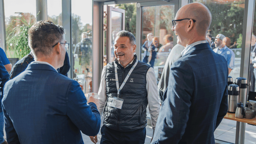
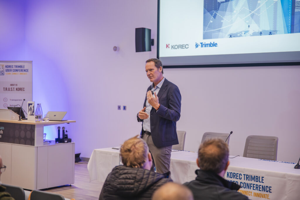
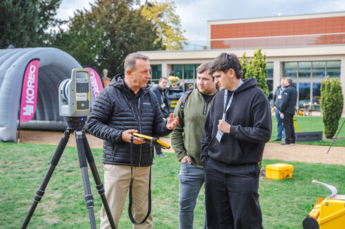
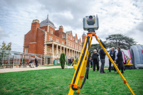
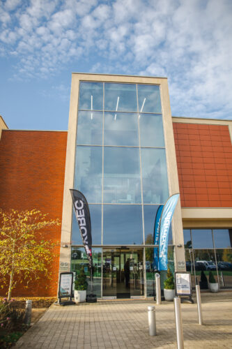
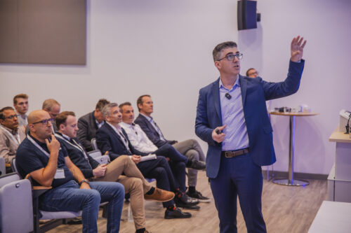
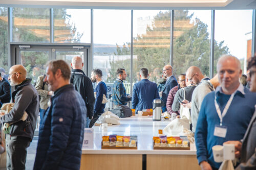
On a bright autumn day at the Babraham Research Campus near Cambridge, the KOREC Trimble User Conference (KTUC25) came alive. It was more than just a tech showcase: it was a gathering of minds and makers – a celebration of community in geospatial, surveying, construction, rail, monitoring and mapping sectors.
Bringing the Community Together
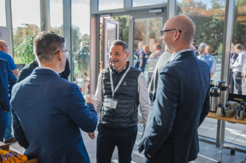
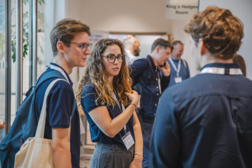
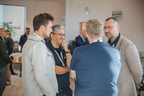
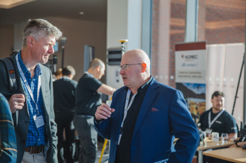
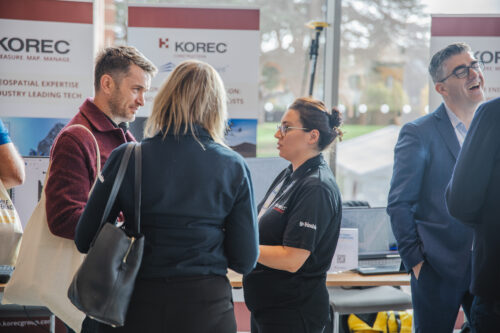
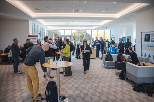
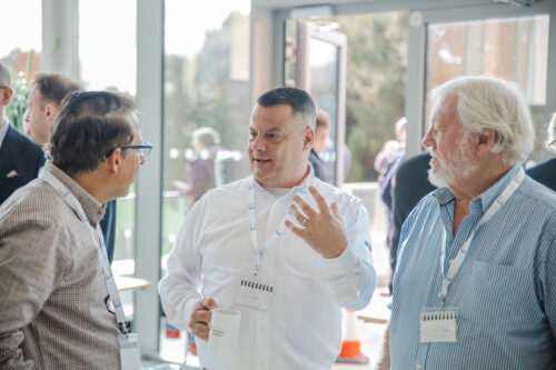
If there was one phrase that echoed through the exhibition halls, breakout tracks and outdoor demos at KTUC25, it was “Learn. Connect. Innovate.” Attendees repeatedly praised the inclusive, conversation-driven spirit of the event, where information and ideas were shared freely. It was the place where senior Trimble executives could connect freely to boots-on-the-ground surveyors. Where construction Tier 1s revealed their secrets to working smarter across field and office. Where people could have their say on important issues affecting our industries. Overall the coming together of the Trimble community made the conference feel like a community reunion – a rare treat in our digitally-mediated world.
Why KTUC25 Resonated
So, what made KTUC25 stand out? Based on attendee feedback:
- Community feels real – people made new contacts, reconnected with old ones, and left inspired by collaboration.
- Diverse tracks – whether you were a hardware geek, software user, field engineer, or decision-maker, there was something for you.
- High-calibre content & speakers – the balance between visionary keynotes, technical depth, and user stories really hit the mark.
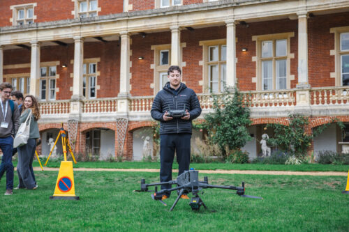
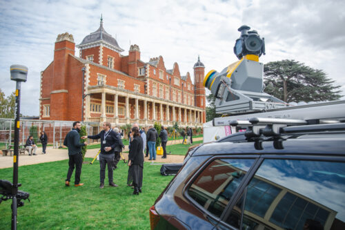
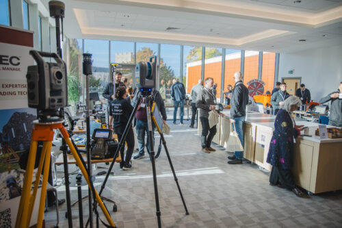
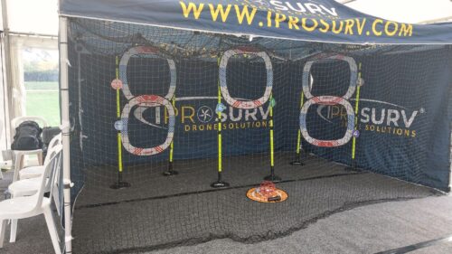
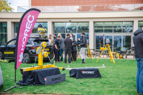
- Interactivity & hands-on access – the demo zone, workshops, partner exhibits and live flights made the experience tactile and memorable.
A Showcase of Technology & Partnerships
Of course, a key purpose of KTUC25 was to spotlight the breadth and depth of Trimble’s ecosystem, and to do so in concert with KOREC’s partners, including Radiodetection, DJI, Wingtra, Terrasolid, and Soarvo. This added dimension and breadth, showing how modern survey, construction, engineering and mapping systems aren’t siloed but interconnected.
Discover KOREC's technology solutions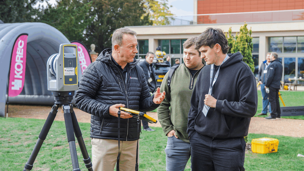
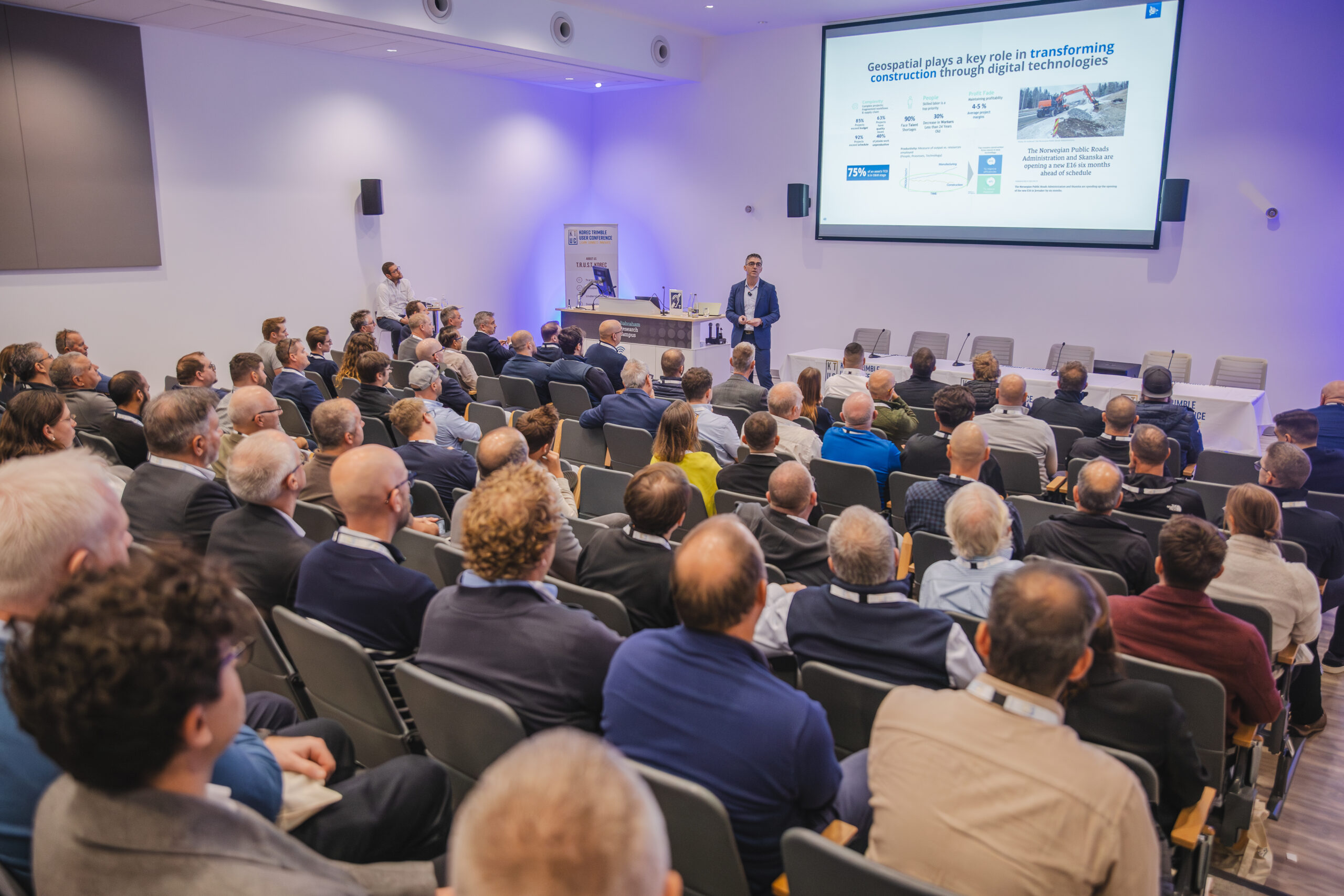
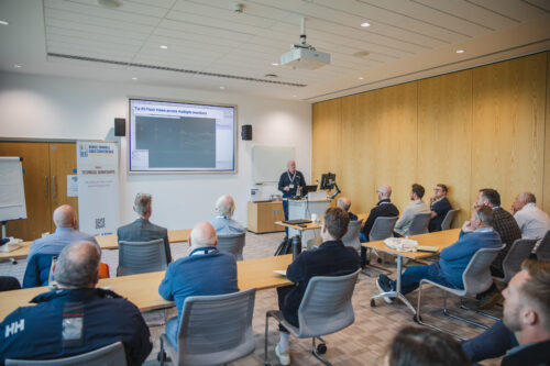
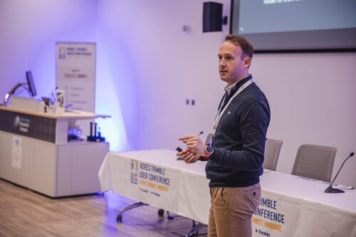
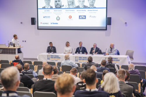
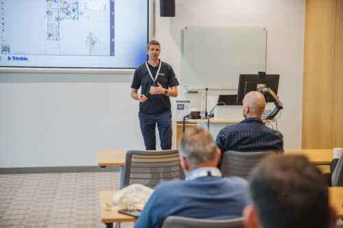
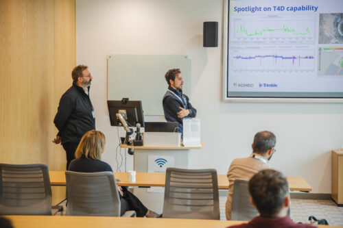
Highlights from the Tracks, Talks & Real Stories
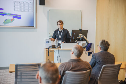
We structured KTUC25 around four tracks (plus an exhibition hall)
- Keynote Theatre – Thought leadership and macro-vision
- Technical Workshops – Deep dives, tips & tricks
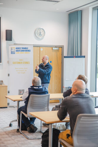
- Customer Stories – Real use cases, real challenges
- Outdoor DemoZone – Live demonstrations and competitions
It’s been a tough call to highlight only a few things across this amazing event, but here’s our top 5 things that got the most of the buzz…
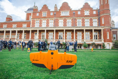
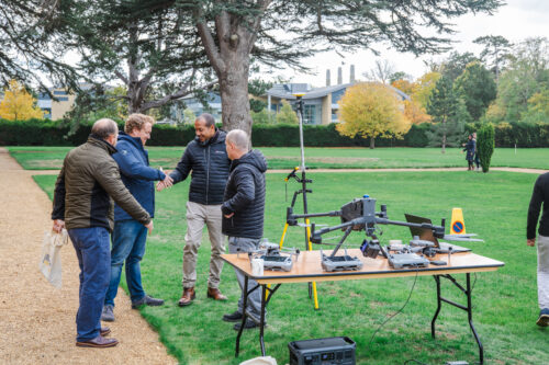
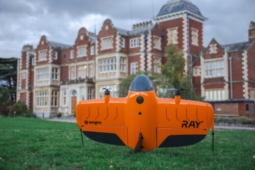
- The literal and figurative launch of the WingtraRAY
We chose our KTUC25 event to launch (in both sense of the word) the new WingtraRAY! This new UAV sets new standards for surveyors and it was a pleasure to see it in flight at KTUC25. You can find out more over on our product page.
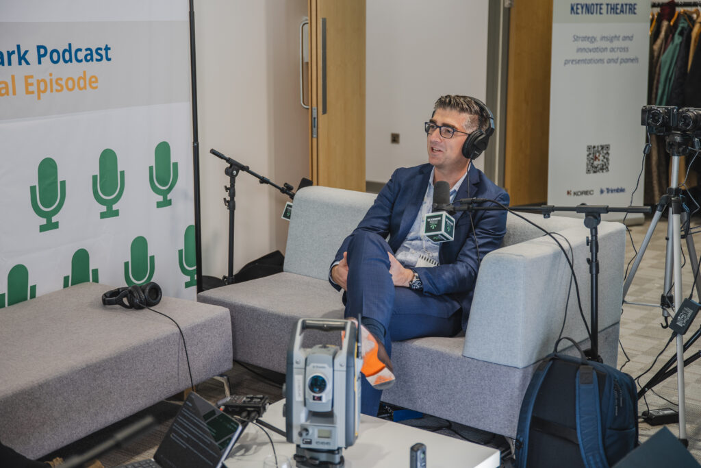
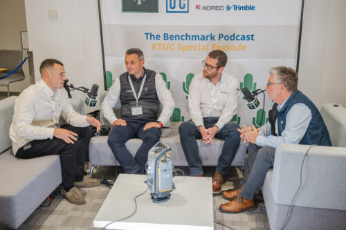
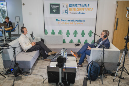
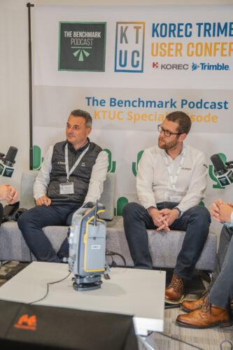
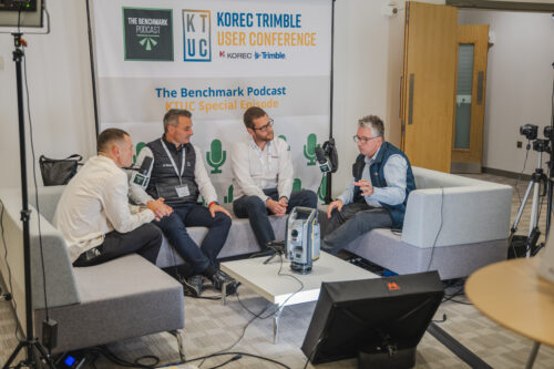
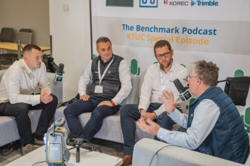
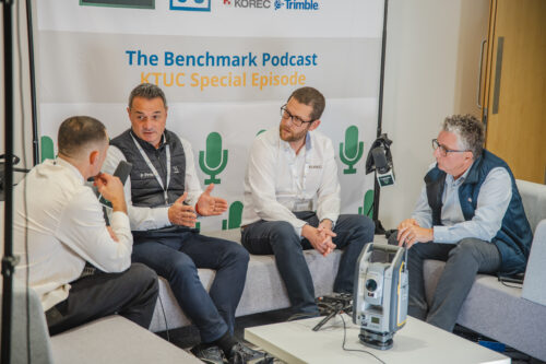
Discover the WingtraRAY2. Boris Skopljak, Trimble’s VP of Geospatial on the Benchmark Podcast
The much-loved Benchmark Podcast did a special KTUC episode, grabbing thoughts and opinions from the full spectrum of KTUC speakers, presenters, exhibitors and attendees. In an exclusive scoop, James Richards managed to get senior Trimble exec Boris Skopljak into the podcast booth. Keep an ear out for when the KTUC episode of Benchamark podcast drops…
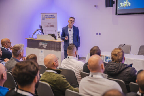
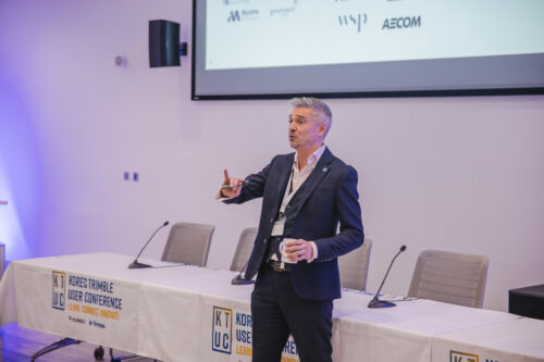
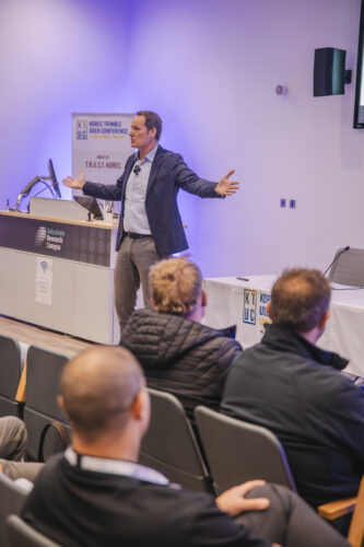
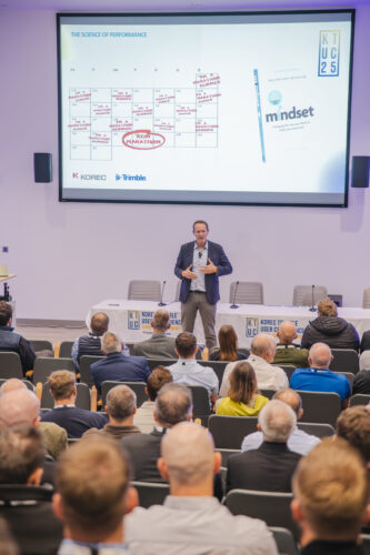
3. The Keynote from award-winning speaker Jim Steele
Jim Steele set the scene for the event with his powerful and interactive talk on motivation and performance. He was a smash hit at KTUC25, and it’s no surprise to learn that he’s 2025’s Speaker of the Year!
He’s kindly provided a wrap-up video of his session, recapping the key points of his presentation, along with providing some free resources to help you be better, smarter, stronger.
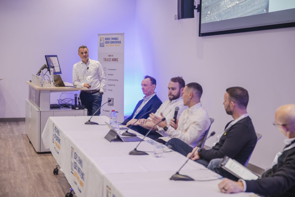
Watch Jim's session recap4. Education and Industry Voices panel discussions
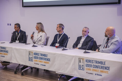
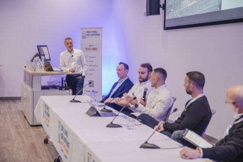
The two panels in the Keynote Theatre didn’t shy away from the big issues facing our industries. With insightful input from a fantastic line-up, we covered a lot. From the challenges of getting more people into surveying, to the opportunities – and pitfalls – of new technology, the future of survey, managing customer expectations, and much, much more.

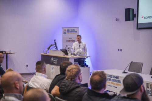
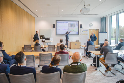
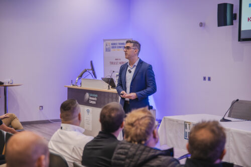
5. The AI and Trimble Business Center Technical Workshops
It was a full house for many of the technical workshops, but it was extra standing room required for the technical insights given by Trimble’s Ronald Van Coevorden and KOREC’s Richard Selby, who talked about AI & Automation, and Trimble Business Center (respectively).
KTUC25 Resources
Download the Presentations!
Due to overwhelming popular demand, we’ve made the presentations at KTUC available for download from our DropBox. You can grab them by clicking the button.


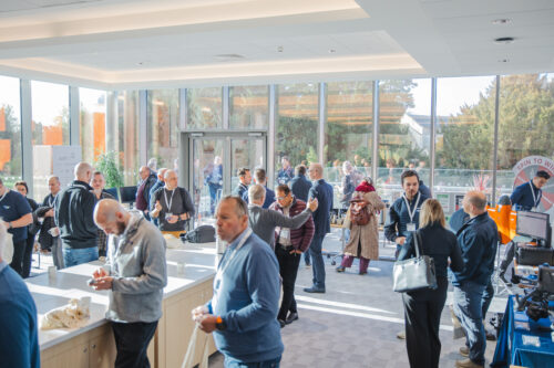
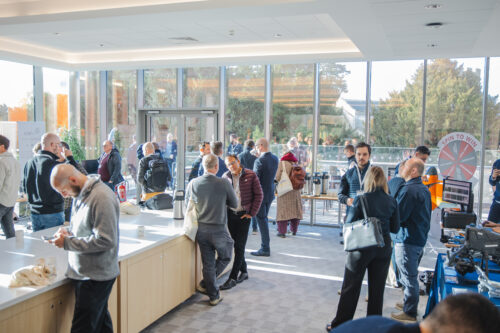
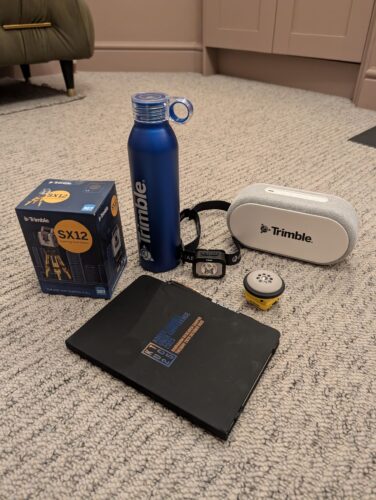
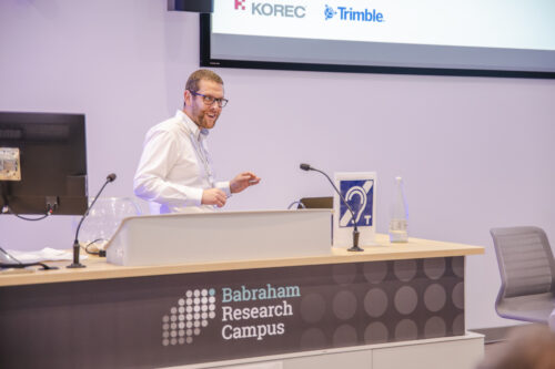
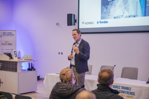
Picture Gallery
Here’s a few pictures of the day that we managed to grab in amongst the madness! Do you spot yourself? If you’d like your photo included in the gallery, please email marketing@korecgroup.com


Looking Ahead
KTUC25 wasn’t just an event – it was a statement. A message that KOREC believe in more than selling technology: we believe in enabling a community of practice where people learn, push boundaries, and lift each other up.
As we reflect on the energy, connections, and ideas generated in Cambridge, we’re already looking ahead to ways we can sustain this momentum. to keep embracing the latest tech, but also the trust and shared culture that made KTUC25 such a resounding success.
One thing’s certain: we can’t wait to see what happens next, and we hope those who attended left not just more informed, but more connected, energised, and ready to transform.
Who’s in for next year?
LEARN MORE
Discover solutions by industry
Discover how KOREC’s technology solutions can help you solve the problems you face in your industry.
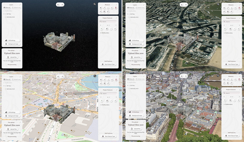
The driving force behind Soarvo’s launch? Pure genius and a bit of fire and frustration too. Soarvo have come up with something designed to rescue a geospatial community drowning in much needed, excellent, high-quality data, but restricted in what they can do with it. Think of it as throwing a life belt… but make it a carefully developed revolutionary 3D geospatial platform instead!
Here at KOREC we have a long history in the development of geospatial data platforms. Go right back to the earliest days of GIS in the 90’s and we were there, developing, supporting and working with the very best. So trust us when we say we know a good thing when we see it – and that good thing is Soarvo.
Why’s it different?
The obvious question is what is Soarvo, and the easy answer is of course found in its official description as a “…..revolutionary 3D geospatial data platform, which enables users to Aggregate, Illustrate and Collaborate all in one place.”
That’s exactly what it ‘does’ but what makes it really different is why and how. Let’s go back a couple of years or so when the geospatial industry was spoilt for choice when it came to sensors for generating extremely large, accurate data sets whether that be from mobile mapping, drones or 3D Laser Scanners. The hardware was doing a great job! But what wasn’t so great was what was happening in many offices. Without the mother of all PC’s and a significant investment in multiple software packages, skills and office time, our fantastic, captured data was becoming either a bottle neck holding up projects or simply siloed.
Great data sets aren’t meant to be hidden away, they need to be shared, seen, and collaborated on, not just admired by a select few. That’s why geospatial professionals across all industries – from surveying to rail to mapping – were on the hunt for something that could handle it all and turn those data sets into useful info, fast. But could they find anything? Nope, there wasn’t a single package that could do the job… until now.
Soarvo is born!
The Soarvo aim was to create something with exceptional functionality and security but with a user-friendly interface as inviting as the hugely popular design software, Canva. So, we created Soarvo from the ground up, taking end-user feedback on board at every step of the development process.
And now it’s ready.
Top left: What you had. Remaining three pictures, adding context with SOARVO
Why it’s exciting? Our top five reasons
It’s extremely easy to use: The development’s been all about the user experience, with an interface built for ease of use. That’s why it looks and feels so different (in the best possible way) compared to other data sharing software out there.
Favourite feature of Paul Brodin, Technical Lead: “The visualisation functionality and the speed with which it loads. I know because I timed it – 15 seconds for a mobile mapping data set that previously took hours!”
It provides a unique view of your data compared to other platforms: Well, how does it do that? The answer is it provides context around your dataset and positions it in the real world. For example, your laser scan point cloud doesn’t sit in a black space, it’s positioned on to the background map of your choice from OS to Google to Bing. This opens up new doors with your clients. It’s all about making your data set relevant for its end users by providing visualisation in a rich 3D environment with analysis and measurement tools thrown in.
Favourite feature of Alan Browne, CEO and Co-Founder of SOARVO: “It’s all about the effortless processing of drone data – everything included and definitely no fuss required.”
It truly delivers on collaboration: Once your datasets are uploaded, you simply share a secure link to your chosen users and they can log in securely, via the cloud, for viewing or editing depending on their pre-determined rights. We don’t mess about with login limits – invite the whole team if you fancy because the whole point is sharing this information whether it be for visualisation, site planning, measurement, whatever.
Everyone’s invited: As well as unlimited log ins, the software handles data from just about every sensor under the sun, seamlessly combining output from drones, laser scans, GNSS, total stations, mobile mapping, mixed reality, 3D models, CAD and GIS.
It’s a standalone tool for drone data: Capture your aerial data and drop it straight into SOARVO to create your deliverables whether that’s an ortho-mosaic, point cloud, or 3D model. No extra software, no faff—just process, share, and crack on!
Favourite feature of Richard Gauchwin, Senior Product Manager: “For me, it’s all about how it looks and also hearing the amazing reactions from our early access users. As someone who used to be in sales, being able to say ‘yes’ to so many questions just proves we’ve built something genuinely unique here.”
But don’t just take our word for it…
We love feedback and our early access users have provided exactly that:
Soarvo provides us with a platform to automatically process drone orthomosaics and view them within a web-based geospatial data solution. This capability is greatly beneficial to us—having a one-stop shop for all our drone and GIS needs in a single platform is both unique and highly valuable.
The ability to easily share project updates with clients, alongside geospatial and media data, has resolved a long-standing need for us. We now have greater flexibility to share data with contractors and provide updates online, without the need to email GIS files or rely on others to know how to use complex GIS software.
Having a central online location where our team can share data and collaborate easily on projects with online easy to use GIS tools makes workflows and data sharing much more efficient and accessible. Soarvo has provided us with an opportunity to streamline data management within the team.
Ease of navigation in 3D
Speed of rendering large point clouds and ability to move them
Simple clean interface and comprehensive basemap data
Favourite feature of Gabriel Hradilek, Chief Operating Officer: “A simple one from me, but absolutely massive for our customers: how easy and secure it is to share data. It’s a big deal, trust me!”
Need to know more, contact KOREC
Here at KOREC we’re delighted to be the UK & Irish distribution partner for SOARVO. That means when you get your hands on the new software, you’re also getting over 30 years of our know-how, support, and training – all backed up in our T.R.U.S.T. brand promise. Join the waitlist at https://soarvo.com/
By following all the industry guidelines, nationwide survey company Survey Solutions is sending out a strong message to equipment thieves: ‘If you steal from us, we will pursue every angle to reclaim that instrument.’ The result is a Trimble S5 Total Station tracked and recovered from Poland.
Whilst survey equipment theft remains rife as recently reported by The Survey Association in one of its regular updates, on a more encouraging front, an instrument stolen from Survey Solutions has been reclaimed from Warsaw in Poland.
For Survey Solutions’ Survey Manager, Reece Maycey, the tracking and recovery of this instrument has proved to be a satisfying experience and one that throws some light on what happens when a piece of equipment is stolen:
“Our company has experienced instrument theft in the past and we have several cases currently under investigation. However, this time, our efforts have led to a successful outcome and the experience of dealing with the relevant parties in the recovery of the instrument have been extremely positive starting with a receptive response from the local police through to the help we’ve received from TSA, DeterTech and the UK Police Task Force that deals with construction and agricultural equipment theft.”
Whilst Survey Solutions protects its equipment in a number of ways (including the use of Trimble’s Sentinel real-time device tracking solution and padlocks and cables) and ensures that all its surveyors are aware that remaining safe during a theft is the number one priority, inevitably incidents still occur. In this case, the KOREC supplied Trimble S5 Total Station was stolen from the roadside in a quiet dead-end street in East London whilst the surveyors were 50-60m away.
The local police were immediately alerted and at the same time, Reece used the Trimble Sentinel app to track the instrument’s movement in real-time. The tracking positions led to a nearby block of flats and although the police were on the scene promptly, it was impossible to pinpoint which flat the instrument was stored in.
Significant progress
However, three weeks later, the signal became active again allowing Reece to track its movement around the Warsaw area and at this stage significant progress was made. Through TSA, Survey Solutions were put in touch with the intelligence-led security solutions company DeterTech (formerly SmartWater), who work in alliance with TSA to coordinate a response to thieves who persistently target surveyors.
Reece was able to provide DeterTech with full details on the instrument, its serial number, type etc to identify it along with real-time positions in Warsaw where its frequent movement indicated it was being used on regular surveys in the area. DeterTech worked in conjunction with a police officer on the UK task force specialising in organised crime of the theft of construction and agricultural equipment who liaised with police in Poland.
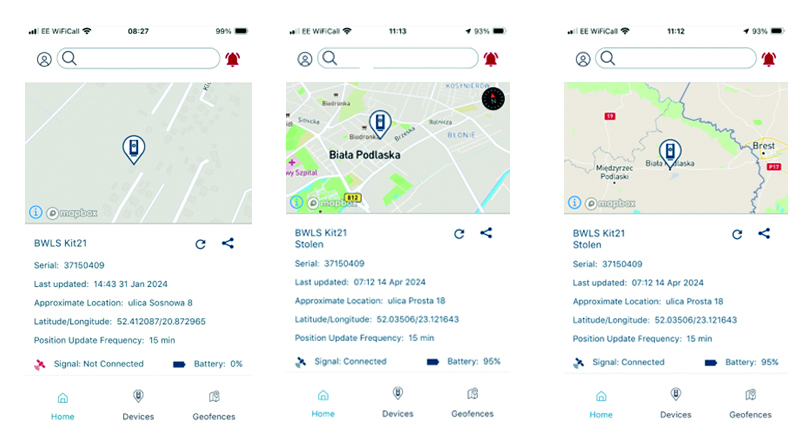
The instrument was recovered by Polish police and is now in the possession of Survey Solutions’ insurance company.
For Reece Maycey, the success of this recovery underlines how important it is to collaborate with industry partners to provide the information that enables not just the recovery of instruments but the avoidance of theft in the first place. This can be assisted through the sharing of information and vigilant business practices that include being alert to unusual vehicle behaviour around a site and being prepared to bring in security in ‘hot spot’ theft areas that can be identified with TSA information.
TSA advice on keeping your equipment safe
About Sentinel: Protect your Trimble Total Stations in the field:
- Trimble Sentinel is app based. If your instrument is stolen, it can be tracked immediately from the field.
- Trimble Sentinel uses the 4G network and locations can be pinged via any available mobile network
- Trimble Sentinel is retro fitted inside the Trimble Total Station and cannot ‘just be taken off’. It also has its own internal battery – charged during general instrument use, it will continue to ping signals for a period of time. In the event of a theft, call KOREC and we will talk you through best practice to ensure you can track this signal for as long as possible.
Sentinel is available as an after-market add-on for Trimble S Series and C5 instruments. Its usefulness goes far beyond retrieving missing instruments. It can help you find teams in the field at any given time. It also contains a G-force sensor that sends alerts to users to check instruments for calibration errors or damage when they’ve been dropped or have endured a rough ride…And remember, the Sentinel tracking module is installed inside the total station by KOREC, an authorised Trimble Service Provider.
Download the Sentinel PDF here
For more information on Sentinel, please call your regional KOREC consultant or contact us here.

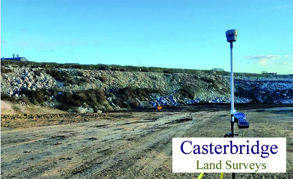
“The benefit lies in being able to record those 2 or 3 difficult points if the internet goes down that I’d otherwise need a total station for.”
Joel Scragg, Casterbridge Land Surveys
Did you know that Trimble’s R12i, R580 and R780 GNSS all offer a feature that most surveyors never even notice, but every time it’s activated saves them up to 30 minutes in the field?
Download a PDF of the story here
Operating out of Weybridge in Dorset, Casterbridge Land Surveys Ltd is a thriving practice, experiencing a consistently high demand for its services. The company prides itself on offering cost-effective and reliable surveys backed up by a personal and personable approach.
Joel Scragg, the Director & Principal of the company, understands the challenges of managing a busy order book and the corresponding demands on both staff and his Trimble survey equipment. Consequently, he meticulously prepares for each survey, ensuring timely execution and optimal allocation of equipment resources.
With a Trimble R12i GNSS (used with a Trimble VRS license for real-time corrections) and S5 Total Station on the fleet, Joel frequently exploits this combination as an integrated surveying solution where the controller is connected to both a conventional survey instrument and a GNSS receiver at the same time to seamlessly collect points in challenging GNSS environments.
However, whilst this has proved to be an effective way of working, setting up a total station adds time to a survey …..and it’s also not always needed thanks to an often overlooked standard Trimble GNSS feature.
Positioning Insurance: Continuous corrections, even when the internet goes down
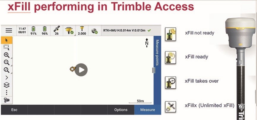
Trimble xFill is the little known standard feature that can save up to 30 minutes in the field by ensuring Joel can carry on working without disruption to his survey schedule or need for a total station set up.
It reliably provides seamless, centimetre-level back-up corrections for up to 5-10 minutes, via satellite, if RTK or VRS signal sources are interrupted due to signal disruptions or loss of radio connectivity. This provides Joel with enough time to measure points in his typical day to day scenarios such is in a quarry behind a stockpile or at the bottom of a hole.
The end result is no interruption to Joel’s survey. The only indication that xFill has been automatically activated is a small icon changing on his logger:
“The benefit lies in being able to record those 2 or 3 difficult points that I’d otherwise need a total station for. Each time I avoid having to set up the total station, I’m saving up to 30 minutes in the field. Why do most surveyors never even notice it? Because it just reliably kicks in every time it’s needed!”
What is Trimble xFill? Trimble xFill provides seamless, centimetre-level back-up corrections via satellite if RTK or VRS signal sources are interrupted due to signal disruptions or loss of radio connectivity. All three receivers supplied by KOREC, the R12i, R780 and R580, offer Trimble xFill Limited as standard. This feature is linked to the GNSS hardware, and it enables cm-levels corrections whenever the internet connection goes down, for up to 5-10 minutes, allowing surveyors to carry on working. xFill Limited is a standard and permanent functionality on the aforementioned Trimble GNSS products, included at no extra cost. Another option is to upgrade to xFill Unlimited. This feature enables the GNSS to carry on working with satellite corrections, without internet, for an unlimited amount of time. However, the user needs to be connected first to a VRS network for this to work. xFill Unlimited works on a yearly subscription. When it runs out, it will revert back to xFill Limited.
Ask us about our current special offer on xFill unlimited.
Q: What is the standout feature of the Trimble R12i for your company?
A: “It always works”
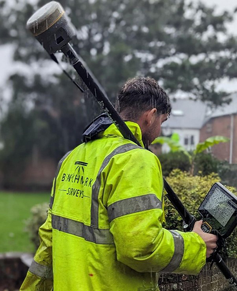
Benchmark Surveys was the first company in the UK to invest in a Trimble R12i GNSS and its continuing commitment to the technology is based on Trimble’s 40-year legacy of reliability and innovation
Download a PDF of the story here
It’s been 40 years since Trimble launched its first GPS onto the market and since then we’ve seen over 30 different iterations culminating in the arrival of the R12i in 2022.
The most advanced survey grade GNSS available, the Trimble R12i underlines Trimble’s commitment to development with its unique combination of technologies delivering a 30% productivity improvement on standard GNSS.
The adoption of this receiver by Exeter based Benchmark Surveys, the first company to purchase one in the UK, has not only transformed the way the company’s surveyors work but has also significantly enhanced the quality and quantity of data they provide to clients.
Transformative system “makes surveying pleasurable”
Benchmark Surveys’ Survey Manager, James Richards, one of xyHt’s esteemed 23 Young Geospatial Professionals to Watch in 2023, is appreciative of all the technologies offered by the Trimble R12i, but rightly points out that the single most important factor for productivity in the field is that that your GNSS always works!
He reports that everyone on the Benchmark team appreciates the R12i simply because it’s always reliable, always works and there’s never been a hardware issue – important benefits that work hand in hand with its performance:
“The R12i’s capabilities shine, even in challenging surveying environments with difficult terrains such as banks, ditches, and areas with overhanging canopies – these are scenarios that surveyors come up against regularly and an area where the R12i decidedly ups productivity. Traditional equipment might falter in such conditions, but Trimble’s TIP (insert link to piece on the IMU) and ProPoint technologies ensure that Benchmark surveyors can effectively capture these challenging data points, leading to fewer client requests for additional information.”
What was once a time-consuming task has become fast and easy and even “pleasurable”, adding to the overall satisfaction of the Benchmark team who can effectively capture points in vegetation and under canopy where other GNSS would struggle.
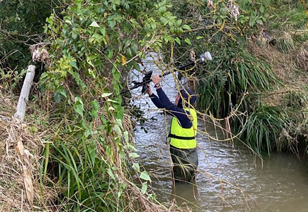
Instagram follower comment on post: Tilt works well under heavy canopy?
Benchmark Surveys: Yes it does 👍
In particular, James emphasises the strong business case for investing in the R12i GNSS over any other system. The decision to adopt Trimble’s technology is not merely based on brand loyalty but on the functionality and reliability that the team relies on to deliver the highest quality data to clients.
Trimble’s commitment to innovation, backed up by KOREC’s support, training and T.R.U.S.T ethos aligns seamlessly with Benchmark’s dedication to providing top-notch surveying services.
How to reliably capture accurate survey data and transform it into intelligence for increased productivity and improved decision making.
KOREC works with a number of utility and fibre companies who have adopted a digital approach to their field data collection and data handling workflows. These companies are now reporting significant benefits from accurately capturing survey data across four main areas; plan, design, build and operate & maintain.
KOREC specialises in tackling the challenges that can impede productivity in all of these stages:
PLAN & DESIGN: Using mobile mapping to enhance productivity for survey, planning and design services
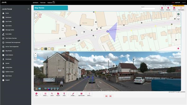
Jorvik Design Group has revolutionised its data capture operations through its investment in a KOREC supplied, vehicle mounted mobile mapping system. Their Trimble MX50 system delivers a very accurate point cloud of the environment along with complimentary immersive imagery and enables Jorvik to create extremely accurate designs without time consuming and labour-intensive site walkovers.
KOREC worked closely with Jorvik to create an enhanced workflow so that clients can now provide a boundary map and all relevant UPRNs (Unique Property Reference Numbers) along with a request that Jorvik plans a design for that network. An initial survey is then driven with the MX50 system mounted on Jorvik’s Land Rover Defender.
Having access to a current, high-accuracy, 3D point cloud means that the Jorvik Design Group can now provide an even better service for its clients through the provision of an accurate 3D point cloud data set for measurements related to costing; a faster design service based on correct asset location and a fully up to date, accurate map of all their assets at the job’s conclusion.
CONSTRUCT: Utility construction company working on new build site
Working on new build sites, the installation of utilities is based on designers’ detailed line drawings rather than OS MasterMap data which has yet to be created for new developments. However, digitising these line drawings to take into the field, sometimes up to 6,000 in a single project, is extremely problematic due to the density of the information contained.
In order to create a new digital workflow, KOREC’s software division, K-MATIC, worked with the client to create an easy drag and drop solution which allows for the easy transfer of these large files from the office on to field devices.
CONSTRUCT: Utility installation company seeking a digitised workflow for greater efficiency and faster payment
KOREC was approached by a company that wished to become more efficient in the field, collecting as-built information. The company required better than 10cm positional accuracy on each connection (as per UK legislation) and also wished to document each connection with attribute information fed live to a secure cloud-based portal. This would enable them to provide proof of connection and bill weekly for work done.
KOREC supplied the company with Trimble Catalyst, a low cost GNSS option (with a choice of subscriptions for different accuracies) and KOREC Capture field data software designed to run on standard smartphones or loggers.

OPERATE & MAINTAIN: a network operator pre-empting potential problems and minimising risk
A utility company has to maintain an existing network including pole inspection and vegetation encroachment across the network. The company approached KOREC who undertook a mobile mapping survey through its Professional Services division. This data, once processed, was analysed with automated routines for poles that were not in the existing inventory and also locations where vegetation could encroach the network and impact connectivity. This allowed them to better manage their assets and foresee potential issues.
Visit KOREC on stand 33b at Connected Britain or look out for our exhibition presentation
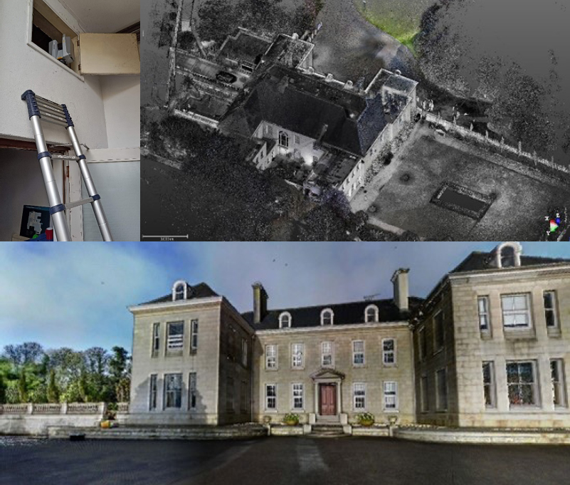
After a day on site with the Trimble X12 3D Laser Scanner – we catch up with Paul Williams, Director of Survey Dimensions
The X12 is Trimble’s highest end scanner and marketed as a ‘best of both worlds’ combination of Z+F technology and a tried and tested Trimble workflow that uses its Perspective software. But does the reality deliver in the field? Customer feedback is vital to both us and Trimble so we were delighted to let Paul Williams, Director of Survey Dimensions, put the X12 through its paces and share his down to earth appraisal.
Paul’s Trimble X12 top 4
Crispness of the data – ‘the data quality is amazingly good’
Perspective workflow – ‘we were up and running immediately, it’s the same interface as the X7 and very easy to pick up’
Ability to scan at very short range and to challenging surfaces – ‘the X12 is very versatile’
It has a handle – ‘this is vital when carrying high value equipment up and down ladders etc’
First thoughts
As a Trimble X7 user, Paul was pleased to see that the X12 was also a manageable weight at 7.7kg (including the batteries). In particular, he noted that it would be easy to carry it up and down ladders and position into tight areas thanks to the handle – something that he was quick to point out that not all scanners have but is vital when you’re manoeuvring a high value piece of equipment around your site. Aside from its portability, his expectations were especially high concerning the quality of the data, the speed of the scans and also how versatile it would be on the trial job he had selected that required both short range and medium range scans in a variety of different scenarios.
Former convent school project
The project that Paul trialled the X12 on is a former Convent School, now owned by Falmouth University, with a spec that required exterior and interior surveys for remediation work and planning. Paul’s X7 was also taken along for the ride and all work was undertaken by a two-man team in a single day. Both scanners were used to complete a total of over 300 scans on the day.
With the X12, Paul was up and running immediately because he was already familiar with the Trimble Perspective workflow from his X7. From his earlier X7 experience, he also knew that the Perspective software was extremely intuitive, even for someone using it for the first time. X12/Perspective features such as ‘Window Scan’ for focusing on areas where greater detail would be required, and the on-site registration to ensure that everything was captured before leaving the site were both rated as good time savers.
During the day, the X12 was used on and off a tripod and also at very short range to scan inside a small dark cupboard. Where more detail was required, for example when scanning architraves and decorative ceiling mouldings, the highest definition was used.
Paul’s feedback
Whilst Paul appreciates that the range of the X12 is over 300m, for this project he was working mainly at a range of 40m and lower. He also carried out a couple of comparisons with the X7 and noted that the quality of the data from the X12 is amazingly good; when sliced from the side, the X12 data had zero deviation on a 3mm thick slice compared to a light fuzziness with the X7. He also reports that the overall quality of the X12 scan data is second to none, especially inside on the ceilings and outside when looking at the brick detail. Around the site, Paul found that there were no surfaces too challenging for the X12 and scan quality was consistently excellent even when scanning at short range into darkness.
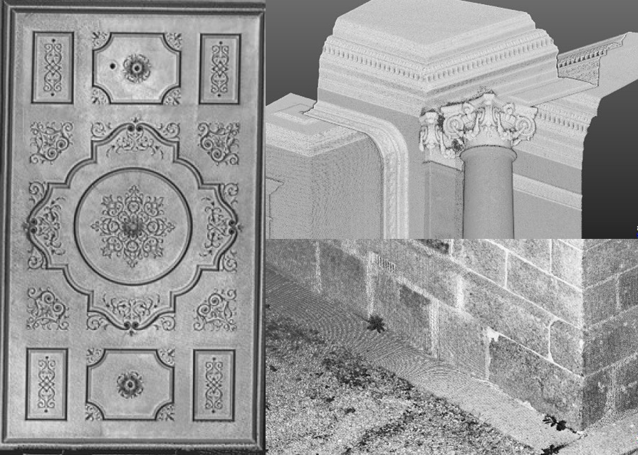
Paul noted that the colour imagery was easy to add, parallax free and excellent quality. The X12 also performed far faster than the X7 when scanning at higher definition (6mm point spacing). For example, a one minute 30 second scan with the X12 was far, far denser than a 5 minute scan with the X7. However, this makes perfect sense considering the different applications the scanners have been developed for.
Overall, Paul feels that the standout feature of the X12 is the ‘amazingly good’ crispness of data and rated the following four points as the X12’s stand out benefits:
“Our clients expect the very best from us and that means we’ve got to provide the very best end product and in turn, that relies on great equipment capable of generating great data. The new Trimble X12 fits the bill perfectly”
Neil Pollock, Director, Three Sixty Group
A few weeks ago, our KOREC Laser Scanning Sector Specialist, Melvin Penwill, got his hands on one of the first Trimble X12’s in the country. He was only too happy to put it through some rigorous testing and then share his opinions, including his 6 highest rated features, in a useful LinkedIn Post.
At some point, he was persuaded to let the customers have a go too!
About Three Sixty Group
Operating nationally, Three Sixty Group works across a diverse range of sectors from Utilities and Rail to heritage and listed buildings. The company has a fleet of 3D Laser Scanners that includes three Trimble X7’s as well as instruments from other manufacturers.
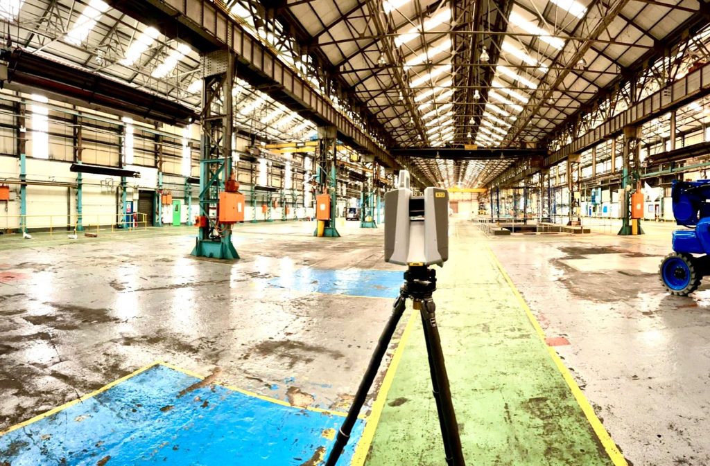
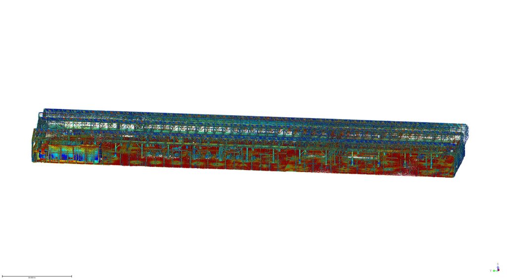
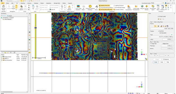
We caught up with Director, Neil Pollock, who’s been using the X12 for a floor flatness survey in a vast, engine manufacturing plant in Derby. With specified tolerances of just +/- 2-3mm for aspects of this job, it was the perfect testing ground for the X12 which was used both indoors for the high accuracy floor survey, and externally for an overall building survey where scans were undertaken with a range of up to 100m.
Here’s what Neil rated:
- Size – although he was aware of the dimensions (150 mm (W) x 258 mm (D) x 328 mm (H)) of the X12, when it came out of the box, he found it even smaller and lighter than he expected.
- Learning curve – The Three Sixty Group surveyors are already familiar with the Trimble Perspective software and workflow from their use of the X7’s. They were therefore able to transition to the X12 seamlessly.
- Cleanliness of the data – Even at a 100m range, Neil found the quality of the data to be top notch and way beyond any other scanner that the company has worked with previously. This ensured total confidence in the overall quality of the survey. Three Sixty Group is seeing a growing requirement for heritage work and felt that the X12 would excel in the level of detail required for this work as well as being suitable for the short or mid-range work required on more standard jobs.
- Low noise – In spite of the shiny factory floor, noise was minimal.
- Image quality – Excellent quality and super-fast to take at just 2 minutes. With Trimble Perspective, it’s now also far easier to retake images.
- ‘Window’ feature – rather than take a full 360 scan with the Trimble X7, or carry out a quick preview with the Trimble TX8, Neil rates the ability to ‘window off’ a section for a high-resolution scan as a great time saver.
Neil concludes: “The data from the X12 is just so clean, and that makes it very, very easy to work with across every job. In short, the better the data, the higher the quality of the product that we can provide all our customers with. This is especially important for our heritage work which is growing all the time. Our clients expect the very best from us and that means we’ve got to provide the very best product and in turn, that relies on great equipment capable of generating great data. The new Trimble X12 fits the bill perfectly.”
Thank you to Neil Pollock for chatting to us about his X12 experiences
For further information, please call your KOREC Sales Consultant or contact Melvin.penwill@korecgroup.com
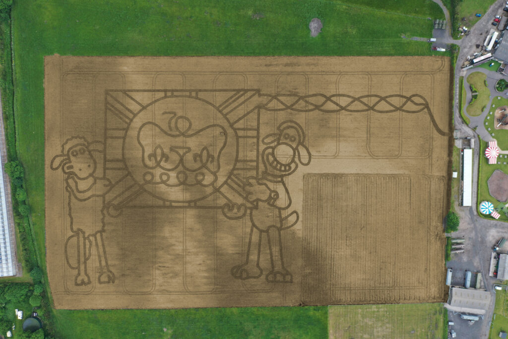
It’s taken permission from the Palace and the loan of one of the most advanced handheld GPS mapping systems available for Mark Edwards, Managing Director of Farmer Ted’s Adventure Farm, Ormskirk, Lancashire, to create this year’s jubilee themed maze attraction.
The maze was designed by Mark who enlisted the help of Liverpool based positioning and survey equipment specialists, KOREC Group. KOREC was delighted to loan him a handheld Trimble Catalyst GPS solution and also helped him turn the design into coordinates that could be loaded into the GPS to recreate the design in the maize field.
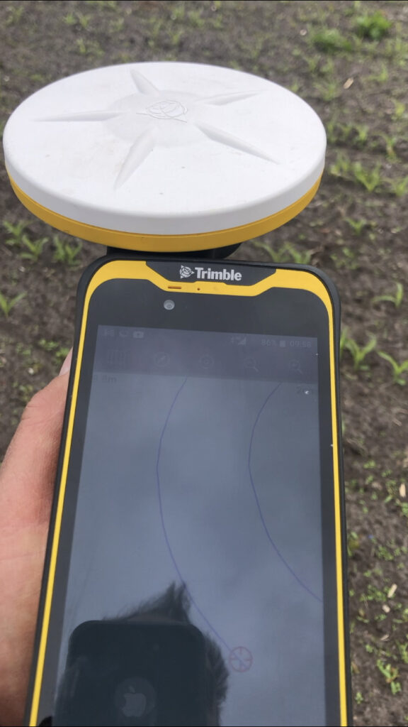
The Trimble Catalyst GPS connects to a smartphone that clearly shows the maze design. It is then taken onto the 14 acre maze site where Mark is able to navigate, using his position on the screen, to plot out the design amongst the tiny maize plants. A cultivator follows his trail cutting out the design.
Left:The KOREC supplied Trimble Catalyst GPS is capable of centimetre accuracy! This picture shows part of the design on a smartphone/logger
This year’s design comes with a royal seal of approval. Working closely with Aardman, the award winning animation studio and the creators of Shaun the Sheep, Mark contacted the Lord Chamberlain’s Office at Buckingham Palace and was granted permission to use the Queens official Platinum Jubilee logo to celebrate this great occasion!
Mark says, “the KOREC supplied Trimble GPS really is an ‘amaizing’ piece of equipment and so easy to use. We were able to create this exciting jubilee design in just 2 days!”
Farmer Ted’s is the UK’s largest Shaun the Sheep farm attraction. It opens daily until mid-September with the Maize Maze opening on 23rd July. Tickets can be purchased on-line at www.farmerteds.com
About Shaun the Sheep
Shaun the Sheep, Aardman’s family favourite TV series, is recognised the world over for its slapstick humour, distinctive look and strong, quirky characters and enjoyed across multiple media platforms. First appearing in Nick Park’s 1995 Academy Award® winning Wallace & Gromit ‘A Close Shave’, Shaun then went on to star in his own series, created by Richard Starzak which launched on BBC One in 2007. Shaun the Sheep is currently broadcast in 170 territories around the world and is an internationally celebrated icon with over 5.6 million fans on Facebook. In 2015 the first Shaun the Sheep Movie with feature film partner Studiocanal was released around the world to critical acclaim and the first half hour TV special aired as part of many broadcaster’s festive season., The feature film sequel Shaun the Sheep Movie: Farmageddon was released in October 2019 and nominated for an Academy Award® and was closely followed by a sixth season of the series in 2020. A new festive special Shaun the Sheep: The Flight Before Christmas was released in December 2021.
As the engineering and construction industries adopt augmented and mixed reality solutions, both the qualitative and quantative benefits are becoming apparent. Skanska share their experiences of using Trimble SiteVision at Infrastructure Projects Central (IPC) Euston, London.
Euston Station is the sixth busiest rail station in the UK and pre covid it was the departure and arrival point for over 44 million people each year. Plans are currently underway to transform the area into a modern transport hub and to construct the new High Speed 2 (HS2) terminal. These improvements will increase passenger capacity whilst improving journeys through a redeveloped terminus and new high-speed platforms.
IPC Euston is a multi-disciplinary, logistics and building works scheme designated to be carried out by Skanska (under the Network Rail Infrastructure Projects Central framework (IPC)), to enable HS2 construction.The construction project is already underway with the Skanska Engineering Survey team being on site since 2018.
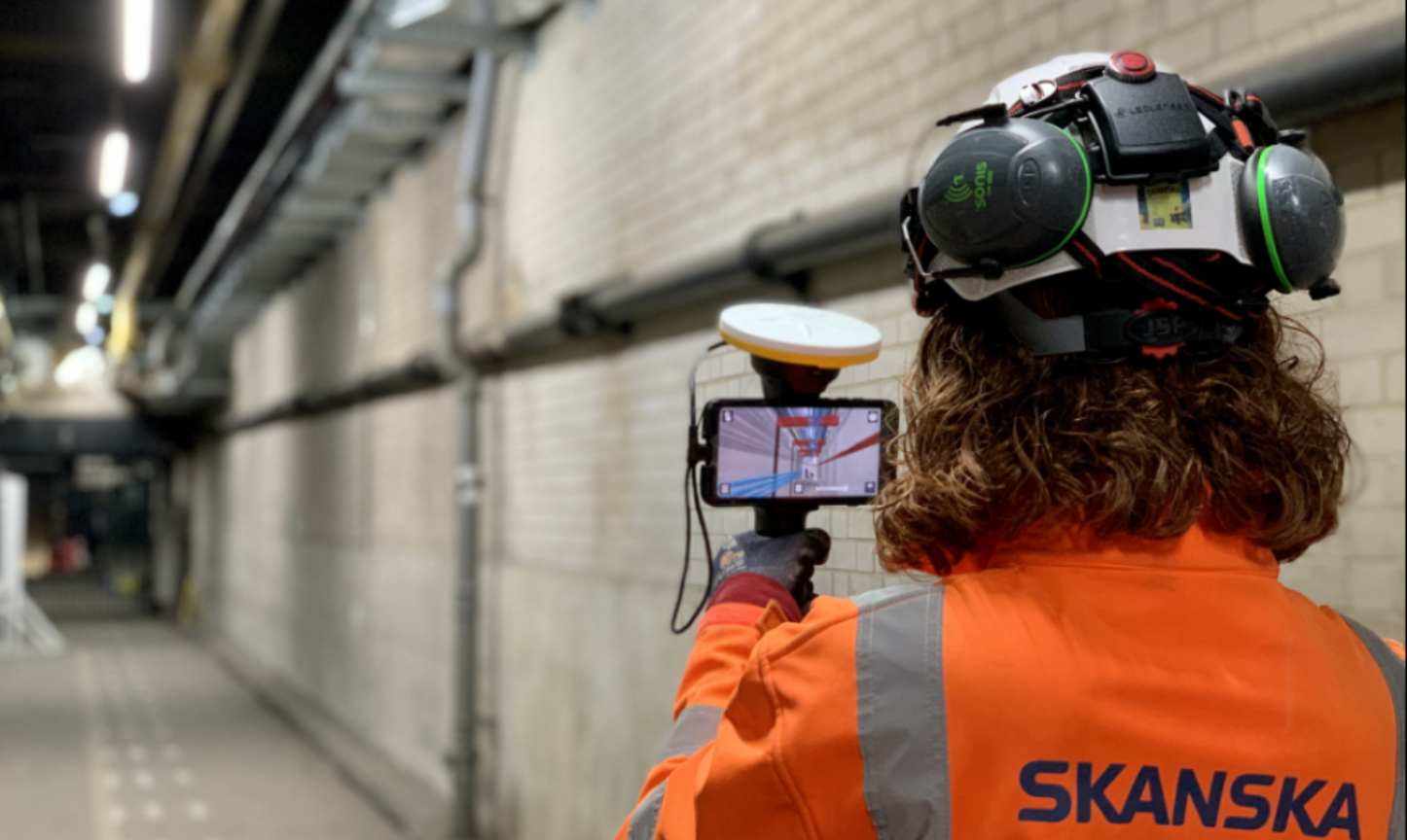
Over the last eighteen months, the engineering survey team has incorporated augmented reality (AR) into their workflow and in particular, the KOREC supplied Trimble SiteVision technology. Having had extensive SiteVision and AR experience on the A14 Road Improvement Scheme, the team has adapted the workflow to suit the indoor environment at IPC Euston.
About Trimble SiteVision
Trimble SiteVision works by fusing cutting-edge augmented reality technology with Trimble Catalyst centimetre-precision GPS, to bring 3D design models off the screen and onto site. The end result is a system that allows you to take your design models into the field and visualise them in 3D, all to a 50mm accuracy.
Underground at IPC Euston – bringing the benefits inside
At IPC Euston, Skanska are using the Trimble SiteVision system to visualise future design, verify as-builts and plan works for feasibility and buildability in applications that are predominantly underground.
Whereas before the GNSS function was used to position new design and to view existing utilities below the ground, at Euston, Skanska Engineering Surveyors Alison Small and Izzy Taylor have found a solution using the Trimble SiteVision indoors where GNSS is unavailable. Instead of automatically placing the 3D model out on site, the manual placement function is used to view 3D models for as-built purposes and viewing future design to check for clashes.
Real-time decision cuts costs by two thirds and reduces work by four months
In particular, Trimble SiteVision was used to visualise a new pipework route in the station’s basement. The ease with which the new route could be visualised ensured a far more efficient approach to decision making between clients, designers and stakeholders, with solutions being reached in real-time. For example, the team had received an initial design with a figure for enabling costs. The Skanska MEP team proposed an alternative route at at one third of these costs that also reduced the programme by four months.
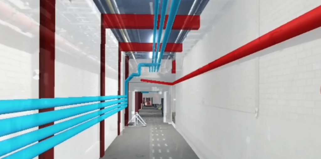
Showing design data overlaid directly onto the real world
The Skanska Engineering Survey team and the BIM team assisted in presenting the new route to the client and stakeholders using the SiteVision system. A physical site walk was conducted with the AR technology by half of the team whilst the remaining team members joined via Microsoft Teams.
SiteVision provided the evidence required to enable the client and its stakeholders to accept the proposal at the same meeting. This saved two thirds of the costs and reduced the programme by four months.
“Watching it in real time is great. One of the best things I noted was that people involved didn’t comment about the technology they just asked questions straight away about clashes that could be seen.”
– David Edwards, Senior Design Manager
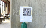
Connect AR allows you to position AR models on your job site with QR markers
Release of Trimble Connect AR for higher accuracy placement of models indoors/underground
Trimble has just released Connect AR, an augmented reality app that gives building construction workers even greater accessibility to 3D models in the field. The app runs on Android and iOS tablets as well as smartphones and integrates with Trimble Connect (cloud-based integration and comms platform) and the Trimble Mixed-Reality portfolio, including SiteVision.
Skanska is currently trialling a Connect AR license and will find some key benefits. For example, for users of Trimble SiteVision indoors or underground, such as Skanska, it is now easier and faster to position the model in the real world. A network of QR code markers are generated in Trimble Connect which can be placed around the jobsite using either a Trimble Robotic Total Station or a manual method. This increases accuracy for the comparison of as-built construction to the digital design.
Connect AR also allows you to use the LiDAR scanner integrated in Apple devices to measure distances and areas between real and virtual objects which can provide valuable information to supplement issue reports or estimates.
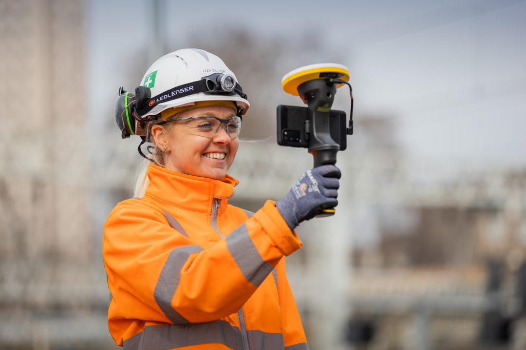
Our thanks to Skanska Engineering Surveyor, Alison Small for supplying the images and information