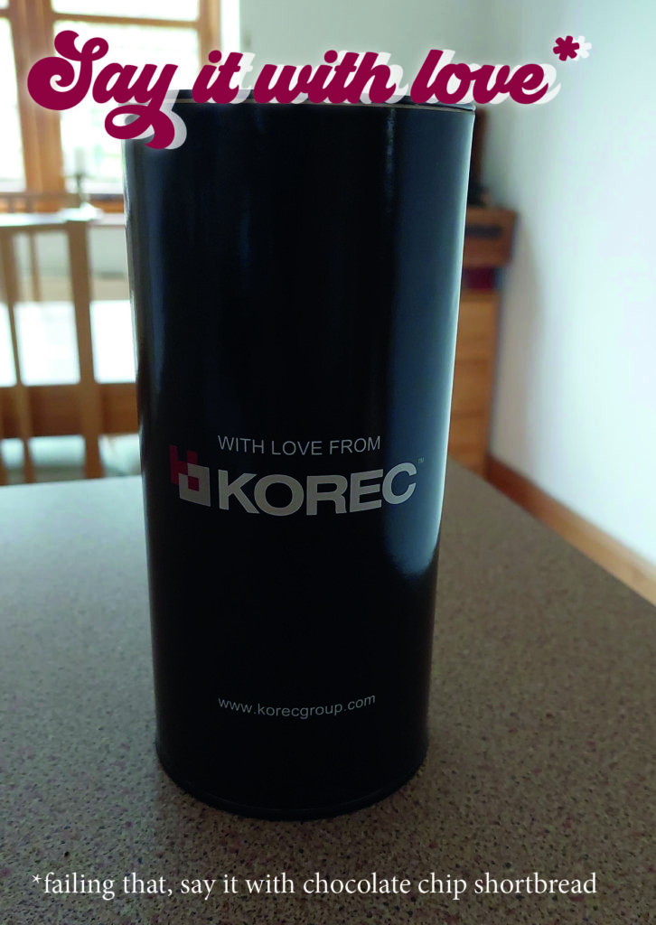
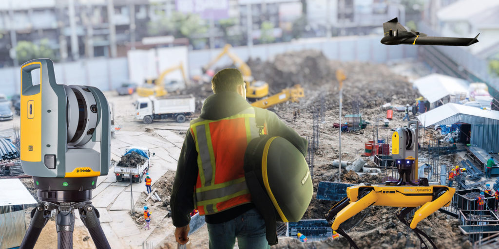
KOREC Group is delighted to announce that it is expanding its operations with the launch of BuildingPoint UK and Ireland as it becomes the newest partner to join Trimble’s BuildingPoint distribution network.
KOREC Group is an existing, established Trimble distribution geospatial partner with over 50 years of experience working with the construction industry. The addition of the BuildingPoint distributorship to its already extensive geospatial portfolio underlines KOREC’s commitment to expansion which saw the company announce 30 new positions across the company at the beginning of the year.
Over 70% of UK and Ireland construction projects run over time and over budget due to a number of factors including rework, barriers to stakeholder collaboration and challenges to onsite efficiency and productivity. Through this new Trimble partnership, those that work within the construction industry, including users of Trimble Tekla, Viewpoint and MEP software, can now access a full Trimble digital construction portfolio backed up by regional expertise .
This will be delivered through a BuildingPoint team dedicated to bringing tried and tested workflows to the UK and Irish markets. These workflows have been developed to deliver increased productivity, schedule adherence and cost discipline through tighter coordination, improved project transparency and collaboration.
The offering will include assistance with the adoption of digital workflows through a range of task specific software and hardware solutions from general setting out tools to Augmented and Mixed Reality technology and Robotics.
Alan Browne, Group Chief Executive of KOREC and EY Entrepreneur of the Year Finalist 2022 said:
“The creation of BuildingPoint UK and Ireland is the next phase on our journey along with Trimble of helping our partners in Building Construction operate more safely, more quickly and more accurately whilst reducing costs and the impact on the environment”
This dedicated and experienced team will be looked after by Sam Hough (UK) and Kevin Colwell (Ireland) whilst a new BuildingPoint construction focused website for the UK and Ireland has been launched at http://buildingpointukandireland.com.
The dates and locations of regional BuildingPoint launch events will be announced shortly.
ENDS
About KOREC Group
KOREC Group is an established Trimble Geospatial Distributor, one of the largest and most successful in the world and has been for over 25 years. The company has been active in the construction market since its inception in the 1960s.
Since 2019 the Trimble construction side of the KOREC offering has been operating as KOREC Construction. BuildingPoint UK & Ireland joined the global BuildingPoint family in September 2022. This network brings the full range of Trimble Buildings’ solutions to their respective markets – solutions designed to improve your productivity, schedule adherence and cost discipline through tighter coordination, improve project transparency and collaboration.
We’re now part of a growing family of BuildingPoint organisations across the Americas, Europe and Asia/Pacific.
About Trimble BuildingPoint
BuildingPoint dealers represent Trimble Buildings’ solutions—a portfolio of synergistic hardware, software and service offerings that allow users to create and transfer constructible models throughout the DBO (Design, Build, Operate) lifecycle. Trimble is dedicated to transforming the planning, design, construction and operation of buildings through advanced, accessible, intuitive technologies. Trimble Buildings’ solutions provide an unprecedented capability to improve productivity, schedule adherence and cost discipline through tighter coordination, improved project transparency and collaboration—enabling stakeholders to realise greater agility, efficiency and insight.
KOREC Group recruits software industry expert to lead large-scale expansion of its K-MATIC operations
The full release can be found here
We are delighted to announce the appointment of Gabriel Hradilek in the new position of Chief Operating Office of K-MATIC, our in-house software development division.
K-MATIC provides customisable solutions for the collection, analysis and processing of geospatial data through a combination of its K-CAPTURE field data capture software, its K-PORTAL and Trimble hardware solutions. Gabriel will manage the next stage in the expansion of these areas.
In this new role, Gabriel will be working alongside KOREC Group CEO Alan Browne, and K-MATIC Software Lead Paul Brodin, to manage an ambitious investment program that will see K-MATIC triple in size by the end of 2022. Specialising in deep industry-focused product and services software development, Gabriel brings experience from high profile previous roles working with global brands such as IBM.
KOREC Group CEO, Alan Browne said: “With a particular interest in helping companies absorb, apply and profit from disruptive digital technologies, Gabriel’s experience is a perfect fit for the ambitious plans we have for K-MATIC as we expand both the breadth and geographical potential of the software we develop.”
Gabriel Hradilek said: “I’m delighted to be taking up the role of Chief Operating Officer of K-MATIC. During my professional career I`ve worked with a number of deep industry-focused product and services software development organisations across the globe, big and small. However, very few of them were actually focused on creating their own market like K-MATIC does in the geospatial, engineering and construction sectors. Its innovative approach to solving the specific problems of a client or vertical market provide tremendous scope for a successful future.”
ENDS
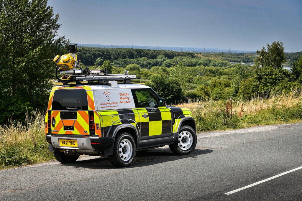

The introduction of the Trimble MX50 system will play a large part in enabling the Jorvik Design Group to provide a tailored survey and design service. This will maximize efficiency throughout their telecoms build and network deployment process.
About the Trimble MX50
The Trimble MX50 is avehicle-mounted mobile LiDAR system suitable for companies, such as Jorvik Design Group, who wish to expand their offering to include precise, high-volume data capture technology. The system delivers a very accurate point cloud of the environment along with complimentary immersive imagery and will provide Jorvik with the ability to create extremely accurate designs without time consuming and labour-intensive site walkovers.
Enhanced workflow
KOREC has worked closely with Jorvik Design Group in the creation of an enhanced workflow that will enable it to complete design jobs far faster and more accurately through the use of the high-precision, current, 3D point cloud data collected by the MX50. Previously, the company worked from Google StreetView where asset data could be outdated or inaccurate. This older data often required time consuming back-and-forth site visits from surveyors for asset checking purposes before network design could begin.
With the new enhanced workflow, clients provide a boundary map and all relevant UPRNs (Unique Property Reference Numbers) and request that Jorvik plans a design for that network. An initial survey is then driven with the MX50 system mounted on Jorvik’s Land Rover Defender.
QGIS integration
Under the guidance of Jorvik Design Group Network Planner, Mahmoud Ali, the point cloud is then processed and split into smaller jobs for the design team. A KOREC developed portal and plug-in allows the MX50 collected data to be automatically loaded as a layer for immediate use in their QGIS.
This easy integration routine means that the initial design can be viewed on top of the point cloud in a pre-defined layer. The same data can then be worked on all by all Jorvik designers simultaneously.
Client benefits
Having access to a current, high-accuracy, 3D point cloud means that the Jorvik Design Group can now provide an even better service for its clients through the provision of:
Accurate 3D point cloud data for measurements related to costing
A faster design service based on correct asset location
A fully up to date, accurate map of all their assets at the job’s conclusion.
“We invested in the Trimble MX50 system because we are always looking to continually develop and improve our approach to surveying & design and felt that this would allow us to step out amongst the crowd, in an ever growing and rapidly moving sector. KOREC has assisted us in tailoring the MX50 specifically to suit the telecoms market and to specific client requirements, which has been instrumental in our growth as a business.
Charlie Farley, Jorvik Design Group, Director
“By investing in such an advanced piece of hardware, we feel that we are extremely well placed to deliver exceptional data at pace, whilst ensuring that the information captured is up to date. This is critical to our design output and has allowed Jorvik to cover vast areas across the UK in a very short space of time. This system has proven to be invaluable to Jorvik and by using this cutting-edge technology, we feel that we are the market leader in the delivery of surveying and design services within the telecoms sector and keeps us one step ahead of the competition.”
“Mobile Mapping is now a recognised and accepted technology playing an important part in the digital strategy of many major businesses including a number of fibre optic installation companies. Jorvik Design Group is the first in the UK to invest in a Trimble MX50 system and KOREC has been delighted to be a part of that process, from initial trials through to assisting with an enhanced workflow and the delivery of training.”
Richard Gauchwin, KOREC Group Business Area Manager – Mapping & GIS
If you’d like to find out more about the Trimble MX50 Mobile Mapping system, please contact your local KOREC consultant, or use the details below;
Call UK Sales: 0345 603 1214
Call Ireland Sales: 01 456 4702
For anything else, view our contact page.
A trio of news stories celebrating the support that both KOREC and Trimble are providing to the education sector across the UK
There isn’t much that’s more important than ensuring the next generation are informed, enthused and inspired to join us in the exciting world of engineering, construction and the built environment.
In how many other industries can you make such a direct and positive change in how we design, build and maintain the spaces in which we live, work and play?
That’s why we’re delighted to highlight 3 recent stories that do just that;
KOREC & National Highways make a Big impact
Our team were delighted to support National Highways at the recent Big Bang Fair in Birmingham.
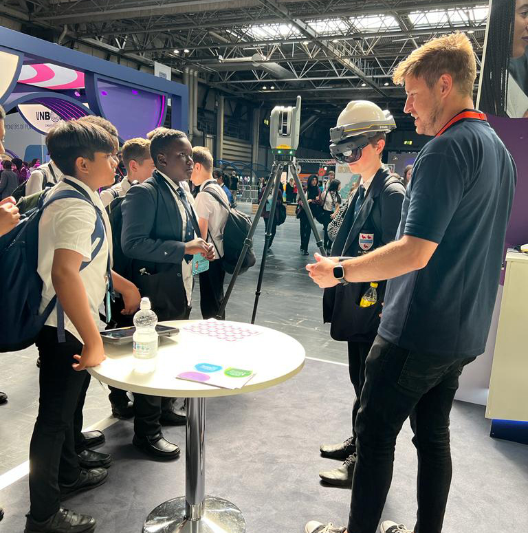
The 3-day event saw tens of thousands of children aged 11-14 descend on the NEC to get involved in all things STEM (science, technology, engineering and maths).
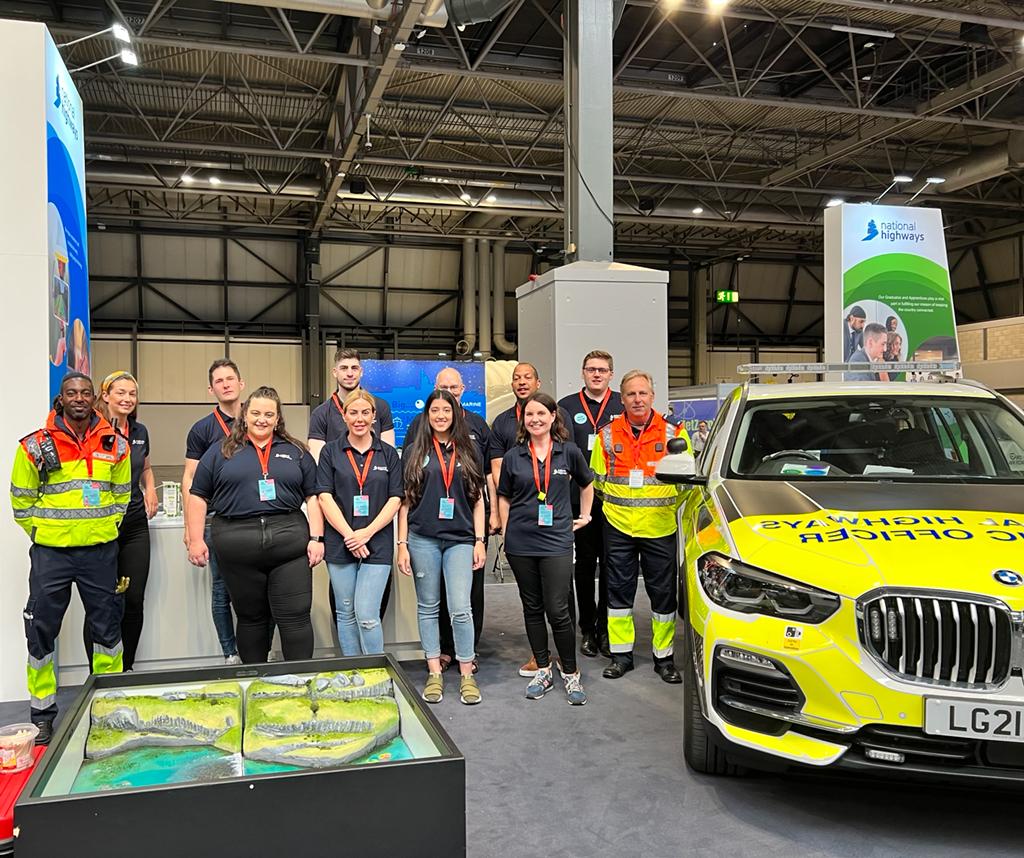
The KOREC team were on hand to showcase the very cool technologies that are being utilised to made the collection, sharing and understanding of spatial data easier and more intuitive. The star of the show was most certainly the Trimble XR10 headset. The team loaded various digital models including dinosaurs, robots and an airplane into the device, which the kids could then view and explore!
Check out more photos of the event and the team, here!
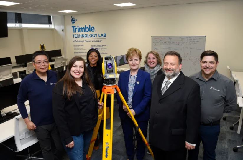
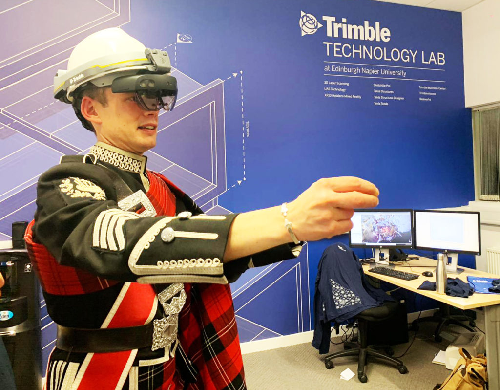
Trimble Technology lab expands in Edinburgh
Trimble and Edinburgh Napier University are celebrating the expansion of the Trimble Technology lab – the first of its kind in the UK.
Click here or the link below to read the complete story over on the North Edinburgh News site.
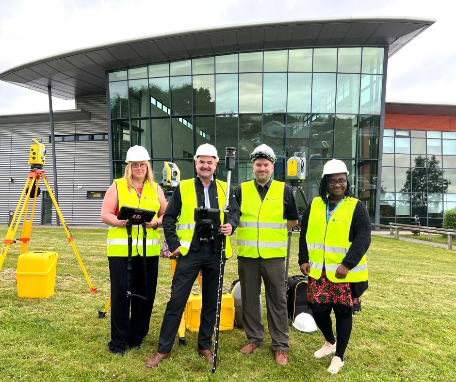
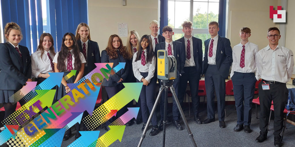
SMB College Group invest in Trimble Technology
Leicestershire-based SMB College Group has recently invested over £80,000 in Trimble technology, supplied by KOREC Group.
The college is a leader in Construction T level courses – preparing its students for work in the construction and engineering sectors including quantity surveying, civil engineering, project management and architecture.
The equipment includes some of Trimble’s most cutting-edge digital construction solutions, including the X7 laser scanner, the XR10 mixed reality headset, and the S5 robotic total station.
Read the full press release on the SMB College Group site
Next Generation is KOREC’s higher education strand – it’s how we inspire, support and train the institutions and the students who are the future workforce of our industry.
If you’d like to know more about Next Generation, or how we can help you, why not get in touch?
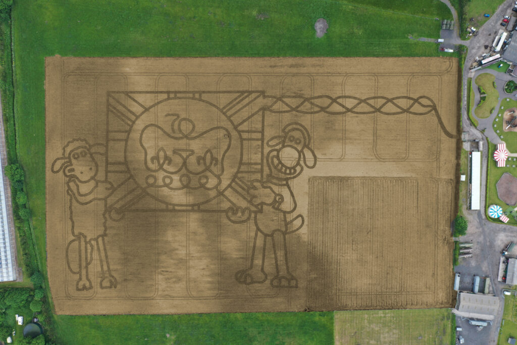
It’s taken permission from the Palace and the loan of one of the most advanced handheld GPS mapping systems available for Mark Edwards, Managing Director of Farmer Ted’s Adventure Farm, Ormskirk, Lancashire, to create this year’s jubilee themed maze attraction.
The maze was designed by Mark who enlisted the help of Liverpool based positioning and survey equipment specialists, KOREC Group. KOREC was delighted to loan him a handheld Trimble Catalyst GPS solution and also helped him turn the design into coordinates that could be loaded into the GPS to recreate the design in the maize field.
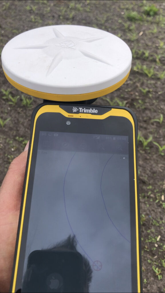
The Trimble Catalyst GPS connects to a smartphone that clearly shows the maze design. It is then taken onto the 14 acre maze site where Mark is able to navigate, using his position on the screen, to plot out the design amongst the tiny maize plants. A cultivator follows his trail cutting out the design.
Left:The KOREC supplied Trimble Catalyst GPS is capable of centimetre accuracy! This picture shows part of the design on a smartphone/logger
This year’s design comes with a royal seal of approval. Working closely with Aardman, the award winning animation studio and the creators of Shaun the Sheep, Mark contacted the Lord Chamberlain’s Office at Buckingham Palace and was granted permission to use the Queens official Platinum Jubilee logo to celebrate this great occasion!
Mark says, “the KOREC supplied Trimble GPS really is an ‘amaizing’ piece of equipment and so easy to use. We were able to create this exciting jubilee design in just 2 days!”
Farmer Ted’s is the UK’s largest Shaun the Sheep farm attraction. It opens daily until mid-September with the Maize Maze opening on 23rd July. Tickets can be purchased on-line at www.farmerteds.com
About Shaun the Sheep
Shaun the Sheep, Aardman’s family favourite TV series, is recognised the world over for its slapstick humour, distinctive look and strong, quirky characters and enjoyed across multiple media platforms. First appearing in Nick Park’s 1995 Academy Award® winning Wallace & Gromit ‘A Close Shave’, Shaun then went on to star in his own series, created by Richard Starzak which launched on BBC One in 2007. Shaun the Sheep is currently broadcast in 170 territories around the world and is an internationally celebrated icon with over 5.6 million fans on Facebook. In 2015 the first Shaun the Sheep Movie with feature film partner Studiocanal was released around the world to critical acclaim and the first half hour TV special aired as part of many broadcaster’s festive season., The feature film sequel Shaun the Sheep Movie: Farmageddon was released in October 2019 and nominated for an Academy Award® and was closely followed by a sixth season of the series in 2020. A new festive special Shaun the Sheep: The Flight Before Christmas was released in December 2021.
We are delighted and proud to announce that our KOREC Group CEO, Alan Browne, has been named on the EY Entrepreneur of the Year shortlist for 2022. Alan’s nomination is for ‘Established Entrepreneur’, one of three categories that also include ‘Emerging Entrepreneur’ and ‘International Entrepreneur’. Following judging of the shortlist the overall winner for Ireland, who will also be a global finalist, will be announced in November.
EY Entrepreneur Of The Year is a unique global programme running in more than 60 countries that recognises entrepreneurial achievement among individuals and companies that demonstrate vision, leadership and success. All finalists will be invited to join the EY networking event in Austin, Texas.
In Alan’s case, the nomination is a fitting recognition of his 27 years as CEO of KOREC that has culminated in a recent period of massive growth for the company resulting in a recruitment drive to fill 30 new positions, in a range of departments, across the UK and Ireland.
Alan Browne said: “I’m delighted to receive this nomination because it’s a truly exciting recognition of what we have achieved at KOREC over the years in a demanding, technology led environment. Our experience has allowed us to build and define our company culture and that means we’ve also created a great workplace, a great team and a world-class ethos.”
Additional information about why Alan was shortlisted
Alan has been entrepreneurial from an early age. At just 27 years old he started a company in Ireland called PCI with a single employee. He felt that large machines on construction sites could be used far more effectively and accurately if they were equipped with a technology called Machine Control (based on laser measurement) that was still very much in its infancy.
In the first year of working, the company had a turnover of £110k. Today KOREC Group will turnover £35m across the Group. From the initial days of just two employees, KOREC now employs over one hundred people and is growing all the time. Currently, KOREC is seeking to recruit for 30 new posts in 2022.
Alan’s strength, and that of the KOREC Group, lies in his ability to spot key business areas whilst they are still in their infancy and in some cases, whilst there is still opposition to the technology. A great example of this is his move into the commercial drone market in 2011 becoming the first in the UK to do this. He worked closely with drone manufacturer senseFly to become one of their most influential partners. This relationship is still strong today and despite initial opposition, many survey companies are now reliant on drone technology and see drones as a vital addition to the surveyor’s toolbox.
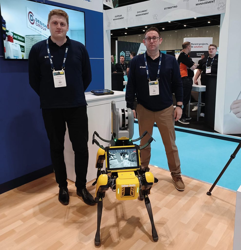
Most recently Alan has moved KOREC towards robotics, again a technology that is still in its earliest phases within the construction and survey industries. This move has seen KOREC working with major engineering contractors in the UK and Ireland as they adopt Spot the Dog, an agile robot developed by Boston Dynamics. Teamed with Trimble laser scan technology, Spot is equipped to carry out 3D laser scans, autonomously, in conditions inhospitable to a surveyor or to just carry out mundane and repetitive tasks to free up skilled engineers or surveyors to focus on other aspects of a project.
Alan has a proven ability to spot key business areas early, including niche markets that require time and investment, along with the ability to understand a customers’ specific and unique project requirements. He has placed KOREC in an advantageous position by connecting customers to the global leading software, hardware, and services technology company that is Trimble, whilst retaining local knowledge and a sense of community. This is what has enabled him to bring cutting edge technology to projects, whilst also developing bespoke software solutions that fit the bill precisely.
The KOREC mission is a simple and one that Alan adheres closely to in every decision he makes whilst also ensuring that the company reflects this overall vision.
The KOREC Mission:
When operating in the natural and built environment, consistent success demands accuracy, safety and speed, whilst reducing costs and environmental impact.
At KOREC, we believe embracing geospatial solutions will transform your outcomes and deliver that success.
KOREC’s mission is to empower you to measure, map and manage the natural and built environment.
Combining industry knowledge, with intuitive software, and world-leading positioning technology, KOREC transforms your operations bringing certainty to your decision making.
Finally, Alan has also invested a lot of time and effort in creating a KOREC culture that is both fun and rewarding to work in.

The onset of the COVID-19 pandemic two years ago really brought home to us the importance of maintaining and improving our health – both inside and out.
Maintaining our physical health could mean the difference between a mild or a severe case of covid, and the impact of multiple lockdowns, separation from our loved ones, and working from home, all took their toll on our mental health, too.
Combined with the distressing and upsetting news coming out of Ukraine on an almost daily basis, it does seem a challenge to keep ourselves upbeat and positive.
As a responsible employer, KOREC understands the importance of ensuring a happy, healthy and supported workforce – and takes action to ensure it.
To mark this International Day of Happiness, here’s just some of the initiatives we’re undertaking to bolster the health, happiness and prosperity of our people;
Perks of the Job
The company now proudly boasts 5 physical first aiders, including Steven Sreeves who just completed his Emergency First Aid at Work training, provided by St John Ambulance
- We’re also proud to have two mental health first aiders, in the shape of Rachel Caddick and Stuart Guthrie-Cadge, both of whom recently completed the Mental Health First Aid England course.
- Rachel and Stuart recently held a Lunch ‘n’ Learn on the difficult but important subject of depression, anxiety and suicide – and offered advice and tips for those who may be struggling.

Meet the KOREC mental health first aiders! Rachel Caddick and Stuart Guthrie-Cadge
- We’ve signed up to Plumm – a dedicated online platform that offers free and confidential chat therapy, online courses and meditation
- We recognise the importance of small gestures, which is why we send every single employee a small Valentine’s gift each year, just to let them know we appreciate them.
- Speaking of small gestures, who doesn’t love a wee perk? For a few years now KOREC has invested in Perkbox, an online portal chock full of freebies and discounts on everything from free cinema tickets to cheaper gym discounts. This also includes access to the Employee Assistance Program – providing 24/7 support for those struggling with legal issues, debt, anxiety, bereavement or relationship issues.
- We also love to party! Which is why we have not one, but two KOREC parties – a summer and a Christmas event! The KOREC gang love nothing more than getting together and having a knees up. During COVID, we thought this was more important than ever, so we held our first ever ‘virtual’ Christmas party, and smaller, socially-distanced summer events.
On this International Day of Happiness, why not take a few moments out of your day to do something that makes you feel good?
Wishing you health, happiness and prosperity – from the whole KOREC team!
The three little words that enabled Storm Geomatics to recover its entire fleet of survey instruments within 4 hours of the theft.
Despite a break in that occurred on Saturday night at 10.30 pm, the company was fully operational on Monday morning at 7.00am thanks to CCTV, Trimble’s Sentinel Solution, a fast Police response and some hard work from the Storm team that saw all the recovered instruments checked and recalibrated over the weekend.
Whilst instrument theft continues to be a problem in our profession, it is always rewarding to hear from companies such as Storm Geomatics that thieving from premises can be reacted to quickly and effectively and that investment in technology is part of the solution.
Theft Timeline
10.30pm: CCTV monitoring the Storm premises picked up unusual activity alerting the monitoring company who called the police and Storm Geomatics Managing Director, Mike Hopkins.
10.37pm: Smoke is released in the building and the thieves leave with stolen equipment escaping through a hedge and setting off on foot across fields.
10.47pm: Mike Hopkins arrives on site along with the Police and a tracker dog which picks up a scent but cannot located the thieves. Further police attend the scene in an attempt to find the panicked thieves.
12.45am: Mike contacts Storm Operations Director Anthony Pritchard who logs into the Trimble Sentinel app to see if one of the chipped Trimble Total Stations can be tracked
12.55am: Lat/Lon reference shows the position of the stolen goods with a time stamp of 12:51am. The lat/lon is converted to a What3words reference and given to the police.
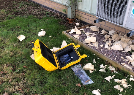
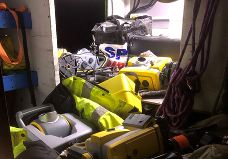
01:30am: A police dog team go straight to the equipment using the What3Words reference – it is found in a wheelbarrow in a hedge, abandoned. Four total stations, one SX10, two controllers, two R12 GNSS units, a level and other survey accessories. The yellow boxes were discarded.
2.10am: The stolen instruments are handled with gloves, placed in the back of a Landrover and returned to a safe place.
Our thanks to Polly Hopkins of Storm Geomatics for sharing this timely reminder on how instrument thieves can strike at any time. She explains, “There’s no doubt that this was a planned operation with the thieves arriving with an angle grinder to cut through the wall of the building and attempts to remove the external CCTV cameras.
“In this case, our investment in security measures has paid off 100%. The police could not have been more responsive and in a particularly busy period for us, our customers were completely unaffected – on Monday morning by 7.00am all our instruments had been checked, calibrated and ready to go.”
Protect your Equipment in the Field
Sentinel is available as an after-market add-on for Trimble S Series and C5 instruments. Its usefulness goes far beyond retrieving missing instruments. It can help you find teams in the field at any given time. It also contains a G-force sensor that sends alerts to users to check instruments for calibration errors or damage when they’ve been dropped or have endured a rough ride.

Contact us;
Call UK Sales: 0345 603 1214
Call Ireland Sales: 01 456 4702
For anything else, view our contact page.
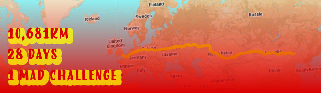
1st February 2022 marks the beginning of the Chinese New Year. Three days later, on Friday 4th, the Beijing Winter Olympics begin.
To mark these two occasions, and because we are mad for a group fitness challenge (or just plain mad?) the KOREC team are committing to undertake a mammoth journey.
In February 2021, our UK and Irish teams undertook their ‘Fit4Feb’ challenges – traversing Europe and America (virtually, of course…), and totting up an impressive 6,200km between them.
This year, in the spirit of the Chinese New Year – the year of the Tiger – we’ve committed ourselves to an even bigger challenge.
We are going to walk, run, swim, cycle and hop our way back from Beijing to London – a distance of a whopping 10,681km!
The well-known quote ‘a journey of a thousand miles’ is attributed to the Chinese philosopher Lao Tzu, and seems particularly apt for the challenge that lies ahead – at first, a journey of over 6,000 miles seems impossible – but all we can do is take that vital first step and begin our journey – and crucially – we’re not alone!

The Year of the Tiger
Since 2022 marks the year of the tiger, we’ve taken some inspiration from our furry friend. According to the Chinese Zodiac, the tiger is the ‘king of all beasts’, and is a symbol of Bravery, Competitiveness, Unpredictability and Confidence – some familiar traits we can see in ourselves!
So we’ve set some mini challenges based on these qualities, with some awesome (tiger-themed) prizes up for grabs!
BRAVE
- Who is brave enough to join our challenge?
- Who will brave dark and dismal early mornings for an invigorating run?
- And most importantly, who is brave enough to share their most embarrassing workout outfit?!
COMPETITIVE
- Who will get the most miles under their belt?
- Who can most accurately guess where we’ll end up come 28th February?
UNPREDICTABLE
- What will we discover en route?
- Who will come up with the most wacky method of exercise?
CONFIDENT
- Who actually thinks we can go the distance?
- Who’s willing to give it a go anyway?


We hit the ground running on February 1st, and we’ll be providing regular weekly updates on our progress throughout the month via our social channels.
Wish us luck, or as the Chinese say – Zhù nǐ hǎo yùn!
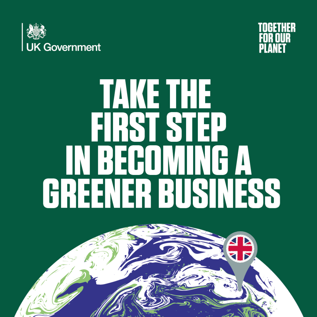
Ahead of next week’s COP26 climate summit, how KOREC are playing their part by investing in the future – not just of our planet, but the next generation of geospatial experts, too
Next week, virtually every world leader will descend on Glasgow for possibly the most important climate summit since Paris in 2015. By the time the summit wraps on 12th November, it is hoped they will have committed to limiting global temperature rise to the vital 1.5C to avoid the most catastrophic effects of climate change.
Since COP26 takes so close to home, and with KOREC in attendance, what better time than to make some commitments of our own?
This week, KOREC Group signed up to the SME Climate Commitment, where we as an organisation have committed to halving our emissions by the year 2030, and going carbon-neutral by 2040 – a full decade ahead of the UK government’s target.
We have been working to reduce emissions across our vehicle fleet for several years with most of our vehicles now hybrid electric models – but we recognise there is work to do when it comes to our offices, our staff travel, and our supply chain.
But it’s not just the climate that we’ve committed to. KOREC was also recently confirmed as a partner of Geospatial UK. Based at Newcastle University, the organisation was formed to counteract the widely-publicised skills shortage in our geospatial industry. Their key aim is thus to engage and inspire the next generation of geospatial experts – by educating and informing them about the exciting, fast-changing and varied industry that we love. As well as being a key sponsor, KOREC will be supporting this great work in a much more hands-on way – more on this to come!
This focus on the climate and future generations will converge beautifully at next week’s COP event, which we are delighted to be attending. Our partners at Edinburgh Napier University (home to a Trimble Technology lab which is helping to expand the University’s leadership in training and research in 3D building design, digital fabrication and the sustainable built environment) have invited us to take part in their #GetOnWithIt event in Glasgow.
Sam and Stuart from KOREC will be in attendance, showcasing key digital construction tools such as the X7 laser scanner, SiteVision augmented reality and XR10 mixed reality headset, to the student body and public alike. Besides being excellent tools to showcase to a live audience, these solutions are excellent examples of ‘connected construction’ – efficient, effective digital tools that allow online collaboration (cutting down unnecessary trips to site) and as well as reducing construction site waste and rework.
We’ll be sure to be sharing pictures and clips from the event – so keep your eyes peeled on our social channels next week!