Best Ground Survey Equipment for Topographic Surveys
Find out which ground survey equipment delivers the best results for topographic surveys, from instrument selection and site conditions to combining technologies for efficient, accurate data capture.
A topographic survey captures the shape, elevation, and features of the ground surface: contours, spot heights, drainage, vegetation, structures, and boundaries. The data forms the basis for planning applications, engineering design, flood risk assessment, and earthworks calculations. Getting it right depends as much on choosing the appropriate equipment as it does on field technique.
This guide covers the main instrument types used for topographic ground survey, the conditions in which each performs best, and how to combine them for efficient results. For a broader introduction to land survey methods, see our guides on what is a land survey and how does land surveying work.
What Topographic Surveys Demand from Equipment
Topographic surveys vary enormously in scale and complexity, but they share a common set of demands. Equipment needs to capture accurate three-dimensional position data across a site, handle varying terrain and vegetation conditions, and produce data that can be processed into contours, digital terrain models, and engineering drawings. The key variables that shape instrument choice are:
Site size: a single residential plot requires a very different approach to a 50-hectare greenfield development
Terrain: open grassland, woodland, steep embankments, and urban environments each create different challenges
Accuracy requirements: a planning-level topographic survey and a pre-construction engineering survey may require different tolerances
Vegetation and obstructions: dense tree cover degrades GNSS performance; structures and walls restrict line of sight for total stations
Understanding these variables before selecting equipment is essential. Most topographic surveys on mixed sites benefit from a combined approach, using more than one instrument type to cover different conditions efficiently.
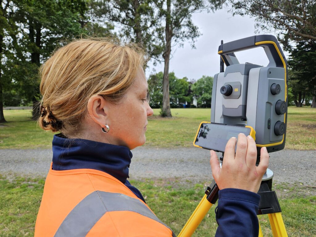
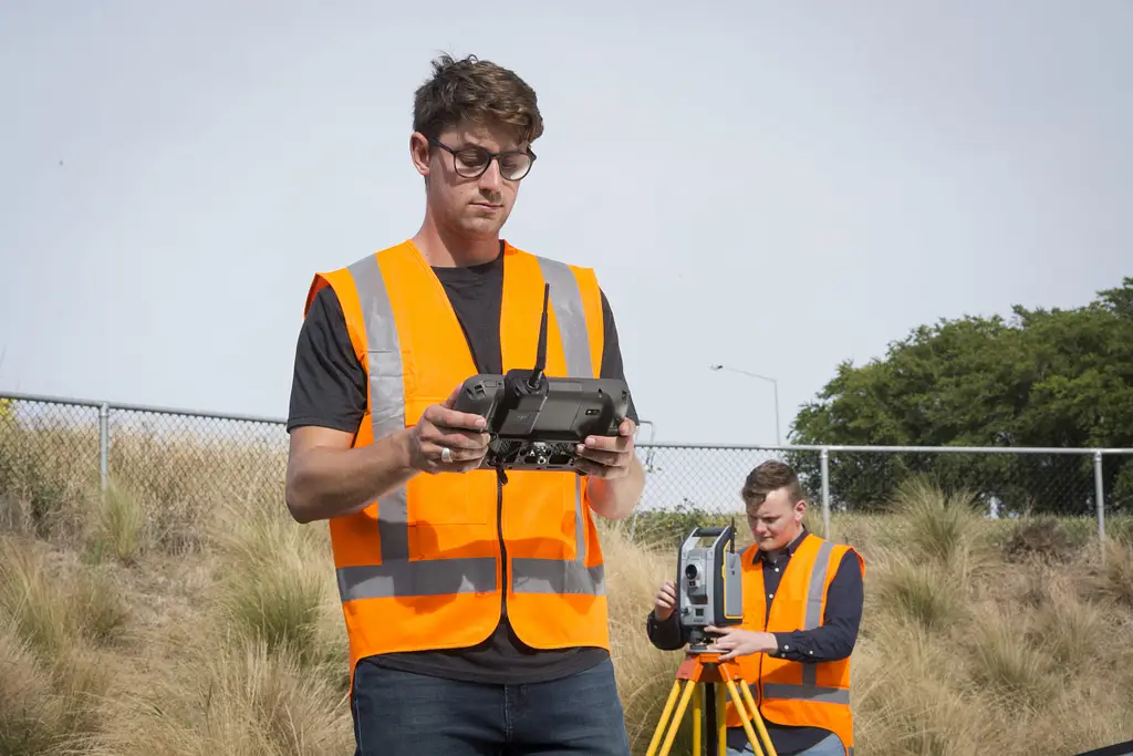
Total Stations
For topographic surveys on sites with obstructions, tree cover, or confined spaces, a robotic total station is often the most reliable choice. The Trimble S Series — spanning the S5, S7, S9, S9 HP, and SX12 — allows a single operator to capture precise three-dimensional coordinates from any point with a clear line of sight to the prism. Trimble MagDrive servo technology delivers fast, smooth instrument rotation, and Trimble MultiTrack active tracking maintains reliable lock on the prism even on busy sites with obstructions, crossing sight lines, and multiple prisms in the field of view.
For topographic work, a robotic total station excels in wooded areas where GNSS satellite visibility is poor, on steeply sloping ground where the instrument can be set up at a known height to measure both up and down slope, inside structures and under bridges, and on urban sites surrounded by buildings.
The Trimble S7 adds scanning capability to the standard robotic platform, allowing surface detail to be captured as a point cloud alongside conventional topographic observations, which is particularly useful for structures, retaining walls, and complex ground features that would be slow to pick up individually.
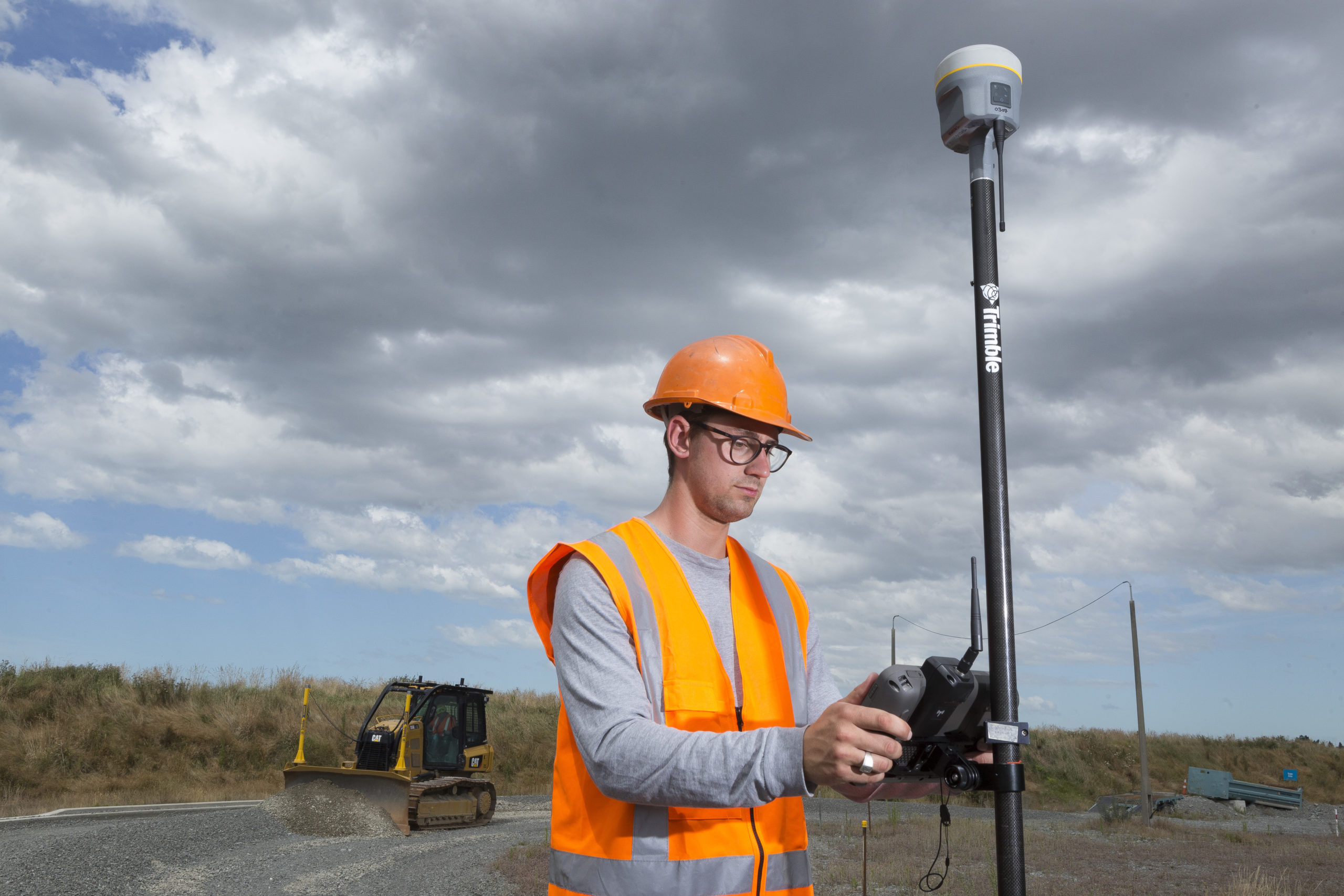
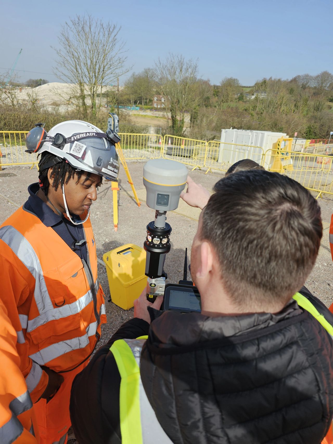
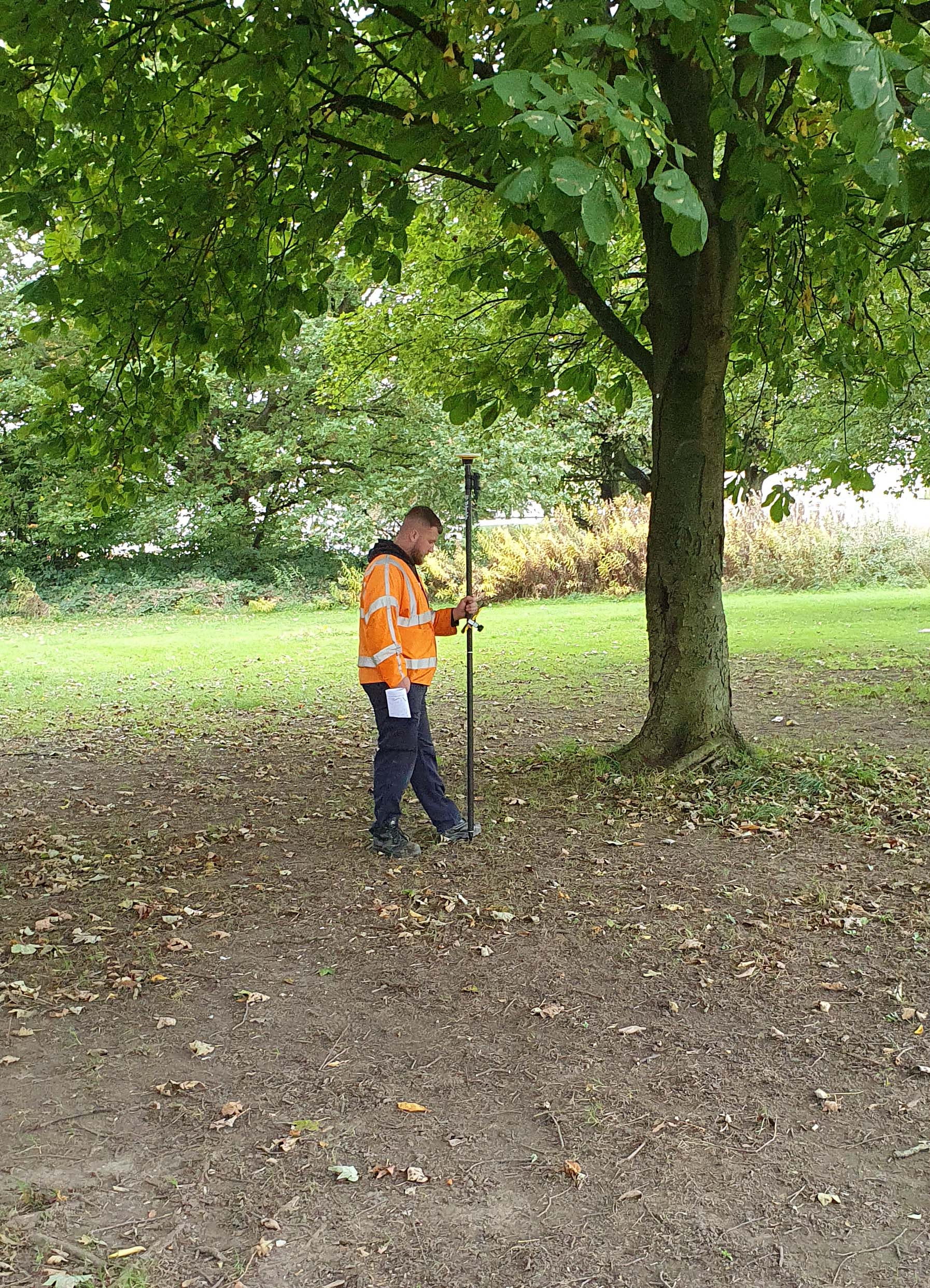
GNSS Rovers
On open sites with good sky visibility, a GNSS rover is the fastest and most productive tool for topographic data capture. The Trimble R580 and Trimble R980 both deliver centimetre-level RTK accuracy with multi-constellation tracking across open terrain. Network RTK services such as Trimble VRS Now provide corrections via mobile internet, removing the need for a base station across most UK and Ireland sites and allowing the rover operator to cover ground quickly without additional equipment.
IMU-based tilt compensation, available on both the Trimble R580 and Trimble R980 via Trimble’s TIP technology, is particularly valuable for topographic work. It allows spot heights and feature points to be captured with the pole tilted, avoiding the need to level up on every observation, which significantly speeds up data collection across uneven ground and vegetation edges. Both receivers also benefit from Trimble ProPoint positioning technology, which improves accuracy and reliability in challenging GNSS environments including near buildings and under partial canopy.
GNSS is the natural choice for large open sites, boundary surveys, and sites where rapid coverage matters most. It is less suitable where canopy cover is dense, in urban canyons, or for capturing detail close to buildings and structures where multipath interference or signal blockage affects accuracy.
Combining Total Station and GNSS
The most efficient approach on many topographic surveys is to use GNSS and a total station in the same workflow. GNSS covers the open areas of the site quickly, while the total station handles the obstructed sections: woodland edges, ditches, structures, and anywhere that satellite visibility is unreliable.
Both instrument types integrate directly into Trimble Access field software, sharing the same project coordinate system and data format. Observations from both instruments are exported together in Trimble Business Center without conversion or manual merging, keeping the field-to-office workflow clean and reducing the risk of data handling errors.
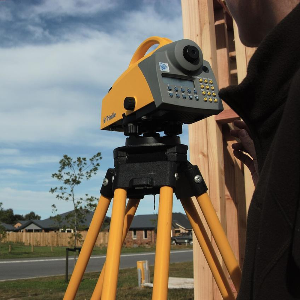
Digital Levels
For projects where accurate vertical control is the priority, a Trimble digital level provides precise height difference measurements that exceed the vertical accuracy of GNSS in most conditions. Digital levels are used to establish benchmarks and vertical control networks that underpin the rest of the survey, check GNSS-derived heights against a known datum, and produce accurate long-section data for drainage, road, and infrastructure projects.
On topographic surveys with tight vertical tolerances, running a digital levelling traverse to verify or supplement GNSS heights is good practice, particularly where the site data will be used for cut and fill calculations or flood risk assessment.
Laser Scanners
3D laser scanners such as the Trimble X9 and Trimble X7 are not standard topographic survey tools for general open-site work, but they are the right choice for topographic surveys that include complex built structures, heritage assets, or surfaces that are difficult or impossible to pick up point by point. A scanner captures millions of measurements in minutes, producing a dense point cloud that can be processed into terrain models, cross-sections, and 3D visualisations.
Scanning total stations such as the Trimble SX12 offer a practical hybrid: conventional robotic total station capability combined with scanning functionality in a single instrument. The Trimble X12 standalone scanner extends the range further, offering up to 2.2 million points per second for projects requiring the highest point density. For surveys that require both topographic data capture and detailed structural recording, the Trimble SX12 removes the need to switch between instruments on site.
Choosing Equipment by Project Type
Small to Medium Open Sites
A GNSS rover with RTK corrections is the most efficient choice for residential plots, agricultural land, and medium-scale development sites with good sky visibility. A digital level adds reliable vertical control where heights are critical. Total station backup is rarely needed unless there are significant obstructions.
Large or Mixed-Terrain Sites
Large sites with varied terrain, woodland, watercourses, and structures benefit most from a combined GNSS and total station workflow. GNSS covers the open ground; the total station handles detail in obstructed areas. A digital level establishes the vertical control framework that ties both datasets together.
Urban and Constrained Sites
Urban environments with buildings, narrow streets, and infrastructure present challenges for both GNSS and total stations. A robotic total station with strong multipath handling is typically the primary instrument, with GNSS used selectively where satellite visibility is adequate. Where dense point cloud data is needed for structures or facades, a laser scanner or scanning total station is the appropriate addition.
High-Accuracy Engineering Surveys
Pre-construction surveys for engineering projects often require tighter accuracy tolerances than planning-level topographic work. The Trimble S9, with sub-arc-second angular accuracy and Trimble FineLock target detection, is the appropriate choice for surveys where millimetre-level sensitivity must be maintained. A digital levelling traverse is essential for establishing and verifying the vertical datum.
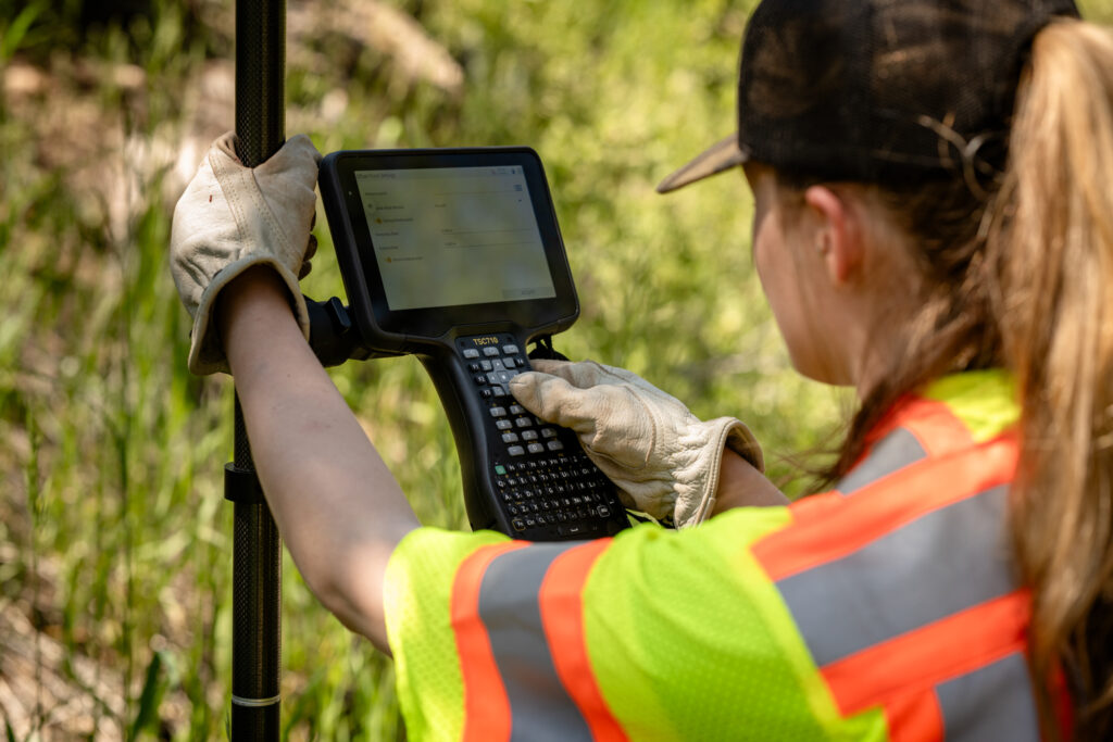
Field Controllers and Software
All of the instrument types described in this guide connect to Trimble data controllers. The TSC510 and TSC710 are the standard field companions for the S Series and GNSS rovers, running Trimble Access field software for the full topographic survey workflow. Laser scanners including the Trimble X7, Trimble X9, and Trimble X12 use the Trimble T110 tablet running Trimble Perspective software, which manages scan setup, field processing, and data export. Trimble Access manages the full topographic survey workflow: project and coordinate system setup, feature code libraries for ground features, real-time data display, and export to Trimble Business Center for processing and drawing production.
Using consistent software environments across instrument types keeps field workflows clear, reduces training time, and ensures data is stored and exported efficiently regardless of which instrument captured it. Total station and GNSS data share the same project files in Trimble Access and Trimble Business Center, while scanner data processed in Trimble Perspective can be brought together with the rest of the survey deliverables in the office.
Frequently Asked Questions
What is the best single instrument for a topographic survey?
For most topographic surveys on open or lightly obstructed sites, a GNSS rover with RTK corrections is the most productive choice. For sites with significant obstructions, tree cover, or urban environments, a robotic total station is more reliable. On mixed sites, combining both gives the best coverage.
Can GNSS alone be used for a topographic survey?
GNSS alone is suitable for open sites with good satellite visibility and no significant canopy cover or structures. For mixed terrain, obstructed areas, or where tight vertical accuracy is required, a total station and digital level should be used alongside the GNSS rover to ensure complete and accurate data coverage.
What accuracy should I expect from a topographic survey?
A well-executed topographic survey using RTK GNSS typically achieves horizontal accuracy of 10 to 20 mm and vertical accuracy of 15 to 30 mm, depending on conditions and correction service quality. Using a digital level for vertical control and a total station for obstructed areas improves overall accuracy, particularly for height-critical applications such as flood risk and drainage design.
Does KOREC offer equipment hire for topographic surveys?
Yes. KOREC’s hire fleet includes robotic total stations, GNSS rovers, and laser scanners, allowing teams to access the right instrument for each project without the capital outlay of purchase. This is particularly useful for specialist equipment such as the Trimble S9 for high-accuracy surveys, or laser scanners for projects requiring 3D point cloud data. See the full KOREC hire range for current availability.
Let us help you choose the right Survey Equipment
KOREC can advise you on the right land surveying equipment for your business. Speak to our friendly experts today to get the right technology to solve your project challenges.
Find out how to select the right survey equipment for difficult field conditions, from steep slopes and dense woodland to remote sites, wet ground, and extreme weather
How to Choose Land Surveying Equipment for Your Business
Find out how to match the right land surveying equipment to your business needs, from understanding your project workload through to making a confident purchasing decision.
Discover why the Trimble S Series is the total station of choice for survey and construction professionals across the UK and Ireland, and how KOREC supports you from day one.