It’s a topic of great concern to many in our industry – how do we attract the next generation of geospatial professionals?
It’s also a question that we’ve addressed in a column for GeoConnexion magazine based on the experiences of KOREC Director, Mark Poveda, who recently returned to his Dublin College with two colleagues to talk to final year students studying Geospatial/Surveying. However, college students are already engaged with our industry having actively chosen a relevant course and maybe we should be talking to students earlier.
A visit with value
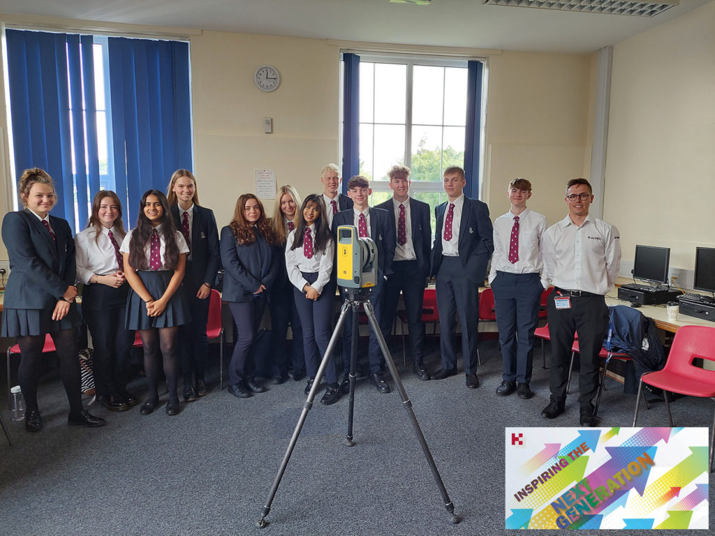
For KOREC Operations Technical Support, Liam Hartley, the 450th Anniversary of his old school, Queen Elizabeth’s Grammar School, Horncastle (QEGS), set him thinking as to what sort of career information he’d have valued as a sixth former living in a rural part of the country just starting to consider future job prospects, apprenticeships, or degree courses.
As a QEGS alumni, he’d seen invites to assist students in CV preparation or interview techniques but felt that this could be the perfect opportunity to offer some time to share his thoughts on geospatial careers with an age group just starting to think about their own futures.
At the invitation of the school’s careers lead, Sarah Holmes, Liam was able to spend a couple of days at the school chatting about the geospatial industry to teachers and students alike.
Great technology and engaging examples
Equipped with a Trimble X7 3D Laser Scanner and plenty of examples of what our industry has to offer, Liam reports that he spent a very rewarding 50 minute Development Class with the mixed group of students. Drawing on relevant examples such as 3D data (used in the gaming and film world) he outlined how F1 tracks are surveyed with Mobile Mapping, how sports events measure distance with total stations, how music festivals are set out with GPS mapping systems and how spatial data is everywhere and in everything we do, from using Google Maps to creating smart cities.
Liam feels that at least three quarters of the class seemed very engaged with four or five particularly responsive to the geospatial world. He reports, “I had a really rewarding two days at QEGS sharing my enthusiasm for an industry that has so much to offer as a career. Interestingly, very few of the students were familiar with the term ‘geospatial’ and of course, this highlights the problem we have in promoting a career where our key audience has very little understanding of what we do. If we’re to overcome this, then it’s vital that we are actively promoting our industry to this age group. Here at KOREC, we want to be a supplier that does just that and we’re perfectly positioned to do so from a unique perspective because we see everything that the industry has to offer technology wise. I very much want us to step forward and lead from the front.”
What next?
Liam used his two days at QEGS to plan for a future event for next year that he hopes can be rolled out to similar age groups in different schools. Watch this space!
To learn about KOREC’s Next Generation initiative (aiming to encourage a new generation to the geospatial industry) please contact marketing@korecgroup.com
Got a question? Want to find out more about the X7? Why not submit an inquiry with our friendly team?
Here at KOREC we love an analogy and this cycling one works a treat!
This year the Tour de France gave us a Wout van Aert as the winner of the prestigious stage 20 time trial in Paris. But he didn’t win the race. That honour was earned by the Slovenian Tadej Pogacar and it was he who finished the race wearing the yellow jersey.
Similarly, if your scanning operations depend on a speedy turnaround for your client, then you can be sure that the Trimble X7 has the features to get you over the finishing line first because the race doesn’t end without a fully registered point cloud that’s ready for the creation of 3D models, drawings etc.
Here are seven reasons why the X7 is unrivalled when it comes to delivering a timely, quality job:
- The Trimble X7 provides you with options to speed up your time on site. For example, thanks to a new firmware update (as recently shared by our laser scanning expert Melvin!), auto-calibration can now be switched off for shorter scans. This can save you 30 seconds per scan providing a 30% speed boost. Remember, you are in charge of the workflow, not the manufacturer, instrument or software. If you don’t need HDR photographs, you’d don’t have to have them, similarly for difficult surfaces or objects, with the Trimble X7 you can simply turn the high-sensitivity scanning mode on or off as required.
- It’s not all about the time the scanner is turning and collecting data. The X7’s auto-levelling feature ensures that you are ready to go as soon as you set the instrument down. The X7 has the IMU and dual axis compensator on all models, meaning data is always level to survey grade accuracy and does not require the same level of post-processing as those that don’t meet that same accuracy specification.
- The X7 doesn’t stop when you do! Infield registration is happening while you scan, full scan refinement, georeferencing, colourisation and export, in the same software on the same device, means that whilst you’re driving around between sites, the X7 is still working, registering the data so that it’s ready to send or transfer at the next stop.
- Or if you’re really pressed for time, you can use the wireless capabilities of the Trimble T10 Tablet and send the registered point cloud from the field.
- The full onboard registration in the field also provides data surety – you can be sure that you’ve got everything whilst still on site so need for return visits for missing data.The unmeasured points view from each Station View assures you nothing has been missed whilst you’re still on site. This allows you to fill in any important areas before leaving, a great time saver if it’s something that may mean a return visit or incomplete data set if you had to wait to do this back in an office.
- It’s got a handle 😉
- Finally, the Trimble X7 has been engineered to capture 500,000 points per second ensuring a high quality point cloud cutting down on any issues that can come from capturing more data than you need, namely extremely large data sets that are unwieldy to handle, navigate, transfer and store to archive.
Got a question? Want to find out more about the X7? Why not submit an inquiry with our friendly team?
Call UK Sales: 0345 603 1214
Call Ireland Sales: 01 456 4702
For anything else, view our contact page.
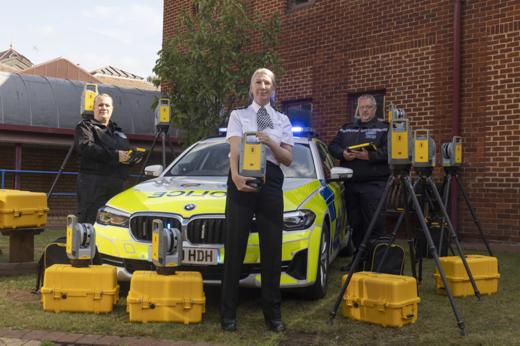
We’re delighted to announce that the hard work of KOREC Regional Director Barry Monk and our KOREC team of scanning/forensic specialists has resulted in a significant investment in Trimble X7 3D Laser Scanners by Surrey and Sussex Police.
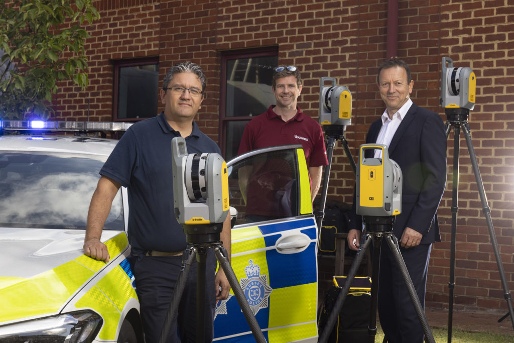
The nine new X7’s have already been delivered and we were pleased to be there on the day to ensure that the handover went smoothly.
Read the official press release here
Whilst the benefits of the Trimble X7 are relevant to a wide range of users including surveying practices, construction companies, architects, steel manufacturers, and many more have been well documented, the demands of police forensic work require an instrument that can deliver in very specific areas which is why the X7 has proved to be an excellent match:
11 points why the Trimble X7 is a perfect match for forensic police work
- Ease of use – the learning curve for the X7 is the shortest of any scanner we’ve ever seen with our training department estimating that even a non-surveyor can be efficient in data collection within hours. This gives it a far wider range of use. Thanks to its intuitive Perspective software running on a tablet, crime and collision scene investigators can reliably collect scan data even if they have not used the instrument for several weeks.
- Fit in with your existing workflow – export formats supported include Trimble and non-Trimble software through the instrument’s new Trimble Perspective software. For example, the open .E57 format for easy importing of data straight into 3rd party registration software.
- Verification of information on site – the X7’s automatic on-site registration means that officers can check that all the information they need has been collected. Often there is no chance to revisit a scene, so this feature is vital for ensuring a full and detailed survey has been completed before leaving the site.
- Survey completed and sent from the site – with registration carried out on site, the finished scan data can be sent from the field for immediate analysis. This ensures a smooth flow of information in an environment where shift work and office processing time can delay the final deliverable by days.
- Fast set up and use – the X7 can be up and running in minutes thanks to the quick release mechanism and automated survey grade self-levelling – just put the scanner down and it’s ready to go.
- Night-time benefits with easy moving and set up around the site – an IMU has been included in the X7 which calculates the new station orientation and will import new data with this orientation already applied. The registration process which follows is then much faster due to the scan already having the correct orientation- just pick it up, hold it as you wish, walk where you want and put it down. This also makes it great for night-time working because unlike other manufacturer’s scanners it is not subject to the dark/low-light condition caveats that optically based solutions are.
- ROI – auto calibration brings reliability, cost-savings and no downtime – not only is the X7 priced competitively, but users are calculating that the auto-calibration feature alone can save in excess of £3k – £4k a year because unlike other manufacturer’s scanners, the X7 does not need to be sent abroad for this process. Instead it’s done automatically, every time it’s used, with the option of a printable certificate.The calibration of some instruments can take up to 2-3 months requiring the hire of a replacement instrument. The X7 eliminates the need for this.
- Rain never stops play – Trimble instruments have a proven record in the rain and with its IP55 rating, the X7 is no exception.
- Highly portable – the X7 weighs just 5.8kg and can be carried easily in a backpack.
- Excellent data quality – fast data collection plus the option of a high sensitivity mode for scanning dark vehicles etc.
- Images and annotations – Trimble Perspective software on a tablet drives the X7 and allows users to annotate, add images, tags, notes etc.
KOREC’s Barry Monk explains why the X7 is a good choice for Surrey Police and Sussex Police chose the Trimble X7
“Working with Surrey Police and Sussex Police on this project was an exciting opportunity to understand the impact a solution such as this can have in ensuring that the requirements of both Police and the public are met.
Breaking down and understanding each element of attending a scene and collecting crucial information was key. The Police have one chance to collect the data in one visit and not miss a thing. With the Trimble X7 solution we were able to tick so many boxes. It is compact and lightweight with all the accessories in a single, easy to carry lightweight backpack and the X7 even has handle which are important aspects when it comes to transporting it quickly on to a scene. Additionally, the onboard Trimble Forensics Capture software is extremely intuitive to use. The X7 proved quick and easy to set up and GO with auto levelling and confirmed calibration at the beginning of each scan. The 3D visualisation of each scan within the Capture software gave confidence and comfort to the investigator that all data was captured. If there were areas that were missed, an extra scan could be added with ease.
In many of the scenes that the investigators attend, speed with accuracy is key. Once the scene was captured, the investigator could start the registration process in the field or whilst on route to another scene or to the station. The complete point cloud would then be ready to review but it didn’t stop there. Once we had the finished point cloud, putting the data set through to Trimble Forensics Reveal software gave the police the power to verify, understand and produce information to support the outcome of the case. As Trimble’s Reveal software was designed with Forensics investigations in mind, there are many tools to allow the investigator to present that data but also to prove what potentially happened in the incident.
The flexibility of the Trimble X7 linked to the Trimble Forensic Reveal software also enables us to develop for future maybe more complicated scenes for investigation and I am pleased that we will continue to work with the police and provide future developments.”
KOREC specialises in bringing end to end solutions and our Forensics offering is no exception. As well as the Trimble X7, we also offer Trimble Forensics Reveal, software that gives you all the tools you need to recreate, analyse and visualise crime and crash scene data. Ideal for capturing small data sets using tape measures or total stations and also for managing full 3D scan point clouds.
If you’d like further information on Police/Forensics applications for our Trimble survey solutions, please contact our KOREC specialist in this area, Cesar Almeida.
Cesar can be emailed at cesar.almeida@korecgroup.com or called on 07721 919912.
For further information on the Trimble X7:
Call UK Sales: 0345 603 1214
Call Ireland Sales: 01 456 4702
For anything else, view our contact page.
When Trimble launched its newest 3D Laser Scanner, the X7, the company clearly stated that its aim was to create a laser scanner that truly addressed the pain points of every user who wished to capture a high-quality point cloud quickly and efficiently.
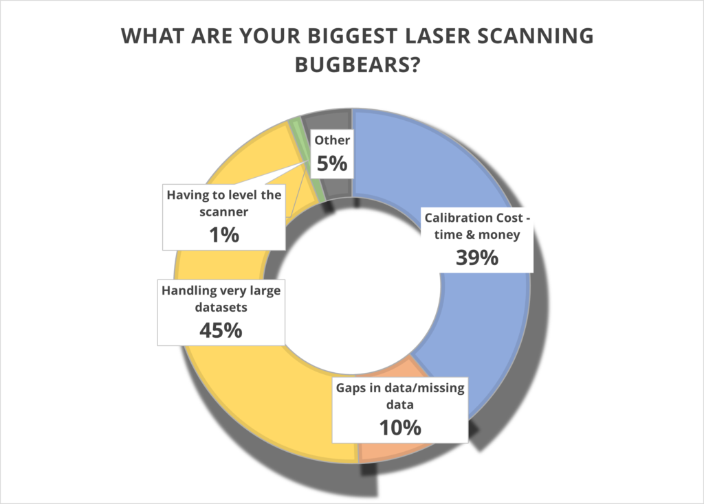
What better way to find out if they succeeded than with some simple market research? We shared our poll with thousands of you via LinkedIn and the Laser Scanning Forum in our efforts to discover the biggest bugbears with your current scanning set up, asking you to select from four options or add your own in the comments section. And the results are in…….
Has Trimble addressed these pain points? Let’s take a closer look.
1. Handling very large data sets (45%)
With surveyors often undertaking up to 100 scans a day, it remains vital that these large data sets can be handled quickly and efficiently. The X7 is perfectly equipped to do this because the scan is fully captured and registered in the field and then can be quickly reviewed and quality controlled in the office via Trimble Realworks. It’s you, the client, who is in the control of the workflow, not the manufacturer.
Additionally, the Trimble X7 captures four times less data (500,000 points per second compared to the 2 million or 1 million of other manufacturer scanners) which of course means less data to store and handle.
You can also avoid unnecessary expenses with storage devices by saving your data directly onto Trimble’s own developed and supported field tablet, the T10. Trimble is unique in that it develops its own scanner, software and tablet for a fully developed and supported Trimble solution.
We can also go directly to a CAD compatible format such as RCP from either the field with Trimble Perspective, or the office with Trimble Realworks, without additional licenses or import\export procedures. Less time in processing in the office, means the client can maximize production time heavily. Remember, having more data isn’t always better!
For more information, Trimble has a handy white paper on scanning and handling large data sets here.
Top KOREC tip – When handling large projects use ‘Labels’ to help organise the data in your project by adding a label like “kitchen or lounge” to each scan. You could also have different registration groups so you can split the scan data into Reg. Set 1 which could be Ground floor scans then Reg. Set 2 could be First floor scans.
2. Calibration cost – time and money (39%)
It’s your number two bugbear and we can completely appreciate why. Centara Ltd is just one of our customers who switched from its existing manufacturer’s laser scanner to a Trimble X7 because the business case made perfect sense. They calculated that the auto-calibration feature alone would save them in excess of £3k-4k a year because unlike their other scanner, the X7 would not need to be sent abroad for this process, nor would a replacement hire be needed for the duration which was usually around to 2-3 months. These savings enabled Centara to invest in additional kit that they were not expecting to purchase until the next financial year.
Other customers have cited the ability to ensure that data is always correct and validated with a calibration certificate as another plus. Evidence required? We’ve done a little video on how to calibrate your X7 in under 2 minutes.
Or why not take a Trimble ‘deep dive’ into auto calibration here
3. Gaps in data/missing data (39%)
Noticing that some of your data is missing only when you’re back at the office registering your scans clearly cuts deep with a large percentage of you. Not only is it frustrating, it’s also time consuming to revisit a site, particularly if entry is restricted.
Trimble has combatted this problem with one of the X7’s strongest features – infield registration. This feature enables users to stitch together different station positions automatically, in the field and directly on the tablet. It works indoors with walls, outdoors with vegetation and relies on a completely innovative alogrithim. You immediately see what you have and if there is a problem, or missing data, you can change settings or take more scans right away there and then in the field. Many Trimble customers have described this feature in just one word ‘Amazing’!
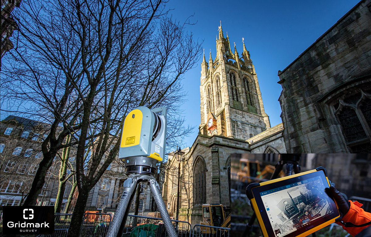
Gridmark Survey particularly appreciated the ability to automatically register each scan when they carried out a survey of the 900-year-old Newcastle Cathedral Church of St Nicholas. This allowed them to review everything in 3D before moving on. Overall, the Gridmark surveyors carried out 104 laser scans and collected 3.7 billion measurable points over a three day period.
4. Having to level the scanner (1%)
We’re amazed that only 1% of the vote went to this tiresome bugbear. However, for those under strict time pressures, it’s definitely a bonus X7 feature. In particular, Police Collision Investigators rate the ability to get the X7 up and running in minutes thanks to the quick release mechanism and automated survey grade self-levelling – they just put the scanner down and it’s ready to go. In each case, the instrument re-adjusts down to millimetre accuracy. There is no compromise with the Trimble X7 which has the IMU and Trimble X-Drive on all models, meaning data is always level and does not require post-processing.
5. Other (4%)
We appreciated all your comments including the addition of a couple more bugbears to our list:
a) Mirrors/Reflection/Refraction
Trimble is a leading hardware and software manufacturer and it is always pushing boundaries and leading development. Trimble appreciates that this remains a challenge and continues to work on a solution.
b) Portability
The good news is that the X7 comes in a handy backpack and weights just 5.8kg. It’s also got a handle!
Got a question? Want to find out more about the X7? Why not submit an inquiry with our friendly team?
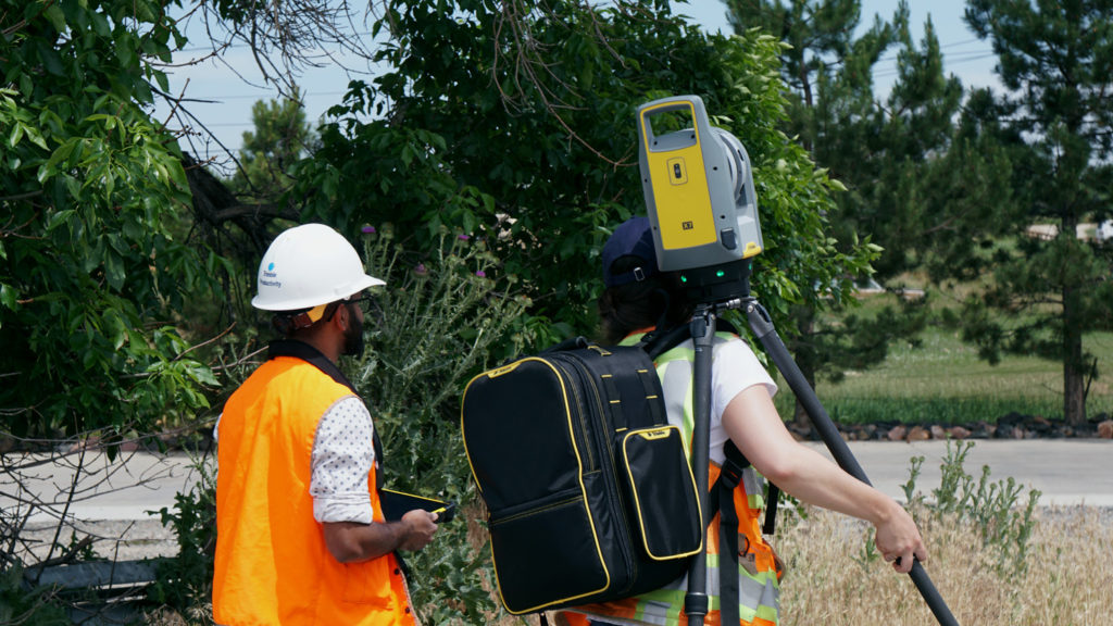
It was only a few weeks ago that we caught up with Sky Revolutions Company Director, Ben Gorham when Sky Revolutions became the first KOREC customer to invest in the newly launched senseFly eBee GEO. This time we’re back with Ben talking about a particularly successful week the company’s had with the Trimble X7.
Whilst picking up the new eBee from the KOREC Huntingdon office, members of the Sky Revolutions team took the time to take a closer look at a Trimble X7 3D Laser Scanner that was on site that day and immediately saw how it could contribute across the business and in particular, to an upcoming measured building survey project.
With over 20 years’ experience in construction surveying, Sky Revolutions undertakes a wide range of work and until recently carried out its measured building surveys using the traditional method of a Trimble S7 Robotic Total Station. However, already familiar with 3D laser scanning technology, they were keen to see what the X7 could deliver on the planned job of 25 measured building surveys on structures ranging in size from as small as a shed sized sports pavilion to as large as an office block with everything in between.
When we caught up with Ben, the Sky Revolutions team had successfully completed eighteen of the scans in just four days and expected to be finished in five. Ben explained, “Our aim is to deliver projects promptly and to supply our clients with data of the highest quality. The X7 has been exemplary in helping us achieve those aims. The scan speed alone has really assisted on this project as did the smart auto-calibration. We’ve had laser scanners before but the X7 is a step ahead. The argument for not buying one doesn’t really exist!”
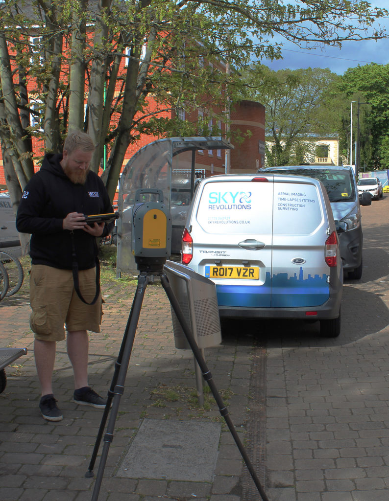
Sky Revolutions surveyor Dave Gaffney puts the Trimble X7 through its paces
Definitely not when it comes to examining why the Trimble X7 3D Laser Scanner lends itself to the pressures of crime and collision scene investigation!
We round up the top ten reasons why the X7 delivers on key requirements.
Over the years, KOREC has enjoyed a long and informative relationship with the UK’s police forces supplying a range of survey instruments from integrated GNSS and Total Station Systems to more recently, 3D Laser Scanning technology including the groundbreaking Trimble SX10 Laser Scanning Total Station.
Crime scene and collision evidence gathering is a discipline that brings its own set of challenges. The pressure to work quickly and capture every detail of a scene, often with no chance to revisit the site later, means that the emergency services need to have 100% confidence in the reliability of their data. They need to be able to gather that information quickly and it needs to be accurate, all encompassing and sufficiently robust to stand up in a court of law. Consequently, we’ve seen a shift towards 3D Laser Scanning as the best methodology for capturing a scene as quickly and completely as possible. Additionally, this can often be done from the side of a site reducing the chances of contaminating evidence.
The latest Trimble X7 3D Laser Scanner lends itself to the unique set of challenges faced by the police in a number of ways:
- Ease of use – the learning curve for the X7 is the shortest of any scanner we’ve ever seen with our training department estimating that even a non-surveyor can be efficient in data collection within hours. This gives it a far wider range of use. Thanks to its intuitive Perspective software running on a tablet, crime and collision scene investigators can reliably collect scan data even if they have not used the instrument for several weeks.
- Fit in with your existing workflow – export formats supported include Trimble and non-Trimble software through the instrument’s new Trimble Perspective software. For example, the open .E57 format for easy importing of data straight into Leica’s Cyclone software.
- Verification of information on site – the X7’s automatic on-site registration means that officers can check that all the information they need has been collected. Often there is no chance to revisit a scene, so this feature is vital for ensuring a full and detailed survey has been completed before leaving the site.
- Survey completed and sent from the site – with registration carried out on site, the finished scan data can be sent from the field for immediate analysis. This ensures a smooth flow of information in an environment where shift work and office processing time can delay the final deliverable by days.
- Fast set up and use – the X7 can be up and running in minutes thanks to the quick release mechanism and automated survey grade self-levelling – just put the scanner down and it’s ready to go.
- Night-time benefits with easy moving and set up around the site – an IMU has been included in the X7 which calculates the new station orientation and will import new data with this orientation already applied. The registration process which follows is then much faster due to the scan already having the correct orientation- just pick it up, hold it as you wish, walk where you want and put it down. This also makes it great for night-time working because unlike other manufacturer’s scanners it is not subject to the dark/low-light condition caveats that optically based solutions are.
- ROI – auto calibration brings reliability, cost-savings and no downtime – not only is the X7 priced competitively, but users are calculating that the auto-calibration feature alone can save in excess of £3k – £4k a year because unlike other manufacturer’s scanners, the X7 does not need to be sent abroad for this process. Instead it’s done automatically, every time it’s used, with the option of a printable certificate.
- The calibration of some instruments can take up to 2-3 months requiring the hire of a replacement instrument. The X7 eliminates the need for this.
- Rain never stops play – Trimble instruments have a proven record in the rain and with its IP55 rating, the X7 is no exception.
- Highly portable – the X7 weighs just 5.8kg and can be carried easily in a backpack.
- Excellent data quality – fast data collection plus the option of a high sensitivity mode for scanning dark vehicles etc.
- Images and annotations – Trimble Perspective software on a tablet drives the X7 and allows users to annotate, add images, tags, notes etc.

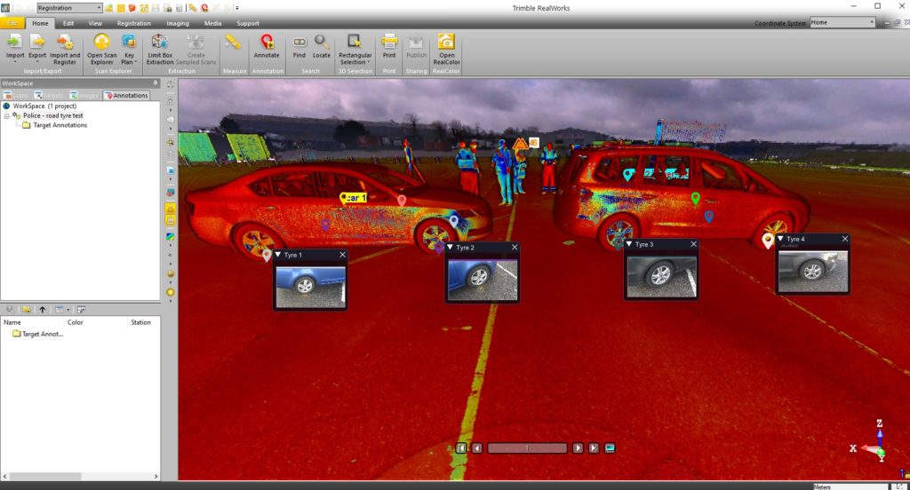
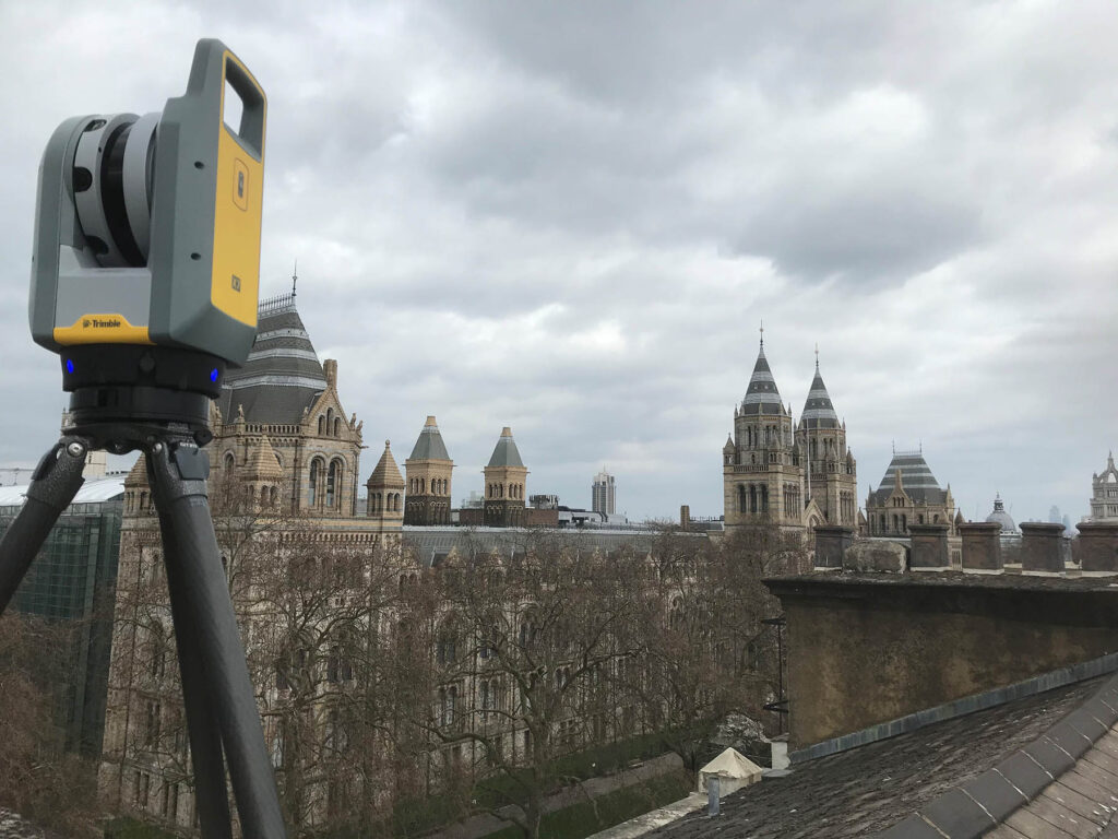
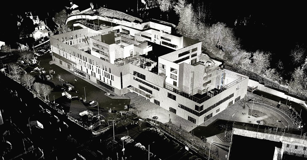
Scan data from the Trimble X7
For further information on the Trimble X7:
Call UK Sales: 0345 603 1214
Call Ireland Sales: 01 456 4702
For anything else, view our contact page.
There are seven days in a week, seven colours of the rainbow, seven seas, seven continents and now Survey Solutions has seven Trimble X7’s!
Following Survey Solutions’ recent acquisition of three further survey companies, Survey Systems, Locate Surveys and Kempston Surveys, it is now the UK’s largest engineering survey company and one that prides itself on offering ‘more than a survey’. Survey Solutions sees investment in the latest technology as an integral part of that process and has an extensive survey fleet that reflects this forward thinking approach. Most recently this has included expanding and updating its range of 3D Laser Scanners.
With nine offices – from Scotland to Somerset – company CEO James Cooper was particularly keen to ensure that his regional teams had access to a 3D Laser Scanner that would meet their demands for high quality data, ease of use and excellent productivity in the field. In upgrading the fleet’s older laser scanners, he was also keen to replace them with an instrument that all the surveyors and engineers would engage with. Their choice was the Trimble X7.
Seven scanners later, we caught up with Survey Solutions South East Director, Dave Bredin, who kindly shared his views on why the X7 has been such a popular addition to their survey fleet.
Top of Dave’s list was onsite registration. With seven X7’s in constant use, the increased efficiency on site and time saved in the office is considerable and a vital part in helping their clients meet important project deadlines. Dave estimates that on every job, office time is reduced by at least one third with the registered point cloud going straight in to drawing up.
The onsite registration also ensures that the Survey Solutions surveyors have total confidence in the data they have captured with the ability to check there and then that there are no gaps or missed areas. This reduces rework as well as time spent travelling back to a site if additional information is required. Tellingly, Dave says that it would be counter-productive to highlight a specific example of this function earning its keep because ‘… it’s every time on every job’!
Second on the list as a requirement for any laser scanner to be used nationwide was ease of use. With a large number of surveyors having access to the instruments it was vital that they could pick up the workflow quickly, with minimal training and have total confidence in their ability to collect high quality data from the off.
Dave reports that aside from the sensible pricing of the X7, there are many features that make it a perfect fit for the Survey Solutions’ fleet. These include it being easily carried in a backpack (many jobs in his SE area are undertaken in central London), the auto-calibration and self-levelling functions that ensure greater productivity on site and the Trimble RealWorks processing and analysis software that handles and combines data from different sensors. However, the real proof of an instrument’s contribution to a fleet is how it’s perceived by those who use it every day. Dave concludes, “The mark of a good piece of kit is the feedback from the surveyors who actually use it and every one of our surveyors loves it! Clearly the advancements in the Trimble X7 represent the next step in laser scanning technology and the X7’s easy to use and productive workflow is highly beneficial to both ourselves and our clients. It certainly ticks all the boxes for Survey Solutions.”

Did you know that the Trimble X7 3D Laser Scanner has an integrated calibration feature that offers full auto-calibration of range and angular systems in 25 seconds with no user interaction or targets?
This Trimble technology is a smart feature that monitors environmental temperature, ambient light, vibration, instrument temperature and vertical speed to take the guesswork out of your data.
With all the X7’s unique benefits, it’s possible that this one can get overlooked but in fact, when we talk to KOREC customers, they cite the low running costs and maintenance of their X7 as one of the major factors behind their purchasing decision.
Here are five reasons why auto-calibration really delivers:
- The X7 is an instrument used in many industries and not just by surveyors – auto-calibration guarantees high-quality data every time you turn on your X7 by removing concerns about whether the instrument is producing accurate scans, especially after transporting it to a project.
- Auto-calibration can save you in excess of £3k-4k a year. This was the figure calculated by Yorkshire based Centara in a recent case sudy taking into account the need to pay for the work, the transportation the instrument and its replacement with a hire instrument during the process. Instead, Centara were able to use saved cash to invest in additional equipment that they were not expecting to purchase until the next financial year.
- Auto-calibration means the X7 stays active on your fleet. With other manufacturers this process can see the instrument sent abroad for periods of up to 2-3months.
- The X7 is the first 3D laser scanner that offers smart auto-calibration and an industry-leading two-year warranty to back it up.
- Certification is provided each time the X7 auto-calibrates, Our KOREC Technical Tips video below shows exactly how it’s done.
Find Out More
- Read how the X7 and its aut0-calibration function assisted Yorkshire based Centara Ltd – Customer Story
- Find out more about the Trimble X7
- Download the Trimble whitepaper on auto-calibration
- Find out about the new mobile app for running your X7, Trimble Perspective mobile
The story of 2 customers
Cast your mind back to September 2019, when trade events were in full swing. At INTERGEO, Trimble announced the launch of a new type of laser scanner – one that delivers powerful performance, with simple operation.
The X7 promised fast, simple and accurate laser scan results, but 1 year on, does the product live up to the hype?
Barry Burrows takes delivery of his X7 from KOREC’s Barry Monk
Barry Burrows of BB Solutions didn’t have to think twice before making the purchase and became the first customer in the UK to own an X7. Since then Barry has put his new kit to the test on multiple occasions and has found that it was the perfect piece of kit for him and his business.
“I watched a few product videos on YouTube, read some online reviews and after about 15 minutes I knew that this was the right kit for me and my business.”
“With that scanner the amount of data collected was huge – I would easily spend 6-8 hours back at the office just processing the data, a lot of which was only needed for registration and would then be discarded”
In August, Survey Solutions took delivery of four brand new Trimble X7 laser scanners to use across their UK offices. The ongoing investment in the latest tech will insure that they continue to supply their clients with the best possible data as well as meeting important project deadlines.
“Laser scanning is a huge part of our measured building service and the new scanners further help our teams carry out their on-site survey and office processing.”
The Trimble X7 has most definitely lived up to expectations and gone above and beyond in just 365 days and we can’t wait to see what the X7 will get up to next.
To see for yourself just what the X7 can do, click here
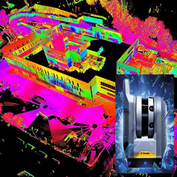
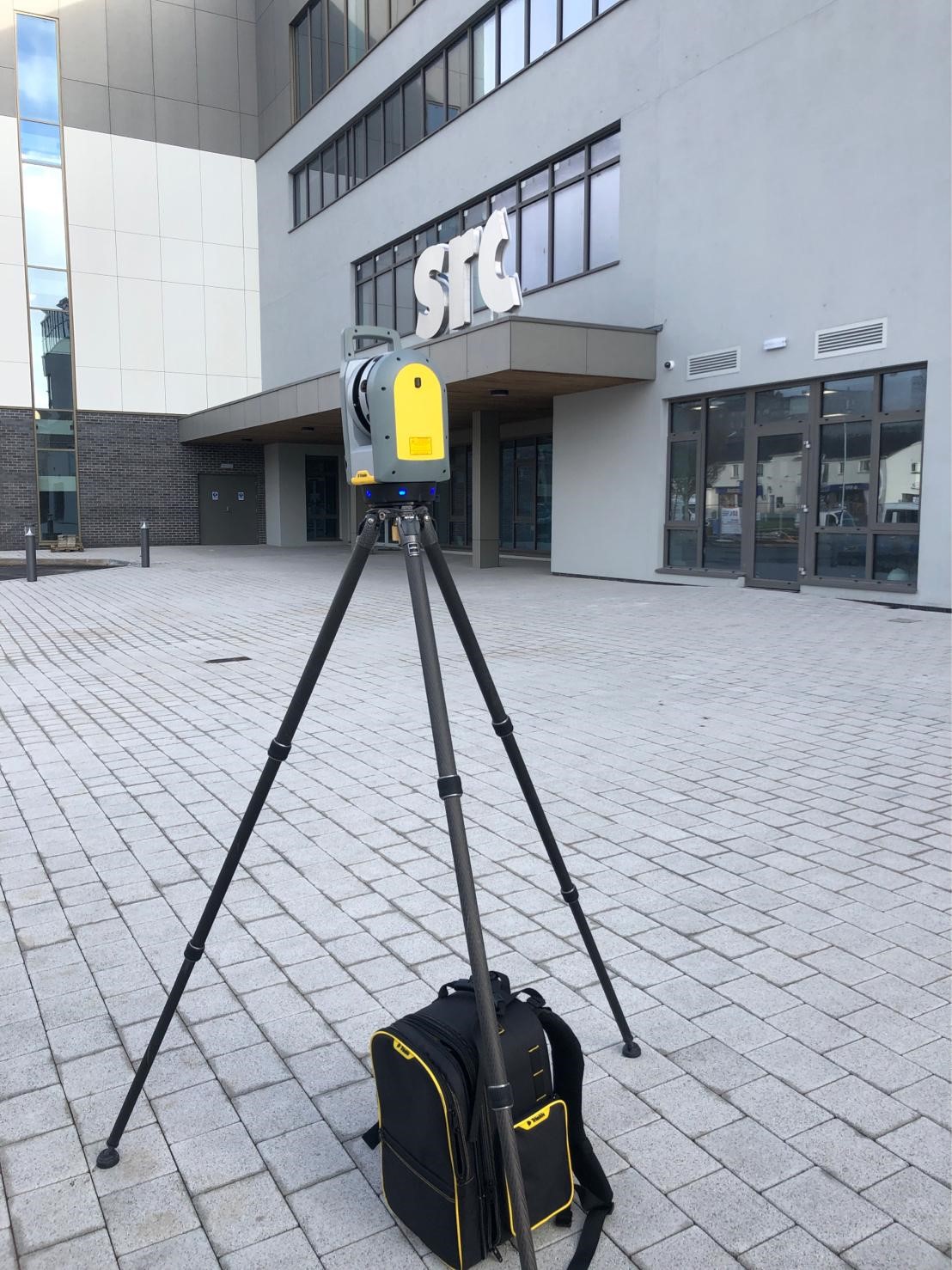
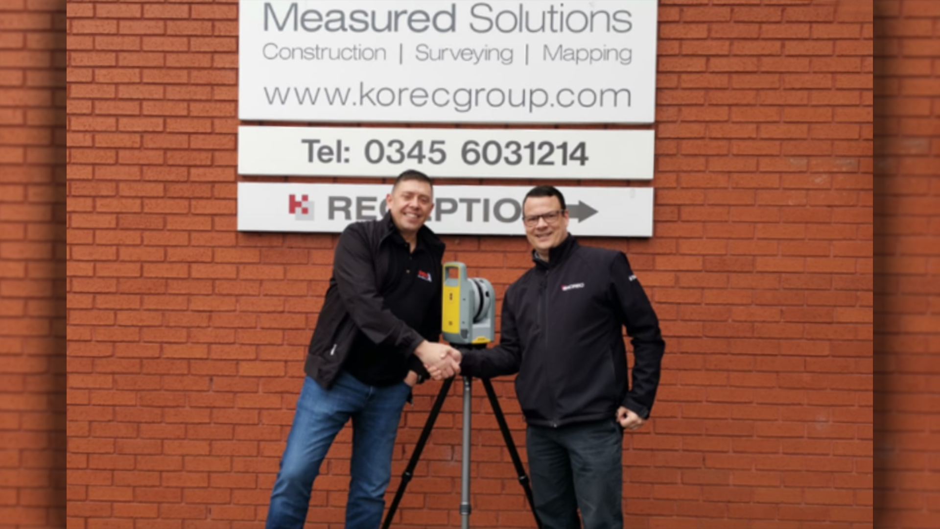
Our next issue of our KOREC Ireland newsletter, Traverse, is coming soon and the front cover features data from a recent trial of the Trimble X7 at the Southern Regional College, Armagh. The college was constructed by Felix O’Hare, which we recently covered in a KOREC case study ‘Taking BIM to the construction site’. SRC has a Queen’s University student embedded with Felix O’Hare under the Knowledge Transfer Partnership scheme (KTP) who was also part of the trial day along with Wayne Nolan, Senior Site Engineer at Felix O’Hare John Meneely, 3D Scanning Specialist at Queen’s University, Belfast (@1manscan) and of course KOREC’s Enda Fox and Kevin Colwell. Over the course of the morning, the X7 was used to scan the entire external envelope of the new campus with 35 set ups. Our thanks to Wayne and John for sharing their thoughts on the X7.
John Meneely: “In recent years, laser scanners have followed a fairly standard development curve as seen in many technologies – faster and lighter with some minor additions to functionality. However, what I like about the X7 is that it brings something new to the mix, namely, the ability to tie into and even place additional control on site, all thanks to the X7’s internal laser pointer. Combining this with the X7’s user-friendly tablet based software, intuitive workflow, on site registration and automatic calibration on power up gives you the reassurance that once a survey is complete, you leave with a fully registered, geo referenced point cloud – confident in the quality, coverage and accuracy of your scan data. Not only does this save a huge amount of time in post processing but engineers can verify on site that nothing has been missed, making the X7 an ideal instrument for the construction industry.
Wayne Nolan: Felix O’Hare & Co. Ltd. Throughout the Armagh SRC project we have embraced many forms of technologies throughout the construction process over our 2 year period on site, from the Trimble R10 GPS equipment to Trimble Robotic Total Stations through to Aerial Drones. As a main contractor, laser scanning is something we are readily looking at to help improve our QA/ QC procedures across all of our projects. The new Trimble X7 laser scanner definitely fits the bill from our point of view – firstly, it’s user friendly and intuitive interface is ideal for construction professionals.
New self-levelling and automatic calibration features not only give you piece of mind regarding the quality of your data but also saves you money year on year! In field registration is a huge benefit for construction professionals alike, as each and every scan is colourised and visible in the field without having to go back to the office – this leaves no stone unturned regarding data capture and eradicates the need to revisit scan areas.
One of the top features for us has to be the X7’s efficient workflows within the field using the Trimble Field Link software. The new integrated laser pointer tool has the ability to geo-reference scans to the site grid and carry out basic setting out procedures without the need to use the Total Station. This is most definitely a game changer for the industry which saves valuable time in any busy site environment. We are currently using this software with our RTS733 total station, so the transition to 3D scanning capabilities is seamless yet effective and productive!
With validation and field verification becoming ever more demanding on our BIM projects, we feel the X7’s capabilities are second to none. Using the T10 Tablet and being able to overlay the scan data onto the live 3D design models in the field ensures quality control and quality assurance are at the forefront whilst maintaining a true and accurate model of the construction project.
In conclusion, the Trimble X7 will provide an excellent tool for many Contractor’s across the industry to provide a first class service to their clients using the latest scanning technology!