GeoConnexionUK has also used its May/June issue to highlight how the exploitation of two very different Trimble technologies (The R10 and Trimble Catalyst) can be used in the fight against the invasive plant, knotweed. In our ‘Whacking the Weed’ article, written with Tom Goodman of TP Knotweed, we outline how TP Knotweed’s take up of GPS is just part of its overall commitment to IT and innovation – a strategy that drives the company and is a great example to many other industries.

Here’s our fact file on the Trimble R10 – everything you need to know on why this is a winter offer that shouldn’t be missed!
Since its launch in 2012 the R10 has proved to be one of KOREC’s best selling products. It’s generated more KOREC case studies than any other Trimble instrument and provided us with a CES magazine front cover photograph that became recognisable across the world. Remember this one?

But what do KOREC customers value most about their Trimble R10’s performance? First up, there are honourable mentions for all the R10’s patented technologies including:
- Trimble CenterPoint RTX delivering GNSS corrections via satellite or internet connection with unprecedented speed and accuracy for a PPP solution
• Trimble xFill ensuring less downtime in the field, with continuous RTK coverage during connection outages from an RTK base station or VRS network
• Trimble SurePoint fully compensating for pole tilt for the convenient measurement of points that were otherwise inaccessible with complete quality assurance
But coming in at number 1 in our R10 customers’ most valued feature list is the R10’s cutting edge Trimble HD-GNSS processing engine which simply enables surveyors to measure points more quickly!
Here’s why the R10’s HD-GNSS processing engine makes it the industry’s turn to GNSS solution:
Trimble has a strong history of in-house is development which is why we have HD-GNSS, the ‘quiet’ hero of the R10. In keeping with Trimble’s ability to produce systems aimed specifically at the needs of the land surveyor, the HD-GNSS processing engine of the R10 provides markedly reduced convergence times as well as high position and precision reliability when compared to earlier processing engines, especially in poor GNSS environments. Key benefits Trimble HD-GNSS delivers include:
- Increased initialisation speed
• Improved real-time measurement precision
• Elimination of the possibilities of a “bad fix”
• Increased reliability of precision reporting
• Reduced post processing complexity for the user
The R10 is based around the Trimble Maxwell-6 custom integrated circuit technology for GNSS signal processing RTK calculations are performed in the R10 with a microprocessor that has more magnitude and is more powerful than anything before it and also more energy efficient. The shift to this new methodology makes it possible for Trimble to continue to improve performance as GNSS constellations develop. Fully scaleable through firmware and software updates, HD-GNSS is well positioned to take full advantage of additional GNSS satellites and signals to further improve surveying in increasingly demanding field conditions.All this is possible because, unlike most other providers of survey grade GNSS, development is in-house and fully under Trimble’s control allowing the company to meet a very specific set of requirements, namely those of the surveyor in the field. Download the Trimble HD-GNSS white paper for full details or call your regional KOREC survey consultant for a demo.
KOREC customer R10 case studies
Greenhatch Group switches to Trimble R10’s and VRS Now for reliability
Land and Satellite Surveys – catching up with the first KOREC customer to purchase an R10.
Skanska – the Trimble R10 delivers on M1 J19 improvements.
Costain – M6 and M1 road projects
Academy Geomatics – Coastal monitoring with the R10
……and of course to check out all related R10 features, datasheets and videos, visit here.
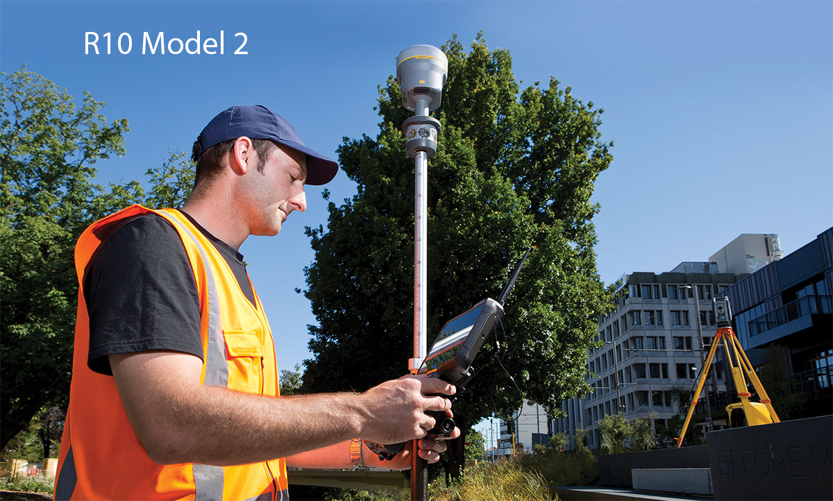
Seriously, we thought it couldn’t get any better, but Trimble has just announced a Model 2 version of its market dominating R10.
Model 2 enhancements include:
- 672 GNSS channels for unrivalled GNSS constellation tracking, including GPS, GLONASS, BeiDou, Galileo, QZSS, IRNSS as well as the full range of SBAS. The Trimble R10 tracks and processes all of today’s available GNSS signals and is designed to support planned GNSS signals and systems that may be launched in the future.
- Improved reliability against sources of interference and spoofed signals.
- 33% more operating time in the field (on average) thanks to improved power management to increase battery life.
- Store more than 10 years of raw observations thanks to an increased internal memory (6 GB).
- Even better equipped for Bring Your Own Device (BYOD) environments with support for Android and iOS platforms.
And of course the Model 2 includes all the Trimble R10’s core technologies:
- Trimble HD-GNSS processing engine that enables points to be quickly measured with confidence
- Trimble SurePoint™ technology for precise positioning capture and full tilt compensation
- Trimble xFill® technology for centimeter-level positioning during outages
- Support for Trimble CenterPoint® RTX corrections for RTK level precision worldwide
Call 0345 603 1214 to book a KOREC demonstration now
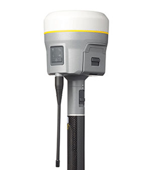
Since its launch in 2012 the R10 has proved to be one of KOREC’s best selling products. It’s generated more KOREC case studies than any other Trimble instrument and provided us with a CES magazine front cover photograph that became recognisable across the world.
But what do KOREC customers value most about their Trimble R10’s performance? Of course there are honourable mentions for all the R10’s patented technologies including:
• Trimble CenterPoint RTX delivering GNSS corrections via satellite or internet connection with unprecedented speed and accuracy for a PPP solution
• Trimble xFill ensuring less downtime in the field, with continuous RTK coverage during connection outages from an RTK base station or VRS network
• Trimble SurePoint fully compensating for pole tilt for the convenient measurement of points that were otherwise inaccessible with complete quality assurance
But coming in at number 1 is the R10’s cutting edge Trimble HD-GNSS processing engine which simply enables surveyors to measure points more quickly!
Here’s why the R10’s HD-GNSS processing engine makes it the industry’s turn to GNSS solution:
Trimble has a strong history of in-house is development which is why we have HD-GNSS, the ‘quiet’ hero of the R10. In keeping with Trimble’s ability to produce systems aimed specifically at the needs of the land surveyor, the HD-GNSS processing engine of the R10 provides markedly reduced convergence times as well as high position and precision reliability when compared to earlier processing engines, especially in poor GNSS environments. Key benefits Trimble HD-GNSS delivers include:
• Increased initialisation speed
• Improved real-time measurement precision
• Elimination of the possibilities of a “bad fix”
• Increased reliability of precision reporting
• Reduced post processing complexity for the user
The R10 is based around the Trimble Maxwell-6 custom integrated circuit technology for GNSS signal processing RTK calculations are performed in the R10 with a microprocessor that has more magnitude and is more powerful than anything before it and also more energy efficient. The shift to this new methodology makes it possible for Trimble to continue to improve performance as GNSS constellations develop.
Fully scaleable through firmware and software updates, HD-GNSS is well positioned to take full advantage of additional GNSS satellites and signals to further improve surveying in increasingly demanding field conditions.
All this is possible because, unlike most other providers of survey grade GNSS, development is in-house and fully under Trimble’s control allowing the company to meet a very specific set of requirements, namely those of the surveyor in the field.
Download the Trimble HD-GNSS white paper for full details or call your regional KOREC survey consultant for a demo.
Why Greenhatch Group switched to Trimble VRS Now

Greenhatch surveyor Scott Smith with Trimble R10
Surveyors want reliable data. They also want to maximise their time on site. When these basic requirements are compromised, businesses will take fast and efficient measures to rectify any issues that could affect hard won and carefully nurtured customer relationships.
For Greenhatch Group Ltd, this entailed the introduction of a completely new positioning correction service for use with their 14 GNSS/GPS systems when their old set up failed to deliver the quality of data, reliability and peace of mind that they required.
Greenhatch Group can trace its origins back to an early offering of surveying services over 35 years ago and today operates through a national network of three regional offices. Employing over 70 staff, the company has expanded in the last few years to offer a wide range of surveying services from topo and measured building surveys to specialist undertakings such as 3D laser scanning, BIM/REVIT Models, bathymetric surveys and aerial drone surveys.
With the core of its business being topographical and measured building surveys, the company depends upon the reliable performance of its optical and GPS/GNSS instrumentation and was therefore quick to react when the performance of its existing RTK broadcast correction service aroused concerns.
Analysing the problem
In 2015 Greenhatch Group’s 14 GNSS/GPS systems were linked to the Leica Geosystems SmartNet RTK Network via supplier approved ‘roaming’ SIMs cards licensed under a 3 year subscription deal. Whilst Greenhatch Group Director Neil Jefferies felt that this solution delivered on many of the sites his surveyors visited, he was concerned that, overall, the combination of the service provided, equipment and SI card was unreliable. Coordinate quality wasn’t sufficiently achieved on a number of sites up and down the country and the amount of lost time due to broken connections was immeasurable. In short, Neil felt that there was considerable room for improvement and that the Group’s correction service should be providing them with more reliable returns.
Trialling solutions…
Greenhatch Group tried various solutions to improve its operational times with the RTK Network. These included upgrading to private APN (Access Point Name) SIM cards and trying SIM cards from different service providers, even to the extent of having a wallet containing separate O2, Vodafone, EE and 3 pay as you go SIM cards for each GPS system. Different combinations of GNSS models and receivers were also tried to see if the loss of connection was a hardware problem and this was supplemented by Greenhatch surveyors keeping a log of each lost/broken connection, recording both time and location.
Only the multi SIM card approach brought any improvement but with that improvement came a set of new problems. Constantly switching SIM cards and settings became tiresome with less experienced users becoming mired in a world of menus and settings and the GNSS rovers were suffering from repeated openings and closings to insert the cards.
…and finding the answer
Greenhatch came upon its solution by chance when a KOREC sales consultant was visiting during one of the surveyor’s – by now daily – reports of a failed RTK connection. The KOREC consultant was able to talk Neil through the benefits of VRS Now, Trimble’s RTK subscription service, and within 48 hours had arranged the loan of a SIM card providing Greenhatch with immediate access.
A GNSS rover was selected and a Greenhatch surveyor sent out as a ‘guinea pig’ to trial VRS Now whilst Greenhatch’s management prepared to field his calls and relay any problems back to KOREC.
“We didn’t receive a single call,” reports Greenhatch director Neil Jefferies. “We later saw our test surveyor in the office and he said that he’d had no issues at all and connection had been good throughout the trial. In fact, his only complaint was that his legs hurt from walking all day!”
To further assess the situation, KOREC additionally loaned Greenhatch a Trimble R10 rover with VRS Now to compare with their existing Leica GNSS also with VRS Now. Following this trial two R10s were purchased along with 15 VRS Now licenses to cover the company’s entire GPS/GNSS fleet.
Neil concludes, “Previously our surveyors were getting frustrated on site. They simply wanted to complete jobs and get home but with the old system they were never sure whether it was going to be a good day or a bad one. Since switching to VRS Now, the number of calls from site surveyors saying they are not going to finish projects, or that they need to return due to GPS issues, has reduced to a level where it is very rare to get one at all. This has also minimised the time technical staff and management have to spend responding to their calls allowing them to concentrate on other parts of the business instead. There is no doubt that for Greenhatch, the benefits of Trimble VRS now can be summed up in a single word – reliability.”
Case study
Greenhatch Group director, Neil Jeffries, reports that a multi-acre greenfield site was recently surveyed by Greenhatch. Traditionally the survey team would use a total station to survey hard detail and boundaries and use GNSS units to infill levels within the fields.
Neil has a general idea of how many acres per day are achievable by a surveyor using a GNSS unit and this includes some down time to cover connection issues. Upon surveying the site with units connected to VRS Now, the systems completed the work 10-20% faster than anticipated compared to similar sites undertaken in the past with the original equipment set up. This project was valued at around £15,000 and Neil affirms that thanks to the reliability and efficiency of the Trimble VRS Now service, cost savings can be calculated at £2,500.
Andrew Beckerson, KOREC’s Director of Business Development comments “Greenhatch’s experience with Trimble VRS Now echoes what many users have found, reliable real-time GNSS correction data will increase your profitability, proving once again that ‘not all correction services are the same.’

VRS Now fact box:
- Availability: Unites States, Europe and Australia
- High Accuracy: Provides < 2 cm (1″) accuracy*
- Ideal for a variety of industries needing high precision including survey and construction, mapping and GIS, cadastral, utilities, transportation and areas having good cellular coverage
- Instant Initialization: Start working immediately under optimal conditions**
- Multi-constellation support: GPS and GLONASS enabled
- More uptime: Built-in redundancy to ensure connectivity, consistency and quality
- No base station required: No need to worry about losing radio signal reception since a base station is not needed for Trimble VRS Now based correction services
- Ease of Use: Online self-service portal to activate subscriptions.
* All horizontal accuracy specifications are based on in-field performance 95% of the time.
** Receiver initialization time varies based on GNSS constellation health, level of multipath, and proximity to obstructions such as large trees and buildings.