“With hindsight… we probably should’ve seen that coming!”
Fortunately, as we move towards the end of the year, we have the next best thing to hindsight: a number of recent insights and reports from Trimble that give us a clear view of what’s coming next.
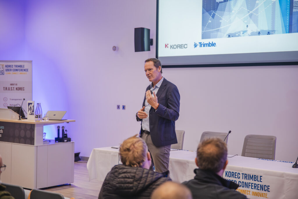
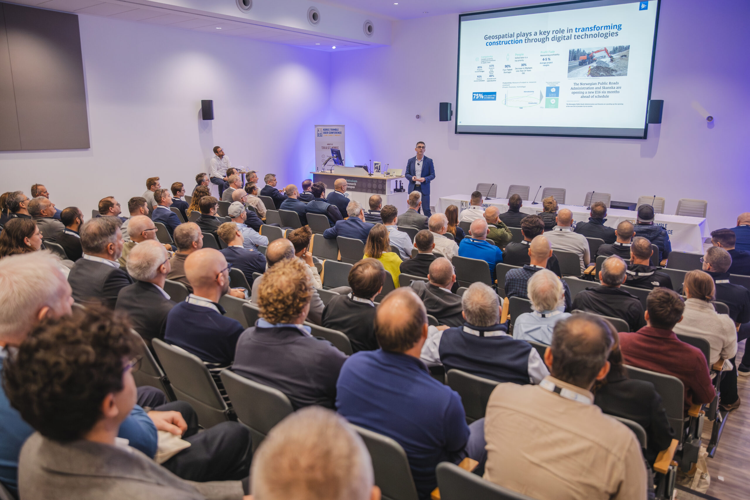
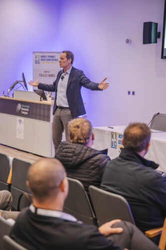
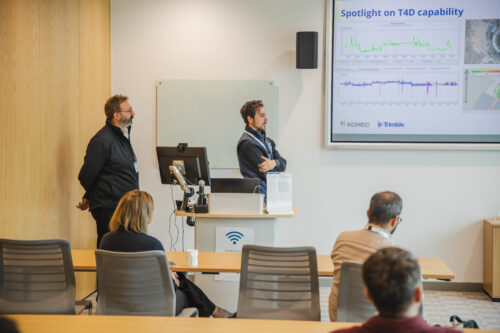
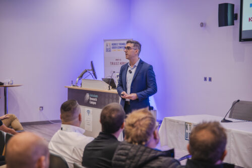
Following November’s KTUC day, we’ve been revisiting a pair of standout presentations from Trimble: a forward-looking keynote from Boris Skopljak, VP of the Geospatial Sector, and a UK-focused future of Trimble data capture session from Lee Braybrooke, Key Accounts & Alliances Director. Throw November’s Trimble Dimensions event and a newly published Trimble report into the mix and we’ve got plenty of insight as to what’s coming our way.
This piece is a quick round-up based on these sources which can all be read via the on page links.
A forward-looking keynote from Boris Skopljak, VP of the Geospatial Sector
Context and action
Our industry’s challenges are well-documented and they’re not going away on their own. The most frequently cited include a shortage of skilled people, slow adoption of digital workflows due to perceived complexity or unfamiliarity and increasingly siloed data – we’re getting better and better at capturing information, yet not nearly as effective at managing, sharing, or making the most of it.
If we are to successfully address these challenges, there are five key steps that Trimble recommends we take:
- Embrace AI and automation
- Leverage cloud solutions
- Focus on user experience
- Prioritise training and skill development
- Foster innovation
Let’s take a closer look.
1.Embrace AI and automation
It’s one of the hot topics within our industry and we already understand that automated workflows remove repetitive manual tasks, deliver faster design & modelling cycles and improve accuracy in jobsite documentation and coordination between teams. But how can we improve?
Step forward Trimble’s agentic AI platform, a collection of core services, security frameworks and tools. Built on top of this platform is Trimble Agent Studio which is currently being piloted with select customers to support its AI strategy by:
- Helping users learn and navigate Trimble software for faster onboarding and engagement.
- Eliminating the manual steps typically required to model from scratch, enabling users to generate 3D objects during design by describing what they want to model.
- Converting voice memos into documents in the field, capturing status updates from crews and helping teams avoid spending hours in front of computer screens back at the office.
- Accelerating access to data and streamlining asset maintenance and permitting workflows.
For more information, visit our recent KOREC blog
2.Leverage cloud solutions
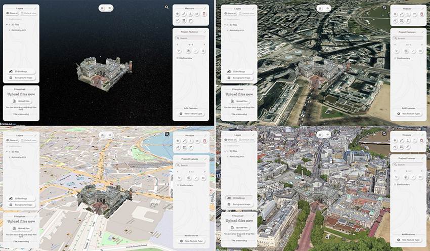
Accurate data underpins everything in geospatial and construction. It shapes decisions, affects project outcomes and keeps day-to-day operations running smoothly. Cloud platforms give you a single, central place to manage that information, making sure everyone is working from the latest, most reliable version. KOREC customers tell us time and time again that siloed data is a regular occurrence and an enormous hinderance to their progress, which is why we offer a range of cloud options – Trimble Connect, Trimble Reality Capture, Trimble Terraflex and SOARVO.
The Trimble report states that the geospatial industry will increasingly adopt cloud-based platforms for managing large datasets and facilitating near real-time field-to-office-to-field workflows for better outcomes.
Important to note is that industry users state the importance of using platforms that prioritise data security and offer robust backup and recovery options.
Leverage cloud solutions
3.Focus on user experience
A user-friendly software interface can significantly reduce the training burden and speed up the adoption process, making advanced technologies more approachable for both new and experienced users. Balancing user-friendliness with professional requirements is a key challenge and on that score, Trimble has already made great inroads. For example, the ease of purchase and use of Trimble Catalyst by those outside of our industry and of course through the massive take up of 3D Laser Scanning through the intuitive workflows of the Trimble X9 series.
Trimble predicts that developers will focus on creating solutions that offer a seamless user experience, incorporating features such as guided workflows, contextual help, and simplified data visualisation – all good news.
4.Prioritise training and skill development
Within our industry, there is an increasing emphasis on spatial awareness and digital data analysis and management, but surveyors must also have a solid understanding of geodetic principles and coordinate systems to ensure the accuracy and integrity of their work. As the industry adopts advanced technologies, surveyors must become proficient in digital tools and software.
How is that being achieved? Trimble survey respondents use on-the-job training (69%), in-person training sessions (57%) and video tutorials (56%), but approaches vary widely, with some designating an expert, some getting group support and some relying on the vendor.
The Trimble report predicts that professional development programs will likely place greater emphasis on digital skills and that the role of the surveyor will evolve to encompass both traditional surveying techniques and advanced digital methodologies.
5.Foster innovation
And finally…the Trimble report urges us to encourage a culture of innovation by leveraging the skills and perspectives of digital natives. Their familiarity with technology can drive the development of new applications and enhance the overall adoption of advanced solutions. Virtual Reality, 3D Laser Scanning, robotics, AI, Reality data capture, data analytics… today’s careers in geospatial offer numerous possibilities and are a perfect fit for the tech-savvy, early adopters of Generation Z. These motivated individuals seek a career path that allows them to evolve, to use technology in an exciting and gratifying way, and to stay relevant throughout their working life. What better match than a career in geospatial.
Foster innovation
….and just for fun
Let’s travel back a decade when Trimble’s Lee Braybrooke looked at the current year and beyond in relation to geospatial trends. In 2015 he focused on 2D-3D, Mobile Mapping, Imaging and GNSS ubiquity. 10/10 Lee! Lee’s presentation at KTUK can be viewed here.
View the Trimble report ‘State of the geospatial industry 2025’ here
Trimble Dimensions 2025 made one thing abundantly clear: AI and automation are no longer on the horizon: they’re here, embedded across the Trimble ecosystem, and already reshaping how organisations design, build, survey and manage assets.
For KOREC customers across the UK & Ireland, this year’s announcements demonstrate how Trimble is moving beyond individual tools and toward connected, automated workflows that reduce manual effort, eliminate data silos, and improve productivity across teams.
Below is our round-up of the most relevant news and innovations revealed at the event.
A Major Announcement: Trimble’s Agentic AI Platform
The headline news from this year’s conference was the introduction of Trimble’s agentic AI platform. This is a scalable, secure foundation for developing AI agents that can automate multi-step processes, analyse data across systems, and assist workers throughout the design-to-delivery lifecycle.
Mark Schwartz, Senior Vice President of AECO Software at Trimble, explained the rationale behind the platform:
“As agentic AI use cases multiply, there is a growing need for common infrastructure that allows creators to rapidly and responsibly develop, deploy, monitor, and maintain high-value AI agents at scale.”
The platform includes the new Trimble Agent Studio, now in pilot, which enables customers and partners to develop their own AI agents that sit on top of the Trimble ecosystem.
This open, future-proof approach reflects what Trimble CEO Rob Painter described as a natural next step in the company’s long-term data strategy:
“Our Connect and Scale strategy has brought us to this point. By embedding AI into our solutions and enabling improved data flow, we’re taking the next steps towards unlocking the power of connected data.”
For KOREC customers, this means that AI will increasingly power real-world workflows, not just isolated product features.
AI Embedded Across the Workflow
Trimble’s announcements demonstrated the breadth of where AI and automation are landing: from early design stages right through to site reporting and project delivery.
1. Design & Modelling Automation
Updates to the SketchUp ecosystem showed how AI will speed up modelling and conceptual work:
- Generate Object – create 3D objects by simply describing what you need
- AI Render – enhanced automated visualisation
- SketchUp Assistant – an upcoming agent to support common modelling tasks
For architects, surveyors and designers, this marks a shift toward faster iterations and fewer manual modelling steps.
2. Field-to-Office Automation
Dimensions featured several real-use examples of AI turning field data into structured, actionable information:
- Site voice notes automatically converted into formatted documents
- Auto-Submittals that prepare and route documentation
- AI Title Block Extraction that reads drawing metadata
- Automated daily reporting tools in ProjectSight
These tools are especially useful for construction and utilities teams where admin tasks consume valuable time that could be spent on delivery.
3. Reality Capture Meets AI: ProjectSight 360 Capture
One of the most practical innovations came in the form of ProjectSight 360 Capture, which automatically integrates 360° jobsite images into the ProjectSight environment.
AI processes each image to:
- Identify where it was taken
- Align it to site drawings
- Assess site progress
- Support remote walkthroughs
For project managers, QS teams, and off-site stakeholders across the UK & Ireland, this gives true “eyes on site” without needing to be physically present.
Connected, Open, Interoperable
A consistent theme across the conference was Trimble’s commitment to open, connected workflows. This is something that aligns strongly with KOREC’s own focus on integrated technology stacks.
Trimble’s ecosystem continues to expand through verified integrations and extensions within Trimble Marketplace, which Chris Peppler, Vice President of Platform at Trimble, described as:
“a trusted source of verified software integrations and extensions that enable customers to solve workflow gaps. Every solution goes through a certification process, making it simple for our customers to easily tailor their Trimble solutions to fit their technology ecosystems.”
For customers operating mixed fleets, multi-discipline teams, or hybrid software stacks, this interoperability is essential.
Why It Matters for Organisations in the UK & Ireland
Across all sessions, Trimble addressed a reality familiar to many of our customers: rising project complexity, data fragmentation and margin pressures.
This year’s announcements directly target those challenges by delivering:
- Faster design and modelling cycles
- Reduced admin and reporting workload
- Improved accuracy in jobsite documentation
- Better coordination between teams
- More accessible adoption of AI via the Agent Studio platform
KOREC will continue to track, test and support these innovations as they move from early access into wider availability.
TRUST KOREC
Trust KOREC to help you measure, map and manage
At KOREC, it’s our business to empower your business. We do this through enabling you to measure, map and manage the natural and built environment with confidence and clarity.
Consistent success demands accuracy, safety and speed, whilst reducing costs and environmental impact. By combining innovative geospatial technologies from global partners such as Trimble, with the skills and deep expertise of our regional specialists, KOREC is trusted to deliver the results that transform your business outcomes.


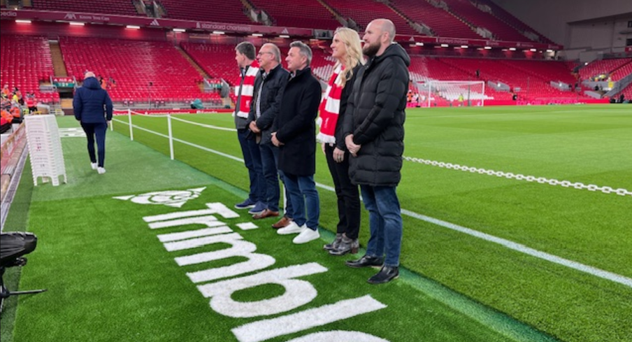
David Hodkinson and Mark Poveda (centre)
Liverpool Football Club (LFC) is widely recognised as one of the most popular clubs in the world’s most popular sport and at a recent home game this month we’re delighted to announce that its name became publicly linked with another high achiever and one especially close to our own hearts – Trimble!
On October 31st, Trimble announced a new multi-year global sponsorship with Liverpool Football Club (LFC) and became a recognised partner. In addition to the sponsorship, LFC will employ Trimble technology in the design and development of the club’s infrastructure including on the recently announced refresh of the LFC Academy, which aims to develop the future stars of football. This will include a starring moment for Trimble SketchUp which will be used to reimagine the high-performance centre into a truly industry-leading space for young footballers to learn.
Expect lots of visibility of the Trimble logo around the LFC stadium and its digital channels and of course plenty of photos from the KOREC team and any lucky customers who get to be a Trimble guest!
Six top moments through the ages – have we got the list right?
- The Miracle of Istanbul (2005): Down 3-0 at halftime in the Champions League final against AC Milan, Liverpool staged the greatest comeback in final history.
- Bill Shankly’s best football quote of all time: “Some people think football is a matter of life and death. I assure you, it’s much more serious than that.”
- The Kop’s roar measured at 130.9 decibels In a 2019 match vs. Barcelona, Anfield’s decibel level hit 130.9—louder than a jet taking off at 100 meters.
- The “This Is Anfield” plaque: Shankly installed the famous plaque in the tunnel to intimidate opponents and remind his players: “This is Anfield—play like gods.” Opposing managers still touch it for luck… or fear.
- 2024 Premier League Champions: Liverpool clinched the title on April 27, 2025, with a thrilling 5-1 home win over Tottenham Hotspur.
- Best ever rendition of ‘You’ll never walk alone’: It’s back to the Miracle of Istanbul in 2005 for this one!
A front row seat!
What better way to celebrate the shared values of this Trimble / LFC collaboration – precision, innovation and commitment – than by witnessing it ourselves. With our north west office just 5 miles from Anfield, two of KOREC’s finest, Mark Poveda (Managing Director) and David Hodkinson (Group Finance Director) were lucky enough to be Trimble’s guests for the game on 1st November v. Aston Villa (spoiler: LFC won 2-0), and as a lifelong fan, David was more than happy to share his experiences:
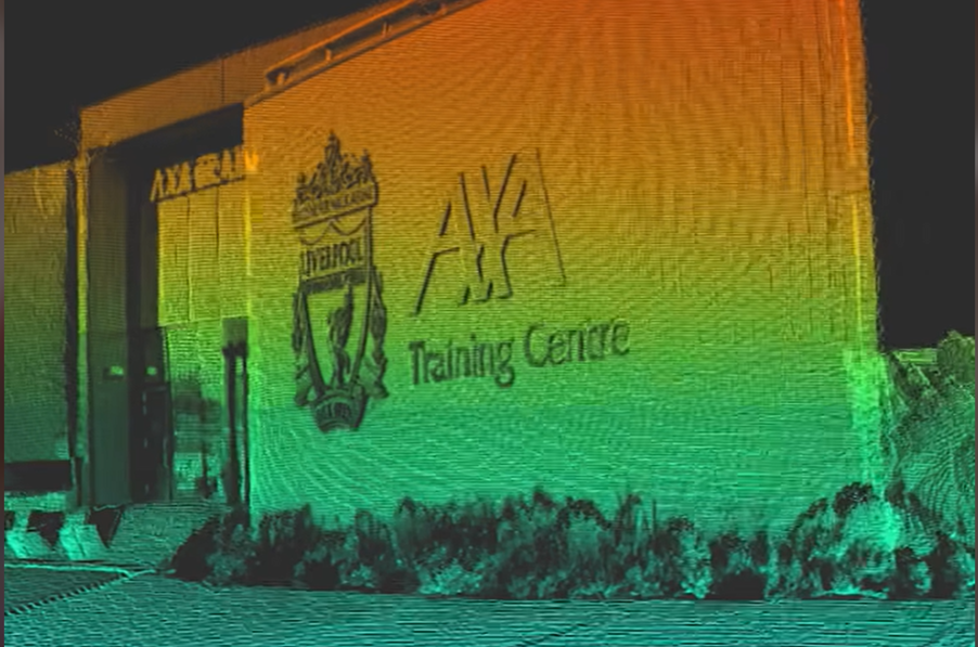
“The day started with lunch in Liverpool before being bussed over to the AXA Training Centre for a tour of the 1st team and Academy teams training facility over in Kirkby.
This is a state-of-the-art facility with pitches that wouldn’t look out of place as golf greens!
We saw Arne Slot’s office and all the indoor and outdoor training facilities and the press conference room. They also have all the myriads of Trophies on display that Liverpool have won – It was a very impressive facility.
We were then bussed back to Anfield for a tour of the stadium – including getting to stand on the world famous Kop and then pitch side for the photos with the new Trimble logo. It was great to be down on the pitch in the full glare of all the lights giving us a taste of what it must be like as a player.
Then it was up to the “Legends Lounge” for our top-notch food (and drink) – including a talk from Emile Heskey (Liverpool & England star).
Kick off was 20.00 in our halfway line seats – and I am pleased to report that Trimble brought us a change of fortune and we won (following 4 league defeats in a row!) – So Trimble are now 100% with LFC!
It was a brilliant day and great to see the behind the scenes operations that underpin what you see on the pitch!
Many thanks to our hosts Trimble and LFC for a superb day!”

Trimble Becomes Official Global Partner with Liverpool Football Club
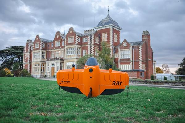
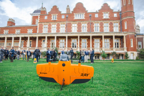
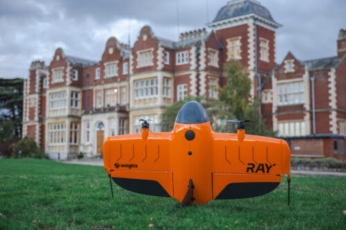
New Wingtra-Trimble partnership brings seamless data integration for KOREC drone customers
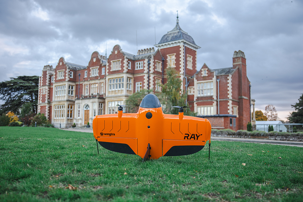
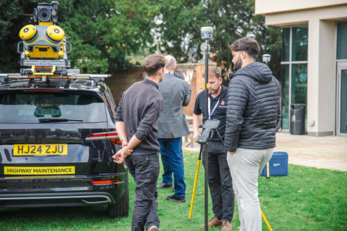
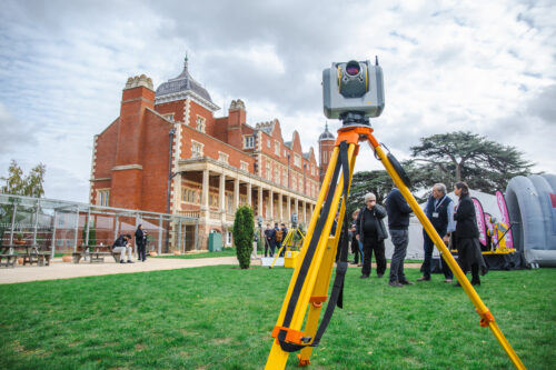
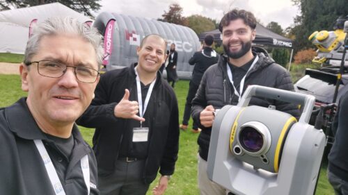
The WingtaRAY at the KOREC Trimble User Conference held in Cambridge in October (KTUC 2025)
KOREC is delighted to announce that a new partnership between Wingtra and Trimble will deliver tighter integration between Wingtra’s industry-leading drone solutions and Trimble’s world-class survey and mapping workflows.
Delivering a smarter way to get high-quality data, the joining of these powerful Trimble and Wingta survey tools will cut field time, minimise manual work and ensure users achieve accurate, actionable results far faster.
Available now is Trimble-native file support in WingtraCLOUD enabling quick drag-and-drop compatibility. This will enable KOREC customers to create survey sites instantly by uploading Trimble Business Center export files in .JXL (no manual setup), Skip RINEX conversions (just drag and drop your TO2/TO4 files) and work faster in local coordinate systems with fewer errors
Coming in 2026 is Wingtra’s cm-level positioning powered by Trimble correction services with no need for a base station. Users will be able to automatically apply cm-accurate corrections in WingtraCLOUD and establish known points globally with PPP support. Plus users will also have the ability to sync and export maps directly from WingtraCLOUD to Trimble Connect and TBC.
Future data connectivity will be ongoing throughout 2026 with tighter Trimble + Wingtra hardware/software integrations ensuring data flows from flight to final deliverable, without interruptions.
John Cartlege, Mapping & GIS Business Area Manager, KOREC said:
“Trimble leads in precision positioning, data integration and advanced GNSS solutions, Wingtra drives innovation in aerial mapping with its WingtraRAY VTOL drone technology and KOREC champions emerging technologies, bringing these innovations to our UK and Irish customers through our local expertise, support, and consultancy.
“We look forward to doing what we do best – helping KOREC customers seamlessly integrate these solutions into their workflows for greater efficiency accuracy and value.”
For more information or to arrange a demonstration, contact the KOREC Mapping Team at on0345 603 1214or visit www.korecgroup.com/contact
ENDS
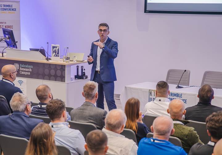
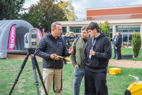
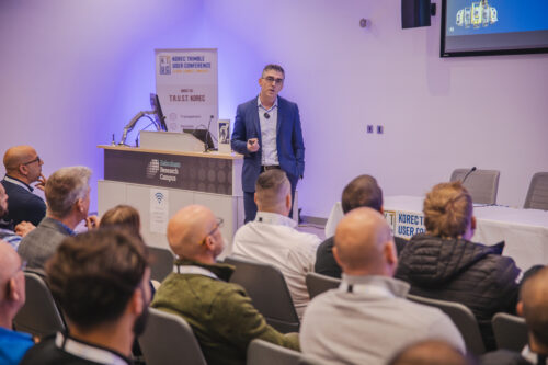
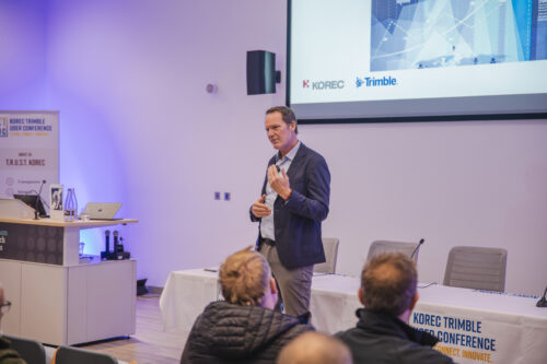
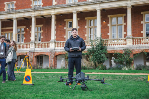
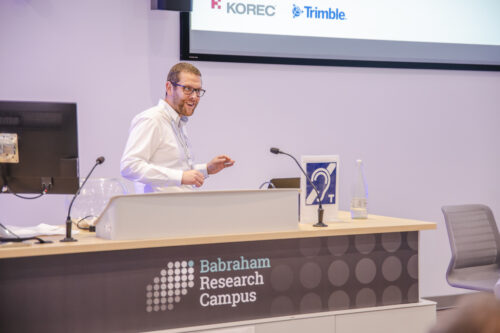
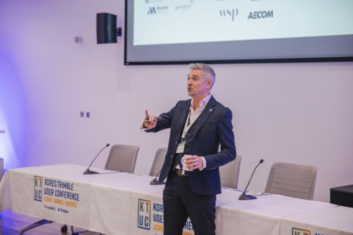
KTUC25: When Community, Innovation & Connection Converged
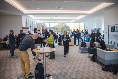
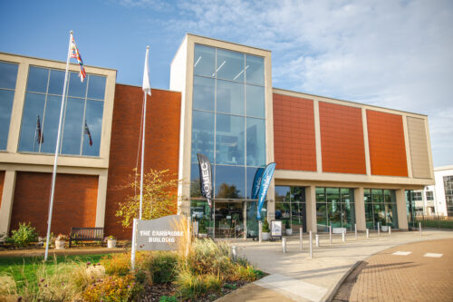
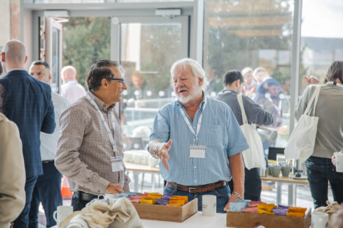
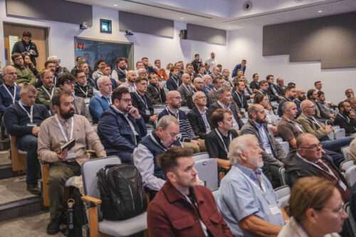
On a bright autumn day at the Babraham Research Campus near Cambridge, the KOREC Trimble User Conference (KTUC25) came alive. It was more than just a tech showcase: it was a gathering of minds and makers – a celebration of community in geospatial, surveying, construction, rail, monitoring and mapping sectors.
Bringing the Community Together
If there was one phrase that echoed through the exhibition halls, breakout tracks and outdoor demos at KTUC25, it was “Learn. Connect. Innovate.” Attendees repeatedly praised the inclusive, conversation-driven spirit of the event, where information and ideas were shared freely. It was the place where senior Trimble executives could connect freely to boots-on-the-ground surveyors. Where construction Tier 1s revealed their secrets to working smarter across field and office. Where people could have their say on important issues affecting our industries. Overall the coming together of the Trimble community made the conference feel like a community reunion – a rare treat in our digitally-mediated world.

Why KTUC25 Resonated
So, what made KTUC25 stand out? Based on attendee feedback:
- Community feels real – people made new contacts, reconnected with old ones, and left inspired by collaboration.
- Diverse tracks – whether you were a hardware geek, software user, field engineer, or decision-maker, there was something for you.
- High-calibre content & speakers – the balance between visionary keynotes, technical depth, and user stories really hit the mark.
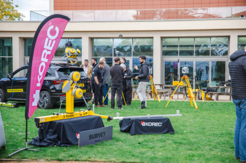
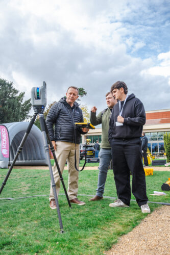
- Interactivity & hands-on access – the demo zone, workshops, partner exhibits and live flights made the experience tactile and memorable.
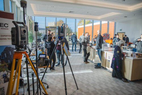
A Showcase of Technology & Partnerships
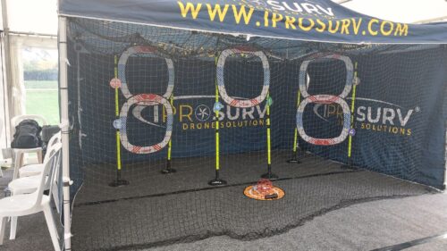
Of course, a key purpose of KTUC25 was to spotlight the breadth and depth of Trimble’s ecosystem, and to do so in concert with KOREC’s partners, including Radiodetection, DJI, Wingtra, Terrasolid, and Soarvo. This added dimension and breadth, showing how modern survey, construction, engineering and mapping systems aren’t siloed but interconnected.
Discover KOREC's technology solutions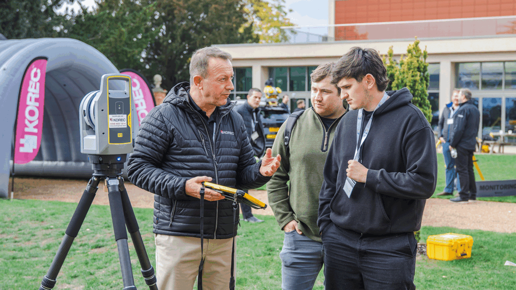
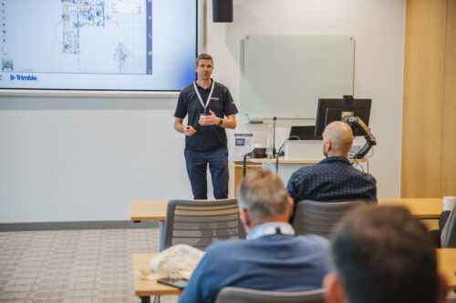
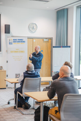
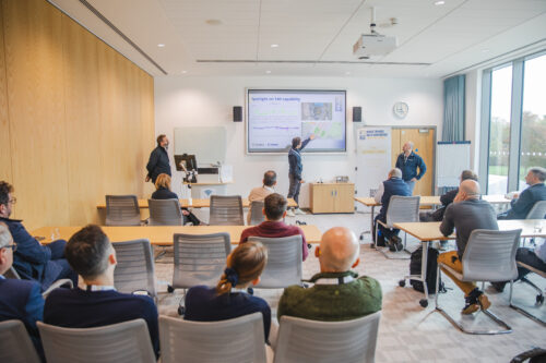
Highlights from the Tracks, Talks & Real Stories
We structured KTUC25 around four tracks (plus an exhibition hall)
- Keynote Theatre – Thought leadership and macro-vision
- Technical Workshops – Deep dives, tips & tricks
- Customer Stories – Real use cases, real challenges
- Outdoor DemoZone – Live demonstrations and competitions
It’s been a tough call to highlight only a few things across this amazing event, but here’s our top 5 things that got the most of the buzz…
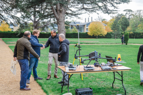
- The literal and figurative launch of the WingtraRAY
We chose our KTUC25 event to launch (in both sense of the word) the new WingtraRAY! This new UAV sets new standards for surveyors and it was a pleasure to see it in flight at KTUC25. You can find out more over on our product page.
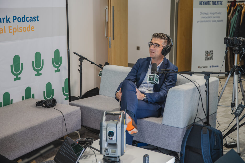
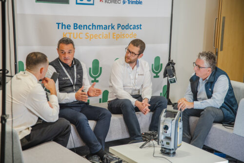
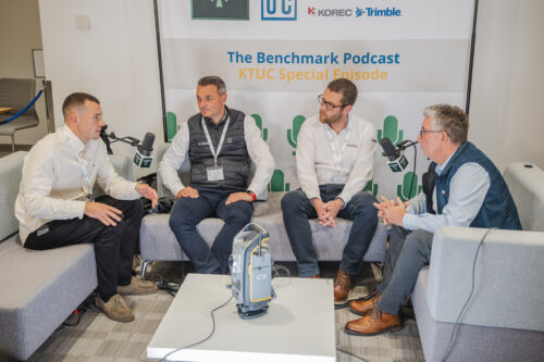
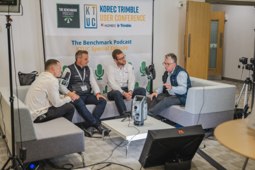
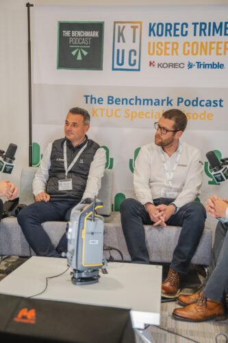
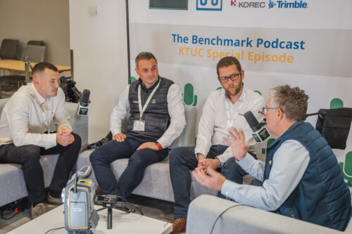
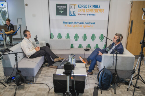
Discover the WingtraRAY2. Boris Skopljak, Trimble’s VP of Geospatial on the Benchmark Podcast
The much-loved Benchmark Podcast did a special KTUC episode, grabbing thoughts and opinions from the full spectrum of KTUC speakers, presenters, exhibitors and attendees. In an exclusive scoop, James Richards managed to get senior Trimble exec Boris Skopljak into the podcast booth. Keep an ear out for when the KTUC episode of Benchamark podcast drops…
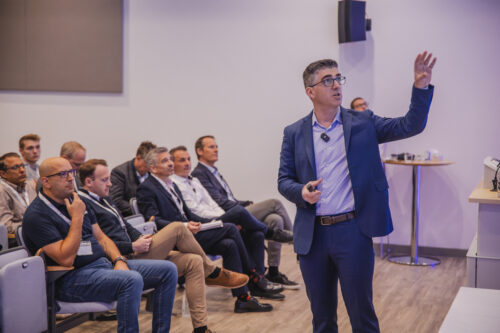
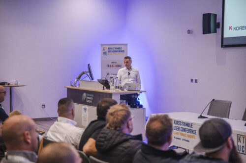
3. The Keynote from award-winning speaker Jim Steele
Jim Steele set the scene for the event with his powerful and interactive talk on motivation and performance. He was a smash hit at KTUC25, and it’s no surprise to learn that he’s 2025’s Speaker of the Year!
He’s kindly provided a wrap-up video of his session, recapping the key points of his presentation, along with providing some free resources to help you be better, smarter, stronger.
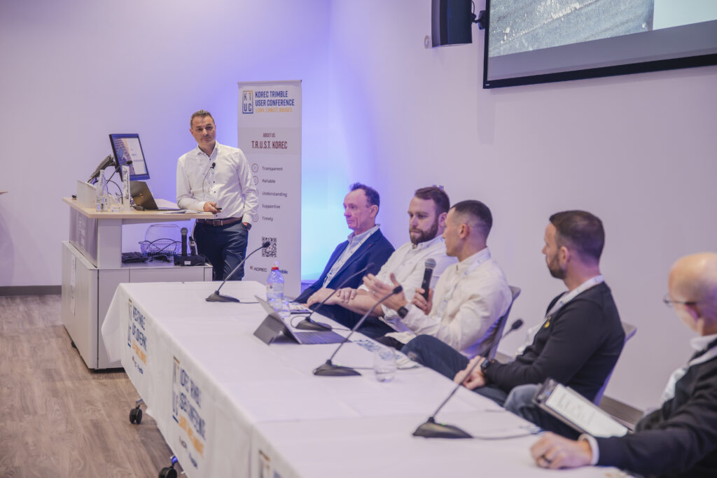
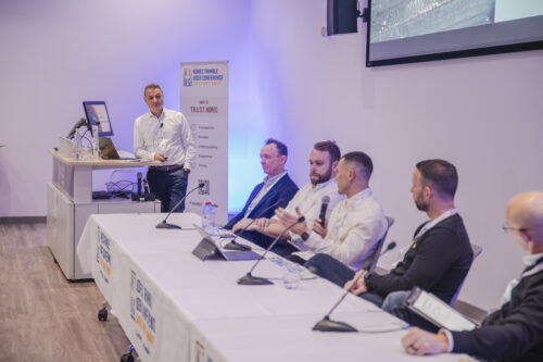
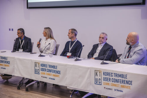
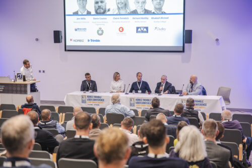
Watch Jim's session recap4. Education and Industry Voices panel discussions
The two panels in the Keynote Theatre didn’t shy away from the big issues facing our industries. With insightful input from a fantastic line-up, we covered a lot. From the challenges of getting more people into surveying, to the opportunities – and pitfalls – of new technology, the future of survey, managing customer expectations, and much, much more.

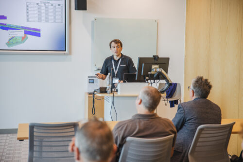
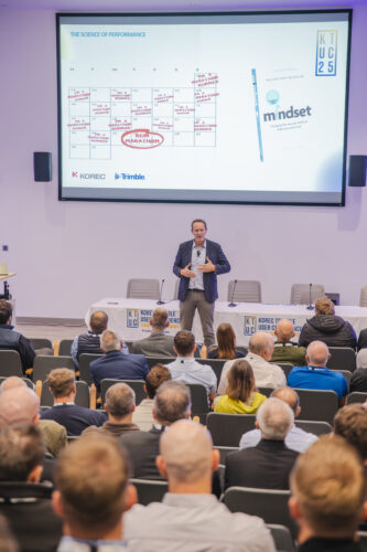
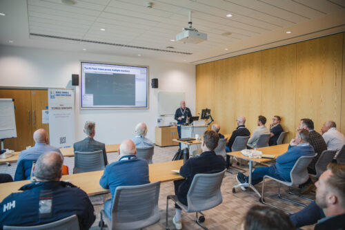
5. The AI and Trimble Business Center Technical Workshops
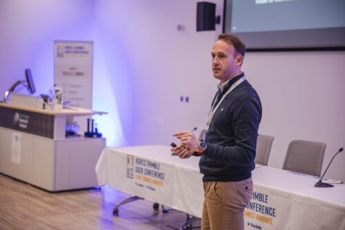
It was a full house for many of the technical workshops, but it was extra standing room required for the technical insights given by Trimble’s Ronald Van Coevorden and KOREC’s Richard Selby, who talked about AI & Automation, and Trimble Business Center (respectively).
KTUC25 Resources
Download the Presentations!
Due to overwhelming popular demand, we’ve made the presentations at KTUC available for download from our DropBox. You can grab them by clicking the button.
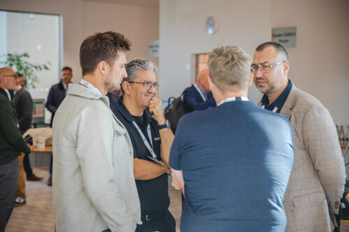
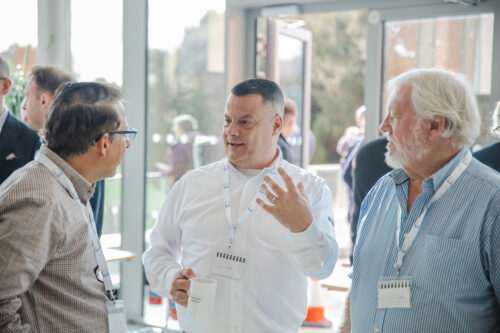
Picture Gallery
Here’s a few pictures of the day that we managed to grab in amongst the madness! Do you spot yourself? If you’d like your photo included in the gallery, please email marketing@korecgroup.com


Looking Ahead
KTUC25 wasn’t just an event – it was a statement. A message that KOREC believe in more than selling technology: we believe in enabling a community of practice where people learn, push boundaries, and lift each other up.
As we reflect on the energy, connections, and ideas generated in Cambridge, we’re already looking ahead to ways we can sustain this momentum. to keep embracing the latest tech, but also the trust and shared culture that made KTUC25 such a resounding success.
One thing’s certain: we can’t wait to see what happens next, and we hope those who attended left not just more informed, but more connected, energised, and ready to transform.
Who’s in for next year?
LEARN MORE
Discover solutions by industry
Discover how KOREC’s technology solutions can help you solve the problems you face in your industry.
KOREC Group is pleased to announce that it has been appointed as the exclusive channel partner in the UK and Ireland for Exyn Technologies, a leading US specialist in autonomous robotics and data collection
KOREC’s focus will lie with the company’s latest 3D mapping solution, the recently released Exyn Nexys. Modular in design, this system can be used as a handheld device as well as an attachment to a drone, ground robot, vehicle, or backpack.
The Nexys is equipped with a LiDAR scanner and Exyn’s proprietary SLAM algorithms, delivering exceptional capture speeds of up to 1.9 million scan points per second, alongside real-time point cloud colourisation.
The system can also navigate autonomously in GNSS-denied environments, featuring what Exyn defines as Autonomy Level 4 capabilities. At this level, drones and robots can explore and map unknown spaces completely independentlyeliminating the need for human intervention.
The introduction of the Nexys range, which includes both standard and Pro models, further strengthens KOREC’s portfolio of mobile mapping systems. This expansion ensures that KOREC continues to meet the growing demand for accurate, easily captured point cloud data with workflows relevant to the UK and Irish markets.
Additional Nexys features include direct export into Trimble Reality Cloud Platform Service (TRCPS), integration of Trimble GNSS solutions for precise georeferencing, adjustment to ground control meaning no drift, real time colourisation and advanced dust filtering.
Mark Poveda, Managing Director – UK & Ireland, KOREC Group said:
“Exyn recognises KOREC as a trusted partner with decades of experience in delivering customer-focused solutions shaped by invaluable feedback. With our strong mutual alignment with Trimble, this partnership is a perfect fit, ensuring that Exyn’s cutting-edge US technology is introduced to the UK and Irish markets by a local expert who understands their customer’s real-world challenges faced on site every day.”
Brandon Torres Declet, CEO at Exyn Technologies said:
“We are thrilled to welcome KOREC Group as our first UK and Irish-based partner. Their commitment to empowering industries to measure, map, and manage the natural and built environment aligns perfectly with our mission. We’re excited to collaborate with a like-minded partner to bring Exyn’s cutting-edge autonomous technology to the UK market.”
About Exyn
Founded in 2014 with headquarters in Philadelphia, Exyn Technologies is pioneering autonomous aerial robot systems for complex, GNSS-denied environments. The company’s full-stack solution enables flexible deployment of single or multi-robots that can intelligently navigate and dynamically adapt to complex environments in real-time.
Download a PDF of this press release here
Nexys is a modular system and can be used as a handheld device as well as an attachment to a drone, ground robot, vehicle, or backpack
03/03/2025
A trio of news stories celebrating the support that both KOREC and Trimble are providing to the education sector across the UK
There isn’t much that’s more important than ensuring the next generation are informed, enthused and inspired to join us in the exciting world of engineering, construction and the built environment.
In how many other industries can you make such a direct and positive change in how we design, build and maintain the spaces in which we live, work and play?
That’s why we’re delighted to highlight 3 recent stories that do just that;
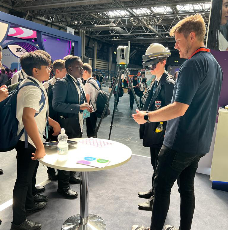
KOREC & National Highways make a Big impact
Our team were delighted to support National Highways at the recent Big Bang Fair in Birmingham.
The 3-day event saw tens of thousands of children aged 11-14 descend on the NEC to get involved in all things STEM (science, technology, engineering and maths).
The KOREC team were on hand to showcase the very cool technologies that are being utilised to made the collection, sharing and understanding of spatial data easier and more intuitive. The star of the show was most certainly the Trimble XR10 headset. The team loaded various digital models including dinosaurs, robots and an airplane into the device, which the kids could then view and explore!
Check out more photos of the event and the team, here!
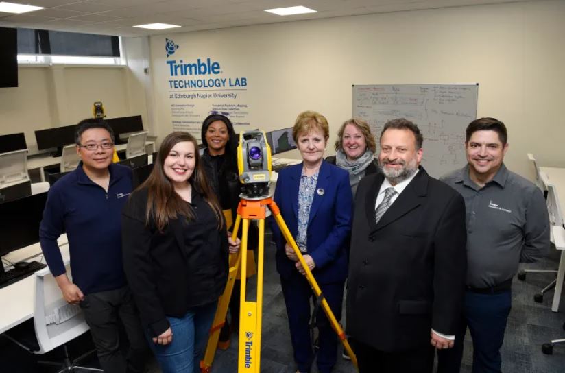
Trimble Technology lab expands in Edinburgh
Trimble and Edinburgh Napier University are celebrating the expansion of the Trimble Technology lab – the first of its kind in the UK.
Click here or the link below to read the complete story over on the North Edinburgh News site.
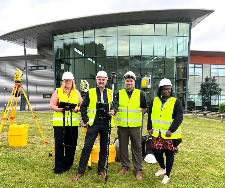
SMB College Group invest in Trimble Technology
Leicestershire-based SMB College Group has recently invested over £80,000 in Trimble technology, supplied by KOREC Group.
The college is a leader in Construction T level courses – preparing its students for work in the construction and engineering sectors including quantity surveying, civil engineering, project management and architecture.
The equipment includes some of Trimble’s most cutting-edge digital construction solutions, including the X7 laser scanner, the XR10 mixed reality headset, and the S5 robotic total station.
Read the full press release on the SMB College Group site
Next Generation is KOREC’s higher education strand – it’s how we inspire, support and train the institutions and the students who are the future workforce of our industry.
If you’d like to know more about Next Generation, or how we can help you, why not get in touch?
Last month, we calculated that the cost of wet weather due to lost productivity, repeat visits and wasted trips could be in the region of £20,000 per year for the ‘average’ land surveying practice*.
Not all brands of surveying equipment work well in the rain, and with the UK averaging 161 days of wet weather a year, that’s a lot of wasted journeys and repeat visits. And if there’s one thing we hate at KOREC, it’s waste and inefficiency.
So, with this is mind, we decided to do something rather bold. We teamed up with ATR Shield to give away 50 total station shields, free of charge, to the 50 surveyors who gave us their most convincing reason for needing one.

And boy did you deliver! We received over 150 requests from across the nations. From the tip of Cornwall to the top of Ireland, from the Welsh valleys to Brixton – and your reasons made for fascinating reading. Here’s just a selection of your comments for why you desperately need a shield for your soggy total station;

Trimble to the Rescue!
At KOREC, we’re all about empowering our customers with the solutions they need to get the job done, with the minimum of fuss. After all, the slogan ‘Do It Once, Do It Right, Do It Now’ was a former company motto of ours!
That’s why we are so proud to provide solutions that are built for all weather conditions – come rain, shine – or even sleet and snow!
Trimble S Series total stations are world renowned for their reliability, their accuracy, and their robust nature in all weather conditions – no shields needed for this one!
Right now, we are offering over 20% off the Trimble S5, along with all the kit you need;
- Trimble TSC5 controller
- Access software (General Surveyor)
- Trimble Sentinel track & retrieve app
- Prism
- Telescopic pole
- Tripod
If you’d like to find out more about this bundle, contact your local KOREC consultant, or use the details below;
Call UK Sales: 0345 603 1214
Call Ireland Sales: 01 456 4702
For anything else, view our contact page.
*See previous blog ‘Don’t Let Rain Stop Play’ for full breakdown of the numbers
We’ve all heard of the saying ‘a little bit of rain won’t hurt’, but when it comes to your land survey kit, is it true?
Being the stats nerds that we are, we decided to run the numbers to see how much your soggy survey kit is really costing you.
Picture the scene. You’re out on a land survey or set out job with your total station, when the skies darken, the wind picks up, and the heavens open. You’ve got two choices – you fashion a DIY cover out of spare bits and bobs, or, if you’re like us, you make a dash for the van, grab a coffee to keep warm and dry, and wait for the rains to subside.
If we lived in the Med this may not be such an issue, but here in the UK it rains an average of 161 days of the year – that’s almost half of the time!
That’s a lot of days wasted sitting waiting for the skies to clear – or risking damaging kit that you know isn’t too fond of water ingress. We’ve even heard tales of folk desperately drying off their kit with hair dryers in the back of the van!
Running the Numbers
So, we decided to run the numbers to see exactly how much all of this wasted time could be costing you.
Over the last two decades, the UK has averaged 161 rainy days each year, 44% of the days. When it comes to working days (assuming you’re not a workaholic and enjoy the odd weekend and holiday each year) there’s roughly 240 days of working per year, which means a potential for 106 ‘rainy’ working days.
With the average land surveyor costing around £120 a day*, and assuming that on the rainiest of days you’re losing around 3 hours of productive time packing away kit, returning to the van, sitting in the van (not to mention getting the hair dryer out) we reckon the daily loss is around £48 per rainy day.
But, it gets worse. That ‘lost’ 3 hours of work still needs to be completed on a dry day, meaning another trip to site, another mileage expense, and another £48 gone. This second trip to site also means that other survey work, for other clients, has to either be rearranged, pushed back – or worst of all, lost.
All in all, we reckon that ‘bit of rain’ could be costing you the best part of £10,000 per surveyor over the course of a year!

Of course, the financial cost is just one element.
Every time rain stops survey, it shortens the timescale for getting the job done. Not only does this add time pressure to the job, it cause severe reputational damage to your business, straining relations with your client, as well as threatening your competitive edge when it comes to bidding for other work.
Dry your Eyes
If those figures brought a tear to your eye, don’t be concerned – there is another way!
We’ve put together the #WinterReady land survey package which has everything you need to get your survey work completed – come rain or shine.
Featuring the robust Trimble S5 with active tracking, the new TSC5 controller, a license for Trimble Access (General Survey) and more, our #WinterReady bundle gives you all you need to keep on working thru’ the wind and rain.

If you’d like to find out more about this bundle, contact your local KOREC consultant, or use the details below;
Call UK Sales: 0345 603 1214
Call Ireland Sales: 01 456 4702
For anything else, view our contact page.
*Based on figures from Reed.co.uk, assuming an annual salary of £30,518 and a working week of 37.5 hours, we obtained a figure of approximately £117 per day for a land surveyor, or £16 per hour.
We’re delighted to announce that the hard work of KOREC Regional Director Barry Monk and our KOREC team of scanning/forensic specialists has resulted in a significant investment in Trimble X7 3D Laser Scanners by Surrey and Sussex Police.
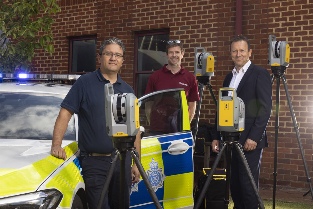
The nine new X7’s have already been delivered and we were pleased to be there on the day to ensure that the handover went smoothly.
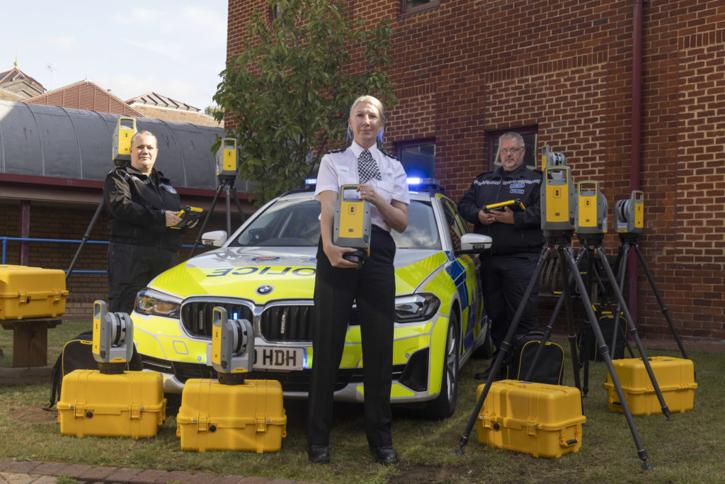
Read the official press release here
Whilst the benefits of the Trimble X7 are relevant to a wide range of users including surveying practices, construction companies, architects, steel manufacturers, and many more have been well documented, the demands of police forensic work require an instrument that can deliver in very specific areas which is why the X7 has proved to be an excellent match:
11 points why the Trimble X7 is a perfect match for forensic police work
- Ease of use – the learning curve for the X7 is the shortest of any scanner we’ve ever seen with our training department estimating that even a non-surveyor can be efficient in data collection within hours. This gives it a far wider range of use. Thanks to its intuitive Perspective software running on a tablet, crime and collision scene investigators can reliably collect scan data even if they have not used the instrument for several weeks.
- Fit in with your existing workflow – export formats supported include Trimble and non-Trimble software through the instrument’s new Trimble Perspective software. For example, the open .E57 format for easy importing of data straight into 3rd party registration software.
- Verification of information on site – the X7’s automatic on-site registration means that officers can check that all the information they need has been collected. Often there is no chance to revisit a scene, so this feature is vital for ensuring a full and detailed survey has been completed before leaving the site.
- Survey completed and sent from the site – with registration carried out on site, the finished scan data can be sent from the field for immediate analysis. This ensures a smooth flow of information in an environment where shift work and office processing time can delay the final deliverable by days.
- Fast set up and use – the X7 can be up and running in minutes thanks to the quick release mechanism and automated survey grade self-levelling – just put the scanner down and it’s ready to go.
- Night-time benefits with easy moving and set up around the site – an IMU has been included in the X7 which calculates the new station orientation and will import new data with this orientation already applied. The registration process which follows is then much faster due to the scan already having the correct orientation- just pick it up, hold it as you wish, walk where you want and put it down. This also makes it great for night-time working because unlike other manufacturer’s scanners it is not subject to the dark/low-light condition caveats that optically based solutions are.
- ROI – auto calibration brings reliability, cost-savings and no downtime – not only is the X7 priced competitively, but users are calculating that the auto-calibration feature alone can save in excess of £3k – £4k a year because unlike other manufacturer’s scanners, the X7 does not need to be sent abroad for this process. Instead it’s done automatically, every time it’s used, with the option of a printable certificate.The calibration of some instruments can take up to 2-3 months requiring the hire of a replacement instrument. The X7 eliminates the need for this.
- Rain never stops play – Trimble instruments have a proven record in the rain and with its IP55 rating, the X7 is no exception.
- Highly portable – the X7 weighs just 5.8kg and can be carried easily in a backpack.
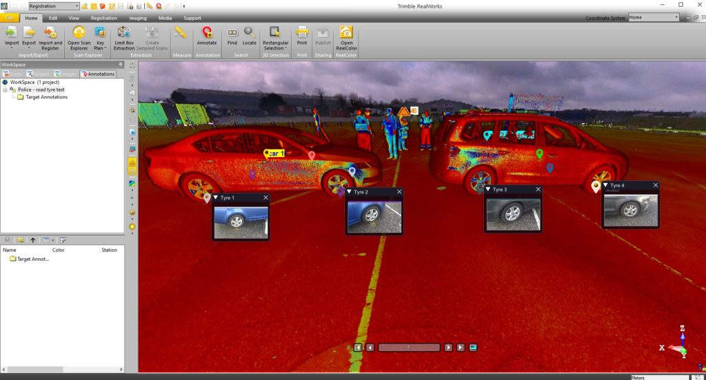
- Excellent data quality – fast data collection plus the option of a high sensitivity mode for scanning dark vehicles etc.
- Images and annotations – Trimble Perspective software on a tablet drives the X7 and allows users to annotate, add images, tags, notes etc.
KOREC’s Barry Monk explains why the X7 is a good choice for Surrey Police and Sussex Police chose the Trimble X7
“Working with Surrey Police and Sussex Police on this project was an exciting opportunity to understand the impact a solution such as this can have in ensuring that the requirements of both Police and the public are met.
Breaking down and understanding each element of attending a scene and collecting crucial information was key. The Police have one chance to collect the data in one visit and not miss a thing. With the Trimble X7 solution we were able to tick so many boxes. It is compact and lightweight with all the accessories in a single, easy to carry lightweight backpack and the X7 even has handle which are important aspects when it comes to transporting it quickly on to a scene. Additionally, the onboard Trimble Forensics Capture software is extremely intuitive to use. The X7 proved quick and easy to set up and GO with auto levelling and confirmed calibration at the beginning of each scan. The 3D visualisation of each scan within the Capture software gave confidence and comfort to the investigator that all data was captured. If there were areas that were missed, an extra scan could be added with ease.
In many of the scenes that the investigators attend, speed with accuracy is key. Once the scene was captured, the investigator could start the registration process in the field or whilst on route to another scene or to the station. The complete point cloud would then be ready to review but it didn’t stop there. Once we had the finished point cloud, putting the data set through to Trimble Forensics Reveal software gave the police the power to verify, understand and produce information to support the outcome of the case. As Trimble’s Reveal software was designed with Forensics investigations in mind, there are many tools to allow the investigator to present that data but also to prove what potentially happened in the incident.
The flexibility of the Trimble X7 linked to the Trimble Forensic Reveal software also enables us to develop for future maybe more complicated scenes for investigation and I am pleased that we will continue to work with the police and provide future developments.”
KOREC specialises in bringing end to end solutions and our Forensics offering is no exception. As well as the Trimble X7, we also offer Trimble Forensics Reveal, software that gives you all the tools you need to recreate, analyse and visualise crime and crash scene data. Ideal for capturing small data sets using tape measures or total stations and also for managing full 3D scan point clouds.
If you’d like further information on Police/Forensics applications for our Trimble survey solutions, please contact our KOREC specialist in this area, Cesar Almeida.
Cesar can be emailed at cesar.almeida@korecgroup.com or called on 07721 919912.
For further information on the Trimble X7:
Call UK Sales: 0345 603 1214
Call Ireland Sales: 01 456 4702
For anything else, view our contact page.