Using GNSS for Slope Stability and Embankment Movement Monitoring
Find out how GNSS technology monitors slope stability and embankment movement, the equipment used for continuous automated deployment, and how KOREC supports monitoring projects across the UK and Ireland.
With over 15 years in survey, Adam now specialises in Trimble's monitoring solutions, helping customers deploy real-time systems like Trimble 4D Control to track movement and deformation with confidence.
Embankments and slopes are among the most challenging assets to monitor. They are often remote, extensive, and subject to gradual movement that is difficult to detect without continuous measurement. When movement does accelerate, the consequences for adjacent infrastructure, transport networks, and communities can be severe.
GNSS monitoring provides a practical solution for many slope and embankment applications. Fixed receivers installed at key points on the slope collect position data continuously and automatically, transmitting to a central platform where change is tracked and alerts are issued when movement exceeds defined thresholds. No staff are required on site for routine data collection.
Why Slope and Embankment Monitoring Is a Safety Priority
The Consequences of Undetected Ground Movement
Embankments and natural slopes can shift gradually over years, or fail suddenly with little warning. The factors that contribute to instability include saturation from heavy rainfall, freeze-thaw cycles, changes in loading from adjacent construction, and the long-term degradation of the materials that make up the embankment. None of these processes announces itself clearly at the surface.
The consequences of failure range from the disruption of a transport route to the loss of life. Rail embankments carry passenger trains; road cuttings border motorways; reservoir embankments retain large volumes of water. The stakes associated with undetected movement in these environments are high, and the case for continuous monitoring is straightforward.
Who Is Responsible for Monitoring Slopes and Embankments?
Responsibility for slope and embankment monitoring typically falls on the infrastructure asset owner, the managing engineer, or the geotechnical specialist appointed to assess stability. Network Rail manages an extensive programme of embankment monitoring across the rail network. National Highways monitors cuttings and embankments on the strategic road network. Water authorities monitor reservoir embankments as a regulatory requirement. For each of these organisations, a reliable, continuous monitoring system reduces both risk and the cost of inspection.
Why GNSS Is Well Suited to Slope Stability Monitoring
Continuous, Autonomous Data Collection
The most significant practical advantage of GNSS for slope monitoring is that it collects data continuously without anyone needing to be present. A fixed receiver installed on a slope measures its own position repeatedly, building a time series of position data that reveals how the installation point is moving. The data is transmitted automatically to the monitoring platform, where it is stored, analysed, and compared against thresholds.
This is fundamentally different from periodic survey visits, where movement between visits may go undetected. A GNSS monitoring receiver captures what is happening to the slope at all times, including overnight, at weekends, and during periods of heavy rainfall when movement is most likely to accelerate.
Performance on Remote and Inaccessible Sites
Slopes and embankments are often located in areas where regular site visits are difficult, expensive, or hazardous. The Trimble R750 MON is designed specifically for this type of deployment. It operates across a temperature range of -40°C to +65°C, handles extended periods without maintenance, and communicates via integrated 4G LTE cellular with 8 GB of internal data storage to bridge any connectivity gaps.
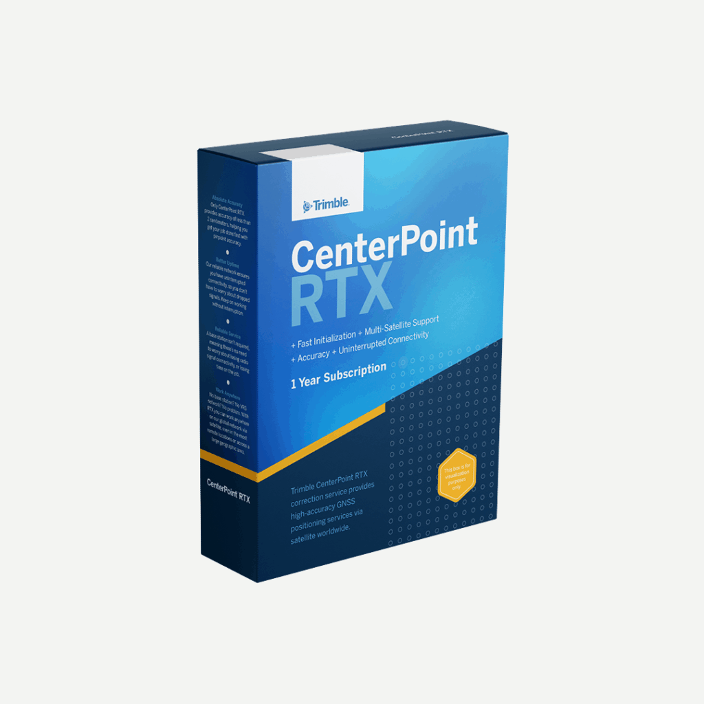
For sites where mobile network coverage is limited or unavailable, Trimble CenterPoint RTX corrections can be delivered via satellite rather than internet, removing the dependency on local network infrastructure entirely. This makes it possible to deploy a precise, automated monitoring system on a slope or embankment that would otherwise be impractical to instrument.
Millimetre-Level Precision Without a Base Station
The Trimble R750 MON delivers 8 mm horizontal and 15 mm vertical RTK precision using Trimble CenterPoint RTX corrections, with no local base station required. This is a significant logistical advantage for remote monitoring deployments, where setting up and maintaining a base station would add cost and complexity without a proportionate benefit.
The Trimble Maxwell 7 GNSS chipset tracks all available constellations, mitigates multipath interference, detects signal interference, and protects against spoofing. On slopes where the sky view may be partially obstructed by terrain or vegetation on one side, multi-constellation tracking maintains accuracy by using signals from a wider range of satellite positions.
Where GNSS Works Best and Where It Has Limitations
GNSS monitoring performs best on open slopes with good sky visibility. Rail and road embankments, open hillside landslips, reservoir embankments, and exposed cuttings are all well suited to GNSS. The receiver needs a clear view of the sky above to maintain reliable positioning, and performance degrades under dense canopy or in areas where terrain significantly restricts the visible sky.
In these cases, a robotic total station monitoring system is more appropriate, using line-of-sight measurement to prisms that is unaffected by sky visibility. The two technologies are complementary: GNSS covers open areas efficiently, while total stations handle environments where GNSS cannot perform reliably. For more detail on total station monitoring, see the companion article in this series on how robotic total stations are used for structural monitoring.
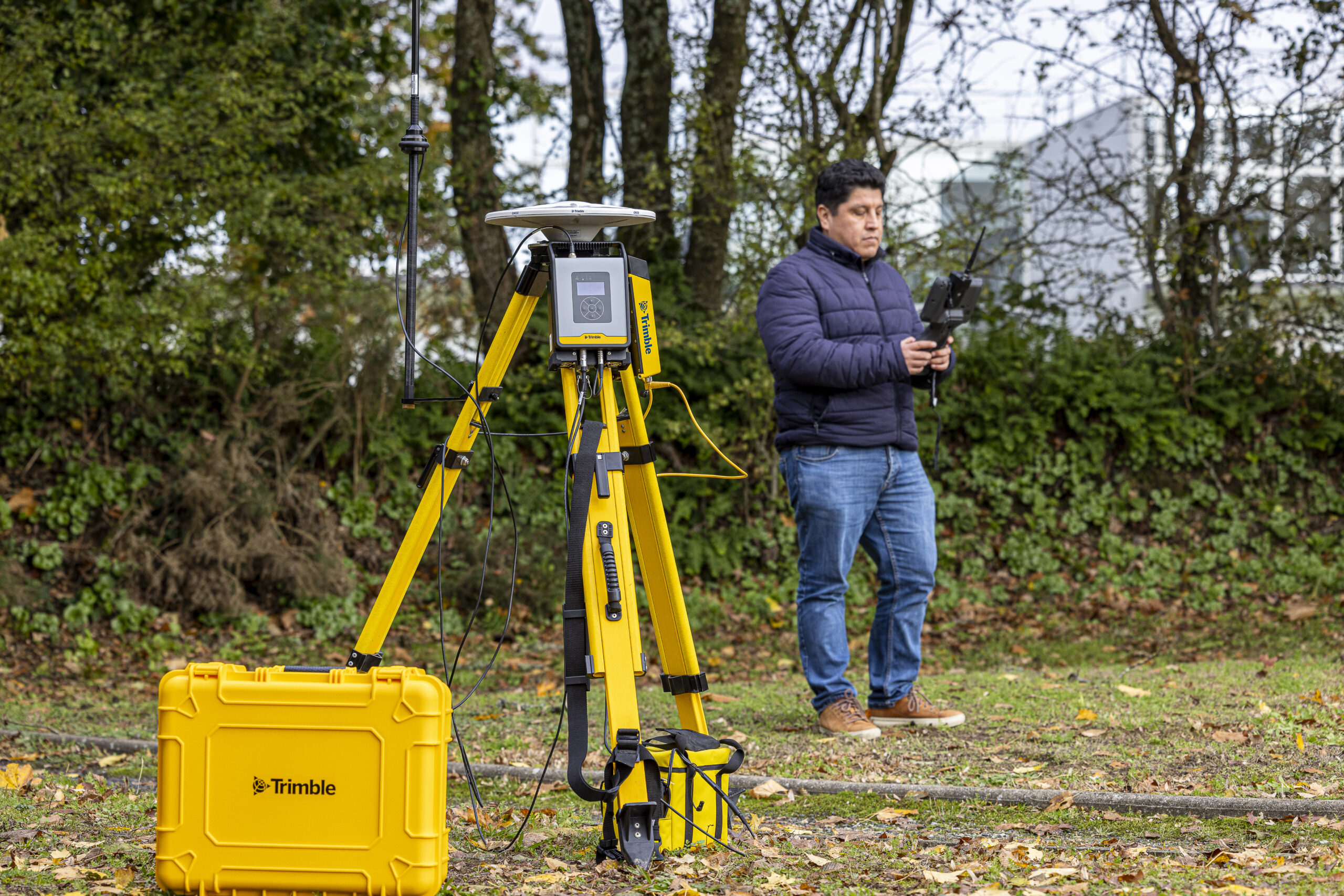
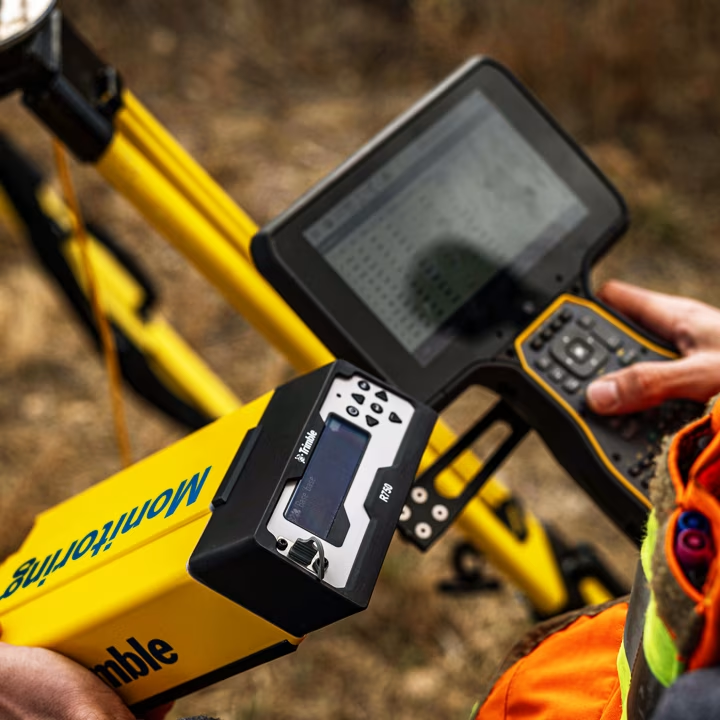
The Trimble R750 MON is built for permanent deployment on automated monitoring projects. Unlike a standard survey GNSS rover, the Trimble R750 MON is designed to be fixed in position, collecting continuous position data from that point. Key specifications include 8 mm horizontal and 15 mm vertical RTK precision, a position update rate of up to 20 Hz, integrated 4G LTE cellular communication, and 8 GB of internal storage.
The Trimble R750 MON connects directly to Trimble 4D Control without an external modem, simplifying field installation and reducing the number of components that need to be maintained on site. The external Zephyr 3 Base antenna is supplied with the receiver and provides the sky-facing antenna required for the installation.
Trimble 4D Control: Automated Alerts and Reporting
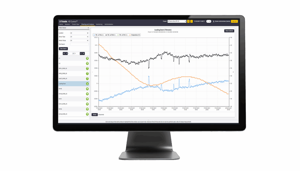
Data from every Trimble R750 MON in the monitoring network flows to Trimble 4D Control, where it is stored, analysed against defined thresholds, and used to generate reports and alerts. Movement thresholds can be set for total displacement, rate of movement, or both, allowing the alert configuration to reflect the specific risk profile of the site.
When a threshold is exceeded, Trimble 4D Control issues an alert within seconds, by email or SMS, to whoever is configured to receive it. Reports can be generated automatically on a defined schedule or on demand, providing the documentation needed for ongoing compliance and client reporting.
Trimble Wireless Data Loggers: Integrating Geotechnical Sensors
GNSS monitoring captures the position of the receiver. Geotechnical sensors capture other aspects of slope behaviour: pore water pressure from piezometers, tilt from inclinometers, and soil moisture from sensors buried within the embankment. Trimble Wireless Data Loggers automate the collection of data from these sensors and feed it directly into Trimble 4D Control, so position data from the Trimble R750 MON and geotechnical sensor data from the loggers are visible in the same platform.
This integrated view is particularly valuable for embankment monitoring, where pore water pressure increases are often an early precursor to movement. Monitoring both simultaneously allows the engineer to identify the conditions that lead to movement, not just the movement itself.
Combined GNSS and Total Station Monitoring
Some slope and embankment monitoring programmes use GNSS and robotic total stations in combination, with GNSS receivers covering the open parts of the embankment and a total station measuring prisms in areas with restricted sky visibility. Both data streams feed into Trimble 4D Control, providing a unified picture of the embankment’s behaviour across its full extent. For information on the total station side of this approach, see the companion article in this series on how robotic total stations are used for structural monitoring.
How a GNSS Slope Monitoring System Works in Practice
Installation and Setup on a Slope or Embankment
Each Trimble R750 MON is fixed to a stable mounting point on the slope, typically a driven post or a concrete-anchored pillar, with the Zephyr 3 Base antenna oriented to give the best available sky view. The number of receivers and their positions are determined by the geometry of the slope and the areas of highest risk. A relatively simple embankment might require two or three receivers; a complex natural slope with multiple failure mechanisms could require significantly more.
Once installed, each receiver begins collecting position data automatically. Initial position measurements establish the baseline, against which all subsequent measurements are compared. The baseline is typically established over a period of several days to account for any initial settlement of the mounting and to characterise the natural variation in the position measurements under stable conditions.
Setting Movement Thresholds and Configuring Alerts
Movement thresholds are set in Trimble 4D Control and are typically agreed with the geotechnical engineer responsible for the monitoring programme. Warning and action levels are defined for both total displacement and rate of movement. A warning level might be set at a displacement that warrants investigation; an action level would trigger an immediate response.
Configuring both levels allows the monitoring system to provide early notice of developing movement and a higher-priority alert if movement accelerates. The response plan associated with each level should be agreed before the monitoring programme begins, so that when an alert is received, the team knows exactly what to do.
Data Transmission and Remote Access
The Trimble R750 MON transmits data to Trimble 4D Control via its integrated 4G LTE cellular connection. Where cellular coverage is poor or unavailable, Trimble CenterPoint RTX satellite corrections allow the receiver to maintain precise positioning, and data can be stored locally in the 8 GB internal memory until a connection is available.
The monitoring team can access the full data record, review trend plots, and check receiver status remotely at any time, without visiting the site. This remote access capability is particularly valuable for embankments and slopes where physical access is difficult or where conditions that drive movement, such as heavy rainfall, are also conditions that make site visits unsafe.
Key Applications
Rail Embankment Monitoring
Rail embankments carry a significant proportion of the UK’s railway network and are subject to ongoing maintenance and monitoring programmes. GNSS monitoring provides continuous, automated data from embankment crests and slopes, with alerts configured to trigger ahead of the thresholds that would require a line speed restriction or closure. The Trimble R750 MON’s operating temperature range and robust construction make it suitable for year-round deployment in exposed conditions.
Highways Cuttings and Slopes
Road cuttings and embankments on the strategic road network are subject to National Highways’ inspection and monitoring requirements. Automated GNSS monitoring provides the continuous data record needed to demonstrate compliance with monitoring specifications and to detect movement before it affects the carriageway or the structures that support it.
Natural Slopes and Landslip-Prone Areas
Natural slopes in areas with a history of landslip, or on geology known to be susceptible to instability, benefit from continuous GNSS monitoring that can detect the early stages of movement before it becomes a safety risk. In combination with Trimble Wireless Data Loggers monitoring pore water pressure and soil moisture, the system captures both the physical movement and the conditions that drive it.
Reservoir Embankments and Dam Structures
Reservoir embankments are subject to regulatory inspection and monitoring requirements under the Reservoirs Act 1975. GNSS monitoring provides a continuous spatial record of embankment crest and slope movement, supporting both the ongoing safety case and the formal inspections required under the Act. The satellite correction capability of the Trimble R750 MON is particularly relevant for reservoir sites, which are often in remote locations with limited mobile infrastructure.
Frequently Asked Questions
How accurate is GNSS for slope monitoring?
The Trimble R750 MON delivers 8 mm horizontal and 15 mm vertical RTK precision using Trimble CenterPoint RTX corrections. This level of accuracy is appropriate for most slope and embankment monitoring applications, where the movements of concern are typically measured in tens of millimetres or more. For applications requiring sub-millimetre precision, such as bridge deck deflection or precise structural monitoring, a robotic total station is the more appropriate instrument.
Can the system work without mobile network coverage?
Yes. The Trimble R750 MON supports Trimble CenterPoint RTX satellite corrections, which are delivered via satellite rather than internet and do not require mobile network coverage. Data collected during periods without connectivity is stored in the 8 GB internal memory and transmitted to Trimble 4D Control when a connection is available, ensuring no gaps in the monitoring record.
How does GNSS monitoring differ from total station monitoring?
GNSS monitoring is best suited to open sites with good sky visibility, where receivers can be fixed in position and collect continuous data autonomously without line-of-sight measurement to a reference point. Total station monitoring uses a robotic instrument to measure prisms at defined positions, providing higher precision and reliable performance in environments where sky visibility is restricted, such as under dense canopy, in cuttings, or inside structures. The two methods are complementary and can be combined within a single monitoring programme managed through Trimble 4D Control.
How does KOREC support the design and installation of a GNSS monitoring system?
KOREC’s monitoring specialists support clients from initial project specification through to installation, commissioning, and ongoing programme management. This includes advising on receiver placement and system configuration, supplying the Trimble R750 MON and associated equipment, and providing training on Trimble 4D Control.
Learn more about GNSS for slope stability and embankment monitoring
KOREC can advise you on the use of GNSS for slope stability and embankment monitoring. Speak to our friendly experts today to get the right technology to solve your project challenges.