
KOREC’s ‘Scanning and Point Clouds’ Sector Specialist, Melvin Penwill, field tests the new Trimble X12.
At the end of July, Trimble announced the new X12 3D Laser Scanner, its first release since the groundbreaking X7 of which you’ve no doubt heard plenty of talk over the last couple of years! A new instrument is always an exciting moment and as KOREC’s ‘Scanning and Point Clouds’ product specialist, I was delighted to get my hands on one of the units that landed at our Huntingdon Offices for our consultant training day.
The Trimble press release describes the X12 as ‘…..integrating intuitive Trimble software for precise data capture and in-field registration with state-of-the-art 3D laser scanning and imaging hardware technology from Zoller+Fröhlich (Z+F), combining the expertise of two industry leaders into a single solution.” A nice description, that highlights that this really is a ‘best of both worlds’ combination of Z+F technology and a tried and tested Trimble workflow, but let’s take a look at how that works in practice.
Out of the box
So, first impressions, it’s small! For a scanner of this range (0.3 m–365 m) and precision (≤ 1 mm + 10 ppm/m), it’s way more compact than its closest rivals measuring just 150 mm (W) x 258 mm (D) x 328 mm (H)) and weighs in at 7.7kg and that includes the batteries. It also has a handle, a significant detail that’s been much appreciated on the X7. The box looks great too, but doesn’t accommodate the Trimble T10x Tablet, but then again, that makes sense since the tablet is often going to be separate from the instrument for charging etc.

However, this is an all-in-one package and includes everything you need to start scanning immediately including the Trimble Perspective software.
Here’s what I rate – my six top highlights:
- All the KOREC consultants found the Trimble Perspective workflow incredibly easy to use. Those that were familiar with the X7 were up and running immediately, those that were unfamiliar found Perspective intuitive and with just a couple of questions here and there required little further assistance. This is vital for survey companies that need an instrument that’s suitable for use by everyone on the team for an early ROI with little down time for training.

- Window scanning – this is a great feature! Do a quick 360° scan (23 or 46 seconds) to position yourself and then use the window option to select areas for more detail. Expect 0.6mm at 10m….unbelievable!
- Great imagery – you can add excellent imagery to your scan in just 2 minutes, again it’s super quick and the quality is excellent. The Perspective software also means that it’s really easy to retake images. A lot of thought has gone into making this a really simple procedure.
- Clean, sharp data and noise, or more accurately, lack of noise! One KOREC customer scanned a black car. Normally with a reflective surface of this sort, you can expect noise. In this case, the customer thought that that the data had been filtered in Trimble RealWorks because it looked so unbelievably clean. Not so, this was all the work of the X12. It’s worth noting that noise is at 0.2mm at 10m for the X12 compared to maybe 2-3mm with the X7.
- Scanning in the dark – don’t be put off anymore, even for inspection work. The X12 has four LED lights which are so strong that from the results, you wouldn’t even know you were in a dark room.
- Fast – this scanner is also speedy, one of the fleetest on the market and with Trimble Perspective, users can check their data, take measurements, and add annotations before leaving their site which makes for faster turnaround time in the office.
The proof of the pudding…

I spotted this on the drive back from Huntingdon and couldn’t resist! The obelisk was in a really tricky environment with trees all around but I wanted detail, not trees. I did a 360° scan for registration and then a window scan with images. The end result was clean and crisp.

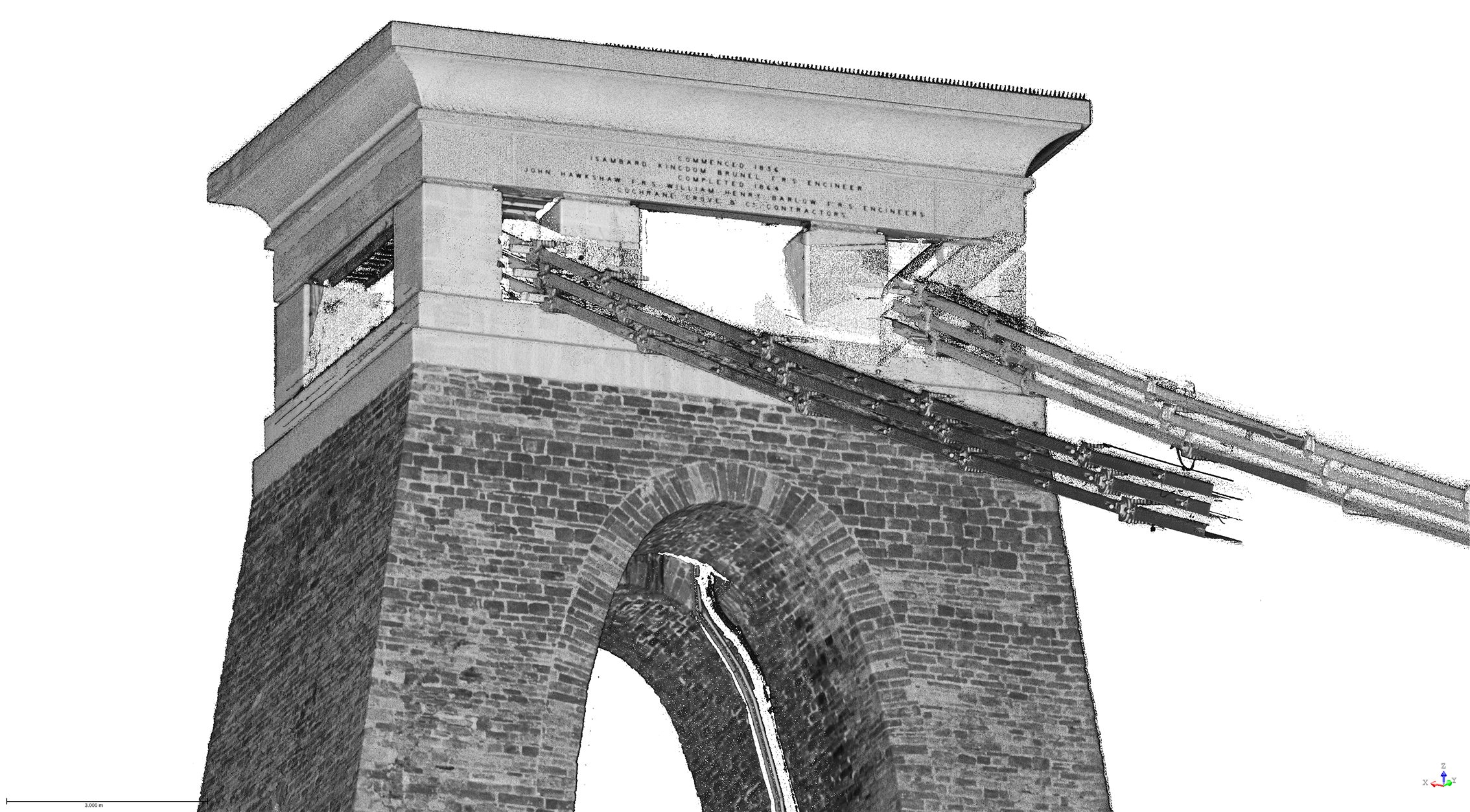
I chose this bridge because I’ve visited it regularly with the X7 so I knew it would be a really useful comparison to undertake the same scan with the X12. The result with the X12 is a totally different level. This is an instrument with an understandably higher price tag than the X7, but this scan reminded me exactly why. I scanned at an 80-90m range and again, the results were impeccable with the detail on the brickwork crisp and clear.

Conclusion
In all honesty, when I first heard about the X12, I was asking myself how it would fit into the fleet of one of our typical KOREC survey customers and as ever, the answer comes not from a press release or a data sheet but those who are out in the field or running a survey business, all of whom have productivity, profit and great deliverables in mind. The customers I’ve shown the X12 to have been wowed by its performance as a single instrument suitable for any job. So, I’m signing off with a quote from a recent demonstration that sums it up perfectly:
“It’s totally fit for purpose, every purpose, in fact it’s a bloody great scanner!”
If you’d like to know more about the X12, please contact me at Melvin.penwill@korecgroup.com and please do sign up for our X12 webinar at https://korec.group/x12-webinar-1 on Tuesday 11th October.

KOREC Group is delighted to announce that it is expanding its operations with the launch of BuildingPoint UK and Ireland as it becomes the newest partner to join Trimble’s BuildingPoint distribution network.
KOREC Group is an existing, established Trimble distribution geospatial partner with over 50 years of experience working with the construction industry. The addition of the BuildingPoint distributorship to its already extensive geospatial portfolio underlines KOREC’s commitment to expansion which saw the company announce 30 new positions across the company at the beginning of the year.
Over 70% of UK and Ireland construction projects run over time and over budget due to a number of factors including rework, barriers to stakeholder collaboration and challenges to onsite efficiency and productivity. Through this new Trimble partnership, those that work within the construction industry, including users of Trimble Tekla, Viewpoint and MEP software, can now access a full Trimble digital construction portfolio backed up by regional expertise .
This will be delivered through a BuildingPoint team dedicated to bringing tried and tested workflows to the UK and Irish markets. These workflows have been developed to deliver increased productivity, schedule adherence and cost discipline through tighter coordination, improved project transparency and collaboration.
The offering will include assistance with the adoption of digital workflows through a range of task specific software and hardware solutions from general setting out tools to Augmented and Mixed Reality technology and Robotics.
Alan Browne, Group Chief Executive of KOREC and EY Entrepreneur of the Year Finalist 2022 said:
“The creation of BuildingPoint UK and Ireland is the next phase on our journey along with Trimble of helping our partners in Building Construction operate more safely, more quickly and more accurately whilst reducing costs and the impact on the environment”
This dedicated and experienced team will be looked after by Sam Hough (UK) and Kevin Colwell (Ireland) whilst a new BuildingPoint construction focused website for the UK and Ireland has been launched at http://buildingpointukandireland.com.
The dates and locations of regional BuildingPoint launch events will be announced shortly.
ENDS
About KOREC Group
KOREC Group is an established Trimble Geospatial Distributor, one of the largest and most successful in the world and has been for over 25 years. The company has been active in the construction market since its inception in the 1960s.
Since 2019 the Trimble construction side of the KOREC offering has been operating as KOREC Construction. BuildingPoint UK & Ireland joined the global BuildingPoint family in September 2022. This network brings the full range of Trimble Buildings’ solutions to their respective markets – solutions designed to improve your productivity, schedule adherence and cost discipline through tighter coordination, improve project transparency and collaboration.
We’re now part of a growing family of BuildingPoint organisations across the Americas, Europe and Asia/Pacific.
About Trimble BuildingPoint
BuildingPoint dealers represent Trimble Buildings’ solutions—a portfolio of synergistic hardware, software and service offerings that allow users to create and transfer constructible models throughout the DBO (Design, Build, Operate) lifecycle. Trimble is dedicated to transforming the planning, design, construction and operation of buildings through advanced, accessible, intuitive technologies. Trimble Buildings’ solutions provide an unprecedented capability to improve productivity, schedule adherence and cost discipline through tighter coordination, improved project transparency and collaboration—enabling stakeholders to realise greater agility, efficiency and insight.
KOREC Group recruits software industry expert to lead large-scale expansion of its K-MATIC operations
The full release can be found here
We are delighted to announce the appointment of Gabriel Hradilek in the new position of Chief Operating Office of K-MATIC, our in-house software development division.
K-MATIC provides customisable solutions for the collection, analysis and processing of geospatial data through a combination of its K-CAPTURE field data capture software, its K-PORTAL and Trimble hardware solutions. Gabriel will manage the next stage in the expansion of these areas.
In this new role, Gabriel will be working alongside KOREC Group CEO Alan Browne, and K-MATIC Software Lead Paul Brodin, to manage an ambitious investment program that will see K-MATIC triple in size by the end of 2022. Specialising in deep industry-focused product and services software development, Gabriel brings experience from high profile previous roles working with global brands such as IBM.
KOREC Group CEO, Alan Browne said: “With a particular interest in helping companies absorb, apply and profit from disruptive digital technologies, Gabriel’s experience is a perfect fit for the ambitious plans we have for K-MATIC as we expand both the breadth and geographical potential of the software we develop.”
Gabriel Hradilek said: “I’m delighted to be taking up the role of Chief Operating Officer of K-MATIC. During my professional career I`ve worked with a number of deep industry-focused product and services software development organisations across the globe, big and small. However, very few of them were actually focused on creating their own market like K-MATIC does in the geospatial, engineering and construction sectors. Its innovative approach to solving the specific problems of a client or vertical market provide tremendous scope for a successful future.”
ENDS
Over the coming weeks, we’re going to be asking prominent people in the survey industry to outline their three most rated geospatial industry innovations/changes in around 100 words or so…and anything goes!
We’ll be sharing these thoughts on LinkedIn and have some great names lined up!
We’ll be adding each addition to our ‘Insider Series’ to the KOREC blog to build up a picture of what those in the know really rate.
Polly Hopkins, Company Secretary of Storm Geomatics, specialists in surveying in water
Polly has been with Storm Geomatics since day 1! Her expertise lies in understanding and researching Storm Geomatic’s clients’ pain points, then ensuring that her colleagues address these by providing solutions through the best methods of data capture.
Polly’s three most rated innovations/changes:
The increasing use of photogrammetry to produce highly accurate and detailed models of both the built and natural environments are now readily available to a wider number of geospatial surveyors. The increased use of photogrammetry is possible because of:
Increasing power and memory storage of computers too process large volumes of data and media that compliments data capture capabilities and processing. Such as photogrammetry.
Software innovation focusing on being specific to client needs to accelerate the process of problem solving. For example, GeoRiver® River Channel processing software that is a result of collaboration between Storm Geomatics and engineer clients to produce an understanding of specific requirements to solve flood solutions.
To conclude; photogrammetry, the power of the computer and functionality of software are all innovations that will greatly enhance geospatial data capture and ensure processing of data is accelerating the process of problem solving.
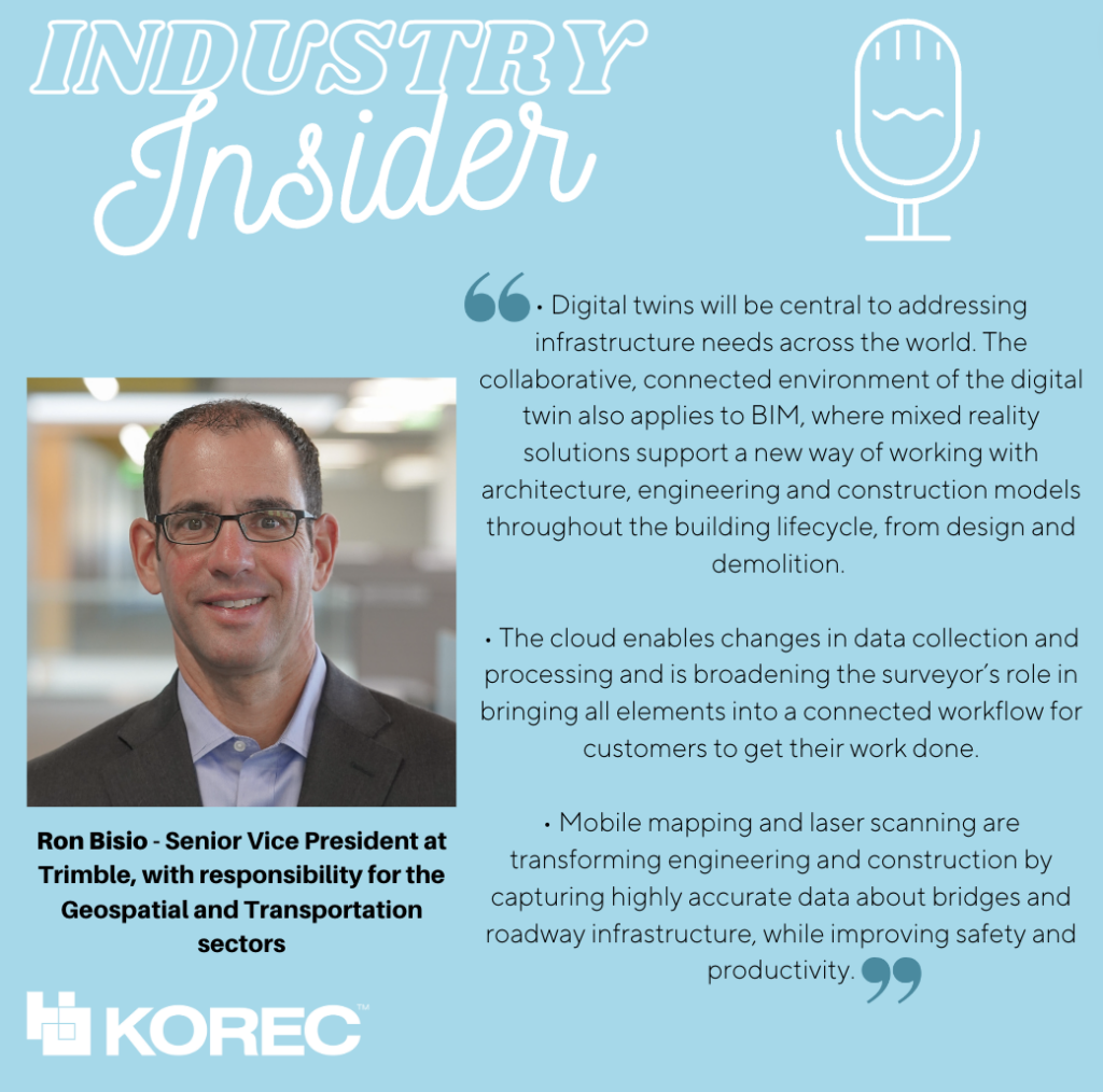
Ron Bisio, Senior Vice President at Trimble, with responsibility for the Geospatial and Transportation sectors
Ron joined the company in 1996 and has held several marketing, sales and general management positions prior to taking over worldwide responsibility for Trimble Geospatial in 2015. He earned a master’s degree in business administration from the University of Denver, a master’s in regional planning from the University of Massachusetts and an undergraduate degree in geographic information systems & cartography from Salem State University in Salem, Mass.
Ron’s three most rated geospatial industry innovations/changes
• Digital twins will be central to addressing infrastructure needs across the world. The collaborative, connected environment of the digital twin also applies to BIM, where mixed reality solutions support a new way of working with architecture, engineering and construction models throughout the building lifecycle, from design and demolition.
• The cloud enables changes in data collection and processing and is broadening the surveyor’s role in bringing all elements into a connected workflow for customers to get their work done.
• Mobile mapping and laser scanning are transforming engineering and construction by capturing highly accurate data about bridges and roadway infrastructure, while improving safety and productivity.
Gavin Schrock, Licensed land surveyor and consulting editor of GoGeomatics
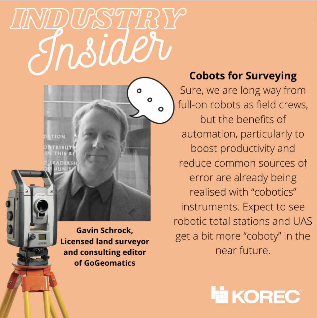
Gavin Schrock is also a practicing, licensed land surveyor, technology writer, administrator of a cooperative real-time GNSS network (RTN) and consulting editor of GoGeomatics. He has worked in surveying, mapping, geodesy, monitoring, data management, satellite navigation, and GIS in public works, commercial development, defense, and utilities. @schrockg
Gavin’s four most rated geospatial industry innovations/changes
• Practical Augmented Reality for Construction and Surveying
The face-box AR systems, like we see promoted in consumer markets, were never going to be practical—or safe—for field or worksite environments. The realisation of true “mixed reality” was long overdue for AEC applications; I’d been waiting for this for decades, ever since I saw those heads-up displays in fighter aircraft and thought “why can’t we have this in the field?” Then along came the Trimble XR10 in 2019, based on the HoloLens 2, later productized as for construction layout earlier this year, powered by the FieldLink MR application. The future just got quite bit closer. Ok Trimble, now give us a tilt-prims-pole to go with it!
• Cobots for Surveying
Sure, we are long way from full-on robots as field crews, but the benefits or automation, particularly to boost productivity and reduce common sources of error are already being realised with “cobotics” instruments. A “cobot” is often defined as “a computer-controlled robotic device designed to assist a person”. A prime example in surveying is advanced scanners like the X7 that self-calibrate, perform automated fine levelling, and progressively self-register multiple scans. Another is the robotic platforms, like the surveying robo-dogs (and follow-along equipment pods) that take their cues from their human party chief/coach. Expect to see robotic total stations and UAS get a bit more “coboty” in the near future.
• The Time to Upgrade Your Survey GNSS is Now
It’s good move to help firms keep up with the present more-work-than-they-can-handle situation. But also, in this tight job market, the latest kit can help attract and retain staff. GNSS rovers have undergone a dramatic leap forward just in the past few years with the Galileo and Beidou constellations reaching full complement in 2020. Rover manufacturers had to boost processing power and completely revamp RTK engines, like in the R12, to fully leverage an expanded slate of modernized signals. There have been noticeable gains in speed, multipath mitigation, ability to work in sky-view-challenged environments—not to mention sensor integration like no-calibration tilt.
• Pay-as-you-go High Precision GNSS
A unique combination of GNSS hardware and software-as-a-service (SaaS) provides very affordable high-precision—on an as-needed basis. Late last year, I got to test-drive the Trimble DA2/Catalyst system, and found that under most conditions, it performed just as well as a high-end surveying rover. With a small investment in an antenna, you use credits to essentially “rent” the high precision receiver/RTK engine. Perfect for those with occasional or seasonal needs or seeking to outfit a large team for a term project. In 2017, the first generation of Catalyst demonstrated that software-defined-GNSS-receivers were practical; this latest gen system improves the user experience, better leverages multiple constellations.
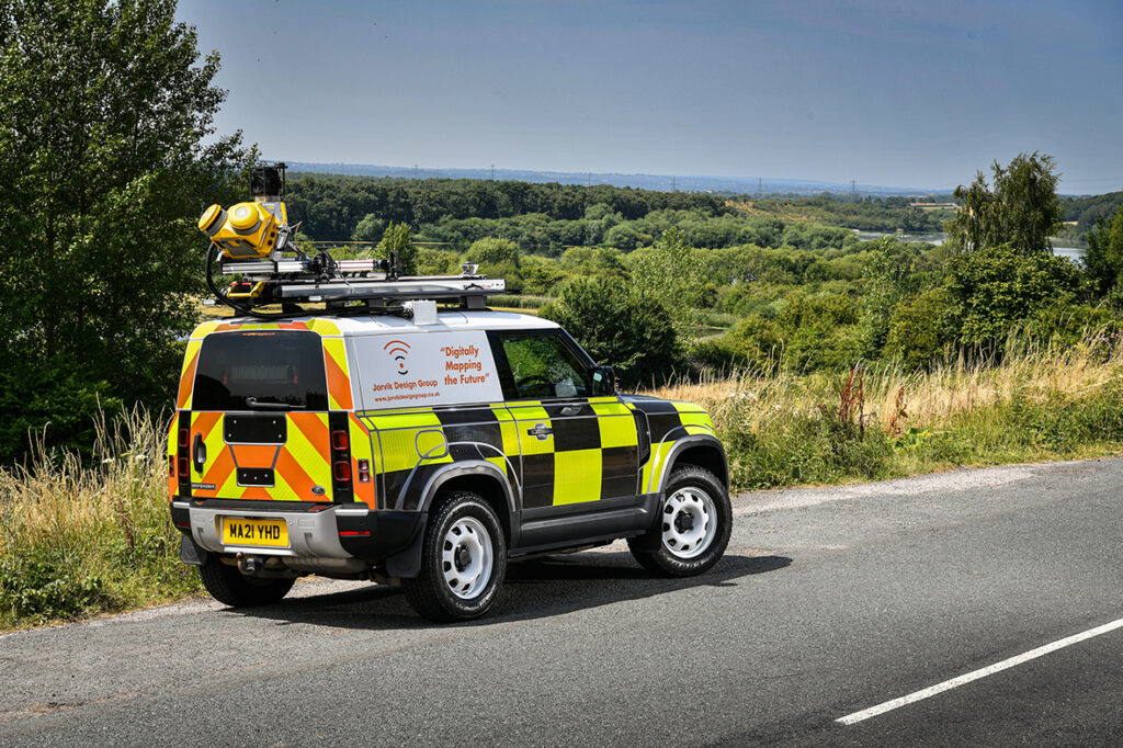

The introduction of the Trimble MX50 system will play a large part in enabling the Jorvik Design Group to provide a tailored survey and design service. This will maximize efficiency throughout their telecoms build and network deployment process.
About the Trimble MX50
The Trimble MX50 is avehicle-mounted mobile LiDAR system suitable for companies, such as Jorvik Design Group, who wish to expand their offering to include precise, high-volume data capture technology. The system delivers a very accurate point cloud of the environment along with complimentary immersive imagery and will provide Jorvik with the ability to create extremely accurate designs without time consuming and labour-intensive site walkovers.
Enhanced workflow
KOREC has worked closely with Jorvik Design Group in the creation of an enhanced workflow that will enable it to complete design jobs far faster and more accurately through the use of the high-precision, current, 3D point cloud data collected by the MX50. Previously, the company worked from Google StreetView where asset data could be outdated or inaccurate. This older data often required time consuming back-and-forth site visits from surveyors for asset checking purposes before network design could begin.
With the new enhanced workflow, clients provide a boundary map and all relevant UPRNs (Unique Property Reference Numbers) and request that Jorvik plans a design for that network. An initial survey is then driven with the MX50 system mounted on Jorvik’s Land Rover Defender.
QGIS integration
Under the guidance of Jorvik Design Group Network Planner, Mahmoud Ali, the point cloud is then processed and split into smaller jobs for the design team. A KOREC developed portal and plug-in allows the MX50 collected data to be automatically loaded as a layer for immediate use in their QGIS.
This easy integration routine means that the initial design can be viewed on top of the point cloud in a pre-defined layer. The same data can then be worked on all by all Jorvik designers simultaneously.
Client benefits
Having access to a current, high-accuracy, 3D point cloud means that the Jorvik Design Group can now provide an even better service for its clients through the provision of:
Accurate 3D point cloud data for measurements related to costing
A faster design service based on correct asset location
A fully up to date, accurate map of all their assets at the job’s conclusion.
“We invested in the Trimble MX50 system because we are always looking to continually develop and improve our approach to surveying & design and felt that this would allow us to step out amongst the crowd, in an ever growing and rapidly moving sector. KOREC has assisted us in tailoring the MX50 specifically to suit the telecoms market and to specific client requirements, which has been instrumental in our growth as a business.
Charlie Farley, Jorvik Design Group, Director
“By investing in such an advanced piece of hardware, we feel that we are extremely well placed to deliver exceptional data at pace, whilst ensuring that the information captured is up to date. This is critical to our design output and has allowed Jorvik to cover vast areas across the UK in a very short space of time. This system has proven to be invaluable to Jorvik and by using this cutting-edge technology, we feel that we are the market leader in the delivery of surveying and design services within the telecoms sector and keeps us one step ahead of the competition.”
“Mobile Mapping is now a recognised and accepted technology playing an important part in the digital strategy of many major businesses including a number of fibre optic installation companies. Jorvik Design Group is the first in the UK to invest in a Trimble MX50 system and KOREC has been delighted to be a part of that process, from initial trials through to assisting with an enhanced workflow and the delivery of training.”
Richard Gauchwin, KOREC Group Business Area Manager – Mapping & GIS
If you’d like to find out more about the Trimble MX50 Mobile Mapping system, please contact your local KOREC consultant, or use the details below;
Call UK Sales: 0345 603 1214
Call Ireland Sales: 01 456 4702
For anything else, view our contact page.
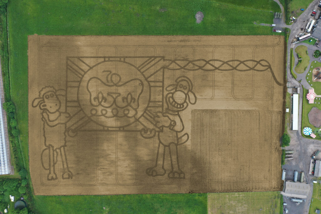
It’s taken permission from the Palace and the loan of one of the most advanced handheld GPS mapping systems available for Mark Edwards, Managing Director of Farmer Ted’s Adventure Farm, Ormskirk, Lancashire, to create this year’s jubilee themed maze attraction.
The maze was designed by Mark who enlisted the help of Liverpool based positioning and survey equipment specialists, KOREC Group. KOREC was delighted to loan him a handheld Trimble Catalyst GPS solution and also helped him turn the design into coordinates that could be loaded into the GPS to recreate the design in the maize field.
The Trimble Catalyst GPS connects to a smartphone that clearly shows the maze design. It is then taken onto the 14 acre maze site where Mark is able to navigate, using his position on the screen, to plot out the design amongst the tiny maize plants. A cultivator follows his trail cutting out the design.
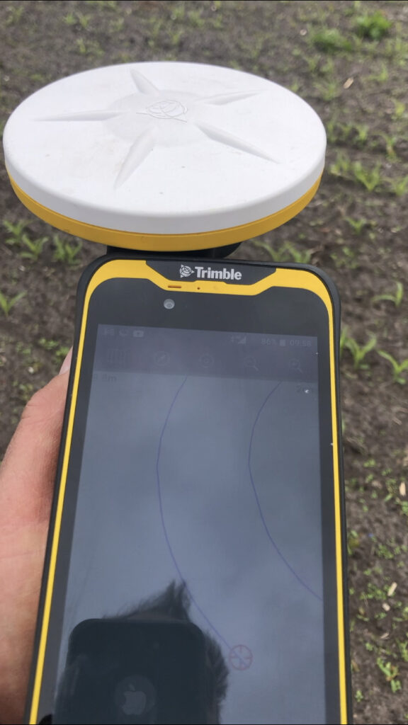
Left:The KOREC supplied Trimble Catalyst GPS is capable of centimetre accuracy! This picture shows part of the design on a smartphone/logger
This year’s design comes with a royal seal of approval. Working closely with Aardman, the award winning animation studio and the creators of Shaun the Sheep, Mark contacted the Lord Chamberlain’s Office at Buckingham Palace and was granted permission to use the Queens official Platinum Jubilee logo to celebrate this great occasion!
Mark says, “the KOREC supplied Trimble GPS really is an ‘amaizing’ piece of equipment and so easy to use. We were able to create this exciting jubilee design in just 2 days!”
Farmer Ted’s is the UK’s largest Shaun the Sheep farm attraction. It opens daily until mid-September with the Maize Maze opening on 23rd July. Tickets can be purchased on-line at www.farmerteds.com
About Shaun the Sheep
Shaun the Sheep, Aardman’s family favourite TV series, is recognised the world over for its slapstick humour, distinctive look and strong, quirky characters and enjoyed across multiple media platforms. First appearing in Nick Park’s 1995 Academy Award® winning Wallace & Gromit ‘A Close Shave’, Shaun then went on to star in his own series, created by Richard Starzak which launched on BBC One in 2007. Shaun the Sheep is currently broadcast in 170 territories around the world and is an internationally celebrated icon with over 5.6 million fans on Facebook. In 2015 the first Shaun the Sheep Movie with feature film partner Studiocanal was released around the world to critical acclaim and the first half hour TV special aired as part of many broadcaster’s festive season., The feature film sequel Shaun the Sheep Movie: Farmageddon was released in October 2019 and nominated for an Academy Award® and was closely followed by a sixth season of the series in 2020. A new festive special Shaun the Sheep: The Flight Before Christmas was released in December 2021.
We are delighted and proud to announce that our KOREC Group CEO, Alan Browne, has been named on the EY Entrepreneur of the Year shortlist for 2022. Alan’s nomination is for ‘Established Entrepreneur’, one of three categories that also include ‘Emerging Entrepreneur’ and ‘International Entrepreneur’. Following judging of the shortlist the overall winner for Ireland, who will also be a global finalist, will be announced in November.
EY Entrepreneur Of The Year is a unique global programme running in more than 60 countries that recognises entrepreneurial achievement among individuals and companies that demonstrate vision, leadership and success. All finalists will be invited to join the EY networking event in Austin, Texas.
In Alan’s case, the nomination is a fitting recognition of his 27 years as CEO of KOREC that has culminated in a recent period of massive growth for the company resulting in a recruitment drive to fill 30 new positions, in a range of departments, across the UK and Ireland.
Alan Browne said: “I’m delighted to receive this nomination because it’s a truly exciting recognition of what we have achieved at KOREC over the years in a demanding, technology led environment. Our experience has allowed us to build and define our company culture and that means we’ve also created a great workplace, a great team and a world-class ethos.”
Additional information about why Alan was shortlisted
Alan has been entrepreneurial from an early age. At just 27 years old he started a company in Ireland called PCI with a single employee. He felt that large machines on construction sites could be used far more effectively and accurately if they were equipped with a technology called Machine Control (based on laser measurement) that was still very much in its infancy.
In the first year of working, the company had a turnover of £110k. Today KOREC Group will turnover £35m across the Group. From the initial days of just two employees, KOREC now employs over one hundred people and is growing all the time. Currently, KOREC is seeking to recruit for 30 new posts in 2022.
Alan’s strength, and that of the KOREC Group, lies in his ability to spot key business areas whilst they are still in their infancy and in some cases, whilst there is still opposition to the technology. A great example of this is his move into the commercial drone market in 2011 becoming the first in the UK to do this. He worked closely with drone manufacturer senseFly to become one of their most influential partners. This relationship is still strong today and despite initial opposition, many survey companies are now reliant on drone technology and see drones as a vital addition to the surveyor’s toolbox.
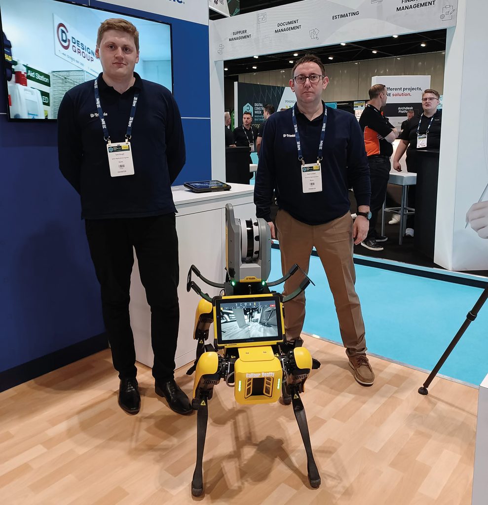
Most recently Alan has moved KOREC towards robotics, again a technology that is still in its earliest phases within the construction and survey industries. This move has seen KOREC working with major engineering contractors in the UK and Ireland as they adopt Spot the Dog, an agile robot developed by Boston Dynamics. Teamed with Trimble laser scan technology, Spot is equipped to carry out 3D laser scans, autonomously, in conditions inhospitable to a surveyor or to just carry out mundane and repetitive tasks to free up skilled engineers or surveyors to focus on other aspects of a project.
Alan has a proven ability to spot key business areas early, including niche markets that require time and investment, along with the ability to understand a customers’ specific and unique project requirements. He has placed KOREC in an advantageous position by connecting customers to the global leading software, hardware, and services technology company that is Trimble, whilst retaining local knowledge and a sense of community. This is what has enabled him to bring cutting edge technology to projects, whilst also developing bespoke software solutions that fit the bill precisely.
The KOREC mission is a simple and one that Alan adheres closely to in every decision he makes whilst also ensuring that the company reflects this overall vision.
The KOREC Mission:
When operating in the natural and built environment, consistent success demands accuracy, safety and speed, whilst reducing costs and environmental impact.
At KOREC, we believe embracing geospatial solutions will transform your outcomes and deliver that success.
KOREC’s mission is to empower you to measure, map and manage the natural and built environment.
Combining industry knowledge, with intuitive software, and world-leading positioning technology, KOREC transforms your operations bringing certainty to your decision making.
Finally, Alan has also invested a lot of time and effort in creating a KOREC culture that is both fun and rewarding to work in.

The three little words that enabled Storm Geomatics to recover its entire fleet of survey instruments within 4 hours of the theft.
Despite a break in that occurred on Saturday night at 10.30 pm, the company was fully operational on Monday morning at 7.00am thanks to CCTV, Trimble’s Sentinel Solution, a fast Police response and some hard work from the Storm team that saw all the recovered instruments checked and recalibrated over the weekend.
Whilst instrument theft continues to be a problem in our profession, it is always rewarding to hear from companies such as Storm Geomatics that thieving from premises can be reacted to quickly and effectively and that investment in technology is part of the solution.
Theft Timeline
10.30pm: CCTV monitoring the Storm premises picked up unusual activity alerting the monitoring company who called the police and Storm Geomatics Managing Director, Mike Hopkins.
10.37pm: Smoke is released in the building and the thieves leave with stolen equipment escaping through a hedge and setting off on foot across fields.
10.47pm: Mike Hopkins arrives on site along with the Police and a tracker dog which picks up a scent but cannot located the thieves. Further police attend the scene in an attempt to find the panicked thieves.
12.45am: Mike contacts Storm Operations Director Anthony Pritchard who logs into the Trimble Sentinel app to see if one of the chipped Trimble Total Stations can be tracked
12.55am: Lat/Lon reference shows the position of the stolen goods with a time stamp of 12:51am. The lat/lon is converted to a What3words reference and given to the police.
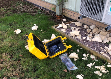
01:30am: A police dog team go straight to the equipment using the What3Words reference – it is found in a wheelbarrow in a hedge, abandoned. Four total stations, one SX10, two controllers, two R12 GNSS units, a level and other survey accessories. The yellow boxes were discarded.
2.10am: The stolen instruments are handled with gloves, placed in the back of a Landrover and returned to a safe place.
Our thanks to Polly Hopkins of Storm Geomatics for sharing this timely reminder on how instrument thieves can strike at any time. She explains, “There’s no doubt that this was a planned operation with the thieves arriving with an angle grinder to cut through the wall of the building and attempts to remove the external CCTV cameras.
“In this case, our investment in security measures has paid off 100%. The police could not have been more responsive and in a particularly busy period for us, our customers were completely unaffected – on Monday morning by 7.00am all our instruments had been checked, calibrated and ready to go.”
Protect your Equipment in the Field
Sentinel is available as an after-market add-on for Trimble S Series and C5 instruments. Its usefulness goes far beyond retrieving missing instruments. It can help you find teams in the field at any given time. It also contains a G-force sensor that sends alerts to users to check instruments for calibration errors or damage when they’ve been dropped or have endured a rough ride.

Contact us;
Call UK Sales: 0345 603 1214
Call Ireland Sales: 01 456 4702
For anything else, view our contact page.
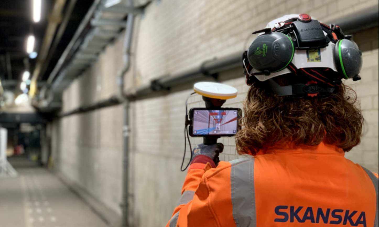
As the engineering and construction industries adopt augmented and mixed reality solutions, both the qualitative and quantative benefits are becoming apparent. Skanska share their experiences of using Trimble SiteVision at Infrastructure Projects Central (IPC) Euston, London.
Euston Station is the sixth busiest rail station in the UK and pre covid it was the departure and arrival point for over 44 million people each year. Plans are currently underway to transform the area into a modern transport hub and to construct the new High Speed 2 (HS2) terminal. These improvements will increase passenger capacity whilst improving journeys through a redeveloped terminus and new high-speed platforms.
IPC Euston is a multi-disciplinary, logistics and building works scheme designated to be carried out by Skanska (under the Network Rail Infrastructure Projects Central framework (IPC)), to enable HS2 construction.The construction project is already underway with the Skanska Engineering Survey team being on site since 2018.
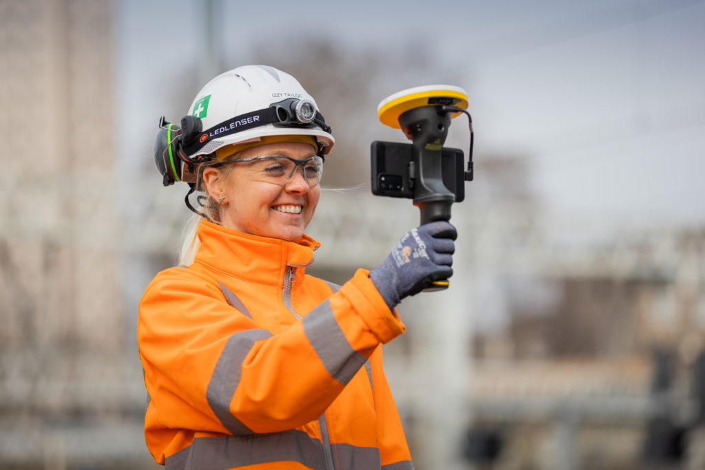
Over the last eighteen months, the engineering survey team has incorporated augmented reality (AR) into their workflow and in particular, the KOREC supplied Trimble SiteVision technology. Having had extensive SiteVision and AR experience on the A14 Road Improvement Scheme, the team has adapted the workflow to suit the indoor environment at IPC Euston.
About Trimble SiteVision
Trimble SiteVision works by fusing cutting-edge augmented reality technology with Trimble Catalyst centimetre-precision GPS, to bring 3D design models off the screen and onto site. The end result is a system that allows you to take your design models into the field and visualise them in 3D, all to a 50mm accuracy.
Underground at IPC Euston – bringing the benefits inside
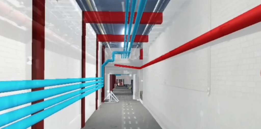
At IPC Euston, Skanska are using the Trimble SiteVision system to visualise future design, verify as-builts and plan works for feasibility and buildability in applications that are predominantly underground.
Whereas before the GNSS function was used to position new design and to view existing utilities below the ground, at Euston, Skanska Engineering Surveyors Alison Small and Izzy Taylor have found a solution using the Trimble SiteVision indoors where GNSS is unavailable. Instead of automatically placing the 3D model out on site, the manual placement function is used to view 3D models for as-built purposes and viewing future design to check for clashes.
Real-time decision cuts costs by two thirds and reduces work by four months
In particular, Trimble SiteVision was used to visualise a new pipework route in the station’s basement. The ease with which the new route could be visualised ensured a far more efficient approach to decision making between clients, designers and stakeholders, with solutions being reached in real-time. For example, the team had received an initial design with a figure for enabling costs. The Skanska MEP team proposed an alternative route at at one third of these costs that also reduced the programme by four months.
Showing design data overlaid directly onto the real world
The Skanska Engineering Survey team and the BIM team assisted in presenting the new route to the client and stakeholders using the SiteVision system. A physical site walk was conducted with the AR technology by half of the team whilst the remaining team members joined via Microsoft Teams.
SiteVision provided the evidence required to enable the client and its stakeholders to accept the proposal at the same meeting. This saved two thirds of the costs and reduced the programme by four months.
“Watching it in real time is great. One of the best things I noted was that people involved didn’t comment about the technology they just asked questions straight away about clashes that could be seen.”
– David Edwards, Senior Design Manager
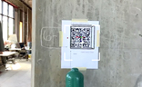
Connect AR allows you to position AR models on your job site with QR markers
Release of Trimble Connect AR for higher accuracy placement of models indoors/underground
Trimble has just released Connect AR, an augmented reality app that gives building construction workers even greater accessibility to 3D models in the field. The app runs on Android and iOS tablets as well as smartphones and integrates with Trimble Connect (cloud-based integration and comms platform) and the Trimble Mixed-Reality portfolio, including SiteVision.
Skanska is currently trialling a Connect AR license and will find some key benefits. For example, for users of Trimble SiteVision indoors or underground, such as Skanska, it is now easier and faster to position the model in the real world. A network of QR code markers are generated in Trimble Connect which can be placed around the jobsite using either a Trimble Robotic Total Station or a manual method. This increases accuracy for the comparison of as-built construction to the digital design.
Connect AR also allows you to use the LiDAR scanner integrated in Apple devices to measure distances and areas between real and virtual objects which can provide valuable information to supplement issue reports or estimates.
Our thanks to Skanska Engineering Surveyor, Alison Small for supplying the images and information
We catch up with Jeremy Murfitt, Owner of Everything is Somewhere, long time Esri user and an early adopter of Trimble Catalyst.
For many, Trimble Catalyst, our on-demand, low-cost subscription based GNSS, may be a relatively new concept, but the release of the DA2 receiver at the end of 2021 actually marked over three years of the technology. Back in 2019, one of Catalyst’s earliest adopters in the UK was Jeremy Murfitt Owner/Director of Everything is Somewhere Ltd (EiS). Jeremy has been doing a great job sharing details of his projects on Twitter, so much so, that we decided to follow up on one of his recent tweets to find out exactly why “Trimble Catalyst made the job easy”.
Based in Leicestershire, EiS is a consultancy practice specialising in a range of professional services on property and town & country planning matters.
The nature of these projects means that Jeremy offers a range of services including UAV surveys and field data collection both supplemented by his extensive GIS experience for understanding and analysing location and spatial data in various sectors.
For the field data capture and GIS work, Jeremy uses Esri software (KOREC is an Esri Silver partner) including Esri Field Maps on a Trimble TDC600 logger with Trimble Catalyst (cm accuracy subscription), Esri ArcGIS Pro and Esri ArcGIS Online.
A perfect combination – Trimble Catalyst, TDC600 and Esri Field Maps
Although already aware of KOREC and Trimble, Jeremy’s first view of Catalyst was at the Geo Business show in 2018 when he was searching for a more efficient and cost-effective method to capture cm positions rather than go through the obvious routes of the purchase or hire of a survey grade GNSS. As someone who required high accuracy positions as a part of his existing workflow rather than as his day in, day out work, Catalyst was an attractive proposition to Jeremy with its low capital outlay (around £300 for the DA1 receiver as opposed to around £8,000+ for a survey grade GNSS system), its ease of use and its fast set up.
Jeremy found it extremely easy to set up with his Field Maps software on the TDC600 logger and reports that it’s also incredibly fast to initialise in the field.
Can we swap?
Jeremy is using Catalyst for a number of applications including basic setting-out of new landscapes, and the recording of points for tree positions and utilities etc. However, his primary use is as a tool for establishing ground control points for the many drone surveys he undertakes. He reports that the 2cm accuracy he needs for flight heights of around 50-60m takes just a couple of minutes to achieve and that using Catalyst and Esri Field Maps he can establish the 5-10 GCPs, with two or three control points for each GCP, in just one hour if he’s walking at a good pace!
Whilst Jeremy particularly rates the system’s reliability and the fact that it hasn’t failed once since he purchased it, he says that its light weight and portability are particularly useful and that he can put the entire kit into his drone backback, something he particularly values when he can be walking around a mile to a site.
Meeting a land surveyor on one particular site who was fully equipped with a heavy tablet and full GNSS system, the surveyor was amazed to find that Jeremy’s system could achieve exactly the same results as his own. His response, “Can we swap?”
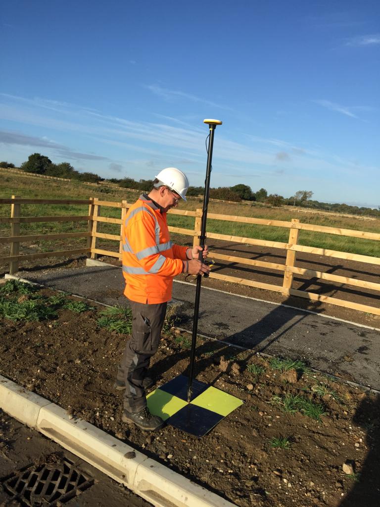
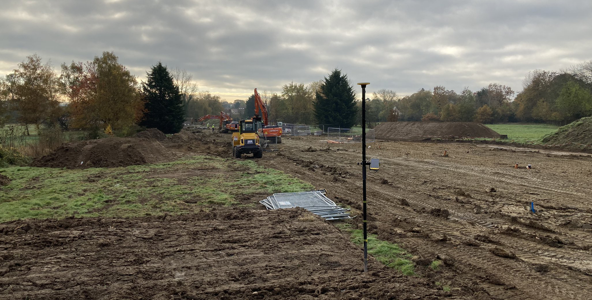
On site with Trimble Catalyst, the TDC600 logger and Esri Field Maps setting out Ground Control Points for a drone survey
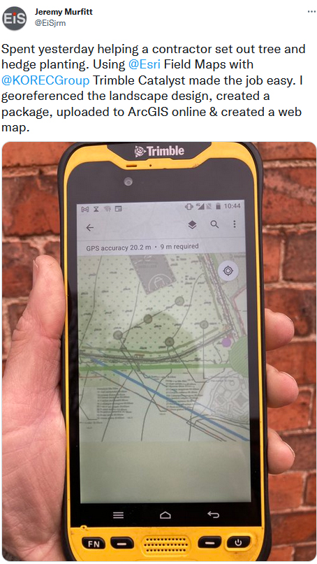
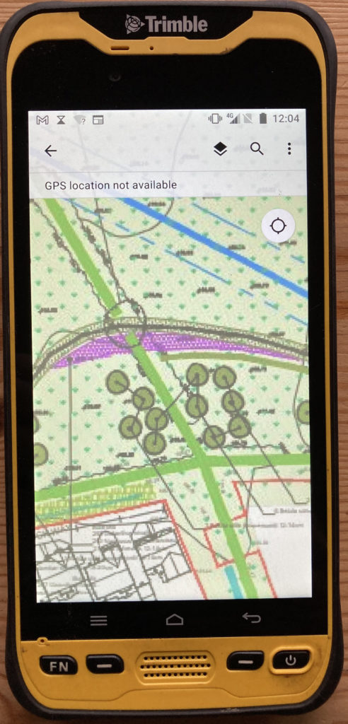
Setting out trees and hedgerows with Esri and Trimble Catalyst
On a recent job, Jeremy used his Catalyst, TDC600 and Esri software to assist with the setting out of around 150 trees and 500m of hedges as part of a new development in Leicestershire. Jeremy’s usual workflow has been to use point and line data provided by the landscape architect in CAD format which is easy to map and upload to ArcGIS Online and then use with Trimble Catalyst. However, the downside of this method is a loss of context and the detail that is shown on the large (A1/0) pdf drawings. Instead, Jeremy uses the original PDF’s, georeferences them and then uploads these to the Trimble TDC600 to use with Catalyst which he find particularly beneficial when in the field. A straightforward workflow that works well for this application, it took around 30 minutes to set up but saved a lot of time in the field:
- Convert pdf’s to tiffs/jpegs
- Import into Esri ArcGIS Pro and georeferenced
- In ArcGIS Pro “share” the images as a Webmap. You need to go to configuration and properties and check that the tiling scheme goes right down to level 23.
- Review the data in ArcGIS Online
- On your mobile device connect with Trimble Catalyst to get the required GPS accuracy
- Open the WebMap in Field Maps to set out the features.
Jeremy concludes, “I’ve been using Trimble Catalyst for over two years now and it makes capturing x/y/z data so easy plus it’s been 100% reliable. In short, it just works.”
Our thanks to Jeremy Murfitt, Owner/Director of Everything is Somewhere Ltd, for supplying the information for this article.
You can read a Trimble Catalyst business case here.
Download the PDF of this case study here
Visit our webinar section here for the full details on the new Catalyst system.