IO Geomatics combines over 27 years of topographical expertise with an extensive survey portfolio that allows them to apply the most effective methodologies for each site’s specific challenges. A recent example is their complex survey of Wexford Bridge, a critical regional crossing connecting Wexford to Ferrybank.
IO Geomatics combines over 27 years of topographical expertise with an extensive survey portfolio that allows them to apply the most effective methodologies for each site’s specific challenges. A recent example is their complex survey of Wexford Bridge, a critical regional crossing connecting Wexford to Ferrybank.
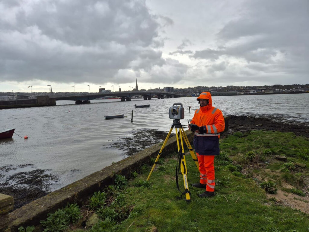
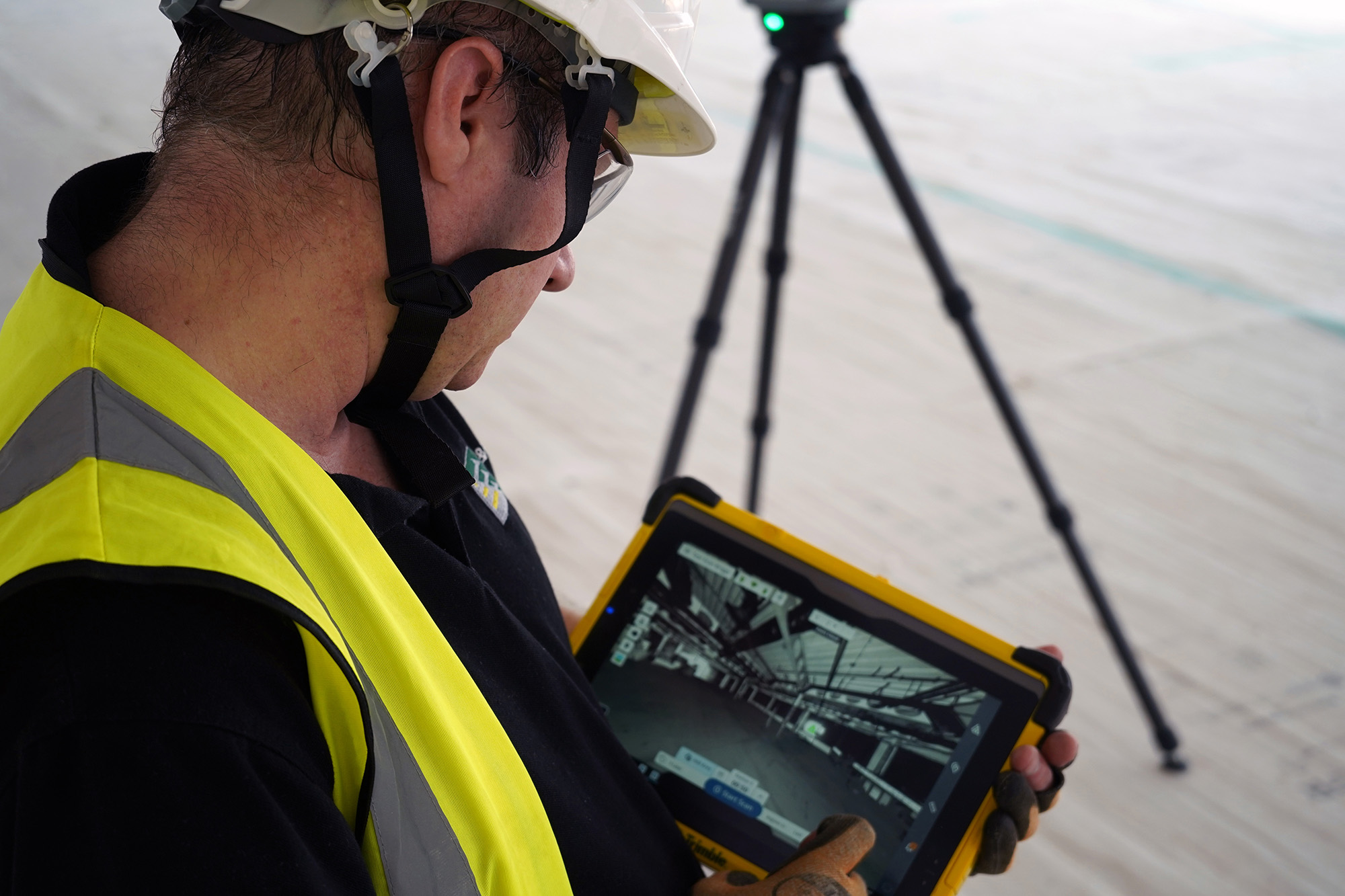
The Trimble SX10 Scanning Total Station was the project’s stand out instrument
About Wexford Bridge
Carrying the R741 road from Wexford towards Dublin and the north, Wexford Bridge has been rebuilt three times, most recently in 1997 after the structure suffered severe corrosion. Today it comprises seven spans across a total length of 590 metres, of which 380 metres cross open water.
The bridge’s composite concrete slab and steel girder deck is supported longitudinally by six pairs of twin concrete columns, carrying heavy vehicle, pedestrian and cyclist traffic. With critical remediation and maintenance works now required, IO Geomatics was contracted by Wexford County Council to deliver a comprehensive 3D topographical and hydrographic survey to inform the design process.
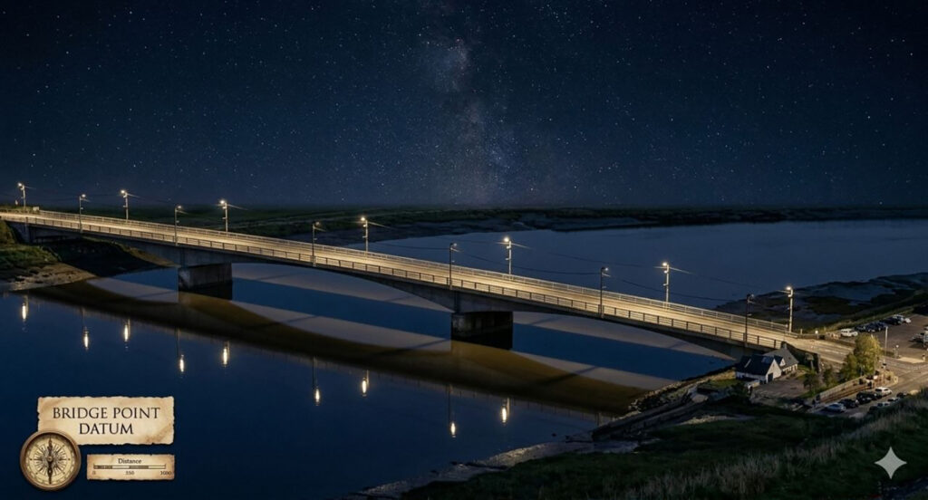
Wexford Bridge by night
Site specific challenges
For IO Geomatics Lead Geospatial Surveyor Nik Shakun, this is exactly the type of project that plays to his strengths.
Nik’s role sees him maintain complete control and visibility across every stage of a job from initial concept through to final delivery. This enables him to draw on IO Geomatics’ extensive toolkit of advanced equipment, software and proven workflows and carefully select and deploy the optimal methodologies to deliver accurate, efficient, and reliable results. This end-to-end approach ensures nothing is left to chance providing the professionalism and precision their clients require:
“When I’m faced with a complex or unconventional project, my first priority isn’t just the data – it’s the strategy. The goal is always to deliver a high-precision result while ensuring the safety of both the team and our high-value equipment.”
The Wexford Bridge project presented Nik with a number of considerations:
A dynamic marine environment – the team would need to work with heavy tidal variations, occasional large waves and unpredictable coastal wind conditions.
Complex structural geometry – remote data capture was needed to safely model the underside of the structure (superstructure cross-sections, pier/abutment geometry and riverbed levels).
High-detail asset auditing – requirement to capture detailed parameters of the heavy steel parapets and accurately map structural defects (e.g. spalled concrete on the bridge soffit) to a structural accuracy of ±10 mm.
Live traffic constraints – ruling out prolonged closures or disruptive ground-based survey methods.
Nik’s strategy would include 85% usage of KOREC supplied technology allowing him to successfully combine several complementary survey methods, each covering a particular aspect of the project.
Mapping the riverbed topography and obtaining watercourse inverts
Control network setup
To meet strict client compliance, the IO Geomatics team established a robust local control network.
Horizontal framework: A network of at least six primary control points was tied directly into the Ordnance Survey of Ireland (OSi) Active Network, supplemented by at least six secondary control points. The Trimble R12 GNSS was used for first control then refined to survey grade with the Trimble SX10 Scanning Total Station. Due to distance from the bank this could be up to 200m and therefore control was prepared from each bank.
Coordination & Transformation: Network baselines were adjusted using a rigorous Least Squares adjustment in the Irish Transverse Mercator (ITM) coordinate system. Final coordinates were mathematically transformed into the Irish National Grid (ING).
Vertical Control: All elevation data was referenced to the Malin Head Vertical Datum.
A targeted approach with a multi-sensor workflow
Terrestrial laser scanning
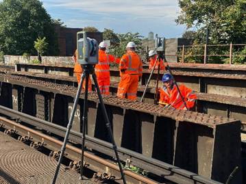
With the control network coordinates locked in to eliminate blind spots across the 380m span, the SX10 was then used to scan the bridge (deck, columns, girders, underside) and every point in that scan was automatically tied to the same real-world coordinate system as the control points. This was done through high-density polygon scans from four distinct setups on each riverbank.
GNSS
A Trimble R12 was used to establish first control and carry out soft surveys
Mobile Mapping
Used to map along the R741 corridor, rapidly capturing the paved driving surface, footways and channel lines without closing lanes.
Hydrographic and Bathymetric Sonar
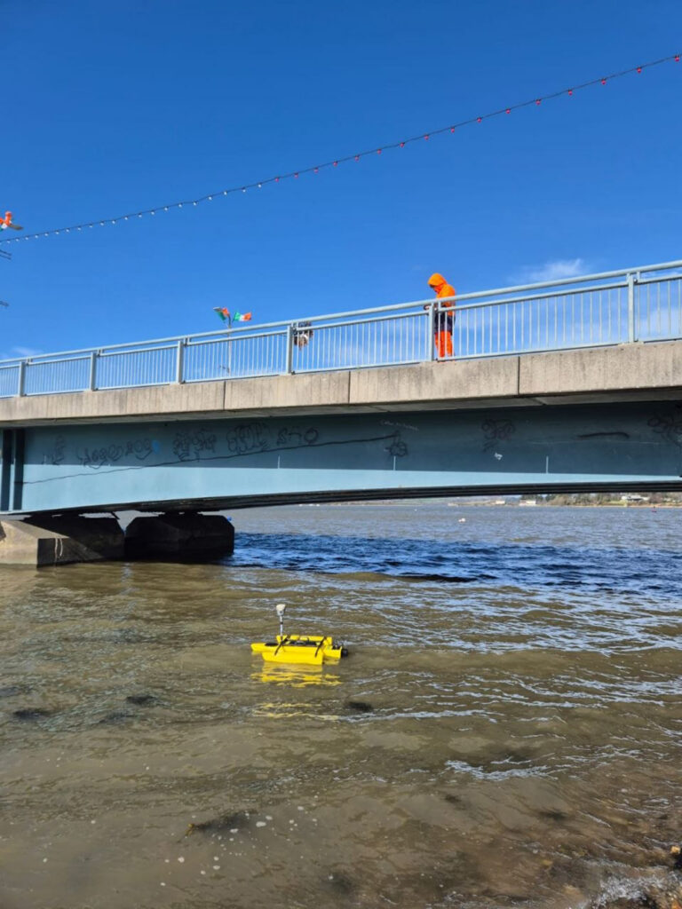
A KOREC supplied automated Seafloor Systems TriDrone hydrographic survey boat was used to systematically map the riverbed topography and obtain watercourse inverts around the six twin concrete piers despite high-flow conditions.
DJI Matrice 350 RTK drone
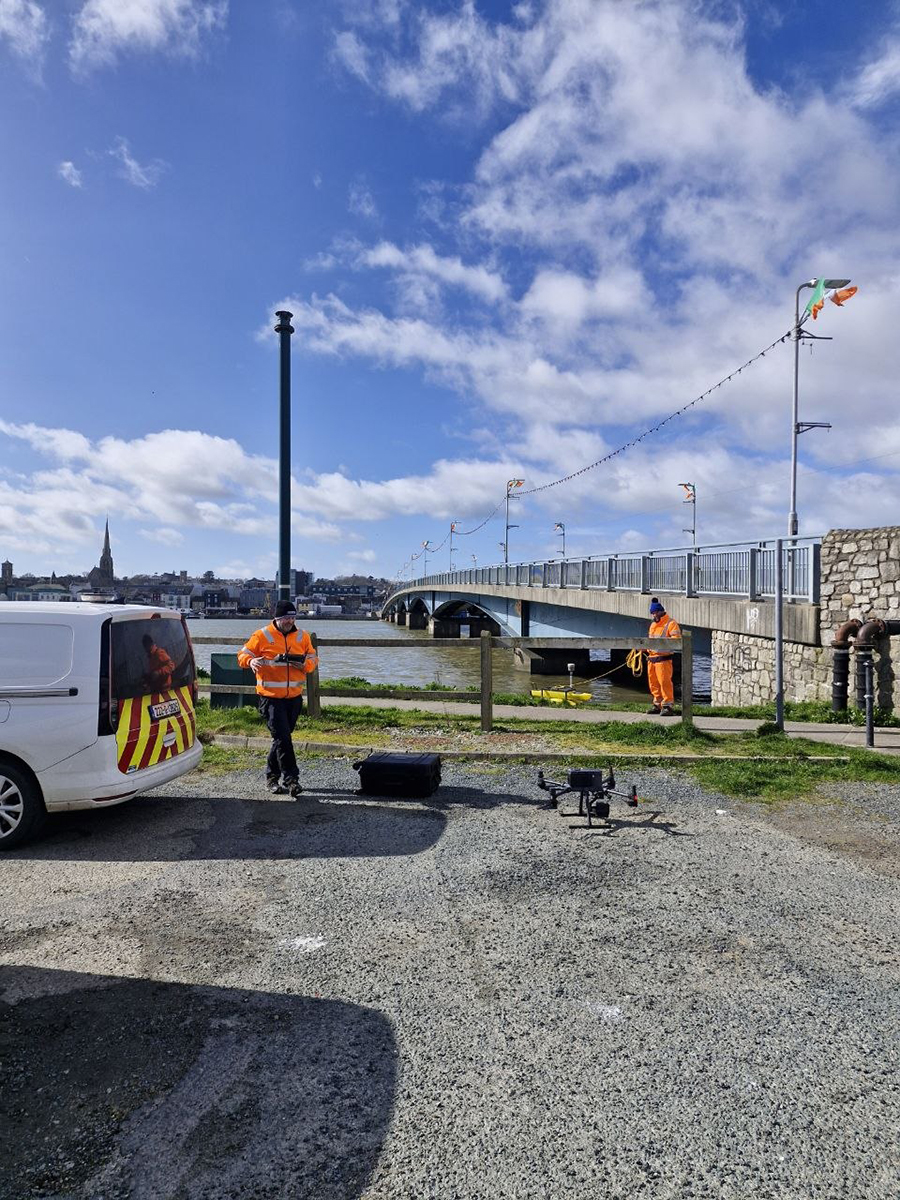
Deployed to capture dense, high-resolution aerial photogrammetry. This enabled the team to fill in critical blind spots and occluded areas on top of the high structures and heavy steel parapet rails that were inaccessible from ground level.
Processing
The aerial drone sets were processed in DJI Terra whilst the terrestrial scans, sonar swaths and GNSS control data were combined in Trimble Business Center (TBC) office processing software.
The final point cloud was processed in TBC with Nik stating that several of the software’s features were particularly useful including TBC’s ability to display coloured points, matching scan points to colour from the panorama image. This turns a raw geometric point cloud into a true-to-life 3D ‘photograph’.
Nik also noted the option to toggle between true colour (as the eye would naturally see) and high-intensity colour, which helped reveal fine details such as manholes, edges and kerb lines.
Finally, Nik emphasised that TBC’s box selection tool allows users to isolate specific regions of the point cloud. This creates lighter datasets, delivers faster performance and enables the team to focus on individual structural elements one at a time.
Stand out instrument – Trimble SX10 Scanning Total Station
On this complex project the SX10 was the link between the GPS-established control on land and the detailed 3D scan data needed across and underneath the structure giving the whole survey one consistent, accurate coordinate system from bank to bank.“The SX10 was an amazing solution for the project. Its ability to vary point cloud density across a scan was extremely useful. We could frame small areas (using polygons, rectangles, or bands) even at distances of 100–200m and assign higher densities only where needed.”
Deliverables
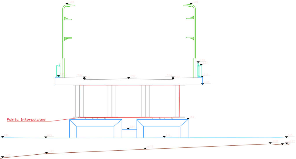
The deliverable was prepared 1:500 scale 2D and 3D cartographic mapping, cross-sections through each deck and riverbed surfaces. Spot levels on hard paved surfaces and riverbed inverts were compiled at nominal 10-meter intervals, and river water levels were mapped at 20-meter intervals tagged with the exact survey dates.
Ares Commander was used to format final structural profiles, detailed plans and CAD deliverables fully aligned to the ITM/Malin Head datum.
Cross section of the bridge survey
What was achieved
Following the completion of this successful project, Nik is quick to highlight the Trimble SX10 Scanning Total Station as the standout piece of equipment:
“Deploying instruments like the R12 GNSS receivers, TSC5 and TSC7 Controllers alongside our SX10 Scanning Total Station and X7 3D Laser Scanner, allows us to solve complex daily challenges on-site with absolute precision and seamless data integration. On this project, the SX10 was undoubtedly the standout performer.”
Strict accuracy compliance: Achieved planimetric and vertical survey tolerances of ±0.005m on the carriageway and hard-engineered elements, safely satisfying the client’s stringent 1:500 accuracy tolerances.
Uninterrupted corridor flow: By combining long-range bank-to-bank scanning with mobile mapping, there was no need for disruptive road closures or traffic management along the active R741, ensuring zero impact on daily vehicular and pedestrian traffic.
Subsurface to air data continuity: The multi-sensor combination successfully bridged the data gap between the underwater riverbed bathymetry, the tidal concrete columns, the road deck and the upper structural parapets.
Enhanced safety margin: Remote data gathering completely eliminated the risk of placing field engineers adjacent to live regional traffic or in direct contact with unpredictable tidal river currents.
Nik concludes:
“Our Trimble fleet is a core part of our technical arsenal and used on about 85% of this unique job. KOREC are extremely professional and if we run into any issues in the field, they’re solved very quickly. A big thank you to the whole team.”
Transforming MEP delivery with the Trimble X9 3D Laser Scanner
Transforming MEP delivery with the Trimble X9 3D Laser Scanner - the recent acquisition of this laser scanner represents the company’s commitment to working smarter, empowering its people and delivering...
How WM Ironwork’s use of Tekla Structures led them to introduce the Trimble X9 3D laser scanner into their workflow, increasing their abilities tenfold by significantly reducing rework and improving...