Low Cost GNSS Receiver Applications: Where They Excel
Explore the applications where affordable GNSS receivers like the Trimble Catalyst DA2 genuinely excel, and where their limitations are worth understanding before you commit.


Explore the applications where affordable GNSS receivers like the Trimble Catalyst DA2 genuinely excel, and where their limitations are worth understanding before you commit.
Centimetre-accurate positioning was once the exclusive domain of specialist survey teams with expensive dedicated equipment. That has changed significantly. A new generation of affordable GNSS systems, most notably positioning-as-a-service platforms such as the Trimble Catalyst DA2, available from KOREC at around £300 for the hardware with a pay-as-you-go subscription, has placed high-accuracy positioning within reach of a much broader range of professionals. The question is not whether these systems are capable, they demonstrably are, but whether they are the right tool for a given application. This guide works through the key use cases where low cost GNSS receivers genuinely excel, and is honest about where they fall short. For a practical introduction to GNSS setup and positioning modes, see our GNSS receiver setup guide.
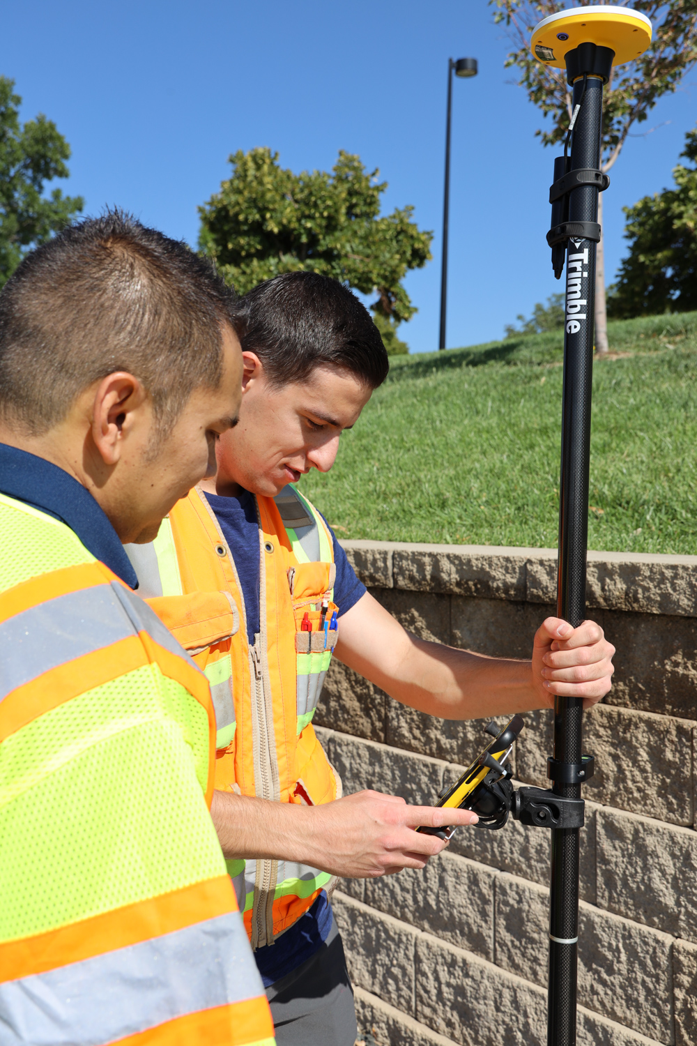
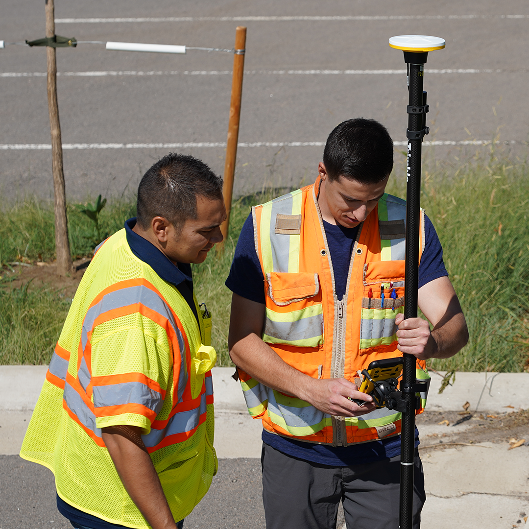
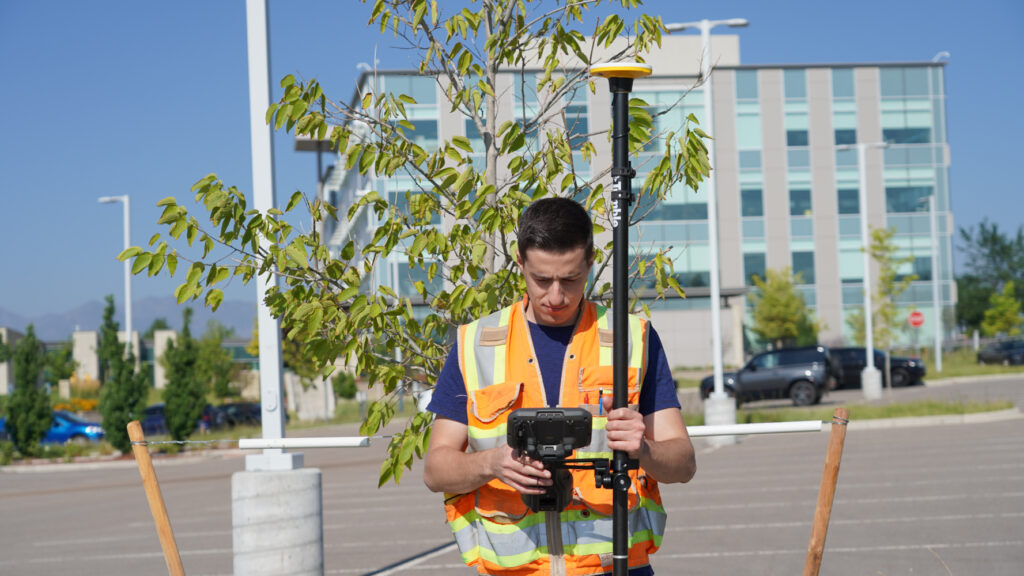
The Trimble Catalyst DA2 is the clearest example of what modern affordable GNSS looks like. The hardware connects wirelessly to an Android or iOS device and draws on Trimble’s Z-Blade GNSS engine, with subscriptions available at accuracy tiers from 60 cm down to 1 cm RTK quality. A user capturing four or five centimetre-accurate positions on a site visit, four times a month, might spend around £480 per year in total running costs compared to over £1,200 in annual correction service charges alone for a dedicated survey-grade system. For professionals who need precision positions as a supporting part of their work rather than their primary daily activity, that value proposition is compelling. The Trimble R580 occupies a different but related space: a fully integrated survey rover at a more accessible price point than flagship systems, suited to teams that need survey-grade performance every day but with tighter budget constraints than those using the Trimble R980 or R780.
Environmental consultants, ecologists, and conservation organisations are among the most natural users of low cost GNSS. The work typically involves recording the positions of sample points, habitat features, species observations, or monitoring stations across a project area. The accuracy requirements are generally sub-metre to low centimetre, the number of positions captured per visit is modest, and the primary output is a georeferenced dataset for GIS analysis rather than a precision survey deliverable. A scientist who needs to know exactly where a soil sample was collected, or a conservation officer recording the extent of an invasive species, has very different requirements from a land surveyor, and a low cost receiver meets them at a fraction of the ongoing cost. The Trimble Catalyst DA2 connects directly to Esri FieldMaps, making it a natural fit for teams already working in an ArcGIS environment for mapping and GIS workflows.
Precision agriculture has driven significant demand for affordable positioning. Field boundary mapping, soil sampling point location, yield monitoring, and the recording of drainage and irrigation infrastructure all benefit from centimetre to decimetre accuracy without requiring the continuous high-accuracy positioning that full survey-grade systems are optimised for. A soil sampling contractor taking fifty points across a large farm in a day needs accurate, repeatable positions, but does not need the robustness, processing power, or warranty terms of a flagship GNSS rover. Low cost receivers also make it practical to equip multiple field operatives simultaneously, since deploying ten Trimble Catalyst DA2 receivers costs far less than deploying a single survey-grade system per person.
Archaeological fieldwork involves recording the positions of features, contexts, and finds as they are uncovered, often across sites where speed of documentation is important and survey-grade precision, while desirable, is not always the binding accuracy requirement. A low cost GNSS connected to a suitable field data collection app can deliver position data to the 1 to 2 cm level, sufficient for most site plans, artefact location recording, and excavation grid establishment. For heritage organisations and research institutions with limited equipment budgets, the ability to equip field teams with accurate positioning without significant capital outlay is a practical advantage. Where the site requires formal survey-grade control, a dedicated receiver can establish that framework while low cost systems handle the bulk of feature recording.
Utility companies and infrastructure operators routinely need to record the positions of assets: valves, manholes, cable joints, inspection chambers, and service entry points. Most of these applications require accuracy in the sub-metre to 10 cm range, and the primary concern is capturing a comprehensive, consistent spatial record rather than achieving the millimetre-level accuracy that engineering control surveys demand. Equipping field operatives, maintenance teams, and inspection crews with low cost receivers tied to a data capture app is a practical way of building and maintaining an accurate asset register without the cost of deploying survey professionals for every recording task. For preliminary site surveys and maintenance route planning in construction and infrastructure contexts, the same logic applies.
Ground control points (GCPs) for drone surveys need to be accurately positioned, but not all drone applications require full survey-grade GCP accuracy. For inspection flights, progress photography, and applications where the primary output is visual rather than a geometrically precise surface model, GCPs established with a low cost RTK receiver are often adequate. A drone operator who needs four or five reliably positioned GCPs per project, captured quickly and without a second operator, will find a system like the Trimble Catalyst DA2 fits that workflow well. For survey-grade photogrammetric outputs where GCP accuracy directly determines deliverable quality, a full RTK rover remains the appropriate tool. See our UAV 3D mapping guide for more detail on GCP requirements at different accuracy levels.
Universities, colleges, and training organisations increasingly use GNSS as part of surveying, geography, and environmental science curricula. Providing students with hands-on access to precision positioning has historically been constrained by equipment cost. Low cost receivers make it practical to equip entire student cohorts with devices that deliver real accuracy, allowing practical field projects to be conducted at a meaningful scale. Students who develop familiarity with GNSS concepts using affordable equipment are also better prepared to transition to professional survey-grade systems when they enter industry.
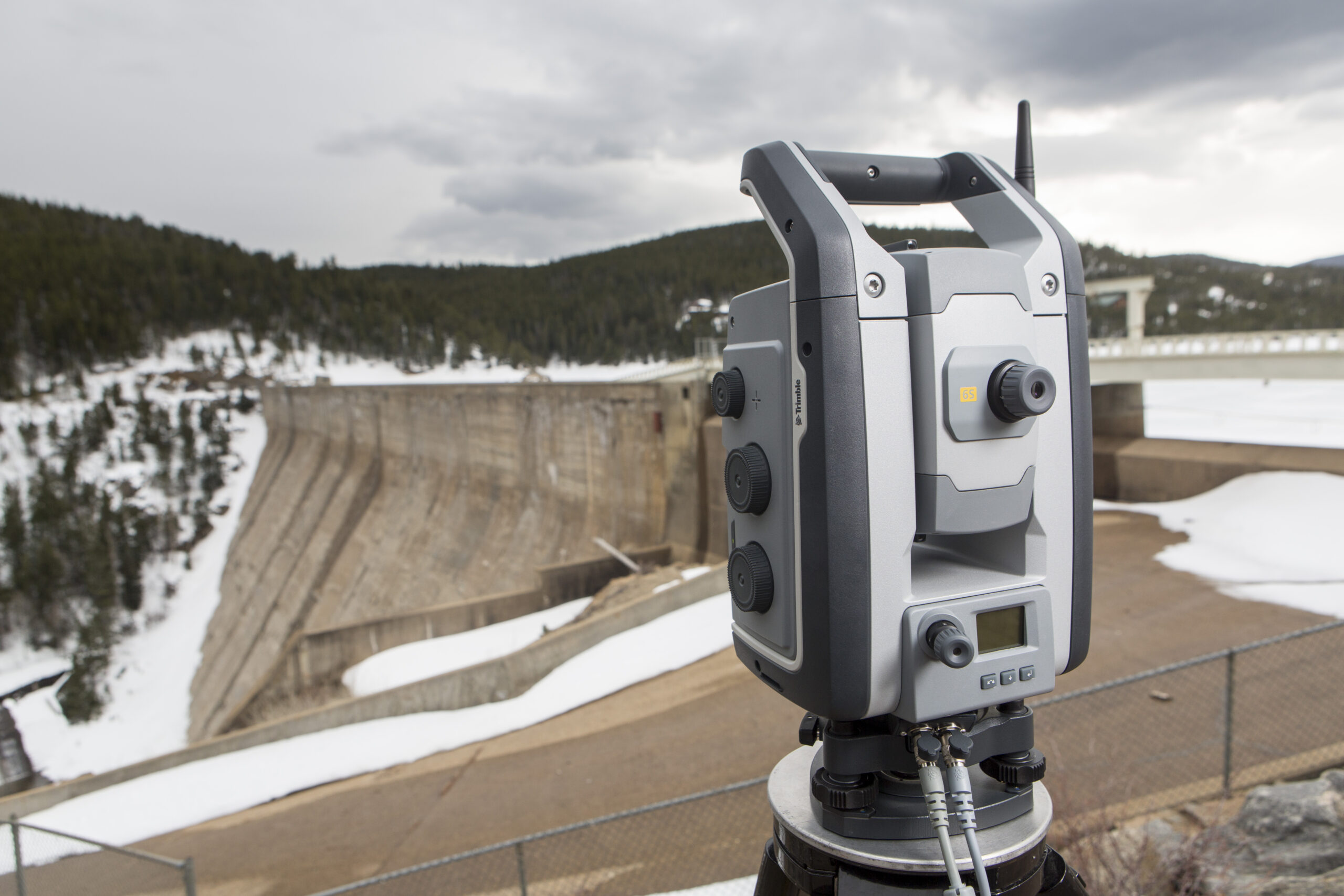
Honest assessment of the limitations matters as much as understanding the strengths. Legal boundary surveys, cadastral applications, and any work with formal accuracy requirements set by statute or professional standards need verified survey-grade performance with traceable accuracy documentation. High-precision engineering control, structural monitoring, and safety-critical infrastructure surveys require the robustness, specification, and quality assurance that dedicated survey receivers provide. The distinction is not primarily about the accuracy numbers achievable by modern low cost systems in ideal conditions: it is about the consistency of performance across all conditions, the quality reporting, the support, and the professional accountability that come with dedicated survey-grade equipment. For these applications, the full KOREC GNSS range, including the Trimble R580, R780, and R980, provides the appropriate tool. The investment in a dedicated system is justified when precision positioning is a daily professional requirement, not an occasional supporting task.
The accuracy tier selected for the subscription should match the application: paying for 1 cm corrections when 10 cm is adequate wastes subscription time; using 10 cm corrections for GCP capture when the drone survey requires higher accuracy undermines the whole dataset. Connecting to a reliable correction service matters, and the Trimble Catalyst DA2 supports Trimble CenterPoint RTX corrections via satellite for locations where mobile internet is not available. Standard GNSS best practice applies regardless of the equipment tier: avoid dense canopy and tall obstructions, confirm the coordinate system matches the project requirement, and always capture a few check points against known positions to verify that results are within the expected accuracy range. For a thorough grounding in GNSS setup principles that apply across all receiver types, our GNSS receiver setup guide covers positioning modes, correction services, and quality checking in detail.
To explore the full range of GNSS systems available from KOREC, including the Trimble Catalyst DA2 and dedicated survey rovers, or to discuss which option best suits your application, speak to our team. We support professionals across surveying, mapping and GIS, and construction.
KOREC can advise you on the right GNSS system for your project. Speak to our friendly experts today to get the right technology to solve your business challenges.