Why Do Pre-Construction Surveys Matter?
Find out why a pre-construction survey is essential before any project begins, what it should include, and how accurate site data reduces design errors, rework, and costly surprises during construction.


Find out why a pre-construction survey is essential before any project begins, what it should include, and how accurate site data reduces design errors, rework, and costly surprises during construction.
Whether you’re building a housing development, commercial premises or major infrastructure, every successful project starts with an accurate understanding of the site. A pre-construction survey provides the reliable information architects, engineers and contractors need before design work begins, ensuring decisions are based on the site’s true existing conditions rather than assumptions.
This guide explains what a pre-construction survey includes, how it is carried out and why investing in accurate survey data at the start of a project can save significant time and money later.
One of the most common causes of project delays is discovering site constraints after construction has already started.
Ground levels may differ from historical surveys, boundaries may have changed, or underground services may be located directly beneath proposed foundations. Discovering these issues during design is relatively inexpensive. Discovering them once construction is underway often results in redesigns, delays, contractual disputes and expensive remedial work.
An accurate pre-construction survey provides the information needed to identify these issues before they become problems.
Industry studies consistently show that design errors account for a significant proportion of construction rework.
Providing designers with accurate survey information from the outset allows informed decisions to be made during the design phase, reducing the likelihood of changes once work has begun.
Ultimately, good survey data reduces risk throughout the project lifecycle.
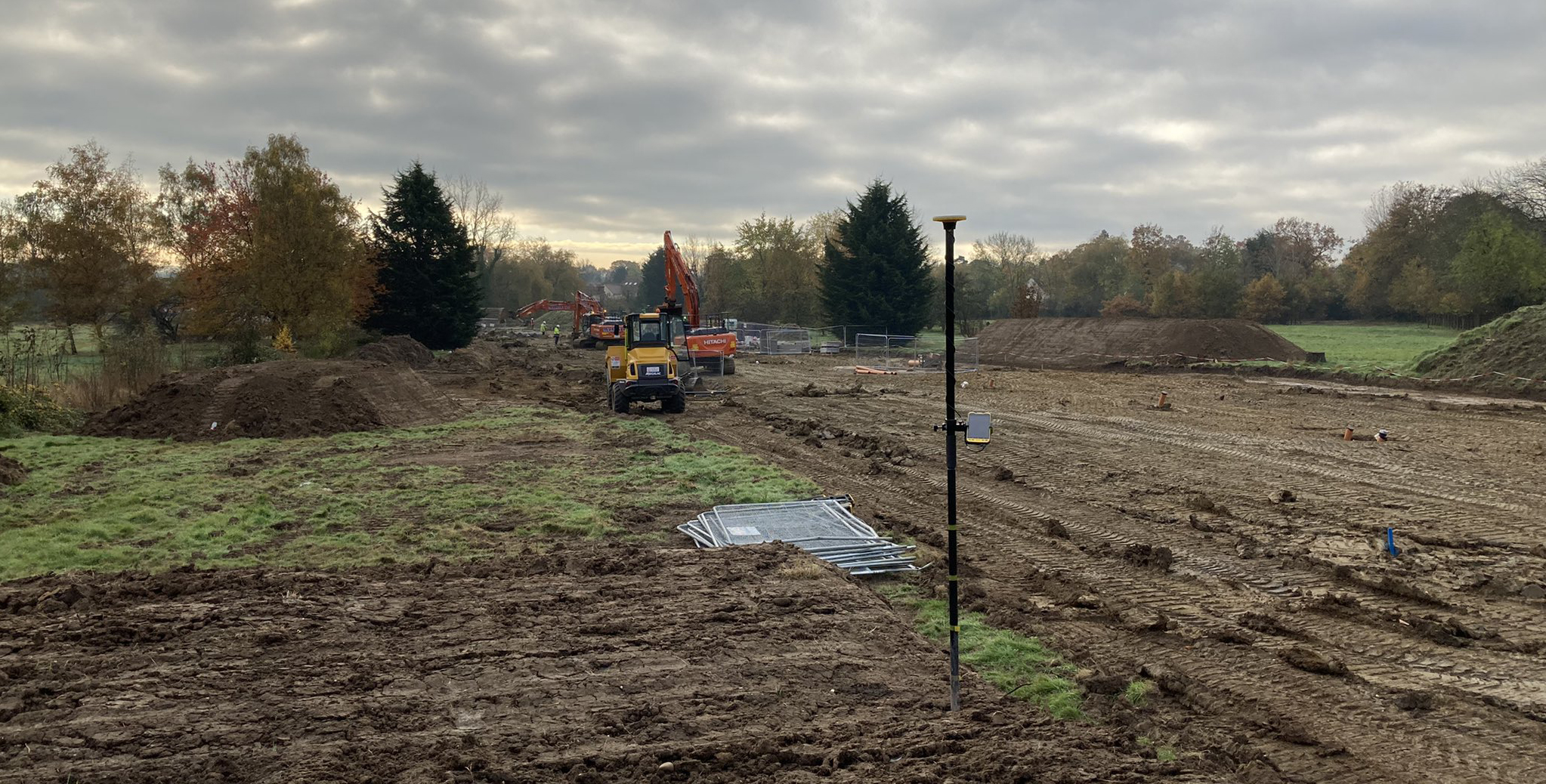
A topographic survey records the true existing condition of the site, including ground levels, buildings, kerb lines, vegetation, drainage features, utilities, boundaries and other visible infrastructure.
This information provides architects and engineers with a reliable base for design, helping ensure proposals reflect the site as it exists.
Where existing buildings are involved, a measured building survey captures their true geometry, dimensions and structural layout.
Original construction drawings are often outdated or inaccurate following years of alterations and refurbishment. Measuring the building in its current condition ensures new works integrate correctly with the existing structure.
Locating underground utilities before excavation begins is essential.
Modern utility surveys combine electromagnetic locating equipment with Ground Penetrating Radar (GPR) to detect and map buried services, often including estimated depths where survey conditions allow.
Understanding the position of buried assets before construction reduces the risk of utility strikes, improves site safety and helps prevent costly project delays.

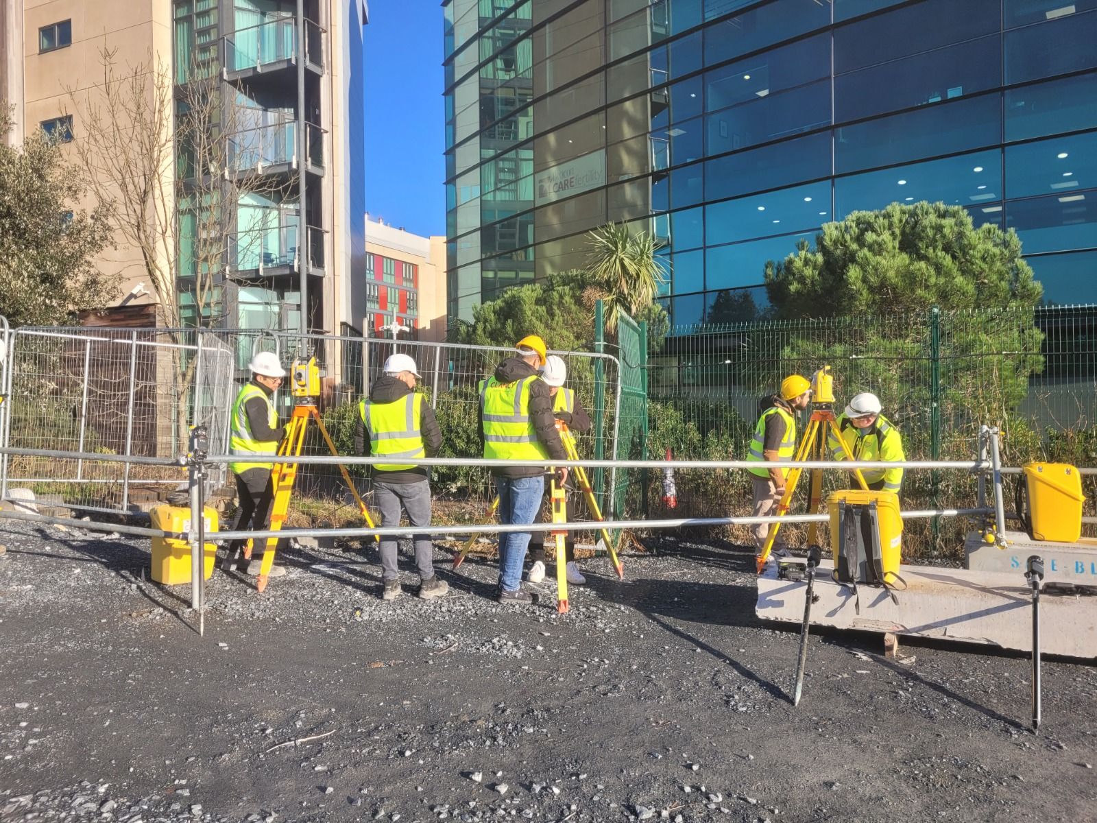
Today’s surveyors use a combination of technologies depending on the project requirements.
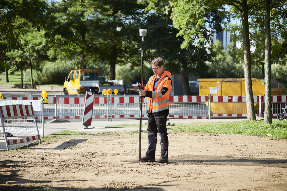
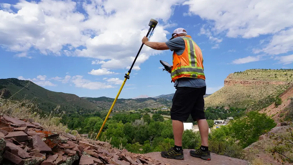
GNSS receivers rapidly establish site control and capture large areas of topographic detail on open sites.
Robotic total stations provide the millimetre-level accuracy required for detailed topographic surveys, boundary definition and work close to buildings or other obstructions where GNSS performance may be reduced.
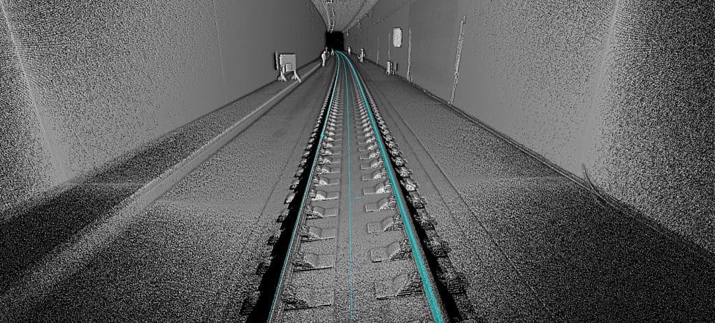
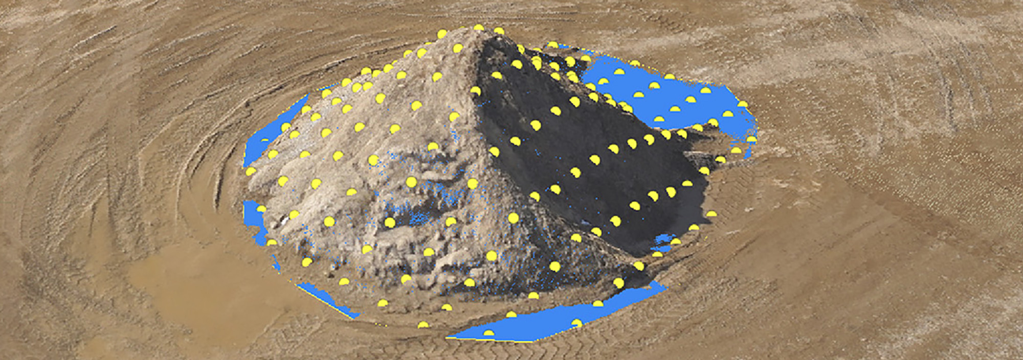
Laser scanners capture millions of survey points in a matter of minutes, creating highly detailed point clouds of buildings, structures and complex environments.
This technology is particularly valuable where comprehensive existing-condition information is required or where future modelling and clash detection are anticipated.

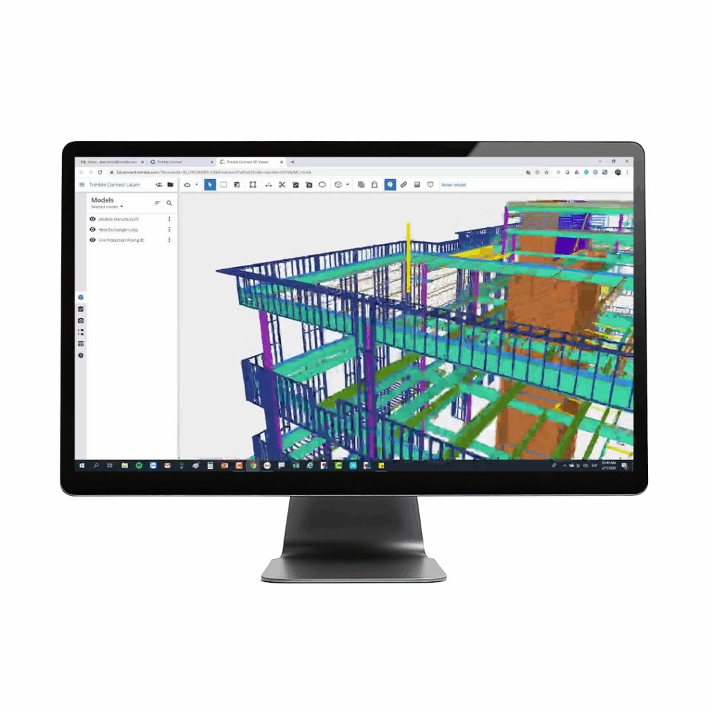
Collecting accurate survey data is only part of the process.
Modern software such as Trimble Business Center processes field observations into coordinated CAD drawings, digital terrain models, BIM deliverables and point clouds that can be used immediately by architects, engineers and contractors.
Using connected workflows through platforms such as Trimble Connect also allows project teams to collaborate from a single source of accurate survey information, reducing duplication and helping ensure everyone is working from the latest data.
Ideally, a survey should be completed before any detailed design work begins.
Early access to accurate survey information enables designers to make informed decisions from the outset, reducing design revisions and improving the quality of planning applications.
Delaying the survey until designs are already underway often results in unnecessary redesign work when site conditions differ from initial assumptions.
Every project is different.
Discussing your requirements with both your design team and surveyor before work begins ensures the survey scope captures the information most relevant to the project.
An experienced surveyor can also recommend the most appropriate combination of technologies depending on the size, complexity and objectives of the site.
The exact scope depends on the project, but typically includes a topographic survey, measured building survey (where required), utility mapping and supporting control information used throughout the construction process.
Smaller sites can often be surveyed in a single day, while larger or more complex developments may require several days of fieldwork followed by office processing. The overall programme depends on site size, required deliverables and project complexity.
KOREC supplies the complete range of Trimble survey solutions used throughout pre-construction projects, including GNSS receivers, robotic total stations, laser scanners, utility detection equipment and supporting software. Combined with nationwide technical support and accredited training, we help surveyors and contractors capture accurate site information and deliver reliable survey data from the very start of every project.
KOREC can advise you on the right equipment to support your pre-construction survey. Speak to our friendly experts today to get the right technology to solve your project challenges.