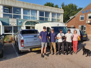
The Benchmark Surveys team; Josh Rogers, Sebastian Glover, James Richards, Sebastian Richards, Helen Richards & Dennis the dog
It’s been just 3 weeks since the R12i was launched to the world on 1st September.
But already Benchmark Surveys of Exeter have taken delivery of their new GNSS solution – the very first to be sold in the UK.
The team took part in trials with the new unit at the end of August, and it’s fair to say, they were blown away by the results they saw – watch the video below to see what we mean!
To see the R12i for yourself, take a look on the product page and sign yourself up for a demo;
Or find out more about Benchmark’s work;
https://www.benchmarksurveys.co.uk/
The story of 2 customers
Cast your mind back to September 2019, when trade events were in full swing. At INTERGEO, Trimble announced the launch of a new type of laser scanner – one that delivers powerful performance, with simple operation.
The X7 promised fast, simple and accurate laser scan results, but 1 year on, does the product live up to the hype?
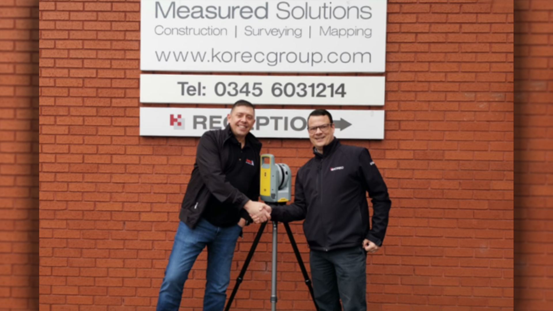
Barry Burrows takes delivery of his X7 from KOREC’s Barry Monk
Barry Burrows of BB Solutions didn’t have to think twice before making the purchase and became the first customer in the UK to own an X7. Since then Barry has put his new kit to the test on multiple occasions and has found that it was the perfect piece of kit for him and his business.
“I watched a few product videos on YouTube, read some online reviews and after about 15 minutes I knew that this was the right kit for me and my business.”
“With that scanner the amount of data collected was huge – I would easily spend 6-8 hours back at the office just processing the data, a lot of which was only needed for registration and would then be discarded”
In August, Survey Solutions took delivery of four brand new Trimble X7 laser scanners to use across their UK offices. The ongoing investment in the latest tech will insure that they continue to supply their clients with the best possible data as well as meeting important project deadlines.
“Laser scanning is a huge part of our measured building service and the new scanners further help our teams carry out their on-site survey and office processing.”
The Trimble X7 has most definitely lived up to expectations and gone above and beyond in just 365 days and we can’t wait to see what the X7 will get up to next.
To see for yourself just what the X7 can do, click here
2020, the year of no summer blockbuster movies… A little bit of googling and you’ll soon find out that summer blockbusters have been around since the summer of 1975 with the release of Jaws. Here at KOREC, we weren’t prepared to see that tradition die.
Introducing, KOREC’s Summer Blockbusters!
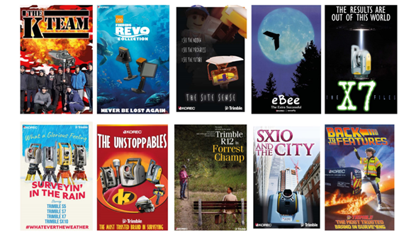
Whether it’s an action packed movie to get you on the edge of your seat, or an animated classic to watch with the kids, we’ve got a movie for you.

And to make things even better, we’re offering one lucky person the chance of winning a whole year’s worth of movies on us! All you have to do is vote for your favourite movie poster here to be in with a chance of winning. Good luck!
Last month we saw the launch of Meet the Experts, our new initiative to help and support our customer base. Since then, we have launched our very first Q&A with our laser scanning expert, Melvin Penwill.

With over 20 years’ experience under his belt, Melvin has done it all. Starting his career as a Graduate Surveyor working on HS1, to Survey Project Manager, using laser scanners to collect, process and even model data. He really has done it all!
“Laser scanning can capture millions of points a second, it really reduces the field surveying times”
In our latest Q&A, Melvin talks all things benefits, applications and even gives us some top tips for first time users.
“At KOREC we’re happy to support both, on the field data collection, and also processing through tools such as Trimble Realworks”
If you’d like to keep up to date with all things laser scanning or get in touch with Melvin, you can connect with him on LinkedIn here. You can watch the full Q&A here.
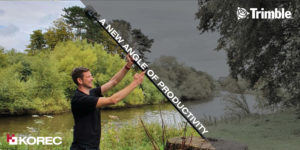
This week saw the launch of the next level GNSS solution from Trimble – the R12i.
Featuring robust IMU tilt-compensation via their patented TIP (Trimble Inertial Platform) technology, you can forget about levelling the pole and focus on collecting points, faster, safer and easier.
Utilising an angled pole allows you to obtain previously impossible or hazardous points – such as corners of buildings, tree bases and by rivers/watercourses.
With no time wasted calibrating or levelling, you can be much more rapid when collecting points – check out the video here to see how the R12i compares!
We are hosting a special R12i webinar on the 10th, to give you the complete lowdown on the new features, the benefits to your business, and multiple applications. Sign yourself up;
Join our launch webinar on the 10th
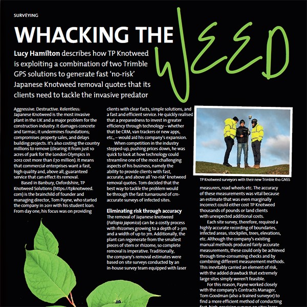
GeoConnexionUK has also used its May/June issue to highlight how the exploitation of two very different Trimble technologies (The R10 and Trimble Catalyst) can be used in the fight against the invasive plant, knotweed. In our ‘Whacking the Weed’ article, written with Tom Goodman of TP Knotweed, we outline how TP Knotweed’s take up of GPS is just part of its overall commitment to IT and innovation – a strategy that drives the company and is a great example to many other industries.
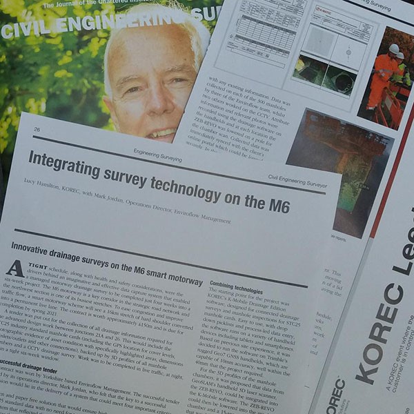
The April issue of CES magazine features our casestudy on the SX10 done in partnership with Paul Henzell of the Three Sixty Group. It looks at their resourceful approach to bringing consistency to above and below the ground surveys using the Trimble SX10
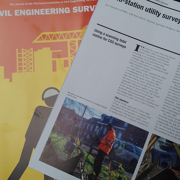
The March issue of CES magazine is hitting desks as we speak and featured on pages 26 and 27 is the latest case study from KOREC.
This story sees Enviroflow Management tackling a demanding M6 drainage survey with a truly unique approach – they’ve integrated GeoSLAM’s ZEB-REVO handheld data scanner technology with KOREC’s own K-Mobile data capture software. The end result is a paper free solution that delivers data in realtime (including internal 3D profiles of all the manholes) directly to a portal for remote access by the client.