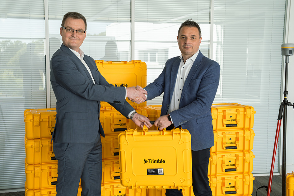
As a result of their recent successful integration into Cansel Group, KOREC Group and Survey Solutions Group (SSG) are pleased to announce that both companies are now authorised Propeller distributors covering the UK, Scotland and Ireland.
The two companies will sell and support Propeller’s leading cloud-based platform for drone mapping, 3D site analytics and earthworks management.
KOREC and SSG customers will have a proven solution for processing and analysing drone data across a range of applications including surveying, mapping, construction, housebuilding, aggregates, mining and waste management. The Propeller distributorship will also enable KOREC and SSG to expand into the BYOD (bring your own data) market.
Compatible with all the major UAVs sold by both KOREC and SSG, Propeller can also be fully integrated into the Trimble eco-system via the Trimble Connect common data environment.
Benoit Mallen, President UK and Ireland, Cansel Group said:
“At Cansel, with KOREC Group and Survey Solutions Group now fully integrated, we’re committed to delivering user-friendly field-to-finish workflows. The Propeller agreement brings their leading cloud-based drone mapping, 3D analytics, and earthworks platform to customers across the UK, Scotland, and Ireland enabling faster, more actionable insights from drone data in surveying, construction, aggregates, mining, waste management, and more.”
Sam Long, Account Executive, Propeller Aero said:
“We’re excited to welcome KOREC and SSG as new distributions for Propeller Aero. KOREC and SSG have built an outstanding reputation within the geospatial industry, and their expertise and strong relationships across the sector make them a natural fit for Propeller. Since they already provide many of the survey-grade drones our customers rely on, this partnership makes it easier for surveyors to process drone data, reduce photogrammetry workloads and share accurate site insights with teams across the business. We’re really looking forward to bringing the Propeller platform to KOREC and SSG’s customers and helping them unlock the value of accurate aerial data and streamlined site workflows.”
For more information or to arrange a demonstration, please contact www.korecgroup.com/contact or www.surveysolutionsgroup.co.uk
Propeller will be attending KOREC’s upcoming UAV days in March and April with further dates in Scotland to be announced by SSG.
Download a PDF of the release here
About KOREC Group
KOREC Group specialises in the provision of intuitive software and world lead positioning technology for the measurement, mapping and management of the natural and built environment.
KOREC is the UK and Irish distributor for Trimble and operates nationwide out of offices in Huntingdon, Liverpool, Dublin and Craigavon (NI). .In December 2025, KOREC joined the Cansel Group, a respected leader in geospatial technology with established operations across Canada and North America. www.canselgroup.com www.korecgroup.com
About Survey Solutions Group
Established in 1993, Survey Solutions Group provides high quality survey systems, for sale or hire, backed up by its service and repair centre, technical support and training service.
In 2001 it became the only authorised Trimble distributor in Scotland for all Geospatial solutions and in 2025 joined the Cansel Group, a respected leader in geospatial technology with established operations across Canada and North America. www.canselgroup.com http://www.surveysolutionsgroup.co.uk/
About Propeller
Propeller Aero is a leading global provider of cloud-based drone mapping, 3D site analytics and earthworks management solutions. Founded in 2014 in Sydney, the company has grown from a startup into a trusted industry player with offices in Denver, Manila, and Amsterdam. www.propelleraero.com
KOREC Group is delighted to announce a new partnership with Worldsensing that will see KOREC supply and support Worldsensing’s Loadsensing devices directly, rather than through the Trimble brand.
By working directly with Worldsensing, KOREC will be able to offer customers monitoring expertise based on a full understanding of their project and integration requirements, backed up by a fast turnaround on Worldsensing’s Loadsensing devices.
This new collaboration places KOREC in a stronger position to meet the time pressured needs of the monitoring market and deliver greater value to customers.
Trimble remains fully committed to the monitoring industry and to T4D Control as the central software for a complete monitoring solution.
Ric Kirman, UK & Ireland Business Area Manager Rail & Monitoring, KOREC, said:
“In an industry that can impose extremely tight deadlines, our new partnership with Worldsensing means KOREC customers will benefit from significantly faster response times across the board – from expert consultancy and system-design advice to seamless integration and supply of the right equipment. This streamlined approach ensures we can react swiftly and deliver robust monitoring solutions exactly when they’re needed.”
Arnau Carbonell, Worldsensing EMEA Sales Director said:
“By uniting technological and industry expertise, this partnership with KOREC Group expands the boundaries of what’s achievable and sets a new standard for innovation and connectivity in geotechnical and construction monitoring.”
About KOREC Group
KOREC Group specialises in the provision of intuitive software and world lead positioning technology for the measurement, mapping and management of the natural and built environment.
KOREC is the UK and Irish distributor for Trimble (www.trimble.com) and operates nationwide out of offices in Huntingdon, Liverpool, Dublin and Craigavon (NI). www.korecgroup.com
About Worldsensing
Worldsensing is a global IoT pioneer. Founded in 2008, the infrastructure monitoring expert serves clients in more than 70 countries, with a network of global partners to jointly drive safety in mining, construction, rail and structural health.
Worldsensing is headquartered in Barcelona and has a local presence in the UK, North and South America, Singapore and Australia.
ENDS
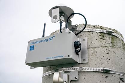
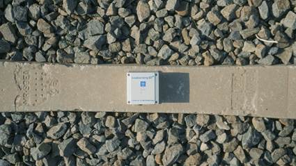
Products from the Worldsensing range that will be supplied directly by KOREC
“With hindsight… we probably should’ve seen that coming!”
Fortunately, as we move towards the end of the year, we have the next best thing to hindsight: a number of recent insights and reports from Trimble that give us a clear view of what’s coming next.
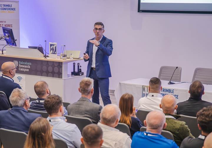
Following November’s KTUC day, we’ve been revisiting a pair of standout presentations from Trimble: a forward-looking keynote from Boris Skopljak, VP of the Geospatial Sector, and a UK-focused future of Trimble data capture session from Lee Braybrooke, Key Accounts & Alliances Director. Throw November’s Trimble Dimensions event and a newly published Trimble report into the mix and we’ve got plenty of insight as to what’s coming our way.
This piece is a quick round-up based on these sources which can all be read via the on page links.
A forward-looking keynote from Boris Skopljak, VP of the Geospatial Sector
Context and action
Our industry’s challenges are well-documented and they’re not going away on their own. The most frequently cited include a shortage of skilled people, slow adoption of digital workflows due to perceived complexity or unfamiliarity and increasingly siloed data – we’re getting better and better at capturing information, yet not nearly as effective at managing, sharing, or making the most of it.
If we are to successfully address these challenges, there are five key steps that Trimble recommends we take:
- Embrace AI and automation
- Leverage cloud solutions
- Focus on user experience
- Prioritise training and skill development
- Foster innovation
Let’s take a closer look.
1.Embrace AI and automation
It’s one of the hot topics within our industry and we already understand that automated workflows remove repetitive manual tasks, deliver faster design & modelling cycles and improve accuracy in jobsite documentation and coordination between teams. But how can we improve?
Step forward Trimble’s agentic AI platform, a collection of core services, security frameworks and tools. Built on top of this platform is Trimble Agent Studio which is currently being piloted with select customers to support its AI strategy by:
- Helping users learn and navigate Trimble software for faster onboarding and engagement.
- Eliminating the manual steps typically required to model from scratch, enabling users to generate 3D objects during design by describing what they want to model.
- Converting voice memos into documents in the field, capturing status updates from crews and helping teams avoid spending hours in front of computer screens back at the office.
- Accelerating access to data and streamlining asset maintenance and permitting workflows.
For more information, visit our recent KOREC blog
2.Leverage cloud solutions
Accurate data underpins everything in geospatial and construction. It shapes decisions, affects project outcomes and keeps day-to-day operations running smoothly. Cloud platforms give you a single, central place to manage that information, making sure everyone is working from the latest, most reliable version. KOREC customers tell us time and time again that siloed data is a regular occurrence and an enormous hinderance to their progress, which is why we offer a range of cloud options – Trimble Connect, Trimble Reality Capture, Trimble Terraflex and SOARVO.
The Trimble report states that the geospatial industry will increasingly adopt cloud-based platforms for managing large datasets and facilitating near real-time field-to-office-to-field workflows for better outcomes.
Important to note is that industry users state the importance of using platforms that prioritise data security and offer robust backup and recovery options.
Leverage cloud solutions
Discover Soarvo3.Focus on user experience
A user-friendly software interface can significantly reduce the training burden and speed up the adoption process, making advanced technologies more approachable for both new and experienced users. Balancing user-friendliness with professional requirements is a key challenge and on that score, Trimble has already made great inroads. For example, the ease of purchase and use of Trimble Catalyst by those outside of our industry and of course through the massive take up of 3D Laser Scanning through the intuitive workflows of the Trimble X9 series.
Trimble predicts that developers will focus on creating solutions that offer a seamless user experience, incorporating features such as guided workflows, contextual help, and simplified data visualisation – all good news.
4.Prioritise training and skill development
Within our industry, there is an increasing emphasis on spatial awareness and digital data analysis and management, but surveyors must also have a solid understanding of geodetic principles and coordinate systems to ensure the accuracy and integrity of their work. As the industry adopts advanced technologies, surveyors must become proficient in digital tools and software.
How is that being achieved? Trimble survey respondents use on-the-job training (69%), in-person training sessions (57%) and video tutorials (56%), but approaches vary widely, with some designating an expert, some getting group support and some relying on the vendor.
The Trimble report predicts that professional development programs will likely place greater emphasis on digital skills and that the role of the surveyor will evolve to encompass both traditional surveying techniques and advanced digital methodologies.
5.Foster innovation
And finally…the Trimble report urges us to encourage a culture of innovation by leveraging the skills and perspectives of digital natives. Their familiarity with technology can drive the development of new applications and enhance the overall adoption of advanced solutions. Virtual Reality, 3D Laser Scanning, robotics, AI, Reality data capture, data analytics… today’s careers in geospatial offer numerous possibilities and are a perfect fit for the tech-savvy, early adopters of Generation Z. These motivated individuals seek a career path that allows them to evolve, to use technology in an exciting and gratifying way, and to stay relevant throughout their working life. What better match than a career in geospatial.
Foster innovation
….and just for fun
Let’s travel back a decade when Trimble’s Lee Braybrooke looked at the current year and beyond in relation to geospatial trends. In 2015 he focused on 2D-3D, Mobile Mapping, Imaging and GNSS ubiquity. 10/10 Lee! Lee’s presentation at KTUK can be viewed here.
View the Trimble report ‘State of the geospatial industry 2025’ here
Get in touchKOREC is delighted to announce that it has signed a reseller agreement with Terrasolid to sell the company’s software which is widely recognised as the industry standard for LiDAR and image data processing.
The agreement is for the UK and Ireland and covers the main Terrasolid product suite including TerraScan, TerraModeler, TerraPhoto, TerraMatch, TerraStereo and TerraBatch as well as UAV and Lite versions.
Developed specifically to meet the demanding requirements of geospatial, engineering, and environmental professionals, Terrasolid’s software provides the versatile tools needed to create everything from 3D vector models and feature extractions to orthophotos and advanced point cloud visualisations, regardless of data source or sensor.
This agreement reinforces KOREC’s position as a one-stop solution provider – hardware, software, and support & training – and enhances the company’s ability to deliver complete end-to-end workflows for 3D data capture, processing, and analysis.
“For 25 years Terrasolid has been the industry standard for processing LIDAR data from dynamic laser scanning solutions including Mobile Mapping, UAV, fixed wing, and handheld SLAM,” said Mark Reid, UK Sales Director at KOREC. “The software is agnostic and complements our existing portfolio to help customers efficiently process and extract value from their captured datasets with even greater accuracy and efficiency.”
“For Terrasolid, the partnership with KOREC represents strengthened access to a key geospatial market,” said Xabier Eraña, VP Sales at Terrasolid. “With KOREC’s deep reach into surveying, mapping and infrastructure sectors in the UK & Ireland, Terrasolid is better positioned to deliver its 3D reality-capture software to critical industry workflows.”
For more information or to arrange a demonstration, please visit www.korecgroup.com/contact
ENDS
About KOREC Group
KOREC Group specialises in the provision of intuitive software and world lead positioning technology for the measurement, mapping and management of the natural and built environment.
KOREC is the UK and Irish distributor for Trimble (www.trimble.com) and operates nationwide out of offices in Huntingdon, Liverpool, Dublin and Craigavon (NI). www.korecgroup.com
About Terrasolid
Terrasolid develops world-leading software solutions for processing 3D point clouds and imagery collected from airborne, mobile, and terrestrial sensors. Based in Finland, Terrasolid’s applications are trusted by mapping professionals and engineers in over 100 countries. www.terrasolid.com
PRODUCT SPOTLIGHT
Discover TerraScan
TerraScan from Terrasolid is the industry standard for managing and processing point clouds – a reputation its held for over 25 years. TerraScan is the main app in the Terrasolid software suite, designed to make it easy for you to manage, process and visualise point cloud data. Deliverables include high quality classified point cloud data or vector data to be used in various engineering and maintenance applications.


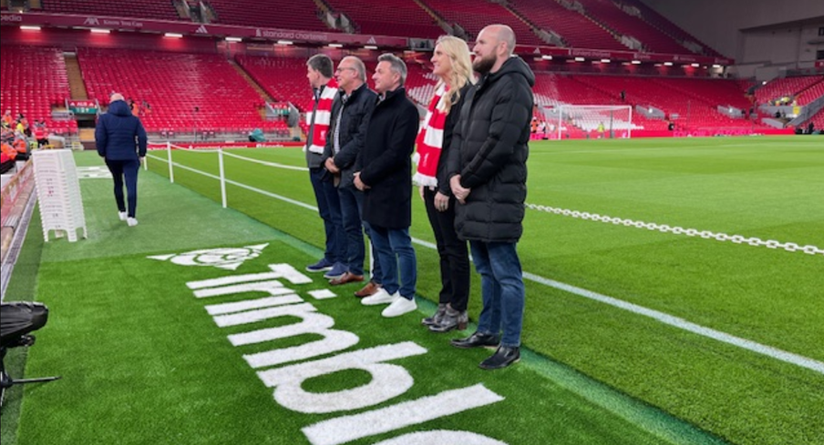
David Hodkinson and Mark Poveda (centre)
Liverpool Football Club (LFC) is widely recognised as one of the most popular clubs in the world’s most popular sport and at a recent home game this month we’re delighted to announce that its name became publicly linked with another high achiever and one especially close to our own hearts – Trimble!
On October 31st, Trimble announced a new multi-year global sponsorship with Liverpool Football Club (LFC) and became a recognised partner. In addition to the sponsorship, LFC will employ Trimble technology in the design and development of the club’s infrastructure including on the recently announced refresh of the LFC Academy, which aims to develop the future stars of football. This will include a starring moment for Trimble SketchUp which will be used to reimagine the high-performance centre into a truly industry-leading space for young footballers to learn.
Expect lots of visibility of the Trimble logo around the LFC stadium and its digital channels and of course plenty of photos from the KOREC team and any lucky customers who get to be a Trimble guest!
Six top moments through the ages – have we got the list right?
- The Miracle of Istanbul (2005): Down 3-0 at halftime in the Champions League final against AC Milan, Liverpool staged the greatest comeback in final history.
- Bill Shankly’s best football quote of all time: “Some people think football is a matter of life and death. I assure you, it’s much more serious than that.”
- The Kop’s roar measured at 130.9 decibels In a 2019 match vs. Barcelona, Anfield’s decibel level hit 130.9—louder than a jet taking off at 100 meters.
- The “This Is Anfield” plaque: Shankly installed the famous plaque in the tunnel to intimidate opponents and remind his players: “This is Anfield—play like gods.” Opposing managers still touch it for luck… or fear.
- 2024 Premier League Champions: Liverpool clinched the title on April 27, 2025, with a thrilling 5-1 home win over Tottenham Hotspur.
- Best ever rendition of ‘You’ll never walk alone’: It’s back to the Miracle of Istanbul in 2005 for this one!
A front row seat!
What better way to celebrate the shared values of this Trimble / LFC collaboration – precision, innovation and commitment – than by witnessing it ourselves. With our north west office just 5 miles from Anfield, two of KOREC’s finest, Mark Poveda (Managing Director) and David Hodkinson (Group Finance Director) were lucky enough to be Trimble’s guests for the game on 1st November v. Aston Villa (spoiler: LFC won 2-0), and as a lifelong fan, David was more than happy to share his experiences:
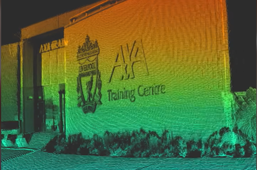
“The day started with lunch in Liverpool before being bussed over to the AXA Training Centre for a tour of the 1st team and Academy teams training facility over in Kirkby.
This is a state-of-the-art facility with pitches that wouldn’t look out of place as golf greens!
We saw Arne Slot’s office and all the indoor and outdoor training facilities and the press conference room. They also have all the myriads of Trophies on display that Liverpool have won – It was a very impressive facility.
We were then bussed back to Anfield for a tour of the stadium – including getting to stand on the world famous Kop and then pitch side for the photos with the new Trimble logo. It was great to be down on the pitch in the full glare of all the lights giving us a taste of what it must be like as a player.
Then it was up to the “Legends Lounge” for our top-notch food (and drink) – including a talk from Emile Heskey (Liverpool & England star).
Kick off was 20.00 in our halfway line seats – and I am pleased to report that Trimble brought us a change of fortune and we won (following 4 league defeats in a row!) – So Trimble are now 100% with LFC!
It was a brilliant day and great to see the behind the scenes operations that underpin what you see on the pitch!
Many thanks to our hosts Trimble and LFC for a superb day!”

Trimble Becomes Official Global Partner with Liverpool Football Club
New Wingtra-Trimble partnership brings seamless data integration for KOREC drone customers
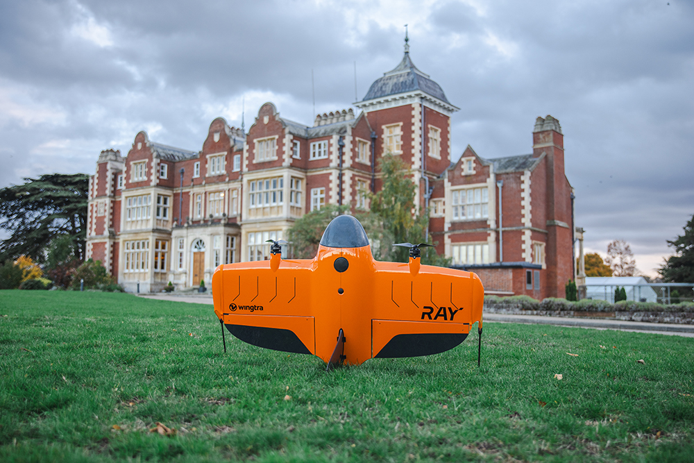
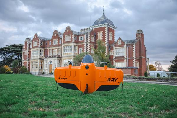
The WingtaRAY at the KOREC Trimble User Conference held in Cambridge in October (KTUC 2025)
KOREC is delighted to announce that a new partnership between Wingtra and Trimble will deliver tighter integration between Wingtra’s industry-leading drone solutions and Trimble’s world-class survey and mapping workflows.
Delivering a smarter way to get high-quality data, the joining of these powerful Trimble and Wingta survey tools will cut field time, minimise manual work and ensure users achieve accurate, actionable results far faster.
Available now is Trimble-native file support in WingtraCLOUD enabling quick drag-and-drop compatibility. This will enable KOREC customers to create survey sites instantly by uploading Trimble Business Center export files in .JXL (no manual setup), Skip RINEX conversions (just drag and drop your TO2/TO4 files) and work faster in local coordinate systems with fewer errors
Coming in 2026 is Wingtra’s cm-level positioning powered by Trimble correction services with no need for a base station. Users will be able to automatically apply cm-accurate corrections in WingtraCLOUD and establish known points globally with PPP support. Plus users will also have the ability to sync and export maps directly from WingtraCLOUD to Trimble Connect and TBC.
Future data connectivity will be ongoing throughout 2026 with tighter Trimble + Wingtra hardware/software integrations ensuring data flows from flight to final deliverable, without interruptions.
John Cartlege, Mapping & GIS Business Area Manager, KOREC said:
“Trimble leads in precision positioning, data integration and advanced GNSS solutions, Wingtra drives innovation in aerial mapping with its WingtraRAY VTOL drone technology and KOREC champions emerging technologies, bringing these innovations to our UK and Irish customers through our local expertise, support, and consultancy.
“We look forward to doing what we do best – helping KOREC customers seamlessly integrate these solutions into their workflows for greater efficiency accuracy and value.”
For more information or to arrange a demonstration, contact the KOREC Mapping Team at on0345 603 1214or visit www.korecgroup.com/contact
ENDS
“Surveying isn’t just about surveyors, right?… it’s about the power of spatial understanding for everyone.”
That’s what Barry Bassnet published on LinkedIn recently – and let’s just say his post sparked more interest than a KOREC consultant arriving on site with a bag of warm doughnuts! And why did he make this comment? Because he’d just seen a demonstration of Soarvo, a new cloud-based platform that reimagines how 3D spatial data should look, feel and function for a much broader audience, one that’s well beyond the usual circle of geospatial professionals.
Barry suggested that we’ve become so laser-focused on CAD deliverables that we risk reducing rich, multi-dimensional data into flat lines on a page. Accurate lines, for sure -but certainly less accessible to the many people who could actually benefit from the data; a list that includes project managers, planners, environmental consultants, utility specialists and even the general public. These are the typical stakeholders who need to understand space and context so why not give them a format that makes sense, and why not ensure that the software that provides this information is truly visual with a user interface so intuitive that nobody needs expensive training on how to use it?
…and the solution is Soarvo
Here at KOREC we have the means for our customers to do exactly that thanks to Soarvo. Humans are visual creatures (we process visuals 60,000 times faster than text) and Soarvo taps into that by presenting survey data from any number of different sensors in an intuitive, interactive 3D environment that even the non-technical can navigate with ease. Remember how Google Earth revolutionised map navigation…that’s what Soarvo can do for survey data.
We’ve already talked about Soarvo functionality in an earlier blog ‘Born of Frustration’, and how it can unlock the full value of geospatial data but today we’re not here to talk about some hypothetical use case, it’s time to show the results from real world projects and where better to start than with a Soarvo highlight – the drone workflow.
We therefore despatched our KOREC drone specialist to undertake two drone focused projects that would not only showcase Soarvo’s data handling and processing but also the Wingtra Gen II drone with VTOL:
Drone project 1: Into the woods
Our first mission? A dense forest survey to assess tree density and map the terrain for flood risk analysis. For this, the Wingtra Gen II, fitted with a LiDAR sensor, was the obvious choice thanks to its ability to penetrate through thick canopy and deliver multiple returns.
Once complete, the LiDAR was swiftly swapped out for Wingtra’s premium RGB61 camera and the site was re-flown at 100 metres (up from 80m). Same flight plan, fresh perspective.
Processing the Data
Data was processed in the Wingtra LiDAR app, then seamlessly uploaded into Soarvo – a simple drag and drop – and instantly ready to be explored, analysed, and shared with a far wider audience, all with zero fuss.
Soarvo standouts on this project
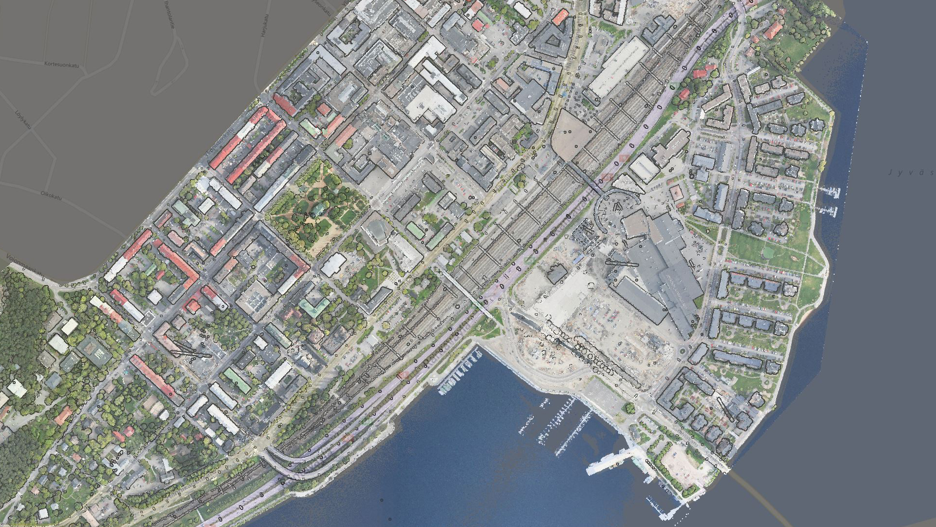
- See the forest and the ground: The Wingtra Gen II with LiDAR cuts through the forest’s canopy to ground level. Once in Soarvo, the point cloud can be colourised by height and then a clipping plane used to show data just at ground level for better assessing flood risk.

Point cloud colourised by height
- Focus only on what you need: Soarvo has the ability to read point cloud classifications and remove the ones not relevant to your application from view. In this case we created a purely ground level view to analyse the natural drainage within the forest and to examine where the ditches converge and assess what is happening in these vulnerable areas.
Showing the natural drainage within the forest
- RGB data rendered in seconds: With the RGB61 sensor data, we produced an ultra-accurate 3D model of the forest that loads and renders impressively fast. Bonus: Soarvo allows you to drape the orthomosaic over the terrain, offering a rich, contextualised visual that’s miles ahead of a flat 2D map.
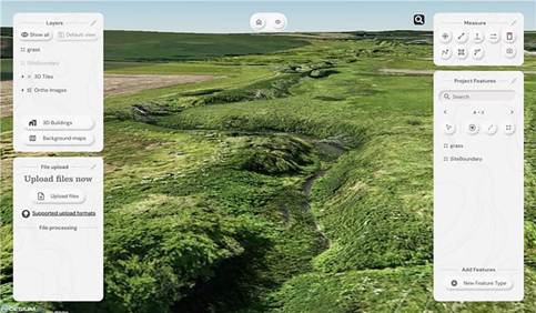
Orthomosaic draped over the terrain
- Snapshots with measurements: The ‘Snapshot’ tool came in handy for exporting JPEGs with embedded measurements. This function is ideal for briefing teams and stakeholders – no confusion, just clear visuals with context.
- Buit in GIS – done properly: Unlike most platforms, Soarvo includes full GIS functionality. Create features, draw polygons, and record detailed attribute data – not just vague notes. A great time saver, everything in one place, exactly where you need it.
Permission to fly the forest kindly granted by Phillip Wilcox-Moore, Managing Director, Axter Ltd. We’ll be covering this community story in an upcoming case study.
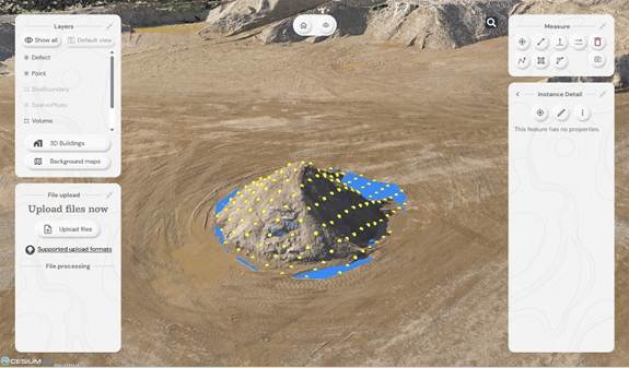
Drone Project 2: No stone unmeasured
Next up, a quarry stockpile survey. This time, it was all about volume calculations with a single flight using the RGB61 sensor. Just 7 minutes and 152 images later, the job was done.
Processing the drone data:
This data was processed in Soarvo by simply uploading the raw images in a zip file. Once loaded, Soarvo takes care of the rest generating an orthomosaic, 3D mesh and point cloud. No third-party software required, no CAD skills required and all processed and ready for sharing in typically, under an hour.
Soarvo standouts on this project
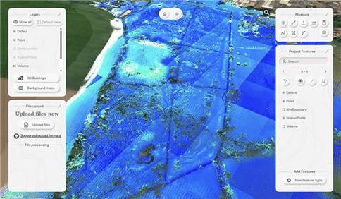
- Calculate volumes, fast! Let’s start with the main aim of this project, volume calculations – a regular need in quarry operations because that’s where the value lies. With Soarvo, it’s refreshingly easy, simply draw a polygon around the stockpile base, hit ‘calculate volume’, and you’re done. As accurate as traditional GPS-based surveys only faster, easier, safer and with the option for putting down more points for even higher accuracy, all completed from the desk.
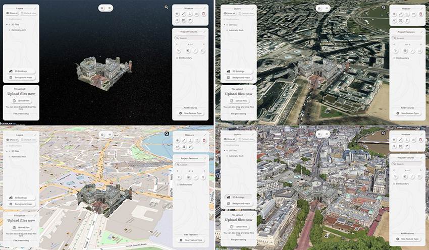
- Context matters: Unlike many platforms, Soarvo shows your drone generated point cloud in full context – no black voids, just clean, continuous terrain on a choice of background mapping that adds the sort of extra context you need for a true real-world view, ideal for planning access, security etc.
- More ways for easy visualisation: Simply use the ‘snapshot’ function with added notes or measurements for easy insights without any technical expertise required.

Quarry point cloud shown in context to surroundings – no black void!
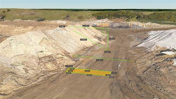
‘Snapshot’ with measurements
Calculating stockpile volumes – add as many points as you wish

Volume calculation report
And general to both projects – four more Soarvo benefits
No limits on the number of people who have access to the data
It’s all about making spatial data more accessible to more stakeholders – securely and without limits. Anyone you grant access can view the data straight from a web browser, no installs, no restrictions.
Security is vital, so it’s named user access only
Importantly, by avoiding use of a hyperlink, security is increased and Soarvo users can share this data only through named user access. Data security has been a key building block in the development of Soarvo since its conception.
Unique to Soarvo – merge and view ALL your data in one place
With Soarvo, you can bring together all your datasets – regardless of sensor type – into a single, cohesive view. But it doesn’t stop there. You can create layers of other key information too, like CAD-based topo surveys, GIS data with feature and attribute details (eg, boreholes), or even supporting documents like drainage reports. Just click to open with no digging around. It’s a genuinely useful feature, and a unique one that sets Soarvo apart.
Add context to your data – no black voids here
Soarvo provides context around your dataset and positions it in the real world rather than a giant black void. For example, your laser scan point cloud doesn’t sit in a black space, it’s positioned on to the background map of your choice from OS to Google to Bing. This opens up new doors with your clients who may need great data to check access to site etc.
And to sum up….
Undoubtedly CAD remains vital to our industry and is understandably widely popular, but as technology evolves, it becomes only part of a far richer story. The real value lies in how we make our geospatial data accessible, visual, and useful to everyone, not just specialists. And simply, that’s what makes Soarvo so exciting and relevant to an industry that needs its data to work harder and smarter – for us all.
Find out more about Soarvo by contacting KOREC for a chat or demonstration and visit Soarvo Stand G361 at GeoBusiness 2025.
It’s not quite the O.K. Corral, but KOREC’s Cesar Almeida – armed with 20 years of surveying know-how across two countries – takes on one of the industry’s favourite debates: Total Station vs GNSS. Which reigns supreme for topo surveys?
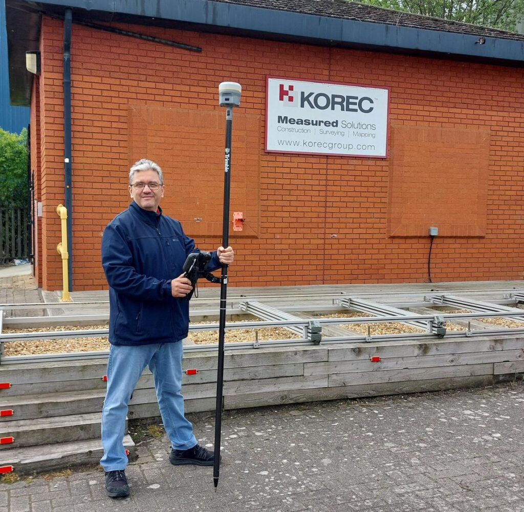
The author, Cesar Almeida
And to add a bit more clarity to the shootout, we’ve brought in KOREC’s Technical Training and Support Director, Richard Selby, to share a few thoughts from out in the field. Take it away Cesar…
A bit of background
“A story to share first. Back in 2005, when the first VRS was established in Portugal, the standard for any surveyor and/or site engineer was very much to use a two-man mechanical total station, and base/rover GNSS.”
Efficient use of the team: manpower matters
“Once they were shown the first GNSS rovers (significantly less costly than a rover and base), the adoption across the mediterranean areas was almost instantaneous over a total station. Customer ‘What do you mean I can swap a team of 2 or 3 people, with a single user on the pole, and get survey-level accuracies for topos?’
The immediate gain is obviously one of better use of the team. Traditional methods using a total station require two people for a topo survey, one holding the pole and another operating the total station, or if a robotic, protecting it from accidental damage or theft. For construction setting out, add in a third person to hammer in the nails or stakes.
During straight forward topo work, a single person can perform these tasks using a GNSS rover, freeing up team members for other projects. And of course, one person is with the rover at all times keeping it safe. It’s therefore easy to argue that the higher cost of a GNSS rover can be justified in operational savings.”
Accuracy expectations: Southern Europe vs UK
“All good, because in that part of the world accuracies under 5cm horizontal and vertical, were fit for purpose for those applications. It’s still the case today.
However, I have been in the UK now for 10 years, and it’s clear and accepted that the standards for accuracies here are higher. There’s probably a number of reasons for it, least of which are TSA guidelines written by the industry and for the industry, which are generally adhered to by customers and companies alike.
This shared standard ensures consistency, credibility, and ultimately, value across the entire supply chain.”
Trimble ProPoint changes it up
“In the last 4 years at KOREC, things have changed. Starting with the introduction of the Trimble R12, followed by the R12i and of course its latest iteration, the R980, we now have Trimble’s ProPoint technology. This gives hugely superior performance under challenging GNSS environments such as under tree canopy and in urban canyons, and the market has responded with several common observations about this technology that more than back up the Trimble marketing spiel:
- Yes, it can measure in more difficult locations than ever before and is much better under canopy and urban canyons than any previous GNSS. (Case study example here)
- Rule of thumb – it has increased productivity allowing users to capture 3 times more data in a day than with a total station or a previous GNSS generation, with enough accuracy for a topo survey. (Case study example here)
- And…the repeatability of the measurements has come down to a point where it’s almost indistinguishable from a total station for topo work. To produce a topo from a ProPoint enabled GNSS compared to a total station has led to results that are now comparable.”
Why wouldn’t you switch?
“So why wouldn’t you use a ProPoint enabled GNSS receiver to do topo work instead of a total station when there are some clearly obvious gains: just one man on the pole, no line of sight required to a fixed instrument, reduction in instrument theft and accidental damage, and overall, faster data capture.”Well, there are of course cons as well
“Recently, I was just discussing with a colleague in sales that the opportunities to use a total station are still quite large and sometimes conditions absolutely dictate that it’s the method of choice because there are still plenty of situations where GNSS just isn’t enough. On construction sites where precision control is critical, or in places like downtown London where skyscrapers turn the GPS signal into spaghetti, total stations are still the go-to. No question. But for a lot of day-to-day work, GNSS is earning its spot in the toolkit — and it’s making a real difference in efficiency and flexibility out in the field.
There’s no doubt that over the last few years GNSS technology has come a long way — and Trimble, with over 40 years of development behind them, has really led the charge. Thanks to these improvements, we’re seeing more and more customers using GNSS for jobs that would’ve traditionally been total station territory. Things like scan-to-topo workflows are becoming more common too, because let’s be honest — scanning is often quicker and easier than setting up a full traverse (at least most of the time!).”
So, what’s my conclusion?
“Unlike the gunfight at the O.K. Corral, it’s taken a bit longer to draw — but here it is:
Now’s the time to consider using GNSS more regularly simply because the technology you find in the Trimble R12i and R980 mean it’s finally accurate and repeatable enough for most applications.
And if anyone can bring a simple balance to an debate like this, it’s my KOREC colleague ‘out in the field’, Richard Selby:
The smart approach? Always remember context is king — the ideal would be to have both a total station and a ProPoint enabled GNSS receiver in the toolkit so that decisions can be made specific to the job in hand.”
What are your thoughts?
KOREC is delighted to announce that following a successful tender, it is supplying Ordnance Survey (OS) with one hundred and eighty Trimble R980 GNSS Receivers. These receivers will be supported by KOREC for the duration of the five-year contract.
Download a PDF of the press release here
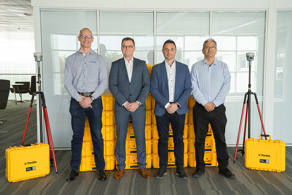
From left to right: Chris Harris (Channel Sales Manager, Field Systems EMEA, Trimble), Michael McEvoy (Principal Production Consultant, Ordnance Survey), Mark Poveda (Managing Director – UK & Ireland, KOREC Group) and Cesar Almeida (Senior Applications Engineer, KOREC Group)
The OS move to Trimble UK distributor, KOREC, has been based on both the advanced performance and productivity that the top-tier Trimble R980 Receivers can deliver, and their easy integration with OS’s existing data collection and handling software, the Esri suite of ArcGIS products.
The R980 Receivers brings together several top Trimble GNSS technologies and are particularly suitable for OS through features such as Trimble CenterPoint® RTX corrections for RTK level accuracy worldwide delivered via satellite or internet, without the need for a local base station or VRS network.
Mark Poveda, Managing Director – UK & Ireland, KOREC Group said:
“We’re extremely proud to be supporting Ordnance Survey with the supply of Trimble R980 GNSS Receivers following a successful tender. This significant contract reflects not only the performance and reliability of Trimble’s leading-edge GNSS technology, but also the confidence that OS has placed in KOREC as a long-term technology partner. We look forward to supporting OS over the next five years and ensuring their teams have the tools they need to maintain the highest mapping standards.”
Michael McEvoy, Principal Production Consultant, Ordnance Survey said:
“Ordnance Survey is pivotal in supporting the government, businesses, and individuals by maintaining and updating the digital master map of Britain with 20,000 changes a day. Our field surveyors therefore need a modern, robust, and accurate GNSS system to assist with the capture of our data which will serve them effectively now and into the future. The KOREC Group has provided OS with a great solution that integrates into our existing production environment. It will also enable our surveyors to use new technologies and capture tools to improve efficiency, whilst other features will enable work in remote areas, reliably and to high precision.”
From left to right: Michael McEvoy (Principal Production Consultant, Ordnance Survey) and Mark Poveda (Managing Director – UK & Ireland, KOREC Group)
About KOREC Group
KOREC’s mission is to empower you to measure, map and manage the natural and built environment.
Combining industry knowledge, with intuitive software, and world-leading positioning technology, KOREC transforms your operations bringing certainty to your decision making.
About Ordnance Survey
Ordnance Survey (OS) is Great Britain’s national mapping service. We carry out the official surveying of Great Britain (GB), providing the most accurate and up-to-date geographic data, relied on by government, business, and individuals.
KOREC Group is pleased to announce that it has been appointed as the exclusive channel partner in the UK and Ireland for Exyn Technologies, a leading US specialist in autonomous robotics and data collection
KOREC’s focus will lie with the company’s latest 3D mapping solution, the recently released Exyn Nexys. Modular in design, this system can be used as a handheld device as well as an attachment to a drone, ground robot, vehicle, or backpack.
The Nexys is equipped with a LiDAR scanner and Exyn’s proprietary SLAM algorithms, delivering exceptional capture speeds of up to 1.9 million scan points per second, alongside real-time point cloud colourisation.
The system can also navigate autonomously in GNSS-denied environments, featuring what Exyn defines as Autonomy Level 4 capabilities. At this level, drones and robots can explore and map unknown spaces completely independentlyeliminating the need for human intervention.
The introduction of the Nexys range, which includes both standard and Pro models, further strengthens KOREC’s portfolio of mobile mapping systems. This expansion ensures that KOREC continues to meet the growing demand for accurate, easily captured point cloud data with workflows relevant to the UK and Irish markets.
Additional Nexys features include direct export into Trimble Reality Cloud Platform Service (TRCPS), integration of Trimble GNSS solutions for precise georeferencing, adjustment to ground control meaning no drift, real time colourisation and advanced dust filtering.
Mark Poveda, Managing Director – UK & Ireland, KOREC Group said:
“Exyn recognises KOREC as a trusted partner with decades of experience in delivering customer-focused solutions shaped by invaluable feedback. With our strong mutual alignment with Trimble, this partnership is a perfect fit, ensuring that Exyn’s cutting-edge US technology is introduced to the UK and Irish markets by a local expert who understands their customer’s real-world challenges faced on site every day.”
Brandon Torres Declet, CEO at Exyn Technologies said:
“We are thrilled to welcome KOREC Group as our first UK and Irish-based partner. Their commitment to empowering industries to measure, map, and manage the natural and built environment aligns perfectly with our mission. We’re excited to collaborate with a like-minded partner to bring Exyn’s cutting-edge autonomous technology to the UK market.”
About Exyn
Founded in 2014 with headquarters in Philadelphia, Exyn Technologies is pioneering autonomous aerial robot systems for complex, GNSS-denied environments. The company’s full-stack solution enables flexible deployment of single or multi-robots that can intelligently navigate and dynamically adapt to complex environments in real-time.
Download a PDF of this press release here
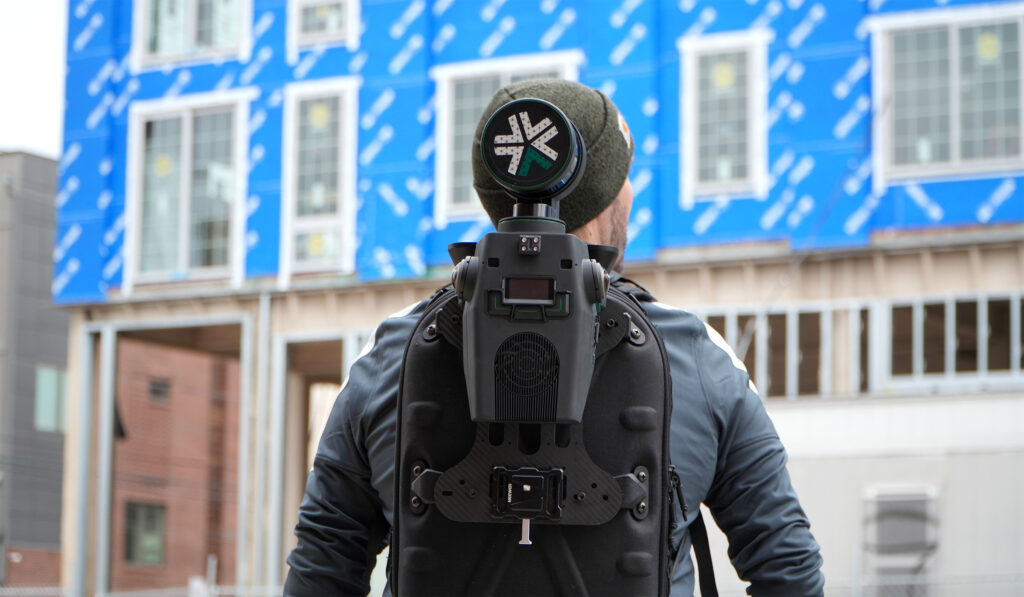
Nexys is a modular system and can be used as a handheld device as well as an attachment to a drone, ground robot, vehicle, or backpack
03/03/2025