Learn how modern survey technologies calculate stockpile volumes and discover which method is best suited to your site, whether you're working in a quarry, recycling facility, construction project or bulk material storage yard.
Accurate stockpile measurements are essential for stock valuation, material reconciliation, production planning and contractual reporting. Even small errors can translate into significant financial differences, particularly where high-value materials or large volumes are involved.
This guide explains the most common stockpile survey methods and the advantages of each.
Why Accurate Stockpile Surveys Matter
Stockpiles represent a physical asset, so knowing exactly how much material is on site is critical for both operational and financial reporting.
Accurate volume surveys help businesses:
Value stock correctly
Reconcile delivered and processed materials
Monitor production
Reduce financial discrepancies
Produce reliable contractual reports
For large aggregate producers, quarries and recycling facilities, even a small percentage error can equate to many thousands of pounds.
How Stockpile Volumes Are Calculated
Regardless of the survey method used, the principle is always the same.
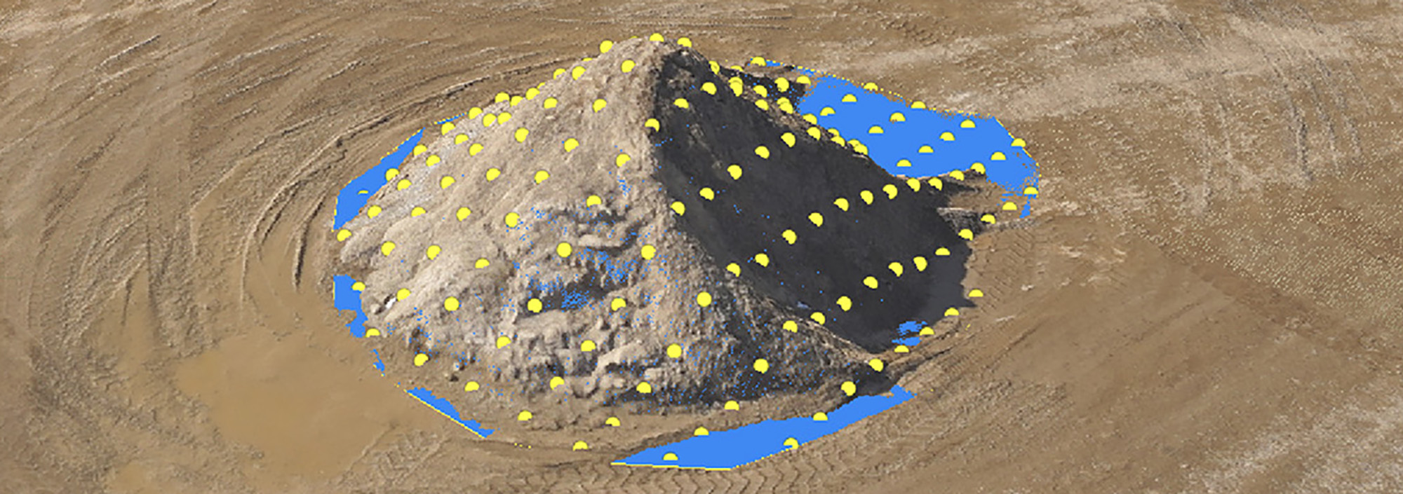
The surface of the stockpile is captured to create a digital terrain model (DTM). Survey software then compares this surface against a known base surface to calculate the volume of material between the two.
Where previous surveys exist, software can also calculate cut-and-fill volumes, allowing changes in stock levels to be monitored over time.
Survey Methods
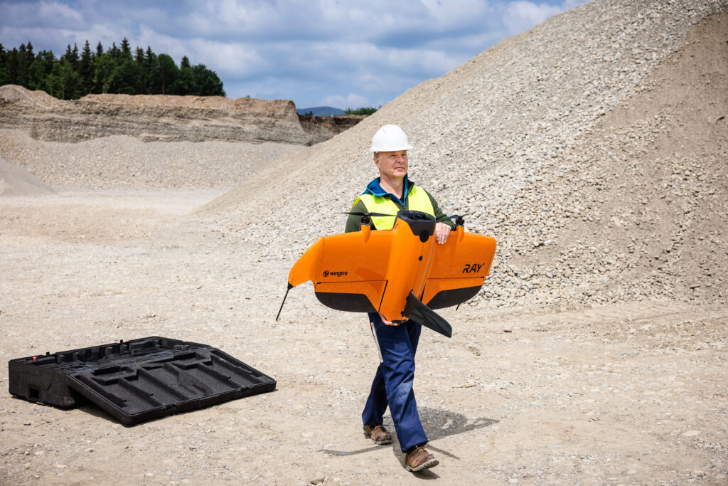
Drone Photogrammetry
Drone surveys are often the quickest solution for large, open sites.
High-resolution aerial imagery is processed into a 3D surface model using photogrammetry software, producing accurate volume calculations across multiple stockpiles in a single flight.
Best suited to:
Quarries
Aggregate sites
Recycling facilities
Large earthworks
Open storage areas
Advantages
Rapid data capture
Excellent coverage
Safe operation
Ideal for multiple stockpiles
Repeatable survey flights
Limitations
Weather dependent
Airspace restrictions
Not suitable for indoor stockpiles
Laser Scanning
Terrestrial laser scanners rapidly capture millions of survey points, producing highly detailed point clouds suitable for volume calculations.
Laser scanning is particularly effective where drone operations are restricted or where stockpiles are located inside buildings or beneath overhead structures.
Best suited to:
Indoor storage
Covered stockpiles
Complex stockpile geometry
High-detail surveys
Advantages
Extremely high data density
Fast capture
Excellent repeatability
Safe operation from ground level
Limitations
Multiple scan positions may be required for larger stockpiles
Slightly longer field time than drone surveys on extensive sites.
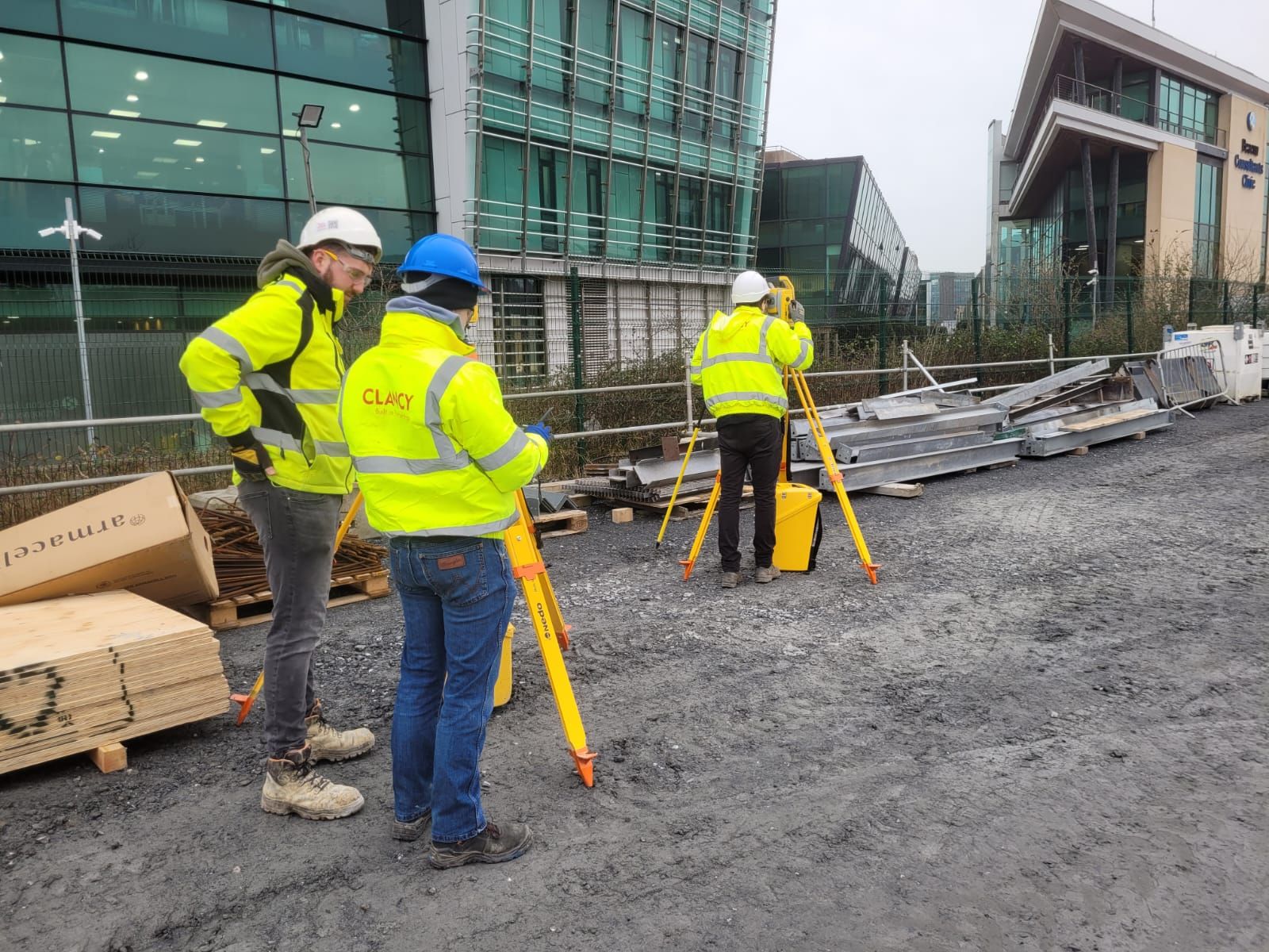
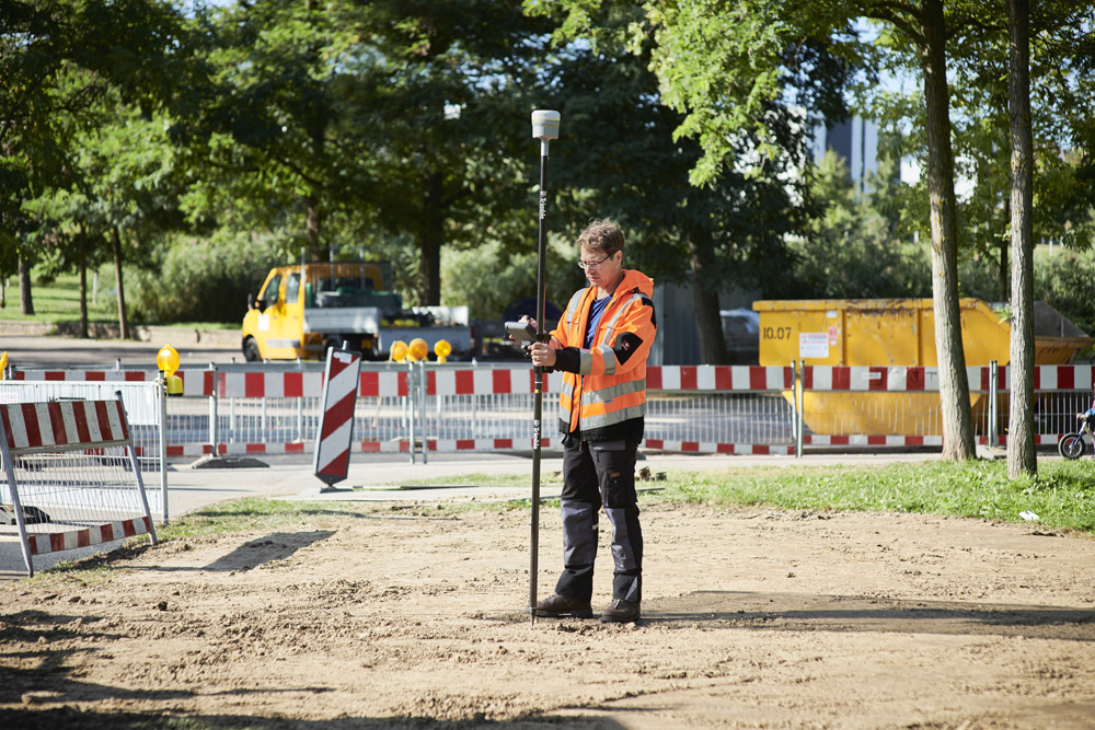
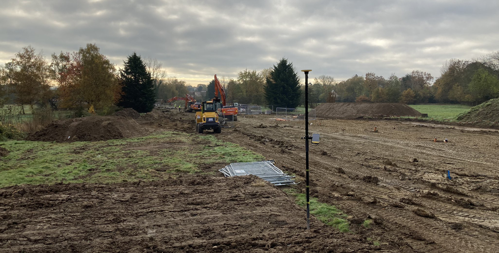
GNSS Surveys
GNSS receivers such as the Trimble R980 provide a simple and effective way to survey smaller stockpiles.
The surveyor records points across the stockpile surface, allowing software to generate a terrain model and calculate volume.
Best suited to:
Small stockpiles
Simple geometries
Occasional volume checks
Advantages
Simple workflow
Minimal equipment
Highly accurate positioning
Limitations
Slower than drones or laser scanners
Lower point density
Less suitable for irregular stockpiles
Choosing the Right Survey Method
No single survey technique is ideal for every application.
Large outdoor sites generally benefit from drone surveys due to their speed and coverage.
Laser scanning is the preferred option where drones cannot fly or where complex geometry requires extremely detailed data capture.
GNSS remains an excellent solution for smaller, less complex stockpiles where rapid deployment and simplicity are priorities.
Selecting the right technology depends on the site, the required accuracy and how frequently surveys need to be repeated.
Processing Survey Data
Modern processing software transforms raw survey observations into accurate volume reports.
Drone imagery, GNSS observations and laser scan point clouds can all be processed within Trimble Business Center, producing:
Digital terrain models
Volume calculations
Cross sections
Cut-and-fill reports
CAD deliverables
Historical comparisons
Trimble Connect can then be used to share survey information with project teams, ensuring everyone is working from the latest dataset.
Frequently Asked Questions
How accurate are stockpile volume surveys?
Accuracy depends on the survey method, equipment and site conditions. Modern drone surveys, laser scanning and GNSS surveys all provide highly reliable volume calculations when carried out using appropriate survey control and established workflows.
How often should stockpiles be surveyed?
This depends on operational requirements. Active sites often carry out weekly or monthly surveys, while slower-moving stock may only require quarterly or annual reporting.
How can KOREC help?
KOREC supplies a complete range of Trimble drone solutions, GNSS receivers, robotic total stations, laser scanners and office software for stockpile volume measurement. Our technical specialists can advise on the most appropriate workflow for your site and provide training and ongoing support throughout the project lifecycle.
Discover how to calculate stockpile volumes
KOREC can advise you on the right equipment for your business. Speak to our friendly experts today to get the right technology to solve your project challenges.
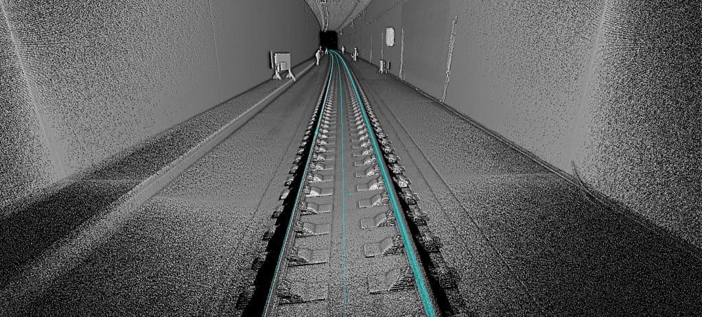
How Is Surveying Carried Out in Tunnelling Projects?
Discover how modern surveying techniques keep tunnelling projects on line and on grade, from establishing control through to TBM guidance, laser scanning and final as-built verification.
Find out why a pre-construction survey is essential before any project begins, what it should include, and how accurate site data reduces design errors, rework, and costly surprises during construction.
What Equipment Is Used for Construction Setting Out?
Find out what equipment is used for construction setting out, from total stations and GNSS through to augmented reality visualisation, and how these tools improve accuracy and reduce rework on...