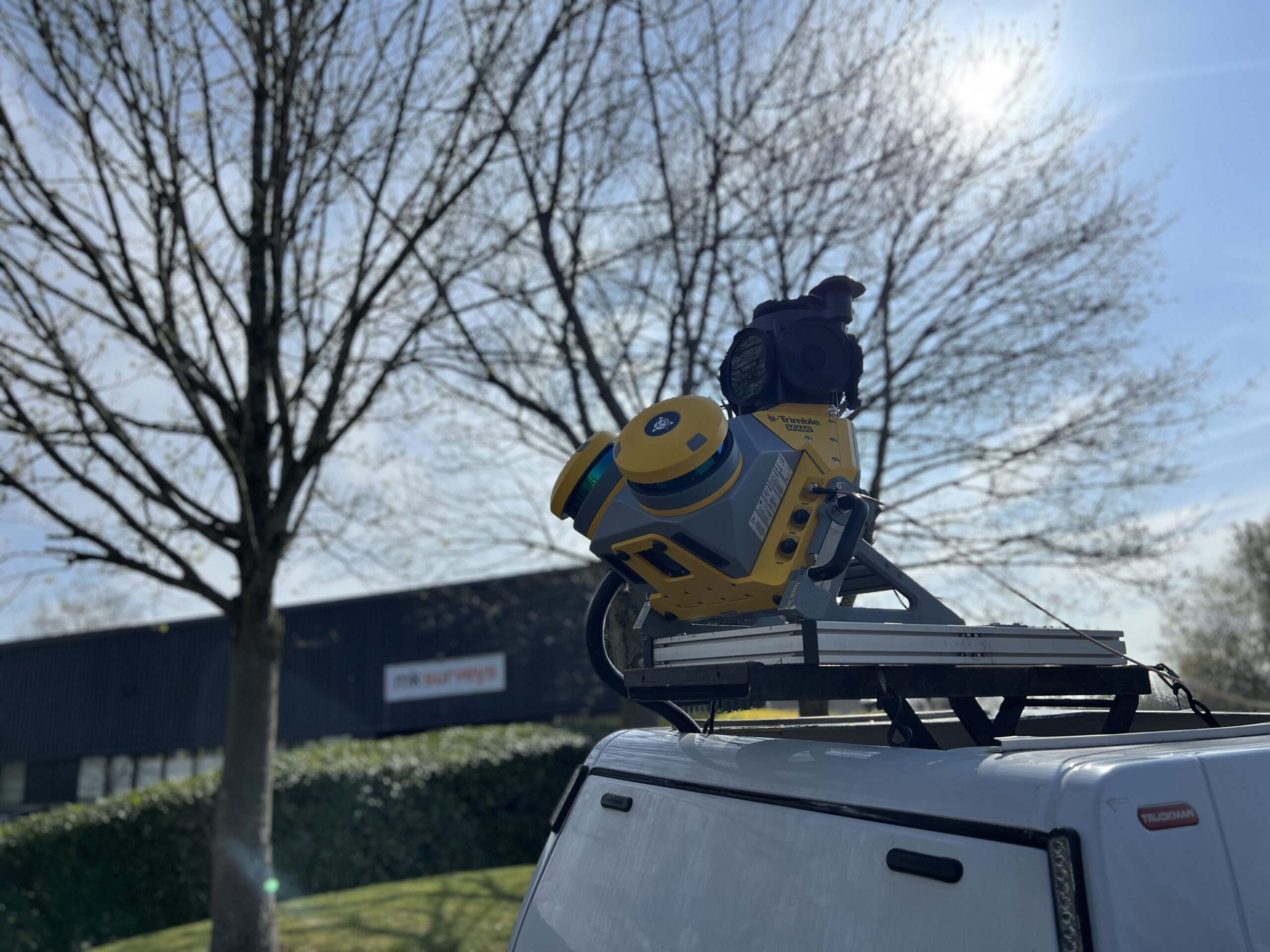
MK Surveys is maximising the value of its Trimble MX60 Premium system in two ways: by treating it as a precision survey tool rather than solely as a mobile mapping solution and by developing new client-focused workflows.
MK Surveys is maximising the value of its Trimble MX60 Premium system in two ways: by treating it as a precision survey tool rather than solely as a mobile mapping solution and by developing new client-focused workflows that go beyond traditional mapping and topographical surveys. The key was balancing price and functionality.
Operating both regionally and internationally through a network of six offices, MK Surveys has over 50 years of industry experience, including a decade in the mobile mapping sector under the leadership of Director and Co-owner Lewis Hook. Committed to continuous improvement, Lewis has used his expertise in scanning and mobile mapping to develop a highly regarded in-house offering with strong foundations for future growth.
When the company’s previous system reached the end of its lifecycle, Lewis undertook a thorough review of the market with assistance from his experienced team before selecting a new solution, moving from their previous manufacturer to the Trimble MX60 Premium system in 2025.
Price/functionality balance
Whilst upgrading to a newer version of their existing system would have been the simplest option, Lewis recognised that achieving the right balance between price and functionality was essential. This balance would enable the company to easily deploy the system across multiple projects, (maintaining the same standards as conventional survey techniques), as well as gaining sufficient new functionality to expand its services beyond mapping and topographical surveys across new workflows such as pavement condition surveys.
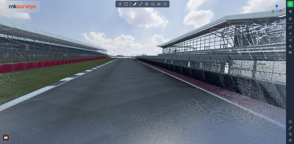
MK Surveys therefore tested three systems with different scanner options – Z&F, Riegl and Trimble – on the Grand Prix Circuit at Silverstone in Northamptonshire.
The MX60 was trialled extensively on the Grand Prix Circuit at Silverstone
Defining factors
On test day, the weather was particularly challenging with dark, wet conditions. All three systems were driven around the track at the same time and the results carefully assessed.
The trial clarified several points for Lewis and his team:
Cost wise, all were competitively priced for what they offered
Based on the spec sheet, technically the two other systems should have outshone the MX60 Premium. However, the MX60 excelled, even in the wet conditions, delivering the best quality data in general, particularly at range. The other two systems were unable to do this, struggling with the mesh on the debris fences and wet asphalt surfaces.
The MX60 had the data with the least noise
The MX60 12MP pavement camera performed especially well and would be key to bringing in new pavement condition workflows.
The Trimble Business Center (TBC) software offered a seamless workflow for extracting the right deliverables and opening doors to new business areas, especially for the planned pavement condition surveys.
The MX60 Premium’s high-end Applanix IMU (AP+60) offers one of the highest-levels of accuracy on the market, providing positional accuracies of ±20mm when using post processed GNSS in good conditions and <10mm in X, Y and Z when adjusted to Ground Control Points.
The MX60’s 2x laser heads are the same as the Trimble X9 terrestrial scanner, (already proven technology on the MK Surveys scanner fleet), providing laser accuracy of 2mm and precision of 1.5mm. This would allow for detailed review of the road surface in cross section for condition surveys and engineering grade as-builts.
KOREC provided the best consultancy and support throughout the process, answering all queries with a high level of expertise. (MK Surveys already owned two Trimble X9 3D laser scanners supplied by KOREC and had been very impressed with the level of support received previously).
KOREC could assist in setting up the MK Surveys mobile mapping vehicle for easy, single user operation.
Why the software matters
Whilst all these factors played a part in Lewis’s decision, he states that the functionality of the Trimble Business Center processing/managing software was an important part of the decision:
“We weren’t familiar with TBC before this, but Trimble has clearly designed the workflow with the end deliverables in mind, simplifying the overall process and opening doors to new markets for us. The pavement survey workflow is a great example, it’s largely self-explanatory with a level of semi-automation that means minimal manual input is required from our side.”
In particular, the PCI, IRI and OrthoLane tools in TBC are essential for surveyors and engineers working with road and surface data:
The PCI tool is used to process and analyse point cloud data and report on pavement surface defects
The IRI tool evaluates road pavement roughness and its impact on vehicle ride quality
The OrthoLane tool creates high-quality, orthorectified image mosaics and helps in managing and analysing orthographic projection of the data which is essential for accurate project planning and execution.
Case study: Paved highways condition survey
On a recent project using the MX60 system, MK Surveys was contracted to carry out a paved highway condition survey for a major infrastructure solutions provider. The survey area would cover 2km of highway and the requested deliverable was for high resolution orthophotos.
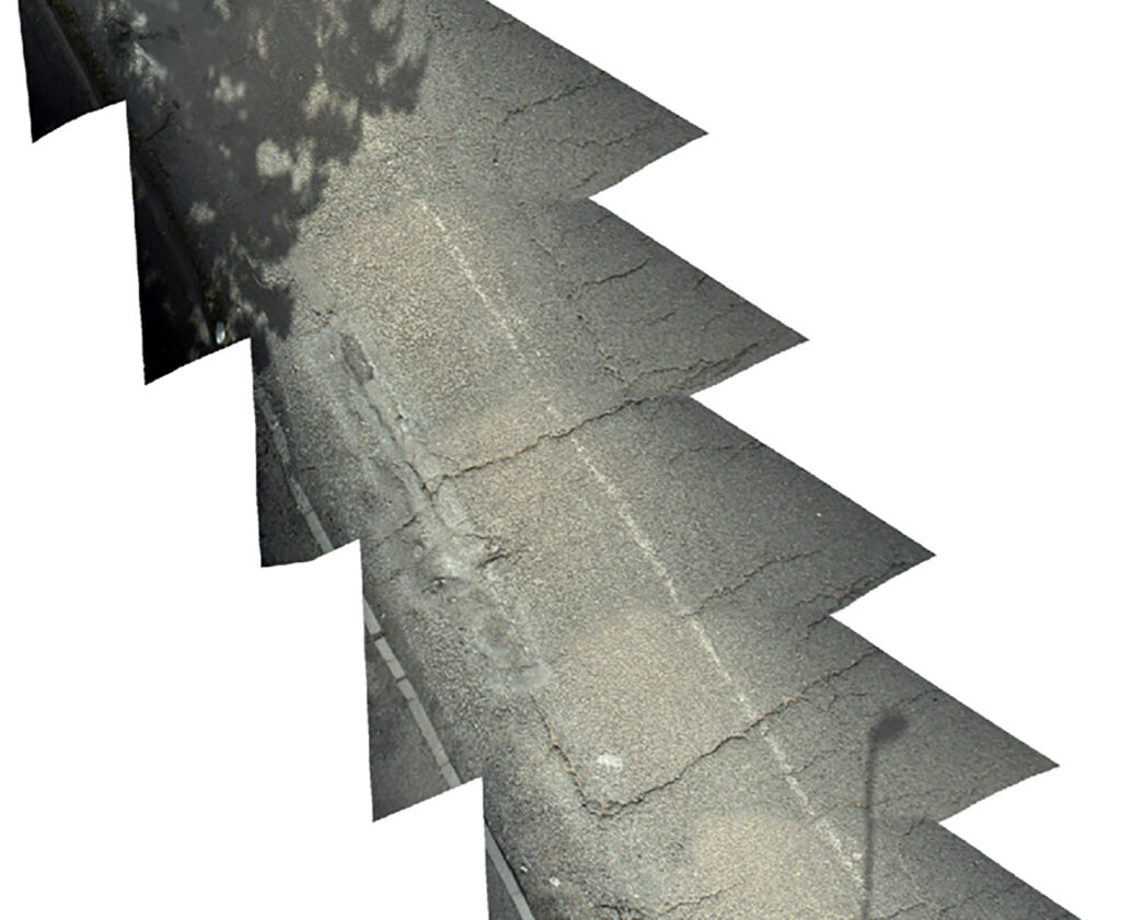
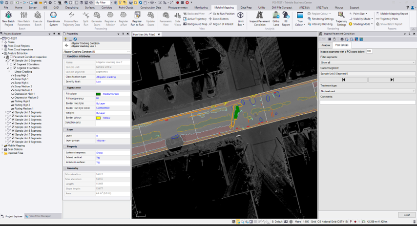
Orthomosaic showing poor road condition in TBC
The site was particularly challenging due to adjacent tree-lined embankments which restricted full sky visibility and made it difficult to obtain high-quality GNSS fixes. These conditions also cast shadows across the paved surfaces presenting an additional challenge in capturing well-exposed imagery.
Following a briefing by the Project Manager, the senior surveyor planned a route using available online digital mapping.
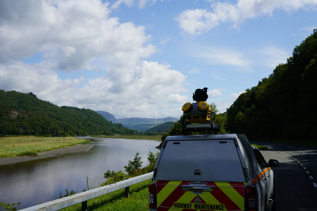
The MX60 system was installed onto the hydraulic lift mount in the back of a dedicated mobile mapping pickup truck for quick and easy deployment. (KOREC had previously assisted with the required modifications to MK Surveys truck for easy, single user operation). On site, once the system was jacked up to full height, static GNSS observations were recorded before a period of dynamic driving to initialise the system’s integrated IMU. The 2km route was then driven with an overall site time of less than 1hr.
Back at the office, the trajectory was fully adjusted in TBC along with the pavement condition deliverables using the OrthoLane tools. A Ground Sample Distance (GSD) of <2mm was achieved.
The MX60’s downward facing pavement camera (12MP) with its high frame rate was extremely useful in providing high-quality outputs for the clients whilst the predefined workflows in TBC kept the processing time down to only 2.5hrs from start to finish.
IO Geomatics combines over 27 years of topographical expertise with an extensive survey portfolio that allows them to apply the most effective methodologies for each site’s specific challenges. A recent...
How WM Ironwork’s use of Tekla Structures led them to introduce the Trimble X9 3D laser scanner into their workflow, increasing their abilities tenfold by significantly reducing rework and improving...