New Wingtra-Trimble partnership brings seamless data integration for KOREC drone customers
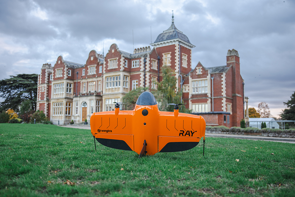
The WingtaRAY at the KOREC Trimble User Conference held in Cambridge in October (KTUC 2025)
KOREC is delighted to announce that a new partnership between Wingtra and Trimble will deliver tighter integration between Wingtra’s industry-leading drone solutions and Trimble’s world-class survey and mapping workflows.
Delivering a smarter way to get high-quality data, the joining of these powerful Trimble and Wingta survey tools will cut field time, minimise manual work and ensure users achieve accurate, actionable results far faster.
Available now is Trimble-native file support in WingtraCLOUD enabling quick drag-and-drop compatibility. This will enable KOREC customers to create survey sites instantly by uploading Trimble Business Center export files in .JXL (no manual setup), Skip RINEX conversions (just drag and drop your TO2/TO4 files) and work faster in local coordinate systems with fewer errors
Coming in 2026 is Wingtra’s cm-level positioning powered by Trimble correction services with no need for a base station. Users will be able to automatically apply cm-accurate corrections in WingtraCLOUD and establish known points globally with PPP support. Plus users will also have the ability to sync and export maps directly from WingtraCLOUD to Trimble Connect and TBC.
Future data connectivity will be ongoing throughout 2026 with tighter Trimble + Wingtra hardware/software integrations ensuring data flows from flight to final deliverable, without interruptions.
John Cartlege, Mapping & GIS Business Area Manager, KOREC said:
“Trimble leads in precision positioning, data integration and advanced GNSS solutions, Wingtra drives innovation in aerial mapping with its WingtraRAY VTOL drone technology and KOREC champions emerging technologies, bringing these innovations to our UK and Irish customers through our local expertise, support, and consultancy.
“We look forward to doing what we do best – helping KOREC customers seamlessly integrate these solutions into their workflows for greater efficiency accuracy and value.”
For more information or to arrange a demonstration, contact the KOREC Mapping Team at on0345 603 1214or visit www.korecgroup.com/contact
ENDS


KOREC are delighted to today (11th August 2020) be announcing their new initiative, Meet the Experts, to further help and support their growing customer base.
The concept is to increase awareness and understanding of eight key business areas and solutions, which are;
- Laser scanning and Trimble RealWorks
- Mobile Mapping
- Trimble Business Center software
- Rail
- GIS & UAV Solutions
- Integrated Layout & Mixed Reality solutions
- Integrated Survey
- Monitoring
Each KOREC Expert has been selected for their specific experience, product knowledge, industry connections, and ability to share that knowledge with our customer base.
The initiative was launched with a introductory video interview with laser scanning expert, Melvin Penwill – watch the video here.

Call us today on 0345 603 1214 or email at info@korecgroup.com
![]() KOREC is delighted to announce that it has signed an agreement with Swiss company, SenseFLY, to become the sole UK and Irish distributor of SenseFLY’s unmanned flying camera, the swinglet CAM.
KOREC is delighted to announce that it has signed an agreement with Swiss company, SenseFLY, to become the sole UK and Irish distributor of SenseFLY’s unmanned flying camera, the swinglet CAM.
The swinglet CAM is a lightweight, unmanned air vehicle (UAV) with a high resolution electronically integrated digital camera. Designed to undertake small scale aerial mapping projects it can be deployed in under one minute, is hand launched and has a take-off weight of just 500g. The camera records 10-40 cm/pixel images and can produce over 100 hectares of aerial photo coverage during its 30 minute flight.
An integrated GPS based miniature autopilot ensures that the swinglet CAM starts, flies and lands silently on its own. Its flight path is defined in easy to use PC based software and can be updated at any point during the flight by using the software’s simple drag and drop functions. When the swinglet CAM lands, images can be immediately downloaded and are ideal for use in a wide range of applications including wildlife monitoring, traffic monitoring, archaeology, crop monitoring, security, mapping or environmental projects.
KOREC’s Mapping Solutions Consultant Brock Ryder said, “The swinglet CAM has been developed to undertake a wide range of aerial mapping projects without the usual costs or set ups involved – it’s simply thrown in the air for take-off and returns to the same location for an automatic landing. Previous sales in Europe indicate that it will open up customised aerial photography to a whole new market in the UK and Ireland where previously costs were prohibitive – anyone from a small landowner to a large government body can expect a swift return on investment. End users can now be the pilot of their own aerial photography missions and have access to the data minutes after landing! Additionally, the swinglet CAM’s low weight and size mean that there are few flying restrictions*! It is the perfect addition to KOREC’s extensive portfolio of Trimble GPS and Mapping solutions.”
For further information please call KOREC on 0845 603 1214 (UK) or 01 456 4702 (Ireland) or view a video of the swinglet CAM in action on the KOREC website at http://bit.ly/korecswinglet
* Certain restrictions & permissions may be required for use of the UAV in Ireland & the UK. KOREC will provide guidance in the granting of permissions as required.
ENDS
About SenseFLY: Based in Switzerland, senseFly is an offshoot of the Laboratory of Intelligent Systems at EPFL – an organization at the cutting edge of research into collective aerial robotics, vision-based flight control for mini UAV and smart locomotion. www.sensefly.com