“Second to none” – the 3D scanner that pays for itself in just 1 year
A Trimble X7 has paid for itself in around 12 months thanks to the quality of the data it is producing for AMR Geomatics’ detailed Revit models and 2D drawings.


A Trimble X7 has paid for itself in around 12 months thanks to the quality of the data it is producing for AMR Geomatics’ detailed Revit models and 2D drawings.
View the case study as a PDF here
Based in the beautiful town of Hexham in Northumberland, AMR Geomatics (Northern) Ltd is a multi service survey practice with a skill set that enables it to work on some of the most beautiful buildings in the area including Alnwick Castle, Hexham Abbey, Hadrian’s Wall and Durham Cathedral.
Acquired by Crawford Higgins Associates Ltd (Chartered Building Surveyors) in 2014, the merger created a company that combined considerable building knowledge with land survey expertise. The resultant AMR Geomatics (Northern) team therefore has an extensive knowledge of survey and construction as well as understanding the specific requirements of architects, engineers and designers in particular.
For AMR Geomatics Director and qualified Building Surveyor, Lee Riley, the merger has proved a particularly rewarding one combining his love of buildings and technology within a team that is renowned for its in-house expertise in Revit and CAD and production of high-quality site and building drawings.
Building a survey fleet fit for purpose
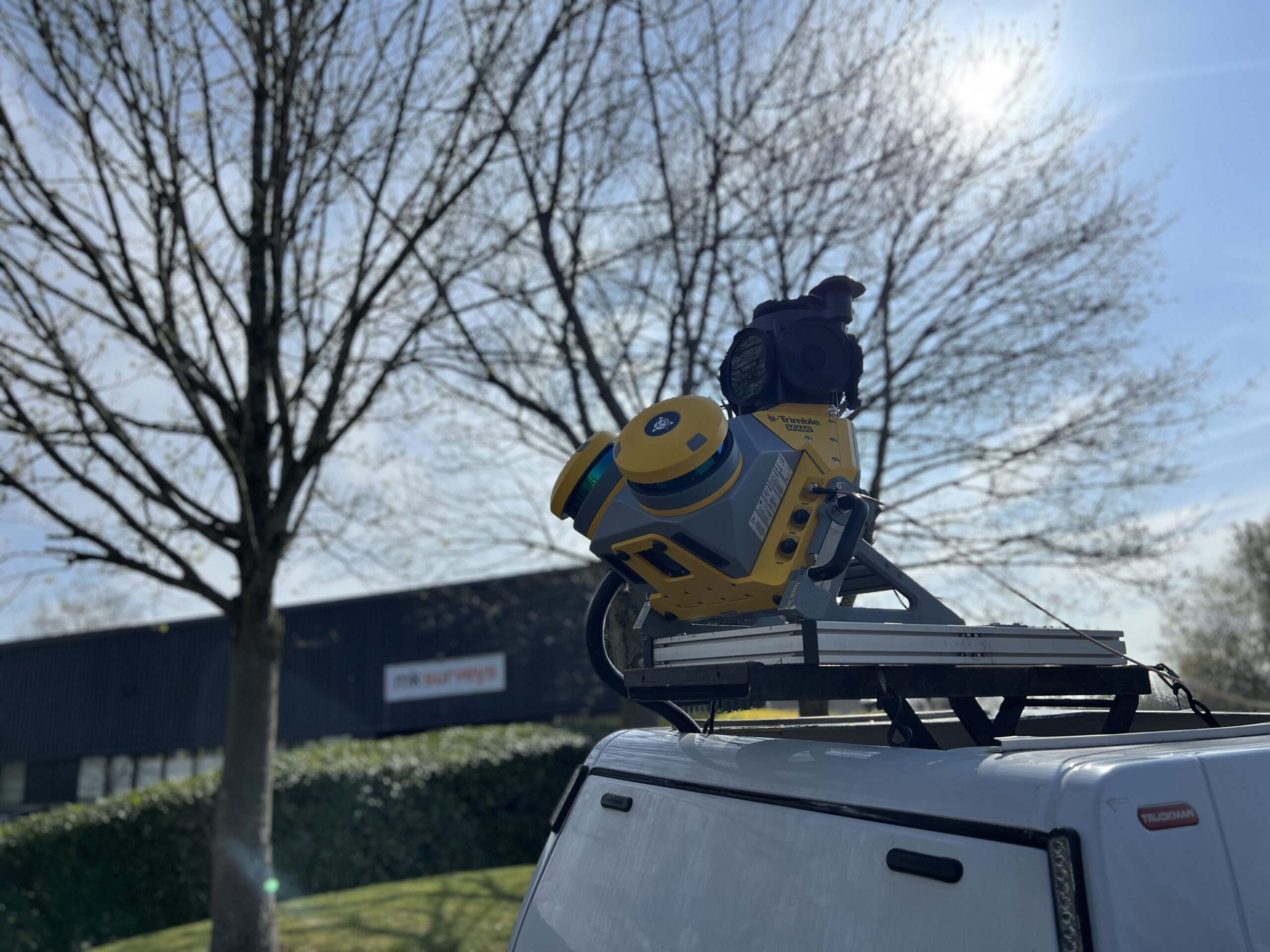
Pre merge, surveys were carried out with a Sokkia Total Station which at times proved to be inefficient. The company therefore contacted KOREC and invested in a Trimble R8 GNSS and S7 Robotic Total Station, both instruments known for their reliability and ‘workhorse’ performance. For over 8 years, the company had also been debating the purchase of a laser scanner but following mixed experiences with the quality of the end Revit models they had been able to create with hired in equipment, had held off any investment. However, when the Trimble X7 was launched, Lee was ‘blown away’ by the benefits that the system could bring them and confident that any negative past experiences would not be repeated:
“The performance, reliability, and functionality of the X7 is second to none. For example, on a measured building survey, whilst still on site, we can be sure that we haven’t missed a single stone thanks to the auto-registration. This is a great feature that means we can now refine and finalise jobs on the way home from site and start producing drawings and models immediately, something greatly appreciated by our clients. It’s extremely easy to use, combines precision and speed and consequently it’s in use almost every day of the week.”
For AMR Geomatics, a successful job is one that enables them to produce the highest quality deliverable for their clients and two recent jobs have proved great examples of what the company can achieve with its Trimble X7.
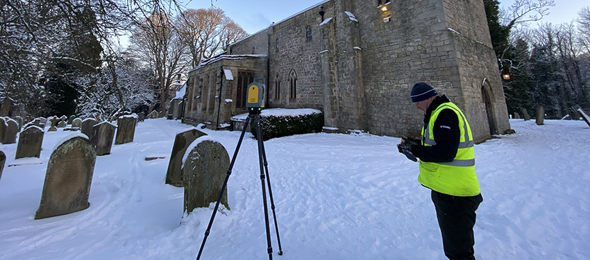
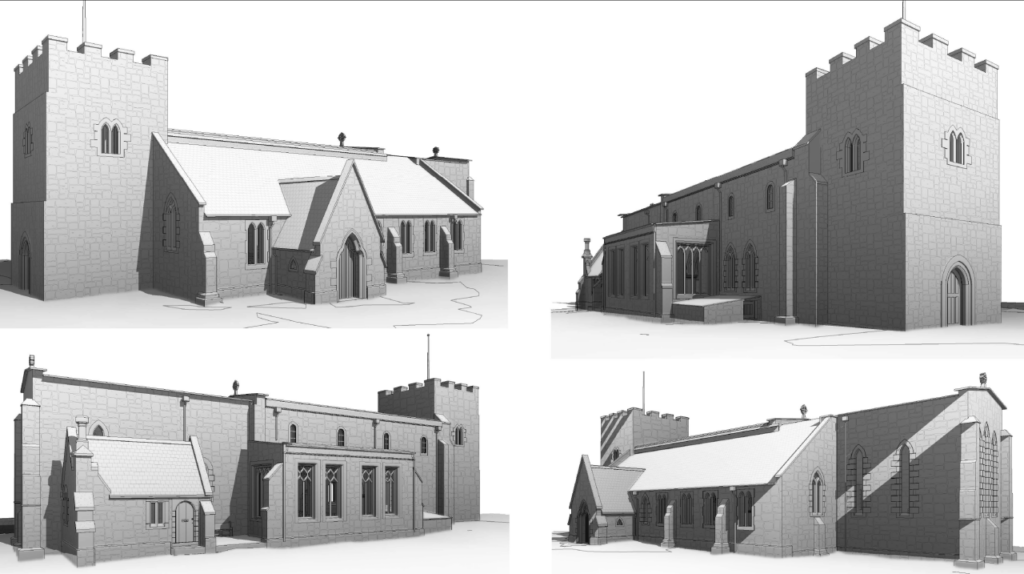
Saxon church in Northumberland
Client: North East based Chartered Architecture Practice
Scope of works: Topo survey of the site, measured building survey and production of existing 3D Revit model.
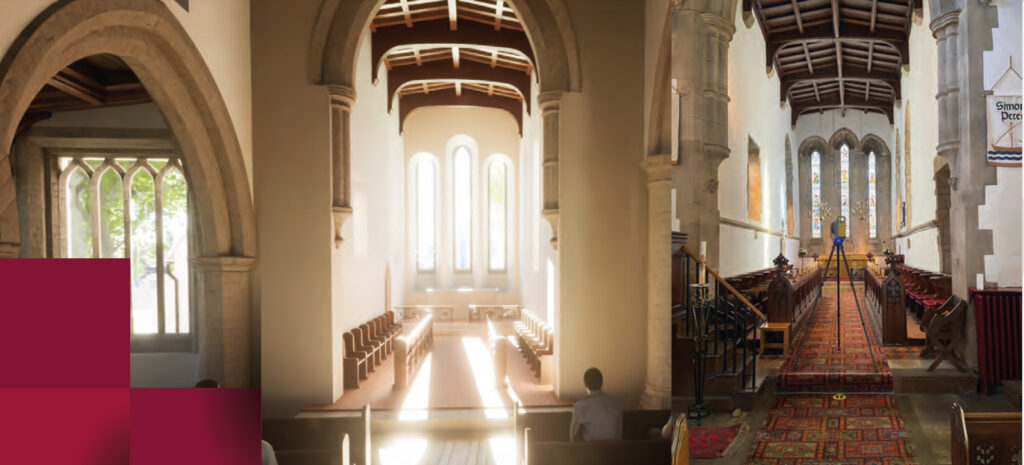
The Saxon church dates back to at least the 9th century when the small village and Parish was one of the most important settlements in Northumbria. The client, an award-winning Chartered Architecture Practice, required a full building survey of the church along with a 3D Revit model generated from the Trimble X7 point cloud.
On completion of the job, Lee reported that he spent just one snowy day on site along with his colleague AMR Geomatics Technical Manager, Mark Hudspith. Whilst Mark carried out the topo survey, Lee used the X7 for the internal and external scan work. In all, around one hundred scans (either four or seven minutes long) were undertaken along with the relevant imagery. This included work up in the bell tower where Lee found the handle of the X7 invaluable in getting it up a vertical ladder and manoeuvring it within the confined space. Once in the tower, the scanner was positioned on steel beams assisted by the built-in self-levelling technology.
Lee found the X7 functionality invaluable on this project: “All the data was registered and refined on the tablet so we left the site knowing we had a fully measured building survey. The overall quality of the scan data was exceptional providing unbelievable detail, stone for stone, it was that good. This meant that we were able to supply our client with a Revit model of the very highest quality.”
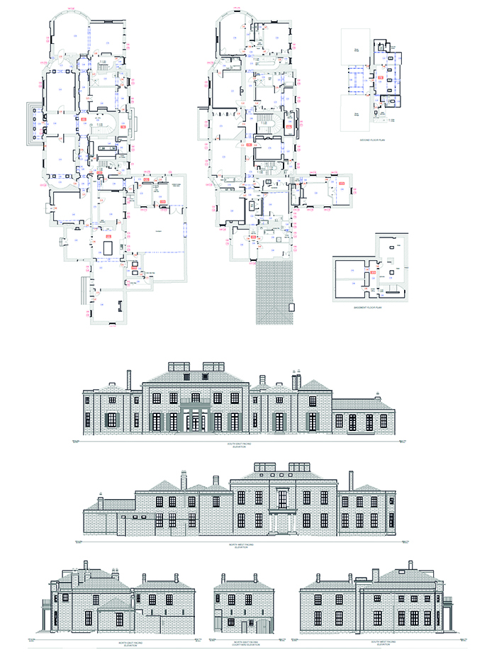
Grade 2 private dwelling in Cumbria
Scope of work: Full measured building survey and production of 2D AutoCAD floor plans and elevations.
Client: Private client and London based architect
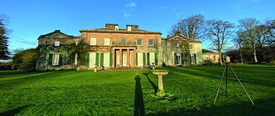
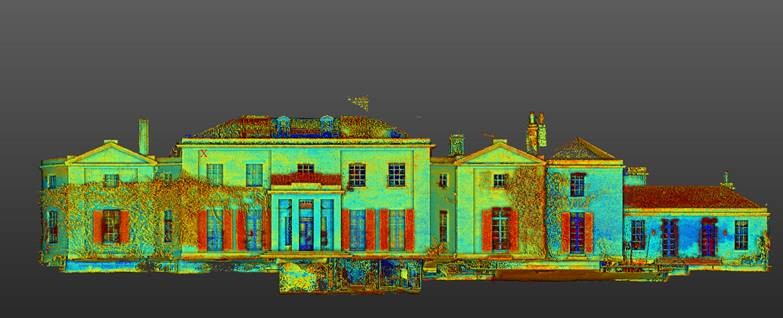
A beautiful private house in Cumbria has been owned by the same family for several generations. A member of this family now wishes to modernise the building in preparation for moving his family in. The approved architect specified a 2D plan, elevations and sections as the deliverable.
The house was complex with many rooms, levels and ornate architectural details requiring over two hundred scans in total with a combination of four and seven minute scans with imagery for the external building work and internally, one minute scans with no imagery. This workload was completed in just one day by a single surveyor.
Lee explains,
“Without the X7, the site work alone would have taken us at least twice as long but thanks to the built-in inclinometer, I could just pick up the X7, move it, and begin the next scan which saved us a considerable amount of time. Again, being able to check that we had captured everything whilst still on site gives us great confidence in the quality of data we can provide for the client. However, what really surprised me with this job was that we were able to refine over 200 scans on the tablet* which meant the data was ready for us to create drawings from first thing the next morning. Generally, we use Trimble RealWorks pointcloud processing and analysis software for refining but on this occasion, due to the workload and travelling between jobs, we thought we would attempt refinement on the tablet which took about 10-12 hours overnight”
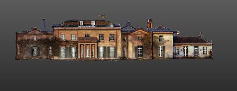
AMR Geomatics has since used the X7 on several other large measured building projects including Prudhoe Hall in Northumberland again producing an existing 3D Revit model in preparation for refurbishment work.
The company has also just invested in a Trimble R12i GNSS to further build its survey fleet.
*KOREC note: Although Lee was able to successfully refine over 200 scans on his powerful Trimble T10 Tablet, we recommend that large scan projects are refined in Trimble RealWorks point cloud processing and analysis software. Even when Lee has a large number of scans on the tablet, the data is still checked over in Trimble RealWorks.