The Benefits of Using GPS in Construction Setting Out
Here, we explain how emerging GPS/GNSS and RTK positioning technologies work and how the increased accuracy and efficiency provided by high-precision GPS benefits the construction setting out process.
The challenges faced by construction setting out engineers are complex, but GPS technology can make the process much more efficient and accurate. High-precision GPS/GNSS and Real Time Kinematic (RTK) positioning provide numerous advantages during the setting out process, enabling engineers to perform high-quality and cost-effective construction setting out.
Understanding GPS Positioning
The Global Positioning System (GPS) was the world’s first Global Navigation Satellite System (GNSS) when it was launched in 1978. Although created, controlled and maintained by the United States government via their Space Force, it can be freely accessed by anyone with a GPS receiver. The system currently consists of over 30 operational satellites, which enable GPS to provide global coverage.
Defining GPS Positioning
The evenly-spaced satellites provide geolocation and time information to GPS receivers on Earth so long as there is an unobstructed line of sight between the receiver and at least four GPS satellites. GPS technology can operate independently of any telephonic or internet reception, and does not need to receive any data to transmit a signal.
How RTK Works
While GPS technology is powerful, on its own it is sometimes not quite accurate enough for surveying purposes, which is where real-time kinematic (RTK) positioning comes in. RTK positioning provides corrections to a GPS signal in real -time, greatly enhancing the accuracy of the signal.
RTK positioning achieves this enhanced accuracy by measuring the phase of the signal’s carrier wave through a single base station receiver and multiple mobile units. The base station re-broadcasts the carrier wave to the mobile units, which compare it to their own measurements of the carrier wave. The carrier wave measurements are then combined with the information content of the signal to provide real-time corrections to the signal’s accuracy.
How accurate is GPS technology?
GPS technology calculates the latitude and longitude of the GPS receiver, and is usually accurate to within a Circular Error Probability diameter of 2 metres. According to the GPS analysis tool GPS Insight, the accuracy rate of GPS signals is approximately 99.88%.
The Limitations of Conventional GPS
Certain factors can hinder the accuracy of GPS technology, including GPS drift and signal bounce. Drift refers to the magnitude of inaccuracy of a device’s positional data and can occur when the GPS satellites change their movement patterns, or when a GPS receiver enters an area with poor reception. Signal bounce refers to the signal bouncing off large objects such as buildings or mountains, which can interfere with the signal’s accuracy.
Sub-centimeter Accuracy with RTK
RTK positioning can enhance a GPS signal to within a sub-centimetre Circular Error Probability. This increased accuracy actually makes RTK positioning less ideal for navigation purposes than the standard GPS signal, but it does make it perfect for surveying and setting out building projects.
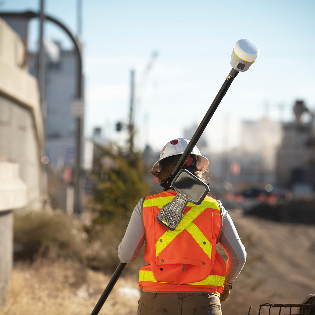
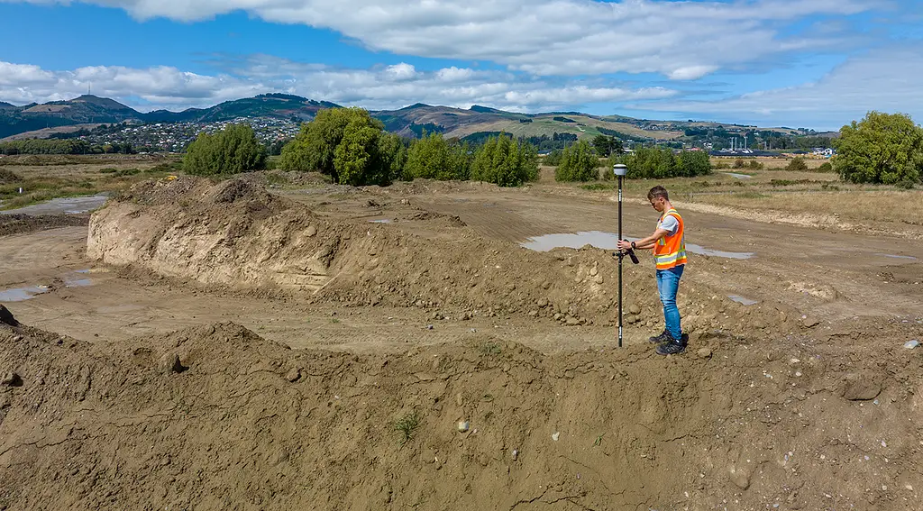
Applications in Construction Setting Out
A single engineer equipped with GPS receivers can set out control points much faster and more accurately than a whole team working manually without GPS. It makes the process more efficient and productive, while the increased accuracy of the measurements and readings reduces miscalculations and errors which can cause disruption and delays to the construction project.
The Setting Out Process Explained
Setting out involves transferring the construction project’s dimensions from a plan onto the actual site. The process consists of establishing the exact location of each part of the project and the measurements of the building’s component sections. The first step of setting out is clearing the site of debris and other obstructions, before using markers to mark out the layout of the planned building.
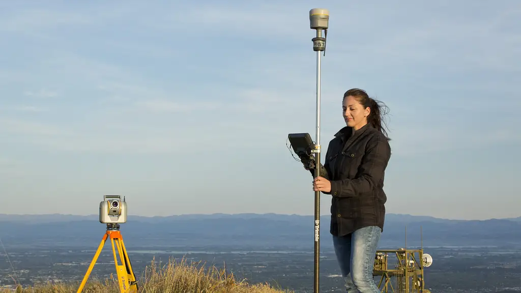
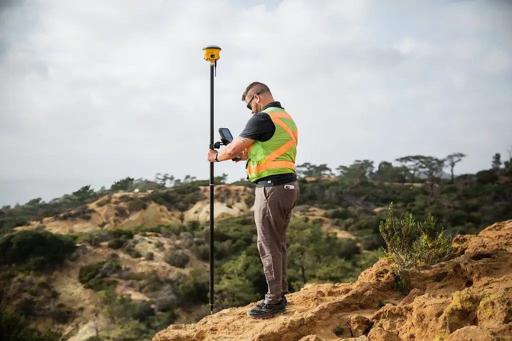
RTK in Surveying and Layout
Using RTK positioning for surveying involves using two receivers. One of the receivers – the base station or GNSS receiver – will remain stationary, while the other receiver moves freely. The static point of the base station receiver has fixed coordinates and uses GNSS to calculate errors in these coordinates by comparing them to its precise location. Any corrections are transmitted in real-time to the second receiver, which uses them to improve its own calculated position from the GNSS and thus achieve precision accuracy within a centimetre.
Benefits of RTK Positioning in Construction
As well as accuracy within a centimetre, real-time kinematic positioning technology eliminates human errors inherent in traditional surveying. RTK’s reliance on satellite and radio positioning helps speed up the surveying process, making it much faster than conventional methods. All of this means RTK positioning enables the quick development of construction layouts.
Improved Precision and Reliability
With surveying and setting out requiring as much precision and accuracy as possible, the reliability of GPS and RTK positioning is essential. There is also the cost-effectiveness, efficiency and safety of high-precision GPS, along with the productive workflows and data integration which make using this technology the smart construction decision. Let’s look closer at the benefits of this improved precision and reliability.
Time and Cost Savings
Using RTK positioning with GPS technology significantly reduces the amount of time that needs to be spent on surveying activities. RTK provides near-instantaneous coordinates thanks to the local base station, which enables surveyors and engineers to collect more accurate data in much less time when compared to traditional techniques.
RTK technology is also more cost-effective than conventional surveying methods as it can be used without much of the other expensive equipment used in traditional surveying, such as total stations. The fact that RTK data is more accurate will also save costs throughout the construction project by minimising errors and miscalculations.
Enhanced Safety
The high-precision GPS provided by RTK positioning improves safety for surveyors and engineers, who will often have to conduct their operations on dangerous ground or in hazardous places. RTK positioning can even be incorporated with drone technology, allowing surveyors to obtain valuable data from otherwise inaccessible areas without endangering themselves.
Streamlined Workflows
Using GNSS with RTK lets surveyors establish a single reference frame for all the measurements they need to make. This eliminates the inconsistencies found in manual measurements and helps facilitate data integration and collaboration, streamlining the workflow and making the whole process much easier for everybody involved. The improved precision and reliability of the data collected by RTK technology enables comprehensive analysis and concise visualisation of the project’s development and progress.
Data Integration and Collaboration
GNSS technology easily integrates with other geospatial technologies, while operators of RTK receivers can easily access and share the data remotely from wherever they are via the internet. This enhanced data integration and collaboration improves both efficiency and productivity for everyone involved in the project.
RTK vs. Other Positioning Technologies
Other positioning technologies, such as Precise Point Positioning, use a single GNSS receiver, with this permanent reference station quantifying any systemic errors in the signal. RTK positioning uses a base receiver temporarily fixed in position on the site, along with the secondary mobile receiver. This makes RTK positioning more versatile and reliable for surveying.
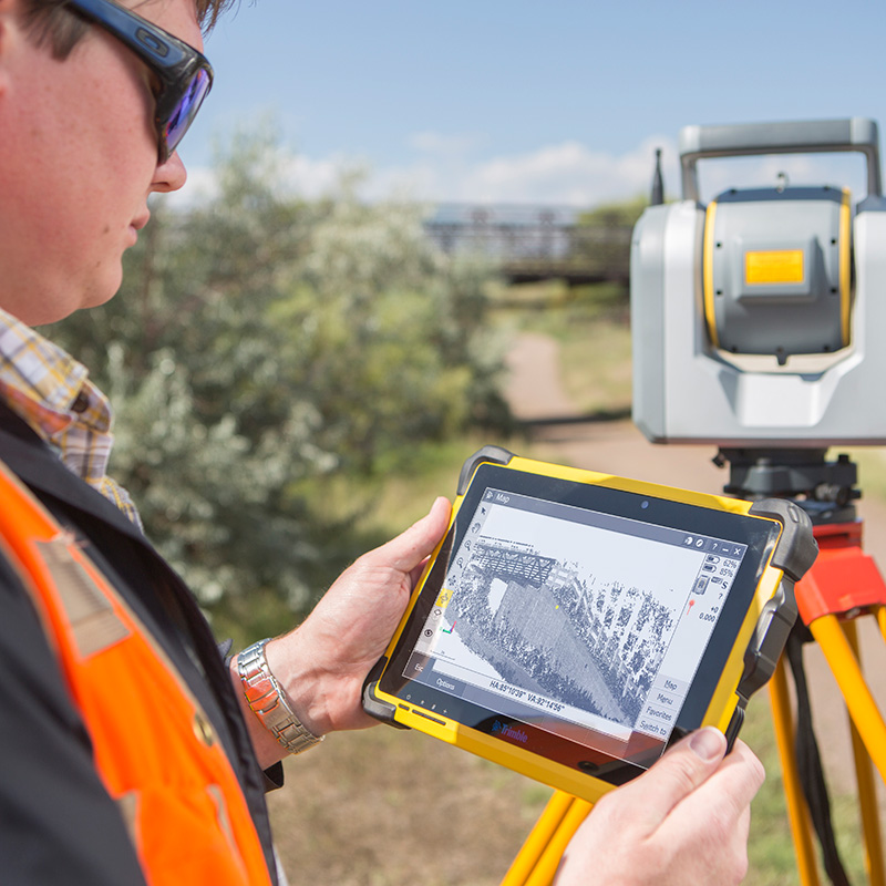
Comparing GPS to Total Stations
Both GPS and total stations are commonly used in construction setting out and surveying, but there are significant differences between the two. While GPS technology uses satellite signals to determine exact coordinates, a total station is an electronic device that incorporates a theodolite to measure angles and an electronic distance metre to measure distances. Both can provide high-precision measurements, although GPS offers better efficiency and broader coverage for larger-scale construction projects.
One advantage of total stations is that they can be used in areas with GPS signals that are limited or prone to interference. However, total stations are also limited to making line-of-sight measurements, which makes them less suitable for larger construction projects.
Advantages of GPS in Construction
The wider coverage provided by GPS is a major advantage for larger projects that require vast areas to be measured. The data collection speed is also much quicker with GPS, which helps reduce the time spent collecting the data.
Data is also processed automatically. GPS technology integrates seamlessly with data analysis software, greatly reducing the chance of human error. This high level of reliable accuracy makes GPS technology ideal for surveying activities.
Challenges and Considerations
While there are multiple advantages to using GPS technology for construction setting out and surveying, that’s not to say that there aren’t any challenges to consider. For example, GPS signals can be vulnerable to interference from environmental factors such as dense vegetation or tall buildings, potentially leading to measurement errors. GPS also relies on the network of satellites to operate, and needs a clear line of sight to multiple satellites at the same time. This means there are some remote locations where GPS is not an option.
Environmental Factors
Another factor to consider is the positive impact of GPS technology on the environment and sustainability. GPS can help streamline projects and reduce waste, minimising the detrimental effects of construction work on the local environment.
Equipment and Maintenance
GPS receiver units are much easier to clean than total stations, as most devices are able to handle some moisture. Water and soap can be used, while alcohol wipes are also excellent for cleaning GPS equipment.
GPS technology should still not be stored in humid environments, however, and should be kept away from places that experience significant changes in temperature.
Data Security and Integrity
GPS data can be protected from unauthorised access or manipulation with encryption and authentication techniques. Encryption scrambles the GPS data unless an authorised party accesses it, and the GPS authentication process verifies the identity and integrity of the GPS data sources along with the receivers.
Future Trends and Innovations
The future is very interesting from a surveying and construction setting out perspective. While we already have drone technology helping to take measurements of inaccessible areas, in future, we will likely see more widespread availability of unmanned aerial vehicles (UAVs). As the costs of this technology comes down, more and more construction projects will take advantage of a UAV’s ability to cover large surface areas in a short time while crossing difficult terrain.
There will also be advancements made with GNSS technology in general as 5G and AI become more widespread, so let’s take a quick look at some of these emerging technologies.
Emerging Technologies in Precision Positioning
AI will play a big role in satellite-based positioning systems in the future. It will help improve accuracy, efficiency and reliability by reducing errors caused by atmospheric interference. AI will also improve real-time data processing by enabling satellites to quickly process huge amounts of data from multiple sources.
The Role of RTK in Smart Construction
RTK will continue to be the key to smart construction, and will play a vital role in high-rise building construction, as well as in infrastructure planning on large-scale building projects. It will also be a valuable tool in land resource and urban planning, as well as landscape and topographic mapping.
Conclusion
High-precision GPS clearly has a number of benefits for smart construction and especially for the construction setting out process. The accuracy and reliability of real-time kinetic or RTK positioning reduce costs and save time while enhancing safety and improving data integration and collaboration.
The importance of GPS positioning in modern construction is only going to increase from here as more and more emerging technologies are integrated to enhance its accuracy and precision.
Drone surveying (also called drone mapping, UAV surveying or aerial surveying), is the process of using unmanned aerial vehicles, or drones, to capture aerial data. These vehicles use downward facing sensors,...
Any professional is only as good as their tools. This is especially true of land surveyors. This profession requires extraordinary exactitude, and the surveying instruments that it requires need to...
The science of land surveying goes back centuries and its impact can be seen everywhere when you look out of your window. Wherever homeowners need to establish property boundaries, wherever...