Common challenges with UAVs for Surveying and Mapping
Discover the common challenges when adding UAV survey and mapping drone technology to your business. Learn what to consider and how to overcome them.


Discover the common challenges when adding UAV survey and mapping drone technology to your business. Learn what to consider and how to overcome them.
UAV or drone technology is an integral part of business-as-usual for all manner of surveying and mapping projects. Adopting and integrating this technology is not without its challenges, but they’re challenges that you can overcome.
In this article we explore the drone surveying obstacles and opportunities for newcomers and established operators alike.
When it comes to mapping problems, this one comes up a lot. Weather mitigation is an ever-present concern for UAV surveying, especially here in the UK and Ireland. It won’t surprise you to learn that there’s no silver bullet for this, however making the right choices can help.
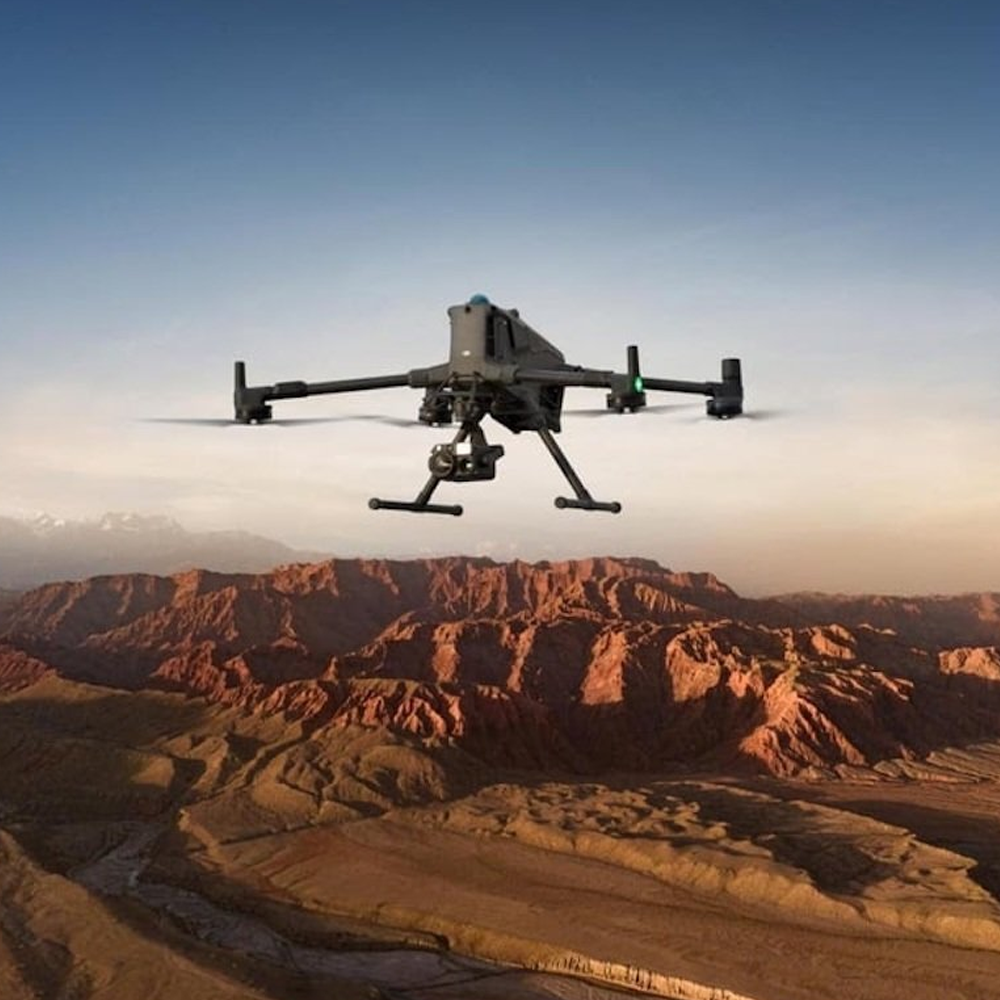
Light rain and wind is generally not a problem for any commercial-grade UAV, be it fixed-wing or quadcopter, though business certainly will experience surveying drone issues if they try to use consumer-grade UAVs. Looking a bit deeper, fixed-wing survey drones such as those from Wingtra are more stable in high wind than quadcopters. Fixed-wing drones are great for linear projects and large sites too, so if that’s the market you’re targeting, then you’re setting yourself up well.
Quadcopters on the other hand are far more flexible across many more jobs, so ultimately keeping a close eye on the weather forecast is an essential part of the drone mapping job. It’s a responsibility that mustn’t be overlooked. The weather can’t be changed, so knowing your customer’s timeframes and requirements can help schedule your drone survey and mapping projects to avoid delivery failures.
For businesses just starting to add UAV survey operations to their arsenal, getting a drone pilot license can seem like a big challenge. It doesn’t help that regulations change – for example, recently in the UK the regulatory requirements were tightened and as of 2026, UK class marks align to their EASA (EU) equivalent. Research on this reveals a myriad of terms and acronyms, including FlyerID, OperatorID, GVC (General Visual Line of Sight Certificate), A1/A2/A3 licenses, Certificates of Competency, and many more.
However, this is one drone mapping challenge that’s easier to solve than you think. The market has reacted to the drone pilot needs and there are many training courses and providers that can hold your hand through this process, with everything clearly explained and CAA-certified where appropriate.
There are also drone advocacy networks that help you stay updated, such as Commit2Drones. Our best advice is to ask the people you buy the drone from. A good provider will help you solve your drone mapping challenges, not just sell you a box – and that includes making sure you’re licensed and set-up for success.
In the UK, standard licenses only allow VLOS operation (visual line of sight). BVLOS (beyond visual line of sight) licenses do exist, so there is a solution, but a BVLOS licenses is not trivial to get. It requires specialist training and operational authorisation from the CAA – however the CAA is working on a roadmap to enable easier BVLOS flight. Until then though, BVLOS flight is a particular a UAV survey problem that you should overcome only when you need to. The process is different again for Ireland and the rest of the EU, and is made easier with newer drones coming with enhanced safety features. A case in point here is the WingtraRAY’s C6 EASA certification and parachute capability.
A key UAV surveying challenge is that drones are limited in flight time and so in coverage area. This is hopefully unsurprising – nothing can stay aloft indefinitely – and managing this effectively is part of the art of running drone-based survey and mapping projects.
The solution is to take drone mapping challenges as seriously as any other part of your business. Invest in the spare batteries, ground control points, and other parts of the project that will make the job go smoothly. For the small extra cost, you save hours on the ground and give confidence to your customers.
A good tip here is also to make sure you’ve got the right drone for the job. At KOREC we always advocate using not just technology, but using the right technology, and this is also true for UAV surveying and drone mapping. For example, if you’re engaged on lots of large-area projects, then consider a fixed-wing UAV such as the WingtraRAY. In both cases, it comes down to getting the basics right. Understand what you really need, and your projects will go smoothly.
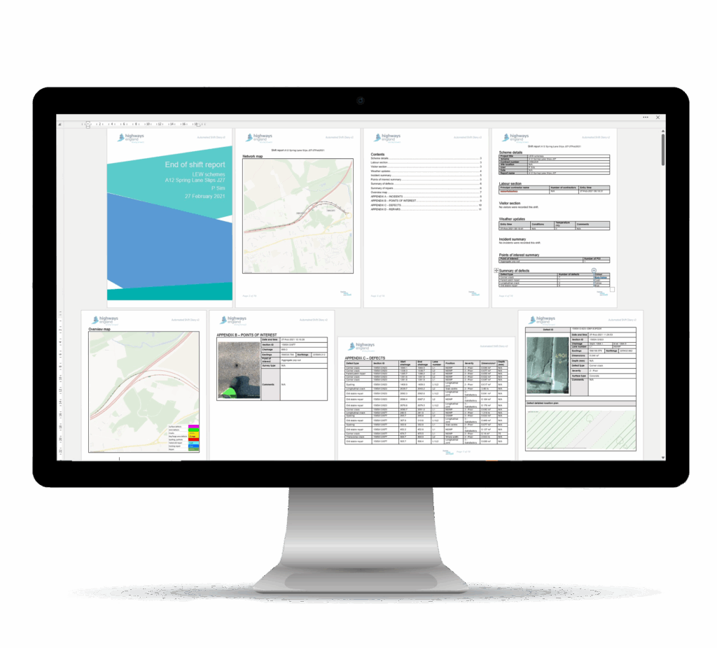
It can be daunting adding new capability into your business, and the ‘data and deliverables’ side is an integral drone mapping challenge to overcome. Common questions we get asked include: “What do I do with the data collected from the drone?”, “How can I turn the data into a deliverable the customer is expecting?” and “How can navigate the solutions ecosystem without overinvesting?”.
The good news is that this is a UAV survey obstacle that’s been solved. There are technology solutions out there that make this easy. Soarvo, for example, is a great way to show drone-originated data with full GIS context. And if you’re struggling finding a workflow, talk to a technology provider that acts as a partner, not just a vendor. Look for someone who can help you solve the problems and support you as you take on UAVs and drones into your business. The truth is they’ve solved these problems before, and they can help you solve it now. Don’t try to re-invent a wheel that already exists.
Related to the workflow challenges above, the software learning curve is seen by some as a significant UAV mapping challenge. To start with there’s no shortage of UAV software packages to choose from – DJI Terra, Pix4D, Trimble Business Center, TerraSolid – and more besides.
Each has pros and cons depending on how you look at them. For example, DJI Terra comes free for a year with all DJI drone purchases, Trimble Business Center sits at the heart of Trimble’s formidable and powerful ecosystem, and TerraSolid is often seen as a go-to for LiDAR processing.
This will naturally lead you in certain directions: if you work a lot with Trimble geospatial hardware and use their ecosystem, then Trimble Business Center makes sense. If you’re dipping your toe in the water, then DJI Terra being free is going to help you get started. They all have different capabilities and strengths though, so there’s no single ‘right answer’ here.
However, there is a better way to think, and it all comes back to establishing what you’re trying to achieve, what kit you’ve got, and what the customer’s expectations are. Identify these, and the software choice becomes a much more simple question of needed capability and ecosystem. Once again, we see the importance of getting the basics right from the beginning. All software has a learning curve, but these days there are plentiful free resources online for all packages. And if you’re really struggling, there’s even affordable training courses.
A UAV mapping obstacle that’s often overlooked is that of data storage and management. Drone mapping and survey generate large volumes of data and once processed, it needs to live somewhere. There’s also the problem of data delivery to the customer. Do you pay for premium file transfer services like WeTransfer or DropBox? Do you buy lots of external SSD drives? Project deliverables in UAV-based survey and mapping are specific, and happily there are specific solutions that are designed specifically for drone mapping obstacles like this.
Platforms like Soarvo offer a combined method of storing and delivering UAV projects. What makes platforms like this different is that the deliverable is viewable with full context. So your photogrammetary, point clouds, LiDAR, thermal, mobile mapping all lives in the same place. This gives a one-point solution that takes care of all UAV data challenges.
KOREC sat down with John Cartledge, our Mapping & GIS Manager, to ask him for 3 top tips for avoiding drone mapping and UAV surveying challenges.
“What I think many people don’t get right in UAV survey and drone mapping is what happens right at the start. When I’m helping people include drones into their workflows, I always recommend asking the simple questions first: what outcomes are you actually working towards? For example, find out what your clients are really trying to achieve, so you can have the full context of their requirements. When you have this, it’s easy to balance out the technology choices to get something really best-fit. But without this, you’re just buying products and trying to include them in an ad hoc manner. It can work, but it’s not smart work. And in today’s landscape, every survey and mapping business needs to work smart.”
This sounds obvious, that how you overcome UAV survey limitations depends on the drone you buy, but there’s nuance here. Again, it comes back to the expectations of the deliverables.
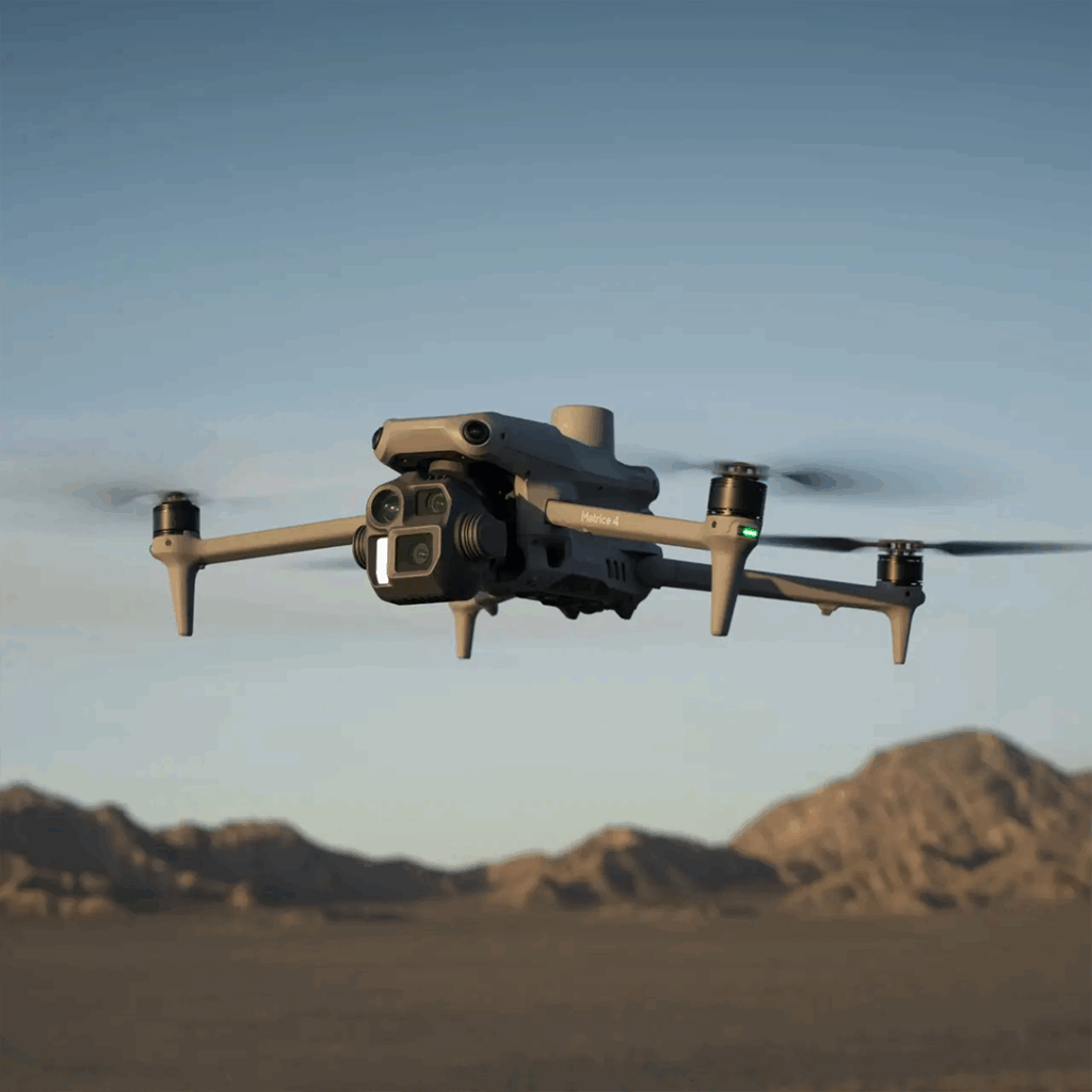
If you’re just starting out, then a lighter-weight and lower-cost devices such as the DJI Matrice 4E may be able to cater for a lot of your drone survey needs for a good while. Then as your business becomes established in drone surveying, moving on to a DJI Matrice 400 series, with more payload capacity, might make sense. Or you might find you need the large-area capability of a fixed-wing device like the Wingtra Ray.
Either way, it’s not about just buying a drone – it’s about buying a particular piece of technology that’s solving a problem at hand. And you can only do that when you’re asking the right question about what it needs to achieve.
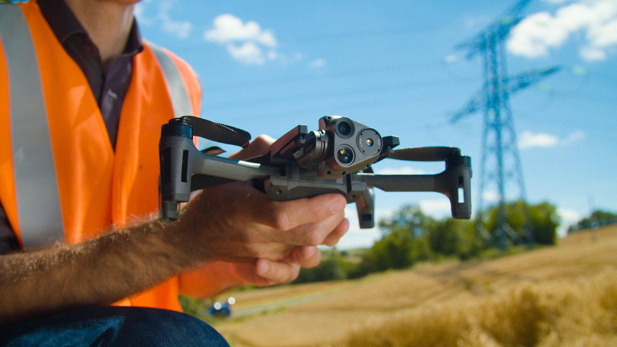
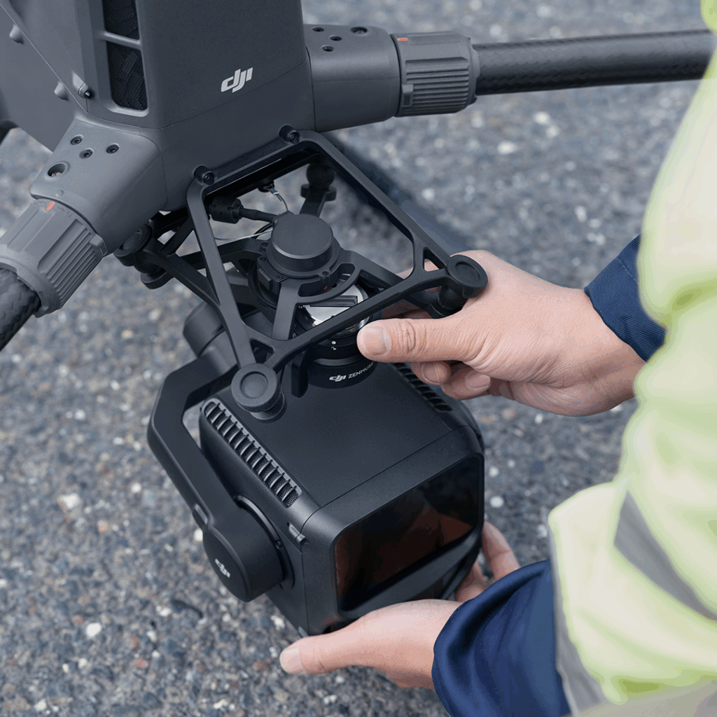
A particular UAV mapping challenge is the problem of the payload. There is a raft of choices from drone manufacturers and third parties. Straight away, you should be asking questions: do you need optical? LiDAR? Thermal? Multi-spectral? Something else? You’ll only know the answers if you’ve asked the right questions of yourself and your customers from the beginning.
One solution is to look for a drone that can easily handle multiple UAV payload options, giving you flexibility in the project outcomes you can deliver.
Now you know what you need to be flying, you’ve got to make sure you’re legally allowed to fly it. This is a UAV survey challenge that is often just seen as an annoying paperwork, but its worth taking a closer look at.
There are different classes of drone license, and the type of drone you fly and where you fly it a determines the license you need. It may actually be worth slightly over-investing in the license, as it removes the obstacle of getting a new license as you expand the drone mapping or surveying side of your business.
Whilst both drone mapping and terrestrial laser scanning generate 3D geospatial data, they differ in the level of detail achieved, and the types of projects they best support.
The key advantage of UAV mapping is speed and coverage. Large areas and linear sites, think construction sites, Highway corridors and land developments, can be surveyed quickly with minimal site access. UAV-based photogrammetric surveys produce orthomosaics and surface models from overlapping images, whilst LiDAR can penetrate vegetation to capture underlying terrain. If RTK technology and is added to your workflow, for example via Trimble Catalyst, drones can achieve centimetre-level accuracy.
Terrestrial laser scanning, by contrast, overcomes the UAV mapping challenge of cm-level resolution, able to capture millimetric detail. Terrestrial scanning can produce extremely dense point clouds with excellent accuracy, making it ideal for high-detail applications. Terrestrial laser scanning is typically considered to be static devices like the Trimble X9, but more recently SLAM (Simultaneous Localisation And Mapping) devices such as the Exyn Nexus give on-the-move terrestrial scanning capability.
In practice, these two technologies are used complementary rather than competitively. Drone mapping provides fast, broad-area context and terrain data, whereas terrestrial laser scanning gives high-precision detail where accuracy is crucial. Getting the right approach depends on the size and complexity of the site, accuracy requirements, and timeframes. Yet again, we come back to understanding the real requirement of the project. Get the bottom of this, and the decisions become easy.
Similar to drone vs terrestrial scanning, UAV surveying vs traditional surveying is a misleading question. The truth is that both ground-based and UAV survey methods play a part in modern geomatics.
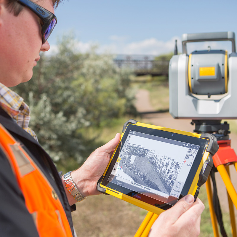
UAV surveying’s advantage is its efficiency, as large and difficult-to-access sites can be surveyed in a fraction of the time required by traditional methods. UAVs also improve safety by reducing the need for surveyors to work in hazardous environments. This is especially relevant for high-safety industries such as rail, where there’s an industry-wide drive to reduce ‘boots on ballast’. UAV surveys can deliver centimetre-level accuracy when used with RTK and ground control, which makes drone-based survey results great for a wide range of topographic mapping, volumetrics and progress monitoring.
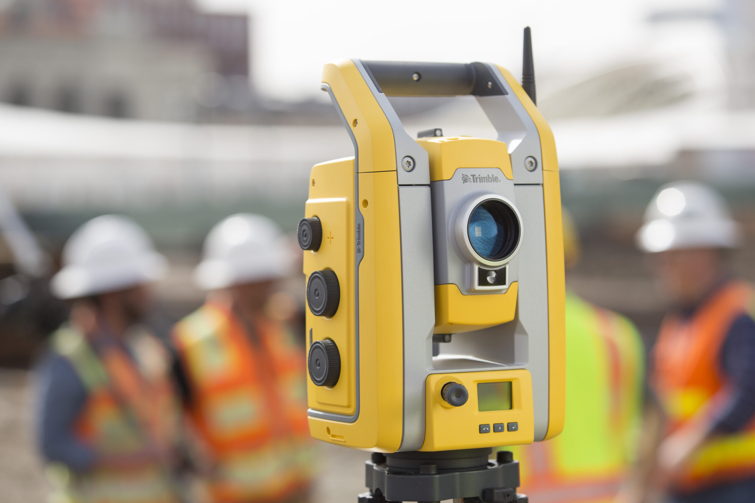
Traditional surveying meanwhile relies on instruments such as total stations and GNSS receivers to measure discrete points directly on the ground. These methods are tried-and-tested and give very high accuracy and strong traceability. This makes them the primary choice for control networks, boundaries, and construction/engineering setting-out. Weather will always be a UAV surveying challenge, which is a key advantage of traditional survey methods.
The key difference lies in data density and productivity. UAVs capture millions of points across a site, providing rich spatial context, while traditional surveys collect fewer, but more precise, points. In practice, the best workflows combine both technologies: traditional surveying establishes control and critical measurements, while UAVs deliver fast, good-fit site data.
KOREC can help you add drones to your workflow. Speak to our friendly experts today to get the right technology to solve your business challenges.