Virtual reality, 3D Laser scanning, robotics, AI, reality data capture, data analytics….today’s careers in the geospatial industry offer numerous possibilities and are a perfect fit for the tech savvy, early adopters of Generation Z who have grown up immersed in technology.
Fuelled by technological developments, the collection and processing of spatial data is now a far cry from the days of just muddy boots and making maps and reflecting these advances is the Technological University Dublin which has recently adapted its BSC in Geospatial Surveying. Changes include a modular approach, updated content and opportunities to combine working with a relevant company whilst completing a degree.
Hands-on with technology
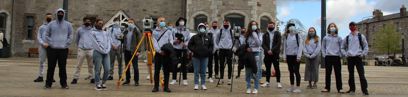
A vital part of any course is for students to be fully aware of developments within the industry. KOREC Ireland’s Mark Poveda, Niall Hand and Fran Mullally (geomatics graduates of the university), along with KOREC colleague Kevin Kinahan, were therefore delighted to have the opportunity to present some new ideas to the University’s 1st and 2nd year students. This was achieved through an on-line presentation and then a day of socially distanced hands-on experience with some of the world’s most advanced Trimble survey technology.
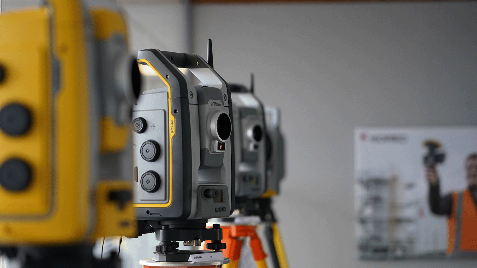
Bringing with them a selection of Trimble instruments including Trimble’s SiteVision Augmented Reality system, the X7 3D Laser Scanner and an R12i GNSS, Mark, Fran and Kevin also had KOREC sponsored hoodies for all the students involved, which was extremely fortunate given the rainy conditions!

Great weather for a new KOREC sponsored hoody!
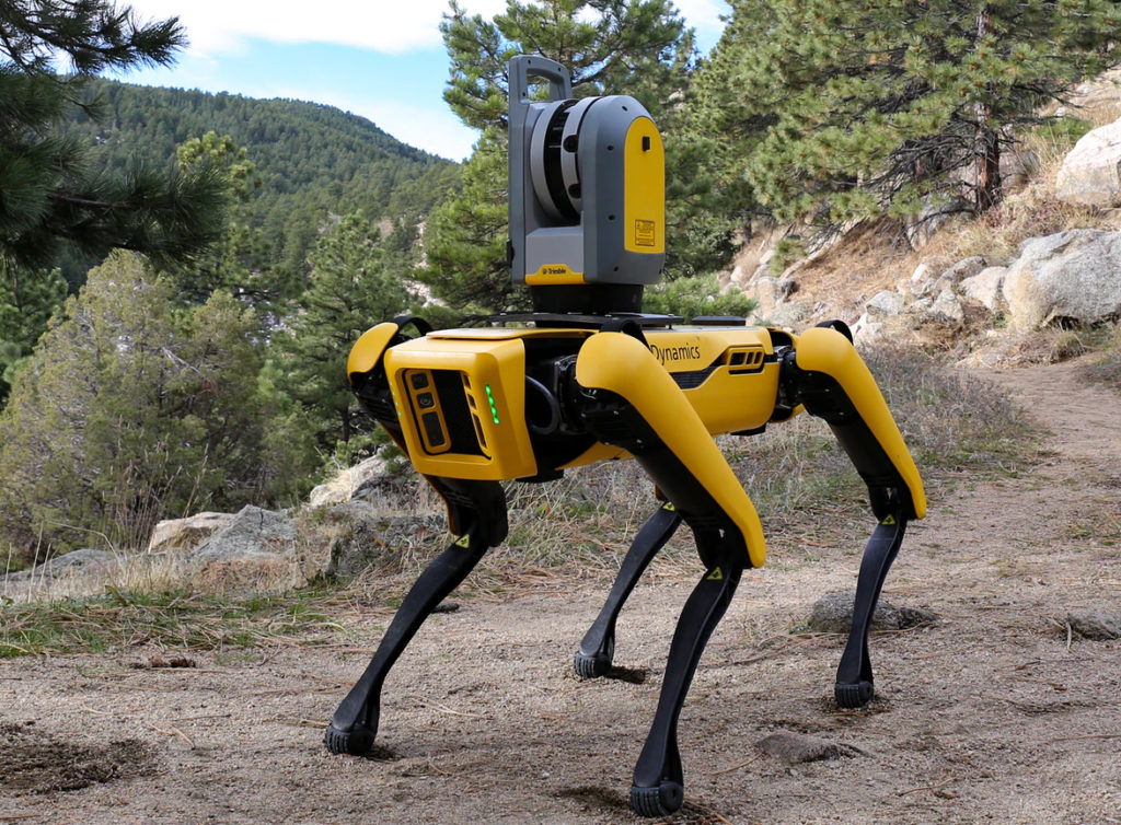
Whilst the students enjoyed the hands-on session, KOREC’s Mark Poveda hopes that the on-line presentation provided a useful source of information on how far reaching and exciting the geospatial industry has become. Particularly well received was the ‘Spot the dog’ Trimble robot video which can be viewed here.

Spot the Dog
“The demonstration day was a great way to finish off my college experience in the BSc of Geographic Science. The Korec team talked us through the operating system of the latest Trimble survey equipment and offered us the opportunity to try out the instruments ourselves. The weather behaved in typical Irish fashion and rain showers were frequent. I was especially impressed with the quality of deliverables produced by the Trimble X7 Laser Scanner and accompanying touch screen under these conditions. The seamless workflow of this machine really highlighted the modern advances in technology enabling us, as surveyors of the future, to carry out surveys to the highest standard regardless of what the Irish climate throws at us. Advances such as these in technology makes me excited for my future career as a surveyor and I can only wait in eager anticipation of what else Trimble will release onto the market in the coming years. “
Rose Pearson, final year student, TU Dublin
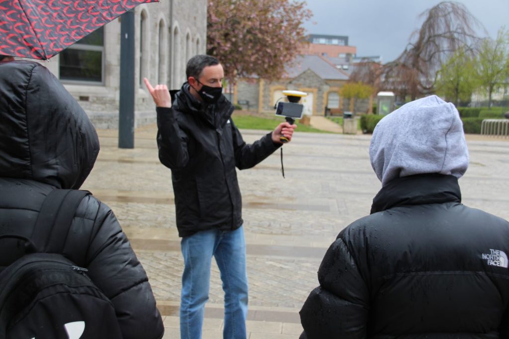
Augmented reality with Trimble SiteVision
“…..the technology demonstrated was very sleek, it was extremely easy to use and makes quick work of any of the tasks given to them. The scanning technology particularly was great, especially being able to view scans right after taking them.”
“The day spent with members of KOREC was extremely insightful and enjoyable. The demonstrations they showed us offered an exciting look into the advancements of this industry and their equipment as well as the broadness of its opportunities.”
1st/2nd year students (TU Dublin)
Our thanks to Dr Audrey Martin, Senior Lecturer, Chair BSc Geographic Science (TU Dublin) and of course to the students who attended and were kind enough to provide some great feedback.