MJ Church's challenge was never the capture or the technical quality of this data, but how to make it accessible and understandable to all those who could benefit, especially those beyond the specialist users. Soarvo was the solution
MJ Church’s specialist team has flown drones for years and is highly skilled at producing consistent, high-quality UAV data for use across its projects.
Their challenge was never the capture or the technical quality of this data, but how to make it accessible and understandable to all those who could benefit, especially those beyond the specialist users.
Leading earthworks and civil engineering contractor MJ Church operates across England working for both public and private clients. It is active on numerous high-profile infrastructure and urban regeneration projects including the M3 Junction 9 and M27 Junction 10 Improvement Schemes. On projects such as these, accurate and consistent drone data is a mainstay for both specialised engineering uses (such as volumetrics) and in providing an understanding of the site as a whole.
‘A key asset’: how high-quality drone data is achieved
Under the guidance of Aled Thomas, Senior Engineering Surveyor / UAV Operations Manager, MJ Church invests heavily in the consistent capture of high-quality drone data. The team uses a KOREC-supplied DJI Mavic 3 Enterprise drone and a Matrice 4 Enterprise drone, both equipped with RTK antennas. Data is processed mainly in DJI Terra and occasionally in Pix4D.
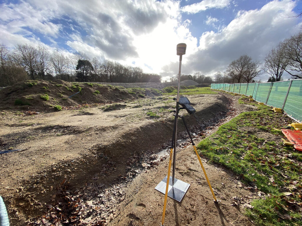
On sites where drones are flown regularly, the company has introduced laminated, permanent aluminium ground control points (GCPs). These are installed at regular intervals throughout each project and are coordinated by Aled to a high level of accuracy. The MJ Church team additionally liaises with clients and their remote pilots conducting joint GCP installation and collaborative surveys to keep all captured UAV data consistently controlled.
The UAVs also receive a continuous RTK correction from installed and rigorously coordinated KOREC-supplied Trimble R750 GNSS base stations. Corrections are broadcast in the widely compatible RTCM3.3 format using the Trimble IBSS platform with 3rd party access enabled. This increases position repeatability, consistency and dependability of the generated deliverables. This is key when checking the grading performance of 3D machine control equipment which was also fed from the same correction source.
Permanently installed ground control target (GCP)
Aled’s careful preparation work includes predefining all flight routes in DJI Flight Hub 2. Flight plans are designed to be fully compliant with the sites’ specific Risk Assessment Method Statements (RAMs) and their UAV operational authorisation. Take-off and landing points are deliberately identified away from congested construction work fronts and possible public interfaces. Details such as crossing highways perpendicularly are implemented as standard to keep pilots and the wider public safe. DJI Flight Hub 2 provides Aled with the confidence and peace of mind that remote pilots cannot deviate from the pre-programmed missions. Thus, flights are compliant by default.
Rigorous checks on the generated UAV digital surface model quality are also carried out by comparing each new survey against the previous one using a CUT/ FILL map (in Virtual Surveyor) and by calculating vertical deltas to observed checkpoints that were not included in the photogrammetry processing. This gives the team complete confidence in what it captures.
The result is consistent, repeatable data using the same flight paths, terrain follow heights, photo intervals and local base GNSS RTK corrections, all tied to the same ground control and rigorously examined and checked.
The challenge for MJ Church was therefore not the capture or the technical quality of that data but how best to share this rich information, beyond the specialist team, and turn it into information that everyone involved in a project could readily understand and use.
Democratising the data with Soarvo
For Construction Technology Lead, Sam Lemon, the value of this data was evident from the outset and he was motivated to find a solution:
“It was very siloed. Sending a Dropbox link to drone survey data often meant firewalls blocking downloads, devices that couldn’t open large orthophotos or meshes, lost files, or people having to dig through folder structures. Gigabytes of data moving across the internet simply didn’t work for the wider project team or clients.”
sam lemon, mj church
As a KOREC customer, he was already aware of Soarvo, a cloud-based data sharing and handling platform with GIS functionality. This software was introduced by MJ Church on the recent successful nine-day possession for the M27/J10 scheme.
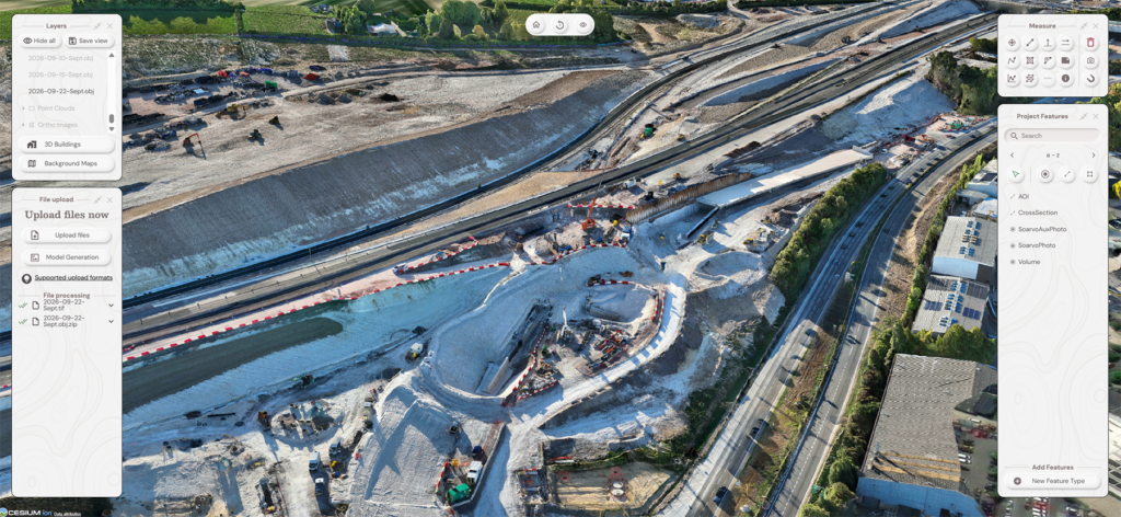
Soarvo takes the data MJ Church has already captured and presents it in an accessible, well-organised, scalable environment. Users can explore detailed 3D meshes and point clouds on ordinary laptops, tablets or even phones without downloading enormous files. Soarvo’s network optimisation means large models load smoothly even on lower-powered devices or poorer connections.
Administration is secure and straightforward: Aled or Sam can add people with just an email address allowing them to gain access to defined datasets. Their Soarvo platform now supports over 150 users.
“Soarvo allows us to present the information we were already capturing in a really accessible, usable and well-organised platform,” says Sam. “It gives the wider project team access to information we were already capturing but hosts it in a much more accessible and intuitive place. We’re now starting to use it across all our sites”
sam lemon, mj church
Case study: M3 Junction 9, a template for Soarvo usage
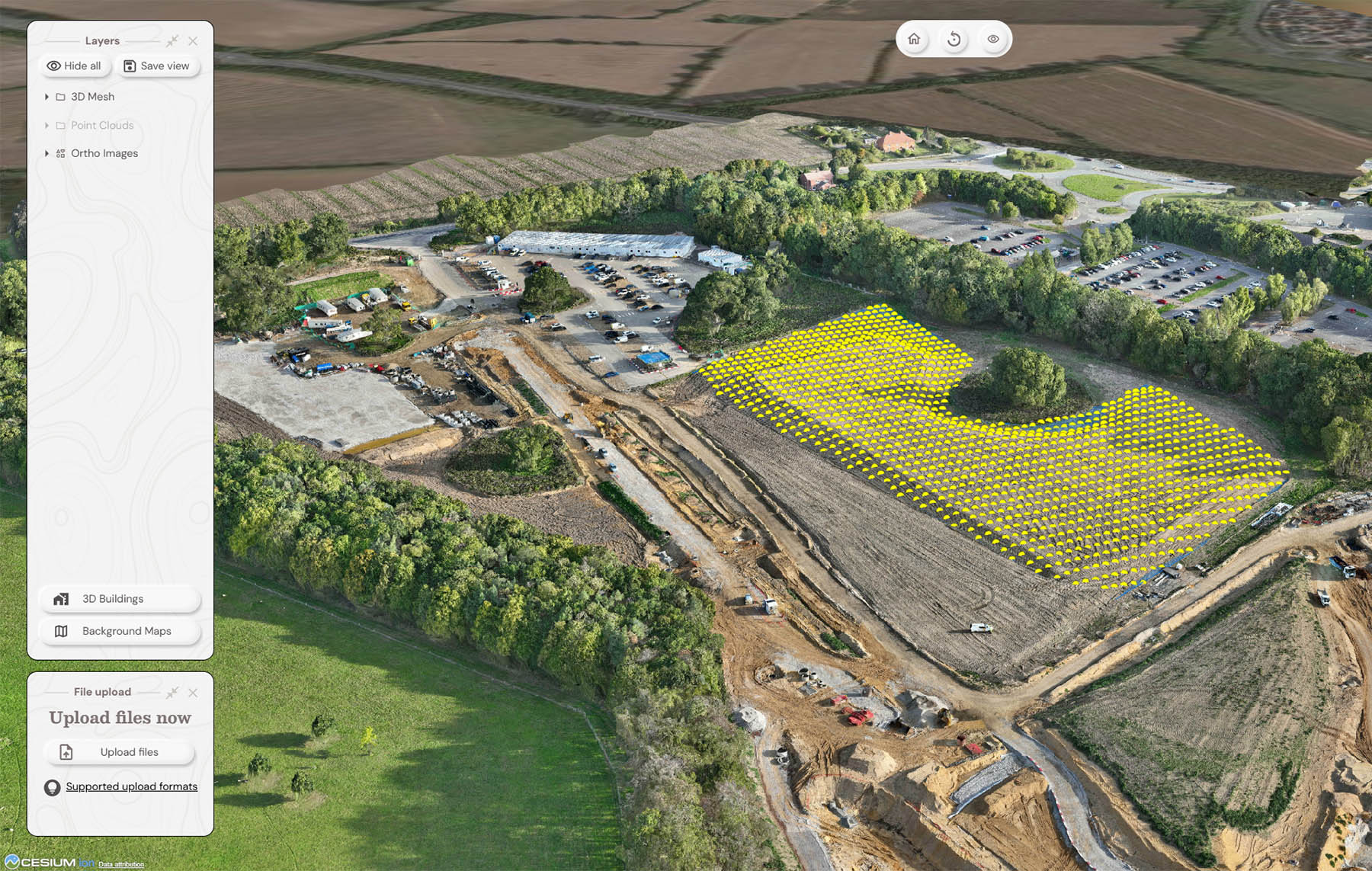
MJ Church is delivering the earthworks package for the M3 Junction 9 improvement scheme in Winchester. This involves bulk excavation and deposition of technically challenging chalk material as well as intricate collaborative work around the project’s many structures including a large underpass under the M3 motorway. This has required the construction of numerous complicated temporary works platforms that interface with the permanent works, all requiring project team coordination and rigorous planning.
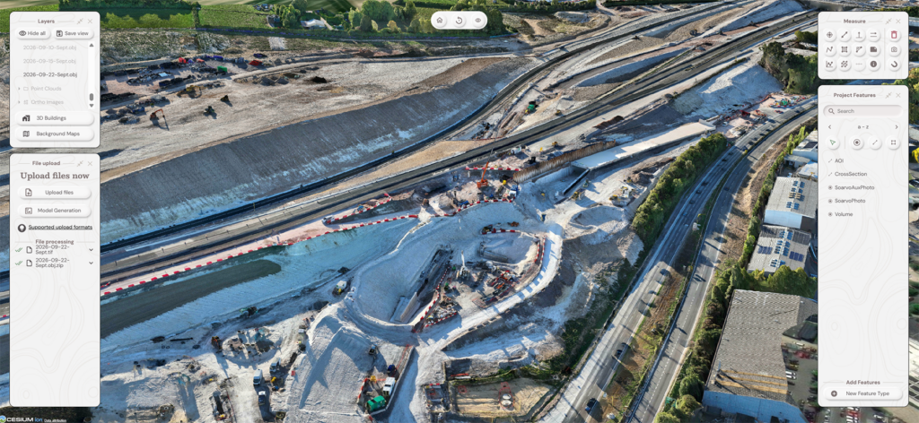
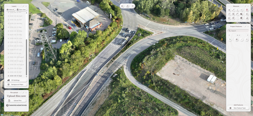
The company is the only contractor approved to fly the site under National Highways GG104 permission. Working on this joint venture with Balfour Beatty and VolkerFitzpatrick, the MJ Church team provides accurate weekly UAV data free of charge via Soarvo. The project manager, project director, quantity surveyors, engineering team, temporary-works designers and a full-time design manager all use it in their resource planning meetings. In particular, the project’s design interface manager uses the data hosted in Soarvo to CAD up increasingly detailed temporary-works models for MJ Church to implement with their 3D machine control equipment.
On the M3 J9 site, Soarvo has become central to planning and progress meetings
The platform has become central to planning and progress meetings. In the site’s digital rehearsal rooms, the first action is often to open Soarvo, spin the 3D mesh and talk through access, demolitions, subcontractor works and resource movements. It supports progression tracking, grade checking and temporary-works modelling and provides a clear understanding of the current terrain and any challenges presented to planned works.
The project will run for at least 18 months and Sam reports that everyone involved is already understanding how much value easy access to the drone data can bring. Its successful reception means that this approach is serving as a template on other schemes.
M3 Junction 9 Soarvo benefits
Weekly site data – always up to date.
One shared view – everyone sees the same site.
Better planning – supports resources, access and sequencing.
Faster decisions – 3D data used directly in meetings.
Progress tracking – clear view of terrain and grades.
Easy access – data available across the project team.
A proven workflow – now being replicated on other schemes.
Case study: Wick Quarry restoration project
Wick Quarry is undergoing one of the largest quarry restoration programmes in the UK – a long-term transformation turning a dangerous quarry void into a safe, stable and ecologically rich landscape for future generations.
Through engineered fill, controlled dewatering, and detailed environmental design, MJ Church is restoring the site responsibly while supporting local biodiversity, water management and future public amenity.
As a result, the quarry is constantly changing as material is excavated, imported, deposited, processed and exported as aggregate to customers.
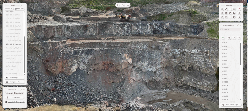
Soarvo allowed the Wick Quarry geotechnical team to view the quarry face in exceptional detail
Previously, MJ Church would have to hire an external land surveying firm with a boat to capture high-resolution images of the quarry for sidewall stability inspection in the voids. The result was hundreds of images that then had to be carefully sifted through – a time-consuming and costly process.
The new workflow sees Aled fly the site every two to three weeks to check the rock face for fractures or stability challenges. Using a DJI Matrice 4E and an automated flight path just 10m from the cliff, he captures the entire face to create a highly detailed mesh. The flight takes around one hour and ten minutes with the data processed overnight.
The resulting model is effectively a digital twin of the rock face, detailed enough to zoom in on cracks just a few millimetres wide. This is vital for geotechnical engineers assessing the stability of the cliff and helps the team plan extraction and sidewall designs to create cells for filling.
For the MJ Church team, however, the challenge wasn’t ‘how can we create a massive detailed model?’ but ‘how can we actually get everyone to use it?’
Rather than downloading a huge dataset and needing a powerful computer to view it, users can simply open the model in Soarvo and explore it online, even on lower-powered devices or less reliable internet connections.
As Sam explains:
“Soarvo does a really good job with network optimisation. In the real world, if you ask someone to download gigabytes of 3D mesh file for their own use, they’re not going to do it. It simply won’t load on their laptop. With Soarvo, you can pull it up on an iPad and it loads immediately, even when the internet is terrible.”
Sam lemon, mj church
Soarvo benefits for Wick Quarry
Safer surveys – no boat or people on the water
Exceptional detail – identifies cracks just millimetres wide
Fast turnaround – data processed overnight
Easy access – huge models viewed without downloading
Shareable data – accessible across devices and locations
Usable by unlimited invited users – no high-powered workstation required
Unexpected lateral uses
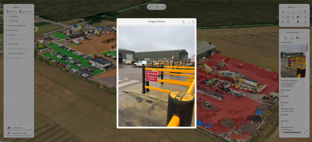
For Sam, the power of Soarvo lies in the number of additional uses where it has proved invaluable as a collaborative tool. One example is Star Farm, MJ Church’s Wiltshire-based storage area, main office and plant repair and servicing premises. On this complex site, with multiple work areas, parking bays and walkways, Soarvo is used when inducting people to give them a 3D understanding of the site. It is particularly useful for the health and safety team because all the information is hosted centrally. Pins can mark crossing points, while quantity surveyors can check plant locations or vehicle numbers.
The MJ Church Senior Leadership Team also benefits. Project managers pull screenshots and measurements into monthly updates, bringing sites to life and supporting commercial decisions. The platform also reduces the burden on stretched engineering teams by answering basic but time-consuming questions such as “how much topsoil was stripped?” without the need for additional requests.
Norfolk Police used the data in Soarvo to measure reduced width lanes to assess access for the Royal Norfolk Show
Soarvo is used on MJ Church’s Star Farm site for inductions
External collaboration has emerged too. When Norwich police were mapping the area ahead of the Norfolk Show and assessing traffic concerns around the A47/A11 Thickthorn Junction works, Sam was already flying the site. MJ Church offered the police access to Soarvo, allowing them to check measurements and access routes without additional flights – a simple collaboration that kept the sky clearer while providing the information they needed.
Why Soarvo works for MJ Church
Both Sam and Aled are clear about the balance they need between a platform’s functionality and its cost. The majority of their Soarvo users don’t need advanced volume or rainwater analysis tools but do need access to the high-quality survey data they captured and the ability to carry out basic measurement and GIS tasks. Soarvo’s focused functionality, economical structure, security and ease of administration make it suitable and cost-effective for exactly this purpose.
Soarvo is hosted on Amazon Web Services (AWS), providing scalability. Access is via viewer permissions so MJ Church does not need to let anyone into their Dropbox Enterprise account and take on the risk that can arise from that. Sam concludes:
“Soarvo is democratising access to geospatial information. It’s giving people access to something that was previously only the territory of the engineers and that comes with opportunities the engineers might not have considered previously. Modern surveying techniques can now easily create large, intricate datasets. The next step is to put that data in the hands of people who need it to make key decisions with the least amount of friction possible”.
sam lemon, mj church
By hosting those models in Soarvo, MJ Church has been able to turn high-quality UAV capture into a shared resource that supports safety, planning, design, commercial decisions and collaboration without the friction of moving gigabytes around the internet.
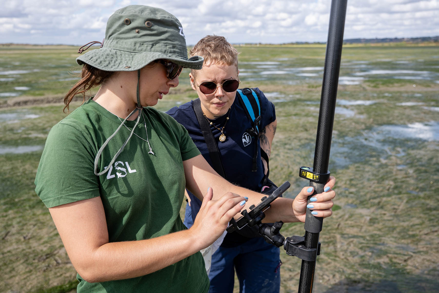
How centimetre accuracy, delivered by a low-cost Trimble Catalyst GNSS system, proved the perfect fit for monitoring seagrass recovery on the multi-million-pound Transforming the Thames Project.
Transforming MEP delivery with the Trimble X9 3D Laser Scanner
Transforming MEP delivery with the Trimble X9 3D Laser Scanner - the recent acquisition of this laser scanner represents the company’s commitment to working smarter, empowering its people and delivering...
IO Geomatics combines over 27 years of topographical expertise with an extensive survey portfolio that allows them to apply the most effective methodologies for each site’s specific challenges. A recent...