Thank you Jordan Knight, Engineering Manager, Greenhatch Group, for supplying the information for this article on how Greenhatch approaches monitoring projects by selecting the most suitable Trimble instruments depending on a site’s particular challenges.
Read the full story here.
The 2018-2019 Geospatial Engineering (CES) publication is out now and includes a great introduction by Skanska’s Mark Lawson and of course another great story from KOREC.
Our thanks go to Rob Brocklehurst of Rob Brocklehurst Civi Engineering for sharing with us his progressive approach to the adoption of drone technology. Rob has specialist knowledge of the wind farm construction industry and has expanded his survey offering with the purchase of both a SenseFly albris for – track surveys and access roads and an eBee Plus RTK for main site surveys.
The whole article can be read here.
K-Mobile is the key to ensuring that a Canadian rock crushing company maintains maximum efficiency through a structured approach to its machinery inspection process.
Situated in a sparsely populated province of western Canada is a rock crushing company that not only has extreme weather conditions to contend with in both winter and summer but also by virtue of its remote location, a senior management team that is predominantly off site.
The company has a simple work remit in that its only purpose is to crush rock to different criteria with profit directly related to the amount of rock crushed per day. Profitability is therefore reliant on the rock crushing equipment being well maintained and having minimal downtime.
In a move to digitise and streamline the inspection process, the company approached KOREC and the K-Mobile team to focus on two separate issues, a ‘fail-safe’ inspection and defect tracking system for the rock crushing machinery and an easy way for the remote management team to assess the amount of work undertaken – and therefore level of profit – each day.
Inspection reporting/Defect tracking
Harsh weather conditions, particularly in winter, meant that none of the crushing crew wished to be outside longer than they had to be. The rock crushing company therefore required a quick and easy to use but fail-safe system that would provide a ‘chain’ approach to form filling with each element of the reporting process having to be filled in before the operator can move on to the next.
KOREC therefore developed a system incorporating NFC tags (low cost, everlasting tags that can be read by most modern smartphones) and a customised version of K-Mobile running on as smartphone. On each bit of machinery requiring inspection, a tag was fitted which could be detected by the smartphone running K-Mobile. Depending on whether it is a daily, weekly or monthly inspection, the NFC reading brings up the relevant inspection form guiding the crew member through the inspection process, prompting replies from picklists and where appropriate, photographs. This information is then wirelessly transferred back to the site manager, wherever he may be located, and shown ‘live’ on a web-based dashboard where recorded defects are flagged up and can be acted upon immediately. These defects remain ‘open’ on the dashboard until resolved with photographic evidence.
Remote production/volume check
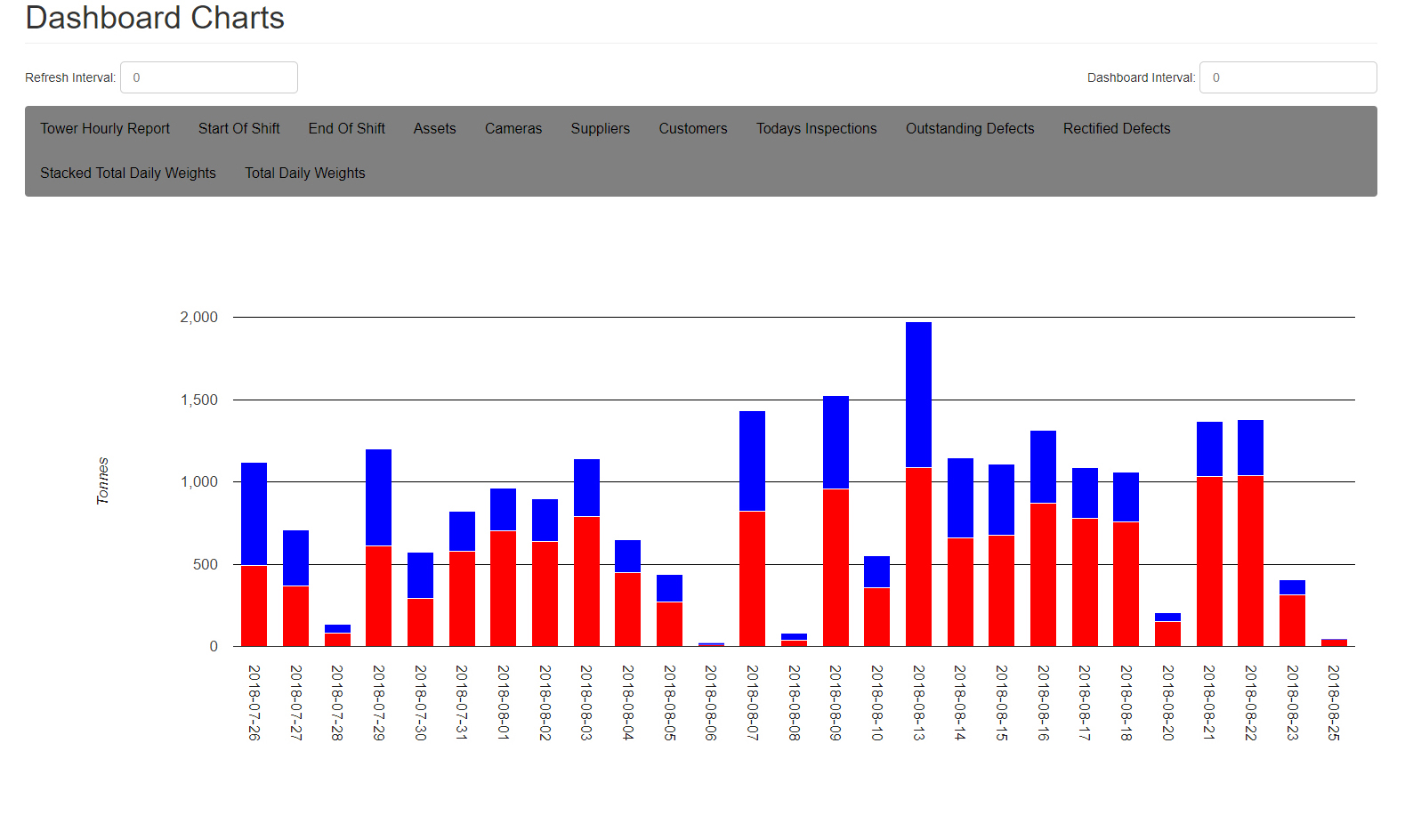
The management team also required a daily report of the amount of each type of rock crushed by weight. The KOREC team therefore integrated the K-Mobile software with the rock weighing scales so that hourly measurements could be taken, along with a photo, and fed into the smartphone showing the increase in weight for both the larger and smaller rock types. From this information the software automatically creates an easy to read bar chart with days of the week and blue and red blocks showing the rising weight of each type of rock. This simple approach make progress extremely easy to monitor at a glance with a line on the graph showing whether a profitable level of crushed rock has been achieved.
This has been a particularly interesting project for KOREC because the principles of the remote management aspect of the K-Mobile software are easily transferrable across many industries.
For further information, please contact the K-Mobile team on 0345 603 1214.
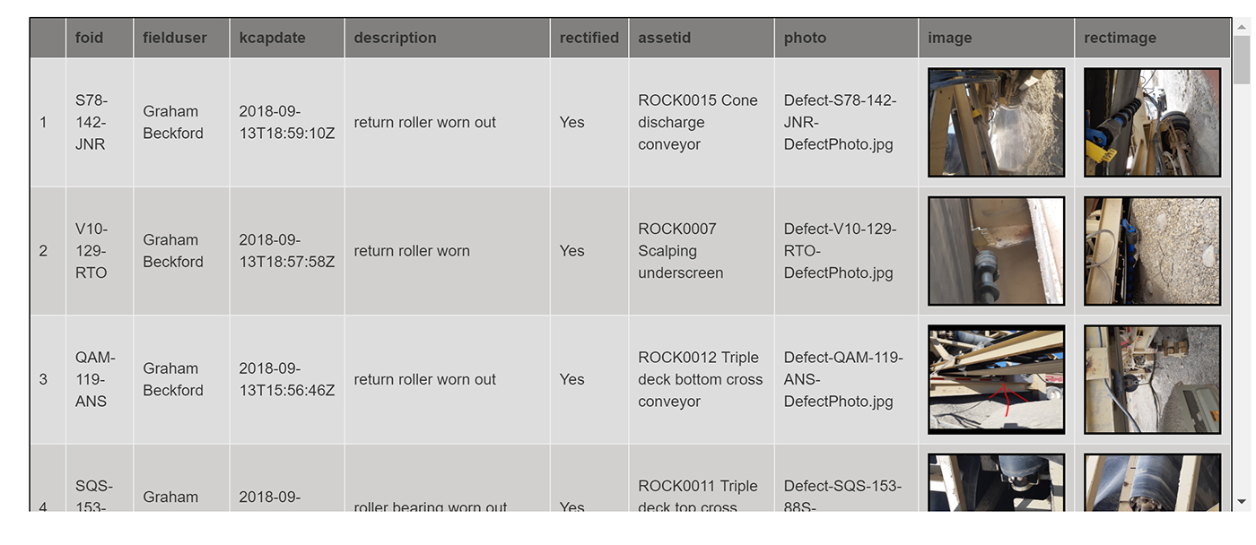
Rectified defect page showing photo of completed work
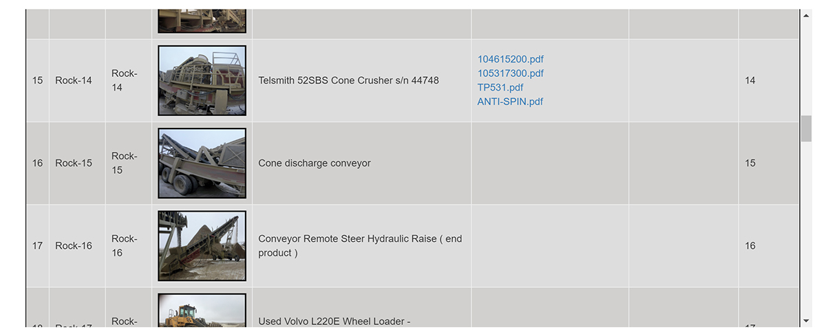
Asset list showing pdf links to all manuals and guides etc
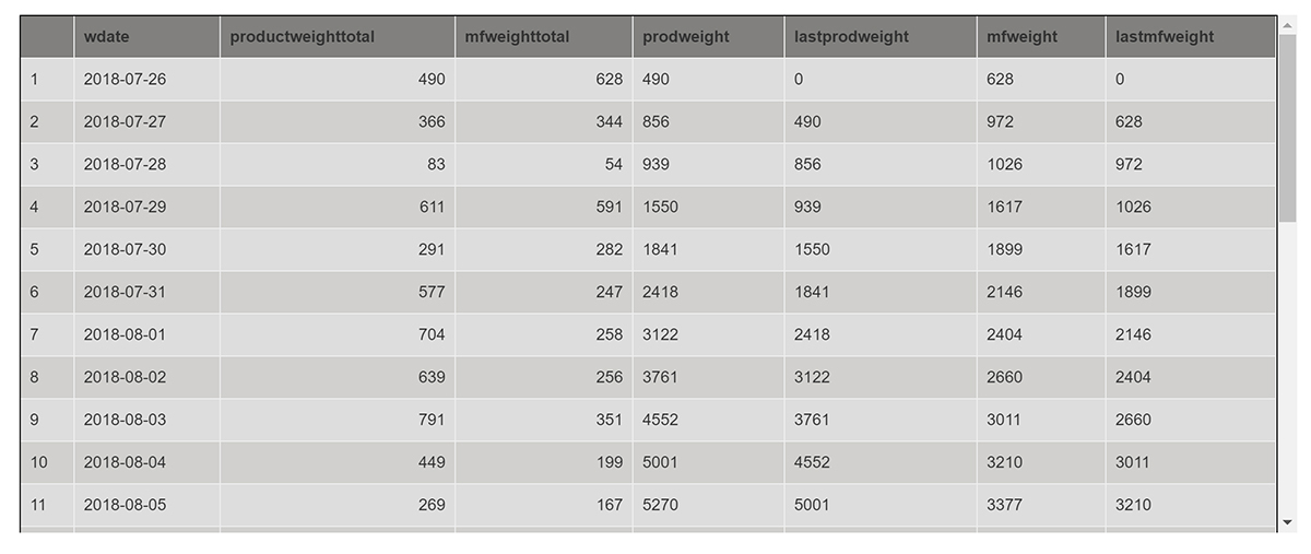
Dashboard showing scale readings per day
Quality, efficiency and safety are the drivers behind senseFly’s latest customer-focused release
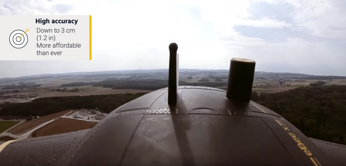
SenseFly has just announced the launch of its latest fixed-wing drone, the eBeeX. Superseding all previous eBee models, the eBee X brings several useful new features along with a significantly reduced cost for the RTK option.
The eBee X has been launched with the promise that “it’s not about the drone,” but instead about overcoming business challenges and indeed it offers a camera to suit every job, the accuracy and coverage capabilities to meet the requirements of even the most demanding projects and is durable enough to work virtually every site.
Here’s what we like:
- Expanded choice of cameras – The eBee X includes a range of revolutionary new camera options to suit every aerial mapping job allowing you to customise your eBee according to your application. Options include:
- senseFly S.O.D.A. 3D, (a unique drone photogrammetry camera with a one-inch sensor, which changes orientation during flight to capture three images (two oblique, one nadir) every time, instead of just one, for a much wider field of view).
- senseFly Aeria X (a compact drone photogrammetry camera with APS-C sensor).
- senseFly Duet T (a dual-camera thermal mapping rig)
The eBee X is also compatible with the Parrot Sequoia+ multispectral camera for agriculture, the senseFly S.O.D.A. drone photogrammetry camera and senseFly Corridor for simple linear mapping.
- Suitable for challenging sites – Built-in space-friendly Steep Landing technology (35° approach)
- Even more rugged – Optimised airframe design and ultra-strong underbody
- Significantly lower cost for RTK option – Worth repeating!
- Endurance Extension option – Unlocks a flight time of up to 90 minutes (versus a maximum endurance of 59 minutes by default) whilst not strictly relevant in the UK, could be useful abroad when flying with less restrictions.
Call 0345 603 1214 to book a KOREC demonstration now
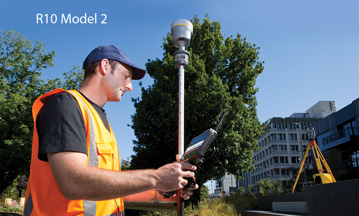
Seriously, we thought it couldn’t get any better, but Trimble has just announced a Model 2 version of its market dominating R10.
Model 2 enhancements include:
- 672 GNSS channels for unrivalled GNSS constellation tracking, including GPS, GLONASS, BeiDou, Galileo, QZSS, IRNSS as well as the full range of SBAS. The Trimble R10 tracks and processes all of today’s available GNSS signals and is designed to support planned GNSS signals and systems that may be launched in the future.
- Improved reliability against sources of interference and spoofed signals.
- 33% more operating time in the field (on average) thanks to improved power management to increase battery life.
- Store more than 10 years of raw observations thanks to an increased internal memory (6 GB).
- Even better equipped for Bring Your Own Device (BYOD) environments with support for Android and iOS platforms.
And of course the Model 2 includes all the Trimble R10’s core technologies:
- Trimble HD-GNSS processing engine that enables points to be quickly measured with confidence
- Trimble SurePoint™ technology for precise positioning capture and full tilt compensation
- Trimble xFill® technology for centimeter-level positioning during outages
- Support for Trimble CenterPoint® RTX corrections for RTK level precision worldwide
Call 0345 603 1214 to book a KOREC demonstration now
The K-Mobile team is nothing if not accommodating and most of all they enjoy problem solving, no matter how large, or in this case, how small! Here are three of the latest that they’ve been tackling.
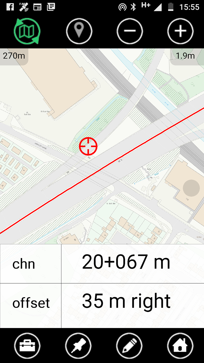
Help – no one delivering goods or visiting us on our motorway site can find us!
Large road construction projects are all referenced by chainage so we’ve developed a really useful little function that’s now included in all versions of K-Mobile. Designed to provide users with a free dynamic chainage display on any linear job, it’s ideal for deliveries and visitors who can be provided with access via a link.
We’re collecting information on traffic light conditions but have to open up each individual record to tick a ‘fully functional’ box. When we have 20 sets of working lights on an intersection this can take 20 minutes. How can we speed up this process?
Welcome to ‘lassoo assets’! It does exactly what the name says and can be used on any asset type allowing for a time saving ‘batch’ approach to changing a field. In this case we developed ‘lassoo assets’ as a useful add-on to K-Mobile, making the process 20x faster. This is just the sort of small development the K-Mobile team can undertake in less than a day!
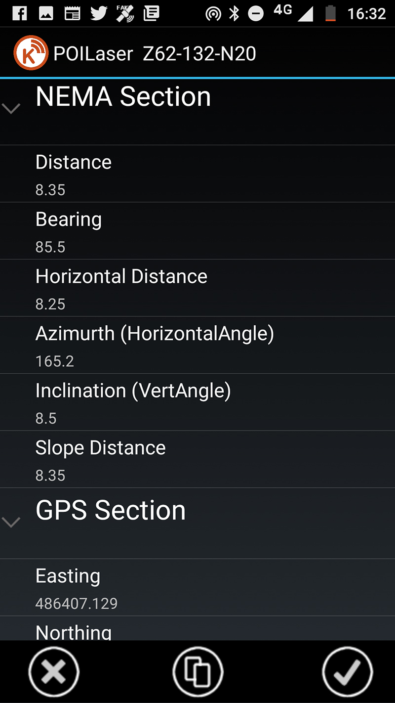
How can I QA check the offset measurements from my laser rangefinder
With the rise of Trimble Catalyst (software based GNSS) running on tablets, we’re seeing increased usage of the TruPulse laser rangefinder for offset measurements as an alternative to the Trimble GeoExporer with its built -in laser. The K-Mobile team has responded accordingly by enhancing the form that pops up automatically when a laser measurement is taken. You can now store any laser measurement and the coordinates of where you are standing as attributes. Two positions – ideal for QA purposes!
Although developed for handheld lasers, this feature works with any NEMA style BlueTooth device such as sonar devices and radiation detectors.
What would improve your productivity? Please contact the K-Mobile team on 0345 603 1214
KOREC’s customer service and technical support accounts for 80% of Coastway’s decision
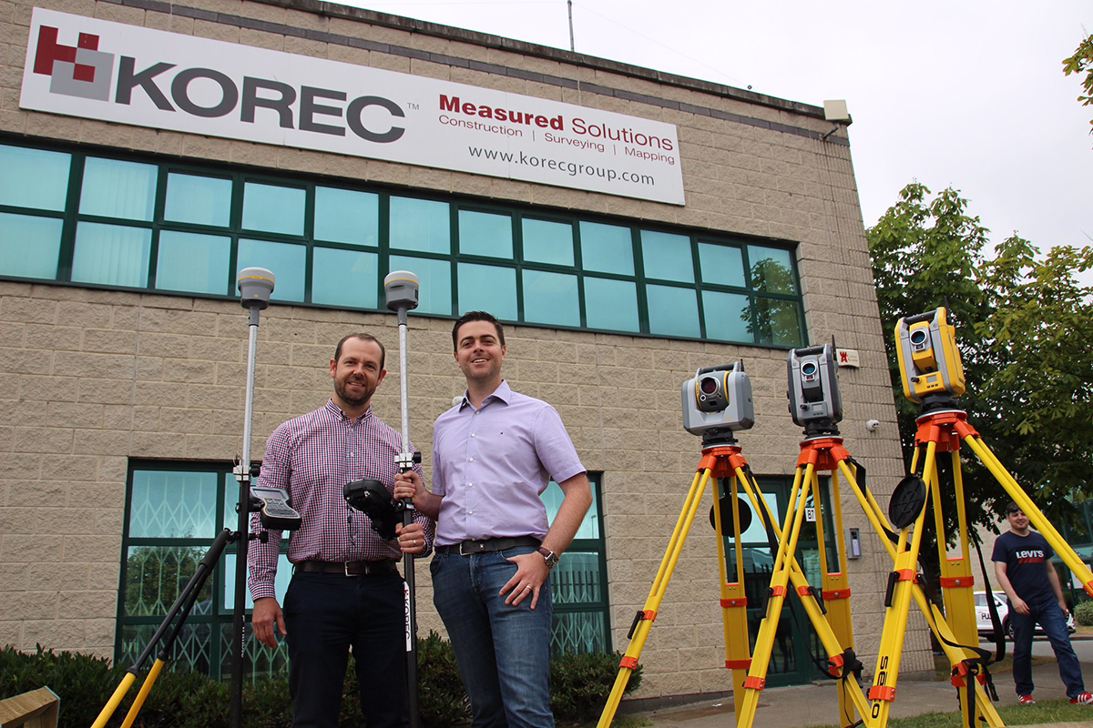
Coastway Surveys is a thriving survey business with offices in Ireland and the UK. Offering a wide range of services including land, engineering and aerial surveys, scan to BIM and mobile mapping, it is a company that has prepared for further expansion with a new management structure designed to meet the needs of a growing business. As a part of this re-structure, Paul Moir has taken up the new role of Operations Director bringing with him extensive surveying, engineering, data analysis and consultancy skills from over 20 years of worldwide industry experience.
One of Paul’s first strategic decisions was to select a preferred surveying instrument supplier that was equipped to grow with Coastway Surveys and work with it as a partner during its expansion into new business areas. Although Coastway had had satisfactory relationships with a number of suppliers previously, Paul felt that whilst price, reliability and functionality of equipment would be key criteria, the overriding consideration would be the level of service and support that a supplier could offer. Familiar with Trimble technology, he therefore contacted KOREC Ireland and was impressed immediately by the fast response of the team, by KOREC’s personal approach and by the set-up of the company’s Technical Support department.
Paul explains, “Service and support are key to the day to day running of our surveying and engineering services. Even the best instruments and software can have break downs or blips and KOREC has proved itself to be extremely proficient in dealing with these issues, whether it’s with the free loan of a replacement instrument or solving something over a quick phone call. For me service and support was 80% of the Coastway decision to go with KOREC as our preferred supplier and the service we have received has been exceptional. The team is always contactable with dedicated support staff so that I never feel I am taking someone away from another area of their job. Issues are addressed immediately and both the technical and sales staff are entirely flexible in their approach – I’ve even had the Regional Sales Director meet me on site over a weekend. Along with some excellent free training, this is the sort of relationship that we believe will help Coastway’s dynamic approach towards expansion into new business areas.”
Coastway Surveys has invested in a wide range of KOREC supplied instrumentation including Trimble R10 GNSS, S6 Total Station, SX10 Scanning Total Station and TX8 Laser Scanner technology. The company has also purchased senseFly eBee Plus fixed wing survey drones.
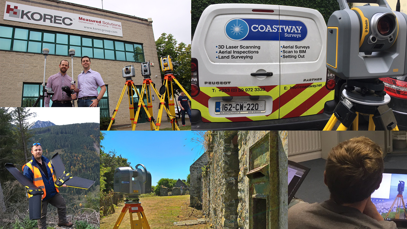
Coastway’s Paul Moir (top left) with Shane Murtagh of KOREC

It is the largest maze in Britain, and one of the largest mazes in the world so we’re delighted to report that once again York Maze has been using KOREC supplied Trimble sub-metre Geo handheld mapping technology to map out this year’s Jurassic themed attraction!
Last year Maze Master Tom Pearcy explained to us exactly how it’s done. “We’ve come a long way since our first creation in 2002. Back then our mazes were based on just lines and circles drawn onto graph paper and in the field, we used sticks and strings to set out the design, a time consuming exercise which could take two weeks or more.
Today the process is much more straightforward. Our theme is designed in a basic drawing package and then uploaded onto our Trimble Geo which provides us with the 0.5m accuracy that this type of work requires.
We then go out into the maize field and effectively create the biggest dot to dot in the world!
Using the map on the Trimble Geo, I plot out the design amongst the 6” high maize plants, marking the points as I go, whilst a cultivator follows on behind.
The accuracy and reliability of the Geo enables us to complete the work in just 3-4 days and of course reproduce much more complex designs.”
www.yorkmaze.co.uk Open daily from 10am – 6:30pm until Monday 3rd September 2018
Stolen instrument recovered, calibrated and back on site within four days
Survey instrument theft is a problem that’s showing no signs of abating and unfortunately Murphy Surveys Ltd. are the latest KOREC customer to fall victim. However, in this case the company was lucky enough to recover its stolen instrument and have it back on site, fully cleaned and recalibrated, within four days, thanks to Trimble L2P tracking, the fast response by the local Gardai and KOREC and Murphy Surveys Ltd. staff working through the night.
Based in the UK and Ireland, Murphy Surveys Ltd. report that although this theft occurred just outside of Dublin, they have suffered more theft incidents in the UK than Ireland, where thankfully this type of event is relatively infrequent. In this case, on Friday 29th June 2018, a Trimble S5 Robotic Total Station was stolen from a site at midday. The theft was immediately reported to the Gardaí, along with the make of vehicle driven by the thieves.
Around 5.00pm Murphy Surveys Ltd. contacted KOREC Ireland on the off chance that the instrument Trimble L2P was protected and were delighted to hear that it was and that we could trace its whereabouts. A quick log-in to our system and we could see that it was currently at rest in a residential area to the south-west of the city, about 30km from the site.
The Gardaí were quick to follow up on a series of screen grabs we sent them and Murphy Surveys Ltd., pinpointing the S5’s location. Although they searched several vehicles in the area, they were unable to recover the instrument. This was due to the number of cars and buildings in close proximity and because there was no sign of the vehicle that Murphy Surveys Ltd. had described.
Not to be put off, KOREC was able to track the journey of the S5 in detail, thus revealing that the instrument had clearly been moved from one vehicle to another, but until it was active again, it was impossible to pinpoint exactly which vehicle.
KOREC therefore set up a ‘geo-fence’ on their L2P tracking software and waited….
Around midnight the geo-fence alarm was triggered and a few minutes later the instrument was shown to be stationary in a green area. The Gardaí were called and the instrument was immediately recovered. It was returned to KOREC the following Monday morning for cleaning and recalibration, and was back on Murphy Surveys Ltd. site, fully functional, by the middle of the week.
The chain of events that led to the recovery of the S5 demonstrates that early police activity in the area had alerted the thieves to the possibility of the instrument being tracked and that they had consequently decided to abandon it.
This is another great example of how promptly the Police, in this case the Gardaí, can respond when supplied with real-time tracking information and coordinates. It’s also an early sign that instrument tracking may eventually prove to be a deterrent to thieves as well as a means of instrument recovery.
Raymond Murphy, Chief Executive Officer, Murphy Surveys Ltd. said, “We were thoroughly impressed with the tracking capability of the Trimble S5. The fact that we were able to pin point the position of the instrument so quickly, and with the support of the Gardaí retrieve the kit was the best possible outcome. As an industry we are being targeted by criminals and we’re not the only survey company falling victim to these senseless crimes. As a business and employer we have a duty of care to our employees and we simply do not stand for this behaviour. We are continually reviewing and strengthening our security polices and we welcome new technology and initiatives to help protect our industry.”
Our thanks to Murphy Surveys Ltd. for sharing this story with us.
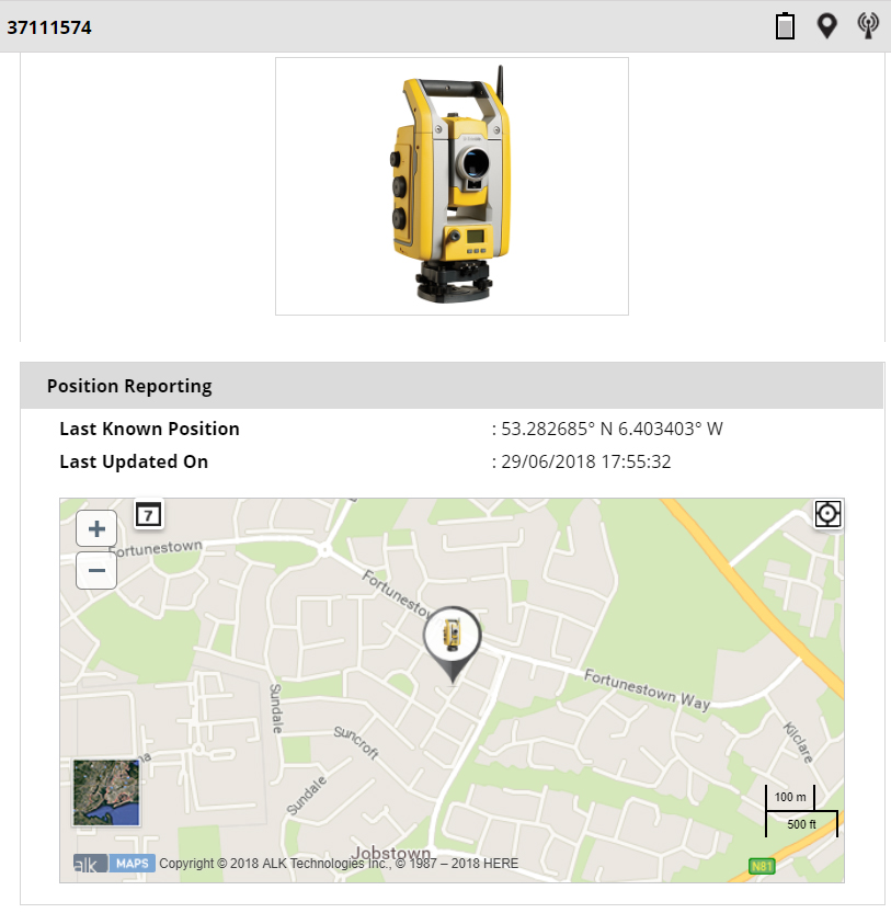
KOREC was able to provide the Gardaí with coordinates of the stolen S5’s position
The latest issue of CES magazine is out now and KOREC can’t help but think that the Editor’s interest in all things Star Wars may have assisted in the great coverage of this unusual case study, a monitoring story set on one of Ireland’s most important herigage sites, Skellig Michael…better know as the location where Luke Skywalker was tracked down in the cliff hanger scene of The Force Awkens!