Trimble Forensics Capture Explained: Guided Scene Mapping for Investigators
Find out how Trimble Forensics Capture guides investigators through efficient scene mapping, what data it collects, and how it connects to the wider Trimble forensics workflow.
Our scanning specialist with 20+ years in geospatial, Melvin has spent a decade capturing huge volumes of data with laser scanners, and is equally passionate about promoting surveying careers through school talks and college partnerships.
Documenting a scene thoroughly under time pressure is difficult, and it is easy for a step to be missed when an investigator is juggling several instruments and trying to remember everything a scene requires. Trimble Forensics Capture exists to remove that burden, guiding the investigator through scene mapping so that the process, rather than memory alone, ensures nothing is overlooked.
This guide explains what Trimble Forensics Capture does and how it fits into an investigator’s day-to-day work. It is the third article in KOREC’s forensics guides series. For the equipment it works alongside, see our guides on forensic scene documentation equipment and crime scene laser scanners.
What Is Trimble Forensics Capture?
Field Software Designed for Forensic Investigators
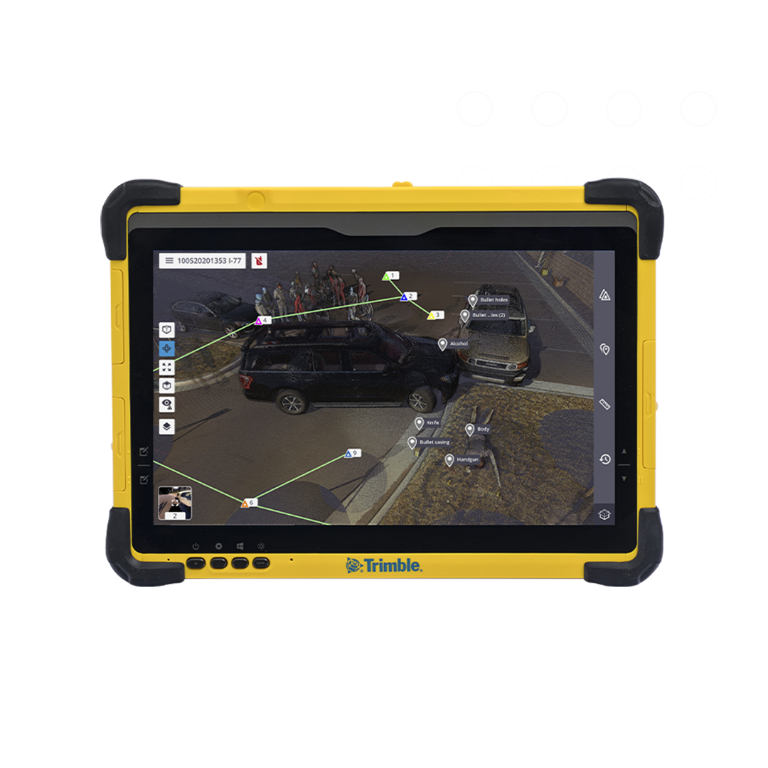
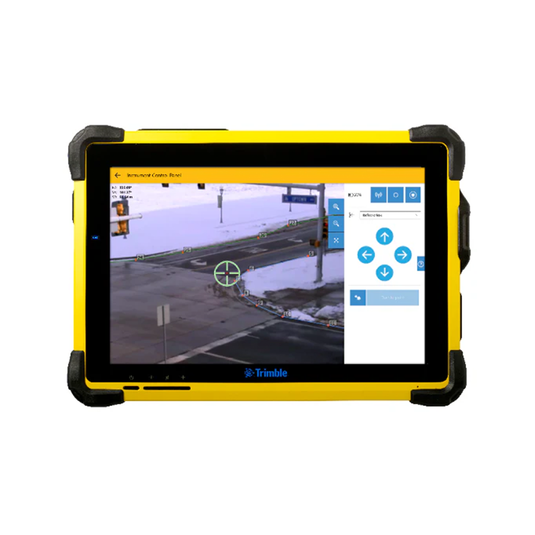
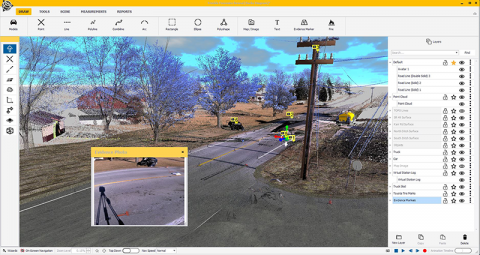
Trimble Forensics Capture is field software built specifically around the way forensic scenes are actually worked, rather than adapted from a general survey package. It runs on a handheld data collector, giving the investigator a single interface to manage scanning, GNSS, and total station tasks at the scene.
How It Fits Into the Trimble Forensics Workflow
Trimble Forensics Capture sits at the start of the wider Trimble forensics workflow, capturing data in the field that then carries forward into office-based analysis. It is the connecting layer between the hardware used at the scene and the software used afterwards, rather than a standalone tool that exists in isolation.
How the Guided Workflow Works at a Scene
Setting Up and Connecting Instruments
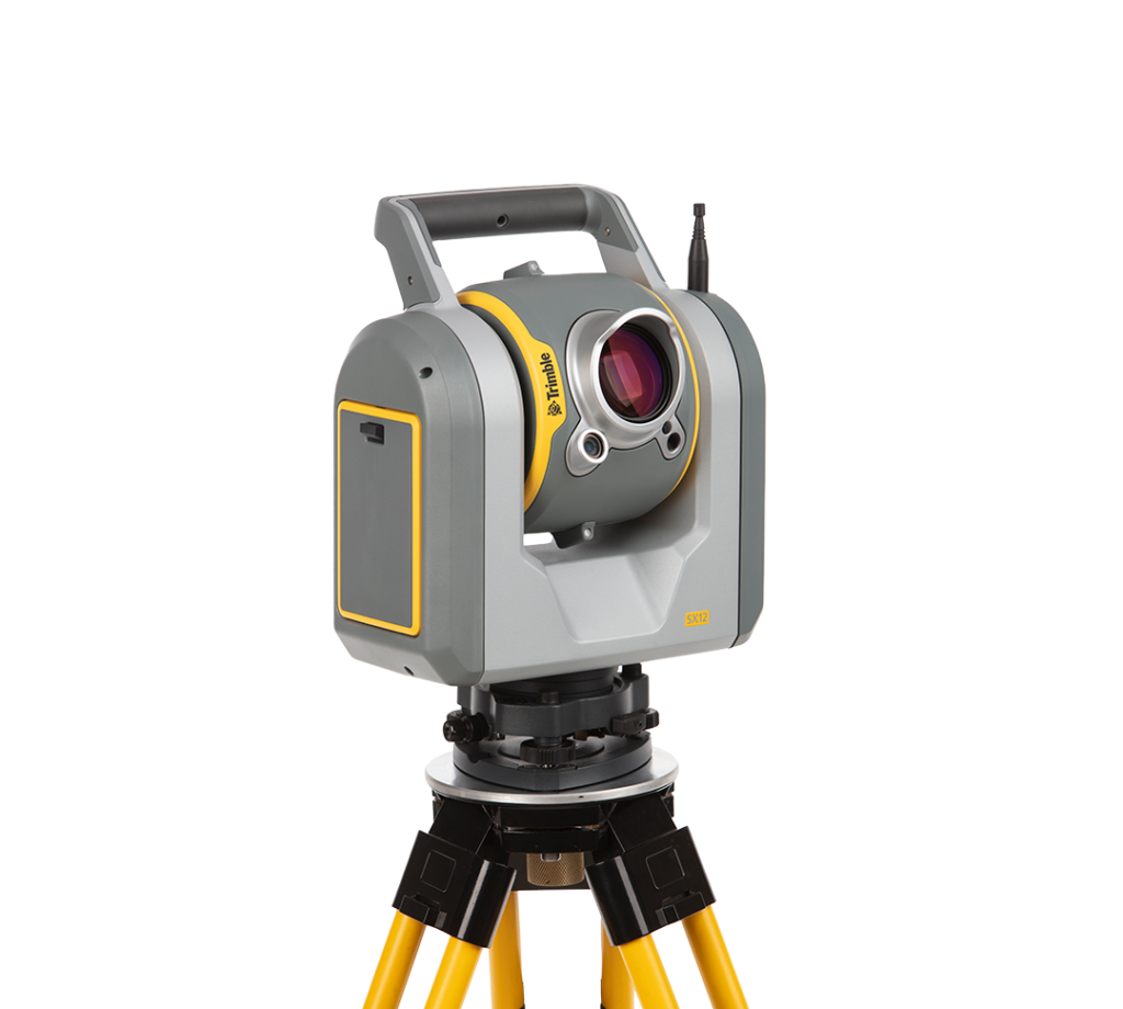
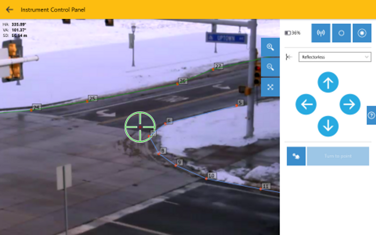
An investigator connects whichever instruments the scene requires, whether that is a Trimble X9 scanner, a Trimble SX12, a GNSS receiver such as the Trimble Catalyst DA2, or a total station, and Trimble Forensics Capture manages each through the same interface. The investigator does not need to switch software depending on which instrument they are using at any given moment.
Collecting Evidence Points, Scans, and GNSS Positions
The guided workflow walks the investigator through each task a scene requires: capturing scans, measuring evidence points with a total station, and recording GNSS positions where absolute location matters. This structure is what protects against a step being missed under the time pressure a real scene almost always involves.
In-Field Point Cloud Georeferencing
Trimble Forensics Capture ties point cloud data to a known position while the investigator is still at the scene, rather than leaving that step for later. This means the data arriving in the office is already correctly positioned, which removes a source of delay and potential error that would otherwise sit between field capture and usable analysis.
Working with Multiple Instruments Through One Interface
GNSS, Scanners, and Total Stations in a Single Workflow
Trimble Forensics Capture gives the investigator both 2D and 3D views of the data as it is being collected, useful for checking coverage and confirming that a particular evidence item has actually been captured before leaving that part of the scene. Checking this on site, rather than discovering a gap once back at the office, is a small habit that saves a great deal of difficulty later.
Customisable Point Code Libraries
Pre-Configuring Codes for Your Scene Types
Trimble Forensics Capture allows investigators to pre-configure point codes for the evidence categories relevant to their typical scene types. Rather than typing a description for every evidence point on the day, an officer selects from a pre-built library, which is considerably faster and reduces the risk of inconsistent or unclear descriptions creeping into the record.
Consistency Between Officers and Across Scenes
A shared point code library also means different officers working different scenes record evidence in a consistent way, which matters when data from multiple visits or multiple investigators eventually needs to be compared or combined. This consistency is a concrete, practical benefit that is easy for a forensic services manager to understand and easy to put in place across a team.
Collaboration on Large or Complex Scenes
Multiple Officers Working the Same Scene
On larger or more complex scenes, Trimble Forensics Capture does not support real-time, simultaneous multi-user collaboration inside a single live scene file. Instead, multiple investigators can map a large scene independently, each working in a separate project file on their own device. Once collection is complete, these individual files are merged into a single combined dataset, so a large scene can still be documented in a fraction of the time a single investigator working alone would need.
Importing Data from Previous Visits
Where a scene requires more than one visit, Trimble Forensics Capture can import data already collected, so a returning officer is building on the existing record rather than starting again or risking duplicated work.
Transferring Data to Trimble Forensics Reveal
Seamless Handover from Field to Office
Once captured, data transfers directly into Trimble Forensics Reveal for office-based analysis and reconstruction, continuing the same workflow rather than requiring a separate import or reformatting step. Our guide on Trimble Forensics Reveal explains what happens at this next stage.
Frequently Asked Questions
Which Trimble hardware does Forensics Capture work with?
Can multiple officers use Forensics Capture on the same scene?
Multiple officers can work a large or complex scene, but not inside the same live scene file at the same time. Trimble Forensics Capture lets each investigator map an area independently in a separate project file, with the resulting datasets merged together once collection is complete.
How does Forensics Capture connect to Trimble Forensics Reveal?
Data captured in Trimble Forensics Capture transfers directly into Trimble Forensics Reveal for office analysis, continuing the same workflow rather than requiring data to be reformatted or reconciled between the two.
Learn more about Trimble Forensics Capture
KOREC can advise you on how to implement Trimble Forensics Capture into your operations. Speak to our friendly experts today to get the right technology to solve your project challenges.
How 3D Laser Scanners Are Used at Crime and Collision Scenes
Find out how 3D laser scanners capture complete crime and collision scenes in minutes, why speed matters for scene clearance, and how point cloud data supports evidence analysis and court...
What Equipment Is Used in Forensic Scene Documentation?
Discover the geospatial equipment used at crime and collision scenes, from 3D laser scanners and total stations through to GNSS, and how each tool contributes to accurate, court-ready documentation.
If a project requires refurbishment, redevelopment, restoration or extension of an existing property, it is likely that a measured survey will be required. Here we dig deeper into why, what...