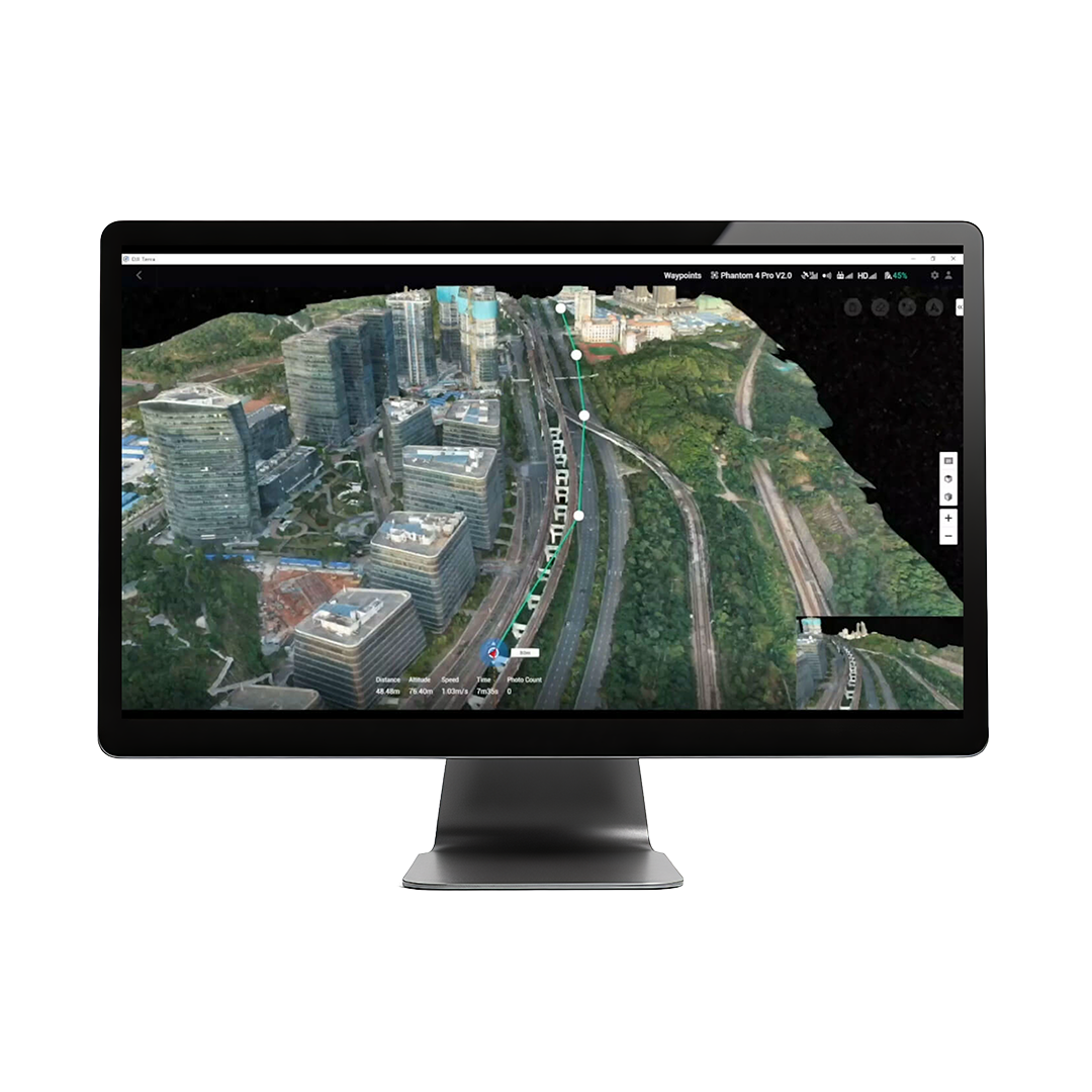
DJI Terra is a 3D model reconstruction software that has photogrammetry as its core technology. It supports a range of accurate and efficient 2D and 3D reconstruction of visible light, and data processing through DJI LiDAR. DJI Terra is a perfect match for DJI Enterprise drones and payloads. It works in conjunction to build a complete application solution that caters to vertical scenarios such as land surveying and mapping, power transmission, emergency services, construction, transportation, and agriculture.

Unparalleled Efficiency and User Experience
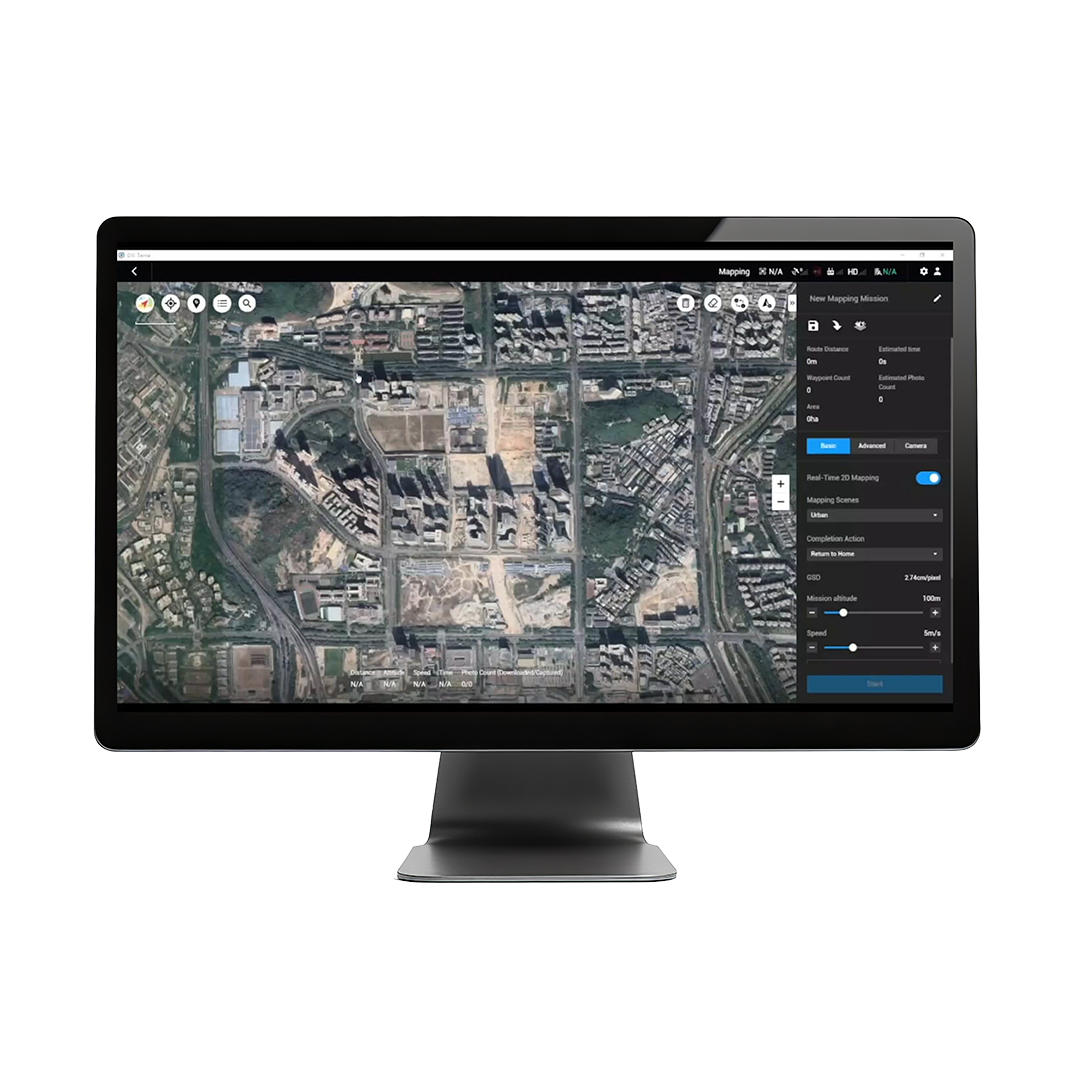
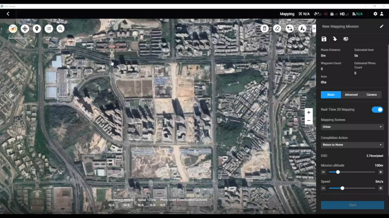
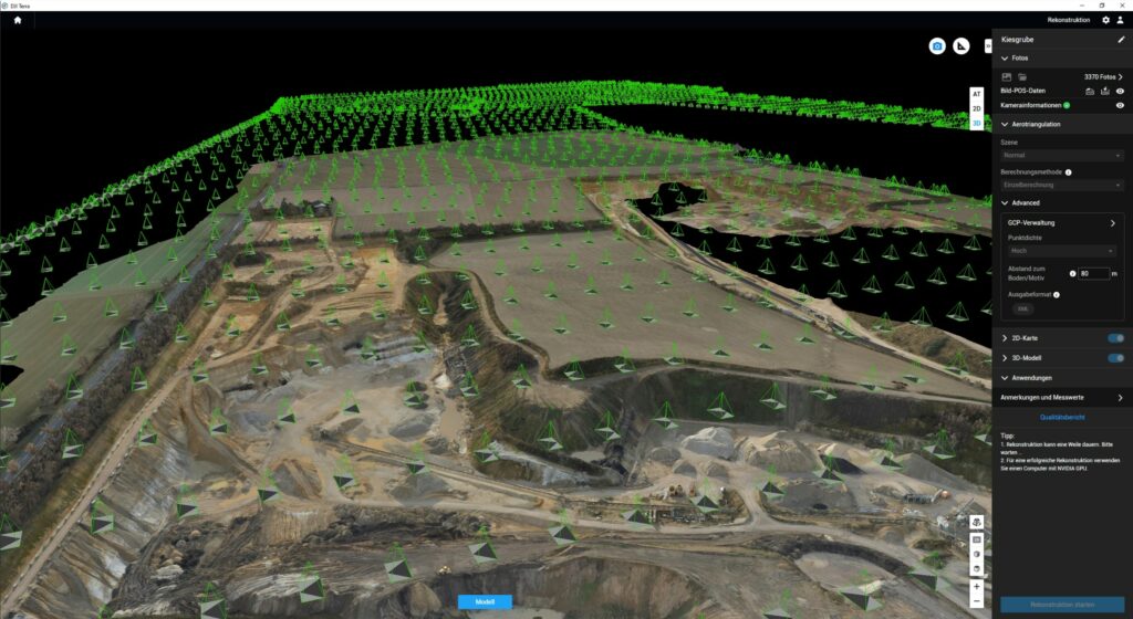
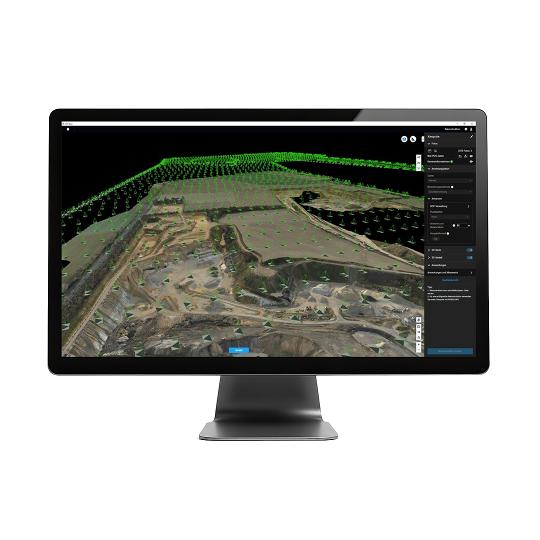
A simple and intuitive interface that gets you flying in no time. Run reconstruction missions by employing multiple graphics cards simultaneously to improve efficiency.
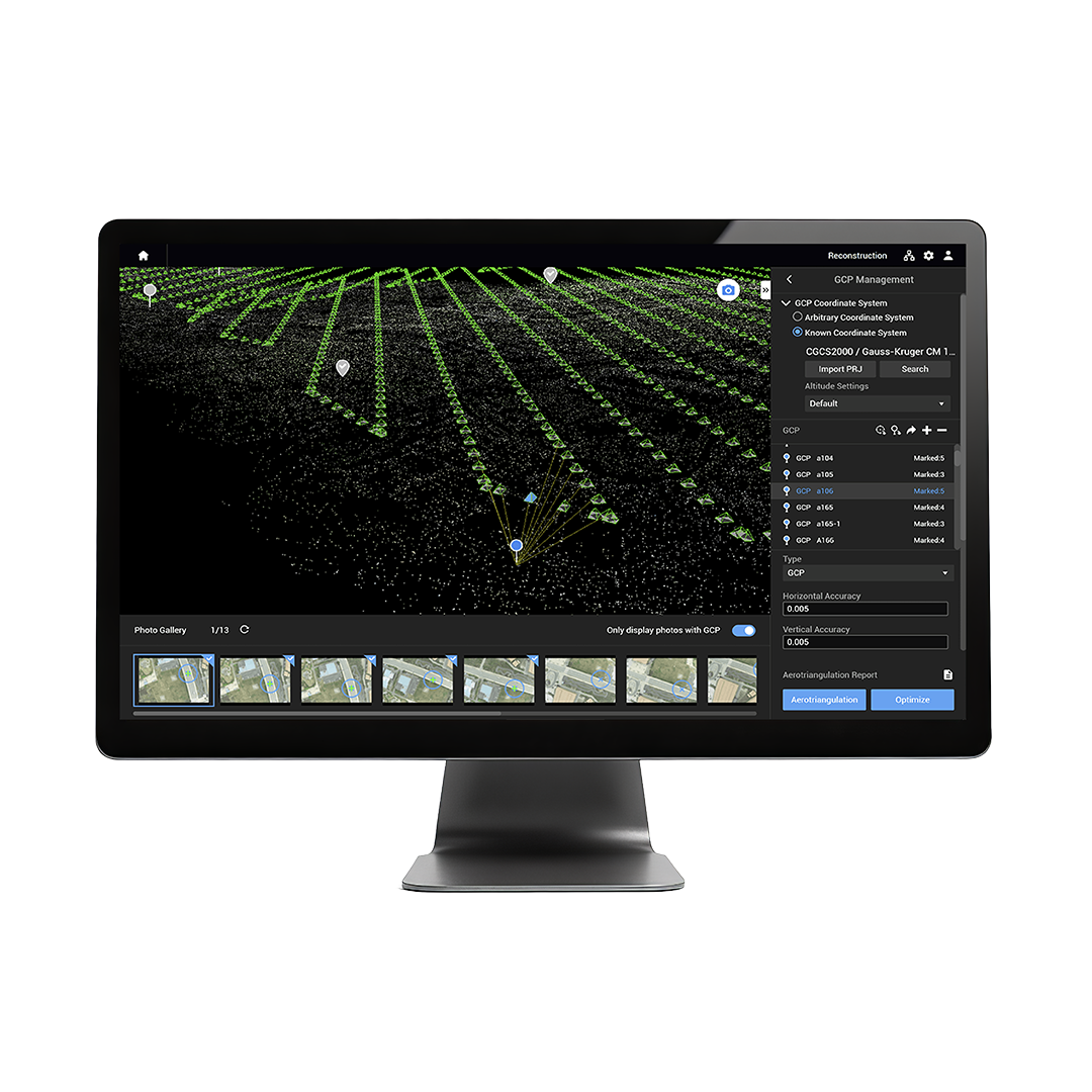
POS and camera parameter editing
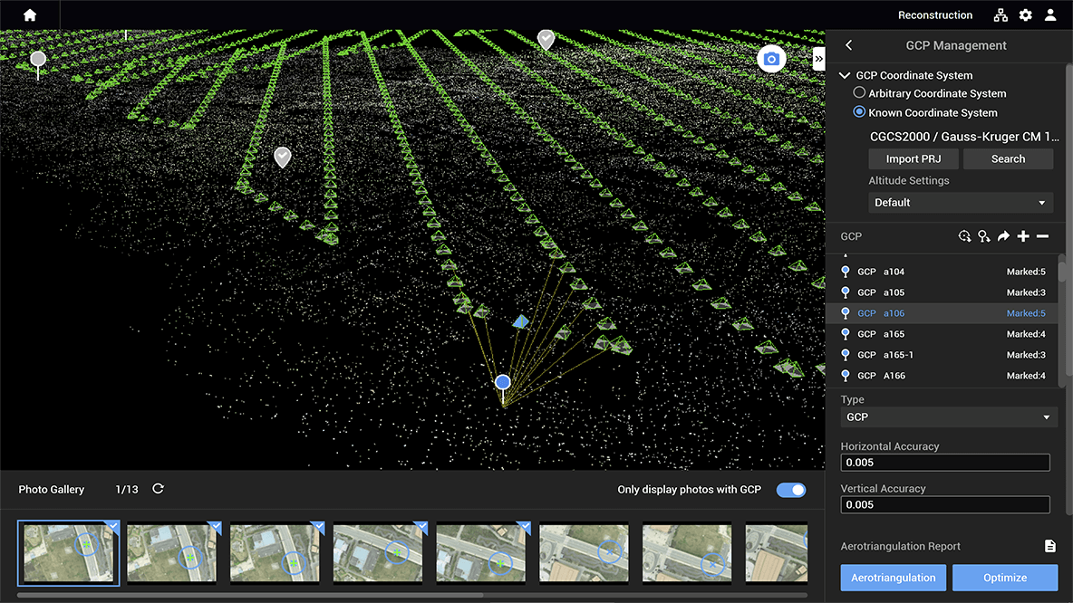
Support for custom camera parameters and importing POS data to create georeferenced maps and models with enhanced accuracy directly in the target coordinate system required by the project.
Easy application integration
DJI Terra supports output in common formats, including TIFF orthomosaic and elevation models, LAS point cloud format, and six common 3D model formats such as B3DM, OSGB, OBJ, as well as DXF and SHP contour formats. These results can be easily integrated into various GIS, CAD, and other third-party data application software, enabling a wide range of drone data industry applications.
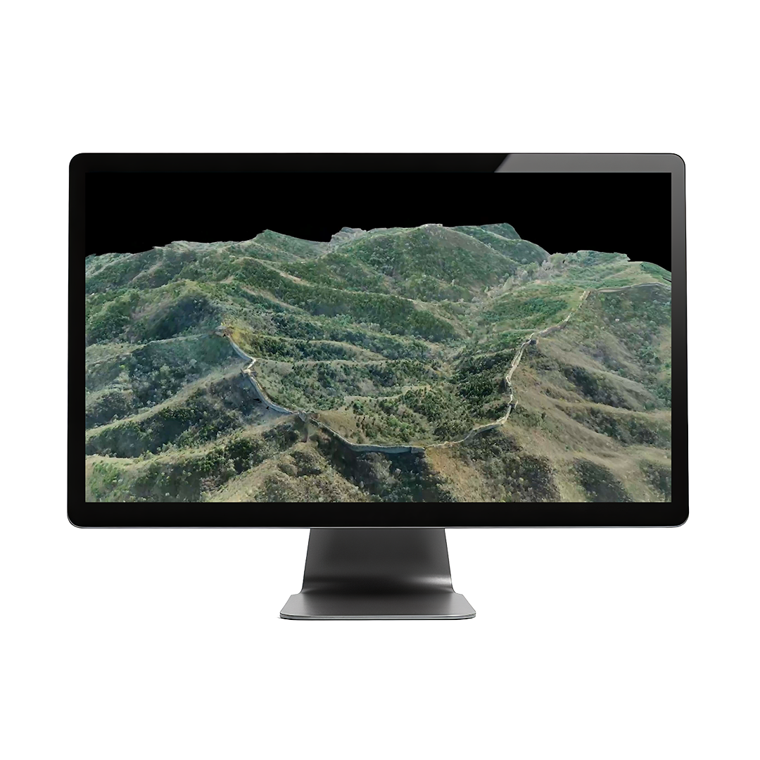
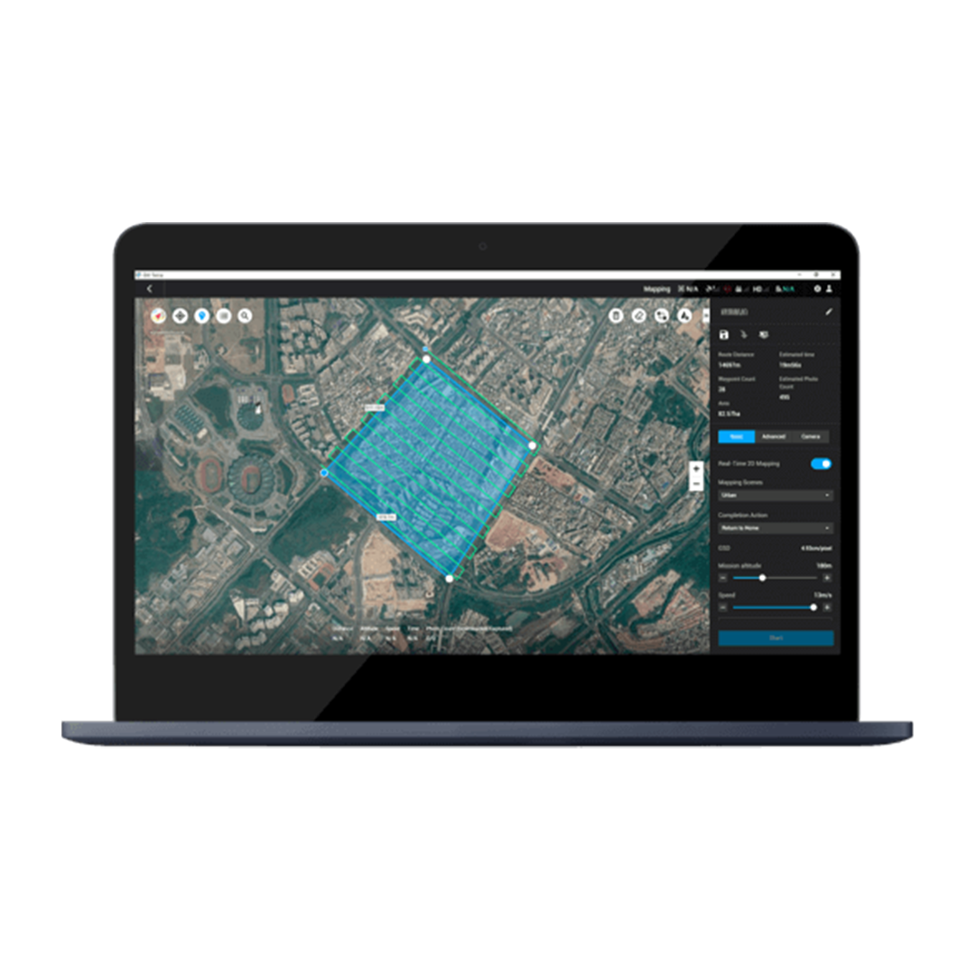
Real-time 3D mapping
When efficiency is key, quickly render and visualise a 3D model of the mapped area. Make decisions based on the preliminary model and check for completeness immediately or plan 3D flights on-site.
DJI Terra is a professional photogrammetry and mapping platform designed for drone-based surveying, modeling, and inspection. It supports automated mission planning, real-time 2D/3D reconstructions, and detailed analysis for industries like construction, agriculture, and public safety.
• Data Types Supported: Imports photos (JPG/RAW), flight logs, and • GNSS data from DJI drones.
- Real-Time Mapping: Supports live 2D map generation during flight (using compatible drones).
- 3D Reconstruction: Offers high-, medium-, and low-resolution 3D modeling (up to 400 images/project for advanced versions).
- Coordinate Systems: Supports global CRS (WGS84, CGCS2000, etc.) and custom local coordinate inputs.
- Output Formats: Exports in OBJ, LAS, PLY, DXF, DSM, GeoTIFF, KML, and more.
- Measurement Tools: Area, volume, linear distance, and coordinate readings from 2D/3D models.
- Multi-GPU Acceleration: High-end versions support GPU parallel processing for faster reconstruction.
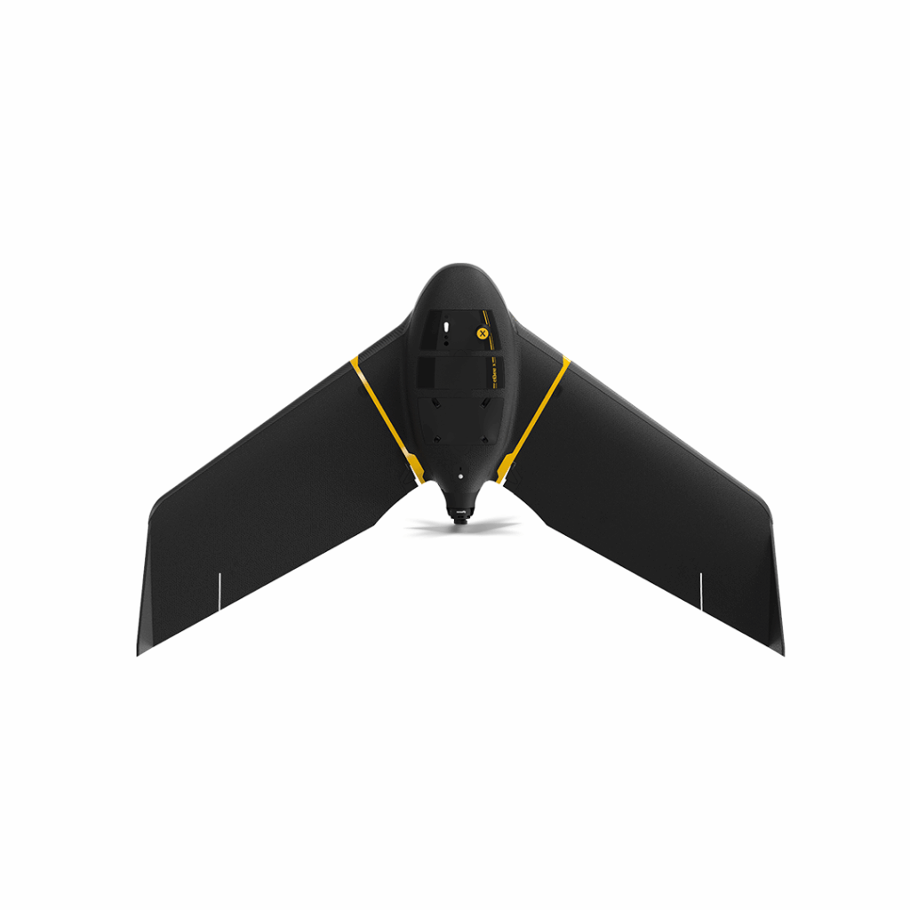
eBee X
Lightweight mapping drone for large coverage and sharp data
£POA
DJI Matrice 400
Engineered for excellence, designed for versatility
£8,875.00
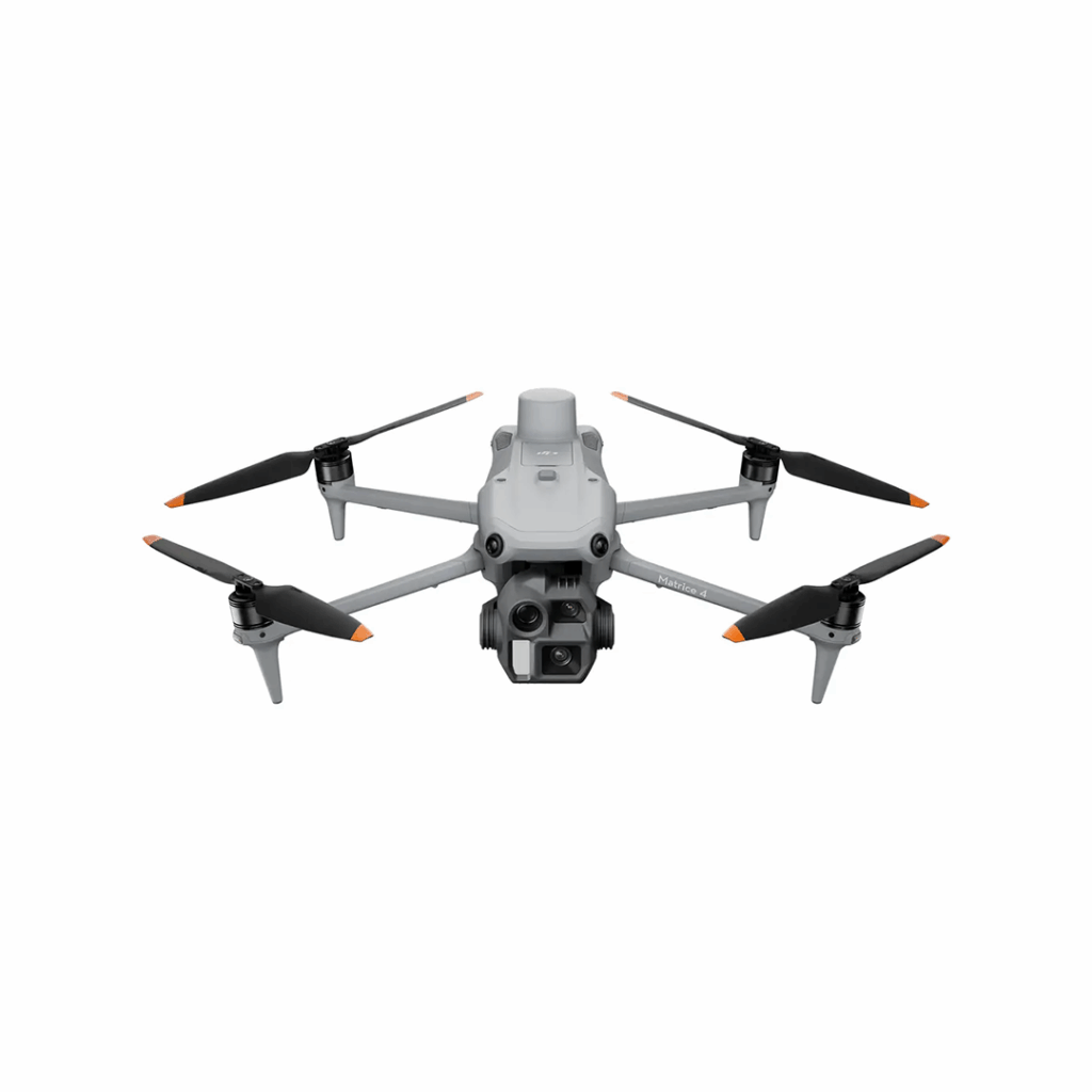
DJI Matrice 4 Series
Bringing intelligence to aerial operations
£POA
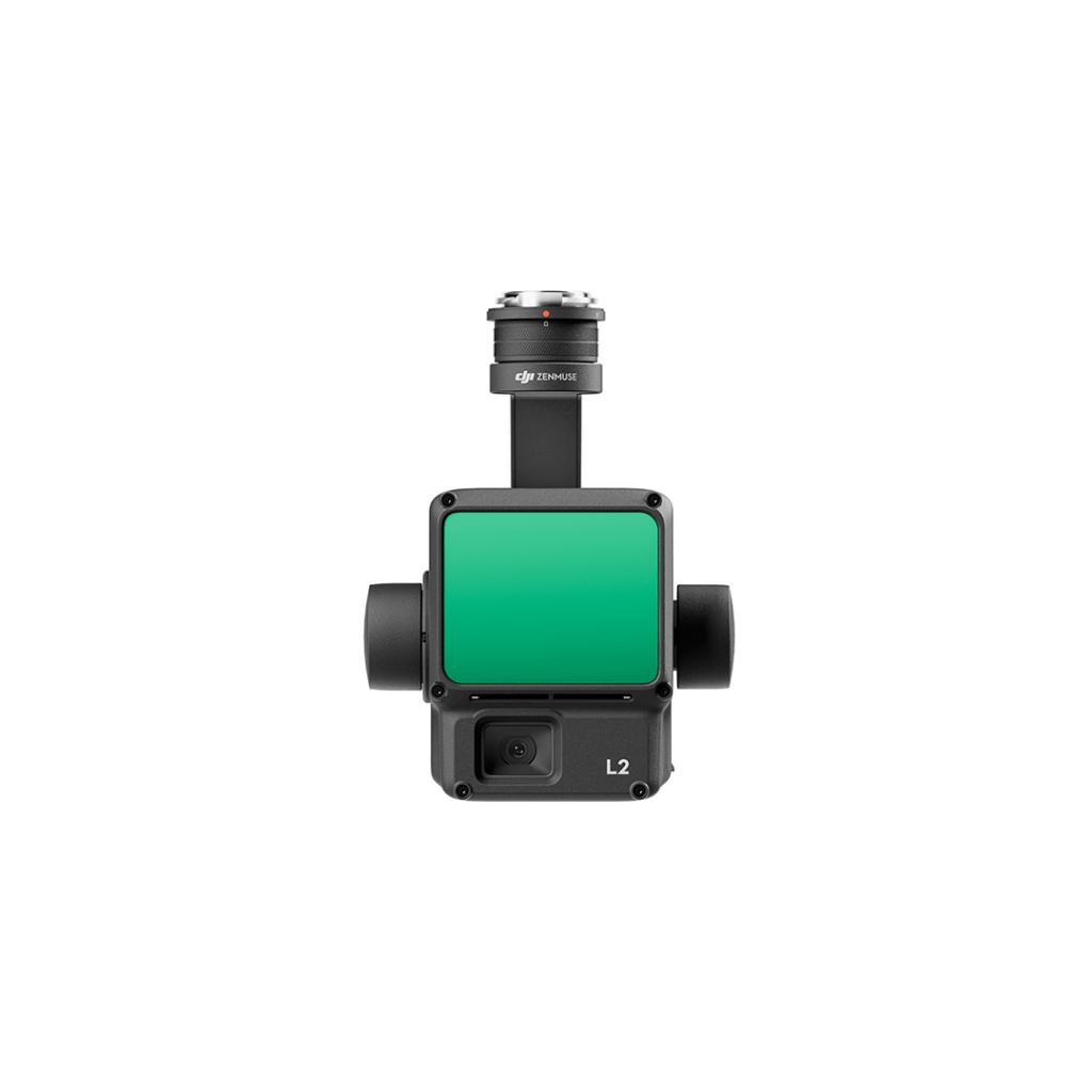
Zenmuse L2
A high-precision aerial LiDAR system that integrates frame LiDAR, IMU, and RGB camera