We catch up with Jeremy Murfitt, Owner of Everything is Somewhere, long time Esri user and an early adopter of Trimble Catalyst.
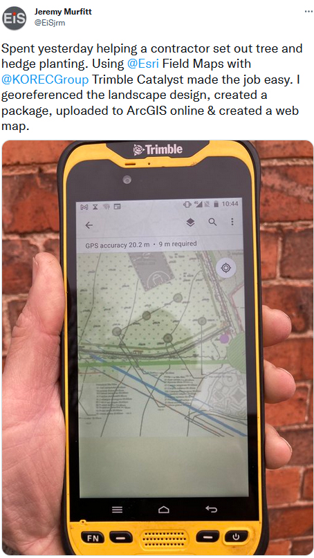
For many, Trimble Catalyst, our on-demand, low-cost subscription based GNSS, may be a relatively new concept, but the release of the DA2 receiver at the end of 2021 actually marked over three years of the technology. Back in 2019, one of Catalyst’s earliest adopters in the UK was Jeremy Murfitt Owner/Director of Everything is Somewhere Ltd (EiS). Jeremy has been doing a great job sharing details of his projects on Twitter, so much so, that we decided to follow up on one of his recent tweets to find out exactly why “Trimble Catalyst made the job easy”.
Based in Leicestershire, EiS is a consultancy practice specialising in a range of professional services on property and town & country planning matters.
The nature of these projects means that Jeremy offers a range of services including UAV surveys and field data collection both supplemented by his extensive GIS experience for understanding and analysing location and spatial data in various sectors.
For the field data capture and GIS work, Jeremy uses Esri software (KOREC is an Esri Silver partner) including Esri Field Maps on a Trimble TDC600 logger with Trimble Catalyst (cm accuracy subscription), Esri ArcGIS Pro and Esri ArcGIS Online.
A perfect combination – Trimble Catalyst, TDC600 and Esri Field Maps
Although already aware of KOREC and Trimble, Jeremy’s first view of Catalyst was at the Geo Business show in 2018 when he was searching for a more efficient and cost-effective method to capture cm positions rather than go through the obvious routes of the purchase or hire of a survey grade GNSS. As someone who required high accuracy positions as a part of his existing workflow rather than as his day in, day out work, Catalyst was an attractive proposition to Jeremy with its low capital outlay (around £300 for the DA1 receiver as opposed to around £8,000+ for a survey grade GNSS system), its ease of use and its fast set up.
Jeremy found it extremely easy to set up with his Field Maps software on the TDC600 logger and reports that it’s also incredibly fast to initialise in the field.
Can we swap?
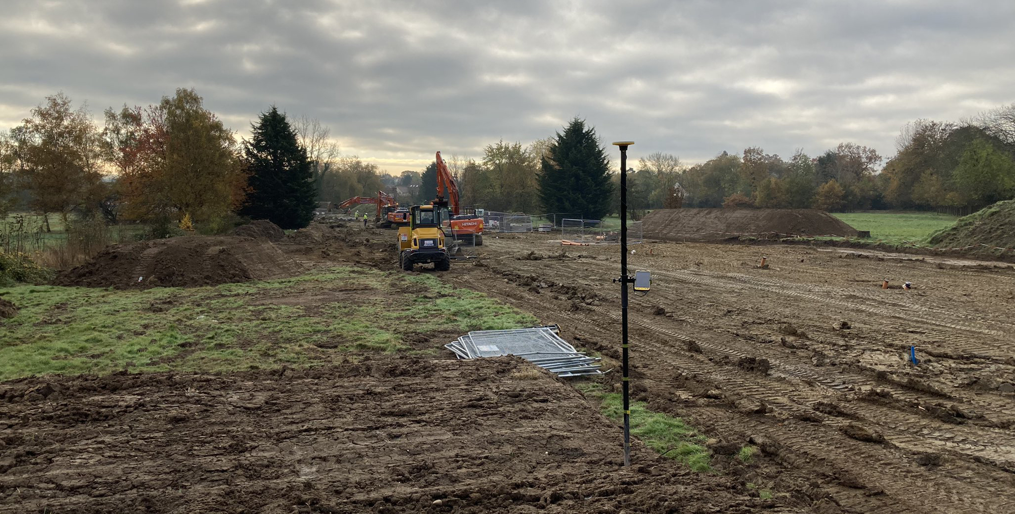
Jeremy is using Catalyst for a number of applications including basic setting-out of new landscapes, and the recording of points for tree positions and utilities etc. However, his primary use is as a tool for establishing ground control points for the many drone surveys he undertakes. He reports that the 2cm accuracy he needs for flight heights of around 50-60m takes just a couple of minutes to achieve and that using Catalyst and Esri Field Maps he can establish the 5-10 GCPs, with two or three control points for each GCP, in just one hour if he’s walking at a good pace!
Whilst Jeremy particularly rates the system’s reliability and the fact that it hasn’t failed once since he purchased it, he says that its light weight and portability are particularly useful and that he can put the entire kit into his drone backback, something he particularly values when he can be walking around a mile to a site.
Meeting a land surveyor on one particular site who was fully equipped with a heavy tablet and full GNSS system, the surveyor was amazed to find that Jeremy’s system could achieve exactly the same results as his own. His response, “Can we swap?”
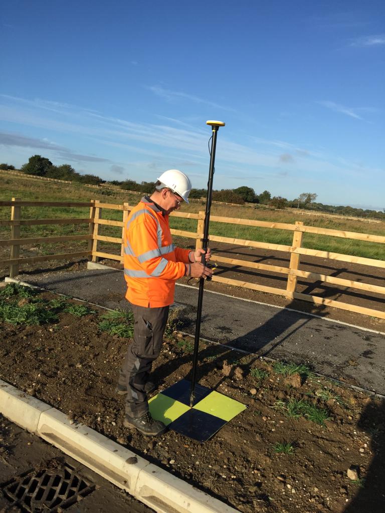
On site with Trimble Catalyst, the TDC600 logger and Esri Field Maps setting out Ground Control Points for a drone survey
Setting out trees and hedgerows with Esri and Trimble Catalyst
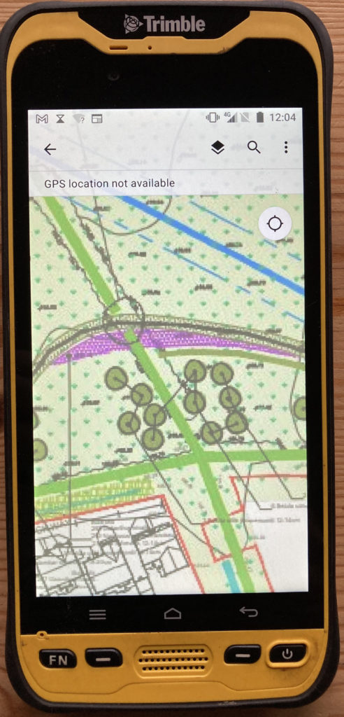
On a recent job, Jeremy used his Catalyst, TDC600 and Esri software to assist with the setting out of around 150 trees and 500m of hedges as part of a new development in Leicestershire. Jeremy’s usual workflow has been to use point and line data provided by the landscape architect in CAD format which is easy to map and upload to ArcGIS Online and then use with Trimble Catalyst. However, the downside of this method is a loss of context and the detail that is shown on the large (A1/0) pdf drawings. Instead, Jeremy uses the original PDF’s, georeferences them and then uploads these to the Trimble TDC600 to use with Catalyst which he find particularly beneficial when in the field. A straightforward workflow that works well for this application, it took around 30 minutes to set up but saved a lot of time in the field:
- Convert pdf’s to tiffs/jpegs
- Import into Esri ArcGIS Pro and georeferenced
- In ArcGIS Pro “share” the images as a Webmap. You need to go to configuration and properties and check that the tiling scheme goes right down to level 23.
- Review the data in ArcGIS Online
- On your mobile device connect with Trimble Catalyst to get the required GPS accuracy
- Open the WebMap in Field Maps to set out the features.
Jeremy concludes, “I’ve been using Trimble Catalyst for over two years now and it makes capturing x/y/z data so easy plus it’s been 100% reliable. In short, it just works.”
Our thanks to Jeremy Murfitt, Owner/Director of Everything is Somewhere Ltd, for supplying the information for this article.
You can read a Trimble Catalyst business case here.
Download the PDF of this case study here
Visit our webinar section here for the full details on the new Catalyst system.
KOREC is delighted to announce that following extensive behind the scenes work demonstrating our ongoing commitment to support the Esri user community, we have been recognised officially as an Esri Silver Tier Business Partner.

This new status will further strengthen the KOREC/Esri relationship allowing KOREC to offer Esri’s ArcGIS software as part of its mapping portfolio to new and existing KOREC customers.
Silver Tier status will also provide Esri UK’s customers with access to KOREC’s in-house software development team and its specialist knowledge on the integration of Trimble GNSS into Esri mobile data capture software.
Potential development for Esri clients will include everything from small tweaks to bespoke workflows based on the ArcGIS system, bringing all the power of their existing software but with customisation options for specific data capture workflows.

The Trimble Catalyst solution with a TDC600
The KOREC mapping team will also be available to assist Esri users with the integration of GNSS into their workflows with up to centimetre positional accuracy. Esri users will now have access to the most cost-effective method possible for cm accuracy by means of Trimble’s subscription based, low cost Catalyst solution.
To discuss all development requirements please contact KOREC Business Area Manager – Mapping & GIS, Richard Gauchwin on 07786 118436 or at richard.gauchwin@korecgroup.com
Or visit www.korecgroup.com/mapping