Trimble GEDO IMS
€POA
PRODUCT ENQUIRY
Visualise your 3D models accurately against the real world with Trimble SiteVision field software.
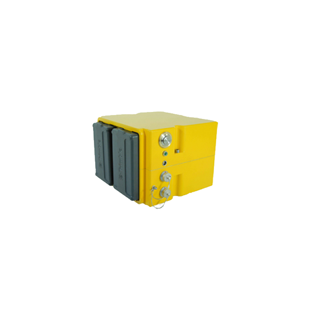
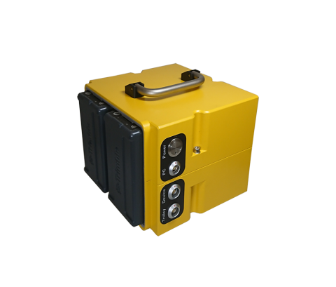
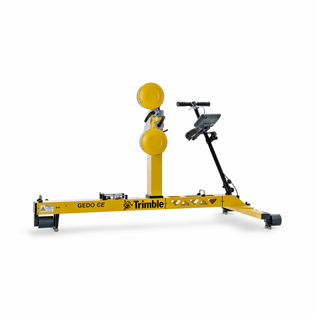
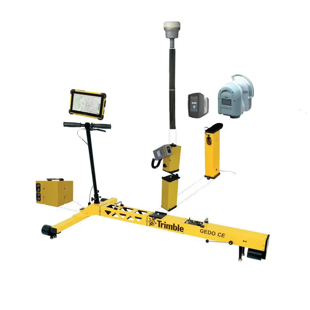
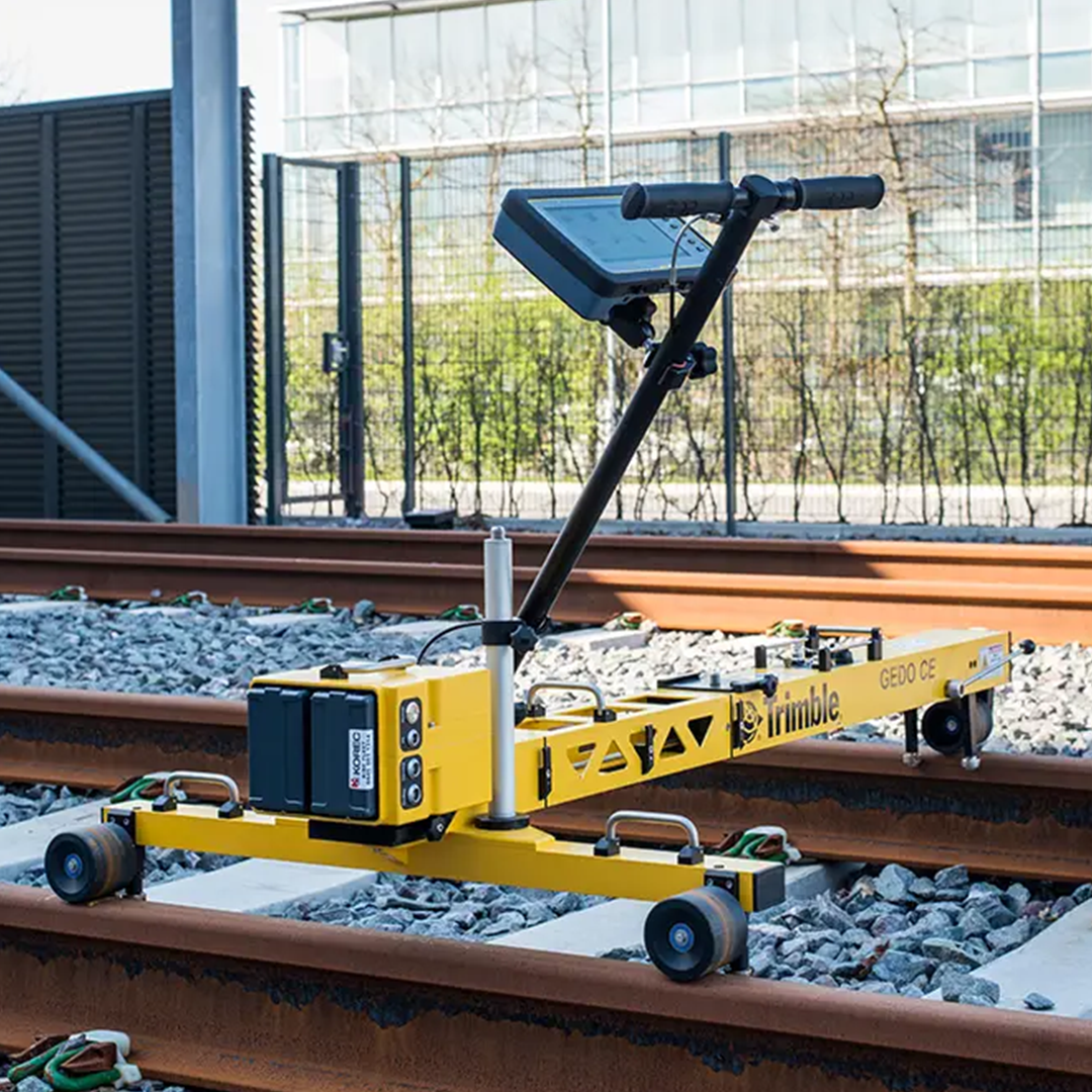
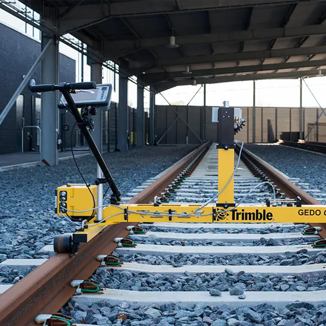
The Trimble GEDO IMS system, consisting of a track survey trolley Trimble GEDO CE 2.0 and a high precise fibre optic gyroscope IMU (inertial measurement unit), is the basis for running an efficient track survey and asset data collection. Additional components and sensors can be added to the system to enable the usage of further applications and to guarantee the best performance. Captures track geometry up to 5,000 metres per hour.

Save time
Complex geodetic station setup with related restrictions are no longer needed, plus a short initialisation time allows rapid on-site use.
Straightforward to use
Simple and self-contained trolley captures track position, gauge and cant in a single operation and there is no requirement for a total station.
Versatile
Flexible combination with additional sensors fitting to the application for best performance
Speed and quality
Internal quality control within the measurement process on site
The Trimble GEDO IMS system, consisting of a track survey trolley Trimble GEDO CE 2.0 and a high precise IMU (inertial measurement unit), is the basis for running an efficient track survey and asset data collection.
Additional components and sensors can be added to the system to enable the usage of further applications and to guarantee the best performance.
• Uses a Trimble GEDO fibre optic gyroscope IMU integrated with the GEDO CE 2.0 trolley to record relative 3D track geometry (chainage, gauge, cant, twist, curvature) at up to 5,000 m/h, with relative accuracy better than ±1 mm for a standard chord length
- Supports georeferencing via control points measured with a GEDO Profiler or total station—or optionally via GNSS—enabling absolute track position capture and alignment validation
- The IMS Scan variant combines the IMU trolley with a laser scanner to generate georeferenced track trajectory alongside high resolution 3D point clouds for clearance analysis and BIM asset mapping
- Field and office workflows support variance comparison against design, automatic resection, and generation of tamping machine correction files for maintenance and renewal tasks
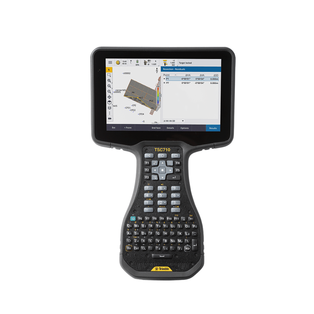
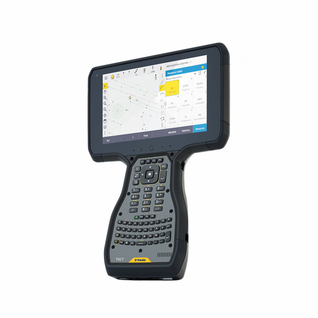
Trimble TSC710
Connect to a better way to work with the all-new Trimble TSC710