Drones and Surveying: Benefits and Best Practices
Explore the key benefits, applications, and best practices that separate a high-quality drone survey from one that simply generates a large volume of data.


Explore the key benefits, applications, and best practices that separate a high-quality drone survey from one that simply generates a large volume of data.
Not many technologies have changed the practical experience of surveying as quickly or as visibly as drones. A discipline that once required extensive ground crew, multiple instrument setups, and days of field time to cover a large site can now be approached from the air in a fraction of the time, producing richer data than was previously achievable by ground-based methods alone. That said, drone surveying is not a replacement for surveying expertise. The professionals getting the most from this technology are those who understand both the capability of the equipment and the principles of good survey practice that make collected data reliable and defensible. This guide covers the key benefits, the most common applications, and the best practices that distinguish a high-quality drone survey from one that simply generates a large volume of data. For detail on the full data processing pipeline from flight to deliverable, see our companion guide on UAV 3D mapping workflows.
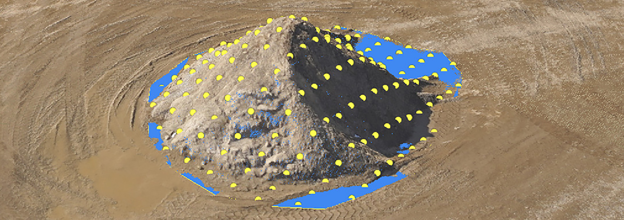
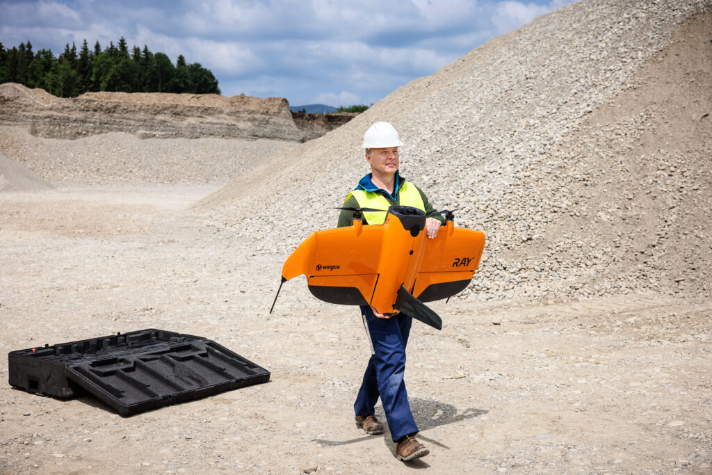
The efficiency advantage of drone surveying over conventional ground-based methods is most apparent on large or open sites. Areas that would require multiple days of ground crew time with total stations and GNSS receivers can often be covered in a single flight session of a few hours. Volumetric surveys on quarries and stockpile sites are a strong example: capturing the entire site from the air and generating accurate volume calculations from the resulting surface model within the same day is simply not achievable with traditional methods at equivalent speed. KOREC’s UAV range includes both multirotor systems such as the DJI Matrice 4 Series for flexible deployment on smaller sites, and fixed-wing platforms such as the WingtraRAY for large-area coverage where endurance matters.
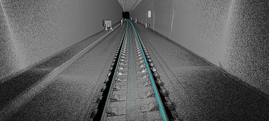
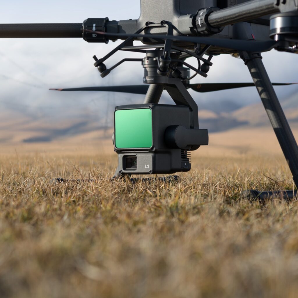
When deployed correctly with appropriate ground control or onboard RTK/PPK positioning, modern drone survey systems routinely achieve horizontal accuracies of 2 to 5 centimetres. The density of data captured in a single flight, potentially millions of 3D points from photogrammetric processing, provides a level of surface detail that exceeds what is practically achievable with ground-based methods on most large sites. LiDAR payloads such as the Zenmuse L2 or L3 extend this capability to environments where photogrammetry has limitations, penetrating vegetation canopy to deliver accurate ground models beneath.
One of the most significant but sometimes underappreciated benefits of drone surveying is the reduction in time survey staff spend in hazardous environments. Industrial sites, active quarries, steep slopes, unstable ground, coastal cliffs, and live road corridors all present genuine risk to ground-based teams. Removing the need for personnel to access these areas physically reduces that exposure substantially. Infrastructure inspection makes this benefit most tangible: bridges, tall structures, power lines, and pipelines can be inspected using drone-mounted cameras without anyone needing to work at height or in proximity to live assets.
A drone survey produces more than measurement data. Orthomosaic maps, 3D point clouds, digital surface models, and, where thermal or multispectral payloads are used, spectral data beyond the visible spectrum all emerge from a single mission. Clients and project stakeholders who are not accustomed to interpreting survey drawings can engage directly with photorealistic 3D models. Soarvo, available through KOREC, enables cloud-based viewing, measurement, and collaboration from drone outputs alongside data from total stations, laser scanners, BIM models, and GIS files, making the full picture of a project accessible to the wider team without specialist software.
Drone surveys have become a standard tool for topographic data collection across land development and planning projects. Pre-application surveys for housing, industrial sites, and infrastructure schemes are well suited to drone methods, delivering contoured plans, cross-sections, and digital terrain models at speeds that keep pace with fast-moving feasibility programmes. Fixed-wing UAVs such as the WingtraRAY offer the coverage and endurance needed for large or steeply graded sites, while LiDAR-equipped multirotors can supplement photogrammetric data in areas where canopy penetration is required.
Regular drone flights over an active construction site provide a time-series record of progress that supports programme management, contract administration, and early identification of issues before they affect the critical path. Volume calculations from successive surface models track cut-and-fill progress against the earthworks design. For large infrastructure schemes, drone-based volume monitoring is increasingly replacing traditional survey methods, offering faster turnaround and broader coverage. Platforms such as Propeller integrate directly with drone data to provide interactive site dashboards accessible to project managers without needing survey expertise.
Bridge decks, retaining walls, dam faces, tower structures, road surfaces, and utility infrastructure all require periodic inspection to identify deterioration and inform maintenance planning. Drone inspection reduces the cost and complexity of accessing these assets while delivering higher quality visual data than traditional access-based methods. High-resolution cameras identify surface cracking, spalling, and corrosion; thermal payloads reveal moisture ingress and delamination invisible to standard cameras. The Parrot ANAFI AI, available through KOREC for Irish customers, offers a 4K zoom camera that allows detailed inspection from safe stand-off distances.
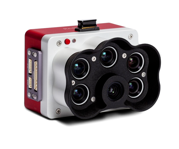
In the mining and quarrying sector, drone surveys have become the standard approach for routine volumetric measurement, replacing manual methods that were slow, labour-intensive, and impractical on active working sites. For environmental monitoring, drones support vegetation mapping, habitat condition assessment, erosion monitoring, and water body surveys. Multispectral payloads, such as the MicaSense RedEdge range compatible with Wingtra systems, extend drone capability into crop health monitoring, land degradation assessment, and ecological baseline surveys.
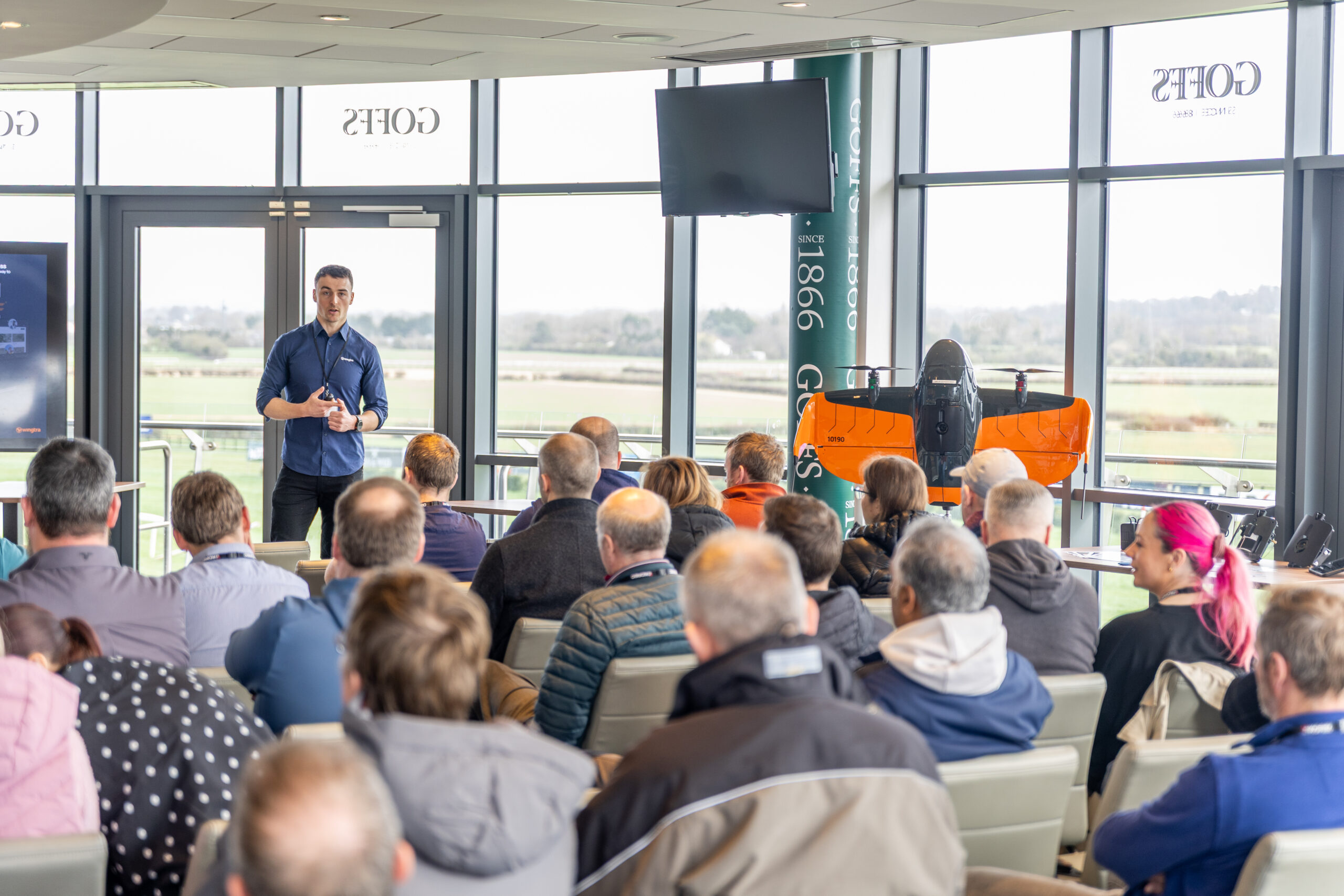
The quality of a drone survey is determined as much by what happens before the aircraft leaves the ground as by the flight itself. Thorough pre-flight planning covers airspace checks, obstacle identification, ground condition assessment, weather confirmation, and regulatory compliance. In the UK, commercial drone operations are regulated by the Civil Aviation Authority. Operators must hold appropriate CAA authorisation, and the remote pilot must hold a valid qualification such as the General Visual Line of Sight Certificate (GVC). KOREC works with trusted CAA Recognised Assessment Entity partners, including DronePilot Academy, to provide access to training for professionals looking to qualify.
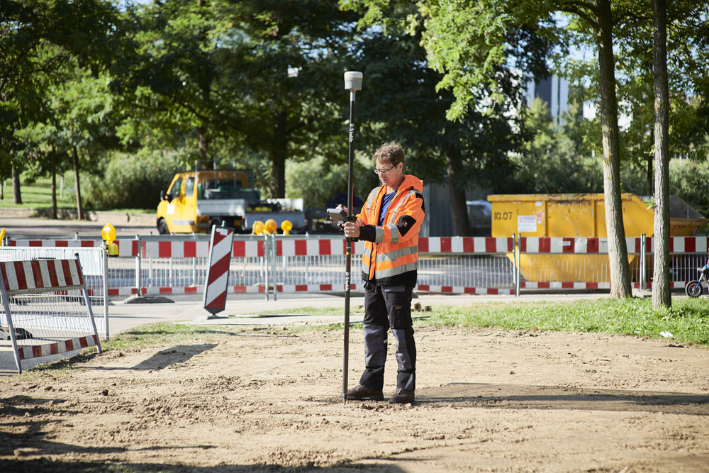
Ground control points (GCPs) are surveyed reference markers placed within the survey area and used to georeference drone data to a known coordinate system. A minimum of five GCPs well-distributed across the survey area, including at edges and corners, is recommended for most applications, with additional points on larger or more complex sites. Independent check points, separate from the GCPs used in processing, should always be surveyed to verify output accuracy. GCPs are typically measured using a GNSS receiver in RTK mode, or a total station tied into the project control network.
Flight altitude determines the ground sample distance of the imagery. For most topographic survey applications, a GSD of 2 to 5 centimetres is appropriate, corresponding to flight altitudes of roughly 80 to 150 metres for a typical survey-grade camera. Image overlap should be set at a minimum of 75 to 80 per cent frontlap and 60 to 70 per cent sidelap. On sites with vertical or near-vertical surfaces, flying a double-grid pattern significantly improves data quality. Camera settings should be configured to prevent motion blur, with a fast enough shutter speed for the aircraft’s forward speed at the chosen altitude.
Onboard RTK positioning, available on systems such as the DJI Matrice 4D and Wingtra platforms, can reduce or eliminate the need for physical GCPs by tagging each image with a high-accuracy position during the flight. Trimble VRS Now UAV provides a convenient RTK correction service for drone operators across the UK network without the need for a local base station. PPK systems log raw GNSS observations during flight and process them against base station data afterwards, offering similar accuracy with added resilience against connectivity issues during the mission. Independent check points should still be surveyed in most professional applications regardless of the positioning method used.
Raw drone imagery requires photogrammetric processing to produce usable survey outputs. Software options include Pix4D Mapper, DJI Terra, Trimble Business Center Aerial Photogrammetry, and WingtraCLOUD, each with different strengths in terms of workflow integration and output options. Quality control should be built into every processing stage: review the processing report to check GCP and check point residuals, and inspect outputs visually for artefacts, voids, and areas of poor reconstruction. Residuals that exceed the accuracy threshold require investigation before outputs are delivered.
Weather dependency is the most consistent operational constraint: wind above the platform’s rated limit, rain, and poor visibility all ground aircraft. Building weather contingency into project schedules and maintaining flexibility in the field programme is essential. Airspace and regulatory compliance requires ongoing attention as CAA requirements evolve; operators must check for temporary restrictions before every flight and ensure appropriate authorisation for operations near aerodromes or congested areas. Processing knowledge is often underestimated: generating high-quality outputs from drone data requires genuine understanding of photogrammetric principles and quality assessment. Organisations adopting drone surveying for the first time should invest in formal training alongside hardware and software.
KOREC supplies a comprehensive range of drone and UAV systems, payloads, processing software, and correction services, alongside pilot training through trusted CAA-approved partners. Whether you are taking your first steps into drone surveying or looking to extend an established capability in mapping and GIS, our team can help you build the right solution for your work.
KOREC can advise you on the right total drone for your project. Speak to our friendly experts today to get the right technology to solve your business challenges.