Video – Hardware set up (1) and getting your phone ready. Trimble SiteVision brings geospatial data to life so you can easily visualise, explore and understand complex information with unrivaled accuracy, right from your mobile device.
In our KOREC series of SiteVision ‘Essentials’ we’ll be bringing you all the information you need to know including Trimble tips and advice, KOREC opinion, video examples, training, customer feedback and some good honest FAQ’s!
First up, a short Trimble tutorial looking at the hardware setup:
- Unboxing SiteVision
- Getting your phone ready
Need some advice as to which is the best phone to use with SiteVision? Then read our ‘What phone should you use with SiteVision?’ post.
You can buy Trimble SiteVision online from KOREC here
[3d-flip-book mode=”fullscreen” urlparam=”fb3d-page” id=”11778″ title=”false”]
The final issue of Mensura for 2019 is out now and includes:
- New releases including Trimble X7 & Trimble R12
- Case study – Surveying the ‘Big One’
- Extended KOREC news
- Monitoring and Rail updates
Download your issue here or request a printed copy here

The greenhouse effect of gas emissions per kilometre on railway transport is 80% less than cars. In a year that has seen the UK become far more environmentally aware, we can reasonably expect to see a corresponding increase in travel by rail in 2020 and beyond.
With exciting new projects such as HS2 on the horizon, the KOREC rail team is preparing for another busy year which is why we’ve introduced our new rail newsletter, Alignment.
Topics in this issue include:
- Product Focus – GEDO IMS
- Interview with Trimble Rail’s Matthew Moss
- KOREC News
- Enhancing safety on site with new technology
Download a pdf of Alignment here
The Autumn issue of CES’s supplement, Geospatial Engineering, features one of our favourite monitoring stories of the year:
“How a single Trimble monitoring system is all that’s required for a challenging site thanks to intelligent planning and a full understanding of the project’s challenges.”
Our thanks to Vince Bridle of Sir Robert McAlpine for all the information and pictures.
Read the story in the supplement here
or
Welcome to the third issue of our KOREC Ireland newsletter, Traverse. Front page news includes the introduction of the newly released Trimble X7 3D laser scanner.
Inside this issue:
Intergeo 2019 – The Trimble X7 has landed!
New releases from Trimble, GeoSLAM and Parrot
KOREC news round-up
KOREC Opinion – Testing Trimble SiteVision

KOREC is delighted to announce that the Drone Pilot Academy, our training partners in the provision of flight training and Civil Aviation Authority (CAA) accredited pilot training courses, have successfully launched their Operational Safety Case consultancy service to assist KOREC senseFly eBee users attain EVLOS (Extended Visual Line of Sight) approval. A UK eBee user has already successfully attained this approval through the new Drone Pilot Academy service.
It will now be possible for the users of eBee X, eBee Plus and eBee Classic models in the UK and Northern Ireland to get approval to fly up to 1500m away from the remote pilot (compared to usual 500m) giving a potential operating range of 3km. This will bring a significant competitive advantage to KOREC customers, particularly those surveying quarries, coastal areas and large-scale projects by cutting extensively the need for multiple take-off and landing points.
eBee drone pilots applying for approval will need to submit an Operational Safety Case to the CAA and demonstrate a history of safe flying and an additional person to act as a spotter on site is required.
senseFly’s Christopher Thomson (Regional Manger EMEAI) said, “Seeing the eBee X being able to fulfil its true potential is hugely exciting. The UK is always on the forefront of pushing the advancements in UAV technology and the EVLOS permission across all of our platforms attests to this. This will now enable over 200 senseFly users to push the boundaries of their mapping capabilities”
Drone Pilot Academy’s Jim Ixer (Managing Director) said, “With the number of large scale mapping projects our clients are routinely involved with at the moment, and the number in the pipeline we wanted to offer a service that allows eBee operators to maximise the impressive flight endurance with the latest battery advancements. With a standard CAA permission, the limiting factor is the regulations, not the drone, so we sought to safely resolve that issue. Now we can offer a consultancy service that includes bespoke training to assist senseFly drone operators to attain the EVLOS accreditation from the CAA”
KOREC’s Richard Gauchwin (Business Area Manager – Mapping & GIS) said, “This really is a game changer for the UAV market in the UK. Being able to fly larger sites and now only requiring one take-off and landing point has huge benefits in terms of efficiencies the system can bring to businesses. The eBee X, with its flight time of up to 90 minutes, has always been capable of undertaking these larger surveys, but has been limited by the legislation governing maximum flight distance from the pilot; now it can realise its full potential.”
A PDF of the release can be downloaded here.

Jim Ixer, Managing Director of the Drone Pilot Academy with a senseFly eBee X
It’s been our rail story of the year – the successful 90mph handback of a 400m stretch of the West Coast Mainline during the replacement of Willesden North Junction. The success of this project was assisted by the willingness of the S&C South Alliance to adopt a range of innovative technology during the blockade including the Trimble GEDO IMS and Trimble SX10. It’s also a major feature in the August/September issue of Rail Engineer.
Read the story in Rail Engineer here

LSTC has conducted more than 50 underground manhole surveys using a KOREC supplied ZEB-REVO RT handheld laser scanner.
Our thanks to Kurt Slater of LS Transmission Consultancy Limited for providing all the information for this great story that focuses on how to achieve more accurate data and safer working conditions for those involved in the collection of invert survey data.
Read the story online here or download the page layout PDF here.
‘A’ road survey completed in safety, 20 times faster!
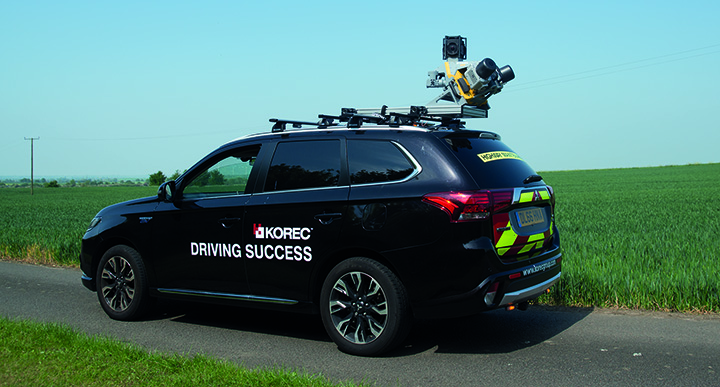
Out now, the July/August issue features a great story on how Anthony Lawton, Director at Academy Geomatics tackled a complex road survey using mobile mapping. KOREC Professional Services specialises in collecting and processing high quality data using the Trimble MX9 Mobile Mapping System.
or the full KOREC case study here
Eight points to consider. “Will we continue to use it…oh yes.”
During this year’s GEO Business show, Skanska’s Mark Lawton, A14 IDT’s Survey Manager, shared some thoughts on Trimble SiteVision based on Highways England’s A14 Cambridge to Huntingdon improvement scheme trial.
Chaired by Mark, the show’s Wednesday Highways Seminar was a critical session for all involved in highway infrastructure. As part of this workshop, Mark gave a talk entitled “An A14 update on the recent trial of mixed reality – what have we learnt so far?” With the launch of Trimble SiteVision now imminent, this was especially topical.
At this stage, Mark was just four weeks into a six month trial but his first point was key – if you are to use Trimble SiteVision to its full potential then you need good data. Accuracy was also checked and Mark reports that in focused tests, SiteVision was delivering 50mm accuracy.

Checking accuracy
Key application areas included utility records, design information, future information and 3D models. In particular, Mark mentioned that on the A14, following the capture of hundreds of km of cable, they needed to know exactly where that cable was for a Permit to Dig. Having the information available visually through SiteVision was hugely helpful in determining where they could excavate.

Clearly showing pipe locations
Additionally, he says that SiteVision provides an easy to understand visual explanation to third parties, such as householders, as to why they are digging in a certain place.

Alison Small (Engineering Surveyor, Skanska) walked the route with SiteVision explaining how the design will miss these trees on the A14 C2H project
Mark’s conclusions following four weeks into a six month trial:
- Easy to use
- Adoption and take up has been welcomed
- The workforce have recommend improvements that are realistic, for example, video screen capture.
- Requires good BIM/Data
- Multiple opportunities for customer briefing
- Will aid success in reducing services strikes
- Expect to wait a little longer to establish GNSS lock with Catalyst than with a high end surveying GNSS
- “Will we continue to use it…oh yes.”
Trimble SiteVision fuses cutting-edge augmented reality technology with Trimble Catalyst centimetre-precision GPS (now available on-demand) to bring your 3D designs off the screen and onto your site.