Survey Operations has exploited its Wingtra GEN II drone’s interchangeable LiDAR/camera payloads and straight forward workflows to create impressive operational and data quality advantages, not just on large scale projects, but on the small ones too.
Survey Operations has exploited its Wingtra GEN II drone’s interchangeable LiDAR/camera payloads and straight forward workflows to create impressive operational and data quality advantages, not just on large scale projects, but on the small ones too.
The result: improved efficiency, reliable repetitive accuracy, significant operational gains and superior quality deliverables for the client.
The Lancashire based company is celebrating 40 years in a business that has seen it evolve into one of the UK’s leading survey companies employing over 80 surveyors, engineers, CAD and support personnel. With a strong offering across the board including surveying and mapping services to construction, utility scanning and laser scanning, the company also has an excellent reputation for its aerial surveys which have been delivered predominantly through the use of rotary drones.
Following a technical issue with an existing multi-rotor platform, Operations Manager Dave Birchall began evaluating fixed-wing alternatives. Responsible for resource management and client liaison, Dave recognised that the right fixed-wing solution could deliver substantial gains in efficiency, coverage and data quality, while also expanding the company’s aerial survey offering. However, any investment would need to demonstrate a clear ROI.
Flexible platform
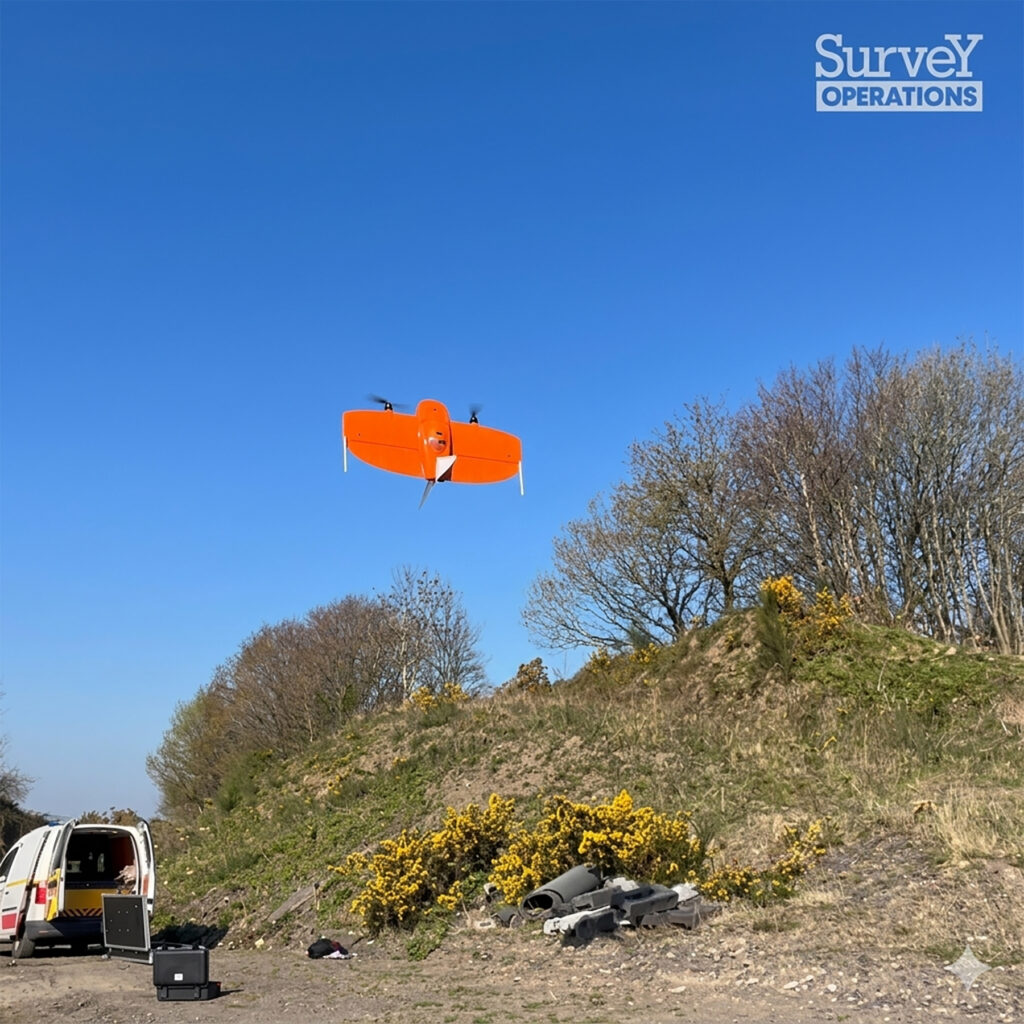
Based on a number of successful demonstrations, a Wingtra Gen II with Sony RX1R II RGB camera (designed for topographic mapping, orthomosaics, and high-accuracy surveys) and an oblique Sony a6100 (ideal for roof surveys, urban 3D modelling, quarry faces, or detailed golf courses etc) was purchased. This was shortly followed by a high-precision KOREC supplied Wingtra LIDAR payload which Dave felt would complement and expand their existing offering by capitalising on the modular flexibility of the GEN II.
Optimised workflow
Survey Operations Land Surveyor and Drone Pilot Tom Pattison established a fast and efficient workflow for deploying the Wingtra GEN II on large-area projects such as coastal and beach surveys. He knew that this same streamlined approach could be applied to projects of any size. By standardising the workflow, Survey Operations’ smaller surveys would also benefit from the efficiency, accuracy and high point density typically associated with fixed-wing operations on large-scale sites.
Tom explains:
“Projects in the 100–300 hectare range are where the Wingtra really excels. You can often complete the entire survey in just one to three flights, reducing setup time and battery changes while delivering high accuracy orthomosaics or LiDAR data far more quickly than with a multi-rotor. The coverage is remarkable, I can stay airborne for nearly an hour, fly lower, increase overlap and ultimately produce better data. Even on smaller sites, those advantages remain: faster delivery, higher quality and far greater efficiency.”
Tom reports that two recent small-scale projects have proved particularly successful as a result of the Wingtra’s flexibility:
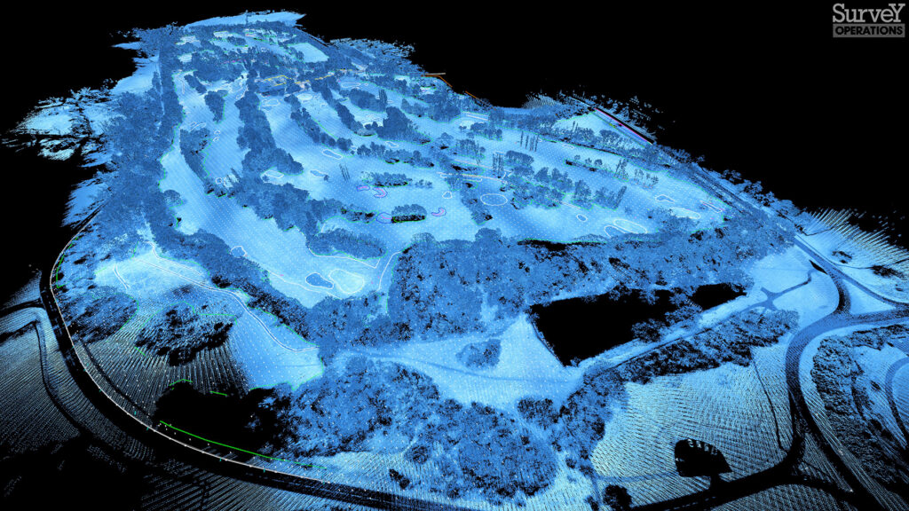
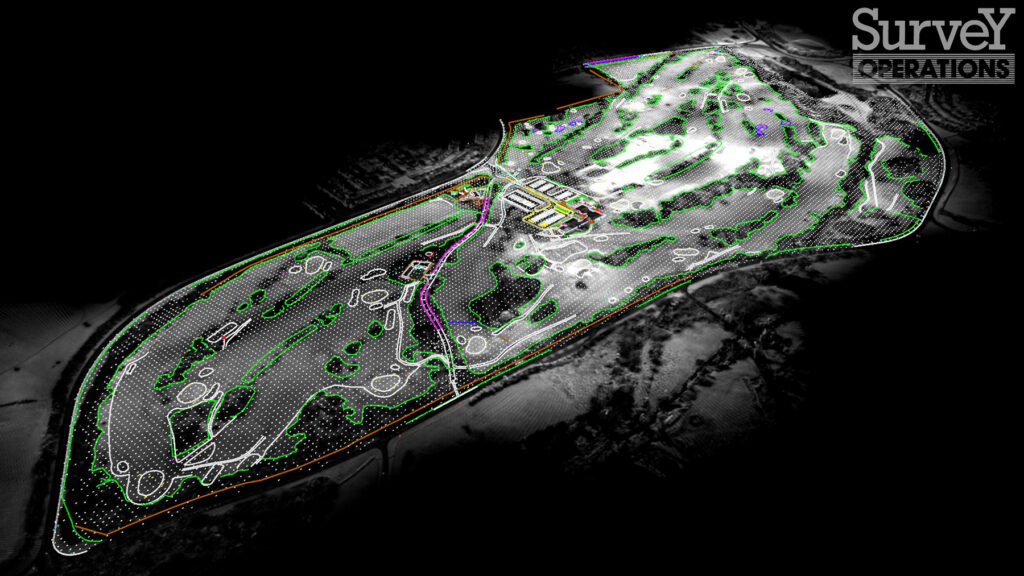
58-hectare golf complex workflow
The client required a full topographic survey, including a grid of levels and a fully georeferenced orthomosaic covering buildings, course features, bunkers, access tracks, irrigation infrastructure and vegetation.
In the office, Tom prepared the flight planning documentation using Google Earth, setting up both LiDAR and photogrammetry missions on his laptop. The site was divided into two sections to maintain a 500m Visual Line of Sight (VLOS) although technically the orange Wingtra can be viewed up to1.2km away. The plans were then seamlessly transferred to the Wingtra controller via the Wingtra App.
On-site, Tom established ground control points and completed a dynamic risk assessment before commencing operations.
Topographic survey of the golf course
Field Performance
On this small golf complex project, the Wingtra GEN II delivered across several key areas:
VTOL capability allowed discreet setup without disrupting golfers or requiring course closures.
Terrain-follow functionality ensured consistent altitude over undulating ground, especially where the course dropped down towards a road, improving both safety and data quality.
Low noise levels minimal disturbance of golfer concentration.
Modular payload system enabled rapid switching between LiDAR and camera missions. LiDAR flights took approximately 45 minutes, while photogrammetry flights ran for around 59 minutes of continuous operation.
High-efficiency LiDAR coverage meant larger areas could be captured in a single flight, or smaller sites completed more quickly.
Three-return LiDAR capability delivered consistent accuracies throughout site for clean, high-density data, even under the course’s heavy vegetation, with vertical accuracy of +/-3 cm RMS.
Automatic LiDAR calibration done prior to the take off so there is no back and forth during the flight lines calibrating, resulting in more time in flight collecting data.
Streamlined processing in the Wingtra LiDAR App with automatic trajectory correction, strip alignment, and direct export of the point cloud in LAS/LAZ.
Survey Operations estimates that using traditional survey techniques, the golf course project would have required 10–11 days on site including a couple of days of additional traditional survey work. Using their previous multi-rotor drone, which lacked LiDAR capability, the photogrammetry alone would have taken 4–5 days.
The satisfied client has returned for further work with Survey Operations.
Tom concludes:
“The Wingtra’s coverage is remarkable. I can stay airborne for nearly an hour, fly lower, increase overlap and ultimately produce better data. Even on smaller sites, those advantages remain: faster delivery, higher quality and far greater efficiency.”
MK Surveys is maximising the value of its Trimble MX60 Premium system in two ways: by treating it as a precision survey tool rather than solely as a mobile mapping...
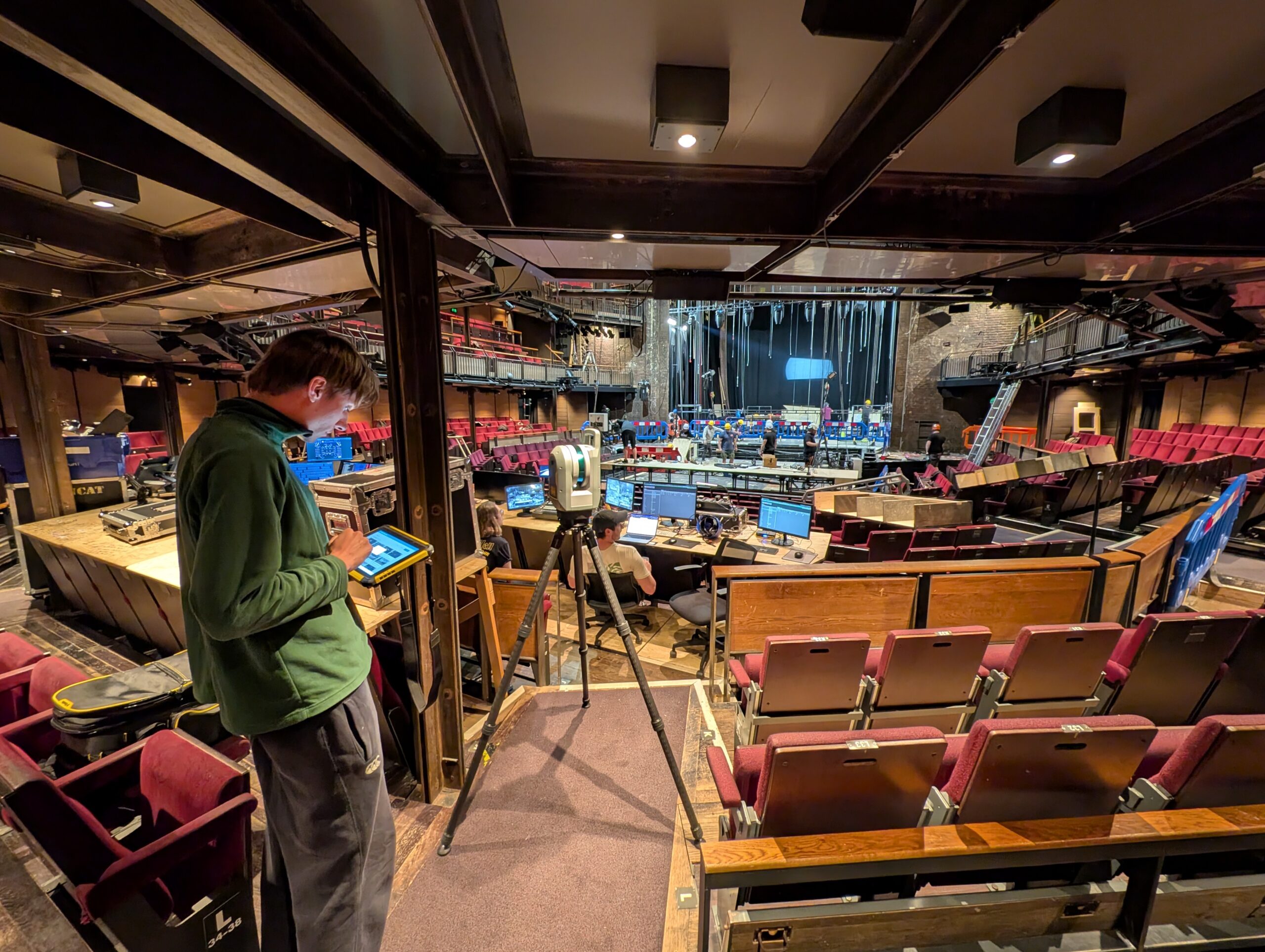
How the Royal Shakespeare Company is using a Trimble X9 Core LT 3D Laser Scanner to move beyond 2D plans and truly understand the 3D spaces they design for.
The reliability of the Trimble X9 Core for 3D laser scanning has made it a go-to tool for the Royal Agricultural University, both in preparing the next generation of land...