SOARVO Advanced Edition
€5,101.36
Add to basketThe SOARVO Advanced Edition is an upgraded annual subscription for growing organizations, offering 1TB of storage, 3000 processing tokens, multi-factor authentication, and extensive user scaling.
Empower larger teams with enhanced security through MFA and vastly expanded user capacities, featuring 1 Admin, 5 Project Managers, unlimited Editors, and unlimited Viewers. Boasting a robust 1TB of storage (as per pricing sheet) and 3000 processing tokens, this edition securely scales your spatial workflows.

Upgraded Security & Scaling
Multi-Factor Authentication (MFA) and expanded roles (5 Project Managers) with unlimited Editor and Viewer accounts.
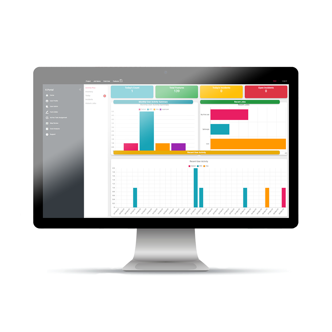
Expanded Capacity
1TB included data storage allowance and 3000 tokens for standard photogrammetry processing.
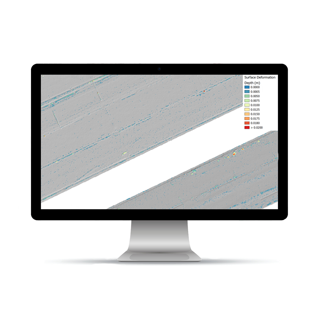
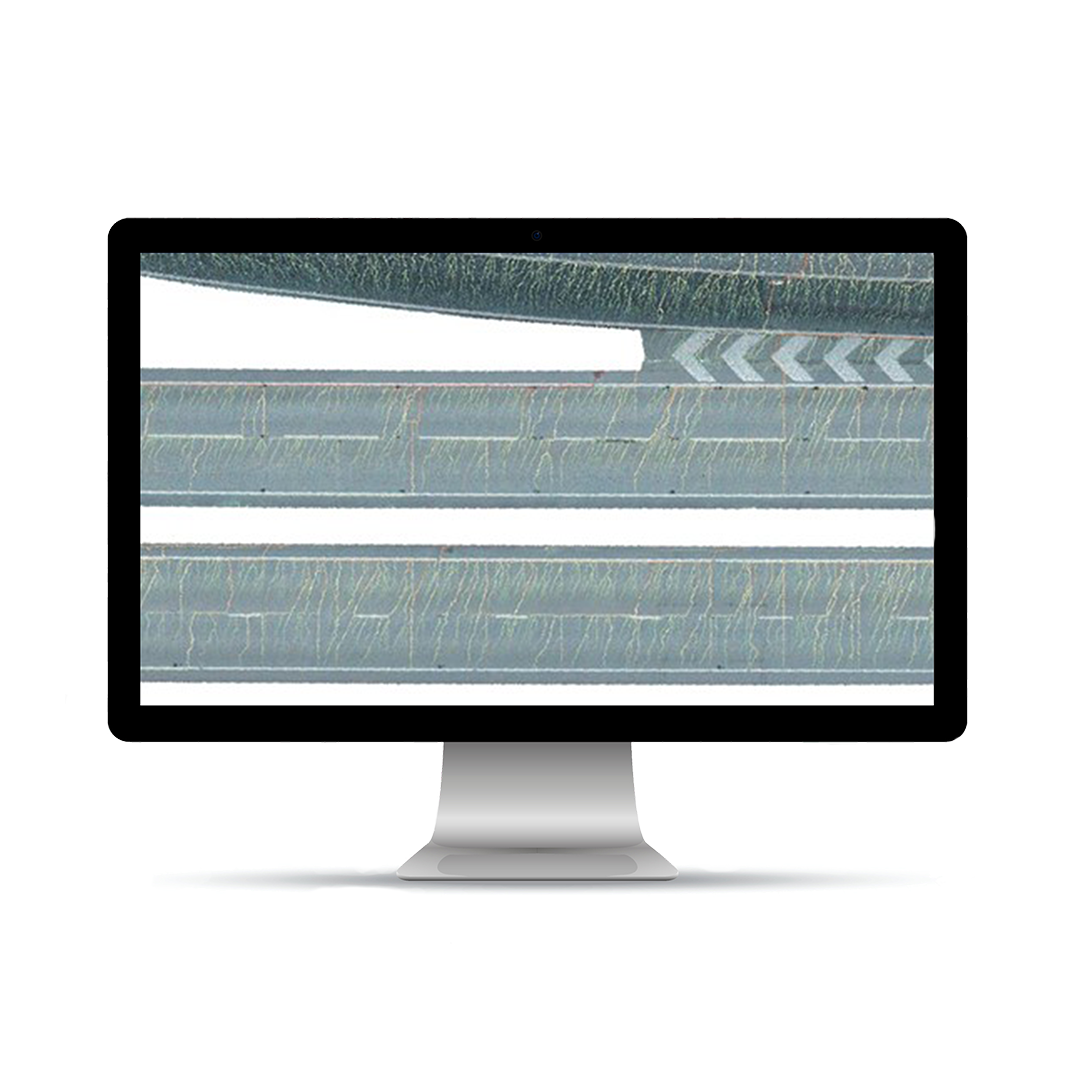
Enhanced Digitisation
Upgraded vector workflows to style and label features by attribute, plus bespoke HTML templated reports.
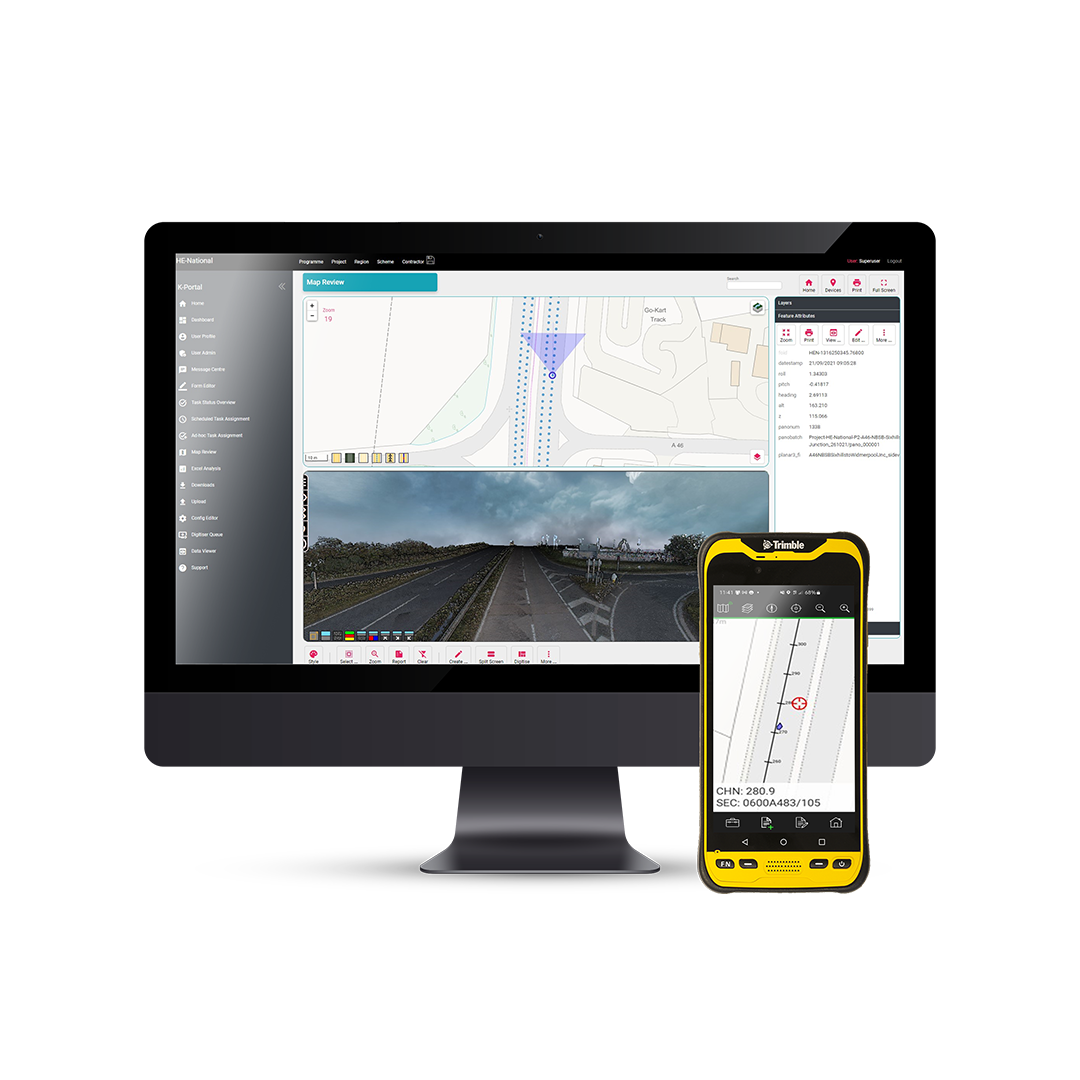
Comprehensive Mobile Workflow
Includes 2 x Full Mobile Licences for capturing GCPs and spatial features, with bi-directional syncing of data.
Incorporates all Standard data formats (.TIF, .LAS/LAZ, .OBJ, .DWG, .IFC, etc.). Advanced visualization introduces Web Map Service (WMS) support and TBA Terrain Model Imports. Security is reinforced via Multi-Factor Authentication (MFA). Digitization allows feature exports as CSV, SHP, DXF, and GeoJSON. The included mobile application supports comprehensive data capture and update of Soarvo features directly from the field, alongside background map syncing. Also includes TBA Whitelabelling for custom branding.
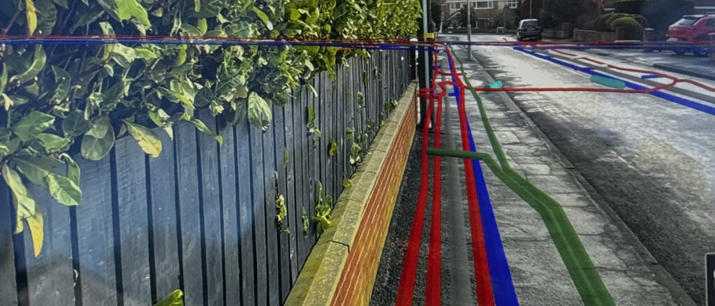
New KOREC case study: After the spray paint fades….
How the smart application of Trimble’s AR SiteVision technology has enabled Castle Keep Surveys to provide their client with an innovative solution for identifying underground utility assets—long after the completion of a PAS128 Underground Utility Survey.
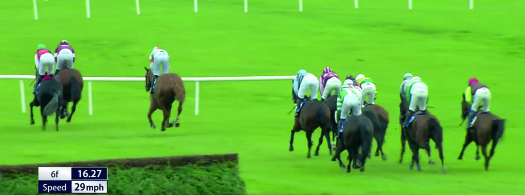
New KOREC case study! Fairyhouse Racecourse clears timing hurdle
Fairyhouse Racecourse leads the way in consistent, centimetre accurate, sectional timing data with IHRB approved low-cost, ground-breaking Trimble GPS syste
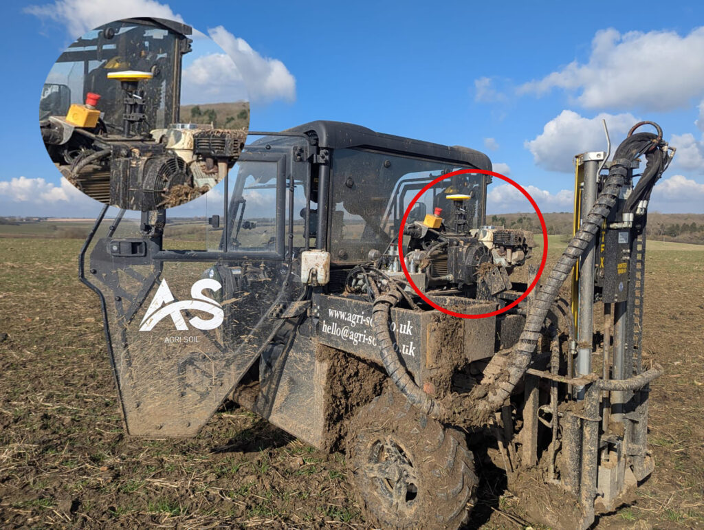
Grounded in accuracy
A family farm has diversified into providing an expert soil sampling and analysis business as an independent alternative to using services provided by large agricultural chemical companies.
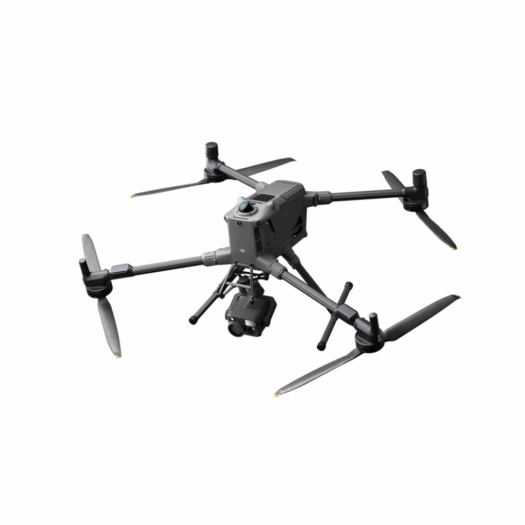
DJI Matrice 400
Engineered for excellence, designed for versatility