Propeller
€POA
PRODUCT ENQUIRY A cloud‑based site analytics and data platform that combines drone mapping, 3D visualisation, measurement tools, and project management capabilities to help teams map, measure, and manage worksites.
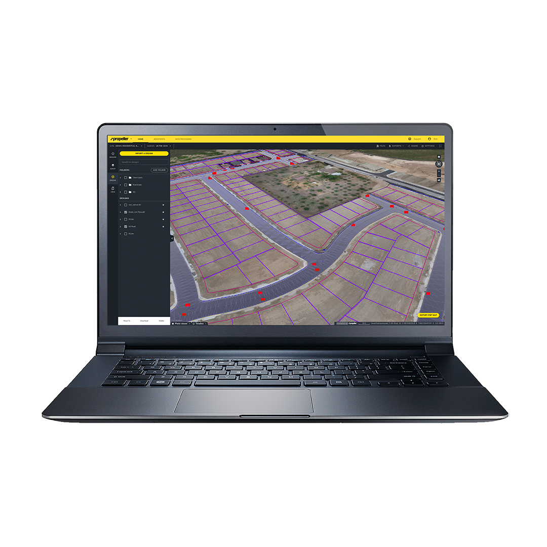
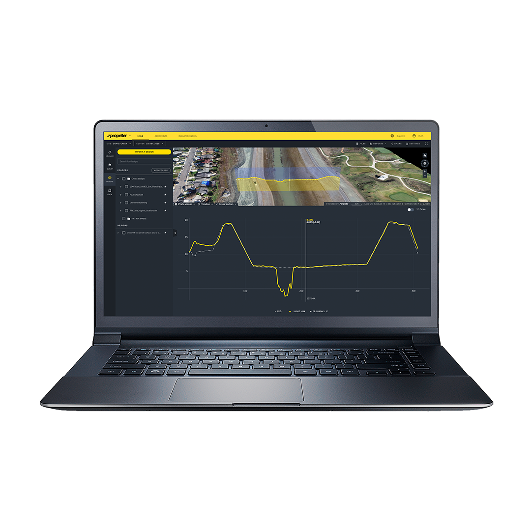
The Propeller Platform is a web‑based geospatial analytics hub designed to centralise site data from drones, GNSS devices, and other capture tools. It transforms survey data into interactive 3D maps and provides collaboration, measurement, and reporting tools to streamline decision‑making, reduce rework, and align team workflows across construction, mining, and aggregates operations.

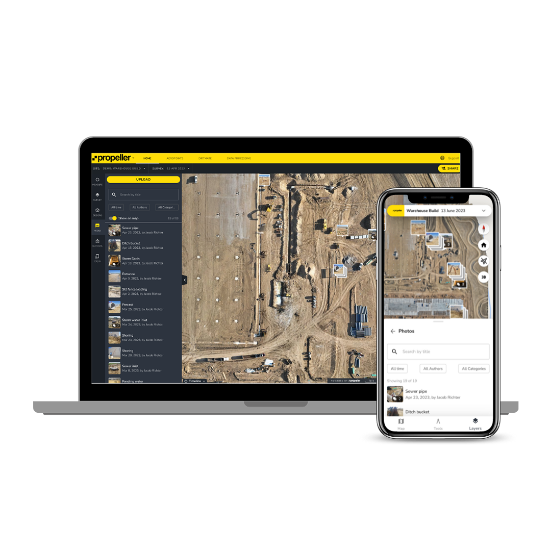
Unified Site Map Hub
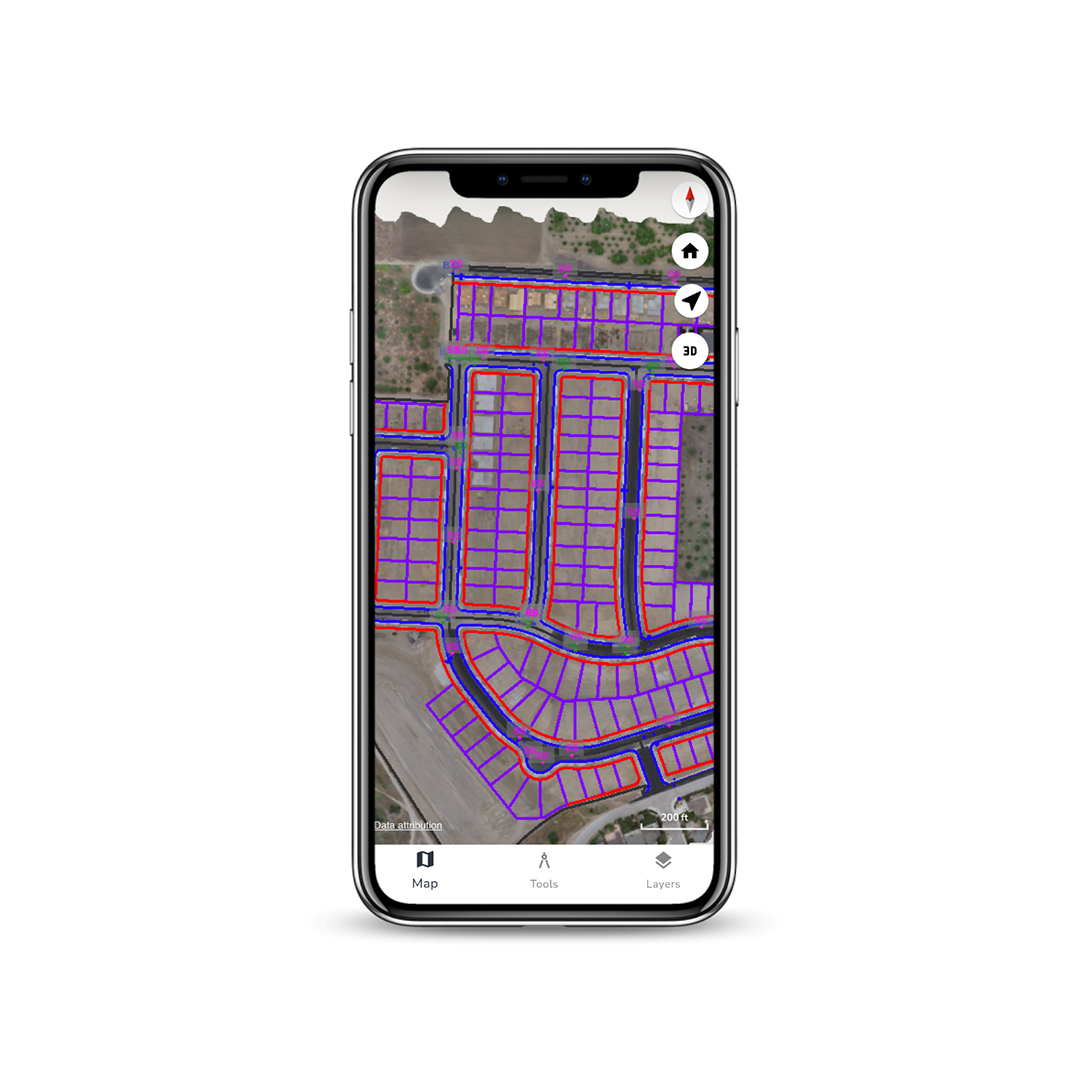
Brings together all site data — surveys, designs, photos, and documents — into a single interactive map for easy access and reference.
Advanced Measurement Tools
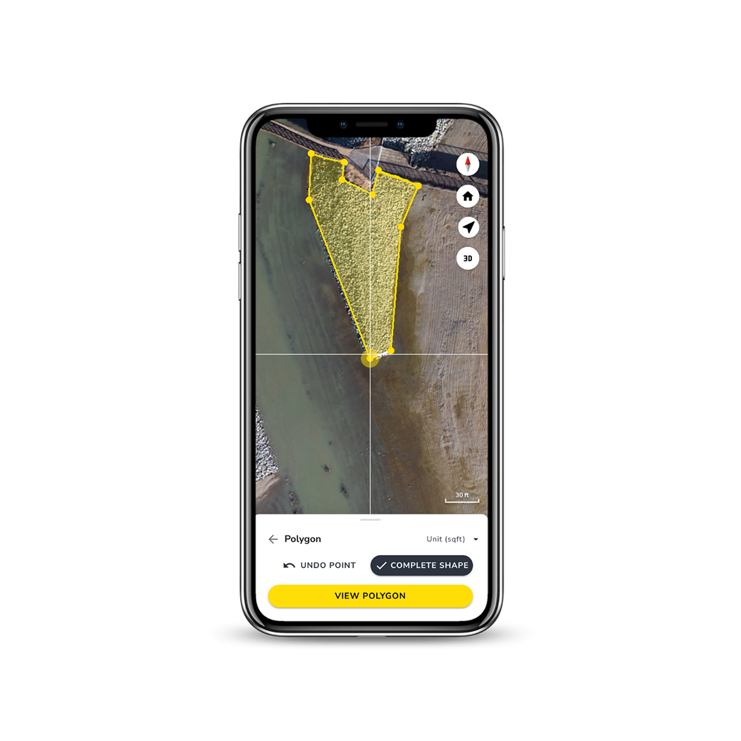
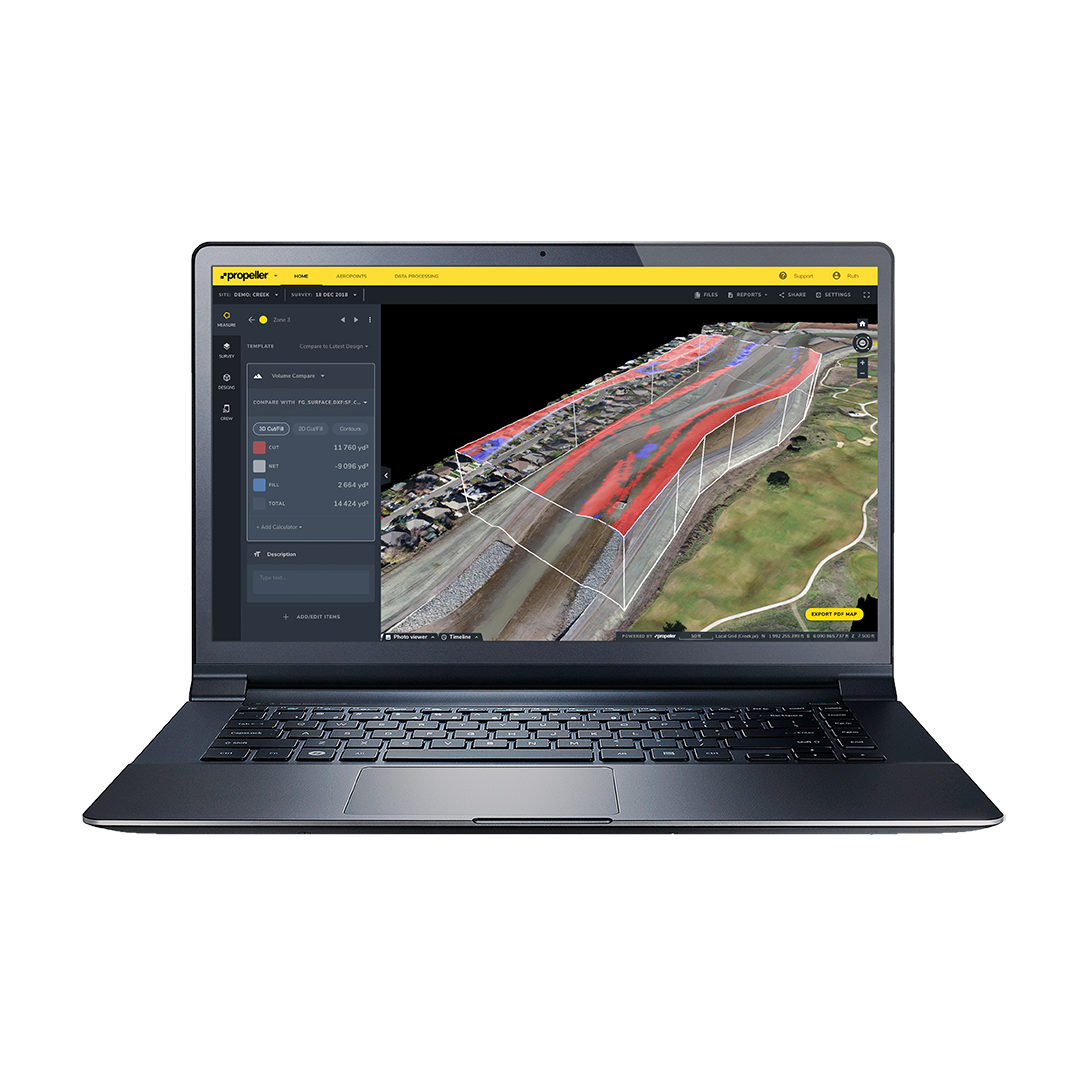
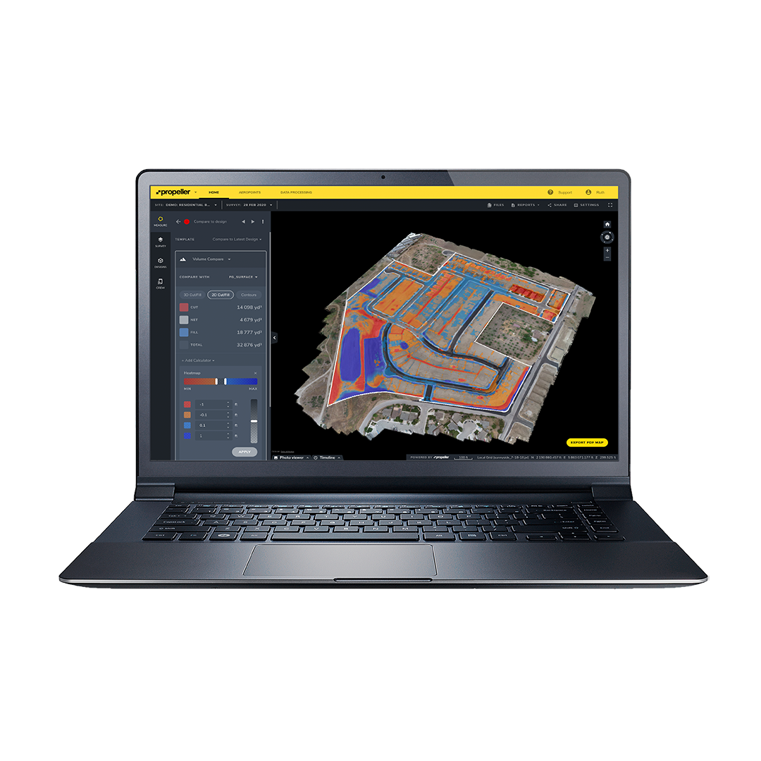
Provides built‑in measurement tools (distances, volumes, heights, grades) to analyse site conditions quickly and accurately.
Collaboration & Sharing
Enables teams to share insights, annotations, reports, and site context instantly, improving transparency and reducing miscommunication.
Integrations & Hardware Agnostic
Supports data from a wide range of capture hardware and integrates with design and project tools such as Procore, Autodesk BIM, and Trimble Connect.
Seamlessly Capture, Connect, and Control Your Site Reality
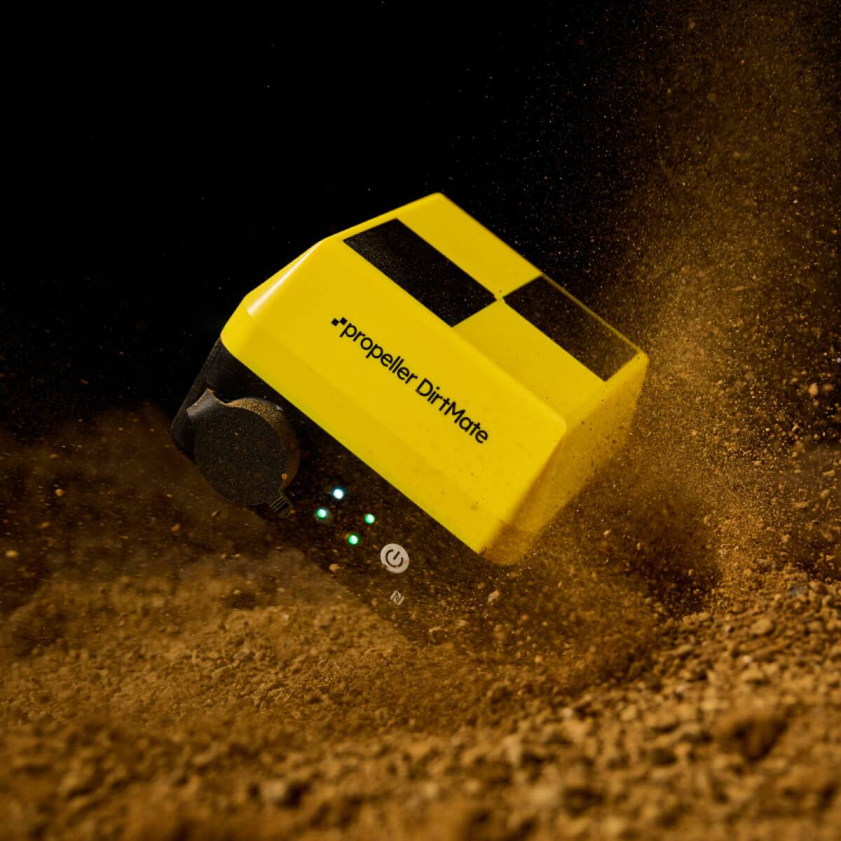
DirtMate & Propeller Hardware Ecosystem Real-Time Site Intelligence
Propeller’s Hardware Ecosystem brings together powerful site data capture tools — including DirtMate, AeroPoints, Drone Sensors, and Hardware Integrations — into one connected workflow. DirtMate turns heavy machinery into live GNSS survey sensors, streaming real-time position and elevation data directly into the Propeller Platform. AeroPoints deliver fast, survey-grade ground control with centimetre accuracy. Combined with supported Drone Sensors and an extensive list of Hardware Integrations, this ecosystem ensures you can collect, integrate, and analyse site data from the field to the cloud with confidence, improving efficiency and decision-making across survey and construction workflows.
Cloud-Powered Processing That Turns Raw Data Into Reliable Site Intelligence
Advanced Processing – From PPK Drone Data to Survey-Ready Outputs
Propeller’s processing suite transforms field data — from drones, LiDAR scanners, and GNSS rovers — into accurate, actionable site models and measurements. With PPK Drone Mapping, Propeller corrects GPS positions at the source for centimetre-level accuracy without extensive ground control. Survey Processing then converts that corrected data into orthomosaics, digital surface models, cut/fill maps, and 3D meshes within Propeller’s secure cloud platform. For more complex elevation capture, LiDAR Survey Processing ingests LiDAR point clouds and delivers dense, survey-grade terrain models and cross sections. Together, they enable fast, reliable deliverables for surveying, construction, mining, and earthworks monitoring.
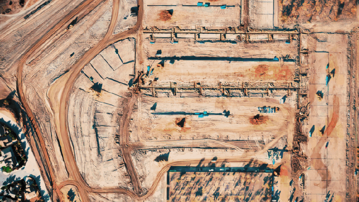
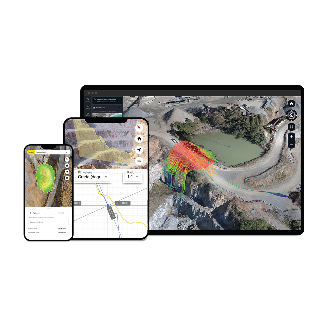
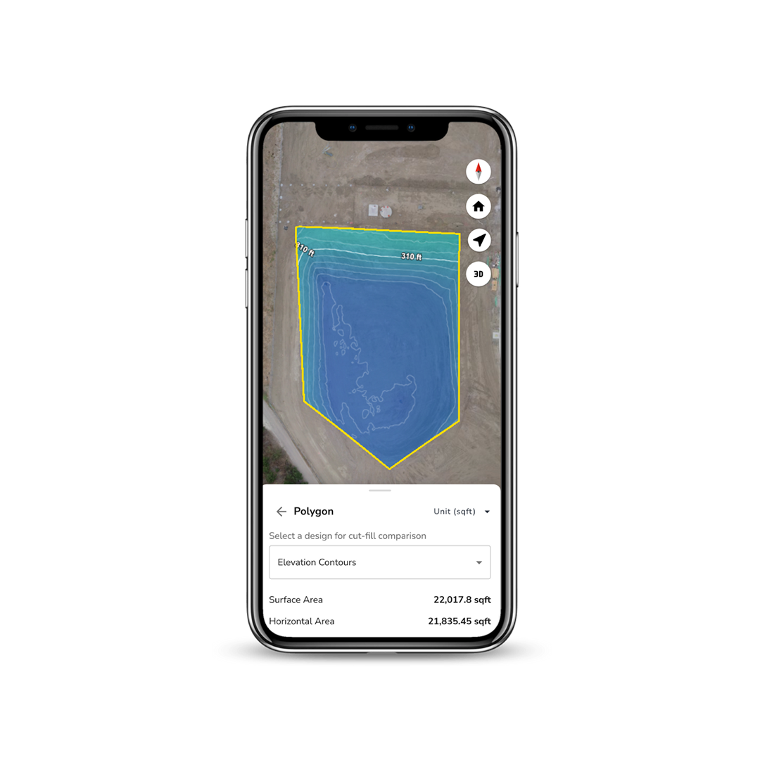
Propeller Platform is a cloud‑hosted analytics and collaboration system built to process, visualise, and analyse geospatial data from multiple sources. Users upload drone photogrammetry or lidar surveys, GNSS rover data, and other site information to generate 3D site models. The platform includes tools for cut/fill measurement, volumetrics, design overlay comparisons, progress tracking, timeline views, and real‑time operator data integration (via add‑ons like DirtMate). It supports secure data storage, collaborative workflows, mobile access, and integrates with design formats such as DXF, GeoTIFF, and BIM files. A 14‑day free trial is available to explore its capabilities.
- Cloud‑based 3D geospatial analytics platform
- Unified map hub for site data
- Built‑in measurement and reporting tools
- Collaboration and sharing features
- Integrates with Procore, Autodesk BIM, Trimble Connect, and more
- Supports multiple data formats (GeoTIFF, DXF, LAS/LAZ, etc.)
- Secure cloud architecture (AWS infrastructure)
- 14‑day free trial available