Shaping the future by revealing the past
The reliability of the Trimble X9 Core for 3D laser scanning has made it a go-to tool for the Royal Agricultural University, both in preparing the next generation of land […]


The reliability of the Trimble X9 Core for 3D laser scanning has made it a go-to tool for the Royal Agricultural University, both in preparing the next generation of land […]
View a formatted PDF of the story here
The Royal Agricultural University (RAU) has been at the forefront of agricultural education and a key contributor to the land-based sector for 180 years. Renowned for producing high-calibre graduates who go on to manage 70% of the surface area of the British Isles through cultural and heritage organisations or private ownership, the RAU has invested heavily in preparing its students for life beyond study. This includes the creation of a £6 million geomatics lab and ensuring that students gain a strong working knowledge of relevant technologies such as 3D laser scanning – something that a number of students have incorporated into their final dissertations.
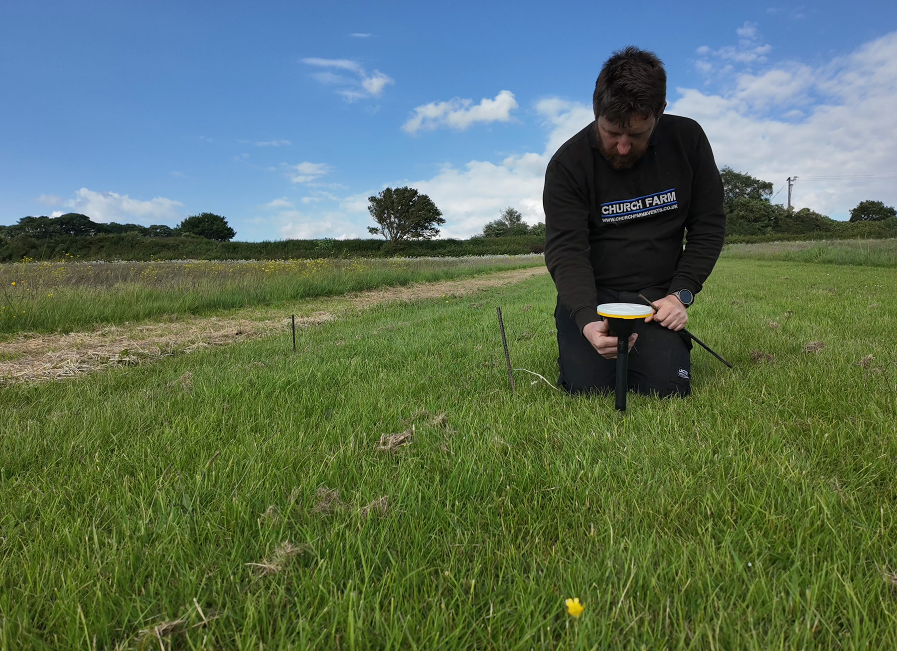
A number of these projects are led by Professor Mark Horton, Director of Research at the RAU. An archaeologist, tv presenter and writer with global interests, Mark’s aims lie in preserving the environment whilst uncovering new information through investigation. He is therefore an avid user of the KOREC supplied Trimble X9 Core 3D Laser Scanner* (part of RAU’s wider Trimble portfolio), finding its reliability and ease of use an ideal combination for both student training and the university’s research projects.
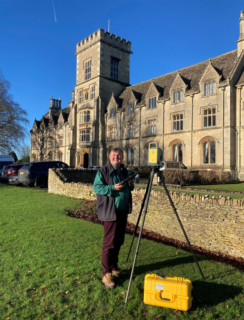
Professor Mark Horton
These research projects cover a range of areas from documenting the excavation of roman ruins to biomass measurement for carbon offsetting, and most recently, a nationwide investigation of cave dwellings that is changing the way we understand and manage these sites:
Documenting and dating a cave dwelling
Across England, more than 150 cave dwellings are cut into the soft sandstone that dominates certain regions, particularly the Midlands and Derbyshire. The aim of the RAU research project, led by Senior Research Fellow Edmund Simons, was to create a permanent record of these “monuments of the landscape” and to gain a clearer understanding of the alterations and expansions they have undergone over the centuries.
The nature of the work posed several survey challenges that ruled out traditional tape measurements (too time-consuming with the highly irregular shapes made drawings impractical) and also discounted SLAM technology (accuracy and reliability could not be guaranteed in such demanding environments).
With 3D laser scanning selected as the method of data capture, it was crucial that the Trimble X9 Core could perform in the difficult conditions encountered across the cave sites and deliver in key areas:
Following extensive use of the Trimble X9 Core in these conditions, Mark reports that it handled the challenging cave sites without issue and has helped them to make some important discoveries.
Challenging assumptions in Derbyshire
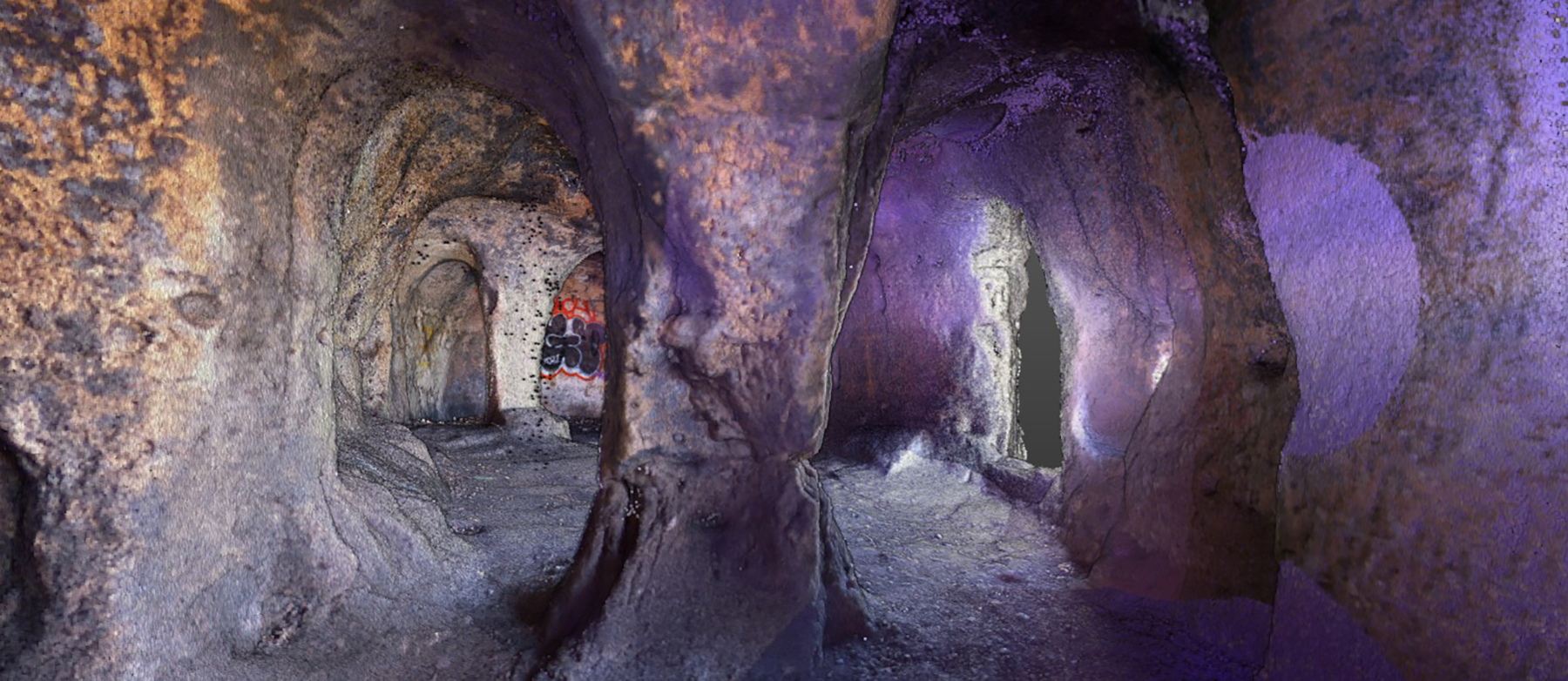
In particular, the X9 Core for 3D Laser Scanning has captured vital information at the Anchor Church Caves in Derbyshire.
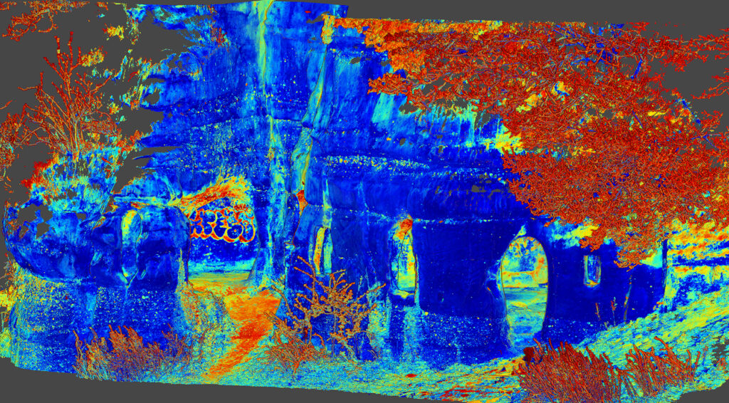
Colour intensity view showing hidden detail
Long regarded as an 18th century folly, a combined drone and laser scan survey that captured the surrounding area, external elevations and internal cave areas has revealed that this dating information maybe out by as much as 1000 years.
On the day of the survey work, the X9 Core was used over a period of hours with each scan taking 3-4 minutes to achieve the required density. Back at the office, Trimble RealWorks was used to combine the scan and drone data into a 3D model of the site which was then used for the creation of plans and cross sections.
By analysing the detailed point cloud data, particularly around the doorways and windows, the construction was found to closely resemble Saxon architecture whilst pillars were found to be similar to those in a Saxon crypt nearby.
The team was therefore able to deduce that the caves most likely dated back to the early medieval period, specifically the 9th century, rather than the 18th century, as previously believed.
The history of the surrounding area, including a nearby church and burial site, provided the RAU team with further evidence that the caves were very likely inhabited by King Eardwulf. He is believed to have lived there as a hermit after his exile from Northumbria in 806 and before he became known as Saint Hardulph.
For Mark, the information provided by the X9 Core scan has proved invaluable:
“It is extraordinary that domestic buildings over 1200 years old survive in plain sight unrecognised by historians, antiquarians and archaeologists. We were able to better understand how the structure builds up over time and hopefully one of the outcomes will be an increased level of protection. The reliability of the X9 Core and the speed with which it can deliver a 3D map on projects such as this is something we value highly.”
Multiple applications
Mark is quick to point out that the X9 Core is also earning its keep across a number of other RAU projects. These include finding a more accurate way to measure biomass, in particular for gauging carbon credits. Mark explains:
“In an industry worth billions of pounds, the traditional method of measuring a tree by holding up a stick and backing up 5 paces is simply not up to it. We’ve looked at drone surveys for this purpose and also used the X9 Core with interesting results confirming that the drone surveys are around 80% accurate compared to the scan data. We now have a useful choice between speed or high accuracy depending on the conditions. A lot of carbon offsetting is based on models with no precision behind them. We want to be more scientific about this and that’s exactly what the X9 Core will allow us to do.”
He concludes that “the X9 Core, widely regarded as an industry standard for 3D Laser Scanning, is the ideal tool for both teaching and research.” He hopes students will carry their knowledge of the system and its applications into the organisations they join, its ease of use making it well suited for bringing survey work in-house and therefore used more frequently.
*the X9 Core superseded the X7
For further information on Trimble Catalyst, please contact us here.