No fuss and full control: monitoring the M25 J10 upgrade works
How Balfour Beatty smoothly implemented a high-performance, easy-to-use Trimble automated monitoring system - with minimal traffic disruption and limited reliance on prisms - during essential utility work at the UK’s busiest motorway junction.
How Balfour Beatty smoothly implemented a high-performance, easy-to-use Trimble automated monitoring system – with minimal traffic disruption and limited reliance on prisms – during essential utility work at the UK’s busiest motorway junction.
The M25 Junction 10 / A3 Wisley interchange is the busiest section of the M25 with over 300,000 vehicles travelling through it every day. As part of a major National Highways upgrade scheme that began in November 2022, Balfour Beatty is delivering substantial improvements to ease congestion and enhance road user safety. These include the construction of four new slip roads, widening the A3 to four lanes in each direction around the junction, and increasing the overall capacity of the roundabout.
The project has also seen the Balfour Beatty team redirect and install a range of utilities requiring the firing of drill shots for the telecoms, water and electricity and the construction of two tunnels for the gas.
With each crossing demanding careful planning and execution to ensure safe operation, Balfour Beatty Engineering Surveyor, Jack Richardson, was responsible for the installation and smooth running of a precise and reliable monitoring system to detect any movement of the A3 carriageway during the utility work.
System selection
As a long term KOREC customer and Trimble user, Balfour Beatty engineers on this site are familiar with Trimble equipment and workflows. Consequently, four Trimble S7 Total Stations, renowned for both their high precision and reliability in all weather conditions were purchased, later supplemented with four additional S7s also hired from KOREC. When used in conjunction with Trimble 4D Control software (T4D) for automated movement detection and monitoring of infrastructure, these total stations became a straightforward to use and highly effective monitoring solution.
While the total stations were powered by an on-site generator, control was managed via the Settop M1 monitoring devices, enabling real-time remote monitoring and management. Acting as a field computer, remote switch, device server, router, Wi-Fi router, and 4G cellular modem all in one, the Settop M1s provided seamless remote access to the S7 total stations. This allowed Jack to check system status at any time, from anywhere, without the need for a complex IT setup, saving him a significant amount of time.
Set up
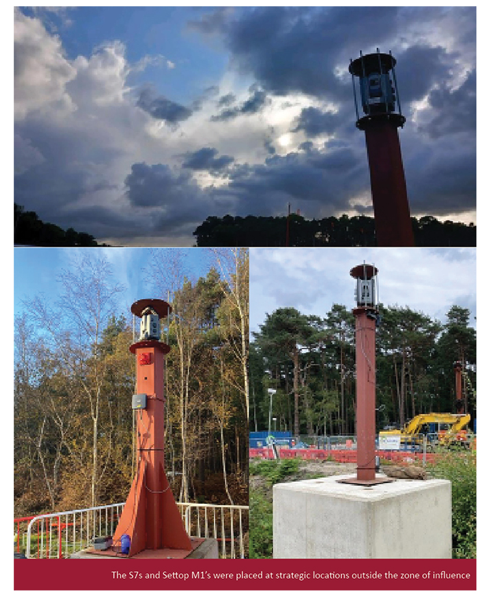
Under Jack’s guidance, the total stations and Settop M1s were positioned outside the zone of influence, away from the drill’s centre line. Mounted on pillars and protected by cages, the instruments were strategically located in accordance with the Geotechnical Design Report (GDR) provided by VEDA – specialists in trenchless installations working alongside Balfour Beatty on these crossings.
A four-week pre-monitoring phase was then conducted to gather sufficient baseline data, with the Trimble software configured to carry out automated monitoring rounds every hour, day and night.
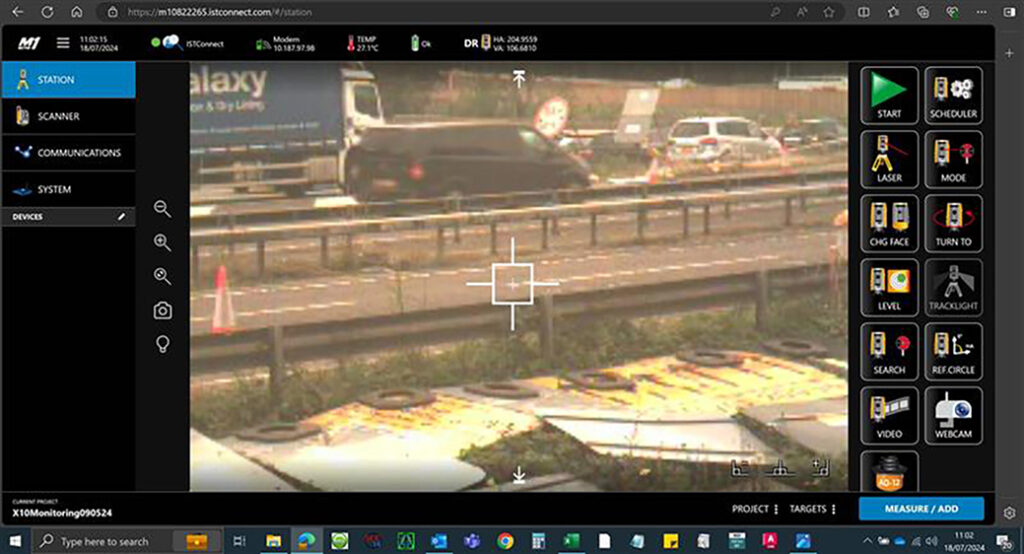
Live view of the carriageway from the Settop M1 WebUI
An alternative approach
While a few prisms were used for coordination before each round, the instruments mainly measured to the white centre line of the carriageway instead of fixed targets. This proved to be a highly effective use of DR measurement – especially on projects like this, where keeping traffic moving is key. By avoiding the need to constantly remove and reposition targets, disruption was kept to a minimum.
The Trimble S7s also come with VISION technology which provides live video streaming and high-resolution image capture, allowing Jack to see exactly what the instrument sees. This is essential for verifying measurements or checking for obstructions, movement, or tampering, without needing to physically access the site.
Using Trimble T4D software
Jack reports that even though he was relatively new to monitoring he found the Settop M1 WebUI and T4D software intuitive to use.
Additionally, with a few helpful tips from the KOREC monitoring team, he was able to set up exactly the alert triggers he required using colour coded bands for the different tolerances with green indicating anything below the required 6mm of movement.
He was also able to program the system to ensure that no major triggers were alerted unless five points in the same area registered movement outside the specified tolerances. This was an important aspect of the set up because a misplaced traffic cone on the carriageway could cause multiple alarms.
Additionally, T4D would alert Jack if no data was collected over a period of hours, something that proved especially useful during a period of problems with the generator.
Stand out features of the system
For Jack, the priority on this project was clear: deliver accurate, reliable monitoring data without causing disruption to the utilities team. That meant the system had to provide clear, easy-to-understand reporting and Trimble’s T4D software delivered exactly that. Not only could it generate reports in the format required by National Highways, but it also made it easy to visualise key data, such as movement shown on a heat map.
One of the standout benefits for Jack was just how straightforward the system was to use and share with others. Training a colleague took no more than a single page of notes:
“The S7s, Settop M1’s and T4D were extremely easy to set up, especially because we are already used to Trimble equipment. I was easily able to summarise the operation into a single page document for another member of the team.”
Project completion
With the final crossing completed earlier this year, Jack reports that there were zero issues with the Trimble equipment, even when they had eight systems running simultaneously:
“The system has been so reliable and easy to use. If we did have any questions, then a quick call to KOREC has been answered immediately or returned within 10 minutes, KOREC has been brilliant!”
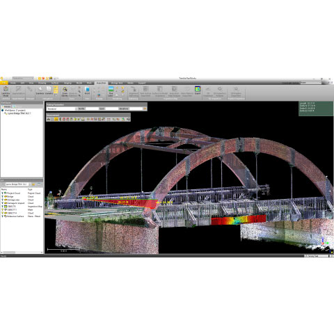
The reliability of the Trimble X9 Core for 3D laser scanning has made it a go-to tool for the Royal Agricultural University, both in preparing the next generation of land...
Using Trimble Catalyst to accurately map plots on their natural burial ground, Forget Me Not Fields has found a perfect balance between efficiency and tranquillity amongst the wildflower meadows. Download...
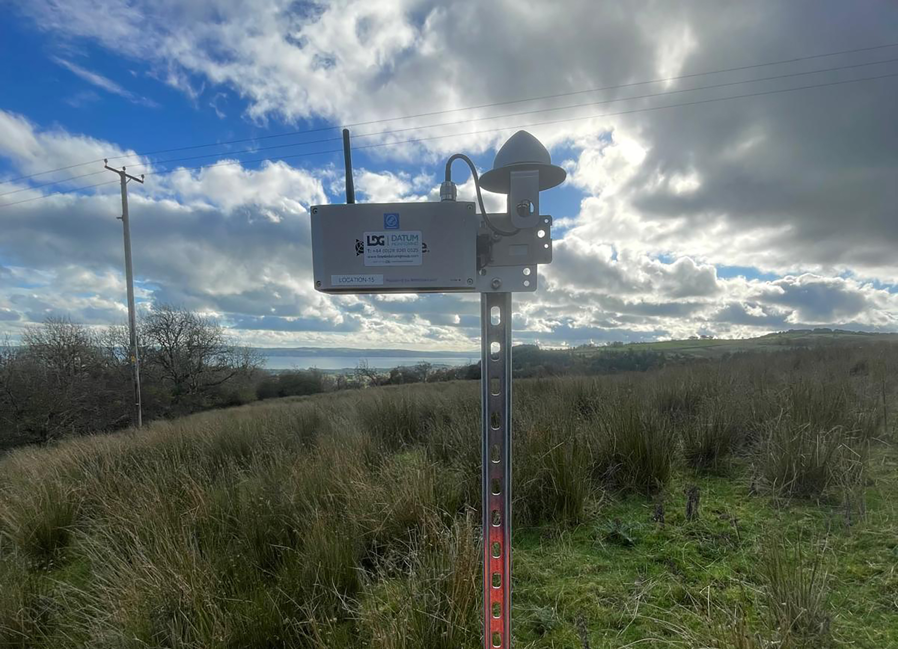
Lloyds Datum Group (now part of SOCOTEC UK and Ireland) has pioneered a landmark project on an abandoned mine site in Northern Ireland. It is the country’s first large-scale ground...