Minimal drift, maximum speed and no disturbance
When Neon Surveys introduced the Exyn Nexys SLAM system into their floor-plan surveying workflow, the only difference their clients noticed was how much faster they received the finished deliverable.


When Neon Surveys introduced the Exyn Nexys SLAM system into their floor-plan surveying workflow, the only difference their clients noticed was how much faster they received the finished deliverable.
When Neon Surveys introduced the Exyn Nexys SLAM system into their floor-plan surveying workflow, the only difference their clients noticed was how much faster they received the finished deliverable.
Established in 2012 by Director Duncan Hallam, Neon Surveys specialises in measured building, topographical and referencing surveys. From the company’s outset, Duncan has invested heavily in innovative hardware and production software to maximise efficiency and find ways to eliminate the traditional obstacles that regularly impeded his team’s progress. In particular, during floor plan work, the same challenges would recur such as time pressures, tenants who couldn’t be disturbed and increasingly complex internal layouts.
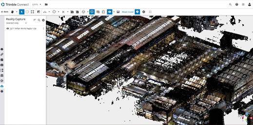
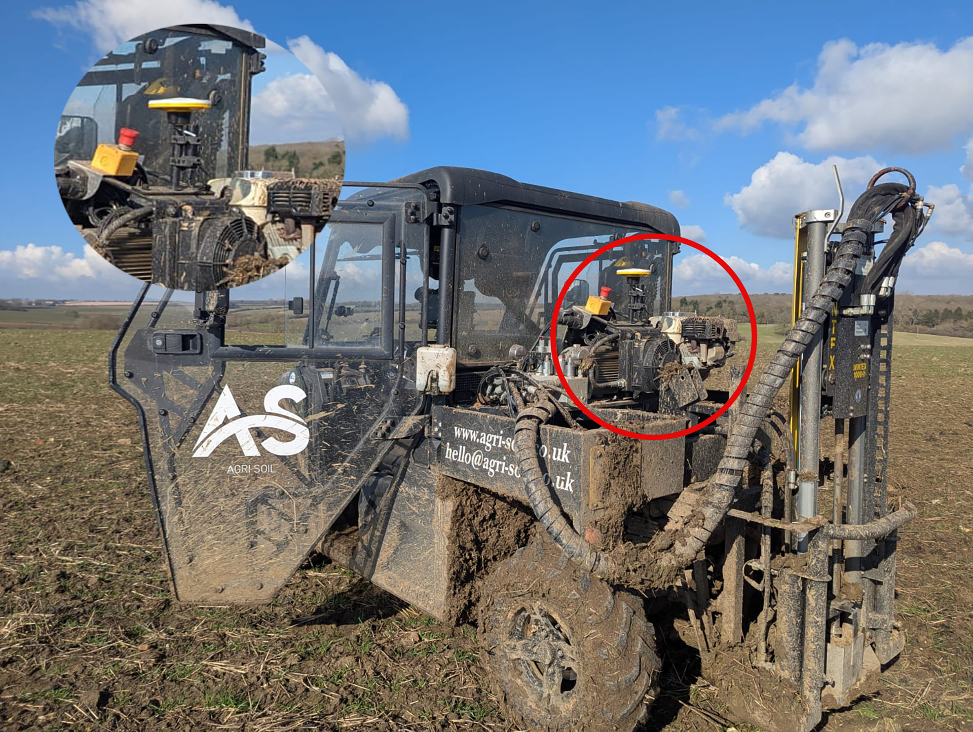
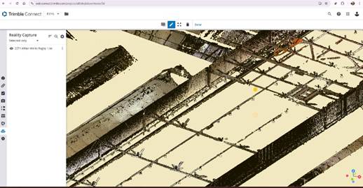
Data captured at the industrial building project in Warwickshire
As a skilled user of 3D laser scanners, he therefore recognised that SLAM technology would be an ideal match for these precise floor-plan surveys that made up a large share of the company’s workload and successfully integrated two system into the Neon workflow five years ago.
In 2025, with the Neon Surveys team continuing to grow, Duncan felt it was the right time to supplement their two existing units with a new SLAM system, one capable of elevating data quality and offering a practical alternative to terrestrial laser scanning in certain scenarios.
After extensive research, Duncan and fellow Director, Will Jordan, felt that the combined support from Exyn and KOREC, along with Exyn’s openness to shaping future developments around user feedback, made the Nexys and its functionality an ideal fit.
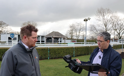
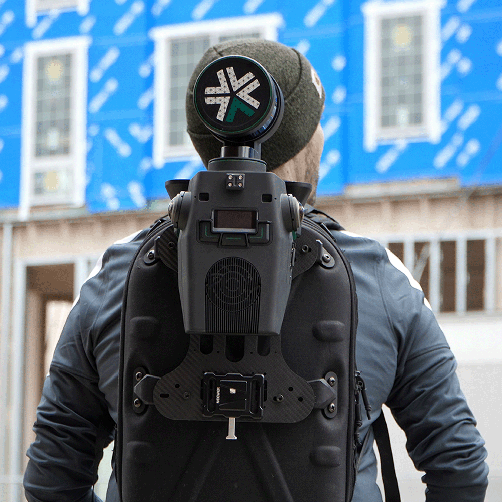
Duncan trialling the Nexys with KOREC
By working closely with Exyn, he and Will have now fine-tuned the Neon workflow to the point where drift is minimal, even in the particularly challenging internal environments they work in. Both Duncan and Will have also benefited greatly from sharing their experiences with KOREC and drawing on the KOREC team’s support and industry knowledge.
Duncan and Will say that, thanks to the reliable support and their own growing expertise, the Exyn Nexys is now deployed several times a week with almost zero downtime and has become the go-to tool for their internal surveys in offices and retail spaces.
A recent project in Warwickshire perfectly demonstrated just how indispensable the Nexys has become.
A large, sprawling industrial site in Rugby, manufacturing parts for power stations and filled with machinery, presented the Neon team with a number of challenges when they were contracted to produce a floor plan/sqm for potential refurbishment.
Due to sensitivity around the industrial parts the site was producing, the client had imposed certain restrictions. Although they were comfortable with Duncan walking around the site, he had to stick to safe walkways and also be escorted at all times. Additionally, Duncan would be just one person in a four strong survey team carrying out supporting work such as environmental surveys. It was therefore imperative that, with just one escort for all of them, he was not holding anyone up despite the amount of data he needed to capture.
Finally, it was esential that the tenants were not disturbed. Typically, the tenants want the surveyor to be silent, not involved in lengthy instrument set ups and offsite as soon as possible. Both Duncan and Will have noted that using the Nexys on this type of job has enabled them to keep the process both fast and quiet, something appreciated by client and tenant alike.
On the day of the survey, Duncan mounted the system in a backpack and walked over 10km around the 27 acre site capturing all the required data (well within 15-20mm accuracy specified for the job) in a single day:
“Our aim is always to get high-quality data into the hands of the client as quickly as possible. On this project, we spent one day scanning, the next day processing and the third day drawing up. If we’d used a 3D Laser Scanner we’d still be on site.”
Data captured at the industrial building project in Warwickshire
Unlike other SLAM systems, the Nexys generated data is owned by Neon and can be processed in-house – a priority for Neon. With full control over the data, they know exactly what the cost of processing will be and can factor in how long it will take. Whilst Duncan and Will acknowledge that other systems that process the data in the cloud can be a little quicker, they find the time difference negligible, enjoying that they can choose the level of refinement required depending on the nature of the project. Duncan notes:
“Cloud processing is done at certain settings. Having the choice to change these, depending on the job, ensures our clients get the perfect balance between speed and accuracy along with the added security that we can do this off-line.”
Duncan concludes:
“Compared to other SLAM systems and compact 3D Laser Scanners, the Nexys SLAM works noticeably better and jobs that would have taken hours are now completed in minutes. Importantly, our clients have made no comment on the data compared to data we have supplied by a laser scanner. What they have noticed is how much faster they receive the deliverable.
“What do I like about the Nexys in particular? Is there an option for everything!”
Discover SLAM
Get in touch with one of KOREC’s friendly laser scanning specialists to see how SLAM scanning can improve your workflows


SLAM (Simultaneous Localisation and Mapping) mobile mapping systems integrate LiDAR sensors with inertial measurement units (IMUs), cameras, and algorithms to build a 3D map in real-time while the device moves.
With Exyn Technologies’ Nexys expect survey-grade LiDAR + proprietary SLAM algorithms that deliver industry-leading data capture speeds, real-time colourisation, on premise post-processing, and instant onsite visualisation in a variety of physical configurations, levels of autonomy, and environmental conditions.
Whether mounted on a drone, vehicle, handheld device, or ground robot, it adapts to different industries, from mining to construction and geospatial surveying. Nexys provides accurate spatial data without relying on GPS, making it particularly effective in underground or obstructed areas where traditional mapping tools struggle.