Specialist training for smarter surveying

Learn and excel with construction and survey training courses from KOREC – the trusted industry experts. With Trimble Certified Trainers, Trimble Certified Product Specialists, and CITB approved courses, you can be sure you’re set up for success.

Hero Block
Hero Block Mobile

Expert, practical training experts across UK and Ireland

Comprehensive product and workflow training is crucial for the success of your projects. That’s why KOREC’s Trimble certified training courses have been specifically designed to equip you and your workforce with the latest skills and techniques needed to take full advantage of Trimble products and software. As one of Europe’s largest distributors, we have training courses available in a location near you, stretching across the UK and Ireland. So if you’re looking for expert-led training in construction, survey, mapping, monitoring or rail – you can trust KOREC.

Get up to 70% funding on training

KOREC are proudly CITB accredited as an Approved Training Organisation, meaning you can access a subsidy of up to 70% against the cost of any KOREC training course in the UK as part of the CITB Employer Network scheme. This is a great way to improve your organisation’s skills and capabilities from a trusted, certified provider. To get started with CITB subsidised training, simply contact your local CITB Advisor to get started.  

Learn in the best way for you

Different businesses have different requirements, so we’ve built both in-person and online training courses that are designed to help you excel. We regularly run in-person training sessions at our regional offices, and we’re always more than happy to create customised training for your organisation. Meanwhile our virtual GeoSchool training is online 24/7, ready whenever you are. So however you’re looking to get our Trimble certified training courses, you can find a way that works for you.

Trusted by leading brands

What do our customers say?

Fantastic amount of information delivered clearly in a limited timespan – many thanks!

Angus Hemmings
Ordnance Survey

The course was very well structured and easy to follow. Any questions or problems were explained clearly.

Joe Rae
Network Rail

Excellent training, well delivered and willing to change small aspects of the course to better suit our needs.

Darren Perkins
A14 Integrated Delivery Team

Talk to our friendly training team

Looking to talk to someone? Get in touch with our friendly training teams for a quick response.

Get in touch

GeoSchool Online training

KOREC GeoSchool is our online learning platform that offers a range of high-quality interactive training courses. These courses have all been designed to allow you to choose, where, when and at what pace you’d like to complete your training, as well as providing lots of opportunity for questions and feedback from our qualified trainers.

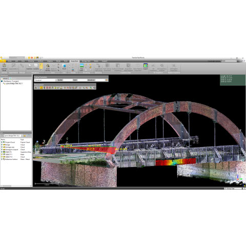
Training topics covered include Trimble RealWorks, Rail sector, Trimble Business Centre, plus you can access our free webinar recordings and free Trimble Virtual World Quests.


In-person training courses

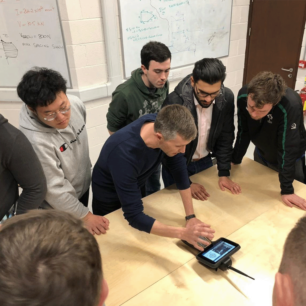
Our dedicated training team includes Trimble Certified Trainers and Trimble Certified Product Specialists, so you can get peace of mind that you’re getting quality training that will make a real impact to your organisation. KOREC trainers are all seasoned experts with years of real-world experience and deep Trimble expertise across hardware and software. We work hard to make our training courses highly engaging and relevant, combining the right mix of classroom theory and practical hands-on.


Upcoming scheduled training courses

KOREC regularly run scheduled training for our most popular courses every month, available at a selection of locations across the UK and Ireland. These are our most popular courses that we run regularly, but we do have a wide variety of courses available that cover survey, construction, rail (and more) for both field and office. Browse our full course catalogue further down the page for more info on our full range.

UK scheduled training is run from our head office in Liverpool, and Ireland and Northern Ireland training is run from locations in Dublin, Cork, and Craigavon.

UK
Introduction to Land Surveying

6-7 January 2026

3-4 February 2026

3-4 March 2026

14-15 April 2026

5-6 May 2026

2-3 June 2026

GNSS Survey & Data Processing

13-14 January 2026

10-11 February 2026

10-11 March 2026

21-22 April 2026

12-13 May 2026

9-10 June 2026

Total Station for Construction (CITB GET3407)

This is a CITB-approved course. CITB Course Code GET3407.


21-22-23 January 2026

18-19-20 February 2026

18-19-20 March 2026

22-23-24 April 2026

20-21-22 May 2026

17-18-19 June 2026

Trimble Business Center Earthworks Basics

27 January 2026

24 February 2026

24 March 2026

07 April 2026

26 May 2026

23 June 2026

Ireland & NI
Total Station Surveying & Setting Out

19th January 2026 – Craigavon

20th January 2026 – Dublin

21st January 2026– Cork


GNSS Surveying & Setting Out

16th February 2026 – Craigavon

17th February 2026 – Dublin

18th February 2026 – Cork


Browse the full course catalogue

In addition to our regular scheduled training courses, KOREC offers an enormous catalogue of Trimble certified training that can be tailored to your groups’ individual needs. We can run them from a KOREC office, or we could come to you! Take a look at the kind of course content we typically cover. Ask about bespoke training.

UK Courses
Introduction to Land Surveying (Short Course)

2 DAYS

This Introduction to Land Surveying: Short Course is designed for assistant or junior surveyors and site engineers who are beginning to conduct their own surveys and seek to enhance their theoretical knowledge and practical skills in site surveying.


Focusing on the use of a robotic total station, the course offers a balanced mix of classroom-based theory and hands-on field sessions. 

Taught by experienced KOREC Trainers, the course covers:

  • Traverse survey and control coordinate processing
  • Total Station setup and orientation
  • Topographical data collection
  • Topographical survey drawing

Participants will benefit from interactive classroom sessions and extensive field practice. This course is ideal for assistant or junior surveyors who are looking to gain a solid foundation in site surveying and are ready to take on more responsibility in their survey projects.


Learning Outcomes

  • Describe the topographic survey process
  • Observe a traverse survey
  • Process and adjust traverse in survey software
  • Save control coordinates to a csv file and transfer to field software
  • Perform a known point
  • Perform a resection station setup
  • Describe prism types, constants and tracking methods
  • Conduct a topographic survey using field coding methods
  • Import field survey data into survey software
  • Draught topographic survey data ready for CAD export
Total Station for Construction CITB (GET3407)

3 DAYS

This is a CITB approved course. CITB code GET3407.

Get hands-on training in surveying and setting out with this practical, CITB Assured course. Ideal for site engineers requiring hands-on training, you’ll learn to operate a modern Total Station confidently and accurately from the installation of Control to Setting Out and Site Checks.

Taught by experienced KOREC Trainers, the course covers:

  • Equipment setup and calibration
  • Establishing control networks
  • Topographical data collection
  • Setting out using coordinates

By the end, you’ll have the practical knowledge and confidence to handle surveying and setting out tasks commonly performed using a Total Station.

CITB course certificate provided upon successful completion of the course learning outcomes.


Learning Outcomes (CITB)

  • Set up the total station over a point
  • Carry out relevant calibration checks
  • List the possible sources of error when using a total station
  • List techniques for improving and checking your accuracy and precision
  • View, edit, add, and delete data
  • Install a network of primary control points from scratch (traverse)
  • Install accurate secondary control points (retro targets)
  • Create a local coordinate system
  • Measure and set out reduced levels with the total station
  • Describe and practice a range of methods for plumbing columns and walls
  • Set the position and orientation of the total station using the resection
  • Set the position and orientation by setting up over a known point and referencing another known point
  • Take a topographical survey and record the results systematically
  • Measure the horizontal distance and level differences between points
  • Stake out points of known co-ordinates using the stake out function
  • Stake out points in relation to a baseline using the reference line function
  • Import and export data
  • Discuss the relationship between Total Station and GNSS equipment 
  • Explain the scenarios when you would choose mechanical and robotic total stations
Trimble Business Center Earthworks Basics

1 DAY

This training course provides an introduction to Trimble Business Centre (TBC) for earthworks applications that require the creation and use of surfaces (terrain models). Participants will learn how to navigate the software, import and manage data, create and modify surfaces, perform earthwork calculations, and generate deliverables for construction projects such as cut/fill maps and volume reports.


The course is designed for engineers, surveyors, and construction professionals looking to enhance their knowledge of TBC’s earthworks functionality.


Learning Outcomes


  • Identify and operate Trimble Business Centre core functions and views
  • Import and manage data suitable for surface creation
  • Create surface models using a surface members methodology
  • Refine surface models using break lines, boundaries and surface properties
  • Perform earthwork volume calculations
  • Create simple profiles
  • Generate a cut/fill map with daylight line
  • Produce contour lines
  • Generate reports and documentation for construction projects
  • Utilise key tools and workflows for efficient earthwork project management
  • Export surface models for use in field software
Trimble Business Center: Survey & Construction Workflows

3 DAYS

This three-day course allows time to go through common survey and construction workflows using Trimble Business Center. Once each subject is introduced the delegate follows written exercise instructions to produce the required outcome.


Taught by experienced KOREC Trainers, the course covers:

  • Data import and checks
  • Traverse data processing
  • Draughting from topographic survey data
  • Topographical survey drawing
  • Surfaces and volumes


This course is suitable for those who are new to Trimble Business Center or for those who want to extend their current use of the software.


Learning Outcomes

  • Identify key software views
  • Import and check Total Station data
  • Process and adjust traverse survey
  • Edit a Feature Code Library
  • Apply a Feature Code Library to a topographic survey
  • Refine survey drawing with text and CAD edits
  • Place survey drawing on to a Sheet with Title Block
  • Create and edit surface models
  • Compute Cut/Fill and Earthworks volumes
  • Clean CAD design drawing files
  • Create setting out points and export
Trimble Access: Roads Module

1 DAY

This course provides practical training on working with road design data and performing setting-out tasks using Trimble Access and Trimble Business Center. Participants will learn how to import, check and apply design information for use in the field. Transfer of design data files to a field controller before using the Access Roads module to:

  • Set out road features
  • Take check measurements
  • Create setting out and as-built reports

By the end of the course, participants will be able to confidently handle road design data and perform accurate setting-out tasks using Trimble software and survey instruments.


Learning Outcomes

  • Check road design data
  • Transfer design data to Trimble Access
  • Set out points at chainages
  • Set out design strings
  • Apply string offsets
  • Set out side profiles
  • Set out slope boards
  • Check position and level
  • Set out wearing course and sub grades
  • Create survey and setting out reports
Trimble Access: Monitoring Module

1 DAY

The Trimble Access Monitoring Module training course serves those who need to perform monitoring surveys using a Total Station.  The Monitoring Module within Trimble Access is specifically tailored to monitoring targets by Total Station measurement.

The course covers how to set up the initial reference measurements, configure rounds and set a time interval between measurements. Training is given on prism fixings, types and location by an expert monitoring technician.

Additional elements:

  • Create reports from the field
  • Analyse results in the Office using Trimble Business Center
  • Remove outlier measurements
  • Create professional level reports from Trimble Business Center

By the end of the course, participants will be able to conduct a field based monitoring survey, analyse the results and create a high quality report.


Learning Outcomes

  • Identify appropriate prism targets
  • Plan data acquisition
  • Set up Total Station by known point and resection
  • Capture reference coordinates baseline
  • Capture rounds of measurements
  • Analyse results in the office using Trimble Business Center
  • Create professional quality reports
Trimble Business Center: Rail Data Preparation for Machine Control

1 DAY

Learn how to use Trimble Business Center to import rail design data from LandXML files.  Define alignments, create rail strings and build the surfaces suitable for Trimble Machine Control system for track installation or renewal projects.  

A real-world worked example is used to further practice the skills learnt during the initial parts of the training. Culminating in the export of Ballast and Formation surfaces in Trimble Earthworks formats.

Some existing familiarity with track design is beneficial but not essential.


Learning Outcomes

  • Import rail design alignments from LandXML files
  • Identify surfaces required
  • List the rail data preparation workflow steps
  • Create rail string points using GEDO Office then form rail strings in Trimble Business Center
  • Configure Templates to define the surface offsets below the rail strings
  • Handle design changes such as change of slope, direction of slope, thickness of material, sleeper and rail type
  • Incorporate Ballast ramps
  • Generate and check surfaces
  • Export surfaces for Trimble Earthworks machine control or LandXML surface files for use in other systems
Trimble RealWorks: Introduction

2 DAYS

This course is suitable for those new to processing scan data using Trimble RealWorks. It is assumed that those attending are familiar with the concept of laser scanning for the creation of point clouds as a source for data extraction.


Taught by experienced KOREC Trainers, the course covers:

  • Data import and checks
  • Scan registration and georeferencing
  • Cloud editing
  • Cloud product creation and reports


By the end of the course, participants will be able to register and process scan data within Trimble RealWorks. 


Learning Outcomes

  • Register scan data both internally and to external coordinates
  • Utilise Scan Explorer to extract scan data to RealWorks
  • Use the Segmentation & Sampling tools to manage scan data
  • Create orthoimages and create line work
  • Mesh and compute volumes
  • Produce a Floor Flatness Report
  • Create a cloud to model inspection
  • Perform basic 3D solid modelling
  • Export data to CAD
  • Create media files
Trimble RealWorks: Measured Building Survey

1 DAY

This one-day course focuses on the functions within RealWorks used to create data for the drawing of Measured Building Surveys.


Taught by experienced KOREC Trainers, the course covers:

  • Create orthoimages
  • Take room measurements for levels and heights
  • Place data into CAD
  • Draw basic floor plan and elevation in CAD
  • Check floor plan against elevation


By the end of the course, participants will be able to create MBS drawings from point cloud data using Trimble RealWorks and CAD.


Learning Outcomes

  • Check scan registration
  • Publish a project
  • Create floor plan orthoimage
  • Take room measurements for levels and heights
  • Insert orthoimage into CAD and draw annotated floor plan
  • Create a UCS
  • Create elevation orthoimage
  • Insert orthoimage into CAD and draw elevation
  • Check floor plan against elevation
Laser Scanning for Collision Investigation and Trimble Forensics

2 DAYS

This course provides practical training on using a Trimble X Series (X7/X9) laser scanner with Trimble Capture field software for the purposes of surveying a collision scene. Trimble RealWorks and Trimble Reveal software provide the office based software element of the course.

Learning Outcomes

  • Set up, calibrate, and operate a Trimble X series laser scanner
  • Capture, refine, and export scan data using Trimble Capture software from the tablet
  • Import, register, and clean scan data within Trimble RealWorks Forensics
  • Export cleaned and registered data (E57 format) for further processing
  • Use Trimble Forensics Reveal to import scan data, create scenes, draw linework, take measurements, and present evidence visually
  • Produce clear forensic deliverables including scene layout, annotations and key measurements with compass, scale bar and title block

By the end of the course, delegates will be competent in collecting, processing, registering, and presenting forensic scan data using the Trimble Forensics ecosystem.

Trimble Business Center: Earthworks Advanced (Data Prep and Site Take-Off)

1 DAY

Learn how to use Trimble Business Center to create Site Take Off reports of volumes and quantities.    

The course covers the use of the Data Prep functions to elevate 2D information from PDF drawings or 2D CAD data into 3D drawings.  The Take-Off workflow is then followed to configure materials and Site Improvements, define site regions, build Take Off surfaces and then report.

Some existing familiarity with Trimble Business Center is beneficial but not essential.


Learning Outcomes

  • Import and place PDF file
  • Elevate site features to 3D
  • Create Materials using the MSI Manager
  • Create Site Improvements
  • Categorise layers
  • Identify site regions
  • Build Take Off surfaces
  • Review surface models
  • Generate Take Off and Earthworks reports
GNSS Survey & Data Processing

2 DAYS

This course is for surveyors and engineers who need to gain a greater understanding of GNSS theory, survey and data processing. The bias is towards collecting and post processing static GNSS data for Control installation.  

Tuition is also provided on setting up a GNSS Base station and performing a site calibration.

Guidance will be provided during the baseline processing segment regarding acceptable error margins and the utilization of precise ephemeris data. Additionally, the network adjustment session will involve refining shorter occupation points to align with longer occupation points. Ordnance Survey RINEX data will be employed to adjust the longer occupation points to precise coordinates, ensuring accuracy and consistency throughout the process.

Through this training, participants will be equipped to handle GNSS equipment more effectively, understand the technicalities of GNSS data processing, and mitigate common sources of error in GNSS surveying.


Learning Outcomes

  • Identify GNSS survey methods
  • Describe potential sources of error
  • Design a GNSS data collection survey
  • Collect static GNSS survey data by field survey
  • Post Process GNSS baselines using Trimble Business Center
  • Utilise OS-Net GNSS base RINEX data
  • Perform a network adjustment of vectors derived from static baseline processing
  • Obtain precise coordinates for surveyed points
  • Set up and start an RTK Base and Rover survey
  • Conduct a site calibration
Drone Flight & Data Processing

1 DAY

Learn how to configure, maintain, operate and fly AgEagle, Wingtra and DJI drones.

GNSS Site Calibration & Working to Scale Factor 1

1 DAY

Understand the theory behind a site calibration and practice observing and interpreting the results. Site calibration is an essential skill to operate GNSS equipment in a local grid coordinate system.

Introduction to Setting Out

2 DAYS

Learn how to use Trimble Access to transfer setting out data onto a field controller, and practice common setting out procedures point installation and line features.

Trimble Access for GNSS Survey

1 DAY

An introduction to the setup and operation of a Trimble GNSS system for RTK or Network RTK for survey and setting out operations.

Trimble GEDO Rec

1 DAY

Learn how to survey rail track using the Trimble GEDO system with Rec software.

This one-day course focuses on field capture of rail survey data and the post processing of the data in Trimble GEDO Office. 


Learning Outcomes

  • Assemble trolley
  • Trolley calibration
  • Total Station setup
  • Track measurement
  • Load survey data into GEDO Office
  • Analyse setup overlaps
  • Export survey data
  • Create track quality reports

By the end of the course, participants will be able to survey track using the Trimble GEDO trolley (Track Measuring Device) and process the data using GEDO Office to produce track measurement exports and quality reports.

Trimble GEDO Track

1 DAY

Learn how to survey rail track against an alignment using the Trimble GEDO system with Track software.

This one-day course focuses on field capture of rail survey data and the post processing of the data in Trimble GEDO Office. 


Learning Outcomes

  • Import alignment / track geometry to GEDO Office
  • Transfer geometry data to field Controller
  • Assemble trolley
  • Trolley calibration
  • Total Station setup
  • Load survey data into GEDO Office
  • Analyse setup overlaps
  • Export survey data
  • Create tamping files

By the end of the course, participants will be able to perform a trolley track survey live against design geometry data with later post processing to produce track survey and tamper files.

Trimble GEDO Vorsys

1 DAY

A course that delivers practice of pre and post tamp surveys using the twin Track Measurement Device solution that is GEDO Vorsys.

Trimble GEDO Rec Scan

1 DAY

Learn how to perform a laser scan track survey using the Trimble GEDO system with Rec software.

This one-day course focuses on field capture of rail survey data and the post processing of the data in Trimble GEDO Scan Office. 


Learning Outcomes

  • Assemble trolley
  • Trolley calibration
  • Total Station setup
  • Track measurement and laser scan survey
  • Import survey data into GEDO Scan Office
  • Synchronisation of scan data
  • Take cloud measurements
  • Clearance profile defintion
  • Collision test
  • Perform shape tracing and OLE detection
  • Processing of sections in GEDO Analysis
  • Export cloud, DXF and SCO files

By the end of the course, participants will be able to perform a trolley based laser scan track survey to generate cross sections and other cloud based data products.

Trimble GEDO IMS

1 DAY

A one-day course which covers the rapid survey of track using the GEDO IMS system and data post processing in GEDO Office.

Ireland & NI Courses
Total Station Surveying & Setting Out

1 DAY

Based on years of training experience this course has been designed to cover the essentials of surveying and setting-out for site engineers using Trimble Total Stations. This 1- day course will also cover the best procedures for station setups, resections and setting up new control points onsite.

This course has also been accredited by Engineers Ireland for Continuing Professional Development (CPD) and a Certificate of Competence will be issued upon completion.

Agenda

Indoor

Total Station Overview PowerPoint

Trimble Access Emulator:

  • Creating Jobs
  • File Management
  • Attaching Files
  • Stakeout
  • Measure

Transferring Data & Kit Inventory

Outdoor

Total Station Practical Exercise:

  • Task 1 – Station Setup
  • Task 2 – Setup New Control Points
  • Task 3 – Resection
  • Task 4 – Total Station Functions
  • Task 5 – Stakeout
  • Task 6 – Measure/As-built
GNSS Surveying & Setting Out

1 DAY

Based on years of training experience this course has been designed to cover the essentials of surveying and setting-out for site engineers using GNSS. As an introductory course, this is open to all, with no previous experience necessary. This course has been accredited by Engineers Ireland for Continuing Professional Development and a Certificate of Competence will be issued upon completion.

Agenda

Indoor

Indoor:
GNSS Overview Powerpoint

CAD Drawing Preparation Exercise

Trimble Access Emulator:

  • Creating Jobs
  • File Management
  • Attaching Files
  • Stakeout
  • Measure

 Transferring Data & Kit Inventory

Outdoor
-GNSS Practical Exercise:

  • Task 1 – Stakeout
  • Task 2 – Measure / As-Built
  • Task 3 – Cogo Functions
  • Task 4 – Export

case studies

No fuss and full control: monitoring the M25 J10 upgrade works

07/17/2025

How Balfour Beatty smoothly implemented a high-performance, easy-to-use Trimble automated monitoring system - with minimal traffic disruption and limited reliance on prisms - during essential utility work at the UK’s busiest motorway junction.

Making data tell stories – when context is everything

06/12/2025

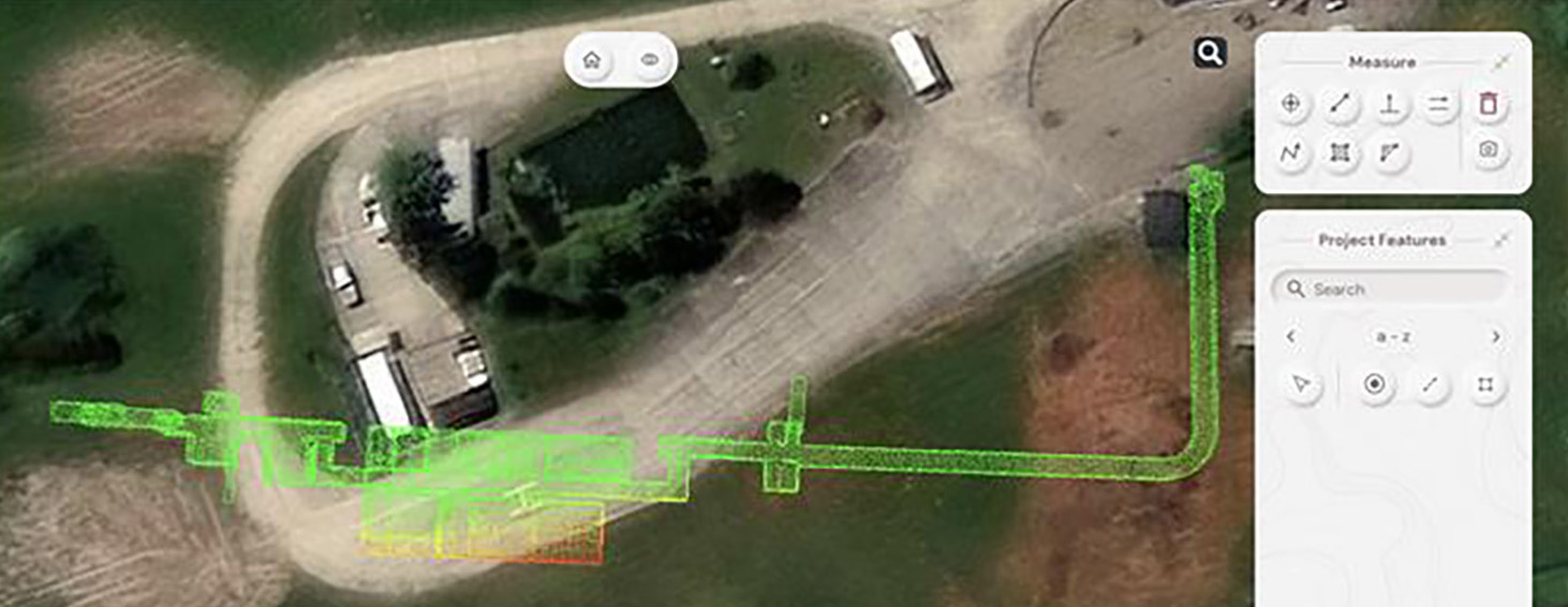
How GeoDrone Survey helped a landowner pinpoint the exact proximity of an underground bunker to the Norfolk coastline thanks to Soarvo, a powerful cloud-based platform for managing and visualising geospatial data.

New KOREC case study with Centara Ltd – Trimble X7 with Leica Cyclone software

11/19/2024

Our latest KOREC case study is called ‘The best of both worlds’. Why? Because Yorkshire based Centara Ltd wanted to invest in the best 3D laser scanner for their line […]

Exeter underground – surveying the city’s hidden history

05/19/2025

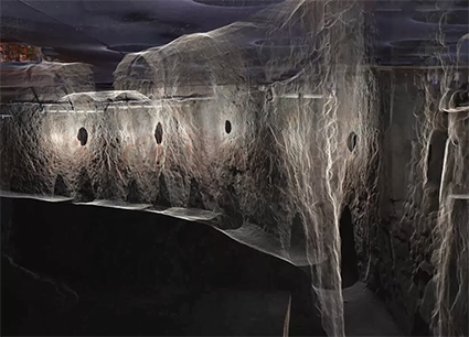
A request to survey a 390m network of Exeter’s historic underground tunnels - some as narrow as 430mm - and to tie those tunnels to the topography of the streets above, presented exactly the kind of complex, technical challenge that Benchmark Surveys excels at.