Trimble SiteVision
€POA
PRODUCT ENQUIRY
Visualise your 3D models accurately against the real world with Trimble SiteVision field software.
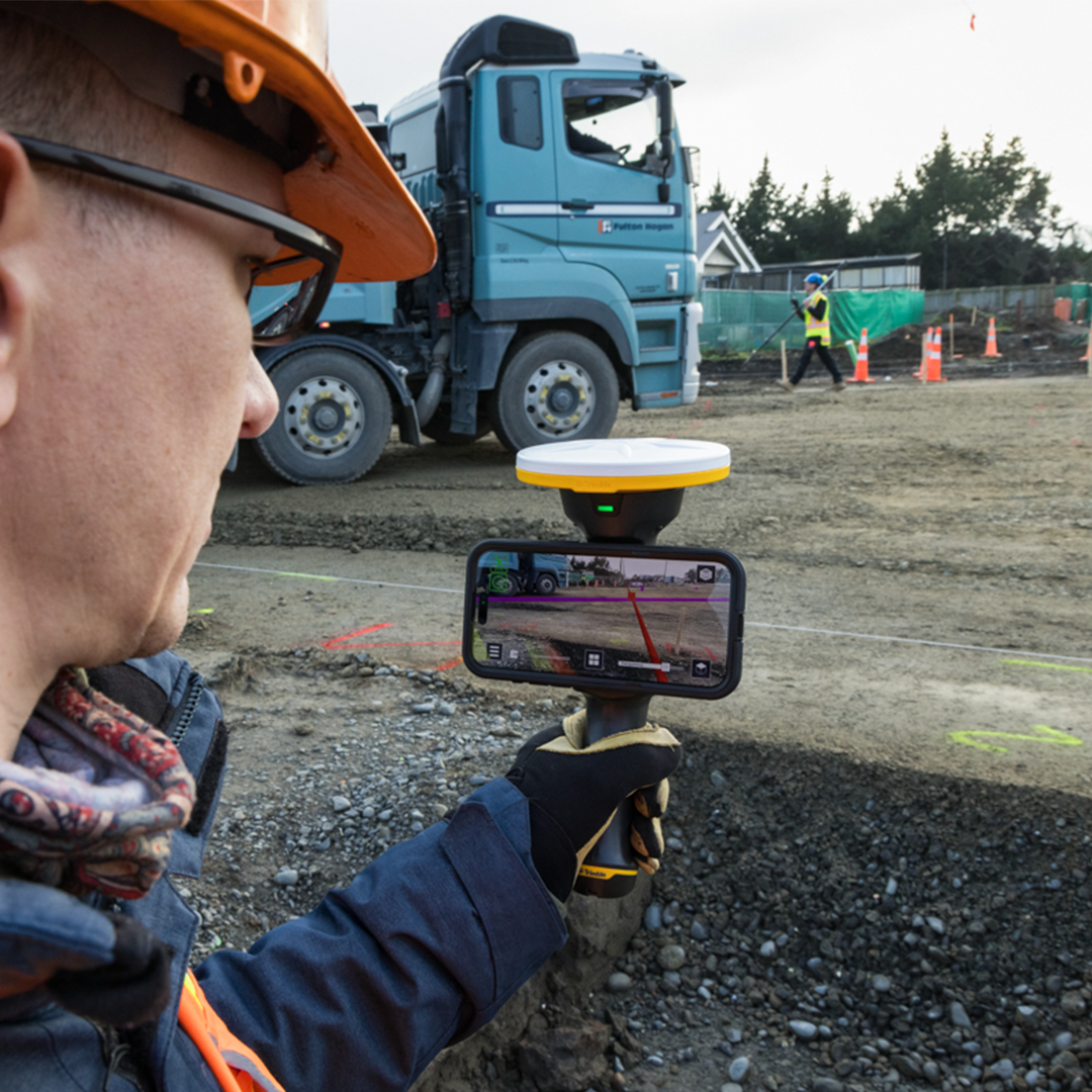
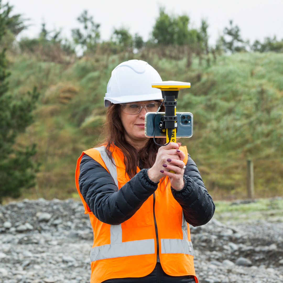
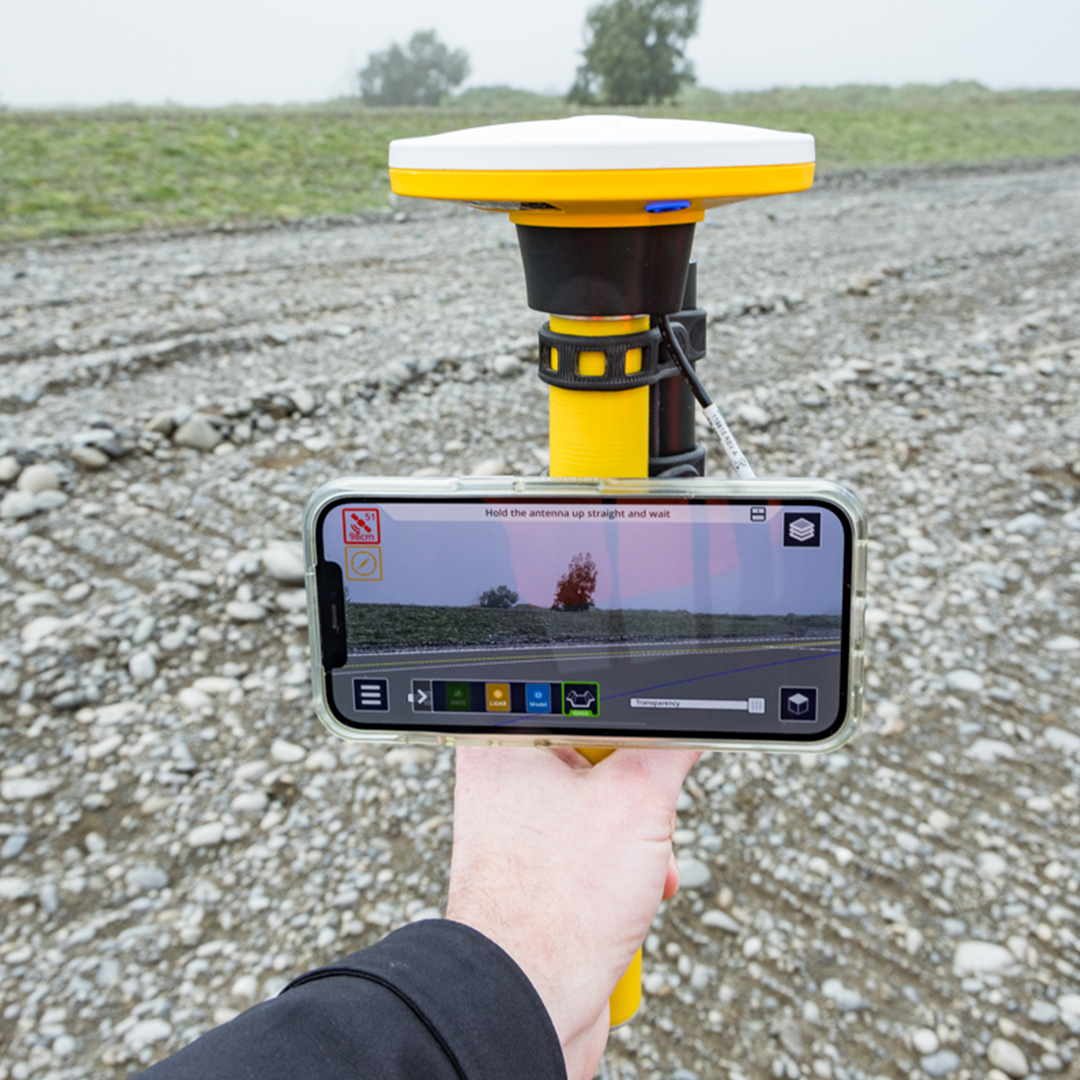
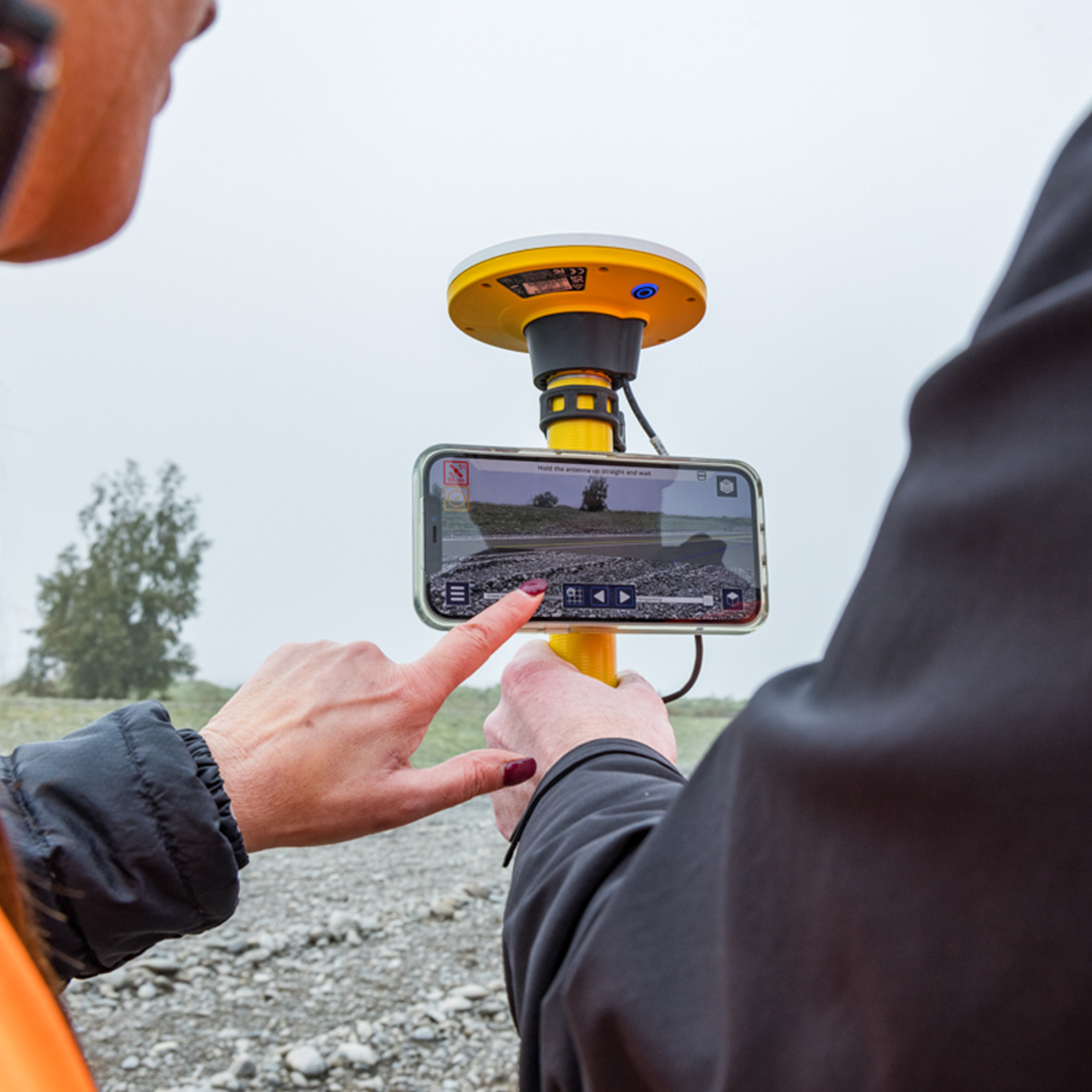
Providing instant visualisation for immediate insights, Trimble SiteVision is a real-time, in-field visualisation software for collaborating on project progress and detecting design changes or conflicts. Choose your hardware configuration to collect images, GNSS points, EDM points or LiDAR scans.

Catch problems early
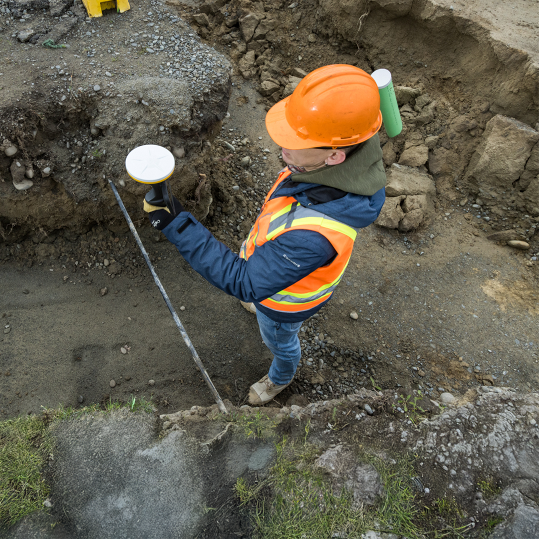
Easily spot discrepancies between the design and existing conditions, above or below the ground. Prevent costly rework by identifying conflicts early.
Improve communication
Never worry about using an old design with revision controls built into Trimble Connect, a cloud-based common data environment and collaboration platform.
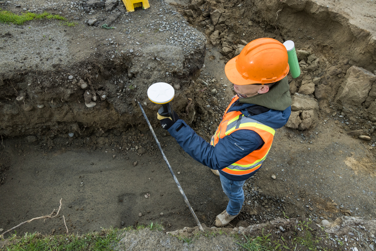
Quickly collect field data
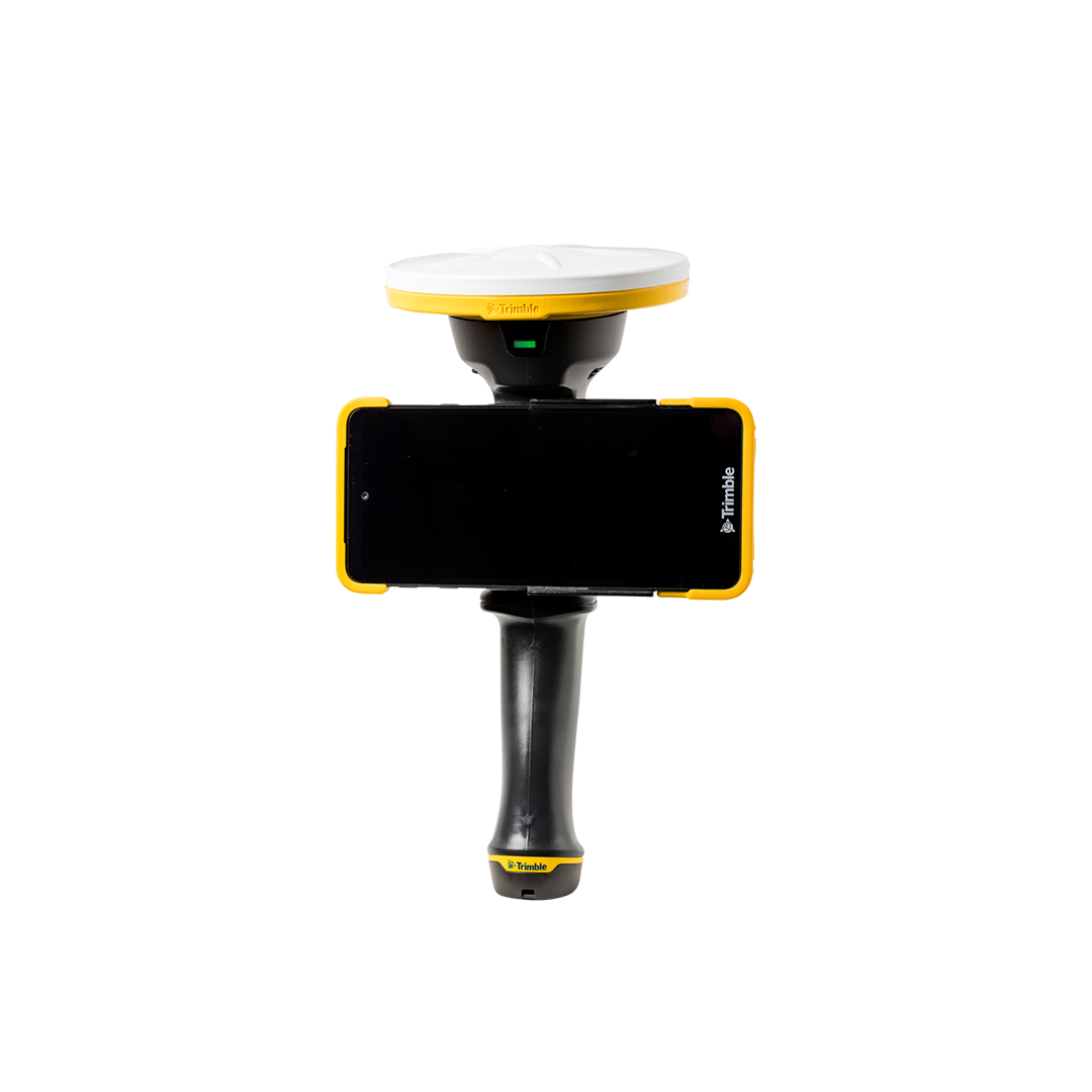
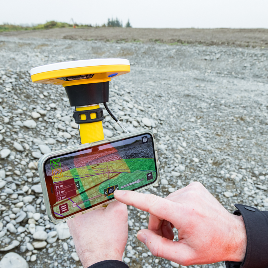
Measure positions, volumes, areas, slope, cut/fill and more using the Trimble Catalyst™ DA2 GNSS system, LiDAR-enabled devices and augmented reality.
Summarise your data
Take pictures, create tasks, report on statuses, request clarifications and assign them to project team members or share with client teams — all in real time.
Powering smarter work
The bridge between design and field
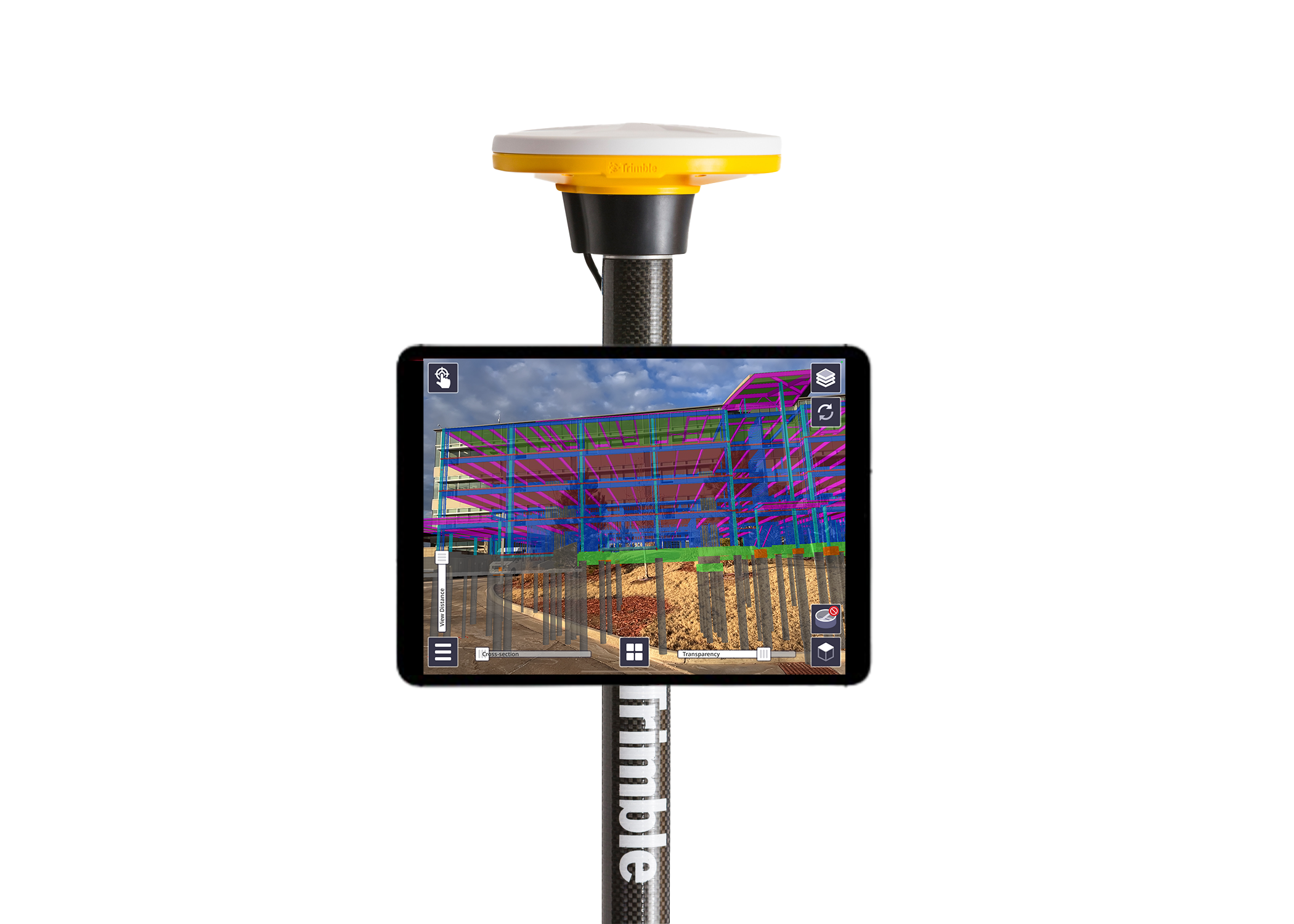
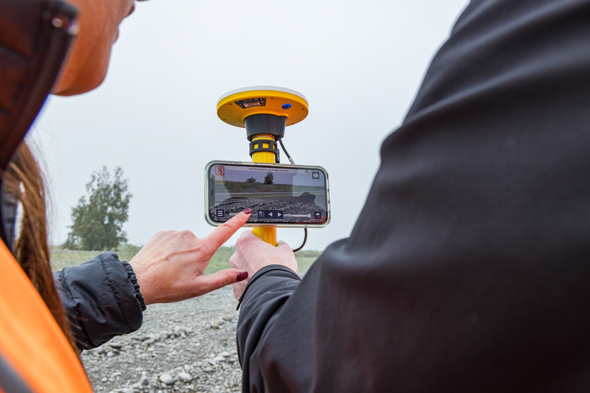
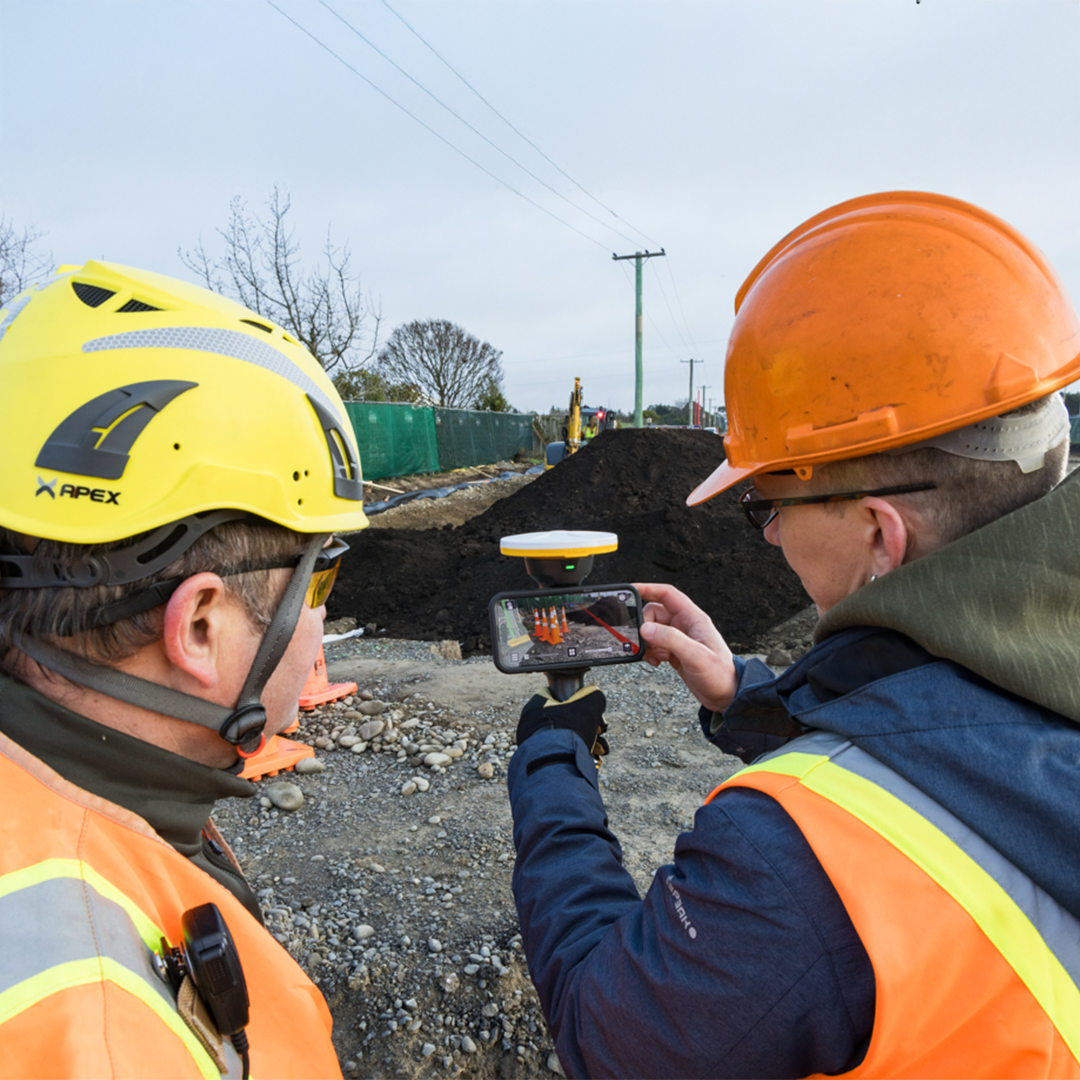
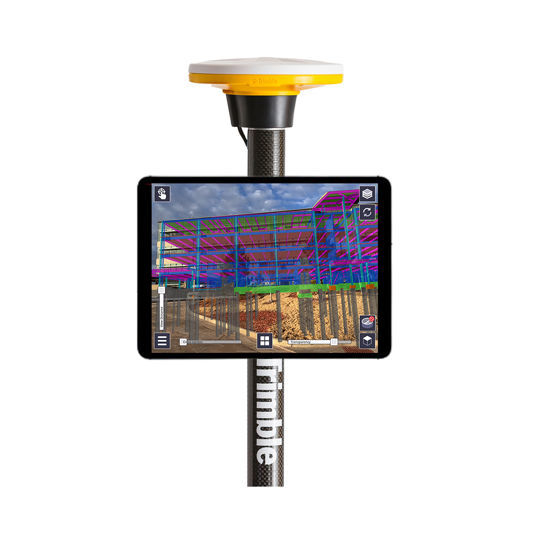
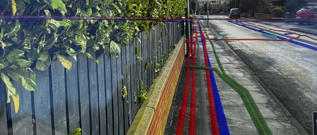
Trimble SiteVision lets you visualise design models live in the field. Verify how real-world layouts compare to the model in real-time. This a real game-change for the construction and utilities industries. See the layout of hidden pipes, check and verify the routes of cable runs, all from a handheld device.
Trimble SiteVision works seamlessly with the Trimble connected ecosystem to ensure your construction and engineering projects are aligned to the design, both before, during and after the field work.
SiteVision allows your entire project team to visualize data like never before, making it easier to collaborate and detect design changes early, saving time and reducing project costs.
• Centimetre-accuracy: With Trimble Catalyst DA2 GNSS
- Platform compatibility: Android and iOS phones or tablets
- Lightweight and portable: Pole or handle mounted operation
- Cloud-based: Trimble Connect integration
- Fully textured models in 3D: Plan view or cross-section
- Compatible file formats: Trimble and open industry standard
New KOREC case study: After the spray paint fades….
How the smart application of Trimble’s AR SiteVision technology has enabled Castle Keep Surveys to provide their client with an innovative solution for identifying underground utility assets—long after the completion of a PAS128 Underground Utility Survey.