Exyn Nexys
€POA
PRODUCT ENQUIRY
A mobile, modular 3D mapping solution designed to reduce time to capture data, increase safety, and drive efficiency.
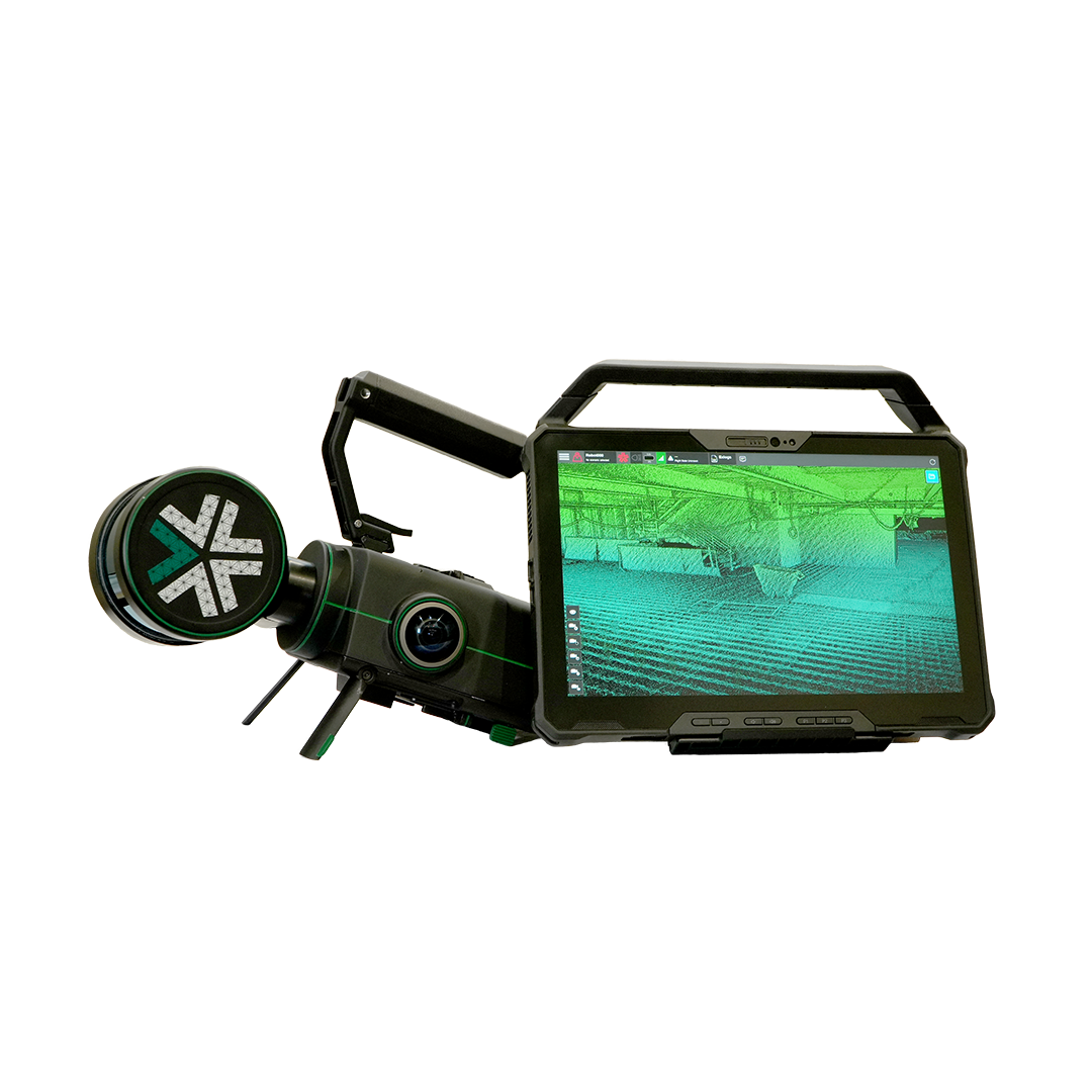
With Exyn Technologies’ Nexys expect survey-grade LiDAR + proprietary SLAM algorithms that deliver industry-leading data capture speeds, real-time colourisation, on premise post-processing, and instant onsite visualisation in a variety of physical configurations, levels of autonomy, and environmental conditions.
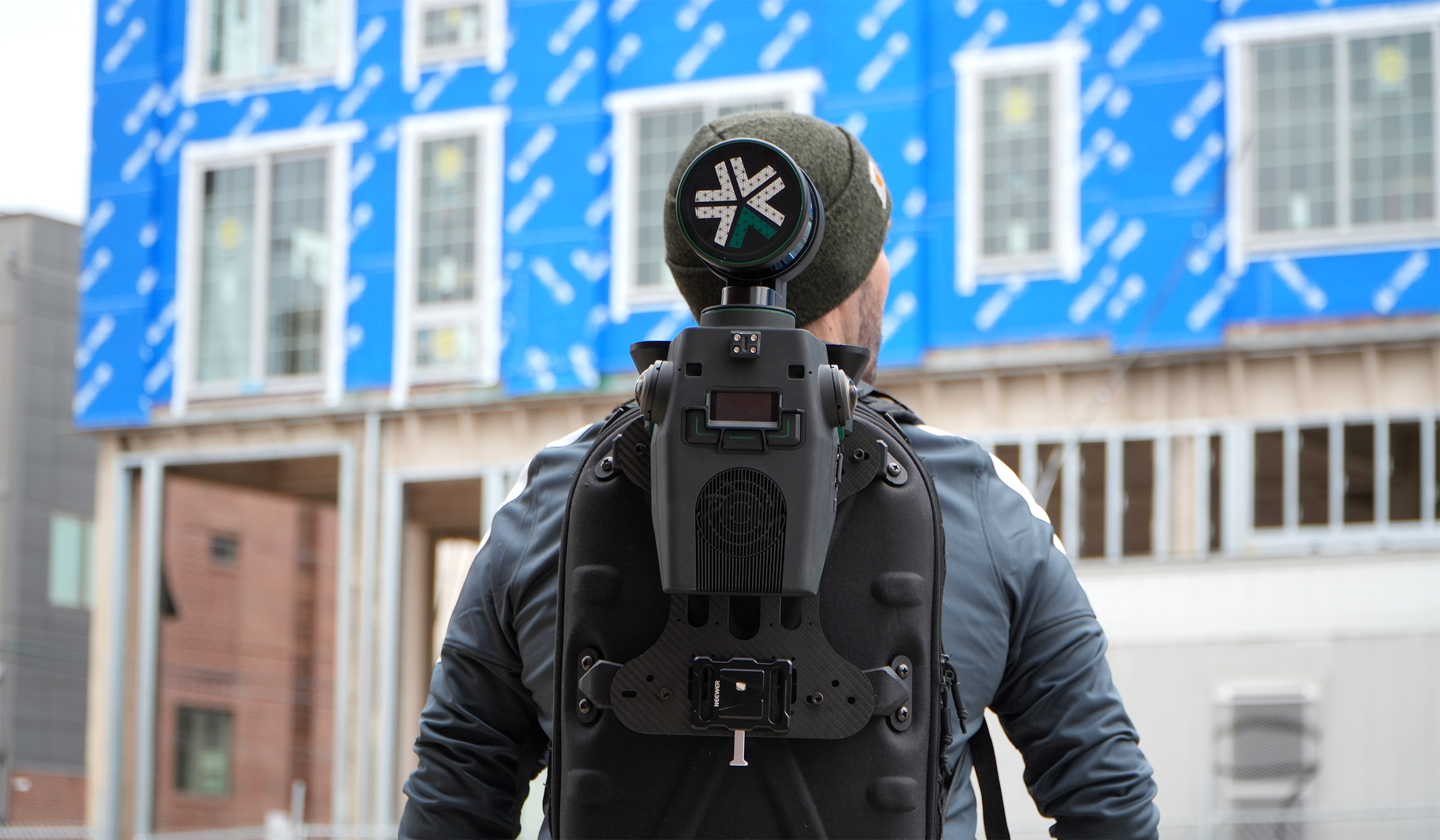
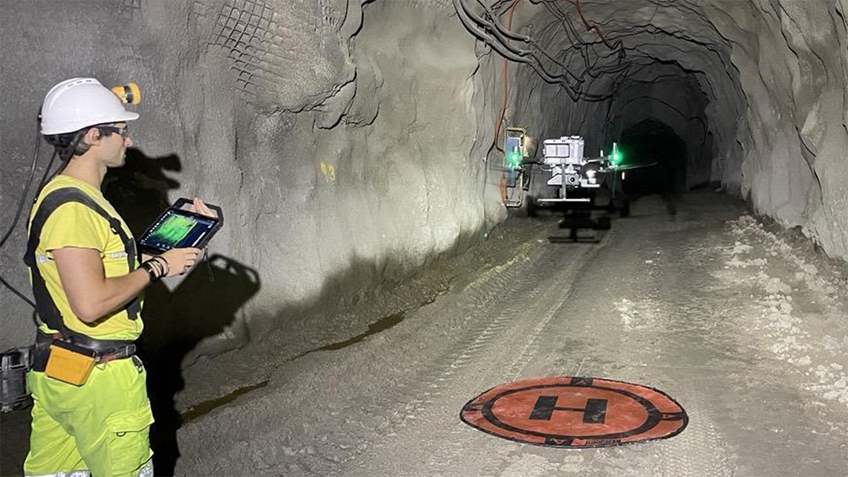
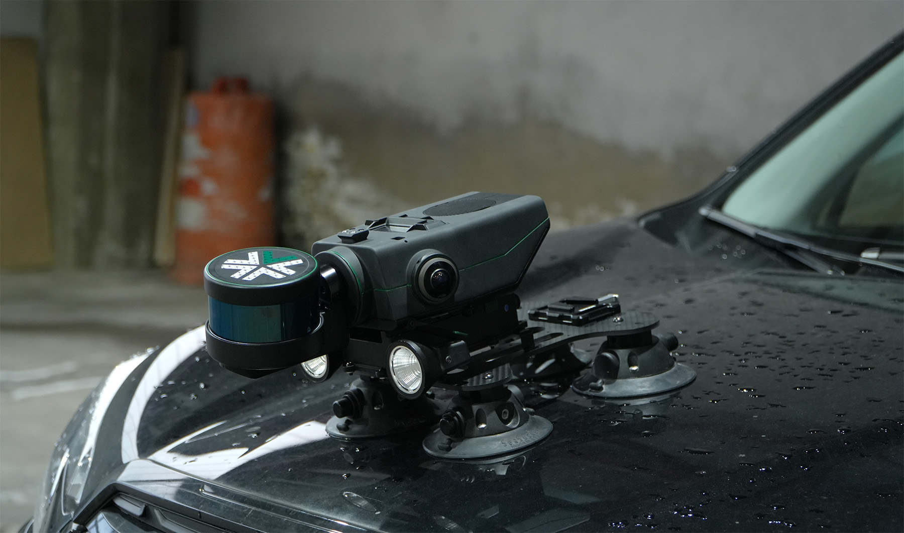
Whether mounted on a drone, vehicle, handheld device, or ground robot (such as Boston Dynamic’s Spot), it adapts to different industries, from mining to construction and geospatial surveying. Nexys provides accurate spatial data without relying on GPS, making it particularly effective in underground or obstructed areas where traditional mapping tools struggle.

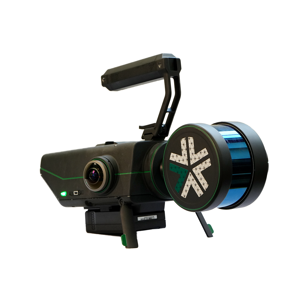
Modular design
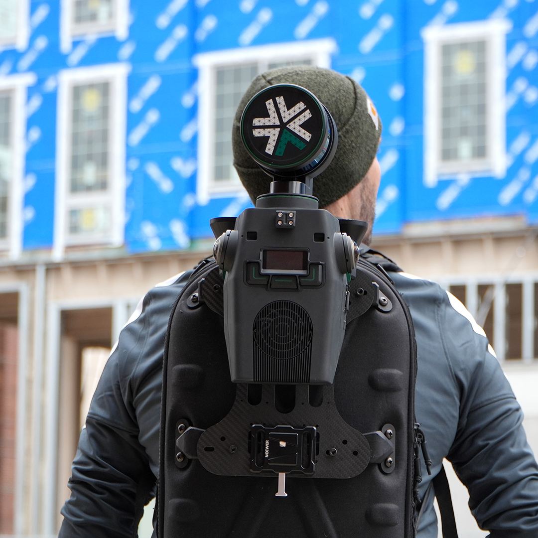
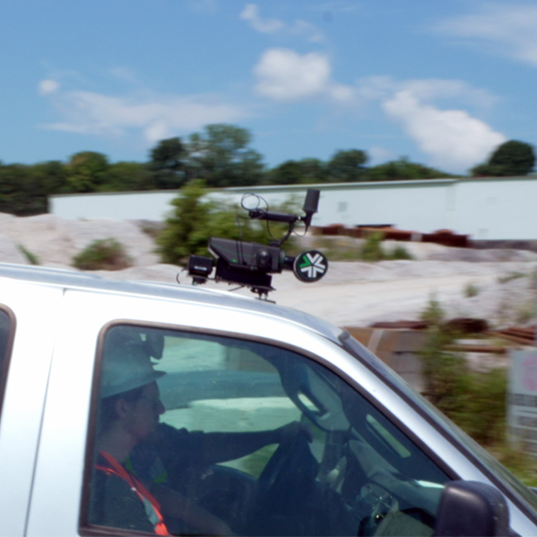
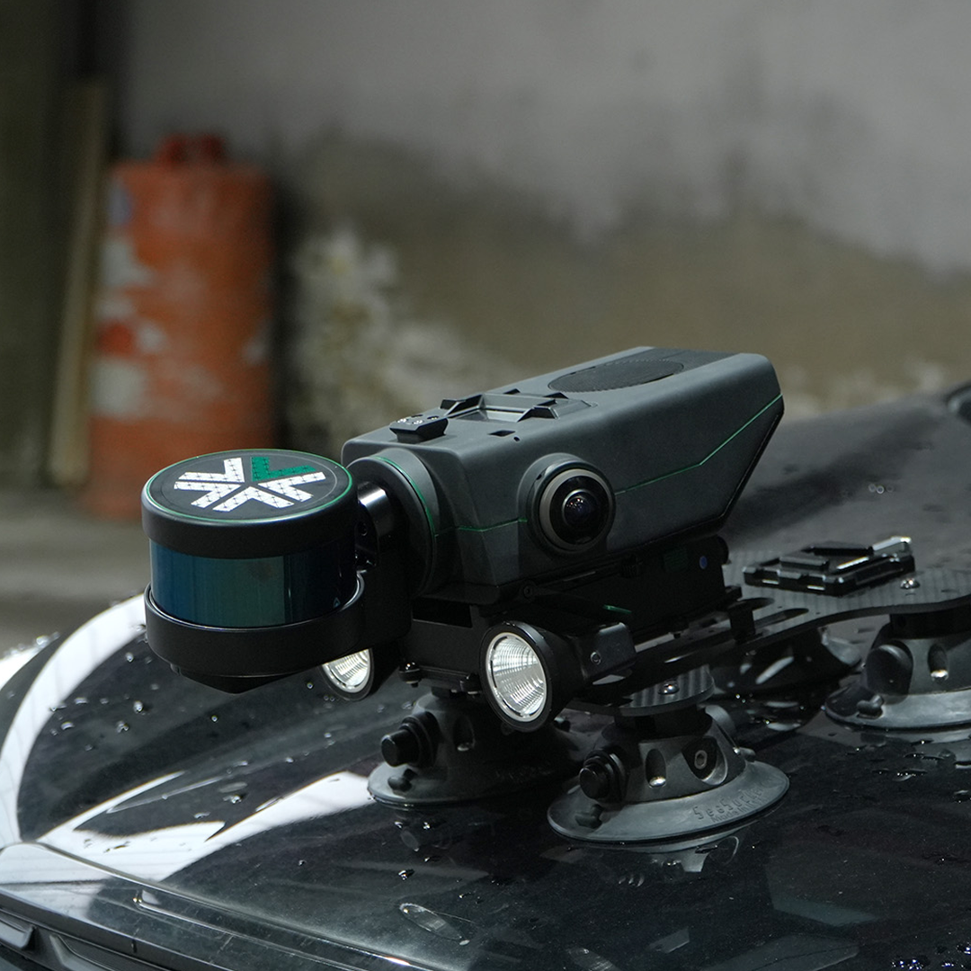
The Nexys’ ground-breaking modular design allows for deployment in various configurations, including handheld, backpack-mounted, vehicle-mounted, drone-integrated, or via ground robots.
Advanced mapping technology
Nexys can be configured for handheld use, backpack mounting, vehicle attachment, drone integration, or deployment on ground robots, allowing for flexible data collection across various scenarios.
Autonomous navigation
Utilising state-of-the-art LiDAR sensors and Exyn's proprietary SLAM algorithms, Nexys delivers high-speed data capture with real-time point cloud colourisation.
Real-time data visualisation
With Autonomy Level 4 (AL-4) capabilities, Nexys enables intelligent, autonomous navigation (without a pilot) through dynamic and GPS-denied environments, facilitating comprehensive mapping without manual intervention.
Two versions of the system are available, with the Pro version offering higher performance specifications including increased points per second and measurement accuracy plus a longer range.
DOWNLOAD DATA SHEET
A five-day survey cut down to half a day
How a strong understanding of the Exyn Nexys SLAM technology enabled SYSTRA UK to strike the perfect balance between speed and accuracy during a recent structural assessment survey of a large and complex building in Manchester.