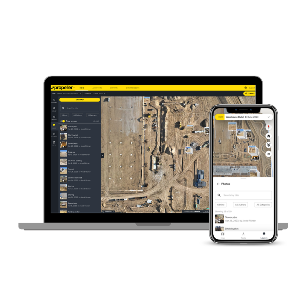
A cloud‑based site analytics and data platform that combines drone mapping, 3D visualisation, measurement tools, and project management capabilities to help teams map, measure, and manage worksites.
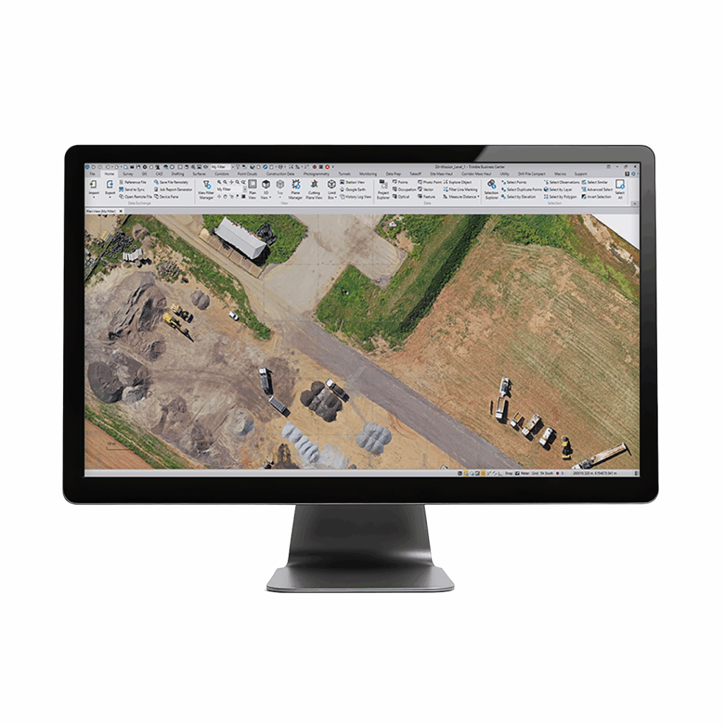
Elevated aerial survey workflows