How a strong understanding of the Exyn Nexys SLAM technology enabled SYSTRA UK to strike the perfect balance between speed and accuracy during a recent structural assessment survey of a large and complex building in Manchester.
How a strong understanding of the Exyn Nexys SLAM technology enabled SYSTRA UK to strike the perfect balance between speed and accuracy during a recent structural assessment survey of a large and complex building in Manchester.
In the heart of Manchester’s busy city centre, a historic building on a well-used thoroughfare is set to undergo structural alterations. From a surveying perspective, the site presented numerous challenges for the appointed contractor, SYSTRA UK, a global design powerhouse and one of the world’s leading engineering and consulting groups specialising in public transport and mobility solutions.
Architecturally complex, the building comprises a mixture of small and large rooms, irregular geometries, long corridors, varying floor levels, and extensive internal clutter including scaffolding and temporary supports. Whilst parts of the building stand vacant, other areas remain fully operational, occupied by office staff. The client requested minimal disruption in these main areas throughout the survey, a requirement that risked limiting access times, particularly if multiple instrument setups and heavy tripods were needed.
For the SYSTRA UK team, led by Senior Survey Manager Tomek Koniuszy, a further challenge lay in meeting a tight deadline to produce a comprehensive point cloud. This dataset would underpin the creation of an accurate floor plan and a detailed structural assessment survey and serve as a baseline for future works.
SLAM technology or 3D laser scanning
Whilst assured that he could create a high-quality millimetre accurate point cloud with a laser scanner (which would over deliver on this project), Tomek was aware that this could take up to five days and disrupt the occupants with the placement of targets and multiple time-consuming set ups to accommodate the complexities of the building. With all the internal scaffolding, shadowing could also be an issue because it was imperative that the point cloud was clean.
Consequently, Tomek immediately considered employing a SLAM system. Despite being relatively new to the technology, he believed that the balance between its advantages – notably speed and flexibility – and the level of accuracy it could achieve strongly favoured its use for this project.
However, he did anticipate some initial challenges in convincing a client accustomed to working to millimetre tolerances for high-accuracy survey and rail applications to adopt a workflow designed to deliver less accurate data, although still within the project’s requirements.
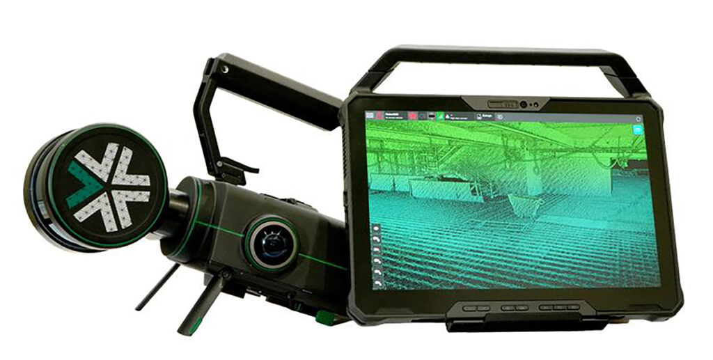
Choosing the Exyn Nexys
Seeking more information about the technology, Tomek conducted online research into potential SLAM systems and soon came across KOREC’s newly announced partnership with Exyn Technologies and their Nexys modular 3D mapping solution. After a brief demonstration, and confident that KOREC would provide a high level of support throughout the project, Tomek felt fully assured in his decision to proceed with the system.
Also, key to Tomek’s decision to go with the Nexys rather than another system was data ownership:
“I want to own my own data. I don’t want a third party to have it. This was very important to us.”
Just half a day required
Before the building was surveyed, control was established outside, rather than inside, which the SYSTRA UK team felt was a notable gain. This was backed up by retro targets around the entry and exit points.
A SYSTRA UK surveyor, with a member of the KOREC team advising, then completed the survey using the Nexys system in just half a day rather than the five days estimated for the use of a laser scanner. This efficiency was further enhanced by the system’s ability to display scans in real time, allowing the team to verify completeness in the field and minimise the need for rework.
As Tomek explained:
“Once in the building we could go anywhere with minimal disruption to the occupants. Behind a wall, under a table, down dead ends, along corridors…anywhere. Capturing all the data we needed for a clean shadow free point cloud couldn’t have been easier.”
Accuracy verification and quality assurance
The captured data was then processed with the assistance of KOREC. Tomek provided accuracy assurance for the client by reporting on previously coordinated scanning targets positioned around the building. These control targets were registered by the Nexys within a range of 5 mm to 20 mm in 3D when compared with the terrestrial scans. This was deemed sufficiently accurate for the project’s requirements.
Further accuracy validation was achieved through common points identified between the terrestrial scans (based on survey control) and the Nexys point cloud. Tomek was aware that the Nexys technology would allow him to adjust to control, but did not consider this necessary having achieved “an excellent result considering the type of technology employed.”
Finally, the client carried out an in-depth review of the dataset, confirming the overall reliability and precision of the results.
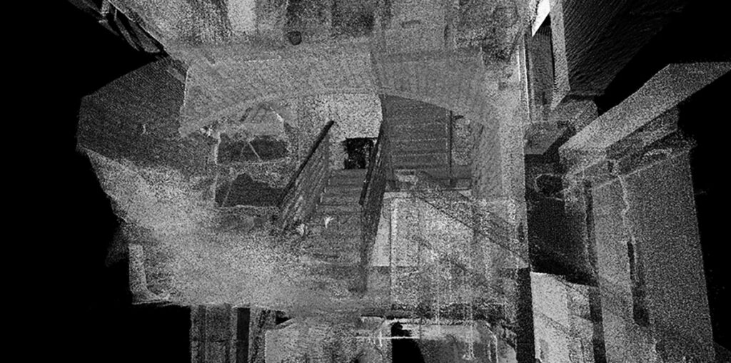
Data captured with the Nexys showing different floor levels
Balancing benefits and accuracy
For Tomek, the advantages delivered by the Nexys system on this project far outweighed the loss of using a static scanner and achieving a millimetre-accurate point cloud. Basically, he could scan 20x times faster than a terrestrial scanner at the expense of around 15mm of accuracy.The key benefits included:
The entire building was surveyed in just half a day, compared with the five days estimated for a traditional laser scanning approach.
Accuracies were within the required tolerance with minimal drift. (±1 cm accuracy, environment-dependent, and refers to spatial mapping precision for 3D point clouds, not raw sensor range).
Minimal disruption to occupants, allowing the survey to be completed during normal working hours.
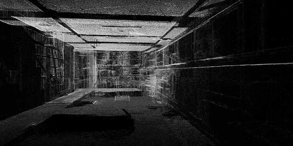
Little to no shadowing, resulting in a clean, comprehensive point cloud.
The technology proved extremely intuitive and easy to master.
Exceptional versatility and speed, even within the building’s complex layout.
Tomek concludes:
“The client was impressed when we demonstrated how the point cloud data had been captured, and for us, working under tight time constraints, the Nexys was an excellent solution. Not every project requires millimetre-level accuracy, and in this case, there was a compelling reason to use a slightly less precise platform. In short, it was a godsend -it truly made the difference between make or break for us.”
About the Exyn Nexys
SLAM (Simultaneous Localisation and Mapping) mobile mapping systems integrate LiDAR sensors with inertial measurement units (IMUs), cameras, and algorithms to build a 3D map in real-time while the device moves.
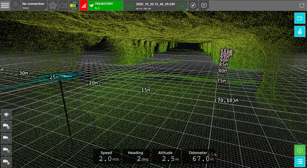
With Exyn Technologies’ Nexys expect survey-grade LiDAR + proprietary SLAM algorithms that deliver industry-leading data capture speeds, real-time colourisation, on premise post-processing, and instant onsite visualisation in a variety of physical configurations, levels of autonomy, and environmental conditions.
Whether mounted on a drone, vehicle, handheld device, or ground robot, it adapts to different industries, from mining to construction and geospatial surveying. Nexys provides accurate spatial data without relying on GPS, making it particularly effective in underground or obstructed areas where traditional mapping tools struggle.
Example of live fast colourisation of the Exyn Nexys Pro point cloud data from another project
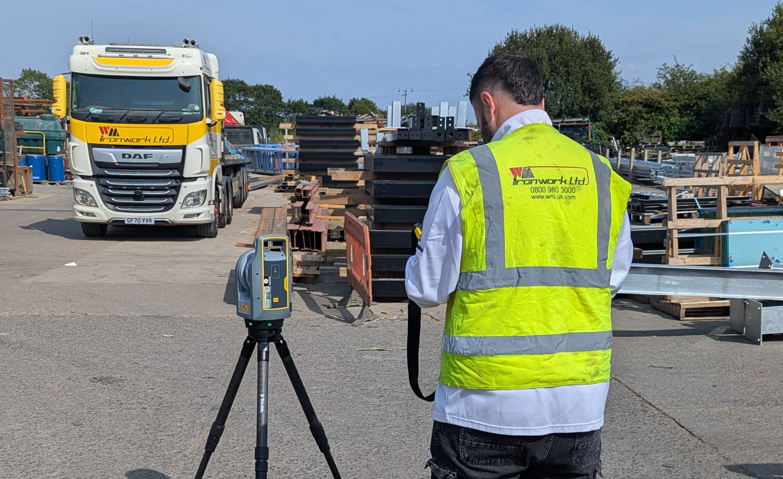
How WM Ironwork’s use of Tekla Structures led them to introduce the Trimble X9 3D laser scanner into their workflow, increasing their abilities tenfold by significantly reducing rework and improving...
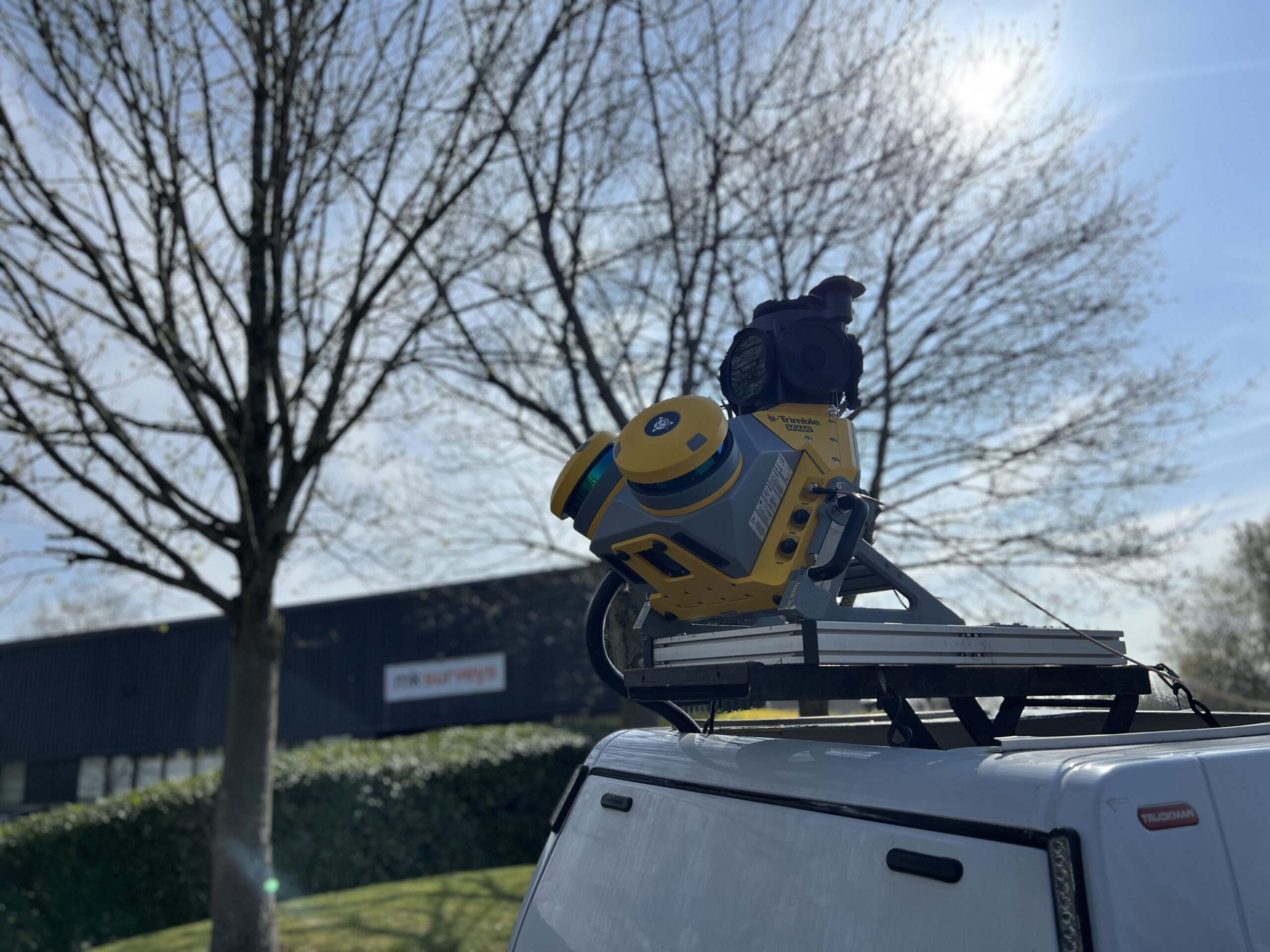
MK Surveys is maximising the value of its Trimble MX60 Premium system in two ways: by treating it as a precision survey tool rather than solely as a mobile mapping...
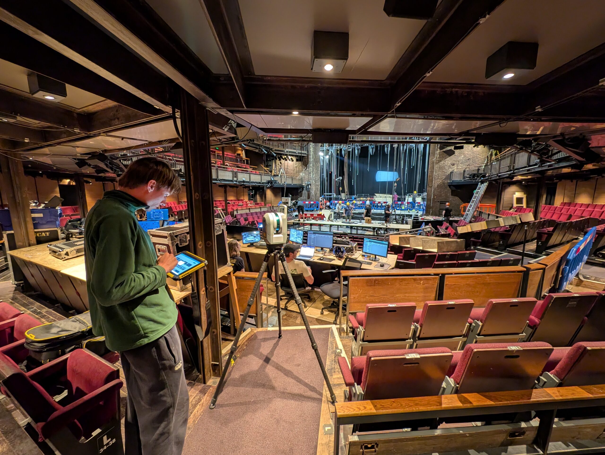
How the Royal Shakespeare Company is using a Trimble X9 Core LT 3D Laser Scanner to move beyond 2D plans and truly understand the 3D spaces they design for.