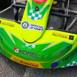
How KOREC are powering a Guinness World Record breaking attempt
Ian Williams is a man on a mission. Over the weekend of 7-8th August, he’ll be attempting to smash the Guinness World Record for the furthest distance travelled in a go kart in 24 hours, at the Teesside Autodrome British 24hr Challenge.
The current record stands at 945 miles, while Ian hopes to smash through the 1,000 mile (1600km) barrier – as well as raising £15,000 for charity in the process.

So how do you go about planning such an exhausting mission? Well first things first, Ian (not to mention Guinness) needed to know the precise distance of the track to be driven – which is where KOREC come in.
Whilst the official track length is stated as 2.1km, Ian needed a precise measurement – both to satisfy the stringent demands of Guinness, and to pace his race.
Ian searched around local survey companies before he was advised that KOREC might be able to assist with obtaining an accurate track measurement. Never ones to shy away from a challenge, we immediately knew this was a job for the MX9 and the Professional Services team.
Flash forward to 1st July, and our team met with Ian trackside. It took a matter of minutes to drive the race-day circuit layout in the MX9 scanning vehicle, capturing millions of measurements of data points of both track position, and elevation.
The data was processed back in the office, producing a dense 3D point cloud of the circuit, allowing for a centre-line to be produced – which came in at 1.64km in distance – almost half a kilometre shorter than the stated distance.
0.5km may not seem much to you or me, but when you’re planning to drive over 1000 miles, it works out at an additional 214 laps of the circuit – knowledge that means the difference between success and failure.
As well as providing these crucial measurements, the Professional Services team have generated beautiful 3D visualisations of the circuit, which have been incorporated into Ian’s marketing video – a vital piece of promotion for his charity drive.
Ian is hoping that his record attempt will raise £5000 each for his three chosen charities – Shelter, Papyrus (prevention of young suicide) and the Lincolnshire and Nottinghamshire Air Ambulance.
So how is Ian gearing up over these final weeks for this massive challenge?
“I’ll be focussing on building up my stamina by taking part in track days. I’m also conditioning my neck muscles, as they’ll be coping with around 70 tonnes of pressure over the 24-hour period. I’ve also upped my water intake, ensuring I am well hydrated, and getting used to a liquid diet”
(Ian won’t be consuming food during the attempt)
Whilst this is a solo attempt, Ian is far from alone. Upwards of 100 other racers will be on the circuit, with Ian hoping his kart’s bright livery will help him stand out from the crowd. He’s also got the support of the Haase UK Kart team, who have learnt him the kart, and his very understanding partner Alyona!
All of us at KOREC wish Ian the very best of luck in his challenge!
If you’d like to support Ian’s chosen charities, you can do so via his Justgiving page; https://www.justgiving.com/team/British24hoursolo
Article Links
Teesside Autodrome – British 24hr Challenge
Guinness World Records – Current World Record
Lincolnshire and Nottinghamshire Air Ambulance
Maps – they’re made to show us where we are, where we’re going, and how to get there. Right? Well, partly. Here at KOREC, we’re self-confessed mapping addicts, and we know that maps are so much more than this.
So, to celebrate the arrival of KOREC Mapping in May, we asked our colleagues to send us their absolute favourite map, and to tell us why they love it so.
From the sheer range of entries received, we see that maps can educate, inform, inspire – make us laugh, make us nostalgic, and yes, even occasionally let us lose ourselves.
Journeys through Space…
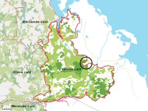
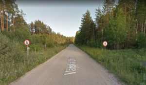
An ‘absolutely mad’ 115ha area of Russia was the choice of Harriet Brewitt. Known locally as ‘Saatse Boot’, the small area of Russia cuts a boot shape into Estonian territory, meaning the Estonian road 178 crosses the border twice and passes through Russian territory for around 1km. Whilst driving the road is allowed, stopping is not, and neither are pedestrians – as the signs on Google streetview attest!
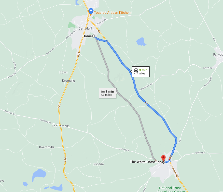
Speaking of driving, Jim McEwan’s map shows us that in just 9 minutes he can be in his favourite pub, the White Horse! But don’t worry – his wife is very kindly doing the driving, or in Jim’s words – “she literally drives me to drink…and then home again”
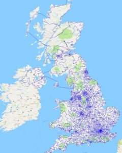
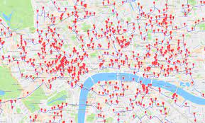
And speaking of pub crawls, how’s this? Philip McCarten’s favourite map combines his passions of map-making, GIS data and a cheeky tipple to highlight all 24,727 pubs in the UK – and the shortest route between them! And before you ask – if you travelled on foot, it would take you 3 years to visit every single one of them.
…And Time
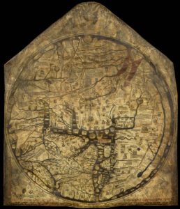
For Rob Judge, a classic map from the medieval world was his choice. The Mappa Mundi, made in around 1300, shows the world as it was understood by Christian Europe – with Jerusalem at its heart. Why is it such a marvel? For Rob, it’s the achievement of “producing a map with very limited technology, communications and the ability to travel long distances. A wonderful bit of history”.
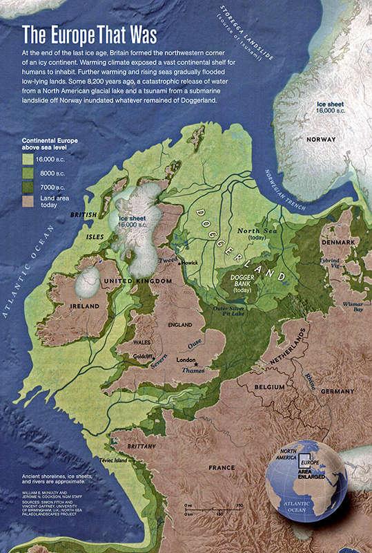
Going further back, Simon Evans’ map shows a time when the United Kingdom was intimately connected to mainland Europe. No, not 2016, rather 16,000BC, when sea levels were much lower and a vast area of land known as ‘Doggerland’ occupied much of the present-day North Sea.
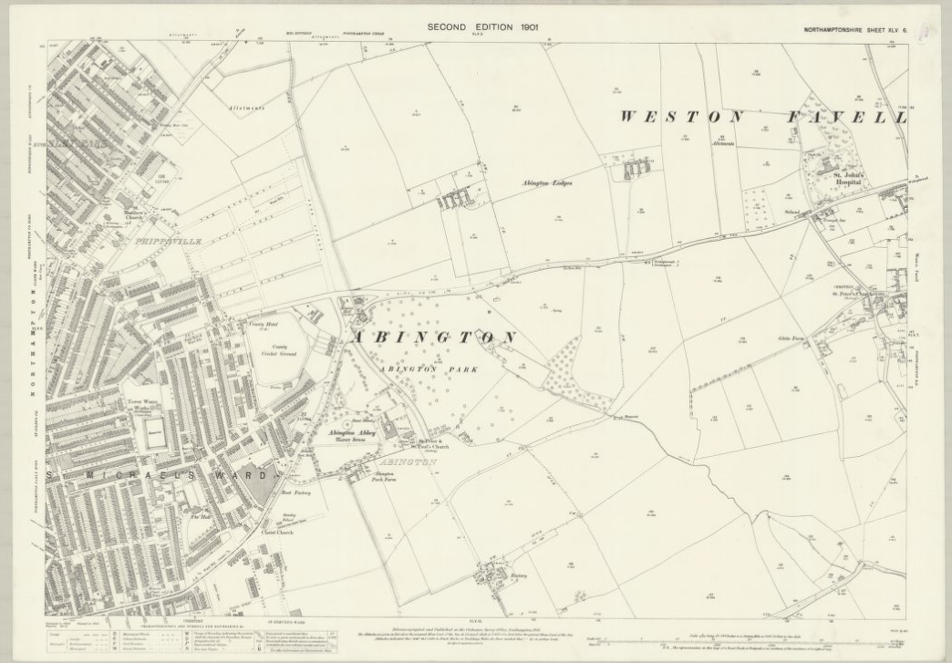
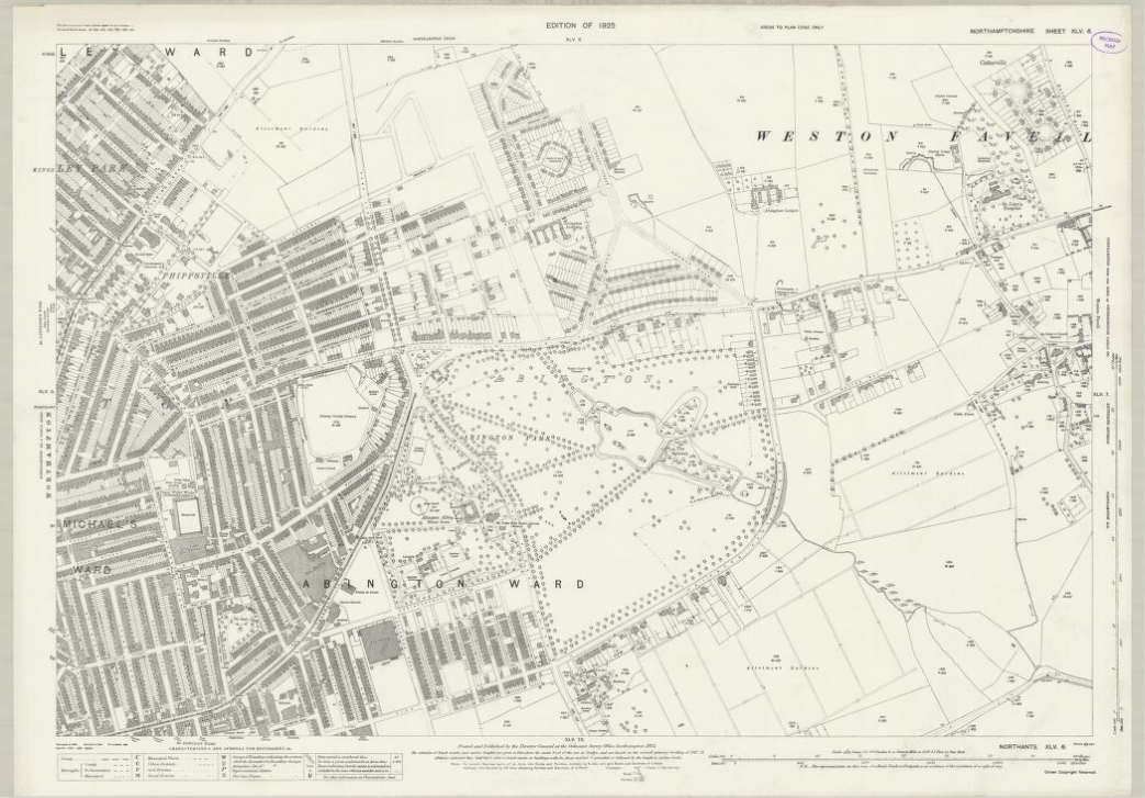
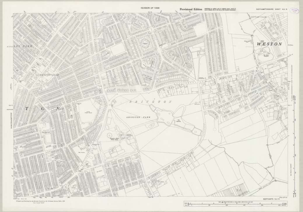
Coming back into the near-present, Lloyd Wilkinson submitted not 1 but 3 maps from the excellent collection at the National Library of Scotland of the same area – his hometown of Northampton. The series of maps from 1900 to 1935 show the rate of change and growth as the town experienced rapid industrialisation, a cause close to Lloyd’s heart as he studied urban industrial growth at university.
Up High….
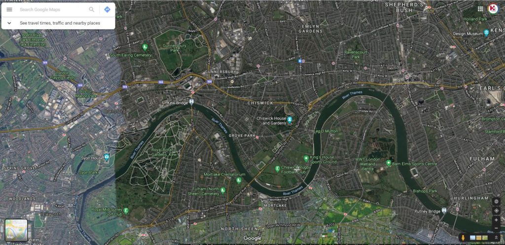
Satellite imagery and remote sensing has transformed our understanding of the world and our sense of place. For Tracy Critcher, a Google satellite map of her childhood home of Chiswick brings back many happy memories of her Dad rowing down the ‘mighty river Thames’, summer days outside the pub, and of course, the biggest ice cream shop EVER. Couldn’t be put better than Tracy herself ‘ “the map looks busy because it is filled with life”
And down low…
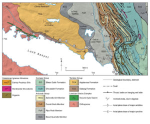
From London to the remote north-west Highlands of Scotland, Laura Harper has chosen this geological map of Loch Assynt. Laura spent a happy six weeks mapping the shore of the loch for her Geology dissertation – despite almost constant rain and the dreaded Scottish flesh-eating midges!
This map combines the geological data of some of the oldest rock formations in the UK, whilst also being a work of art in its’ own right.
Maps as works of Art

And speaking of art, Karen Wentworth has chosen Stephen Walter’s Map of Liverpool (2008-09), a vast, beautiful hand-drawn and insanely detailed map of the city. As a proud Scouser, Karen loves this map due to the sheer amount of local history, knowledge, and local scouse lingo featured – not to mention the two famous football clubs, and of course Crosby, home of KOREC’s Liverpool office!
Literary Maps
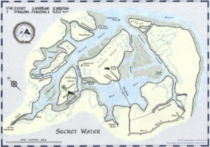
Another Liverpool colleague, Richard Selby has chosen the map from the novel ‘Secret Water’ – from the Swallows and Amazons series of books by Arthur Ransome. In the story, the Swallows’ father maroons the children on the island with just the outline map of the area – leaving the gang to survey the land and fill in the gaps! Perhaps reading the novel as a 10-year old inspired Richard for a career in surveying?!
Maps as Nostalgia
To complete our tour through this world of maps, we look at three maps that create or inspire happy memories.
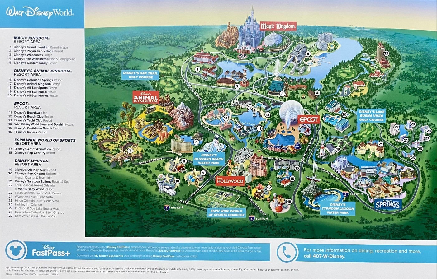
Graham Sharp’s map of Walt Disney World reminds him of the many smiles that this place has brought him and his family, young and old, over the years.
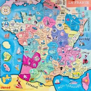
For Kirsten Moss, this jigsaw map of France, purchased when her daughter was 3 years old, brings back many happy memories of French family holidays over the years. Daughter Ruby would love pointing out all the places she’d been, as well as all the different regional birds, animals and foods! So much so, the jigsaw map still hangs on her bedroom wall to this day.
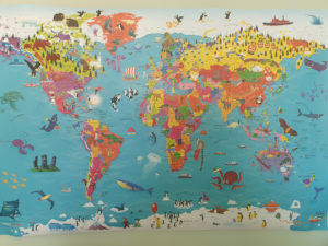
Our final map, another bedroom wall classic, comes from Melvin Penwill. Melvin has unashamedly passed his love of maps onto his son Jacob – who loves to point out all the places his Daddy has visited, as well as discovering the animals and where in the world they live. Jacob’s favourite place on the map? The UK, because this is home.
Thank you to all our map contributors, we had such a great time poring over all your entries.
- Find out more about KOREC Mapping
- Watch the Mad about Maps video on our YouTube channel