Here’s a question. How do you continue to motivate, inspire, inform, or even just get your teams together during a national lockdown?
Whilst 2020 has been unusual (to say the least), for KOREC, we were already quite used to remote working & collaboration. Serving two nations, and with staff the width and breadth of the country, regular communication via phone, email, virtual chat or even Whatsapp was already the norm for many.
But for those used to office working or field working, now confined to the kitchen table at home, we realised that it was more important than ever to ensure everyone felt connected & informed.
That’s why we launched our virtual lunch ‘n’ learn series in October. The objective was simple – every 2 weeks, we invite everyone in the organisation to a brief overview of a product, solution or application. The vibe is informal – questions and interruptions are very much welcomed, prizes are awarded, and of course, lunch is munched.
It’s the perfect opportunity for a refresher on a particular product, an introduction to the latest piece of kit on the market, all presented by one of our in-house experts. For our people, it’s a reminder of the sheer variety & versatility of the solutions that KOREC offers, be it land survey, drone, rail, highways, mobile mapping…the list goes on.
It’s an excellent way for many of us to take 30 minutes out of our day, to get together, have a chat, and even learn something new.
So far, we’ve held 3 sessions;
An overview of our in-house, K-Matic software suite, presented by Darrell Theobalds
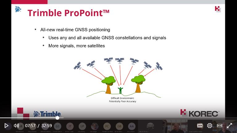
Introduction to the R12 & R12i GNSS systems & ProPoint, hosted by Leigh Rowell
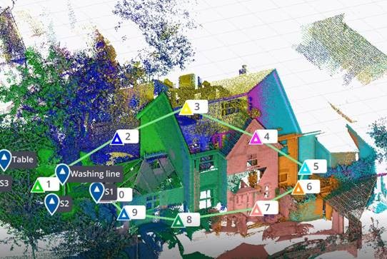
Laser scanning made simple, with the X7, presented by Melvin Penwill
And we have many more up our sleeves going into 2021.
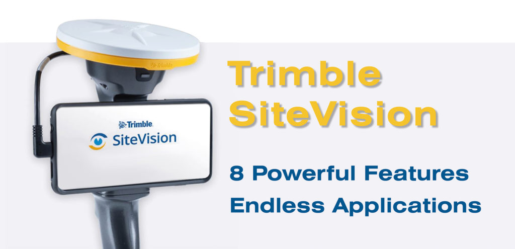
Trimble’s SiteVision is a geospatial tool created for today’s tech-savvy workforce.
Working in sync with your own mobile device, the unit utilises the very latest GNSS technology (including with the R12i – more on that to come) to pinpoint your design model down to cm accuracy.
This allows you to easily and accurately visualise your BIM design model in its true location, before a brick has been laid or concrete poured. What’s more, you can share that model, in real time, with your colleagues or with your client, wherever in the world they happen to be.
The solution is already in use across 1000’s of worksites globally, including here in both the UK & Ireland. Customers here include Gareth Price of O’Brien Contractors in the West Midlands, and the A14 Integrated Delivery Team (a JV of Costain, Skanska, Balfour Beatty & Atkins Jacobs) headed up by Mark Lawton – check out Mark’s thoughts on the device in the video below.
You can also read about the experience of O’Brien’s as they utilised the kit on a new stretch of light railway in our customer story.
The versatile and multi-featured tool lends itself to many industries including, to name a few; civil construction & inspection, building construction, utilities, urban transportation & planning, architecture & residential development, and more.
We’ve picked our Top 8 features of this extraordinary device, to show just how powerful and useful it is;
- Simple, intuitive operation with your smartphone
- Built-in data visualisation & modelling
- Clear & Simple Communication with Trimble Connect
- cm-accuracy thanks to GNSS integration – including the new R12i
- Safely measure distances in hazardous spots with EDM
- Easy & fast data reporting – notes, photos & assign tasks
- Always On – load your model even in internet blackspots
- Compatible with huge range of platforms & data formats
To see SiteVision for yourself, why not get in touch and arrange a demo with our friendly team? Contact Us
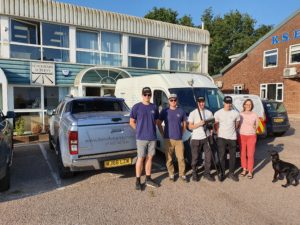
The Benchmark Surveys team; Josh Rogers, Sebastian Glover, James Richards, Sebastian Richards, Helen Richards & Dennis the dog
It’s been just 3 weeks since the R12i was launched to the world on 1st September.
But already Benchmark Surveys of Exeter have taken delivery of their new GNSS solution – the very first to be sold in the UK.
The team took part in trials with the new unit at the end of August, and it’s fair to say, they were blown away by the results they saw – watch the video below to see what we mean!
To see the R12i for yourself, take a look on the product page and sign yourself up for a demo;
Or find out more about Benchmark’s work;
https://www.benchmarksurveys.co.uk/
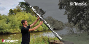
This week saw the launch of the next level GNSS solution from Trimble – the R12i.
Featuring robust IMU tilt-compensation via their patented TIP (Trimble Inertial Platform) technology, you can forget about levelling the pole and focus on collecting points, faster, safer and easier.
Utilising an angled pole allows you to obtain previously impossible or hazardous points – such as corners of buildings, tree bases and by rivers/watercourses.
With no time wasted calibrating or levelling, you can be much more rapid when collecting points – check out the video here to see how the R12i compares!
We are hosting a special R12i webinar on the 10th, to give you the complete lowdown on the new features, the benefits to your business, and multiple applications. Sign yourself up;
Join our launch webinar on the 10th
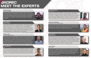
KOREC are delighted to today (11th August 2020) be announcing their new initiative, Meet the Experts, to further help and support their growing customer base.
The concept is to increase awareness and understanding of eight key business areas and solutions, which are;
- Laser scanning and Trimble RealWorks
- Mobile Mapping
- Trimble Business Center software
- Rail
- GIS & UAV Solutions
- Integrated Layout & Mixed Reality solutions
- Integrated Survey
- Monitoring
Each KOREC Expert has been selected for their specific experience, product knowledge, industry connections, and ability to share that knowledge with our customer base.
The initiative was launched with a introductory video interview with laser scanning expert, Melvin Penwill – watch the video here.