KOREC is delighted to announce that following a successful tender, it is supplying Ordnance Survey (OS) with one hundred and eighty Trimble R980 GNSS Receivers. These receivers will be supported by KOREC for the duration of the five-year contract.
Download a PDF of the press release here
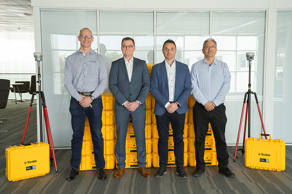
From left to right: Chris Harris (Channel Sales Manager, Field Systems EMEA, Trimble), Michael McEvoy (Principal Production Consultant, Ordnance Survey), Mark Poveda (Managing Director – UK & Ireland, KOREC Group) and Cesar Almeida (Senior Applications Engineer, KOREC Group)
The OS move to Trimble UK distributor, KOREC, has been based on both the advanced performance and productivity that the top-tier Trimble R980 Receivers can deliver, and their easy integration with OS’s existing data collection and handling software, the Esri suite of ArcGIS products.
The R980 Receivers brings together several top Trimble GNSS technologies and are particularly suitable for OS through features such as Trimble CenterPoint® RTX corrections for RTK level accuracy worldwide delivered via satellite or internet, without the need for a local base station or VRS network.
Mark Poveda, Managing Director – UK & Ireland, KOREC Group said:
“We’re extremely proud to be supporting Ordnance Survey with the supply of Trimble R980 GNSS Receivers following a successful tender. This significant contract reflects not only the performance and reliability of Trimble’s leading-edge GNSS technology, but also the confidence that OS has placed in KOREC as a long-term technology partner. We look forward to supporting OS over the next five years and ensuring their teams have the tools they need to maintain the highest mapping standards.”
Michael McEvoy, Principal Production Consultant, Ordnance Survey said:
“Ordnance Survey is pivotal in supporting the government, businesses, and individuals by maintaining and updating the digital master map of Britain with 20,000 changes a day. Our field surveyors therefore need a modern, robust, and accurate GNSS system to assist with the capture of our data which will serve them effectively now and into the future. The KOREC Group has provided OS with a great solution that integrates into our existing production environment. It will also enable our surveyors to use new technologies and capture tools to improve efficiency, whilst other features will enable work in remote areas, reliably and to high precision.”
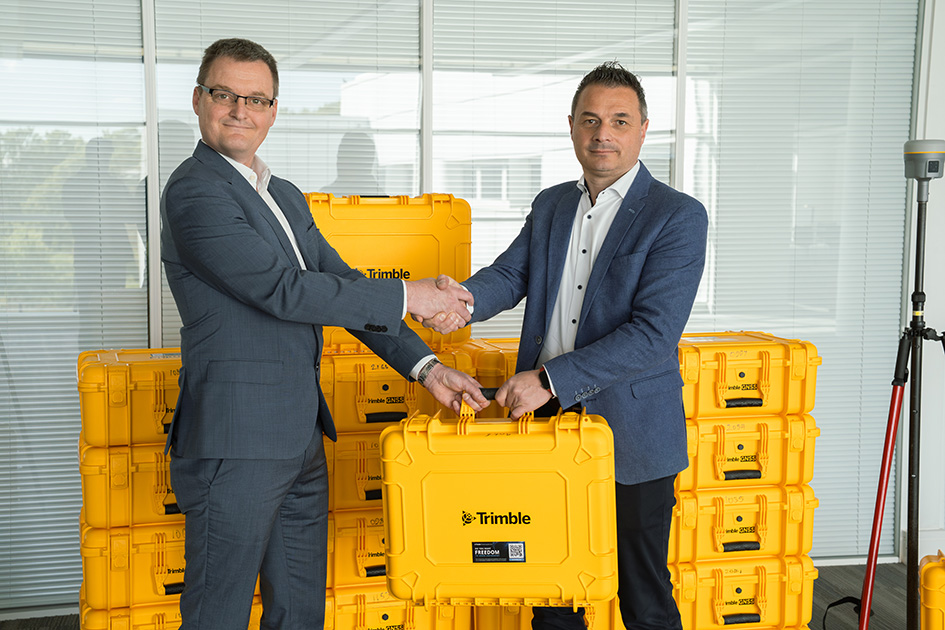
From left to right: Michael McEvoy (Principal Production Consultant, Ordnance Survey) and Mark Poveda (Managing Director – UK & Ireland, KOREC Group)
About KOREC Group
KOREC’s mission is to empower you to measure, map and manage the natural and built environment.
Combining industry knowledge, with intuitive software, and world-leading positioning technology, KOREC transforms your operations bringing certainty to your decision making.
About Ordnance Survey
Ordnance Survey (OS) is Great Britain’s national mapping service. We carry out the official surveying of Great Britain (GB), providing the most accurate and up-to-date geographic data, relied on by government, business, and individuals.
In his last column, KOREC’s Mark Poveda delved into the crucial questions to consider before buying a 3D Laser Scanner. In this column, he turns his focus to four important factors to weigh up before making an investment in a GNSS survey-grade receiver.
Benchmark Surveys and the Trimble R12i
Across the geospatial industry, we’re seeing a bigger shift towards people using GNSS for their survey grade data collection and setting out operations, thanks in part to developments that have increased their ability to work accurately in challenging GNSS conditions such as urban canyons or under tree canopy. However, it’s important to state that if it’s high-accuracy, mm positions you’re after, then a total station will always be your go to.
In this column, I’m going to take a look at four GNSS areas it’s worth considering, especially if you’re keen to avoid time consuming total station set ups in your day-to-day survey work.
1. It’s not about the number of channels, it’s about how your receiver handles and decodes them
When choosing the correct receiver for your purposes, it’s important to understand that most of them now support multi-constellations (GPS, GLONASS, Galileo, BeiDou), but it’s also important to check that they also support L1, L2 and L5 frequencies which mitigate signal interference in harsh GNSS environments. For example, Trimble’s ProPoint technology, found in several of their receivers, takes signals from all available constellations via three frequencies and uses dual core receivers for fast and accurate precision in challenging survey scenarios. My advice here would be to test repeatability of positions in these conditions during a field trial. We don’t want the spoofed accuracies that can occur with some receivers and this is the only way to ensure that doesn’t happen.
2. RTK and Correction Services for positioning security – choose wisely, they’re not all the same
Your RTK and Correction Services are key to continuous centimetre positions in the field and especially if you’re likely to be working where there’s patchy mobile coverage or your signal may drop in areas like quarries. If you want to avoid getting the total station out for those few points you need when there’s no signal, then it’s important to check that your receivers can also ‘bridge the gap’ using satellite corrections. KOREC customers report that the xFill function on their Trimble receivers, which does exactly this, saves them around 30 minutes of site time by avoiding a total station set up, it all adds up on downtime cost savings. Sometimes they’re not even aware the feature has kicked in because work is continuous and uninterrupted. Again, something to check on your field test.
3. Environmental durability and endurance – will your expensive investment survive the conditions you work in?
Construction sites are demanding places to work in and on top of that, did you know that last year rain fell on 171 days in the UK!
If your expensive investment is going to handle the British weather as well as tough site conditions, then you’ll need an IP65 rating for your receiver, or if you want it to withstand submersion, then IP68, plus you’ll need MIL-STD810G or H for ruggedness for both your receiver and controller. Especially, take a really good look at the build quality during your field test and check out whether it comes with local servicing and repairs from your GNSS supplier.
4. It’s all about the workflow – protecting your data and turning it into manageable information
Finally, a successful survey isn’t just about the receiver, it’s about collecting, processing and analysing that data and of course, protecting the information you’ve collected. Unfortunately instrument theft is a common occurrence so we definitely recommend that your receiver has the ability to sync with secure cloud storage and also that you can choose where it is hosted rather than it ending up in a random location anywhere in the world.
It’s also important to consider the end-to-end workflow and ensure that yours is futureproof. For example, is your collected information compatible with your back-end packages if you’re an n4ce or SCC user? Seamless integration is vital for saving office time on the processing and decoding of your collected data.
Whilst I hope this information is a good guide to what to look for in a GNSS Receiver, my best advice would be to rigorously check before you buy with an extensive field test and especially, check its accuracy and repeatability in different conditions.
“The benefit lies in being able to record those 2 or 3 difficult points if the internet goes down that I’d otherwise need a total station for.”
Joel Scragg, Casterbridge Land Surveys
Did you know that Trimble’s R12i, R580 and R780 GNSS all offer a feature that most surveyors never even notice, but every time it’s activated saves them up to 30 minutes in the field?
Download a PDF of the story here
Operating out of Weybridge in Dorset, Casterbridge Land Surveys Ltd is a thriving practice, experiencing a consistently high demand for its services. The company prides itself on offering cost-effective and reliable surveys backed up by a personal and personable approach.
Joel Scragg, the Director & Principal of the company, understands the challenges of managing a busy order book and the corresponding demands on both staff and his Trimble survey equipment. Consequently, he meticulously prepares for each survey, ensuring timely execution and optimal allocation of equipment resources.
With a Trimble R12i GNSS (used with a Trimble VRS license for real-time corrections) and S5 Total Station on the fleet, Joel frequently exploits this combination as an integrated surveying solution where the controller is connected to both a conventional survey instrument and a GNSS receiver at the same time to seamlessly collect points in challenging GNSS environments.
However, whilst this has proved to be an effective way of working, setting up a total station adds time to a survey …..and it’s also not always needed thanks to an often overlooked standard Trimble GNSS feature.
Positioning Insurance: Continuous corrections, even when the internet goes down
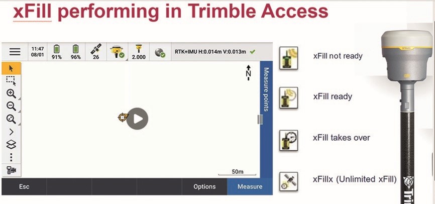
Trimble xFill is the little known standard feature that can save up to 30 minutes in the field by ensuring Joel can carry on working without disruption to his survey schedule or need for a total station set up.
It reliably provides seamless, centimetre-level back-up corrections for up to 5-10 minutes, via satellite, if RTK or VRS signal sources are interrupted due to signal disruptions or loss of radio connectivity. This provides Joel with enough time to measure points in his typical day to day scenarios such is in a quarry behind a stockpile or at the bottom of a hole.
The end result is no interruption to Joel’s survey. The only indication that xFill has been automatically activated is a small icon changing on his logger:
“The benefit lies in being able to record those 2 or 3 difficult points that I’d otherwise need a total station for. Each time I avoid having to set up the total station, I’m saving up to 30 minutes in the field. Why do most surveyors never even notice it? Because it just reliably kicks in every time it’s needed!”
What is Trimble xFill? Trimble xFill provides seamless, centimetre-level back-up corrections via satellite if RTK or VRS signal sources are interrupted due to signal disruptions or loss of radio connectivity. All three receivers supplied by KOREC, the R12i, R780 and R580, offer Trimble xFill Limited as standard. This feature is linked to the GNSS hardware, and it enables cm-levels corrections whenever the internet connection goes down, for up to 5-10 minutes, allowing surveyors to carry on working. xFill Limited is a standard and permanent functionality on the aforementioned Trimble GNSS products, included at no extra cost. Another option is to upgrade to xFill Unlimited. This feature enables the GNSS to carry on working with satellite corrections, without internet, for an unlimited amount of time. However, the user needs to be connected first to a VRS network for this to work. xFill Unlimited works on a yearly subscription. When it runs out, it will revert back to xFill Limited.
Ask us about our current special offer on xFill unlimited.
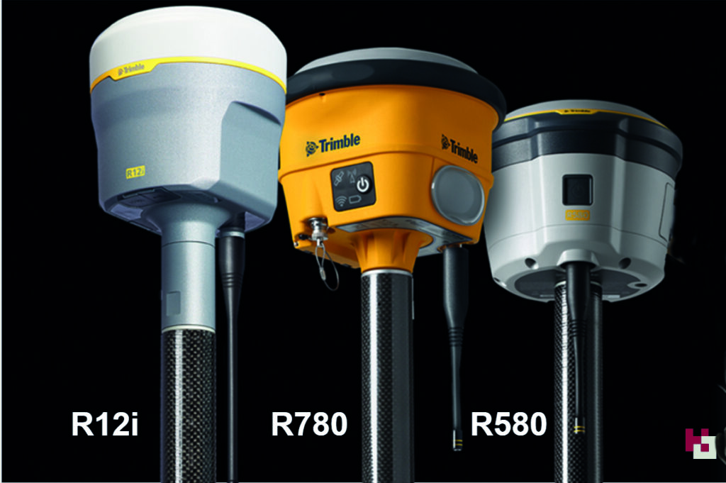
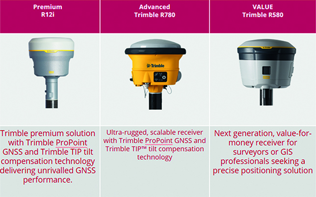
How to choose the right Trimble GNSS for your survey applications – a quick guide to our three best-selling receivers, the R12i, R780 and R580
Choosing the right Trimble GNSS receiver depends on several factors, including your specific application, accuracy requirements, environmental conditions, and budget. Here are some key considerations to help you make an informed decision:
Common factors to the R12i (Premium), R780 (Rugged) and R580 (Value)
- When you buy into the Trimble brand and KOREC support, it’s immaterial which receiver you choose. All of them are based on Trimble’s 40-year heritage dedicated to reliability and innovation and they are all backed up by KOREC’s renowned technical support, training and T.R.U.S.T ethos. You’re buying into a premium brand and that brings a host of proven benefits including long term value, extensive R&D and high-level customer support .
- Trimble users have a single source of supply for the complete GNSS workflow – VRS Network, Mobile SIM cards, GNSS hardware, controllers, field software and augmentation services like xFill – just call KOREC.
- They all have Trimble ProPoint technology, Trimble’s trade-marked technology for increased performance in challenging GNSS environments, including close proximity to trees and in urban environments.
- The all have Trimble Access software compatibility and the same choice of field data loggers to run that software on.
- They all offer survey grade accuracy
- They are all compatible with Trimble Connect for easy transfer of field data back to the office and seamless integration with third party software packages such as n4CE and SCC and others.
- They are all compatible with Trimble Positioning Services like Trimble RTX, xFill, xFill unlimited and VRS Now. (See below for more details on each service)
- They all have Trimble made and supported rugged state-of-the-art field controllers in both current Windows OS and Android versions.
So what’s different?
In a nutshell:
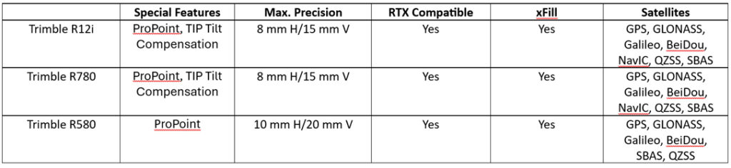
The Trimble R12i is a premium survey GNSS offering dual Maxwell 7 Gen chip, fully loaded with all constellations, and can be used as a base and rover. Features include TiP technology (Trimble Inertial Positioning), ProPoint and xFill limited. It’s the best-in-class GNSS receiver with tilt technology and all of these features are offered as part of the standard package.
The Trimble R780 is a scalable survey GNSS offering ProPoint, a single Maxwell 7 Gen chip and is upgradeable to enable Tilt and full constellations. It can be used in base and rover modeAdditionally it has an ultra-strong housing and an increased IP spec. . This is the perfect receiver to grow with your business.
The Trimble R580 will provide the best return on investment and an affordable way to buy into the Trimble brand. It’s enabled with all constellations, ProPoint technology, and xFill Limited. However, it does not include TiP technology and is not upgradable.
FAQ’s
Which of these Trimble GNSS receiver models offer tilt compensation technology?
The Trimble R12i and Trimble R780 both offer Trimble Inertial Platform (TIP) IMU-based tilt compensation technology.
Which Trimble GNSS receiver models offer Trimble ProPoint GNSS technology?
The Trimble R12i, Trimble R780, and Trimble R580 GNSS receivers all come with Trimble ProPoint technology for increased performance in challenging GNSS environments, including close proximity to trees and in urban environments.
Which Trimble GNSS receiver models support Trimble RTX corrections?
All three models support Trimble RTX corrections, both via L-band (satellite) broadcast and over the internet.
RTX is a streaming service for corrections, managed by Trimble, which provides a correction service using a geostationary satellite – it does not require an internet connection.
On the RTX streaming service there are two products that our GNSS portfolio can use, xFill and xFill unlimited.
What is Trimble xFill limited
All three receivers offer Trimble xFill Limited as standard. This feature enables cm-levels corrections whenever the internet connection goes down for up to 5-10 minutes allowing surveyors to carry on working.
What is Trimble xFill unlimited
This feature enables the GNSS to carry on working with satellite corrections, without internet, for an unlimited amount of time. However, the user needs to be connected first to a VRS network for this to work. Ask us about our current special offer on xFill unlimited.
What is Trimble VRS Now Trimble VRS Now is a network of Continuously Operating Reference Stations (CORS), which provides users with cm-level corrections for their GNSS instruments, via the Internet. This enables users to work to cm-level anywhere there is a VRS network and a mobile internet signal. Trimble has additional permanent reference stations across the UK to strengthen the overall RTK solution, augmenting the network – increased accuracy and availability.
Q: What is the standout feature of the Trimble R12i for your company?
A: “It always works”
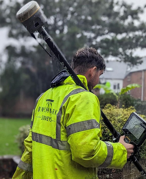
Benchmark Surveys was the first company in the UK to invest in a Trimble R12i GNSS and its continuing commitment to the technology is based on Trimble’s 40-year legacy of reliability and innovation
Download a PDF of the story here
It’s been 40 years since Trimble launched its first GPS onto the market and since then we’ve seen over 30 different iterations culminating in the arrival of the R12i in 2022.
The most advanced survey grade GNSS available, the Trimble R12i underlines Trimble’s commitment to development with its unique combination of technologies delivering a 30% productivity improvement on standard GNSS.
The adoption of this receiver by Exeter based Benchmark Surveys, the first company to purchase one in the UK, has not only transformed the way the company’s surveyors work but has also significantly enhanced the quality and quantity of data they provide to clients.
Transformative system “makes surveying pleasurable”
Benchmark Surveys’ Survey Manager, James Richards, one of xyHt’s esteemed 23 Young Geospatial Professionals to Watch in 2023, is appreciative of all the technologies offered by the Trimble R12i, but rightly points out that the single most important factor for productivity in the field is that that your GNSS always works!
He reports that everyone on the Benchmark team appreciates the R12i simply because it’s always reliable, always works and there’s never been a hardware issue – important benefits that work hand in hand with its performance:
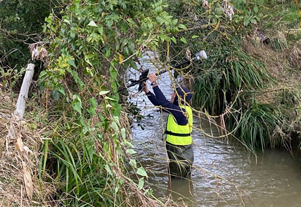
“The R12i’s capabilities shine, even in challenging surveying environments with difficult terrains such as banks, ditches, and areas with overhanging canopies – these are scenarios that surveyors come up against regularly and an area where the R12i decidedly ups productivity. Traditional equipment might falter in such conditions, but Trimble’s TIP (insert link to piece on the IMU) and ProPoint technologies ensure that Benchmark surveyors can effectively capture these challenging data points, leading to fewer client requests for additional information.”
What was once a time-consuming task has become fast and easy and even “pleasurable”, adding to the overall satisfaction of the Benchmark team who can effectively capture points in vegetation and under canopy where other GNSS would struggle.
Instagram follower comment on post: Tilt works well under heavy canopy?
Benchmark Surveys: Yes it does 👍
In particular, James emphasises the strong business case for investing in the R12i GNSS over any other system. The decision to adopt Trimble’s technology is not merely based on brand loyalty but on the functionality and reliability that the team relies on to deliver the highest quality data to clients.
Trimble’s commitment to innovation, backed up by KOREC’s support, training and T.R.U.S.T ethos aligns seamlessly with Benchmark’s dedication to providing top-notch surveying services.
Resolve to save 20% on a Trimble R8s GNSS receiver with TDC600
Flexible and scalable, Trimble’s R8s GNSS has always been ‘the one with all the options’! Choose the configuration level that suits your needs best, whether it’s post-processing, base, rover, or a combination.
The R8s can be used in conjunction with Trimble’s VRS Now service, giving you instant access to RTK positioning services sing a network of permanent, continuously operating reference stations. For more information about VRS, watch this YouTube video or speak to a member of our team.
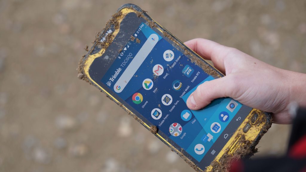
If the R8s is our most flexible GNSS, then the TDC600 is our most versatile logger, a half-way house between a phone and a tablet. Pocket sized, rugged and lightweight, we’d recommend the Android based TDC600 to all those surveyors who have to cover large sites or walk long distances but still want the full functionality of Access software and a decent screen that can be viewed landscape or portrait. Together these devices offer the user accuracy, efficiency and reliability all at once – so for a limited time we’re bundling them together with savings of 20%.
Accuracy needn’t cost the earth
“I’ve been very, very impressed with the TDC600 for a number of reasons. The modern Android interface brings all the slickness, ease of use and extended functionality you’d expect including access to the apps store so that whilst I’m in the field I can now use a CAD viewer, a calculator and of course regularly check weather updates. However the main plus is that it’s a fantastic platform for Access 2020 which is far slicker to use than its Windows counterpart and brings additional features such as a split screen and quick start up.” – Ted Harland, Tri-Tech. Read more about Ted’s experience with the TDC600 here.
If you’d like to streamline your workflows while saving 20% speak to our sales team while stocks last!
Contact us;
Call UK Sales: 0345 603 1214
Call Ireland Sales: 01 456 4702
For anything else, view our contact page.
How does the new Trimble Catalyst DA2 receiver measure up against the DA1?
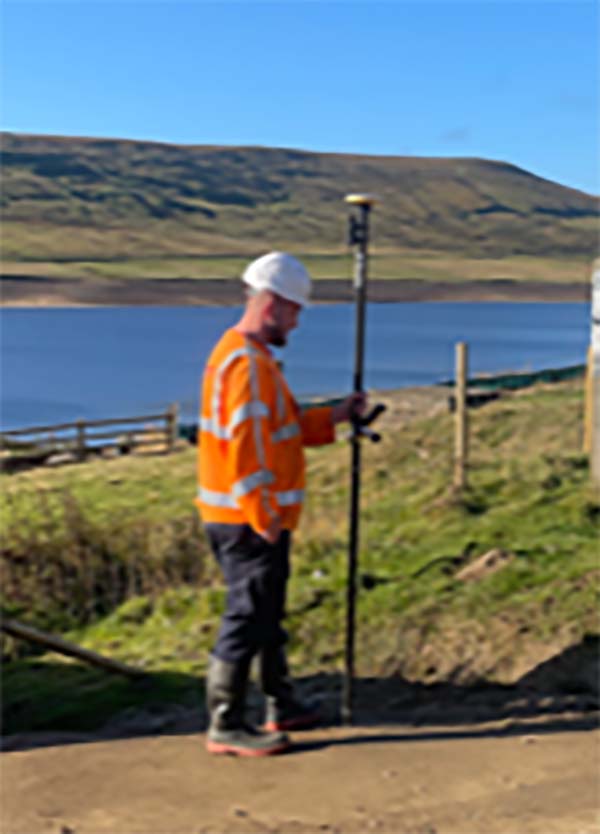
What better way to find out than by putting afforable cm accuracy in the form of the DA2 into the hands of experienced Catalyst user and advocate of the DA1 system, Andrew Stephenson Principal Designer on the Morrison Water Services Northern area Engineering Team.
Andrew was an early adopter of Trimble Catalyst and used the DA1 extensively saving £20k on a recent 1-2cm asset collection project which was nominated for a Water Industry 2021 award for its innovative approach to high accuracy data capture and management.
The set up
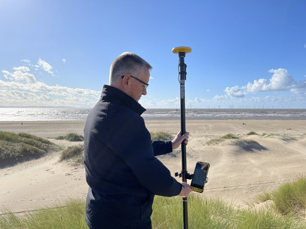
Andrew and Morrison Water Services Surveyor, Asa Blake, used the DA2 in conjunction with a 1cm accuracy Catalyst subscription and their existing KOREC Capture field software running on a rugged Trimble TDC600 Android device (although the DA2 is also now compatible with iOS devices). Drawing on previous experience of how the DA1 worked under different conditions, Andrew was keen to carry out some comparative tests with the new DA2 in the same situations to test its performance and ultimately, it’s productivity improvements.
Three challenging test sites
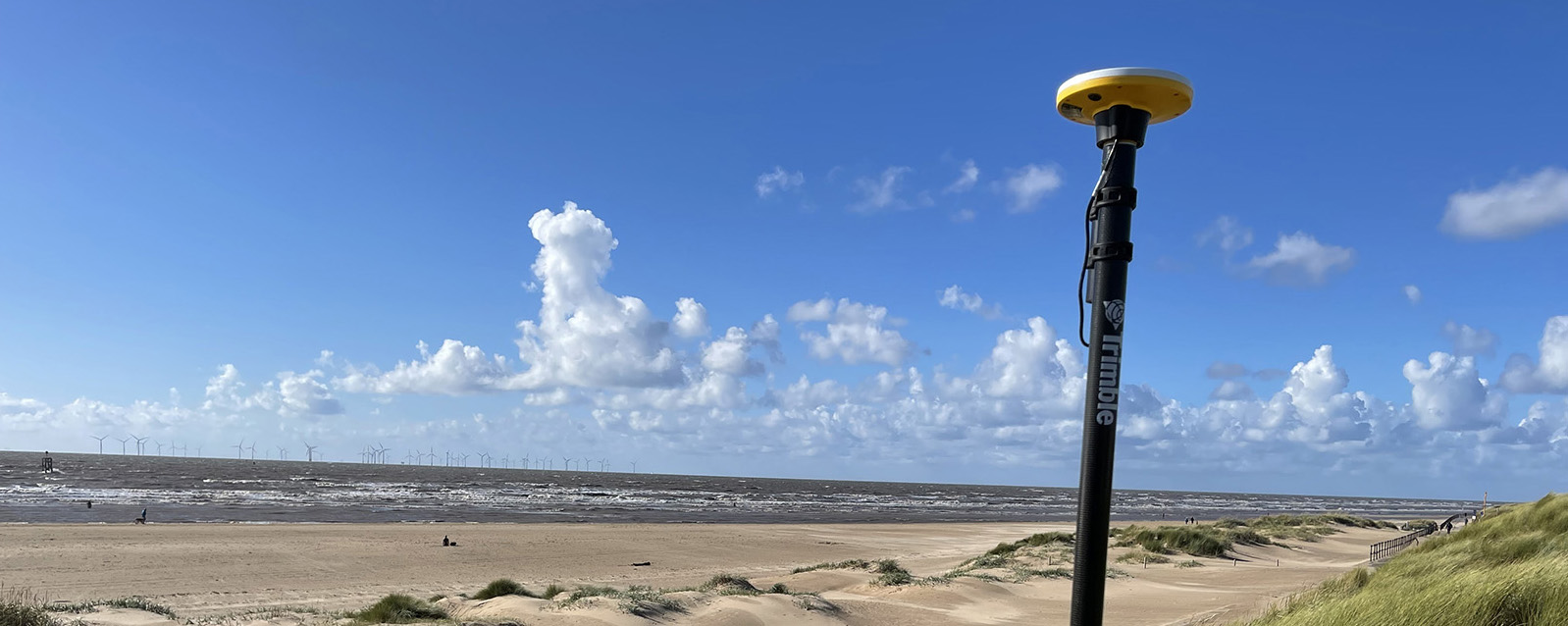
Andrew and Asa opted to test the DA2 in three demanding scenarios which any GNSS would find challenging, firstly, Leeds City centre, secondly under tree canopy and finally in a remote location with no mobile phone coverage.
Here’s Andrew’s report:

Leeds city centre – built up environment
“In Leeds City centre we were able to achieve 1cm positions. Even next to the John Lewis building where previously we’d been unable to receive a signal at all, the DA2, always delivered an accurate position.”
The technology behind the performance: Trimble ProPoint
Until the launch of the DA2, Trimble ProPoint was only available in top of the range Trimble GNSS receivers. ProPoint delivers better results in harsh GNSS conditions, for example, near tree canopy and in built-up areas.
Under tree canopy
“We tested this scenario under the trees in Cookridge, Leeds – centimetre positions were easily achievable. ”
The technology behind the performance: Trimble ProPoint (see above).
Expect cm positions under tree canopy within 40 seconds!

Remote location with no phone signal
“This is a common problem for us so we knew exactly where to test out the DA2’s capabilities for this one. Scar House is situated in the Nidd Valley in North Yorkshire and it’s almost impossible to get a mobile phone signal there. The DA2 again delivered 2cm positions thanks to its ability to receive corrections via satellite rather than via an internet connection. This is a game changer for us.”
The technology behind the performance: Trimble RTX.
The DA2 means that you are no longer reliant on receiving your cm corrections over an internet connection. Thanks to Trimble’s RTX technology you can now get your corrections via satellite (GPS, Galileo, GLONASS, BeiDou, QZSS, IRNSS, MSS, SBAS) which is great for areas with limited mobile phone coverage and internet connectivity.
Conclusion
Andrew’s verdict: “Most of our projects have a specification for 10cm accuracies and in fairness to the DA1 we were often able to work within this spec, but not always. The afforable cm accuracy of the DA2 brings peace of mind and the knowledge that we can always overachieve on precision and in particular,in the three conditions above that previously challenged us.
We’ve also noted some additional benefits with the DA2 – the improved speed is excellent! By the time we’d logged on we were down to 1cm which is a remarkable improvement on the DA1. The DA2 is also Bluetooth enabled which saves battery drain for the phone because there is no need to bother with leads (or water!) into the connection of the phone.
The DA2 delivers outstanding results where we would have never thought possible with the Catalyst technology. We tested this at Scar House Reservoir, which is as remote as it gets in Yorkshire, but the DA2 delivered accuracy of 2cm using RTX which is remarkable!”
You can read about our Trimble Catalyst business case here.
A related case study on knotweed mapping with Catalyst is here and asset data collection here.
Visit our webinar section here for the full details on the new Catalyst system.
If surveying isn’t your main day to day activity but you still have a need for cm positions in your workflow, then the business case for Trimble’s Catalyst is a strong one.

Trimble Catalyst is a revolutionary, GNSS concept delivering positioning as a service to mobile devices. It turns your existing Android or iOS device into a precision mapping, navigation and measurement tool that you can use with any location enabled app or service including KOREC Capture and Esri FieldMaps.
The cost of the Catalyst hardware has been kept low at just £300 per receiver and subscriptions come in a range of choices depending on the number of licenses required and hours used.
However, Trimble Catalyst is not a solution for those who cite survey grade accuracy as the primary part of their working day. Instead, Catalyst has been developed for users who require cm positions as back up to the bulk of their work, for example, the scientist who needs to know precisely where a sample was collected, the utilities engineer who needs to position a valve or the knotweed removal specialist who must know exactly where the plant is located.
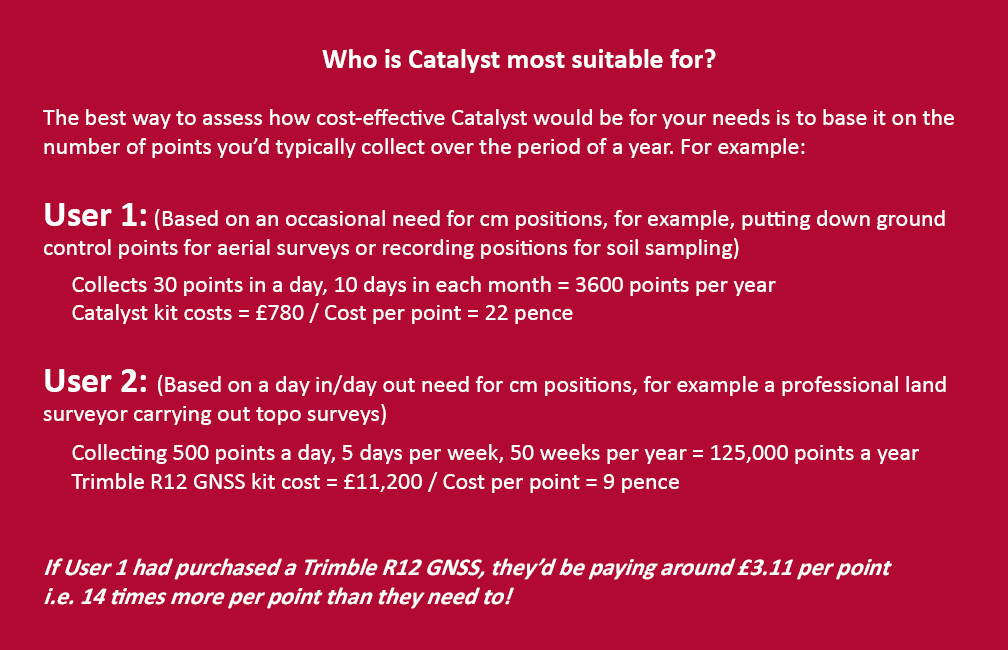
In short, the best way to assess whether Trimble Catalyst will provide the best value proposition for your cm positions is to base it on the number of points you typically over the period of a year.
Case study: DTM Technologies
Typical of the type of user who can benefit from the enormous savings Catalyst delivers is Owner/Director of DTM Technologies, Alan Roberts.
Established in 2014, North Wales based DTM Technologies offers a range of specialist 3D Structural and 3D Modelling Services capturing data predominantly through 3D Laser Scanning and drones. The company uses the very latest in data capture technology (Including the Trimble TX8 Laser Scanner) and provides the high resolution and accurate survey, mapping and environmental information that’s often used to form the basis of any construction (BIM), environmental or engineering project.
With the majority of Alan’s work requiring either a point cloud or aerial imagery, he has an important but fairly minimal need for cm positions. Six years ago, his approach was to purchase a survey grade GNSS system and a license for the corresponding annual correction service. However, he is quick to cite that he is not an engineer or a degree trained surveyor and during the years with this system, he found it expensive to use. As well as the up-front costs for the initial purchase of the hardware, he was also paying an annual correction service charge of around £1,200 p.a. – both large outlays. He therefore sought a solution that would better fit his requirements, spread the cost and offer better value overall.
Alan accordingly purchased a Trimble Catalyst receiver from KOREC and selected the subscription service best suited to his workflow from the options of 60 cm, 30 cm, 10 cm or 1 cm, in this case 1cm. The Catalyst antenna was compatible with his existing mobile phone, easy to set up and required no specialist positioning or GNSS knowledge for use.
The Business case in numbers
Alan states that in a standard working month he may carry out around four surveys that require cm positions and that he can capture the four or five points he requires plus a few check points in one hour of subscription time. He is therefore spending just £10 per site for cm positions, around four times a month. Based on those figures, with the subscription cost spread over a 12 month period, his annual running costs are £480.
| Previously | |
| Hardware: Initial outlay for GNSS system and controller (approx) | £10,000 |
| Annual correction service charge | £1200 |
| Now | |
| Hardware: Catalyst Receiver for use with Alan’s own phone | £300 |
| Subscription: On demand at £10 per hour based on typical annual use | £480 |
Upfront hardware savings ≈ £9600
Annual running cost savings ≈ £760 p.a.
As an experienced user of Trimble Catalyst, even Alan still believes that that system is almost too good to be true. “With Trimble Catalyst, achieving cm accuracy in the field is no longer a niche occupied only by land surveyors, often with the price tag to match. Previously, I was pretty well priced out of the market for this level of accuracy but Catalyst really does bring high cm positions to a mass audience. I’m now in a good position to pass my savings on to my clients which definitely helps in a competitive marketplace.”
Next steps – the new Catalyst DA2
Alan was an early adopter of the Trimble Catalyst system and is already assessing the recently released DA2 receiver.
With much of his work in Snowdonia, mobile phone reception is often compromised and even taking three different SIM cards doesn’t always guarantee a successful connection. The DA2 comes with RTX corrections which means he will no longer be reliant on receiving his cm corrections over an internet connection. Thanks to Trimble’s RTX technology he will be able to get his corrections via satellite.
In addition, the DA2’s ProPoint technology will enable him to pick up his positions in challenging GPS conditions such as near tree canopy.
You can read about our DA2 test here.
A related case study on knotweed mapping with Catalyst is here and asset data collection here.
Visit our webinar section here for the full details on the new Catalyst system.
We’d like to introduce you to a new acronym – PAAS or Positioning as a Service!
The DA2 is the second-generation receiver and antenna for Trimble’s Catalyst service. Simply, Catalyst is a revolutionary, GNSS concept delivering positioning as a service to mobile devices. It turns your Android or IOS device into a precision mapping, navigation and measurement tool that you can use with any location enabled app or service including KOREC Capture and Esri FieldMaps.
Catalyst delivers the most cost-effective method for achieving cm accuracy positioning in the industry.
Subscription based services have grown faster than traditional businesses in many areas of the economy. Trimble is leading the way in PAAS with its Catalyst positioning service.
Of course, here at KOREC we don’t just take things at face value so our Mapping Business Area Manager, Richard Gauchwin, has been out and about putting the DA2 through its paces.
We caught up with him to find out what’s new and what’s impressed. Here’s his verdict:
- Number one has to be the fact that the DA2 is now a full GNSS receiver which removes dependencies on the mobile device which you may have seen with the DA1.
Whilst the DA1 connected via a cable into an Android phone, it was the app on the phone where all the GNSS processing was carried out. In short, processing times etc were limited by the phone’s performance. Not so with the DA2 receiver, it’s a whole different story! The biggest plus is that Catalyst is now so much faster to use. For example using the DA1, it might take you minutes to get a position, with the DA2, we’re talking seconds!
They may look the same and still weigh in at just 330g, but in terms of performance they couldn’t be more different.
2. The DA2 brings you far more flexibility as it now has Bluetooth which allows you to connect wirelessly to your mobile device of choice. And believe me, there is definitely more choice because this now means that the DA2 is compatible with both IOS and Android.
3. The DA2 offers Trimble’s ProPoint technology which has previously only been available in top of the range GNSS receivers. ProPoint means better results in harsh GNSS conditions, for example near tree canopy and in built-up areas. Expect a cm position near tree canopy within 40 seconds.
4. New subscription choices mean even better scalability. Subscriptions have been clarified to accommodate the better accuracies achievable. Choose from 60cm, 30cm, 10cm or 1cm. Trimble have also provided more choice in the number of hours you can purchase including some great options available for equipping large workforces. And of course, you still only pay for what you use.
5. The DA2 means that you are no longer reliant on receiving your cm corrections over an internet connection. Thanks to Trimble’s RTX technology you can now get your corrections via satellite which is great for areas with limited mobile phone coverage and internet connectivity.
6. The DA2 is future proof and will update wirelessly when required.
Who is Catalyst suitable for?
In a nutshell, we describe Catalyst as being a truly cost-effective option for those who require high accuracy positions as a part of their workflow, for example, positioning Ground Control Points for an aerial mapping project, recording the location of soil samples on a construction project or positioning valve or pipe connections on a drainage job. By having access to a cm accuracy system, with no training costs and no outlay for expensive, specialist hardware, Trimble Catalyst is truly a system that can put cm accuracy into the hands of the many different users and/or across large workforces.
We have a great analogy comparing Catalyst to a buying a printer and printer inks. Simply, the hardware costs in buying a printer are minimal, the service, or in this case the printer ink is where the cost lies. If you are just printing out two or three pages every now and again then this is the equivalent of a Catalyst user who can really gain value from the system. If however, you print off many full reports every day, then you will not achieve good value from Catalyst and it’s best to consider a dedicated survey grade GNSS.
If you’d like to see which KOREC customers been using Catalyst then please visit our customer story blog here to read about:
· V.T.O.L Media – establishing ground control points for aerial surveys
· 3LM – a holistic approach to agriculture and the land
· TP Knotweed – rapid response identification and removal of knotweed
· A14 Integrated Deliver Team – fast one-off positions and augmented reality in the field
A related case study on knotweed mapping with Catalyst is here and asset data collection here.
Visit our webinar section here for the full details on the new Catalyst system.
Save up to 20% on a Trimble R8s GNSS receiver with TDC600
Trimble’s R8s GNSS has always been ‘the one with all the options’!
It’s flexible and scaleable, which means that you can choose the configuration level that suits your needs best, whether it’s post-processing, base, rover, or a combination of base and rover functionality. And now it comes with an additional option – the TDC600 logger running the newly released Access 2020 software. Buy both together with up 20% off to streamline and save.
Trimble’s R8s in the field
If the R8s is our most flexible GNSS, then the TDC600 is our most versatile logger, a half-way house between a phone and a tablet. Pocket sized, rugged and lightweight, we’d recommend the Android based TDC600 to all those surveyors who have to cover large sites or walk long distances but still want the full functionality of Access software and a decent screen that can be viewed landscape or portrait. Together these devices offer the user accuracy, efficiency and reliability all at once – so for a limited time we’re bundling them together with savings of up to 20%.
Accuracy needn’t cost the earth
“I’ve been very, very impressed with the TDC600 for a number of reasons. The modern Android interface brings all the slickness, ease of use and extended functionality you’d expect including access to the apps store so that whilst I’m in the field I can now use a CAD viewer, a calculator and of course regularly check weather updates. However the main plus is that it’s a fantastic platform for Access 2020 which is far slicker to use than its Windows counterpart and brings additional features such as a split screen and quick start up.” – Ted Harland, Tri-Tech. Read more about Ted’s experience with the TDC600 here.
If you’d like to streamline your workflows while saving 20% speak to our sales team before the end of March 2021.
Contact us;
Download offer PDF here.
Call UK Sales: 0345 603 1214
Call Ireland Sales: 01 456 4702
For anything else, view our contact page.